
Campgrounds in Arizona
Discover desert camping and Grand Canyon adventures in the Grand Canyon State
94
Campgrounds listed
100%
With photos
100%
Detailed descriptions
Campground
Top campground type
Highlights
Featured campgrounds in Arizona
Explore by campground name letter
Jump to A-Z landing hubs for stronger discovery paths beyond Arizona.
All campgrounds
Showing 94 campgrounds

Overview The Burro Creek Campground (1,960’ elevation) is situated along the 57 mile Burro Creek in a transition zone between the upper reaches of the scenic Sonoran Desert and lower reaches of the scenic Mojave Desert. The campground offers visitors a variety of scenery including saguaro-studded cliffs along steep canyon walls that contrast Burro Creek’s dense vegetation and flowing waters that form deep pools of water just adjacent to the campground. Recreation To enhance the visitor experience, the campground features a Watchable Wildlife Exhibit and an Interpretive Desert Garden as well as access to Burro Creek via hiking trails from the campground. The creek offers opportunities for rockhounding, wading, and wildlife viewing especially for birding with a wide-array of raptors and other species of birds. Sites 7, 8, and 9 are best for bird watching. Facilities To enhance the visitor experience, the campground features a Watchable Wildlife Exhibit and an Interpretive Desert Garden as well as access to Burro Creek via hiking trails from the campground. The creek offers opportunities for rockhounding, wading, and wildlife viewing especially for birding with a wide-array of raptors and other species of birds. Sites 7, 8, and 9 are best for bird watching. Natural Features The campground scenery features an adjacent canyon carved by the flow of Burro Creek with other mountains and mesas visible in the background as well as a diverse Sonoran desert plant community including saguaros, a variety of cholla and barrel cacti, creosote bushes, Palo Verde trees, and catclaw. Nearby, on the banks of Burro Creek, visitors will also see willow and cottonwood trees as well as a wide-variety of riparian shrubs. Wildlife is frequent in the campground and include occasional sightings of desert bighorn sheep on the cliffs above Burro Creek and a variety of birds including cactus wren, Gambel’s quail, Gila woodpecker, great horned owl, great blue heron, Vermilion flycatcher, and cliff swallow to name a few. Javelina, raccoons, coyotes, and foxes have been known to use the area as the creek serves an important role in the harsh desert environment. Nearby Attractions The public lands surrounding the Burro Creek Campground are readily available for visitors interested in sightseeing via use of a four-wheel drive vehicle along county-maintained dirt roads. These roads wind through a variety of interesting geologic scenery combined with unique vegetative communities including Sonoran and Mojave deserts intermingled with areas of interior chaparral and pinyon-juniper woodlands. County roads are maintained regularly, but it is always a good idea to check with the local BLM office prior to planning your trip as well as exercising caution when travelling on any of these unimproved dirt roads as visitors travel at their own risk. The area, while desolate during the warm summer months, gives way to cooler temperatures from October through April annually and provides exceptional opportunities for hunting, off-highway vehicle use, wildlife watching, photography, sightseeing, and a variety of other dispersed recreational opportunities. Depending upon winter and spring precipitation, the area surrounding the Burro Creek Campground provides visitors with excellent spring wildflower displays March through May. Charges & Cancellations Recreation.gov Reservation Cancellations & Changes Cancelling a Reservation: Customers may cancel their reservation prior to arrival both on-line and through the call center. A $10 service fee will be withheld from any refund for a cancellation. Depending on when you cancel in relation to your arrival day, it may be considered a late cancellation (see below). Recreation.gov Late Cancellations or Cancellations within the Cut-off Window Individual Campsites: A customer who cancels a reservation the day before or on the day of arrival will pay a $10.00 service fee AND forfeit the first night's use fee (not to exceed the total paid for the original reservation). Cancellations for a one-night reservation will forfeit the entire amount paid and will not be subject to an additional service fee. Group Facility (including Cabins and Lookouts): Customers who cancel a group overnight facility reservation less than 14 days before the arrival date will pay a $10.00 service fee AND forfeit the first night's use fee. Recreation.gov No-Shows -Overnight and Day-Use Facilities: A no-show customer is one who does not arrive at a campground and does not cancel the reservation by check-out time on the day after the scheduled arrival date (or for day-use facilities, by check-in time the day of arrival). Staff will hold a campsite until check-out time on the day following the arrival date and will hold group day-use facilities until check-in time on the arrival date. -No-shows are assessed $20.00 service fee and forfeit the first night’s recreation fee.
View details →
Overview The Moqui Group Campground sits in a beautiful setting surrounded by ponderosa, oak, and aspen at an elevation of 6,915'. The campground consists of 3 individual group sites: Simmons, Spooner, and Ernst. Each site can accomodate up to 50 people offering picnic tables, fire rings, grills, vault tolets, trash collections, and piped drinking water. For groups larger than 50 people, multiple sites can be reserved. The Simmons and Spooner Group sites can each accomodate a maximum of 3 trailers or RV's up to 22'. The Earnst Group site is best suited for tents and smaller equipment. Recreation Many visitors spend time relaxing and exploring the area. The nearby C.C. Cragin Reservoir and Knoll Lake offer opportunities for water based recreation, while the Arizona National Scenic Trail, General Crook National Recreation Trail, and historic Cabin Loop Trail System offer opportunities for hikers, bicyclist, and equestrian users. There are also several Fire Lookout Towers in the area. Facilities Many visitors spend time relaxing and exploring the area. The nearby C.C. Cragin Reservoir and Knoll Lake offer opportunities for water based recreation, while the Arizona National Scenic Trail, General Crook National Recreation Trail, and historic Cabin Loop Trail System offer opportunities for hikers, bicyclist, and equestrian users. There are also several Fire Lookout Towers in the area. Natural Features The campground is in a forested setting. The nearby Mogollon Rim is one of the most striking geologic features in the state. This steep escarpment, measured in thousands of feet, stretches from New Mexico diagonally accross two thirds of Arizona and offers sweeping views of the landscape. Nearby Attractions The community of Happy Jack, Arizona has a gas station, two convenience stores and two restaurants.
View details →
Overview The Long Valley Work Center Group Campground sits among stately ponderosa pines at an elevation of 6,950 feet offering a cool respite from the summer heat of the valley below. It is also the site of a historic Forest Service work center. The campground is designed to meet the needs of large groups and can accommodate 300 people, offering picnic tables, grills, and a large fire pit. There are vault toilets. For every 25 people after the first 50, the group will need to provide additional port-a-pots. Recreation Many visitors spend time relaxing and exploring the area. The nearby C.C. Cragin Reservoir and Knoll Lake offer opportunities for water based recreation, while the Arizona National Scenic Trail, General Crook National Recreation Trail, and historic Cabin Loop Trail System offer opportunities for hikers, bicyclist, and equestrian users. There are also several Fire Lookout Towers in the area. Facilities Many visitors spend time relaxing and exploring the area. The nearby C.C. Cragin Reservoir and Knoll Lake offer opportunities for water based recreation, while the Arizona National Scenic Trail, General Crook National Recreation Trail, and historic Cabin Loop Trail System offer opportunities for hikers, bicyclist, and equestrian users. There are also several Fire Lookout Towers in the area. Natural Features The campground is in a forested setting adjacent to a meadow. The nearby Mogollon Rim is one of the most striking geologic features in the state. This steep escarpment, measured in thousands of feet, stretches from New Mexico diagonally across two thirds of Arizona and offers sweeping views of the landscape. Nearby Attractions The community of Happy Jack, Arizona has a gas station, two convenience stores and two restaurants.
View details →
Overview Painted Rock Petroglyph Site, approximately 90 miles southwest of Phoenix, Arizona, provides visitors the opportunity to view an archaeological site containing hundreds of figures and designs carved into rocks, known as petroglyphs. These were produced centuries ago by indigenous peoples. This site is considered important and even sacred to many of the Native American tribes in southern Arizona. Please keep this in mind when you visit and be respectful. There are also inscriptions made by people who passed through during historic times. Many important trails are near the site, some of which have been traveled for thousands of years. The 1775 expedition of Juan Bautista de Anza passed nearby on his way to deliver soldiers, padres, settlers, and their livestock to a new home in northern California to secure the area for Spain. In 1846, the Mormon Battalion passed through, following Philip St. George Cooke along some segments of this trail to help secure California from Mexico. This venture included road building tasks along the trail, assuring that future trips could accommodate wagons. A need to improve communication and travel from east to west prompted Congress to fund a stage line. The result was the Butterfield Overland Stage Route, which began service in 1858 and traveled by this site. This mail and freight service guaranteed that the mail, freight, or passengers would be able to travel from Saint Louis to San Francisco in 25 days. Use was halted when the railroad was constructed in 1879. Formerly a unit of the Arizona State Park system, jurisdiction of Painted Rock Petroglyph Site returned to the Bureau of Land Management in 1989. Recreation The day-use site is right next door to the campground and offers two shaded picnic areas and a small interpretive trail around the petroglyph site with informational displays. The petroglyphs face the east-southeast primarily and would have been noticed by any travelers approaching from that direction. Hiking, birdwatching, and star gazing opportunities all present themselves at this site. Facilities The day-use site is right next door to the campground and offers two shaded picnic areas and a small interpretive trail around the petroglyph site with informational displays. The petroglyphs face the east-southeast primarily and would have been noticed by any travelers approaching from that direction. Hiking, birdwatching, and star gazing opportunities all present themselves at this site. Natural Features Set between impressive geologic features such as Oatman Mountain, a few miles to the northwest and the Painted Rock Mountains, situated on the eastern horizon, this campground offers scenic panoramic views and plenty of opportunities for solitude and vast night skies. The surrounding area features a diverse Sonoran Desert plant community including the iconic saguaro cactus, various cholla species, barrel cactus, creosote bush, and both ironwood and palo verde trees. The area is home to a large population of desert mule deer and many other desert species such as kit fox, Gambel’s quail, chuckwalla, and desert iguana. Nearby Attractions Woolsey Peak Wilderness Woolsey Peak Wilderness offers rugged topography, colorful scenic vistas, rich variety of wildlife and vegetation, and outstanding opportunities for solitude and unconfined recreation. Woolsey Peak stands 3,270 feet above sea level and about 2,500 feet above the Gila River (to the south). It is a landmark visible from much of southwestern Arizona. The Painted Rock Dam flood- control dam is situated on the Gila River not far from the southwestern corner of the area. Encompassing a major portion of the Gila Bend Mountains, it is barely separated from the smaller Signal Mountain Wilderness to the north. You will find sloping lava flows, basalt mesas, ragged peaks, and broken ridges dotted with saguaro, cholla, palo verde , creosote, and bursage. Desert mesquite, paloverde, and ironwood grow in the washes throughout this rugged and expansive desert wilderness. The region is especially inviting for its desert backpacking. Desert bighorn sheep, mule deer, bobcats, mountain lions, hawks, and owls might make an appearance. Signal Mountain Wilderness A narrow, four-wheel-drive road is all that separates Signal Mountain Wilderness from Woolsey Peak Wilderness to the south. Signal Mountain itself, rising just north of the center of the area, reaches a summit of 2,182 feet (1,200 feet above the surrounding desert floor). Here you will find sharp volcanic peaks, steep-walled canyons, ragged ridgelines, arroyos (slim, usually dry riverways), and plains spreading out from the washes. Paloverde, saguaro, and creosote are scattered throughout the bajadas and upland regions. Washes are lined with mesquite, ironwood, acacia, and palo verde. Wildlife watchers may see desert bighorn sheep, desert tortoises, and several species of raptors. Wildlife game species are common, and quail and mule deer hunters are frequent visitors. contact_info For facility specific information, please call (602) 867-5400.
View details →
Overview The Virgin River Canyon Recreation Area is located along Interstate 15 approximately 20 miles southwest of St. George, Utah and approximately 20 miles northeast of Mesquite, Nevada. It's accessed from the Cedar Pocket Exit (mile post 18). The overnight-use fee is $8 per site per night and the day-use fee is $2 per vehicle. Overnight use is limited to a 14-night stays. The recreation area currently has 25 of the best sites only available through recreation.gov reservations. The remaining 83 sites are first come, first serve (FF) payable by using the Scan and Pay feature on the recreation.gov app. Please come prepared by either making a reservation here before arrival OR having the recreation.gov app installed with login setup to pay onsite with the scan and pay option. Recreation The Virgin River Canyon Recreation Area provides many recreational opportunities for hiking, wildlife viewing, water play, and more. It is surrounded by two designated wilderness areas. The Paiute Wilderness east of Interstate 15, and Beaver Dam Mountains Wilderness to the west. The Sullivan Canyon Trail starts within the recreation area and heads into the heart of the Paiute Willderness. The campground and day-use areas also both have scenic trails leading to the Virgin River. The Virgin River is occassionally runable to small whitewater boats during spring runoffs. Please check for information on the fish barriers and flow conditions prior to running. Additional opportunities for recreation are available outside of the recreation area. A short drive on the Cedar Pocket Road (directly across the interstate from the campground) leads to the Cedar Pocket Wash Trailhead. This trail leads down a steep path to the narrows of the Cedar Pocket Wash and is a nice short stroll through a Joshua Tree forest. The Virgin River Gorge is also frequented by rock climbers and canyoneers. Additional information about recreation available in the area can be obtained by calling the visitor center at 435-688-3200. Facilities The Virgin River Canyon Recreation Area provides many recreational opportunities for hiking, wildlife viewing, water play, and more. It is surrounded by two designated wilderness areas. The Paiute Wilderness east of Interstate 15, and Beaver Dam Mountains Wilderness to the west. The Sullivan Canyon Trail starts within the recreation area and heads into the heart of the Paiute Willderness. The campground and day-use areas also both have scenic trails leading to the Virgin River. The Virgin River is occassionally runable to small whitewater boats during spring runoffs. Please check for information on the fish barriers and flow conditions prior to running. Additional opportunities for recreation are available outside of the recreation area. A short drive on the Cedar Pocket Road (directly across the interstate from the campground) leads to the Cedar Pocket Wash Trailhead. This trail leads down a steep path to the narrows of the Cedar Pocket Wash and is a nice short stroll through a Joshua Tree forest. The Virgin River Gorge is also frequented by rock climbers and canyoneers. Additional information about recreation available in the area can be obtained by calling the visitor center at 435-688-3200. Natural Features The Virgin River Gorge, where the Virgin River Canyon Recreation Area resides, was cut by the Virgin River. Though the Virgin River is relatively small, it is incredibly steep, dropping an average of 70 feet per mile - 10 times steeper than the Colorado River through the Grand Canyon. This steepness, caused by the uplift of the Colorado Plateau, has given the Virgin River the ability to cut through sandstone and limestone canyons. The gorge provides a stunning and colorful mountain desert setting. The gorge mimics, on a smaller scale, the colorful layers and striking depths of the Grand Canyon. In fact, many of the very same geologic formations are present in both areas. The gorge connects the southwestern rim of the Colorado Plateau and the northeastern part of the Mojave Desert. The climate of the gorge is typical of the Mojave Desert with hot summers and mild winters. This desert climate allows for some of the most northern Joshua Tree populations. The canyon is usually about 5 degrees Fahrenheit warmer than St George, Utah, however the canyon can occasionally amplify winds. Many species depend on the water of the Virgin River. The Virgin River directly supports hundreds of wildlife species including, woundfin, Virgin River chub, Virgin spinedace, flannelmouth sucker, desert sucker, speckled dace, and Southwestern Willow Flycatcher. Many of these species are endangered or are considered sensitive species within the State of Arizona and Utah. Nearby Attractions The recreation area has an easy, short paved trail accessed near the fee instruction station. This trail goes up to a Joshua Tree grove and a nice developed viewpoint of the Virgin River Gorge. The recreation area also has a trailhead to Sullivan Canyon. This trail crosses the river and traverses 3 miles through wilderness to Sullivan Canyon. Follow the high clearance road about 2 miles northwest across from the Virgin River Canyon Recreation Area, you will reach the Cedar Pocket Wash trailhead. Here, there is a short trail to a Joshua Tree grove and plenty of views. A side trail leads steeply down to the wash where you can hike through a limestone slot canyon. contact_info This location is unstaffed. To speak with our main office for general information, please call: (435) 688-3200. Charges & Cancellations Cancellations*: *cancellation becomes a "late cancellation" at 12:01 am EST on the day before arrival. • $10.00 fee if reservation is changed/cancelled earlier than the day before arrival. • $10.00 plus first night's camping fee is charged if reservation is cancelled the day before or the day of the arrival, except when the reservation is only for 1 night (in which case only the first night's camping fee is charged). No Shows: customer does not arrive and/or does not cancel reservation by check out time (11 :00am) the day after the scheduled arrival date. $20.00 service fee charged and forfeit the first night's user fee • If requested before the late cancellation window: NRRS will handle • If requested during the late cancellation window (day before arrival, or day of arrival): Customer will be charged first night's use fee, and refunded rest • If requested after arrival, during or after departure from site: recreation.gov processes and field office has to approve
View details →
Overview The Rock Crossing Campground sits in a beautiful setting surrounded by ponderosa pine and oak at an elevation of 7,316'. The cool summer climate and countless recreational opportunities makes this a popular location. Wildlife is abundant in the area and includes elk, mule deer, black bear, bald eagles, and osprey. Recreation Many visitors spend time relaxing and exploring the area. The nearby C.C. Cragin Reservoir and Knoll Lake offer opportunities for water based recreation, while the Arizona National Scenic Trail, General Crook National Recreation Trail, and the historic Cabin Loop Trail System, offer opportunities for hikers, bicyclist, and equestrian users. There are also several Fire Lookout Towers in the area. Facilities Many visitors spend time relaxing and exploring the area. The nearby C.C. Cragin Reservoir and Knoll Lake offer opportunities for water based recreation, while the Arizona National Scenic Trail, General Crook National Recreation Trail, and the historic Cabin Loop Trail System, offer opportunities for hikers, bicyclist, and equestrian users. There are also several Fire Lookout Towers in the area. Natural Features Coconino National Forest offers 1.8 million acres of recreational opportunity from desert basins to mountain peaks. The campground sits in a forested setting. The nearby Mogollon Rim is one of the most striking geologic features in the state. This steep escarpment, measured in thousands of feet, stretches from New Mexico diagonally across two thirds of Arizona and offers sweeping views of the landscape. Nearby Attractions Tonto Natural Bridge State park is approximately 45 minutes away and offers what may be the world's largest travertine bridge. The community of Happy Jack, Arizona has a gas station, two convenience stores and two restaurants.
View details →
Overview Civilian Conservation Corps Campground offers spread out camp sites with large sycamore trees providing shade. Picnic tables and firepits with cooking grates are available for families to enjoy while passing the time away together. Cave Creek Trailhead is nearby where you can follow along the Cave Creek Riparian Ecosystem. This spot is popular for bird watching! This location is available on a first-come, first-served basis only. Visitors are required to physically arrive at the campground to purchase and claim a site. Once on-site, you may be able to pay for your campsite(s) by scanning a QR code using the Recreation.gov mobile app, and the Scan and Pay feature. If this option is available, you will need to first download the free Recreation.gov mobile app https://www.recreation.gov/mobile-app prior to your arrival as some remote areas have limited or no cellular service. Camping passes can also be purchased at a Tonto Fee Machine Pass. $16 per site, per night. Nearest fee machine location is at the Cave Creek Ranger Station. Recreation Camping Hiking Creek Access OHV Routes Bird Watching Facilities Camping Hiking Creek Access OHV Routes Bird Watching Natural Features Large sycamore trees provide plenty of shade and the Cave Creek Riparian Ecosystem is just steps away from your campsite. Nearby Attractions Towns of Carefree and Cave Creek contact_info For facility specific information, please call (480) 595-3300.
View details →
Overview Horseshoe Campground is farther up the road from Mesquite Campground. Offering more developed campground sites with picnic tables, fire pits and access to the Verde River at campsites 11 and 12. Gorgeous vistas of surrounding mountains and the Verde River are offered along the path for families to enjoy. Most campsites are less shaded than the favored 11 and 12 campsites, so please feel free to bring canopies and coolers to provide shade and stay hydrated during the day, but this campground does have some large mesquite trees providing shade. Bald eagles are frequently seen in this vicinity. This location is available on a first-come, first-served basis only. Visitors are required to physically arrive at the campground to purchase and claim a site. Once on-site, you may be able to pay for your campsite(s) by scanning a QR code using the Recreation.gov mobile app, and the Scan and Pay feature. If this option is available, you will need to first download the free Recreation.gov mobile app https://www.recreation.gov/mobile-app prior to your arrival as some remote areas have limited or no cellular service. Camping passes can also be purchased at a Tonto Fee Machine Pass. $16 per site, per night. Nearest fee machine location is at the Cave Creek Ranger Station. Recreation Swimming Fishing Boating (Non-Motorized on the Verde River and a 25 horsepower motor limit on Horseshoe Reservoir.) Birding Photography OHV Routes Facilities Swimming Fishing Boating (Non-Motorized on the Verde River and a 25 horsepower motor limit on Horseshoe Reservoir.) Birding Photography OHV Routes Natural Features This campground provides some river access for activities like swimming and fishing and offers stunning views of the surrounding mountains. Its proximity to Horseshoe Reservoir makes it a great basecamp for all your lake adventures! contact_info For facility specific information, please call (480) 595-3300. Nearby Attractions Horseshoe Lake, Horseshoe Dam, Mesquite Campground, Catfish Point Day Use Site
View details →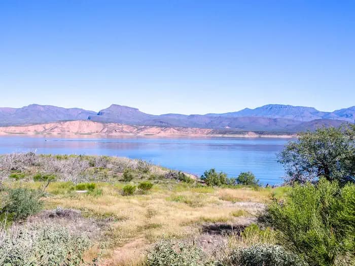
Overview Mesquite Campground provides privacy and shade. Here you can relax under the shaded canopies of mesquite trees while listening to the sounds of water flowing from the Verde River just a short distance from your site. Designated camp sites have fire rings, grills and picnic tables where families can enjoy time together. There are hiking, fishing, swimming opportunities and more. This location is available on a first-come, first-served basis only. Visitors are required to physically arrive at the campground to purchase and claim a site. Once on-site, you may be able to pay for your campsite(s) by scanning a QR code using the Recreation.gov mobile app, and the Scan and Pay feature. If this option is available, you will need to first download the free Recreation.gov mobile app https://www.recreation.gov/mobile-app prior to your arrival as some remote areas have limited or no cellular service. Camping passes can also be purchased at a Tonto Fee Machine Pass. $16 per site, per night. Nearest fee machine location is at the Cave Creek Ranger Station. Recreation Swimming River and Stream Fishing Non-Motorized Boating Nearby Hiking Trails Nearby OHV Routes Facilities Swimming River and Stream Fishing Non-Motorized Boating Nearby Hiking Trails Nearby OHV Routes Natural Features The Verde River is just a short distance from the campground, with swimming, fishing, and non-motorized boating access. Large trees provide plenty of shade. Nearby Attractions Horsehoe Reservoir Towns of Carefree and Cave Creek contact_info For facility specific information, please call (480) 595-3300.
View details →
Overview This Campground offers dozens of shaded, wooded campsites. 54 suitable for tents and 19 suitable for a trailer. Camping and fires are prohibited in rock shelters. Recreation The Red River Gorge offers untouched beauty for hiking enthusiasts. From the campground access: Hidden Arch Trail, Koomer Ridge Trail, Cliff Trail and Silvermine Arch Trail. Facilities The Red River Gorge offers untouched beauty for hiking enthusiasts. From the campground access: Hidden Arch Trail, Koomer Ridge Trail, Cliff Trail and Silvermine Arch Trail. Natural Features Koomer Ridge is located in the heart of the Red River Gorge on the Cumberland District in the Daniel Boone National Forest. Scenic sweeping views and amazing hiking trails. Nearby Attractions Red River Gorge, NADA Tunnel, Zilpo Campground, Tater Knob, Natural Bridge, Sky Bridge, Clifty Wilderness.
View details →
Overview Luna Lake Campground is a pleasant vacation site with open forest, lush meadows, a lake with great fishing, first rate mountain scenery and additional recreation facilities located within easy travel distance. This friendly campground is located in an open stand of ponderosa pines within walking distance of Luna Lake and 5 miles east of the town of Alpine, Arizona, close to the New Mexico border. Recreation Fishing, horseback riding, boating, mountain biking and hiking are some of the activities enjoyed by campers. A non-motorized trail system is open to horse, bicycle and pedestrian travel. Visitors should be aware that although horses are allowed on some of the trails, livestock is not permitted in the campground. Fishing is available in the lake, and a boat ramp provides easy access to the water. The lake is stocked with rainbow trout. The lake is used for irrigation during the summer; fishing is best in spring and early summer. A marina, fishing pier, bait shop, boat rentals and picnic area are located in the day use area. Families can also learn about the many cultural and natural features of the forest by attending educational programs in July and August. Facilities Fishing, horseback riding, boating, mountain biking and hiking are some of the activities enjoyed by campers. A non-motorized trail system is open to horse, bicycle and pedestrian travel. Visitors should be aware that although horses are allowed on some of the trails, livestock is not permitted in the campground. Fishing is available in the lake, and a boat ramp provides easy access to the water. The lake is stocked with rainbow trout. The lake is used for irrigation during the summer; fishing is best in spring and early summer. A marina, fishing pier, bait shop, boat rentals and picnic area are located in the day use area. Families can also learn about the many cultural and natural features of the forest by attending educational programs in July and August. Natural Features The area sits at an elevation of 8,000 feet in the scenic Apache National Forest in eastern Arizona. The campground is near 75-acre Luna Lake, surrounded by a ponderosa pine forest. A large wetland for nesting waterfowl lines the lakeshore, providing good wildlife viewing opportunities. contact_info For facility specific information, please call (928) 537-8888. Nearby Attractions The town of Alpine is convenient for shopping and services. The area is also rich with cultural history, outdoor recreation and sightseeing opportunities, including the Coronado Trail Scenic Byway and Escudilla Wilderness. Visitors can explore endless vistas and take part in many outdoor activities in the surrounding Apache-Sitgreaves National Forest, which encompasses 2 million acres of magnificent mountain country in east-central Arizona and New Mexico.
View details →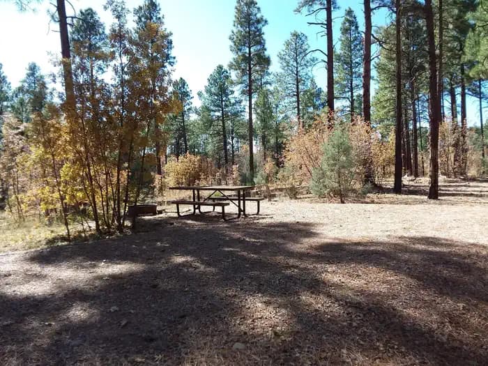
Overview Lewis Canyon is a large single-group campsite located in the scenic White Mountains region of eastern Arizona. With several amenities and activities, including hiking and horseshoes, the facility is great for family gatherings and other large groups. Recreation A variety of recreation opportunities are available from the campground, including hiking, a horseshoe pit, a baseball field and access to the beautiful and extensive White Mountain Trail System for hiking and mountain biking. Numerous Forest Service Roads nearby can accomodate OHV enthusiasts on a variety of terrain. Facilities A variety of recreation opportunities are available from the campground, including hiking, a horseshoe pit, a baseball field and access to the beautiful and extensive White Mountain Trail System for hiking and mountain biking. Numerous Forest Service Roads nearby can accomodate OHV enthusiasts on a variety of terrain. Natural Features Lewis Canyon Campground is located in a beautiful ponderosa pine setting with a large open field nearby. It sits at an elevation of approximately 6,600 feet in the Sitgreaves National Forest. Wildlife including turkey, elk and mule deer are often seen nearby. Summer temperatures can be very pleasant because of the elevation. However, the summer monsoon season often brings afternoon thunderstorms from late June through August. Visitors should come prepared for rain and cool nighttime temperatures. Nearby Attractions Visitors can explore vistas and take part in many outdoor activities in the surrounding Apache-Sitgreaves National Forest, which encompasses 2 million acres of magnificent mountain country in east-central Arizona and New Mexico.
View details →
Overview With an elevation over a mile-high(5640 ft), Christopher Creek Campground's crisp, fresh air and vibrant views are a joy to behold. The facility is tucked along the banks of the spring-fed Christopher Creek, which passes just below the Mogollon Rim. The Mogollon Rim, pronounced by locals as "muggy-own," is a 200-mile long cliff in northern Arizona that ranges between 5,000 and 7,000 ft in elevation. The unique landscape was created by extreme erosion and faulting that has sculpted spectacular canyons and buttes. The rim serves as the geographical dividing line between the cool high country above and the hot, dry desert below. Christopher Creek is located in the desert portion, but is balanced by the cool waters of the creek and forested surroundings. Recreation After a day of horseback riding or mountain biking, take a dip in one of the facility's three swimming holes to cool off from the summer sun. Each spring, the creek is stocked with rainbow trout, allowing anglers the opportunity to cast their hearts out for rainbows as well as brook and brown trout. Facilities After a day of horseback riding or mountain biking, take a dip in one of the facility's three swimming holes to cool off from the summer sun. Each spring, the creek is stocked with rainbow trout, allowing anglers the opportunity to cast their hearts out for rainbows as well as brook and brown trout. Natural Features Christopher Creek provides creek side dwelling in Tonto National Forest, at the base of the Mogollon Rim. Sites are surrounded by ponderosa pines, junipers, oaks and manzanita evergreen shrubs. contact_info For facility specific information, please call (928) 474-7900. Nearby Attractions The small town of Christopher Creek is just a short drive away and offers a few restaurant options for those who tire of cooking at the campground.. A series of lakes called the Rim Country Lakes are about a 10 minute drive east. Woods Canyon Lake is one of the most popular recreational lakes in the state and offers options for boating as well as a nature trail that loops around the lake's perimeter.
View details →
Overview Chavez Crossing Group Campground is in the picturesque Red Rock district of Arizona, with famous red rock formations and breathtaking painted sunsets. Placed beside a creek and surrounded by sycamore and cypress groves, the campground's location offers a fresh sense of the great outdoors. It's also conveniently close to developed entertainment like golf courses and stylish restaurants in the resort town of Sedona. Drive through Oak Creek Canyon to view majestic red-hued cliffs, buttes, and canyons. At night, relax by the campfire at your site or take advantage of Sedona's trendy shopping and nightlife. Recreation Go wading or fishing in the crystal clear waters of Oak Creek or take a stroll with your camera to photograph the unique flora, fauna and rock formations. Cathedral Rock and Bell Rock are famous nearby attractions, perfect for exploring or photographing. Facilities Go wading or fishing in the crystal clear waters of Oak Creek or take a stroll with your camera to photograph the unique flora, fauna and rock formations. Cathedral Rock and Bell Rock are famous nearby attractions, perfect for exploring or photographing. Natural Features Chavez Crossing is in a high desert region situated at the base of the Mogollon Rim, a 200-mile long slope that ranges between 5,000 and 7,000 ft elevation. The unique landscape creates erosion that has shaped spectacular canyons and buttes that make the region an appealing attraction. Nearby Attractions A variety of hiking trails and swimming holes are a short drive away. Seek out your favorite panoramic views at Munds Mountain Wilderness, or explore the Red Rock/Secret Mountain Wilderness area in the heart of Oak Creek Canyon. Here, you can find abandoned dwellings and rock art from early inhabitants. contact_info For facility specific information, please call (928) 203-0624.
View details →
Overview Dairy Springs is a comfortable campground tucked away in a scenic area of northern Arizona. Its main attraction is the seasonal Mormon Lake which, when filled with water, draws visitors for fishing, windsurfing and wildlife watching. Hiking, biking, horseback riding and photography are available year-round. The facility has both individual and group sites that can accommodate groups of many sizes, including large families. Recreation Recreation usually centers around fishing in nearby Mormon Lake (seasonally). The area is ripe with additional outdoor activities. Three hiking trails originate at Dairy Springs and one at nearby Double Springs. The trails lead to scenic overlooks of Mormon Lake and surrounding prairies, forests and volcanoes. Wildlife watching is also popular. It's a very good place to spot hawks, including northern harriers and ospreys. The area boasts a healthy population of elk and mule deer too. Facilities Recreation usually centers around fishing in nearby Mormon Lake (seasonally). The area is ripe with additional outdoor activities. Three hiking trails originate at Dairy Springs and one at nearby Double Springs. The trails lead to scenic overlooks of Mormon Lake and surrounding prairies, forests and volcanoes. Wildlife watching is also popular. It's a very good place to spot hawks, including northern harriers and ospreys. The area boasts a healthy population of elk and mule deer too. Natural Features Dairy Springs sits in a picturesque forest of old Ponderosa pine and oak trees with a grassy understory. The campground is at an elevation of 7,100 ft. and has summers that are characteristically sunny, warm and dry, with the occasional afternoon thunderstorm. Dairy Springs is adjacent to Double Springs Campground, which has a spring that runs to the surface just above the camping area. Nearby Attractions The closest town is Mormon Lake, Arizona. This small and scenic mountain resort village is conveniently close to the campground and offers horseback rides, mountain bike rentals, a country store, service station and steakhouse. contact_info For facility specific information, please call (928) 774-9671.
View details →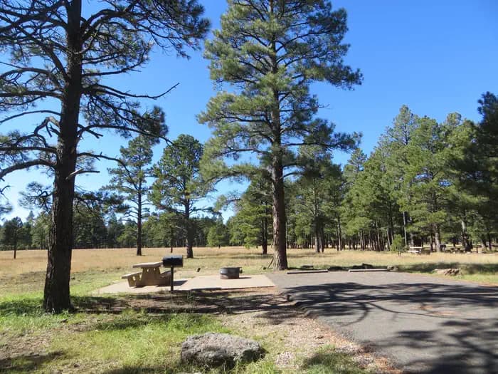
Overview Pinegrove Campground sits in the lush Coconino National Forest of northern Arizona, offering visitors countless recreation opportunities set in a stunning landscape. Recreation Nearby Upper and Lower Lake Mary, Ashurst, Marshall and Kinnikinick Lakes serve as a recreational focus for this campground. All are stocked with fish including trout, bass and channel catfish. Upper Lake Mary is popular with power boaters, and Ashurst attracts a following of windsurfers along with anglers and boaters. Several excellent hiking and biking trails are located within a short drive. Visitors also enjoy wildlife viewing and picnicking. Facilities Nearby Upper and Lower Lake Mary, Ashurst, Marshall and Kinnikinick Lakes serve as a recreational focus for this campground. All are stocked with fish including trout, bass and channel catfish. Upper Lake Mary is popular with power boaters, and Ashurst attracts a following of windsurfers along with anglers and boaters. Several excellent hiking and biking trails are located within a short drive. Visitors also enjoy wildlife viewing and picnicking. Natural Features Coconino National Forest's 1.8 million acres offer clear lakes, red rock cliffs, desert basins and canopies of pine trees. The lakes around these forested campgrounds are used as a stopover for migrating waterfowl, a wintering site for rare bald eagles and a feeding ground for resident ospreys. The area is also home to a considerable number of elk and mule deer. Nearby Attractions The nearest town is Flagstaff, Arizona, about 20 miles away. Camping supplies, groceries, gas, restaurants, shopping and more are available. contact_info For facility specific information, please call (928) 774-9671.
View details →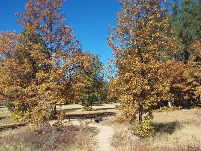
Overview Aspen Campground is a scenic hideaway for anglers, boaters, families and photographers, located in north central Arizona near Heber and Payson. It sits in a dense pine and aspen area forest near the shore of Woods Canyon Lake at an elevation of 7,000 ft. With spacious campsites, calm and scenic lake waters, a marina, boat ramp and many amenities, Aspen is one of the most popular camping spots in Arizona. Recreation Popular activities include trout fishing, hiking, boating and photography. Woods Canyon Lake is one of seven lakes in the Rim Lakes Recreation Area, and one of the most visited. Two other lakes are within a short drive. Woods Canyon Lake only allows electric boat motors. An easy hiking trail meanders around the lake, and the campground's paved roads make for great bike rides. Families might also enjoy attending educational programs given by Forest Service rangers on the weekends. Facilities Popular activities include trout fishing, hiking, boating and photography. Woods Canyon Lake is one of seven lakes in the Rim Lakes Recreation Area, and one of the most visited. Two other lakes are within a short drive. Woods Canyon Lake only allows electric boat motors. An easy hiking trail meanders around the lake, and the campground's paved roads make for great bike rides. Families might also enjoy attending educational programs given by Forest Service rangers on the weekends. Natural Features The large and rambling campground offers several camping experiences and environments from marshy meadows to a rocky forest. Wildlife viewing includes birds, squirrels, deer and elk. Deer, skunks and bears are common campground visitors. Summer temperatures can be very pleasant because of the elevation. However, the rainy season often brings afternoon thunderstorms from late June through August. Visitors should come prepared for rain and cool nighttime temperatures. contact_info For facility specific information, please call (928) 535-0181. Nearby Attractions Visitors can explore endless vistas and take part in many outdoor activities in the surrounding Apache-Sitgreaves National Forest, which encompasses 2 million acres of magnificent mountain country in east-central Arizona and New Mexico. The Mogollon Rim Visitor Center, open weekends from Memorial Day through Labor Day, is only a short drive from Aspen Campground. Visitors can find an informative staff as well as books and gifts related to the local area. The nearest towns are Heber and Payson.
View details →
Overview Benny Creek Campground offers group camping in the remote and scenic White Mountains of Arizona. A perfect outdoor retreat for small to medium group gatherings, the campground is situated in a pine forest above Benny Creek and within walking distance of Bunch Reservoir and Greer Lakes. Picnicking, fishing, hiking and boating are often enjoyed by campers. Recreation Excellent creek and lake fishing for trout draws anglers to the campground. Hikers can seek out the Squirrel Springs trail nearby. Those wishing to relax on a scenic drive can explore the White Mountain and Coronado Trail Scenic Byways. Facilities Excellent creek and lake fishing for trout draws anglers to the campground. Hikers can seek out the Squirrel Springs trail nearby. Those wishing to relax on a scenic drive can explore the White Mountain and Coronado Trail Scenic Byways. Natural Features Benny Creek Campground sits in the White Mountains of eastern Arizona at an elevation of 8,250 feet. Campsites are fairly open under a canopy of ponderosa pine. Abert squirrels and chipmunks are common campground residents, and mule deer and elk inhabit the area as well. The nearby reservoir is one of three area lakes on the Little Colorado River. Summer temperatures can be very pleasant due to the elevation. However, the rainy season often brings afternoon thunderstorms from late June through August. Visitors should come prepared for rain and cool nighttime temperatures. Nearby Attractions The nearby town of Greer offers gas, groceries, restaurants and equipment rentals. Visitors can explore endless vistas and take part in many outdoor activities in the surrounding Apache-Sitgreaves National Forest, which encompasses 2 million acres of magnificent mountain country in east-central Arizona and New Mexico. contact_info For facility specific information, please call (928) 537-8888.
View details →
Overview Brookchar Campground is tucked on the banks of Big Lake in the White Mountains of eastern Arizona. The campground is a small, tent-only facility comprised entirely of walk-in sites. Of the lake's five campgrounds, Brookchar is nearest to the water. The stocked lake draws anglers, and boat rentals and a boat ramp make it easy for campers to enjoy the lake's blue waters. Recreation Big Lake is one of Arizona's top trout fishing lakes, with rainbow, cutthroat, brook and Apache trout being the most sought-after species. The recreation area is also popular for hiking, mountain biking, horseback riding, birding and wildlife viewing. Facilities Big Lake is one of Arizona's top trout fishing lakes, with rainbow, cutthroat, brook and Apache trout being the most sought-after species. The recreation area is also popular for hiking, mountain biking, horseback riding, birding and wildlife viewing. Natural Features The campground sits in the Apache-Sitgreaves National Forest at an elevation of 9,100 feet. The area is scenic, forested with ponderosa pine, fir, spruce and aspen, interspersed with high elevation meadows. Summer temperatures are pleasant and cool, a nice respite from the heat of lower deserts. Visitors should come prepared for afternoon thunderstorms and cool nighttime temperatures. Nearby Attractions Several other lakes can be found in the surrounding area. Visitors can also explore endless vistas and take part in many outdoor activities in the surrounding Apache-Sitgreaves National Forest, which encompasses 2 million acres of magnificent mountain country in east-central Arizona and New Mexico. contact_info For facility specific information, please call (928) 537-8888.
View details →
Overview Located in the scenic Apache-Sitgreaves National Forest in north central Arizona near the town of Heber, Canyon Point has a range of individual and group campsites to suit many visitors. The campground sits in a heavily wooded pine and aspen area 5 miles from the popular Willow Springs Lake. Campers enjoy trout fishing (both lake and stream), hiking, boating and photography. Recreation Hikers enjoy staying at Canyon Point because of its access to trails to the Sinkhole and the edge of the Mogollon Rim, which offers a spectacular view. Its proximity to Willow Springs Lake also draws boaters and anglers. Families who stay on the weekends often attend educational programs given by Forest Service rangers at the facility's amphitheater. Facilities Hikers enjoy staying at Canyon Point because of its access to trails to the Sinkhole and the edge of the Mogollon Rim, which offers a spectacular view. Its proximity to Willow Springs Lake also draws boaters and anglers. Families who stay on the weekends often attend educational programs given by Forest Service rangers at the facility's amphitheater. Natural Features Canyon Point lies in a forested area above the Mogollon Rim at an elevation of 7,500 ft. The Mogollon Rim, pronounced by locals as "muggy-own," is a 200-mile long escarpment in northern Arizona that ranges between 5,000 and 7,000 ft in elevation. The unique landscape was created by the uplift of the Colorado Plateau followed by erosion and faulting that has sculpted spectacular canyons and buttes. The rim serves as the geographical divide between the cool high country above and the hot, dry desert below. Summer daytime temperatures are generally 20 - 40 degrees cooler than the greater Phoenix Area. However, the rainy season often brings afternoon thunderstorms from late June through August. Visitors should come prepared for possible rain and cool nighttime temperatures. Nearby Attractions Forest Lakes, Arizona is located approximately 2 miles east of the campground. Visitors can find food, fuel, telephones, and groceries. The nearest full service community is Overgaard, 22 miles east on Highway 260. contact_info For facility specific information, please call (928) 535-0181.
View details →
Overview Cave Springs sits in the scenic Oak Creek Canyon and is one of Coconino National Forest's most popular campgrounds. The campground is nestled in a forested canyon near the town of Sedona, Arizona, and its famous red rock cliffs. The scenery is unmatched, the stream is stocked with trout, and swimming, hiking and birding spots are nearby. Recreation There are several hiking trails in the vicinity. Some lead up the canyon slopes to offer good views of the surrounding scenery. The creek is bordered with paths that lead along its picturesque course, offering great bird watching and fishing. Facilities There are several hiking trails in the vicinity. Some lead up the canyon slopes to offer good views of the surrounding scenery. The creek is bordered with paths that lead along its picturesque course, offering great bird watching and fishing. Natural Features The area is a heavily wooded, lush riparian zone. Campsites are located in a shady stand of ponderosa pines in the upper reaches of the canyon. Many of the campsites are located right on the banks of Oak Creek. The creek has crystal clear, cool water that is refreshing on hot summer days. Nearby Attractions The nearest town is Sedona, popular for its red rock vistas, resorts and shopping. One of Arizona's best swimming spots, Slide Rock State Park, is down the road. Campers can also explore the 1.8-million acre Coconino National Forest, which boasts a spectacular variety of scenery and outdoor activities. contact_info For facility specific information, please call (928) 203-0624.
View details →
Overview Cutthroat Campground lies at an elevation of 9,000 feet in the White Mountains of eastern Arizona. It sits on the shoreline of Big Lake and affords visitors many recreational opportunities in a quiet, scenic setting. Popular activities include trout fishing and hiking. Recreation Named after a species of trout, Cutthroat is adjacent to 450-acre Big Lake, one of Arizona's top fishing lakes. The lake is known for its trout fishing, with rainbow, cutthroat, brook and Apache being the most sought-after species. The recreation area is also popular for hiking, mountain biking, birding and wildlife viewing. Facilities Named after a species of trout, Cutthroat is adjacent to 450-acre Big Lake, one of Arizona's top fishing lakes. The lake is known for its trout fishing, with rainbow, cutthroat, brook and Apache being the most sought-after species. The recreation area is also popular for hiking, mountain biking, birding and wildlife viewing. Natural Features The campground is located in a very scenic area, forested with ponderosa pine, spruce, Douglas fir, and aspen trees, which provide ample shade. Summer temperatures are pleasant and cool, a nice respite from the heat of lower deserts. Visitors should come prepared for cool nighttime temperatures and occasional summer rain storms. Nearby Attractions Visitors can explore endless vistas and take part in many outdoor activities in the surrounding Apache-Sitgreaves National Forest, which encompasses 2 million acres of magnificent mountain country in east-central Arizona and New Mexico. contact_info For facility specific information, please call (928) 537-8888.
View details →
Overview Grayling Campground offers perhaps the most secluded sites in the Big Lake Recreation Area in eastern Arizona. It sits on the shoreline of the lake in a mixed conifer and aspen forest and affords visitors many recreational opportunities in a quiet, scenic setting. Popular activities include trout fishing and hiking. Recreation The campground is adjacent to 450-acre Big Lake, one of Arizona's top fishing lakes. The lake is known for its trout fishing, with rainbow, cutthroat, brook and Apache being the most sought-after species. The recreation area is also popular for hiking, mountain biking, birding and wildlife viewing. Curious campers can attend educational programs at the recreation area's visitor center. Facilities The campground is adjacent to 450-acre Big Lake, one of Arizona's top fishing lakes. The lake is known for its trout fishing, with rainbow, cutthroat, brook and Apache being the most sought-after species. The recreation area is also popular for hiking, mountain biking, birding and wildlife viewing. Curious campers can attend educational programs at the recreation area's visitor center. Natural Features Grayling sits in the White Mountains at an elevation of 9,000 feet. It is a very scenic area, forested with ponderosa pine, Douglas fir, spruce and aspen trees, which provide ample shade. Summer temperatures are pleasant and cool, a nice respite from the heat of lower deserts. Visitors should come prepared for cool nighttime temperatures and occasional summer rain storms. contact_info For facility specific information, please call (928) 537-8888. Nearby Attractions Visitors can explore endless vistas and take part in many outdoor activities in the surrounding Apache-Sitgreaves National Forest, which encompasses 2 million acres of magnificent mountain country in east-central Arizona and New Mexico. Springerville, Arizona is the closest town to the campground.
View details →
Overview Hoyer Campground is situated among the ponderosa pine forests of eastern Arizona, and is one of the most popular campgrounds in the area for families and seniors. Is is less than a mile from Greer Lakes in the middle of the Apache National Forest. Hiking and fishing are especially popular. Recreation Greer Lakes and the Little Colorado River are within walking distance for avid anglers seeking out rainbow, cutthroat, brook and brown trout. Hikers can check out several trails within a short drive. Those wishing to relax on a scenic drive can explore the White Mountain and Coronado Trail Scenic Byways. Curious campers can take part in guided nature walks around the lake or attend educational programs at the facility's amphitheater on Saturday evenings during the summer. Facilities Greer Lakes and the Little Colorado River are within walking distance for avid anglers seeking out rainbow, cutthroat, brook and brown trout. Hikers can check out several trails within a short drive. Those wishing to relax on a scenic drive can explore the White Mountain and Coronado Trail Scenic Byways. Curious campers can take part in guided nature walks around the lake or attend educational programs at the facility's amphitheater on Saturday evenings during the summer. Natural Features The campground sits in a heavily forested pine and aspen forest at an elevation of 8,300 feet in the scenic and remote White Mountains. Chipmunks and Abert's squirrels are common campground residents, and mule deer and elk inhabit the area as well. The nearby reservoir is one of three area lakes on the Little Colorado River. Summer temperatures can be very pleasant because of the elevation. However, the rainy season often brings afternoon thunderstorms from late June through August. Visitors should come prepared for rain and cool nighttime temperatures. Nearby Attractions The closest towns are Greer and Springerville, Arizona. Campers can find gas, groceries, restaurants and equipment rentals in Greer. Visitors can explore endless vistas and take part in many outdoor activities in the surrounding Apache-Sitgreaves National Forest, which encompasses 2 million acres of magnificent mountain country in east-central Arizona and New Mexico. contact_info For facility specific information, please call (928) 537-8888.
View details →
Overview Rainbow is the largest campground in the Big Lake Recreation Area in eastern Arizona. Because of its proximity to the lake, size and the many amenities it offers, Rainbow is a favorite for families. Popular activities include hiking, horseback riding and fishing. Recreation The campground is adjacent to 450-acre Big Lake, one of Arizona's top fishing lakes. The lake is known for its trout fishing, with rainbow, cutthroat, brook and Apache being the most sought-after species. The recreation area is also popular for hiking, mountain biking, birding and wildlife viewing. Curious campers can attend educational programs at the recreation area's visitor center. Facilities The campground is adjacent to 450-acre Big Lake, one of Arizona's top fishing lakes. The lake is known for its trout fishing, with rainbow, cutthroat, brook and Apache being the most sought-after species. The recreation area is also popular for hiking, mountain biking, birding and wildlife viewing. Curious campers can attend educational programs at the recreation area's visitor center. Natural Features Rainbow Campground sits at an elevation of 9,000 feet in the White Mountains. It is a very scenic area, forested with ponderosa pine, Douglas fir, spruce and aspen trees, which provide ample shade. Summer temperatures are pleasant and cool, a nice respite from the heat of the lower desert. Visitors should come prepared for cool nighttime temperatures and occasional summer thunderstorms. Nearby Attractions Visitors can explore endless vistas and take part in many outdoor activities in the surrounding Apache-Sitgreaves National Forest, which encompasses 2 million acres of magnificent mountain country in east-central Arizona and New Mexico. Springerville, Arizona is the closest town to the campground.
View details →
Overview Spillway Campground is on the shores of popular Woods Canyon Lake near the town of Heber in north central Arizona. Situated in a pine forest with plenty of shade, the campground has individual campsites as well as one group campsite for small gatherings. Given its proximity to the lake, hiking trails and scenic areas, Spillway is a convenient getaway for anglers, boaters, hikers, families and photographers. Recreation Woods Canyon Lake is one of seven lakes in the Rim Lakes Recreation Area, and one of the most visited. Trout fishing (both lake and stream) is a favorite pastime. Woods Canyon Lake only allows electric boat motors. Two other lakes are within a short drive. The Rim Lakes Vista Trail, less than a mile from the campground, and others in the area lead to spectacular views of the Mogollon Rim. An easy hiking trail meanders around the lake, and the paved roads in the recreation area make for great afternoon bike rides. Families might also enjoy attending educational programs given by Forest Service rangers on the weekends. Facilities Woods Canyon Lake is one of seven lakes in the Rim Lakes Recreation Area, and one of the most visited. Trout fishing (both lake and stream) is a favorite pastime. Woods Canyon Lake only allows electric boat motors. Two other lakes are within a short drive. The Rim Lakes Vista Trail, less than a mile from the campground, and others in the area lead to spectacular views of the Mogollon Rim. An easy hiking trail meanders around the lake, and the paved roads in the recreation area make for great afternoon bike rides. Families might also enjoy attending educational programs given by Forest Service rangers on the weekends. Natural Features Spillway is located in a thick forest of ponderosa pine, oak and Douglas fir at an elevation of 7,500 ft. The campground is situated on the lakeshore overlooking the calm blue waters of 52-acre Woods Canyon Lake, where visitors may see squirrels, deer, elk and a variety of birds. Nearby hiking trails offer views of the Mogollon Rim, a 200-mile long cliff in northern Arizona that ranges between 5,000 and 7,000 feet in elevation and serves as the geographical dividing line between the cool high country above and the hot, dry desert below. Summer temperatures can be very pleasant because of the elevation. However, the rainy season often brings afternoon thunderstorms from late June through August. Visitors should come prepared for rain and cool nighttime temperatures. contact_info For facility specific information, please call (928) 535-0181. Nearby Attractions Gas, phone and groceries are available 10 miles east at Forest Lakes. The nearest full service community is Payson, Arizona, 35 miles west on Highway 260. Visitors can explore endless vistas and take part in many outdoor activities in the surrounding Apache-Sitgreaves National Forest, which encompasses 2 million acres of magnificent mountain country in east-central Arizona and New Mexico.
View details →
Overview Winn Campground is situated near the Mt. Baldy trailheads and the East and West Forks of the Little Colorado River, making it an excellent choice for anglers and hikers. The facility offers many amenities and a variety of campsites, from group sites to tent-only and standard individual sites. It offers a peaceful and remote setting, as well as convenience to a host of outdoor activities and scenic areas. Recreation Several nearby lakes invite anglers and boaters to fish for trout, including stocked Apache trout at Lee Valley Reservoir. With its proximity to the Mt. Baldy Wilderness, Winn Campground also attracts hikers. Mount Baldy tops out at 11,420 feet and is the tallest peak in Arizona's White Mountains. Facilities Several nearby lakes invite anglers and boaters to fish for trout, including stocked Apache trout at Lee Valley Reservoir. With its proximity to the Mt. Baldy Wilderness, Winn Campground also attracts hikers. Mount Baldy tops out at 11,420 feet and is the tallest peak in Arizona's White Mountains. Natural Features Winn Campground is situated in a thick pine and aspen forest at an elevation of 8,500 feet near Lee Valley and Big Lake. Several smaller lakes are located within a short drive. From the campground, visitors can take in scenic views of the surrounding White Mountains. Some campsites border a large meadow where elk are often seen at twilight. Summer temperatures can be very pleasant because of the elevation. However, the rainy season often brings afternoon thunderstorms from late June through August. Visitors should come prepared for rain and cool nighttime temperatures. Nearby Attractions Visitors can explore endless vistas and take part in many outdoor activities in the surrounding Apache-Sitgreaves National Forest, which encompasses 2 million acres of magnificent mountain country in east-central Arizona and New Mexico. The nearest town is Springerville, Arizona. contact_info For facility specific information, please call (928) 537-8888.
View details →
Overview Woods Canyon Lake Group Area is located in north central Arizona near the community of Forest Lakes. The camp is adjacent to popular Woods Canyon Lake and situated in thick pine forests, providing a great getaway for large groups of up to 100 people. It offers plenty of activities for anglers, boaters, hikers, families and photographers. Recreation Woods Canyon Lake is one of seven lakes in the Rim Lakes Recreation Area, and one of the most visited. Trout fishing (both lake and stream) is a favorite pastime. Woods Canyon Lake only allows electric boat motors. Two other lakes are within a short drive. The Rim Lakes Vista Trail, less than a mile from the campground, and others in the area lead to spectacular views of the Mogollon Rim. An easy hiking trail meanders around the lake, and the paved roads in the recreation area make for great afternoon bike rides. Families might also enjoy attending educational programs given by Forest Service rangers on the weekends. Facilities Woods Canyon Lake is one of seven lakes in the Rim Lakes Recreation Area, and one of the most visited. Trout fishing (both lake and stream) is a favorite pastime. Woods Canyon Lake only allows electric boat motors. Two other lakes are within a short drive. The Rim Lakes Vista Trail, less than a mile from the campground, and others in the area lead to spectacular views of the Mogollon Rim. An easy hiking trail meanders around the lake, and the paved roads in the recreation area make for great afternoon bike rides. Families might also enjoy attending educational programs given by Forest Service rangers on the weekends. Natural Features Woods Canyon Lake is surrounded by a dense forest of pine, fir, oak and aspen, and sits at an elevation of 7,000 feet. Hikers who venture onto nearby trails are afforded expansive views of the land beneath the Mogollon Rim. The Mogollon Rim, pronounced by locals as "muggy-own," is a 200-mile long cliff in northern Arizona that ranges between 5,000 and 7,000 feet in elevation and serves as the geographical dividing line between the cool high country above and the hot, dry desert below. Summer temperatures can be very pleasant because of the elevation. However, the rainy season often brings afternoon thunderstorms from late June through August. Visitors should come prepared for rain and cool nighttime temperatures. Wildlife viewing includes birds, squirrels, deer and elk. Deer, skunks and bears are common campground visitors. contact_info For facility specific information, please call (928) 535-0181. Nearby Attractions The nearest full service community is Payson, Arizona, 35 miles west on Highway 260. Visitors can explore endless vistas and take part in many outdoor activities in the surrounding Apache-Sitgreaves National Forest, which encompasses 2 million acres of magnificent mountain country in east-central Arizona and New Mexico.
View details →
Overview Close to historic western towns and centrally located in Arizona, Playground Group Campground is a great place for groups of up to 100 people to enjoy a secluded mountain getaway. The 7,500 ft. elevation of the site, puts it near the summit of Mingus Mountain in Prescott National Forest. Spectacular views of the surrounding desert valleys as well as the nearby towns of Sedona, Jerome and Prescott Valley await campers on the winding drive to and from the site. Recreation The surrounding forest offers many hiking trails of various levels of intensity, from easy short-distance walks to more challenging elevated climbs. Campers who need a break from hiking can relax around the campground, take in the views and listen to the sound of the wind in the pines. Facilities The surrounding forest offers many hiking trails of various levels of intensity, from easy short-distance walks to more challenging elevated climbs. Campers who need a break from hiking can relax around the campground, take in the views and listen to the sound of the wind in the pines. Natural Features The campground is in a secluded site in the tall ponderosa pine trees. Pleasant daytime temperatures and cool mountain breezes make it a nice respite from the summer heat of nearby deserts. Nearby Attractions A short drive away is the colorful town of Jerome, an abandoned mining town that has been transformed into an artist and tourist community. Tuzigoot National Monument, an ancient ruin of the Sinaguan culture, and Dead Horse Ranch State Park, which has mountain biking, canoeing and fishing along the Verde River, are also close by. Tuzigoot National Monument Dead Horse Ranch State Park
View details →
Overview Upper Wolf Creek Group Campground provides a quiet forest setting for groups of up to 100 people to camp and enjoy the outdoors. The historic town of Prescott, Arizona is just 8 miles away. This facility is set away from other developed recreation sites and offers town amenities, trails and lake recreation within minutes. To make reservations click on the availability button to the right to book this site or call 1 (877) 444-6777. For general campground questions contact the Bradshaw Ranger District at 1 (928) 443-8000. Recreation Within the facility, campers can relax with a game of volleyball( net not provided ) or horseshoes. Numerous hiking and mountain biking trails are found in the Bradshaw Mountains around the campground, and 15-acre Goldwater Lake is just a few miles away. Boaters, canoers and kayakers can make use of the lake's dock and boat ramp. Anglers try for trout, sunfish, crappie, largemouth bass and channel catfish in the calm waters. A drive down unpaved Forest Road 97 reveals mountain views and passes through a burn scar from a 2002 wildfire. Facilities Within the facility, campers can relax with a game of volleyball( net not provided ) or horseshoes. Numerous hiking and mountain biking trails are found in the Bradshaw Mountains around the campground, and 15-acre Goldwater Lake is just a few miles away. Boaters, canoers and kayakers can make use of the lake's dock and boat ramp. Anglers try for trout, sunfish, crappie, largemouth bass and channel catfish in the calm waters. A drive down unpaved Forest Road 97 reveals mountain views and passes through a burn scar from a 2002 wildfire. Natural Features The group area is set at an elevation of 6,000 feet in a ponderosa pine forest mixed with juniper, Gambel oak, native grasses. Boulders are strewn throughout the area. A multitude of colorful wildflowers bloom in the spring and during the summer monsoon season. Goldwater Lake is nearby. The forest is home to a wide variety of wildlife. Visitors may have the chance to spot deer, mountain lions, bobcats, coyotes, fox, rabbits, lizards, snakes and birds. Afternoon thunderstorms are possible from late June through mid-September. Nearby Attractions This site is a convenient camping spot for groups who reserve the Groom Creek Schoolhouse day use picnic area nearby.
View details →
Overview Rose Canyon Campground is just 17 miles northeast of Tucson, Arizona, off the Catalina Highway Scenic Drive near the summit of Mt. Lemmon. This area is popular for day use as well as overnight camping. With a high elevation, forested setting, two group picnic areas and opportunities for hiking, wildlife viewing and fishing, Rose Canyon offers a great summer respite from the city. Recreation The lake is sheltered by trees and offers a pleasant setting for a walk in the woods, relaxing on the shore or spending an afternoon fishing for stocked trout. A one-mile trail around the lake is convenient for anglers and hikers. The trail is accessible from the lower parking area to a floating dock near a dam. The surrounding national forest boasts a variety of hiking and mountain biking trails, including several that traverse the 9,157-foot Mt. Lemmon. Facilities The lake is sheltered by trees and offers a pleasant setting for a walk in the woods, relaxing on the shore or spending an afternoon fishing for stocked trout. A one-mile trail around the lake is convenient for anglers and hikers. The trail is accessible from the lower parking area to a floating dock near a dam. The surrounding national forest boasts a variety of hiking and mountain biking trails, including several that traverse the 9,157-foot Mt. Lemmon. Natural Features The campground sits high on the slopes of the Santa Catalina Mountains, at an elevation of 7,000 feet. Because of its elevation, it can be much cooler than the lower-elevation campgrounds in the area. The campsites are spacious and spread out among stands of large ponderosa pines and clusters of Gambel oak. During the summer rainy season, Rose Creek meanders through the area to the six-acre Rose Canyon Lake at the lower end of the campground. The Coronado National Forest covers 1.78 million acres of southeastern Arizona and southwestern New Mexico. Elevations range from 3,000 to 10,720 feet in 12 widely scattered mountain ranges, or "sky islands," that rise dramatically from the desert floor, supporting biologically diverse plant communities. contact_info For facility specific information, please call (520) 576-1325. Nearby Attractions Catalina Highway, also known as General Hitchcock Highway and Sky Island Scenic Byway, is the only paved road that leads to the upper reaches of Mt. Lemmon and the Santa Catalina Range. It is one of the most scenic highways in the southwest and is a popular day trip. Other notable attractions include Saguaro National Park, Sabino Canyon and Colossal Cave.
View details →
Overview The cool shade of tall ponderosa pines and an overlook of Palisade Canyon from the campgrounds edge make Showers Point Group Site a popular place for groups to spend a weekend or an afternoon. Visitors can relax in shaded campsites, picnic at nearby Rose Canyon, hike and mountain bike on nearby trails or take a scenic drive on Catalina Highway. Recreation Within easy walking distance from Showers Point is one of the most scenic overlooks in the Santa Catalinas. From this towering bluff visitors can see the lower slopes of the Santa Catalina Range and the Santa Cruz Valley stretching toward Mexico. Tall, pyramid-shaped Mt. Wrightson of the Santa Rita Mountains stands prominent on the horizon. Visitors enjoy hiking through the Santa Catalina backcountry, via the Palisade Trail that departs near the campground. The trail drops down the southwestern slopes of the mountain range to the popular Sabino Canyon Recreation Area. Fishing is also available at the nearby six-acre Rose Canyon Lake. A day-use fee is applicable at Rose Canyon Facilities Within easy walking distance from Showers Point is one of the most scenic overlooks in the Santa Catalinas. From this towering bluff visitors can see the lower slopes of the Santa Catalina Range and the Santa Cruz Valley stretching toward Mexico. Tall, pyramid-shaped Mt. Wrightson of the Santa Rita Mountains stands prominent on the horizon. Visitors enjoy hiking through the Santa Catalina backcountry, via the Palisade Trail that departs near the campground. The trail drops down the southwestern slopes of the mountain range to the popular Sabino Canyon Recreation Area. Fishing is also available at the nearby six-acre Rose Canyon Lake. A day-use fee is applicable at Rose Canyon Natural Features Showers Point Group Campground sits high on the slopes of the Santa Catalina Mountains at 7,700 feet. Because of its elevation, it can be much cooler than the lower-elevation campgrounds in the area. The campsites are spacious and spread out among stands of big ponderosa pines and clusters of Gambel oak. The Coronado National Forest covers 1.78 million acres of southeastern Arizona and southwestern New Mexico. Elevations range from 3,000 to 10,720 feet in 12 widely scattered mountain ranges, or "sky islands," that rise dramatically from the desert floor, supporting biologically diverse plant communities. contact_info For facility specific information, please call (520) 314-0069. Nearby Attractions Catalina Highway, also known as General Hitchcock Highway and Sky Island Scenic Byway, is the only paved road that leads to the upper reaches of Mt. Lemmon and the Santa Catalina Range. It is one of the most scenic highways in the southwest and provides a popular day trip. Other notable attractions include Saguaro National Park, Sabino Canyon and Colossal Cave.
View details →
Overview Little Elden Springs Horse Camp is a campground that was created for those who love horses and enjoy riding in a beautiful landscape. Located in the Coconino National Forest of northern Arizona, the campground offers opportunities for horseback riding, hiking and wildlife viewing. The facility is very accommodating to campers and their horses and including hitching posts, plenty of space for horse trailers and access to over 30 miles of trails. Recreation Campers can access the Kachina Peaks Wilderness at the Weatherford Trail near Schultz Tank just up the road from the campground. The Mount Elden/Dry Lake Hills Trail System is also accessible right from camp and is comprised of over 30 miles of trails for all levels of horseback riding, hiking and mountain biking. Some of the nearby trails offer amazing views of the peaks, especially during the changing of the leaves in the fall when the aspens turn from green to gold. Facilities Campers can access the Kachina Peaks Wilderness at the Weatherford Trail near Schultz Tank just up the road from the campground. The Mount Elden/Dry Lake Hills Trail System is also accessible right from camp and is comprised of over 30 miles of trails for all levels of horseback riding, hiking and mountain biking. Some of the nearby trails offer amazing views of the peaks, especially during the changing of the leaves in the fall when the aspens turn from green to gold. Natural Features The campground lies near the base of Mount Elden in a lush ponderosa pine and gamble oak forest and has a view of the 12,000-ft. San Francisco Peaks. Fall foliage can be outstanding and very inviting for photography. There is a healthy population of mule deer and elk in the area that can be fun to watch and photograph when sighted. Summers are very pleasant with sunny skies, high temperatures in the 60s to 80s and occasional afternoon thunderstorms. contact_info For facility specific information, please call (928) 774-9671. Nearby Attractions The nearby town of Flagstaff, Arizona, has shopping, restaurants and other conveniences. Visitors can also make a quick trip down the road to the must-see Sunset Crater Volcano National Monument and Wupatki National Monument .
View details →
Overview Pine Flat Campground is a popular camping spot in scenic Oak Creek Canyon in Arizona's Coconino National Forest. The campground is nestled in a forested canyon near the well-known town of Sedona, Arizona, and its red rock cliffs. The scenery is unmatched, the stream is stocked with trout, and swimming, hiking and birding spots can be accessed from the facility. Recreation There are several hiking trails in the vicinity, with some leading up the canyon slopes to offer sweeping views of the surrounding scenery. The creek is bordered with paths that lead along its picturesque course, offering excellent birding and abundant fishing. Facilities There are several hiking trails in the vicinity, with some leading up the canyon slopes to offer sweeping views of the surrounding scenery. The creek is bordered with paths that lead along its picturesque course, offering excellent birding and abundant fishing. Natural Features The area is a heavily wooded, lush riparian zone. Campsites are located in a shady stand of ponderosa pines in the upper reaches of the canyon. Many of the campsites are located right on the banks of Oak Creek. The creek has crystal clear, cool water that is refreshing on hot summer days. Nearby Attractions The nearest town is Sedona, popular for its red rock vistas, resorts and shopping. One of Arizona's best swimming spots, Slide Rock State Park, is down the road. Campers can also explore the 1.8-million acre Coconino National Forest, which boasts a spectacular variety of scenery and outdoor activities. contact_info For facility specific information, please call (928) 203-0624.
View details →
Overview Houston Mesa Campground is located in the forested northern section of Tonto National Forest, just one mile north of Payson, Arizona and less than two hours from Phoenix. With family, equestrian and tent-only campsites, this campground can accommodate a range of visitors and offers plenty of ways to enjoy the outdoors, including several miles of hiking and horseback riding trails nearby. As the fifth largest forest in the United States, the Tonto National Forest is one of the most-visited "urban" forests in the United States (approximately 5.8 million visitors annually). Its boundaries are Phoenix to the south, the Mogollon Rim to the north and the San Carlos and Fort Apache Indian reservations to the east. Recreation Many visitors come to Houston Mesa to horseback ride, hike, camp and picnic. Houston Mesa Loop Trail is a 9-mile round trip through a pinyon and juniper woodland and can be accessed from the horse camping area. The Houston Mesa Interpretive Trail is a 0.5-mile self-guided trail. Facilities Many visitors come to Houston Mesa to horseback ride, hike, camp and picnic. Houston Mesa Loop Trail is a 9-mile round trip through a pinyon and juniper woodland and can be accessed from the horse camping area. The Houston Mesa Interpretive Trail is a 0.5-mile self-guided trail. Natural Features The campground is located at an elevation of 5,200 ft. in a mixed forest and shrub area, with spacious campsites offering both sun and shade. Winters are pleasant and cool with cold nighttime temperatures, while summers are warm and sunny, providing a nice getaway from the hotter deserts around Phoenix. Hawks, eagles, javelina, deer, fox, skunk and coyote live in the area. Nearby Attractions Campers who make the quick trip to the town of Payson, one mile south, will find restaurants, shopping and other conveniences. Scenic driving and outdoor recreation abound in the surrounding Tonto National Forest, which embraces almost 3 million acres of rugged and spectacularly beautiful country, ranging from saguaro cactus-studded desert to pine-forested mountains beneath the Mogollon Rim. contact_info For facility specific information, please call (928) 474-7900.
View details →
Overview The North Rim Campground is located on the remote and rustic North Rim of Grand Canyon National Park in northern Arizona, approximately 210 miles (338 km) from Grand Canyon Village, AZ on the South Rim. It is nestled in a thick ponderosa and aspen forest just on the canyon's edge at an elevation of 8,200 feet. This facility is perfect for tent camping and smaller RVs. Due to its heavily forested location, large and/or high-profile RVs cannot be accommodated. The maximum length in each site description is the combined length of both the RV/trailer and tow vehicle. Many sites are not level and have obstacles such as tight curves and narrow passages through trees. Some sites may not accommodate trailer pop-outs or awnings. The maximum vehicle length permitted on the Cape Royal Scenic Road, Widforss Trailhead, and North Kiabab Trailhead is 22 feet ; plan accordingly if renting an RV if you wish to explore these other areas of the park. Recreation Facilities Natural Features North Rim Campground is shaded by large ponderosa pines interspersed with aspens which turn golden in the autumn as it is situated at over 8,000 feet in elevation; however, it only takes a short walk to peer over the canyon rim to see millions of years of geologic history. The North Rim lies on the Kaibab Plateau, an area that has been uplifted by geologic processes. Many species of wildlife call the Kaibab Plateau home including the tassel-eared Kaibab squirrel which is found nowhere else in the world. contact_info Between 05/15/2024 and 10/15/2024 this location is staffed. Please call (928) 638-7814 to speak with local staff. From 11/13/2023 to 05/14/2024 this location is unstaffed. Please call (877) 444-6777 for general information.
View details →
Overview Mather Campground is located on the South Rim of Grand Canyon National Park in northern Arizona. Grand Canyon is one of the most inspiring landscapes on Earth and draws over five million visitors per year to its spectacular scenery. The campground is large and can accommodate a variety of needs and comfort levels. It is the only campground within Grand Canyon Village. Scenic overlooks, the park's free shuttle bus system, the Visitor Center, the general store and hiking and biking trails are all within a few miles from the facility. The campground is at an elevation of approximately 7,000 ft. Summers are sunny with high temperatures generally in the 80s. Thunderstorms frequently occur in July, August, and early September. Fall and spring are mostly sunny and cool with the occasional snow. Weather is variable; visitors should come prepared. Recreation From the campground, campers can access the Greenway, a paved walking and biking trail that leads to scenic overlooks and the Visitor Center. The Rim Trail, a paved walking trail, is one mile away and runs for 14 miles along the edge of the canyon. Leashed pets are allowed on both trails, but are not permitted below the rim. Bright Angel and South Kaibab trails descend into the canyon. Their trailheads are a short shuttle bus ride from the campground. The park's concessionaire also offers day and overnight mule riding trips into the canyon and along the rim. Facilities From the campground, campers can access the Greenway, a paved walking and biking trail that leads to scenic overlooks and the Visitor Center. The Rim Trail, a paved walking trail, is one mile away and runs for 14 miles along the edge of the canyon. Leashed pets are allowed on both trails, but are not permitted below the rim. Bright Angel and South Kaibab trails descend into the canyon. Their trailheads are a short shuttle bus ride from the campground. The park's concessionaire also offers day and overnight mule riding trips into the canyon and along the rim. Natural Features Mather Campground lies beneath a mixture of a tall canopy of Ponderosa pine, Pinyon, and Juniper trees, providing most campsites with ample shade. The campground is one mile from the rim of the canyon. A visit to the canyon during sunrise and sunset yields spectacular views of yellow, orange, red and violet hues in the canyon walls. Layers of rock display billions of years of geologic history. Campers can take a short shuttle bus ride from the campground to the Visitors Center. Visitors can also visit Yavapai Geology Museum, where they learn about the forces that formed the canyon. Below, visitors can see the mighty Colorado River, which flows 277 miles through the bottom of the canyon. Wildlife abounds on the South Rim, including elk, mule deer, coyotes, lizards, songbirds and the endangered California condor. Although condors nest below the rim, they can be seen soaring several thousand feet above the canyon in search for carrion. Nearby Attractions Numerous visitor centers, restaurants, museums and shops are within a shuttle bus ride from the campground. Beyond the village, Desert View provides one of the widest views of Grand Canyon and the Painted Desert. The Desert View Watchtower displays the talent of architect Mary Jane Colter. Tusayan Ruin and Museum provide glimpses into the life of a small Ancestral Puebloan village 800 years ago. Both are within 25 miles from the campground.
View details →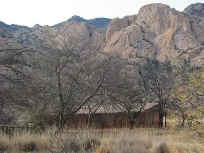
Overview Half Moon Ranch is a ranch style house located in East Cochise Stronghold in the Dragoon Mountains of the Coronado National Forest, approximately 1-1/2 hours east of Tucson. The house is situated in a dramatic canyon that provides excellent rock climbing, hiking, mountain biking, and horseback riding opportunities. Recreation The area around Half Moon ranch has long been considered a bouldering and rock climbing paradise, boasting backcountry and protected routes ranging from one to seven pitches in length, and from 5.6 to 5.12 in difficulty. Most approaches are 30-60 minutes in length, although there are a number of known areas that are easily accessible from the roads. In addition, the nearby Cochise Stronghold Campground has interpretive tales for both natural and cultural resources and history. Facilities The area around Half Moon ranch has long been considered a bouldering and rock climbing paradise, boasting backcountry and protected routes ranging from one to seven pitches in length, and from 5.6 to 5.12 in difficulty. Most approaches are 30-60 minutes in length, although there are a number of known areas that are easily accessible from the roads. In addition, the nearby Cochise Stronghold Campground has interpretive tales for both natural and cultural resources and history. Natural Features Half Moon Ranch is surrounded by the rugged beauty of the Dragoon Mountains and Cochise Stronghold. At an elevation of 5,000 feet, the sparsely wooded area is a protective rampart of granite spires, sheer cliffs, and balanced rocks and boulders which were once the refuge of the Apache Chief, Cochise. The ranch house lies in a mountain range or "sky island" in the Coronado National Forest, rising dramatically from the desert floor and supporting abundant and biologically diverse plant and animal communities. Nearby Attractions The Half Moon Ranch is located approximately 9 miles west of Sunsites, Arizona. Attractions in the area include the Chiricahua National Monument, Fort Bowie National Historic Site, the Amerind Foundation, the ghost towns of Gleeson, Dos Cabezas, and Courtland, and the Willcox Playa.
View details →
Overview Shaw House is a stone masonry cabin located in East Cochise Stronghold in the Dragoon Mountains of the Coronado National Forest. The house is nestled in a dramatic landscape of canyons and rock formations offering guests to the area a unique lodging experience. Nearby trails provide excellent hiking, mountain biking, and horseback riding opportunities. Recreation With rugged granite formations, wooded slopes, seasonal streams, and an amazing variety of plants and wildlife, the Cochise Stronghold area is a popular recreation destination. Long considered a haven for rock climbing and bouldering, the area features backcountry and protected routes ranging from one to seven pitches in length, and from 5.6 to 5.12 in difficulty. Most approaches are 30-60 minutes in length, although there are a number of known areas that are easily accessible from the roads. Nearby trails also provide excellent hiking, mountain biking, and horseback riding opportunities. There are signed interpretive trail for both natural and cultural resources at the nearby Cochise Stronghold Campground. Facilities With rugged granite formations, wooded slopes, seasonal streams, and an amazing variety of plants and wildlife, the Cochise Stronghold area is a popular recreation destination. Long considered a haven for rock climbing and bouldering, the area features backcountry and protected routes ranging from one to seven pitches in length, and from 5.6 to 5.12 in difficulty. Most approaches are 30-60 minutes in length, although there are a number of known areas that are easily accessible from the roads. Nearby trails also provide excellent hiking, mountain biking, and horseback riding opportunities. There are signed interpretive trail for both natural and cultural resources at the nearby Cochise Stronghold Campground. Natural Features Shaw House is surrounded by the rugged beauty of East Cochise Stronghold. The sparsely wooded Dragoon Mountains form a protective rampart of granite spires, sheer cliffs, balanced rocks and boulders, which were once the refuge of the Apache Chief, Cochise. The area is abundant with wildlife, including white-tailed and mule deer, rabbits, wild turkeys, and squirrels. Bats, black bear, Coati, foxes, ring-tailed cats, bobcats, and mountain lion find habitat in the area as well, but are more often seen in the twilight and nocturnal hours. Nearby Attractions The Shaw House is located approximately ten miles west of Sunsites, Arizona. Attractions in the area include the Chiricahua National Monument, Fort Bowie National Historic Site, the Amerind Foundation, and the Willcox Playa.
View details →
Overview Calabasas Group Campground is a place for groups of up to 250 people to enjoy scenery and privacy in a remote, natural setting. Weddings, family reunions and other social gatherings are especially popular during winter due to pleasant seasonal temperatures, yet it is open year-round. Calabasas is situated in Coronado National Forest in southern Arizona, home to a variety of ecosystems and recreation opportunities. It is located a short distance off Ruby Road near Peña Blanca Lake, 67 miles south of Tucson and 14 miles northwest of Nogales, Arizona. Recreation A major attraction at Calabasas Group Site is nearby Peña Blanca Lake. The 45-acre, man-made lake provides birding, boating and fishing opportunities year-round. Anglers can try for rainbow trout, bass, sunfish, crappie and catfish. Groups also enjoy picnicking in the camping area, hiking or mountain biking on area trails or visiting historic sites. Facilities A major attraction at Calabasas Group Site is nearby Peña Blanca Lake. The 45-acre, man-made lake provides birding, boating and fishing opportunities year-round. Anglers can try for rainbow trout, bass, sunfish, crappie and catfish. Groups also enjoy picnicking in the camping area, hiking or mountain biking on area trails or visiting historic sites. Natural Features Campsites within the group area are spread out among a stand of oak trees within a shallow, grassy valley. A few well-worn pathways lead to low hilltops in the area where visitors will find good views of the surrounding valleys and mountains. Calabasas sits at an elevation of 4,000 feet. The Coronado National Forest covers 1.78 million acres of southeastern Arizona and southwestern New Mexico. Elevations range from 3,000 to 10,720 feet in 12 widely scattered mountain ranges or "sky islands" that rise dramatically from the desert floor, supporting plant communities as biologically diverse as those encountered on a trip from Mexico to Canada. Nearby Attractions Visitors can take an educational day trip to Tumacácori National Historical Park, which protects three Spanish colonial mission ruins, and Tubac Presidio State Historic Park, which preserves the ruins of the oldest Spanish Presidio site in Arizona. The border town, Nogales, is also close by. Tumacácori National Historical Park
View details →
Overview With its picturesque vegetation and dramatic setting at the foot of 9,157' Mt. Lemmon in southeastern Arizona, Peppersauce Campground is an outstanding area for enjoying an afternoon picnic or a weekend campout. This year-round facility is a popular stop among off-road vehicle enthusiasts and families. Hunting, hiking and scenic driving opportunities are nearby. It is located 8 miles from the town of Oracle. Recreation The Santa Catalina Mountains are known for their exceptional hiking. Hikers can find access to the Arizona Trail, which runs from Mexico to Utah, about 5 miles from the campground along Forest Road 38. Off-road vehicle trails are also available in the area. A few nearby caves afford visitors the opportunity for caving and spelunking. Facilities The Santa Catalina Mountains are known for their exceptional hiking. Hikers can find access to the Arizona Trail, which runs from Mexico to Utah, about 5 miles from the campground along Forest Road 38. Off-road vehicle trails are also available in the area. A few nearby caves afford visitors the opportunity for caving and spelunking. Natural Features Campsites at Peppersauce are spread throughout a creekside oasis of enormous Arizona sycamore and walnut trees that provide shade in summer and color in autumn. The campground sits at an elevation of 4,700 feet alongside Peppersauce Creek. The creek is normally dry except during heavy rains or the area's summer monsoon season. Campers should be aware that the creek is prone to flash flooding during rain events. Nearby Attractions Visitors can explore several historic, cultural and natural attractions within a day trip, including the University of Arizona's Biosphere 2, the city of Tucson, Saguaro National Park, Sabino Canyon and Colossal Cave.
View details →
Overview Visitors are drawn to Molino Campground for its group camping area, scenic mountain surroundings and hiking and mountain biking opportunities. While most other campgrounds in the Catalina Mountains are closed in winter, Molino Campground and its picnic area are open in late fall, winter and early spring. The pleasant winter weather at this elevation makes it a great time to visit. Molino Basin is conveniently located 5.5 miles from the base of Mt. Lemmon on the Catalina Highway, and about 10 miles northeast of Tucson. Recreation Hiking, mountain biking and horseback riding are popular activities. The Arizona Trail, which extends from Mexico to Utah, passes through the campground, and the Molino Trail leads to the Pusch Ridge Wilderness (hiking and horseback riding only). A variety of additional trails, including some on 9,157' Mt. Lemmon, are available in the area for those who wish to venture away from the campground for the day. Facilities Hiking, mountain biking and horseback riding are popular activities. The Arizona Trail, which extends from Mexico to Utah, passes through the campground, and the Molino Trail leads to the Pusch Ridge Wilderness (hiking and horseback riding only). A variety of additional trails, including some on 9,157' Mt. Lemmon, are available in the area for those who wish to venture away from the campground for the day. Natural Features Campsites sit amid a high desert oak scrub ecosystem at an elevation of 4,500 feet on the slopes of the Santa Catalina Mountains. Along the banks of Molino Creek, which flows during and immediately after rain or snowmelt, species such as cottonwood, Arizona live oak and mesquite provide a scenic setting. Views are dominated by rugged, rocky hills. Colorful wildflowers bloom in spring. Nearby Attractions Catalina Highway (also known as General Hitchcock Highway and Sky Island Scenic Byway), the only paved road that leads to the upper reaches of Mt. Lemmon and the Santa Catalina Range, is one of the most scenic highways in the Southwest and definitely worth a day trip. Other notable attractions include Saguaro National Park, Sabino Canyon, Colossal Cave and the city of Tucson.
View details →
Overview This high-mountain group campground and day use area is located on a site that was once occupied by the old mining town of Reef. Many relics of Reef's mining history, including the remains of the town's old water system, are still visible in and around the campground. Groups of up to 50 people can enjoy walking an interpretive history trail, hiking, horseback riding and watching wildlife in this cool mountain setting. Recreation Reef Townsite Loop Trail, an interpretive trail that highlights the mining history of this area and showcases beautiful views, begins and ends at the northeastern edge of the campground. The national forest has a variety of hiking and mountain biking trails for those who wish to leave the facility for a day trip. Facilities Reef Townsite Loop Trail, an interpretive trail that highlights the mining history of this area and showcases beautiful views, begins and ends at the northeastern edge of the campground. The national forest has a variety of hiking and mountain biking trails for those who wish to leave the facility for a day trip. Natural Features This site rests on the "Reef" rock formations in the in the Huachuca Mountains. At an elevation of 7,200 feet, it provides a cool respite from the heat of surrounding lower deserts in summer. The Coronado National Forest covers 1.78 million acres of southeastern Arizona and southwestern New Mexico. Elevations range from 3,000 to 10,720 feet in 12 widely scattered mountain ranges, or "sky islands," that rise dramatically from the desert floor, supporting biologically diverse plant communities.
View details →
Overview The Camp Rucker Group Site is not available for reservations at this time for site re-design and facility improvements . The group camp area is now open to individual party walk-in camping. Individual sites are $15 per night; cash payment on-site. Camp Rucker sits in the beautiful and remote Chiricahua Mountains of southeastern Arizona. Recreation The Rucker and Tex Canyon scenic drive takes visitors over the southern reaches of the Chiricahua Mountains through beautiful canyon country, several forest campgrounds and a number of trails into the Chiricahua Wilderness. History buffs might want to stop at the historic Rucker Military Camp and Ranch, a remnant of the region's warring between U.S. Cavalry and Chiricahua Apaches. Facilities The Rucker and Tex Canyon scenic drive takes visitors over the southern reaches of the Chiricahua Mountains through beautiful canyon country, several forest campgrounds and a number of trails into the Chiricahua Wilderness. History buffs might want to stop at the historic Rucker Military Camp and Ranch, a remnant of the region's warring between U.S. Cavalry and Chiricahua Apaches. Natural Features Located at an elevation of 5,533 feet, Camp Rucker is situated in a grassy area with plenty of open space between the oak, juniper and Arizona walnut trees that provide welcome shade on a summer day. A short distance from the camp, Rucker Creek runs intermittently throughout the year. Monte Vista Peak to the northeast and a number of other minor peaks and foothills provide a scenic backdrop. Nearby Attractions Campers can take a day trip to Chiricahua National Monument. The monument protects some of the most scenic areas of the Chiricahua Mountains, a wonderland of rocks and forests with many opportunities for hiking and photography. Click here for more about the Chiricahua National Monument.
View details →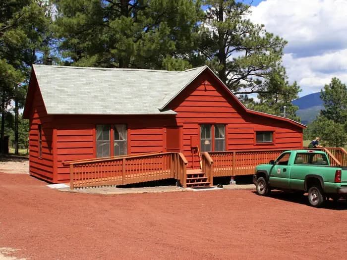
Overview Treasure Park East sits along the scenic Swift Trail in the deserts of southern Arizona. The picturesque mountain meadow setting offers visitors an escape from the desert heat and opportunities for viewing wildlife and wildflowers, as well as group camping, hiking, mountain biking and picnicking. The location boasts an interesting history. Legend has it that a treasure of stolen gold and silver was buried here by a band of outlaws in the 1850s. They reportedly marked the site with a triangle formed by three colored granite stones, though no buried treasure was ever found. Recreation The campground lies along the Swift Trail Scenic Drive, which takes visitors from the Sonoran Desert at 2,900 feet to alpine meadows and forest on the 9,000+ foot ridges of the Pinaleño Range. Because of its diverse habitat, the area is well-known for birding and wildlife watching. The Swift Trail provides access to a number of hiking, horseback riding and mountain biking trails, along with several other campgrounds that invite you for an afternoon picnic. A trip up to Rigg’s Lake, stocked with trout by Arizona Game & Fish, or to the Columbine Visitors Center could make a worth-while day trip as well. Facilities The campground lies along the Swift Trail Scenic Drive, which takes visitors from the Sonoran Desert at 2,900 feet to alpine meadows and forest on the 9,000+ foot ridges of the Pinaleño Range. Because of its diverse habitat, the area is well-known for birding and wildlife watching. The Swift Trail provides access to a number of hiking, horseback riding and mountain biking trails, along with several other campgrounds that invite you for an afternoon picnic. A trip up to Rigg’s Lake, stocked with trout by Arizona Game & Fish, or to the Columbine Visitors Center could make a worth-while day trip as well. Natural Features This site lies within the mixed conifer area of the Pinaleño Mountains at an elevation of 9,000 feet. The high elevations makes this area very pleasant in summer compared to the heat of lower deserts. The Coronado National Forest covers 1.78 million acres of southeastern Arizona and southwestern New Mexico. Elevations range from 3,000 to 10,720 feet in 12 widely scattered mountain ranges, or "sky islands," that rise dramatically from the desert floor, supporting biologically diverse plant communities. Nearby Attractions The Mount Graham Wilderness Study Area, which includes the 10,720-foot Mount Graham, the tallest mountain in southern Arizona. Columbine Visitors Center, Riggs Lake, and a variety of trails can be accessed along the Swift Trail Scenic Drive. The town of Safford is approximately a 1 hour drive from the Treasure Park campground, heading north on SR 191. Safford is home to our Ranger Station, where you can go to find information about trails, camping, hunting and fishing, and other questions you may have about our district (open Monday-Friday, 8am-4:30pm). Charges & Cancellations Please review the Rules & Reservations Policies page on recreation.gov
View details →Overview Treasure Park North sits along the scenic Swift Trail in southern Arizona. The picturesque mountain meadow setting provides an escape from the desert heat and opportunities for viewing wildlife and wildflowers, as well as group camping, hiking, mountain biking and picnicking. The location boasts an interesting history. Legend has it that a treasure of stolen gold and silver was buried here by a band of outlaws in the 1850s. They reportedly marked the site with a triangle formed by three colored granite stones, though no buried treasure was ever found. Recreation The campground lies along the Swift Trail Scenic Drive, which takes visitors from the Sonoran Desert at 2,900 feet to alpine meadows and forest on the 9,000+ foot ridges of the Pinaleño Range. Because of its diverse habitat, the area is well-known for birding and wildlife watching. The Swift Trail provides access to a number of hiking, horseback riding and mountain biking trails, along with several other campgrounds that invite you for an afternoon picnic. A trip up to Rigg’s Lake, stocked with trout by Arizona Game & Fish, or to the Columbine Visitors Center could make a worth-while day trip as well. Facilities The campground lies along the Swift Trail Scenic Drive, which takes visitors from the Sonoran Desert at 2,900 feet to alpine meadows and forest on the 9,000+ foot ridges of the Pinaleño Range. Because of its diverse habitat, the area is well-known for birding and wildlife watching. The Swift Trail provides access to a number of hiking, horseback riding and mountain biking trails, along with several other campgrounds that invite you for an afternoon picnic. A trip up to Rigg’s Lake, stocked with trout by Arizona Game & Fish, or to the Columbine Visitors Center could make a worth-while day trip as well. Natural Features This site lies within the mixed conifer area of the Pinaleño Mountains at an elevation of 9,000 ft. The high elevations makes this area very pleasant in summer compared to the heat of lower deserts. The Coronado National Forest covers 1.78 million acres of southeastern Arizona and southwestern New Mexico. Elevations range from 3,000 to 10,720 feet in 12 widely scattered mountain ranges, or "sky islands," that rise dramatically from the desert floor, supporting biologically diverse plant communities. Nearby Attractions The Mount Graham Wilderness Study Area, which includes the 10,720-foot Mount Graham, the tallest mountain in southern Arizona. Columbine Visitors Center, Riggs Lake, and a variety of trails can be accessed along the Swift Trail Scenic Drive. The town of Safford is approximately a 1 hour drive from the Treasure Park campground, heading north on SR 191. Safford is home to our Ranger Station, where you can go to find information about trails, camping, hunting and fishing, and other questions you may have about our district (open Monday-Friday, 8am-4:30pm). Charges & Cancellations Please review the Rules & Reservations Policies page on recreation.gov
View details →
Overview Eagle Ridge Group Campground sits within a tall ponderosa pine forest of Prescott National Forest. The site lies in the Bradshaw Mountains along Lynx Lake and is convenient to the historic town of Prescott, Arizona. Summer visitors seeking relief from the hot weather in Phoenix frequent the recreation area to camp, fish, picnic, hike and mountain bike. To make reservations click on the availability button to the right to book this site or call 1 (877) 444-6777. For general campground questions contact the Bradshaw Ranger District at 1 (928) 443-8000. Recreation The Lynx Lake Recreation Area is a popular fishing spot, with crappie, trout, bluegill, bass and catfish available, and anglers have the convenience of a boat ramp (motor boats less than 10 horsepower allowed). Swimming and wading are not allowed, though campers can rent canoes, kayaks, paddle boats and electric row boats at the campground concessionaire. Trails in the area allow for a variety of uses, including hiking and mountain biking. An easy, family-friendly, two-mile trail loops around the lake. The Bradshaw Mountains are known for their history of mineral mining. Visitors can still pan for gold in Lynx Creek, and many historic mining sites lie in the area. Facilities The Lynx Lake Recreation Area is a popular fishing spot, with crappie, trout, bluegill, bass and catfish available, and anglers have the convenience of a boat ramp (motor boats less than 10 horsepower allowed). Swimming and wading are not allowed, though campers can rent canoes, kayaks, paddle boats and electric row boats at the campground concessionaire. Trails in the area allow for a variety of uses, including hiking and mountain biking. An easy, family-friendly, two-mile trail loops around the lake. The Bradshaw Mountains are known for their history of mineral mining. Visitors can still pan for gold in Lynx Creek, and many historic mining sites lie in the area. Natural Features At an elevation of 5,700 feet, Eagle Ridge offers visitors pleasant summer temperatures and cool breezes. It is surrounded by a dense ponderosa pine forest mixed with juniper and oak. Lynx Lake covers 55 acres and is just 0.25 mile. The area's animal residents include the osprey, coyote, deer, javelina, squirrel, fox, badger and mountain lion. Temperatures are pleasant during the camping season, though the area experiences a monsoon season from late June through mid-September that may result in afternoon thunderstorms.
View details →
Overview Upper Hospital Flat is a great place for groups to escape the summer heat of surrounding deserts and retreat to a scenic meadow in the Pinaleño Mountains of southeastern Arizona. The area is known for camping, scenic driving, picnicking, birding, wildlife viewing, hiking, mountain biking and history. In the 1880s, the campground served as the site for a field hospital for ailing soldiers from nearby Fort Grant, hence its name. The restorative powers of this cool, high-elevation location also attracted officers and their families seeking a summer refuge from desert heat. Today, Hospital Flat serves as popular getaway for outdoor enthusiasts and campers. Recreation The campground lies along the Swift Trail Scenic Drive, which takes visitors from the Sonoran Desert at 2,900 feet to alpine meadows and forest on the 9,000+ foot ridges of the Pinaleño Range. Because of its diverse habitat, the area is well-known for birding and wildlife watching. Nearby Hospital Flat Campground includes a 0.75-mile nature trail that gives interpretive information about the meadow and its plant and animal inhabitants. The Swift Trail also provides access to a number of hiking, horseback riding and mountain biking trails, along with several other campgrounds that invite you for an afternoon picnic. A trip up to Rigg’s Lake, stocked with trout by Arizona Game & Fish, or to the Columbine Visitors Center could make a worth-while day trip as well. Facilities The campground lies along the Swift Trail Scenic Drive, which takes visitors from the Sonoran Desert at 2,900 feet to alpine meadows and forest on the 9,000+ foot ridges of the Pinaleño Range. Because of its diverse habitat, the area is well-known for birding and wildlife watching. Nearby Hospital Flat Campground includes a 0.75-mile nature trail that gives interpretive information about the meadow and its plant and animal inhabitants. The Swift Trail also provides access to a number of hiking, horseback riding and mountain biking trails, along with several other campgrounds that invite you for an afternoon picnic. A trip up to Rigg’s Lake, stocked with trout by Arizona Game & Fish, or to the Columbine Visitors Center could make a worth-while day trip as well. Natural Features The campground sits along Big Creek in a mixed conifer forest, adjacent to a meadow that comes to life with wildflower blooms in late summer. The 9,000-ft. elevation offers pleasant summer temperatures. The Coronado National Forest covers 1.78 million acres of southeastern Arizona and southwestern New Mexico. Elevations range from 3,000 to 10,720 feet in 12 widely scattered mountain ranges, or "sky islands," that rise dramatically from the desert floor, supporting biologically diverse plant communities. Nearby Attractions The Mount Graham Wilderness Study Area, which includes the 10,720-foot Mount Graham, the tallest mountain in southern Arizona. Columbine Visitors Center, Riggs Lake, and a variety of trails can be accessed along the Swift Trail Scenic Drive. The town of Safford is approximately a 1 hour drive from the Hospital Flat campground, heading north on SR 191. Safford is home to our Ranger Station, where you can go to find information about trails, camping, hunting and fishing, and other questions you may have about our district (open Monday-Friday, 8am-4:30pm). Charges & Cancellations Please review the Rules & Reservations Policies page on recreation.gov
View details →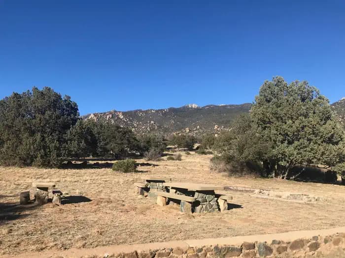
Overview Named after "Old Man Stockton," a rancher who settled in this area in the 1870s, Stockton Campground lies off the beaten path in the high desert of the Pinaleño Mountains in southeastern Arizona. Groups of up to 30 people can come here to camp and enjoy hiking, picnicking and wildlife viewing. The facility is located on a beautiful scenic drive with panoramic views of the mountains. Recreation A leisurely drive on SR 266 reveals large cattle ranges, rugged mountain ranges, and broad grasslands dotted with desert plants, a true southwestern experience. The Pass is open year-round, though summer can bring soaring temperatures and muddy rainstorms. The area offers excellent hiking, and trails are easily accessed from the campground. The Shake Trail #309 winds through the high desert landscape and begins a climb that continues to the Swift Trail, high in the Pinaleño Mountains. The campground’s setting is also inviting for an afternoon picnic, with tables set in a desert grassland with the occasional oak, manzanita tree, or cactus. Facilities A leisurely drive on SR 266 reveals large cattle ranges, rugged mountain ranges, and broad grasslands dotted with desert plants, a true southwestern experience. The Pass is open year-round, though summer can bring soaring temperatures and muddy rainstorms. The area offers excellent hiking, and trails are easily accessed from the campground. The Shake Trail #309 winds through the high desert landscape and begins a climb that continues to the Swift Trail, high in the Pinaleño Mountains. The campground’s setting is also inviting for an afternoon picnic, with tables set in a desert grassland with the occasional oak, manzanita tree, or cactus. Natural Features This site encompasses an area of beautiful desert grassland mixed with oak woodlands. Many species of birds and wildlife live in the area, including deer, black bear and mountain lions. Stockton Pass serves as a route over the Pinaleño Mountains into Sulphur Springs Valley. The campground is located at the apex of the pass and offers good views of the south slopes of some of the mountain range's highest peaks, as well as views of surrounding valleys and mountains. With an elevation of 5,600 feet, temperatures are cooler than the surrounding low deserts in summer but still allow for camping in fall and winter. The Coronado National Forest covers 1.78 million acres of southeastern Arizona and southwestern New Mexico. Elevations range from 3,000 to 10,720 feet in 12 widely scattered mountain ranges, or "sky islands," that rise dramatically from the desert floor, supporting biologically diverse plant communities. Nearby Attractions SR 266 West will take you out to the Galiuro Wilderness area, equipped with a variety of additional trails, including the West Divide Trail #289/Powers Garden Trail #96, which will bring you to the Power’s Family Cabin. The Power’s family were pioneers that farmed, ranged and mined in the Rattlesnake Canyon in the early 1900s until three members of the family were involved in a gunfight with law officers on a gold claim they were working. Two of the members escaped, at the time becoming the object of one of the longest manhunts in Arizona’s history. SR 266 East will bring you back to SR 191, where you could continue heading north to reach the town of Safford (approximately a 1 hour drive from the Stockton Pass campground). Safford is home to our Ranger Station, where you can go to find information about trails, camping, hunting and fishing, and other questions you may have about our district (open Monday-Friday, 8am-4:30pm). Charges & Cancellations Please review the Rules & Reservations Policies page on recreation.gov
View details →
Overview Upper Arcadia sits along Swift Trail in southeastern Arizona, providing an escape from desert heat and a pleasant place to take in the high desert scenery in spring and fall. Visitors enjoy hiking, camping, birding and picnicking. Recreation The campground lies along the Swift Trail Scenic Drive, which takes visitors from the Sonoran Desert at 2,900 feet to alpine meadows and forest on the 9,000+ foot ridges of the Pinaleño Range. Because of its diverse habitat, the area is well-known for birding and wildlife watching. The Swift Trail provides access to a number of hiking, horseback riding and mountain biking trails, along with several other campgrounds that invite you for an afternoon picnic. A trip up to Riggs Lake, stocked with trout by Arizona Game & Fish, or to the Columbine Visitors Center could make a worth-while day trip as well. The Arcadia Trail #328 starts at the Upper Arcadia Campground and leads up the mountain to Shannon Campground. A 1-mile spur off this trail leads to the top of Heliograph Peak, one of the highest mountains in southeastern Arizona. Facilities The campground lies along the Swift Trail Scenic Drive, which takes visitors from the Sonoran Desert at 2,900 feet to alpine meadows and forest on the 9,000+ foot ridges of the Pinaleño Range. Because of its diverse habitat, the area is well-known for birding and wildlife watching. The Swift Trail provides access to a number of hiking, horseback riding and mountain biking trails, along with several other campgrounds that invite you for an afternoon picnic. A trip up to Riggs Lake, stocked with trout by Arizona Game & Fish, or to the Columbine Visitors Center could make a worth-while day trip as well. The Arcadia Trail #328 starts at the Upper Arcadia Campground and leads up the mountain to Shannon Campground. A 1-mile spur off this trail leads to the top of Heliograph Peak, one of the highest mountains in southeastern Arizona. Natural Features The shady campground is in a thick forest of tall ponderosa pines interspersed with Gambel oaks and Arizona walnuts, at an elevation of 6,700 feet. The Coronado National Forest covers 1.78 million acres of southeastern Arizona and southwestern New Mexico. Elevations range from 3,000 to 10,720 feet in 12 widely scattered mountain ranges, or "sky islands," that rise dramatically from the desert floor, supporting biologically diverse plant communities. Nearby Attractions The Mount Graham Wilderness Study Area, which includes the 10,720-foot Mount Graham, the tallest mountain in southern Arizona. Columbine Visitor Center, Riggs Lake, and a variety of trails can be accessed along the Swift Trail Scenic Drive. The town of Safford is approximately a 30 minute drive from the Upper Arcadia campground, heading north on SR 191. Safford is home to our Ranger Station, where you can go to find information about trails, camping, hunting and fishing, and other questions you may have about our district (open Monday-Friday, 8am-4:30pm). Charges & Cancellations Please review the Rules & Reservations Policies page on recreation.gov
View details →
Overview Sharp Creek is a small campground located in an area of central Arizona known for its pleasant temperatures, spectacular scenery and outdoor recreation. There are tent-only, family and group sites to accommodate a wide range of visitors. Recreation The campground is in a central location for hiking, fishing, boating and picnicking. Anglers can try for trout in nearby Christopher Creek. Hikers can access the historic Highline National Recreational Trail, which runs for 51 miles along the base of the Mogollon Rim, from the 260 Trail three miles east of the campground. Two lakes nearby offer additional fishing and boating options. Facilities The campground is in a central location for hiking, fishing, boating and picnicking. Anglers can try for trout in nearby Christopher Creek. Hikers can access the historic Highline National Recreational Trail, which runs for 51 miles along the base of the Mogollon Rim, from the 260 Trail three miles east of the campground. Two lakes nearby offer additional fishing and boating options. Natural Features Sharp Creek sits at a cool 6,000 feet elevation, perfect for escaping the desert heat of southern Arizona and getting away to shaded forests and refreshing creeks and lakes. It is surrounded by a thick ponderosa pine forest below the Mogollon Rim. The clear waters of Christopher Creek are less than a mile away. The Mogollon Rim, pronounced by locals as "muggy-own," is a 200-mile long cliff in northern Arizona that ranges between 5,000 and 7,000 feet in elevation. The unique landscape was created by extreme erosion and faulting that has sculpted spectacular canyons and buttes. The rim serves as the geographical dividing line between the cool high country above and the hot, dry desert below. contact_info For facility specific information, please call (928) 474-7900. Nearby Attractions The small town of Christopher Creek is less than a mile away and has a few restaurant and shopping options for basic conveniences. Woods Canyon and Willow Springs Lakes sit above the Mogollon Rim, only a 10-minute drive away, and offer boating and fishing.
View details →
Overview O'Leary Group Campground was constructed in 2001 and is named for O'Leary Peak, which overlooks this site. The campground is designed to accommodate the special needs of large groups with everything from picnic shelters, tables and grills, to lots of level ground covered in native volcanic cinders, perfect for setting up tents. Its proximity to Sunset Crater Volcano and Wupatki National Monuments make it especially suitable for visitors who are intrigued by the cultural and natural history of the area. Recreation Most visitors spend time hiking, exploring and learning at the national monuments. Sunset Crater and Wupatki National Monuments have visitor centers and feature self-guided and ranger-guided tours. Another popular activity is hiking to O'Leary Lookout Tower. The trail is 4.9 miles one way on an old forest road with a steady, steep climb that rewards visitors with a vast panoramic view of Flagstaff, the San Francisco Peaks and the Painted Desert which was carved out by the Little Colorado River. Facilities Most visitors spend time hiking, exploring and learning at the national monuments. Sunset Crater and Wupatki National Monuments have visitor centers and feature self-guided and ranger-guided tours. Another popular activity is hiking to O'Leary Lookout Tower. The trail is 4.9 miles one way on an old forest road with a steady, steep climb that rewards visitors with a vast panoramic view of Flagstaff, the San Francisco Peaks and the Painted Desert which was carved out by the Little Colorado River. Natural Features The campground sits on a bed of soft, flat volcanic soil amidst Arizona's ponderosa pine country. This area of volcanic activity is so unique that much of it has been set aside as Sunset Crater National Monument. The camping area offers incredible views of dark cinder cone peaks, thick forests and open grassy meadows that burst with wildflowers in spring and early summer. Wupatki National Monument is also nearby and features an ancient four-story pueblo, a masterpiece of Ancient Pueblo stone masonry circa A.D. 1120. contact_info For facility specific information, please call (928) 774-9671. Nearby Attractions The nearby town of Flagstaff, Arizona, has shopping, restaurants and other conveniences. Visitors also frequent the must-see Sunset Crater Volcano National Monument and Wupatki National Monument .
View details →
Overview This group campground is situated in a tall ponderosa pine forest, just down the road from the popular Woods Canyon Lake in north central Arizona. The shaded campground is a nice hideaway for large groups with opportunities for boaters, anglers, hikers, families and photographers. Recreation Popular activities include trout fishing, hiking, boating, cycling, horseback riding, and photography. Woods Canyon Lake is the most popular of four lakes in the Rim Lakes Recreation Area. Woods Canyon Lake only allows electric boat motors. The paved Meadow Trail borders Crook Campground and will bring you about 1 mile north to Woods Canyon Lake or one quarter mile south to the The Rim Lakes Vista and Rim Trail is just a quarter mile from the campground and leads to spectacular views of the Mogollon Rim and surrounding area. Facilities Popular activities include trout fishing, hiking, boating, cycling, horseback riding, and photography. Woods Canyon Lake is the most popular of four lakes in the Rim Lakes Recreation Area. Woods Canyon Lake only allows electric boat motors. The paved Meadow Trail borders Crook Campground and will bring you about 1 mile north to Woods Canyon Lake or one quarter mile south to the The Rim Lakes Vista and Rim Trail is just a quarter mile from the campground and leads to spectacular views of the Mogollon Rim and surrounding area. Natural Features The campground is situated a ponderosa pine forest at an elevation of 7,500 feet. Wildlife viewing includes birds, squirrels, deer and elk. Hikers who venture onto nearby trails are afforded expansive views of the land beneath the Mogollon Rim. The Mogollon Rim, pronounced by locals as "muggy-own," is a 200-mile long escarpment in northern Arizona that ranges between 5,000 and 7,000 ft. in elevation and serves as the geographical divide between the cool high country above and the hot, dry desert below. Summer temperatures can be very pleasant because of the elevation. However, the rainy season often brings afternoon thunderstorms from late June through August. Visitors should come prepared for rain and cool nighttime temperatures. contact_info For facility specific information, please call (928) 535-0181. Nearby Attractions Gas, food, and groceries are available in Forest Lakes 9 miles east. The nearest full service community is Payson, Arizona, 34 miles west on Highway 260. Visitors can explore endless vistas and take part in many outdoor activities in the surrounding Apache-Sitgreaves National Forest, which encompasses 2 million acres of magnificent mountain country in east-central Arizona and New Mexico.
View details →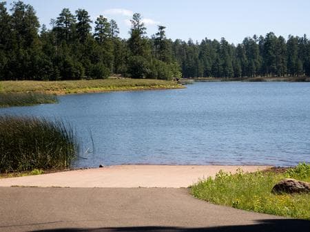
Overview White Horse Lake is an extremely popular fishing lake, 19 miles southeast of Williams, in northern Arizona. The lake's campground is conveniently located an hour from Grand Canyon National Park's south rim and surrounded by the exciting and diverse scenery of Kaibab National Forest. A number of forest attractions are nearby, including scenic overlooks, dams and hiking and mountain biking trails. White Horse also offers a place to enjoy beverages and snacks provided by The Bear Shack. Recreation In addition to fishing, the area offers excellent opportunities for hiking, mountain biking and wildlife watching. Anglers seek out Large Mouth Bass, Crappie and Bluegill. Facilities In addition to fishing, the area offers excellent opportunities for hiking, mountain biking and wildlife watching. Anglers seek out Large Mouth Bass, Crappie and Bluegill. Natural Features Kaibab National Forest is nestled on the Colorado Plateau, an area of land that was uplifted by geologic processes. Dogtown Lake sits at an elevation of 6,600 feet, and the campground is forested with plenty of open areas. Wildlife such as deer and elk frequent the shoreline. Summer temperatures range from 50 degrees at night to 80-90 degrees during the day. Summer thunderstorms, known as the monsoon, can build up quickly, especially during July and August. Snow is common from December through March. contact_info For facility specific information, please call +0000000. Nearby Attractions Grand Canyon National Park's South Rim is just over one hour north of the campground. The cities of Williams and Flagstaff have amenities such as shops, restaurants and cultural and historic sites. From canyons to prairies, peaks to plateaus, Kaibab National Forest offers layers of opportunity for peace, solitude and discovery. Over 300 miles of trails, some clinging to the rims of the Grand Canyon, allow visitors to step off the beaten path into uncrowded landscapes.
View details →
Overview Dogtown Lake offers a scenic setting convenient to Grand Canyon National Park and the cities of Williams and Flagstaff, Arizona. The campground is situated in a pine forest along the shore of a small and scenic lake. Visitors come here to hike, fish, mountain bike and explore the area's cultural and natural history. It's also a great place to relax and enjoy the sound of the wind in the pines and the spectacular view of nearby Bill Williams Mountain. Recreation Campers are drawn to the area's hiking and fishing opportunities. The lake is stocked with trout, crappie and channel catfish. Visitors can enjoy a guided nature trail near the lake and a hiking trail that leads to a scenic overlook of the area from the top of nearby Davenport Hill. The calm waters are inviting for canoes, kayaks and electric motorboats. Single motors of one horsepower or less are permitted. Facilities Campers are drawn to the area's hiking and fishing opportunities. The lake is stocked with trout, crappie and channel catfish. Visitors can enjoy a guided nature trail near the lake and a hiking trail that leads to a scenic overlook of the area from the top of nearby Davenport Hill. The calm waters are inviting for canoes, kayaks and electric motorboats. Single motors of one horsepower or less are permitted. Natural Features Kaibab National Forest is nestled on the Colorado Plateau, an area of land that was uplifted by geologic processes. Dogtown Lake sits at an elevation of 7,050 feet. The lake got its name from the extensive prairie dog "towns" that once covered open areas near the lake. In spite of the name, this medium-sized body of water is surrounded by trees. Summer temperatures range from 50 degrees at night to 80-90 degrees during the day. Summer thunderstorms, known as the monsoon, can build up quickly, especially during July and August. Snow is common from December through March. contact_info For facility specific information, please call +0000000. Nearby Attractions Grand Canyon National Park's South Rim is just over one hour north of the campground. The cities of Williams and Flagstaff have amenities such as shops, restaurants and cultural and historic sites. From canyons to prairies, peaks to plateaus, Kaibab National Forest offers layers of opportunity for peace, solitude and discovery. Over 300 miles of trails, some clinging to the rims of the Grand Canyon, allow visitors to step off the beaten path into uncrowded landscapes.
View details →
Overview Kaibab Lake sits among the diverse landscape of Kaibab National Forest of northern Arizona. The lake is a popular spot for fishing and picnicking, as well as for RV and motorhome campers. With Grand Canyon National Park just 60 miles north and several other cultural and historic sites nearby, the location is a hotspot for recreation, learning and sightseeing. Recreation Kaibab Lake is a popular area to join friends or family for a picnic in the cool pines. A number of forest attractions are easily accessed from the campground, such as overlooks, dams and hiking trails. A nature trail wanders through the facility. Swimming is not allowed in the lake, but anglers can take to its shores or deeper waters via an accessible fishing pier and small boat ramp. On clear nights, campers can turn their eyes to the night sky to enjoy spectacular views of summer stars. Facilities Kaibab Lake is a popular area to join friends or family for a picnic in the cool pines. A number of forest attractions are easily accessed from the campground, such as overlooks, dams and hiking trails. A nature trail wanders through the facility. Swimming is not allowed in the lake, but anglers can take to its shores or deeper waters via an accessible fishing pier and small boat ramp. On clear nights, campers can turn their eyes to the night sky to enjoy spectacular views of summer stars. Natural Features Kaibab National Forest is nestled on the Colorado Plateau, on an area of land that was uplifted by geologic processes. The lake sits at an elevation of 6,800 feet, and pine forests and grass line its shores, while wildflowers add extra color to the landscape in late spring and early summer. Summer temperatures range from 50 degrees at night to 80-90 degrees during the day. Summer thunderstorms, known as the monsoon, can build up quickly, especially during July and August. Snow is common from December through March. contact_info For facility specific information, please call +0000000. Nearby Attractions Grand Canyon National Park's South Rim is about one hour north of the campground. The cities of Williams and Flagstaff have amenities such as shops, restaurants and cultural and historic sites. From canyons to prairies, peaks to plateaus, Kaibab National Forest offers layers of opportunity for peace, solitude and discovery. Over 300 miles of trails, some clinging to the rims of the Grand Canyon, allow visitors to step off the beaten path into uncrowded landscapes.
View details →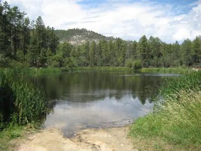
Overview Horsethief Cabin is situated in a clearing of Ponderosa pines at an elevation of over 6,000 feet in the Bradshaw Mountains of the Prescott National Forest. The original cabin was built in 1939 as quarters and a staging area for Forest Service crews charged with protecting the southern end of the Bradshaw Mountains against wildfires. The cabin was remodeled and modernized over the years, but eventually fell into disuse by the 1980s. The historic structure now enjoys a second life as a rental cabin, providing a unique recreation opportunity for visitors to the Prescott National Forest. To make reservations select the date range on this site or call 1 (877) 444-6777. For general cabin question contact the Bradshaw Ranger District at 1 (928) 443-8000. Recreation Anglers will appreciate the short hike from the cabin to Horsethief Basin Lake, stocked with largemouth bass, channel catfish and sunfish. Non-motorized boating is also available at the lake. Hikers have plenty of opportunities to explore the area on trails leading to Horsethief Canyon, Twin Peaks, Castle Creek and Jim Creek. Off-highway vehicles have several roads and trails available for travel, and a Forest Service fire lookout tower and a campground are in close proximity. Facilities Anglers will appreciate the short hike from the cabin to Horsethief Basin Lake, stocked with largemouth bass, channel catfish and sunfish. Non-motorized boating is also available at the lake. Hikers have plenty of opportunities to explore the area on trails leading to Horsethief Canyon, Twin Peaks, Castle Creek and Jim Creek. Off-highway vehicles have several roads and trails available for travel, and a Forest Service fire lookout tower and a campground are in close proximity. Natural Features The nearby Castle Creek Wilderness is defined by rugged and diverse terrain ranging from lower elevations with saguaro cactus, palo verde, mesquite, jojoba, cat claw, and grasslands to higher elevations dominated by piñon pine and juniper. Dense populations of mule deer and javelina inhabit this area, along with a few mountain lions, bobcats, black bears, coyotes, rabbits, foxes, skunks, and badgers. Snakes and lizards live here, and numerous birds soar overhead, including doves, quail, hawks, owls, ravens, jays, and many smaller species. The area is rich in history, including early Native American inhabitants and later in the 1860s, home to horse thieves and rustled livestock. Evidence of historical mining activity abounds in this area, especially in the nearby community of Crown King. Nearby Attractions Horsethief Lookout Tower as well as Hazlett Hollow and Turney Gulch Campgrounds are in close proximity to the cabin.
View details →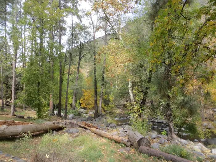
Overview Manzanita Campground is a small, year-round, tent-only facility with campsites that fill up very quickly. Visitors enjoy the campground for its fishing and swimming holes along Oak Creek, beautiful scenery and excellent wildlife watching. Oak Creek Canyon is very crowded, especially on weekends; to get a campsite, it is best to reserve a weekday. Recreation Recreation and relaxation abound in Oak Creek Canyon. Camping, fishing, swimming, wading and hiking are some of the activities awaiting visitors. Anglers have the convenience of creekside campsites, where they can cast a line for trout. Families love driving down the road to nearby Slide Rock State Park, one of Arizona's most popular swimming spots, or trying out several nearby hiking trails. Facilities Recreation and relaxation abound in Oak Creek Canyon. Camping, fishing, swimming, wading and hiking are some of the activities awaiting visitors. Anglers have the convenience of creekside campsites, where they can cast a line for trout. Families love driving down the road to nearby Slide Rock State Park, one of Arizona's most popular swimming spots, or trying out several nearby hiking trails. Natural Features The campground borders Oak Creek in a lush, forested riparian zone with Arizona ash and box elders, gravel beaches and stream-bed boulders. Colorful songbirds add flashes of brilliance to the trees. The creek's crystal clear waters are cool and refreshing on hot summer days. contact_info For facility specific information, please call (928) 203-0624. Nearby Attractions The well-known town of Sedona is popular for its red rock vistas, resorts and shopping. Slide Rock State Park is a great local spot for swimming and only a few minutes away. Campers can also explore the 1.8 million-acre Coconino National Forest, which boasts a spectacular variety of scenery and outdoor activities.
View details →
Overview COMMERCIAL TOUR GROUPS ARE NOT ALLOWED AT TEN-X CAMPGROUND Commercial operators MUST obtain a special use permit to operate on National Forest System lands, including Ten-X Campground. Due to high public demand, Kaibab National Forest will not be issuing any special use permits for Ten-X Camground until further notice. Therefore, no commercial tour groups are allowed at Ten-X Campground. All violators will be removed from the campground immediately and given a fine for violating the Code of Federal Regulations. Perhaps the biggest draw to Ten-X Campground in northern Arizona is its proximity to the South Rim of Grand Canyon National Park. Located just 4 miles south of the park entrance in beautiful Kaibab National Forest, Ten-X is a quiet, peaceful campground that generally has open camping sites. A nature trail weaves its way through the pine forest, and many more hiking opportunities are within a short drive. The facility can accommodate individual and family visitors, as well as large groups up to 75 people. Recreation The campground The campground has a 3 mile loop trail as well as a shorter hikes that allow visitors to observe local flora and fauna. Elsewhere, the nearby town of Tusayan offers horseback riding, helicopter rides and other tours. Many hiking, sightseeing, cultural history and outdoor recreation opportunities lie just a few miles away in Grand Canyon National Park. Facilities The campground The campground has a 3 mile loop trail as well as a shorter hikes that allow visitors to observe local flora and fauna. Elsewhere, the nearby town of Tusayan offers horseback riding, helicopter rides and other tours. Many hiking, sightseeing, cultural history and outdoor recreation opportunities lie just a few miles away in Grand Canyon National Park. Natural Features Ten-X is situated in a pleasant Ponderosa pine and Gambel oak forest at an elevation of 6,600 ft. The forest is nestled on the Colorado Plateau, an area of land that was uplifted by geologic processes. Summer temperatures range from 50 degrees at night to 80-90 degrees during the day. Summer thunderstorms, known as the monsoon, can build up quickly, especially during July and August. Snow is common from December through March. Nearby Attractions Grand Canyon National Park's South Rim, just 4 miles away, is a must-see for Ten-X campers. The adjacent town of Tusayan has a wide array of amenities, such as a gas station, restaurants, small grocery store, banks, hotels, internet access, mountain biking trails and many different tours.
View details →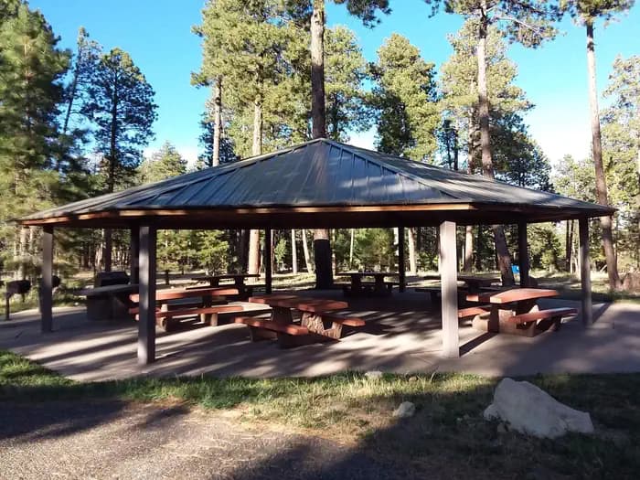
Overview Jacob Lake Recreation Area is conveniently located in Jacob Lake, Arizona, the gateway to the Grand Canyon's North Rim. The campground is nestled among the towering Ponderosa Pine trees of the North Kaibab National Forest, where ample opportunities to enjoy nature abound, from hiking and mountain biking to birding. Summer temperatures are pleasant during the day and nights are cool, while several feet of snow cover the landscape in winter. The campground closes each year by the end of October, though the national forest remains open. Recreation Grand Canyon National Park is a popular destination for campers staying at Jacob Lake Recreation Area. But from the campground itself, visitors can walk a pleasant one-mile loop trail, or take a 10 minute drive to the Kaibab Plateau Trail a section of the Arizona Trail, which runs north-to-south across the entire length of the state. The national forest also has a variety of mountain biking trails ranging from beginner to advanced levels. There is no fishing at Jacob Lake. Reservations for horseback riding and chuck wagon rides, as well as bike rentals, are available at Jacob Lake Inn across the street. Facilities Grand Canyon National Park is a popular destination for campers staying at Jacob Lake Recreation Area. But from the campground itself, visitors can walk a pleasant one-mile loop trail, or take a 10 minute drive to the Kaibab Plateau Trail a section of the Arizona Trail, which runs north-to-south across the entire length of the state. The national forest also has a variety of mountain biking trails ranging from beginner to advanced levels. There is no fishing at Jacob Lake. Reservations for horseback riding and chuck wagon rides, as well as bike rentals, are available at Jacob Lake Inn across the street. Natural Features Jacob Lake is at an elevation of 7,920 feet. The Kaibab Plateau is an area uplifted by geologic processes, making it higher in elevation than the surrounding deserts (the closest town of Fredonia, Arizona is 28 miles away and nearly 4,700 feet). Many species of wildlife call the Kaibab home, including the tassel-eared Kaibab squirrel, found nowhere else in the world, and numerous species of birds. The nearby lake only fills up with water occasionally, but marsh areas along the edges of the lake are great bird habitats. Nearby Attractions The campground is 44 miles north of Grand Canyon National Park's rustic and less populated North Rim - home to abundant wildlife, hiking trails, spruce-fir and Ponderosa pine forests and unparalleled views of one of the Seven Natural Wonders of the World. Enjoy a visit to the North Rim from mid-May through mid-October; the road is closed during winter. Grand Canyon National Park>
View details →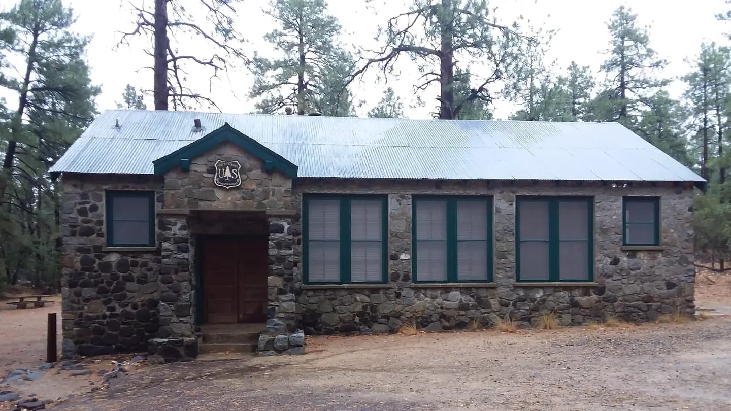
Overview Built in 1902, this historic schoolhouse and adjacent picnic area in Arizona's Prescott National Forest may be reserved for day use for groups of up to 60 people. The facility offers a picturesque, quiet setting with indoor and outdoor areas for weddings, reunions, luncheons and group meetings. The schoolhouse served about 10 to 15 children in the early 1900s. The building was an active school until 1952. It is now listed on the National Register of Historic Places and is used for administrative and training purposes. Recreation Groups enjoy gathering in the outdoor picnic area during nice weather or heading indoors into the the two-room schoolhouse if the weather turns. A leisurely walk through the forest on the accessible, paved Groom Creek Nature Trail provides a nice afternoon respite, and visitors can camp nearby if desired. Prescott National Forest has miles of hiking, mountain biking and horseback riding trails for visitors wishing to explore the area. Facilities Groups enjoy gathering in the outdoor picnic area during nice weather or heading indoors into the the two-room schoolhouse if the weather turns. A leisurely walk through the forest on the accessible, paved Groom Creek Nature Trail provides a nice afternoon respite, and visitors can camp nearby if desired. Prescott National Forest has miles of hiking, mountain biking and horseback riding trails for visitors wishing to explore the area. Natural Features The group area is set in a ponderosa pine ecosystem, an area dominated by pines and mixed with juniper trees, Gambel oaks and native grasses. A multitude of colorful wildflowers bloom in the spring and during the summer monsoon season. Afternoon thunderstorms are possible from late June through mid-September. The forest is home to a wide variety of wildlife. Visitors may spot deer, mountain lions, bobcats, coyotes, foxes, rabbits, lizards, snakes and birds. Nearby Attractions Upper Wolf Creek Campground is just around the corner if you want to camp overnight. Restaurants, shopping, historic sites and many amenities are nearby in the historic town of Prescott.
View details →
Overview Named for the towering pines under which it sits, Ponderosa Campground is tucked in the rolling forests of northern Arizona. As the fifth-largest forest in the country, the Tonto National Forest is one of the most-visited urban forests in the United States, boasting about 5.8 million visitors annually. Its boundaries are Phoenix to the south, the Mogollon Rim to the north and the San Carlos and Fort Apache Indian reservations to the east. Recreation Most visitors enjoy walking along the campground's nature trail, traveling into the town of Payson, taking advantage of the area's hiking trails and lakes or simply relaxing at the campsite. Scenic driving and outdoor recreation abound in the surrounding Tonto National Forest. A series of lakes called the Rim Country Lakes are about a 15 minute drive east. Woods Canyon Lake is one of the most popular recreational lakes in the state and offers options for boating. Facilities Most visitors enjoy walking along the campground's nature trail, traveling into the town of Payson, taking advantage of the area's hiking trails and lakes or simply relaxing at the campsite. Scenic driving and outdoor recreation abound in the surrounding Tonto National Forest. A series of lakes called the Rim Country Lakes are about a 15 minute drive east. Woods Canyon Lake is one of the most popular recreational lakes in the state and offers options for boating. Natural Features The ponderosa pine trees make this a memorable campground. Larger ponderosas release a vanilla scent into the air and have a relatively open understory, making the area perfect for camping. Mixed into the understory are junipers, oaks and manzanita shrubs. The campground sits on the border of the Mogollon Rim, pronounced by locals as "muggy-own," a 200-mile-long cliff in northern Arizona that ranges between 5,000 and 7,000 feet in elevation. The unique landscape was created by extreme erosion and faulting that has sculpted spectacular canyons and buttes. The rim serves as the geographical dividing line between the cool high country above and the hot, dry desert below. contact_info For facility specific information, please call (928) 474-7900. Nearby Attractions The nearby town of Payson, Arizona, offers restaurants, shopping and other conveniences.
View details →
Overview Whitetail Campground offers group campsites in the foothills of the Catalina Mountains of southeastern Arizona, 5 miles south of the town of Summerhaven and the top of Mt. Lemmon. Groups can enjoy picking, hiking, camping and wildlife watching while enjoying a cool respite from hot summer. The facility can accommodate groups for day or overnight use. Recreation Hiking and sightseeing are popular activities. The surrounding national forest boasts a variety of trails, including some on the 9,157-foot Mt. Lemmon, for those who wish to venture away from the campground for the day. The University of Arizona runs an observatory just up the road, and visitors can also drive a few minutes to the small town of Summerhaven, which offers amenities and attractions on Mt. Lemmon's summit. Anglers can try for stocked trout at nearby Rose Canyon Lake. Facilities Hiking and sightseeing are popular activities. The surrounding national forest boasts a variety of trails, including some on the 9,157-foot Mt. Lemmon, for those who wish to venture away from the campground for the day. The University of Arizona runs an observatory just up the road, and visitors can also drive a few minutes to the small town of Summerhaven, which offers amenities and attractions on Mt. Lemmon's summit. Anglers can try for stocked trout at nearby Rose Canyon Lake. Natural Features Whitetail Campground sits high on the slopes of the Santa Catalina Mountains at an elevation of 8,000 feet. Because of its elevation, it can be much cooler than the lower-elevation campgrounds in the area. The campsites are spacious and spread out among stands of big ponderosa pines The Coronado National Forest covers 1.78 million acres of southeastern Arizona and southwestern New Mexico. Elevations range from 3,000 to 10,720 feet in 12 widely scattered mountain ranges, or "sky islands," that rise dramatically from the desert floor, supporting biologically diverse plant communities. Nearby Attractions Catalina Highway, also known as General Hitchcock Highway and Sky Island Scenic Byway, is the only paved road that leads to the upper reaches of Mt. Lemmon and the Santa Catalina Range, offering a scenic day trip. Other notable attractions include Saguaro National Park, Sabino Canyon and Colossal Cave.
View details →
Overview Lower Twilight Group Site offers groups a secluded camping escape from the summer desert heat. The scenic mountain setting is a great base for hiking, wildlife viewing and picnicking. The facility sits along the Swift Trail in southeastern Arizona, adjacent to Upper Twilight Group Site. Recreation The campground lies along the Swift Trail Scenic Drive, which takes visitors from the Sonoran Desert at 2,900 feet to alpine meadows and forest on the 9,000+ foot ridges of the Pinaleño Range. Because of its diverse habitat, the area is well-known for birding and wildlife watching. The Swift Trail provides access to a number of hiking, horseback riding and mountain biking trails, along with several other campgrounds that invite you for an afternoon picnic. A trip up to Riggs Lake, stocked with trout by Arizona Game & Fish, or to the Columbine Visitors Center could make a worth-while day trip as well. Facilities The campground lies along the Swift Trail Scenic Drive, which takes visitors from the Sonoran Desert at 2,900 feet to alpine meadows and forest on the 9,000+ foot ridges of the Pinaleño Range. Because of its diverse habitat, the area is well-known for birding and wildlife watching. The Swift Trail provides access to a number of hiking, horseback riding and mountain biking trails, along with several other campgrounds that invite you for an afternoon picnic. A trip up to Riggs Lake, stocked with trout by Arizona Game & Fish, or to the Columbine Visitors Center could make a worth-while day trip as well. Natural Features At an elevation of 7,400 feet, the campground lies beneath a nice canopy of ponderosa pine trees in the scenic Pinaleño Mountains in Coronado National Forest. Temperatures are very pleasant in summer compared to the heat of surrounding lowers deserts. The Coronado National Forest covers 1.78 million acres of southeastern Arizona and southwestern New Mexico. Elevations range from 3,000 to 10,720 feet in 12 widely scattered mountain ranges, or "sky islands," that rise dramatically from the desert floor, supporting biologically diverse plant communities. Nearby Attractions The Mount Graham Wilderness Study Area, which includes the 10,720-foot Mount Graham, the tallest mountain in southern Arizona. Columbine Visitors Center, Riggs Lake, and a variety of trails can be accessed along the Swift Trail Scenic Drive. The town of Safford is approximately a 45 minute drive from the Twilight campground, heading north on SR 191. Safford is home to our Ranger Station, where you can go to find information about trails, camping, hunting and fishing, and other questions you may have about our district (open Monday-Friday, 8am-4:30pm). Charges & Cancellations Please review the Rules & Reservations Policies page on recreation.gov
View details →
Overview At an elevation of 7,400 feet, Upper Twilight Group Site offers groups a secluded camping escape from the summer desert heat. The scenic mountain setting is a great base for hiking, wildlife viewing and picnicking. The facility sits along the Swift Trail in southeastern Arizona, adjacent to Lower Twilight Group Site. Recreation The campground lies along the Swift Trail Scenic Drive, which takes visitors from the Sonoran Desert at 2,900 feet to alpine meadows and forest on the 9,000+ foot ridges of the Pinaleño Range. Because of its diverse habitat, the area is well-known for birding and wildlife watching. The Swift Trail provides access to a number of hiking, horseback riding and mountain biking trails, along with several other campgrounds that invite you for an afternoon picnic. A trip up to Rigg’s Lake, stocked with trout by Arizona Game & Fish, or to the Columbine Visitors Center could make a worth-while day trip as well. Facilities The campground lies along the Swift Trail Scenic Drive, which takes visitors from the Sonoran Desert at 2,900 feet to alpine meadows and forest on the 9,000+ foot ridges of the Pinaleño Range. Because of its diverse habitat, the area is well-known for birding and wildlife watching. The Swift Trail provides access to a number of hiking, horseback riding and mountain biking trails, along with several other campgrounds that invite you for an afternoon picnic. A trip up to Rigg’s Lake, stocked with trout by Arizona Game & Fish, or to the Columbine Visitors Center could make a worth-while day trip as well. Natural Features The campground lies beneath a nice canopy of ponderosa pine trees in the scenic Pinaleño Mountains in Coronado National Forest. Temperatures are very pleasant in summer compared to the heat of surrounding lowers deserts. The Coronado National Forest covers 1.78 million acres of southeastern Arizona and southwestern New Mexico. Elevations range from 3,000 to 10,720 feet in 12 widely scattered mountain ranges, or "sky islands," that rise dramatically from the desert floor, supporting biologically diverse plant communities. Nearby Attractions The Mount Graham Wilderness Study Area, which includes the 10,720-foot Mount Graham, the tallest mountain in southern Arizona. Columbine Visitors Center, Riggs Lake, and a variety of trails can be accessed along the Swift Trail Scenic Drive. The town of Safford is approximately a 45 minute drive from the Twilight campground, heading north on SR 191. Safford is home to our Ranger Station, where you can go to find information about trails, camping, hunting and fishing, and other questions you may have about our district (open Monday-Friday, 8am-4:30pm). Charges & Cancellations Please review the Rules & Reservations Policies page on recreation.gov
View details →
Overview Apache Trout Campground is one of five campgrounds at the Big Lake Recreation Area in Apache-Sitgreaves National Forest, and is especially popular for group camping. With boating and fishing facilities and a variety of amenities, Apache Trout is a convenient and comfortable place to stay. Plenty of open space, shaded forests and mountain scenery make for a pleasant outdoor experience. Recreation The Apache Trout facility is a short walk away from the 450-acre Big Lake, one of Arizona's top fishing lakes. Big Lake is known for its trout fishing, with rainbow, cutthroat, brook and Apache trout being the most sought-after species. The recreation area is also popular for hiking, mountain biking, bird watching and wildlife viewing. Facilities The Apache Trout facility is a short walk away from the 450-acre Big Lake, one of Arizona's top fishing lakes. Big Lake is known for its trout fishing, with rainbow, cutthroat, brook and Apache trout being the most sought-after species. The recreation area is also popular for hiking, mountain biking, bird watching and wildlife viewing. Natural Features The campground sits at an elevation of 9,100 ft. in the White Mountains of eastern Arizona. It is a very scenic area, forested with ponderosa pine, Douglas fir, spruce and aspen interspersed with high elevation meadows. Some campsites have shade, while others are mostly sunny. Summer temperatures are pleasant and cool, a nice respite from the heat of lower deserts. Nearby Attractions Visitors can explore endless vistas and take part in many outdoor activities in the surrounding Apache-Sitgreaves National Forest, which encompasses 2 million acres of magnificent mountain country in east-central Arizona and New Mexico.
View details →
Overview The DeMotte Campground is located within the North Kaibab Ranger District just seven miles north of the entrance to the Grand Canyon National Park's North Rim. This is about 25 miles south of the Kaibab Plateau Visitor Center on Arizona’s Highway 67. Recreation Visitors to the DeMotte Campground enjoy camping and picnicking, sight-seeing and wildlife viewing. Enjoy a visit to the North Rim from mid-May through mid-October; the road is closed during winter. Hiking trails, spruce-fir and Ponderosa pine forests and unparalleled views of one of the Seven Natural Wonders of the World. Facilities Visitors to the DeMotte Campground enjoy camping and picnicking, sight-seeing and wildlife viewing. Enjoy a visit to the North Rim from mid-May through mid-October; the road is closed during winter. Hiking trails, spruce-fir and Ponderosa pine forests and unparalleled views of one of the Seven Natural Wonders of the World. Natural Features Many species of wildlife call the Kaibab home, including the tassel-eared Kaibab squirrel, found nowhere else in the world, and numerous species of birds. Nearby Attractions The North Rim of the Grand Canyon National Park.
View details →
Overview Equestrian campers will find Groom Creek Horse Camp seven miles south of Prescott, Arizona at an elevation of 6,398 feet. The ponderosa pine setting, nearby trails and limited equestrian camping opportunities make this a popular destination. Each campsite has a steel corral enclosure and an overhead tether line that accommodates two to four horses. Two group picnic sites are also available for reservation for group gatherings within this campground. To make reservations click on the availability button to the right to book this site or call 1 (877) 444-6777. For general horse camp questions contact the Bradshaw Ranger District at 1 (928) 443-8000. Recreation Three trails are in close proximity to Groom Creek Horse Camp. Horse Camp Loop Trail 383 (2 miles) is accessed from Loop C, across from the group site or at the campground's entrance. Wolf Creek Loop Trail 384 (5 miles) is accessed from Horse Camp Loop Trail 383 and from Forest Service Road C101. Groom Creek Loop Trail 307 (9 miles) is accessed from the trailhead across from the entrance to Horse Camp. These trails are shared with other users including mountain bikers and hikers. Off-highway vehicle use occurs on designated roads and trails. Facilities Three trails are in close proximity to Groom Creek Horse Camp. Horse Camp Loop Trail 383 (2 miles) is accessed from Loop C, across from the group site or at the campground's entrance. Wolf Creek Loop Trail 384 (5 miles) is accessed from Horse Camp Loop Trail 383 and from Forest Service Road C101. Groom Creek Loop Trail 307 (9 miles) is accessed from the trailhead across from the entrance to Horse Camp. These trails are shared with other users including mountain bikers and hikers. Off-highway vehicle use occurs on designated roads and trails. Natural Features Horse Camp occupies an area dominated by ponderosa pine mixed with alligator juniper, oak species, and a variety of forbs and native grasses. Colorful wildflowers bloom in the spring, and during the summer monsoon seasons. Visitors may see a variety of wildlife including deer, mountain lion, bobcat, coyotes, fox, rabbits, lizards, snakes, and birds. Nearby Attractions Prescott is a 15 minute drive from Horse Camp. Many activities including arts, crafts and music festivals are scheduled throughout the summer. Goldwater Lake, located within minutes of Horse Camp, is managed by the City of Prescott. The City of Prescott's recreation pass and day-use fee should not be confused with the Prescott National Forest Day-Use Passes or day-use fee.
View details →
Overview Lynx Campground is located in the Lynx Lake Recreation Area at 5,600 feet in elevation. Within 1/4 mile of the popular Lynx Lake, the campground is situated along the lake's west shoreline. The facility is about seven miles southeast of the city of Prescott, Arizona. To make reservations click on the availability button to the right to book on this site or call 1 (877) 444-6777. For general campground questions contact the Bradshaw Ranger District at 1 (928) 443-8000. Recreation Several trail systems trails are within the Lynx Lake Recreation Area. Most trails allow for multiple modes of travel. The exceptions are Lynx Creek Ruin Trail #301 and Loop Trail #311 that allows hiking only. Wildlife viewing is a grand event when a bald eagle, osprey, or great blue heron has been seen flying effortlessly above Lynx Lake or skimming the water surface. Recreational panning is allowed on the Prescott National Forest, as long as any natural feature is not harmed and no motorized or mechanical equipment or mining aids are used. Lynx Lake is one of the most popular recreation spots in central Arizona and attracts more than 90,000 visitors each year. The lake offers a boat ramp and allows for boats with 10 HP motors or less. Oar, paddle, or sail-powered boats are also permitted. Horseback riders, mountain bikers, and hikers can be found on most trails. Forest Service Day-Use Facilities in the Prescott Basin are accessible at no additional fee. See the Volunteer Host for a complimentary pass validated for your length of stay. Visiting a Day-Use facility requires a pass visibly displayed on the vehicle's dashboard, driver's side. Facilities Several trail systems trails are within the Lynx Lake Recreation Area. Most trails allow for multiple modes of travel. The exceptions are Lynx Creek Ruin Trail #301 and Loop Trail #311 that allows hiking only. Wildlife viewing is a grand event when a bald eagle, osprey, or great blue heron has been seen flying effortlessly above Lynx Lake or skimming the water surface. Recreational panning is allowed on the Prescott National Forest, as long as any natural feature is not harmed and no motorized or mechanical equipment or mining aids are used. Lynx Lake is one of the most popular recreation spots in central Arizona and attracts more than 90,000 visitors each year. The lake offers a boat ramp and allows for boats with 10 HP motors or less. Oar, paddle, or sail-powered boats are also permitted. Horseback riders, mountain bikers, and hikers can be found on most trails. Forest Service Day-Use Facilities in the Prescott Basin are accessible at no additional fee. See the Volunteer Host for a complimentary pass validated for your length of stay. Visiting a Day-Use facility requires a pass visibly displayed on the vehicle's dashboard, driver's side. Natural Features Lynx Campground offers visitors pleasant summer temperatures and cool breezes. The campground is situated in a ponderosa pine ecosystem mixed with alligator juniper, oak species, and a variety of forbs and native grasses. The 55-acre Lynx Lake skirts the campground's east boundary. Several species of colorful wildflowers bloom in the spring and during the summer monsoon seasons. Day-time and overnight temperatures are pleasant and afternoon thunderstorms are likely from late June through mid-September. The forest is home to a wide variety of wildlife. Visitors may see deer, osprey, great blue heron, bald eagle, mountain lion, bobcat, coyote, fox, skunk, rabbit, and several species of snakes, lizards, and birds. Nearby Attractions The Highlands Center for Natural History, in partnership with the Prescott National Forest, is only a few minutes from Lynx Campground. A learning center, trail system on 80 acres, and scheduled interpretive programs are but a few of the exciting activities the Center offers through the spring, summer, and fall. Lynx Lake Cafe near North Shore Day-Use Area offers a full service restaurant serving breakfast 8-11 and lunch 11-2 Thrusday through Sunday. Dinner is served Thursday thru Saturday 4-8 pm. The City of Prescott is a few minutes drive from Lynx Campground. Many activities including arts, crafts, and music festivals are scheduled throughout the summer. Watson Lake, islocated within a 20-minute drive from Lynx Campground, is managed by the City of Prescott. The City of Prescott recreation pass and day-use fee should not be confused with the Prescott National Forest Day-use Passes or Day-Use fee. Fain Lake, in Prescott Valley, is a private enterprise and a short 20-minute drive from Lynx Campground. Fishing and picnicking can be found there.
View details →
Overview Alamo Canyon Campground sits nestled at the base of the Ajo mountains in Organ Pipe Cactus National Monument. This primitive campground provides scenic views of the surrounding mountains and Sonoran Desert, along with spectacular night sky viewing and peaceful quiet. Recreation Along with photography and birding, hiking is ideal here. There is a .9 mile point to point trail that leads into Alamo Canyon from the campground. Beyond the campground there are miles of hiking trails laced around Organ Pipe Cactus National Monument, some easy, others more strenuous. Always carry water and snacks, and avoid hiking during the hottest parts of the day. Stop at the Kris Eggle Visitor Center for recommendations. Facilities Along with photography and birding, hiking is ideal here. There is a .9 mile point to point trail that leads into Alamo Canyon from the campground. Beyond the campground there are miles of hiking trails laced around Organ Pipe Cactus National Monument, some easy, others more strenuous. Always carry water and snacks, and avoid hiking during the hottest parts of the day. Stop at the Kris Eggle Visitor Center for recommendations. Natural Features Organ Pipe Cactus National Monument exhibits an extraordinary collection of plants and animals of the Sonoran Desert. This is a showcase for creatures who have adapted themselves to the extreme temperatures, intense sunlight, and little rainfall that characterize this Southwest region. Thirty-one species of cacti have mastered the art of living in this place, including the park's namesake and the giant saguaro. Here, the life of the Sonoran Desert is protected and allowed to flourish under nearly ideal wilderness conditions. The monument is an outstanding natural preserve where one of the Earth's major ecosystems survives almost unspoiled. Nearby Attractions Lukeville Port of Entry to Mexico - approximately 18 miles (29 km) south of Alamo Canyon Campground following SR 85. Gas is available. Historic Ajo, AZ - approximately 26 miles (42 km) north of Alamo Canyon Campground following SR 85. Gas, restaurants, shops, an art gallery, and groceries are available.
View details →
Overview Burnt Corral Campground and Recreation Area (elevation 1914') is about 5.8 miles south of Roosevelt Dam along the Apache Trail (AZ Hwy 88) along the shoreline of Apache Lake. It is nestled amongst the saguaros, mesquites, and palo verdes, and offers opportunities to boat, swim, fish, relax, hike, and sightsee. Recreation Burnt Corral Campground offers something for almost everyone. Motorboating, fishing, water-skiing, and paddlesports are very popular because of the developed and undeveloped lake access from within the campground. Others may enjoy hiking nearby trails, being challenged by local jeep trails, or practicing their landscape photography, or simply relaxing with a good book. Facilities Burnt Corral Campground offers something for almost everyone. Motorboating, fishing, water-skiing, and paddlesports are very popular because of the developed and undeveloped lake access from within the campground. Others may enjoy hiking nearby trails, being challenged by local jeep trails, or practicing their landscape photography, or simply relaxing with a good book. Natural Features Burnt Corral Campground is situated in what may be the most stunning Sonoran Desert landscape in Arizona. The contrast of sunshine, clear blue water, and saguaro's surrounded by the Four Peaks and Superstition Wilderness' is a magnificant sight to see. While shade is scarce in the desert, campsites are situated amongst mature mesquite and palo verde trees, and desert chaparral. Apache Lake is 17 miles long making it the longest in the chain of reservoirs on the lower Salt River below Roosevelt Dam. Nearby Attractions Roosevelt Dam, Apache Lake Marina, Tortilla Flats, Tonto National Monument (Cliff Dwellings), Roosevelt Lake, Apache Trail Scenic Byway (AZ Hwy 88), Spines to Pines Scenic Byway (AZ Hwy 288). The City of Globe and Town of Payson are only an hour away.
View details →
Overview Schoolhouse Campground is located in close proximity to the eastern shores of Roosevelt Lake with an elevation of 2,100 feet. Roosevelt is Arizona's largest lake offering a number of great water based recreation opportunites such as fishing, motorized and non-motorized boating, and lakeside hiking. Recreation Schoolhouse Campground offers easy access to Roosevelt Lake with a paved boat ramp. This provides excellent opportunities for boating, kayaking, canoeing, and other water-based recreation activites. Fishing is another popular activity where anglers fish for Largemouth and Small mouth Bass; Crappie; Sunfish; Channel and Flathead Catfish. Other activities in this area include, hiking, biking, wildlife viewing, and photography. Facilities Schoolhouse Campground offers easy access to Roosevelt Lake with a paved boat ramp. This provides excellent opportunities for boating, kayaking, canoeing, and other water-based recreation activites. Fishing is another popular activity where anglers fish for Largemouth and Small mouth Bass; Crappie; Sunfish; Channel and Flathead Catfish. Other activities in this area include, hiking, biking, wildlife viewing, and photography. Natural Features The campground loop provides spacious sites perfect for RVs and trailers with mesquite trees throughout, and views of the mountains and native Sonoran Desert plants and wildlife. This is a small campground ideal for individuals or families looking for a quiet area to get away. Nearby Attractions Two National Scenic Byways (AZ Hwy 88 Apache Trail and AZ Hwy 288 Spines to Pines Highway). Roosevelt Dam, Tonto National Monument, the Arizona Trail, endless miles of jeep trails, Towns of Payson and Globe, Superstition, Sierra Ancha, and Four Peaks Wilderness'. Don't forget to stop by the Tonto Basin Environmental Center learn about the history of the area.
View details →
Overview Located on central Arizona's largest lake, Windy Hill offers great water recreation opportunities to the public. Because of its close proximity to the Lake, Windy Hill allows fishing, non-motorized and motorized boating, along with hiking trails. There are plenty of developed campsites available at Windy Hill, which allows for an easy, quick escape during any time of the year for families and individuals. Recreation Fishing is popular activity where anglers can expect to catch a variety of fish species, such as Largemouth and Smallmouth Bass; Crappie; Sunfish; Channel and Flathead Catfish. This campground is also situated right on the shore of Roosevelt Lake which is open to boating, kayaking, and other water-related activites. A fully accessible boat ramp and fishing dock are available for easy lake access, and maps and other important site details can be found at the kiosks at the entrance to the campground. Facilities Fishing is popular activity where anglers can expect to catch a variety of fish species, such as Largemouth and Smallmouth Bass; Crappie; Sunfish; Channel and Flathead Catfish. This campground is also situated right on the shore of Roosevelt Lake which is open to boating, kayaking, and other water-related activites. A fully accessible boat ramp and fishing dock are available for easy lake access, and maps and other important site details can be found at the kiosks at the entrance to the campground. Nearby Attractions Two National Scenic Byways (AZ Hwy 88 Apache Trail and AZ Hwy 288 Spines to Pines Highway). Roosevelt Dam, Tonto National Monument, the Arizona Trail, endless miles of jeep trails, Towns of Payson and Globe, Superstition, Sierra Ancha, and Four Peaks Wilderness'. Don't forget to stop by the Tonto Basin Environmental Center learn about the history of the area.
View details →
Overview Cholla Campground at Roosevelt Lake, is one of several campgrounds on the shores of the largest lake/reservoir located entirely in the State of Arizona. It is situated within a lush sonoran desert landscape at an elevation of 2168'. Cholla Campground is also the largest solar powered campground in the United States. Each of its 206 campsites have shade ramadas, firepits, grills, and picnic tables. Playgrounds, showers and toilet facilites are scattered throughout the campground. The area around Cholla Campground is often alive with abundant wildlife such as mule deer, coyotes, geese, fox, javalina, and the occasional bald eagle. Recreation Recreation opportunities abound at Cholla Campground. Launch your bass boat, ski boat, or pontoon boat from the developed boat ramps within the recreation site and play on the water all day long. If motorsports aren't your thing, there's an abundance of places to explore from your kayak, canoe, or paddleboard. While you're visiting, you can also hike a portion of the Arizona Trail, visit the Tonto National Monument cliff dwellings, explore endless miles of jeep trails or drive a portion of the Apache Trail or Spines to Pines Highway. If if you're looking for a day in town, consider the easy 45 minute drive Globe or Payson where you can shop for antiques, buy ice cream and learn about Arizona's rich mining and timber history. Roosevelt Lake is a landscape photograhers dream so don't forget your camera (and sunscreen). Facilities Recreation opportunities abound at Cholla Campground. Launch your bass boat, ski boat, or pontoon boat from the developed boat ramps within the recreation site and play on the water all day long. If motorsports aren't your thing, there's an abundance of places to explore from your kayak, canoe, or paddleboard. While you're visiting, you can also hike a portion of the Arizona Trail, visit the Tonto National Monument cliff dwellings, explore endless miles of jeep trails or drive a portion of the Apache Trail or Spines to Pines Highway. If if you're looking for a day in town, consider the easy 45 minute drive Globe or Payson where you can shop for antiques, buy ice cream and learn about Arizona's rich mining and timber history. Roosevelt Lake is a landscape photograhers dream so don't forget your camera (and sunscreen). Natural Features Roosevelt Lake was dedicated by President Theodore Roosevelt in 1911 and boasts 112 miles of shoreline and peaceful coves. When full, the lake provides 21,500 acres of surface water for your recreating pleasure. Cholla Campground is situated within a Sonoran Desert Landscape along the lakes shorelines. Views of the blue water and sunsets against the Sierra Ancha, Salome, and Superstition Wilderness' are a sight that keep many visitors coming back year after year. Nearby Attractions Two National Scenic Byways (AZ Hwy 88 Apache Trail and AZ Hwy 288 Spines to Pines Highway). Roosevelt Dam, Tonto National Monument, the Arizona Trail, endless miles of jeep trails, Towns of Payson and Globe, Superstition, Sierra Ancha, and Four Peaks Wilderness'. Don't forget to stop by the Tonto Basin Environmental Center learn about the history of the area.
View details →
Overview Black Canyon Rim Campground has 20 sites of varying sizes. All sites can accommodate tents and pop-up campers. Some sites are suitable for pull trailers, 5th-wheel trailers, and motorhomes up to 40 feet. Recreation Fishing and boating (electric motors) are available on Black Canyon Lake, approximately 2.5 miles northeast of the campground. The historic grave site of Stott, Scott, and Wilson, three young men lynched during the Pleasant Valley War is located within walking distance. This campground is a favorite stopping place for those traveling on the General Crook National Recreation Trail. Facilities Fishing and boating (electric motors) are available on Black Canyon Lake, approximately 2.5 miles northeast of the campground. The historic grave site of Stott, Scott, and Wilson, three young men lynched during the Pleasant Valley War is located within walking distance. This campground is a favorite stopping place for those traveling on the General Crook National Recreation Trail. Natural Features Black Canyon Rim Campground is sheltered among towering ponderosa pines and located in an area that is relatively flat and sandy. A herd of wild horses is often seen running through the area and stopping at Black Canyon Lake for water. contact_info For facility specific information, please call (928) 535-0181. Nearby Attractions Gas, phone, and groceries are available 8 miles west at Forest Lakes or 13 miles east at Heber.
View details →
Overview Bonita Canyon Campground is located in Chiricahua National Monument, also known as the "Wonderland of Rocks". Visitors love Chiricahua for its stunning rock columns (hoodoos), hiking trails, and bird watching opportunities. NOTE: Vehicles and RV's longer than 24 feet are NOT permitted on the scenic drive beyond the campground. Trailers are not permitted on the Scenic Drive. See campground regulations and map. Recreation Chiricahua National Monument offers 17 miles (27 km) of day-use hiking trails. Birders frequent this site for the diversity of species that reside in or migrate through the area. Enjoy sweeping views of the surrounding valleys and mountain ranges which make for stunning photography opportunities at Massai Point, the end of the 8-mile (13 km), paved scenic drive. No backcountry camping is permitted in the park. The Coronado National Forest surrounds Chiricahua and may offer dispersed or other camping opportunities as well as reservations for developed campgrounds . Facilities Chiricahua National Monument offers 17 miles (27 km) of day-use hiking trails. Birders frequent this site for the diversity of species that reside in or migrate through the area. Enjoy sweeping views of the surrounding valleys and mountain ranges which make for stunning photography opportunities at Massai Point, the end of the 8-mile (13 km), paved scenic drive. No backcountry camping is permitted in the park. The Coronado National Forest surrounds Chiricahua and may offer dispersed or other camping opportunities as well as reservations for developed campgrounds . Natural Features Set in a pine and oak forest, Bonita Canyon Campground provides an atmosphere of relaxation. Most campsites are well shaded and have views of Bonita Creek which is dry most of the year, Nearby Attractions The park visitor center is open daily, 8:30 a.m. to 4:30 p.m., Mountain Standard Time (except Thanksgiving Day and December 25). Inside you will find interactive exhibits about the cultural and natural history of the park, plus a Western National Parks Association store. Visitors may explore Faraway Ranch , originally the Erickson family pioneer homestead, converted into a 20th century guest ranch by the family daughters and currently an historic site. For more information visit the Chiricahua National Monument website. Nearby Fort Bowie National Historic Site , Coronado National Memorial , the Coronado National Forest , Portal/Cave Creek, Tombstone, Bisbee, and Willcox are additional places visitors to Chiricahua may also enjoy exploring. Charges & Cancellations
View details →
Overview The Reynolds Creek Group Campground is a rustic and secluded, creek side camp located on the Pleasant Valley Ranger District in the Tonto National Forest. The primitive group camping area is nestled between towering ponderosa pine at an elevation of 5,250 feet and provides a great base camp for a wide range of recreational activities including, hiking, fishing, hunting, and nature photography. Recreation The site is located between the Salome and Sierra Ancha Wilderness Areas and adjacent to the From the Desert to the Tall Pines National Scenic Byway. Two trailheads are located within a quarter mile of the campground and provide access to the Wilderness Areas as well as a lookout tower. Facilities The site is located between the Salome and Sierra Ancha Wilderness Areas and adjacent to the From the Desert to the Tall Pines National Scenic Byway. Two trailheads are located within a quarter mile of the campground and provide access to the Wilderness Areas as well as a lookout tower. Natural Features The group site is located adjacent to Reynolds Creek, which runs year round. Opportunities for wading, fishing, and hiking abound. Berry picking is a popular activity in the fall. A thick stand of ponderosa pine covers the group area, offering pleasant shade. A large meadow provides the perfect place for group activities and games. Nearby Attractions Workman Creek is located two miles to the south and has cascading waterfalls and plenty of opportunities for berry picking in the fall. Hikers and equestrians can explore the area's majestic scenery on meandering trails.
View details →
Overview Alto Pit OHV Campground is located at the foot of Granite Mountain Wilderness Area, at an elevation of 6,200 feet. The off-highway trail system within the recreation area draws enthusiasts of all ages with degrees of skills that prove challenging and enjoyable for everyone alike. To make reservations click on the availability button to the right to book this site or call 1 (877) 444-6777. For general campground questions contact the Bradshaw Ranger District at 1 (928) 443-8000. Recreation Once an active gravel pit, Alto Pit is now exclusively used for motorized off-road travel. Main Pit is the larger of two gravel pits within the recreation area. West Pit is located a short distance to the southwest of Main Pit. The 20-mile trail system offers challenging rides for advanced recreationists and thrilling rides for beginners. Facilities Once an active gravel pit, Alto Pit is now exclusively used for motorized off-road travel. Main Pit is the larger of two gravel pits within the recreation area. West Pit is located a short distance to the southwest of Main Pit. The 20-mile trail system offers challenging rides for advanced recreationists and thrilling rides for beginners. Natural Features The rugged landscape that encompasses and surrounds Alto Pit OHV Campground is a nearly perfect setting for off-highway vehicle (OHV) enthusiasts. Granite rock in various stages of degradation is evident and is more pronounced when viewing craggy and rugged Granite Mountain rising abruptly to the north. Predominate vegetation include ponderosa pine, limber pine, oak, manzanita, and a variety of shrubs and grasses. Nearby Attractions Granite Basin Recreation Area is located northeast of the Alto Pit OHV Area and just a 15 minute drive away. Granite Basin contains Yavapai Campground, Granite Basin Lake and several day use areas. Visitors enjoy fishing, bird-watching, backpacking, hiking, horseback riding, biking, picnicking, camping, and just plain relaxing. Immediately rising north of Granite Basin Lake is rugged Granite Mountain with a highest point of 6,874 feet within Granite Mountain Wilderness Area. Thumb Butte, at 6,515 feet, rises prominently southeast of Alto Pit OHV Area and can be seen from most anywhere in the Prescott Basin. It is one of the most popular destinations in the Prescott National Forest.
View details →
Overview Yavapai Campground is within the Granite Basin Recreation Area, at an elevation of 5,600 feet. The campground is located seven miles northwest of downtown Prescott. Main attractions are mild weather, cool ponderosa pine forest, and Granite Basin Lake. Activities include fishing for largemouth bass, channel catfish, and sunfish, canoeing, hiking, mountain biking, horseback riding, and bird watching. Rising to the northwest is prominent Granite Mountain Wilderness Area. Several connector and loop trails reside in close proximity to the campground. Most trails allow for multiple modes of travel. To make reservations click on the availability button to the right to book this site or call 1 (877) 444-6777. For general campground questions contact the Bradshaw Ranger District at 1 (928) 443-8000. Recreation Yavapai Campground is available year-round and is enjoyed by people of all age groups and diverse backgrounds. Campsites are designed for RV, trailer, or tent camping. Two sites allow for double occupancy. Most campsites are compact and each has a degree of privacy and solitude. Many popular outdoor activities abound in the Granite Basin Recreation Area. Facilities Yavapai Campground is available year-round and is enjoyed by people of all age groups and diverse backgrounds. Campsites are designed for RV, trailer, or tent camping. Two sites allow for double occupancy. Most campsites are compact and each has a degree of privacy and solitude. Many popular outdoor activities abound in the Granite Basin Recreation Area. Natural Features Yavapai Campground was designed to be integrated within the natural setting of granite rock outcrops and a variety of ponderosa pine, limber pine, oak, manzanita, and a variety of shrubs and grasses. The facility is located within Granite Basin Recreation area. Access to Granite Mountain Wilderness and Granite Basin Lake can either be made by several interlocking hiking trails or by driving a short distance. Nearby Attractions Within a short distance of Yavapai Campground, in the Granite Basin Recreation Area, there are several day use areas and Granite Basin Lake. Visitors enjoy fishing, bird-watching, backpacking, hiking, horseback riding, mountain biking, picnicking, camping, and just plain relaxing. Immediately rising north of Granite Basin Lake is Granite Mountain at 6,874 feet. The rugged topography and mixed vegetation it comprises is enveloped by the Granite Mountain Wilderness Area. Alto Pit OHV Campground and Day-Use Area is just a 15 minute drive to the southwest of the Granite Basin Recreation Area. Rising prominently to the south of the Granite Basin Recreation Area is Thumb Butte. At an elevation of 6,515 feet, Thumb Butte is one of the most popular destinations in the Prescott National Forest.
View details →
Overview Located in the ponderosa pine forest, this campground is within walking distance of Willow Springs Lake which provides boating and fishing opportunities. Hiking and mountain biking opportunities are nearby in the non-motorized Wildlife Area. The General Crook National Recreation Trail is also within a mile of the campground. Be prepared for rain, often heavy, through July and August. Expect cool to cold nighttime temperatures. Recreation Fishing and boating are available at nearby Willow Springs Lake which is approximately one mile from the campground. Facilities Fishing and boating are available at nearby Willow Springs Lake which is approximately one mile from the campground. Natural Features Sinkhole Campground is surrounded by ponderosa pines. The entrance, roads and back-in section is asphalt. Nearby Attractions Woods Canyon Lakes is located approximately 10 miles west off of Road 300 and Road 105. The store at the lake has boat and kayak rentals. Gas, phone and groceries are available approximately four miles east at Forest Lakes. contact_info For facility specific information, please call (928) 535-0181.
View details →
Overview Rim Campground is situated close to the edge of the Mogollon Rim. Spectacular 100-mile views are seen from many vantage points along the rim. Recreation Fishing and boating are available at Woods Canyon Lake which is approximately 3 miles from the campground. Facilities Fishing and boating are available at Woods Canyon Lake which is approximately 3 miles from the campground. Natural Features Rim Campground is surrounded by ponderosa pines and located in an area that is relatively flat. Once in a while a few elk will walk through the campsites. contact_info For facility specific information, please call (928) 535-0181. Nearby Attractions Some groceries are available at the Marina Store at Woods Canyon Lakes which is approximately three miles from the campground. The store also offers boat and kayak rentals. This lake is a great location for fishing.
View details →
Overview Mogollon Campground, although not directly in the Woods Canyon Recreation area, sits just outside and is only two miles from the lake. For those who like spectacular views, this campground is one of the closest to the Mogollon Rim. Recreation Fishing and boating are available at Woods Canyon Lake which is approximately three miles from the campground on Road 105. Facilities Fishing and boating are available at Woods Canyon Lake which is approximately three miles from the campground on Road 105. Natural Features Mogollon Campground is surrounded by ponderosa pines. The road to Mogollon is a sandy road off of Road 300. The campground itself is also sandy and gravel. contact_info For facility specific information, please call (928) 535-0181. Nearby Attractions Some groceries are available at the Marina Store at Woods Canyon Lake which is approximately three miles from the campground. The store also offers boat and kayak rentals. Woods Canyon Lake is a great lake for fishing.
View details →
Overview White Spar Campground at 5,641 feet in elevation is a short drive of 2.7 miles south of downtown Prescott and east of Hwy 89. Campers will appreciate the mild weather and the cool ponderosa pine forest the campground is nestled in. The campground's convenient location allows for many opportunities for pursuing camping, hiking, mountain biking and bird watching. Several loop trails in the area allow for multiple modes of travel. The Tri-City Community comprising Prescott, Chino Valley, and Prescott Valley has events, functions, benefits, and attractions throughout the year are all within a few minutes' drive. To make reservations click on the availability button to the right to book this site or call 1 (877) 444-6777. For general campground questions contact the Bradshaw Ranger District at 1 (928) 443-8000. Recreation White Spar Campground is available year-round, but campsites are limited during the winter season. Campsites are designed for RV, trailer or tent camping. Many popular outdoor activities abound in the area. Visitors may enjoy fishing, bird-watching, boating, backpacking, hiking, horseback riding, rock climbing, mountain biking, picnicking and just plain relaxing. Facilities White Spar Campground is available year-round, but campsites are limited during the winter season. Campsites are designed for RV, trailer or tent camping. Many popular outdoor activities abound in the area. Visitors may enjoy fishing, bird-watching, boating, backpacking, hiking, horseback riding, rock climbing, mountain biking, picnicking and just plain relaxing. Natural Features White Spar Campground is surrounded by a forest of ponderosa pine, oak, manzanita, and a variety of shrubs and grasses. In the Prescott Basin, the campground is near Granite Basin Recreation Area, Granite Mountain Wilderness Area, Granite Basin Lake, Lynx Lake Recreation Area, and Thumb Butte. Access to these areas can either be made by several interlocking hiking trails or by driving a short distance. Nearby Attractions Northwest of White Spar Campground, within ten miles, is the Granite Basin Recreation Area. Granite Basin Recreation Area has several day-use areas, and Granite Basin Lake (five acres), which is known for channel catfish, large-mouth bass, and sunfish. Rising prominently north of Granite Basin Lake is Granite Mountain at 6,874 feet. The Granite Mountain Wilderness Area is comprised of the mountain's rugged topography and mixed vegetation suite. Also, within ten miles, is Alto Pit Off-Highway Vehicle (OHV) Campground and Day-Use Area. OHV riders of all skill levels can ride the several miles of trails that meander through the area's challenging terrain and vegetative cover. Southeast of downtown Prescott and within eight miles of White Spar Campground is Lynx Lake Recreation Area. Lynx Lake (55 acres) is an popular attraction in the Prescott National Forest that offers a variety of recreation opportunities for all age groups. Activities include fishing, boating, and hiking. West and within four miles, is the Thumb Butte Recreation Area. At 6,515-feet Thumb Butte is quite visible in the Prescott Basin. The Butte is popular for its scenic vistas, jogging and hiking. Rock climbing is allowed, but only between July 16 and January 31 as it is closed to climbing during the peregrine falcon nesting period. Birdwatching is popular outside the closed area. The City of Prescott offers several day-use recreation facilities within ten miles. To the north and northeast are Watson (70 acres) and Willow Lakes and to the south Goldwater Lake (15 acres). Each have unique qualities and recreation opportunities including boating, fishing, birdwatching and hiking.
View details →
Overview The Elks Group Campground sits among a mix of ponderosa pines and juniper at an elevation of 6,500 feet offering a cool respite from the summer heat of the valley below. This campground facility was designed and constructed by the Winslow Elks Lodge and generously donated to the Mogollon Rim Ranger District. The campground is designed to meet the needs of large groups and can accommodate 300 people, offering picnic tables, grills, and fire pits. There are vault toilets. For every 25 people after the first 50, the group will need to provide additional port-a-pots. Recreation Many visitors spend time relaxing and exploring the area. The nearby C.C. Cragin Reservoir and Knoll Lake offers opportunities for water based recreation, while the Arizona National Scenic Trail, General Crook National Recreation Trail, and historic Cabin Loop Trail System offers opportunities for hikers, bicyclist, and equestrian users. There are also several Fire Lookout Towers in the area. Facilities Many visitors spend time relaxing and exploring the area. The nearby C.C. Cragin Reservoir and Knoll Lake offers opportunities for water based recreation, while the Arizona National Scenic Trail, General Crook National Recreation Trail, and historic Cabin Loop Trail System offers opportunities for hikers, bicyclist, and equestrian users. There are also several Fire Lookout Towers in the area. Natural Features The campground is in a transition zone where ponderosa pines fade into stands of pinyon and juniper trees. The nearby Mogollon Rim is one of the most striking geologic features in the state. This steep escarpment, measured in thousands of feet, stretches from New Mexico diagonally across two thirds of Arizona and offers sweeping views of the landscape. Nearby Attractions The community of Happy Jack, Arizona offers two convenience stores, two restaurants, and a gas station.
View details →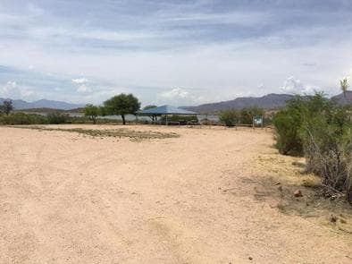
Overview The campground overlooks Roosevelt Lake and is nestled in the saguaro cactus-studded Sonoran Desert. Recreation In addition to camping, horseback riders, hikers, and mountain bikers can access the Arizona National Scenic Trail from the campground via the Frazier Trail. There are many other trails in the area. Facilities In addition to camping, horseback riders, hikers, and mountain bikers can access the Arizona National Scenic Trail from the campground via the Frazier Trail. There are many other trails in the area. Natural Features At an elevation of 2,200 feet, the group site has stunning views of the blue water and sunsets against three mountainous wilderness areas. Nearby Attractions Multiple opportunities for enjoying spectacular scenery and learning about the area's pre-history, history, flora, fauna, or geology include visiting Tonto National Monument cliff dwellings (National Park Service), driving portions of the Apache Trail Historic Road (State Hwy 88) and Desert to Tall Pines Scenic Road (State Hwy 288) or visiting the Tonto Basin Visitors Center.
View details →
Overview Groups are drawn to Grapevine Campground's unique setting and expansive facilities. The site's location near Roosevelt Lake's shoreline and nestled in the Saguaro cactus-studded Sonoran Desert and facilities such as a boat ramp and event area provide a perfect setting for fishing tournaments, family reunions, and even weddings year-round. Recreation In addition to camping, Grapevine provides opportunities for boating, fishing, jet skiing, water skiing, and exploring peaceful coves from non-motorized watercraft. Additional activities include a playground for children, sports field, and a shoreline trail for hikers and mountain bikers. Facilities In addition to camping, Grapevine provides opportunities for boating, fishing, jet skiing, water skiing, and exploring peaceful coves from non-motorized watercraft. Additional activities include a playground for children, sports field, and a shoreline trail for hikers and mountain bikers. Natural Features At an elevation of 2,200 feet, each group site has stunning views of the blue water, the Sierra Ancha mountains, and sunsets against three mountainous wilderness areas. Nearby Attractions Multiple opportunities for enjoying spectacular scenery and learning about the area's pre-history, history, flora, fauna, or geology include visiting Tonto National Monument cliff dwellings (National Park Service), driving portions of the Apache Trail Historic Road (State Hwy 88) and Desert to Tall Pines Scenic Road (State Hwy 288) or visiting the Tonto Basin Visitor Center.
View details →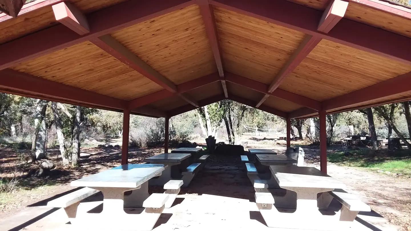
Overview Cave Creek Group Site is located 20 miles north of Cave Creek and Carefree, Arizona. It is a historic campground constructed in the 1930s by the Civilian Conservation Corps (CCC). This site is a short drive from the blistering heat of Phoenix offering cooler temps, a clear running creek, and plentiful shade to relax and enjoy nature. With food prep areas, grills and covered picnic tables, you're all set for a weekend with your loved ones you'll never forget! Recreation At this site you'll enjoy camping, hiking, mountain biking, picnicking, sightseeing, exploring, bird and wildlife viewing, and there is even a game area for volleyball and horseshoes. Facilities At this site you'll enjoy camping, hiking, mountain biking, picnicking, sightseeing, exploring, bird and wildlife viewing, and there is even a game area for volleyball and horseshoes. Natural Features This group campsite is nestled in a narrow valley of juniper and sycamore trees providing abundant shade. Water flowing through seven springs is minimal and only several inches in depth. The area has one large open camping area and a nearby trailhead offering access to over 48 miles of hiking and mountain biking trails. Bring your camera during springtime to get photos of the desert wildflowers in bloom. Nearby Attractions Across the road, Cave Creek trailhead offers over 48 miles of hiking trails - great for overnight backpacking trips. Bronco Trailhead further south, offers parking for 40 vehicles plus trailers and six horse pens. Just seven miles south is Sears-Kay ruin. Listed in the National Register of Historic Places, this site features the remains of an ancient Native American tribe's hilltop village. For spectacular scenic views take Forest Road 562 to Humboldt Mountain. Or, you can simply stay on site and observe nature and hunt for crawdads in the nearby creek.
View details →
Overview Campers looking for some peace and quiet will find this relaxing campground offers cool summertime temperatures and easy access from scenic Hwy 89A in central Arizona. The campground is located at 7,200 ft. in elevation between Mingus Mountain and Woodchute Wilderness in a beautiful ponderosa pine forest. To make reservations click on the availability button to the right to book this site or call 1 (877) 444-6777. For general campground questions contact the Verde Ranger District at 1 (928) 567-4121. Recreation Wildlife viewing, hiking, scenic driving and off-highway scenic driving are popular in the area. The wanderer in you will appreciate your close proximity to Yeager Canyon Trail #28 and Woodchute Trail #102, a rewarding hike into the 5,923 acre Woodchute Wilderness and view from the top of Woodchute Mountain. Access to a segment of The Great Western Trail is located adjacent to the campground. Mingus Lake is just across the highway and stocked for fishing. The Verde River in the valley below offers rafting, kayaking and bird watching. Facilities Wildlife viewing, hiking, scenic driving and off-highway scenic driving are popular in the area. The wanderer in you will appreciate your close proximity to Yeager Canyon Trail #28 and Woodchute Trail #102, a rewarding hike into the 5,923 acre Woodchute Wilderness and view from the top of Woodchute Mountain. Access to a segment of The Great Western Trail is located adjacent to the campground. Mingus Lake is just across the highway and stocked for fishing. The Verde River in the valley below offers rafting, kayaking and bird watching. Natural Features This mountain top campground offers a cool respite from hot Arizona summers -- a classic forest setting for a memorable camping adventure. Connect with your inner naturalist and observe the wildlife and wildflowers found in abundance around the campground. Interesting geology can be found in any direction with many significant rock formations, canyons and mountains within easy driving distance from Potato Patch. Nearby Attractions The historic and eclectic mining town of Jerome is just down the steep, winding mountain road, with unique shopping and dining opportunities and Jerome State Historic Park. Tuzigoot National Monument, an ancient pueblo, and the lively historic towns of Clarkdale and Cottonwood with museums and basic services are just over 9 miles away. Hayfield Draw OHV Area is located on Highway 260 between Cottonwood and Camp Verde for a unique OHV recreational experience. The towns of Prescott Valley and Prescott are 20 miles away and provide a wide array of services, shopping and dining.
View details →
Overview Twin Peaks Campground is located within Organ Pipe Cactus National Monument, in the heart of the Sonoran Desert along the United States border with Mexico. This landscape reveals a thriving community of plants, animals, and human stories that echo throughout this desert preserve, chronicling thousands of years of desert living. A scenic drive, a wilderness hike, or a night of camping will expose you to a flourishing, living desert. Recreation Along with photography and birding, hiking is ideal here. There is a 0.9 mile (1.4 km) perimeter trail around Twin Peaks Campground, and the 1.2 mile (2 km) Desert View Trail located near the group camping area. Beyond the campground area, miles of hiking trails lace Organ Pipe Cactus National Monument, some easy, others more strenuous. Some of the best hiking is off the beaten trails out in the canyons with a map and compass to guide you. Always carry water and snacks, and avoid hiking during the hottest parts of the day. More detailed trail information is available in the park newspaper and in person at the Kris Eggle Visitor Center. Facilities Along with photography and birding, hiking is ideal here. There is a 0.9 mile (1.4 km) perimeter trail around Twin Peaks Campground, and the 1.2 mile (2 km) Desert View Trail located near the group camping area. Beyond the campground area, miles of hiking trails lace Organ Pipe Cactus National Monument, some easy, others more strenuous. Some of the best hiking is off the beaten trails out in the canyons with a map and compass to guide you. Always carry water and snacks, and avoid hiking during the hottest parts of the day. More detailed trail information is available in the park newspaper and in person at the Kris Eggle Visitor Center. Natural Features Organ Pipe Cactus National Monument exhibits an extraordinary collection of plants and animals of the Sonoran Desert. This is a showcase for creatures who have adapted themselves to the extreme temperatures, intense sunlight, and little rainfall that characterize this Southwest region. Thirty-one species of cacti have mastered the art of living in this place, including the park's namesake and the giant saguaro. Here, the life of the Sonoran Desert is protected and allowed to flourish under nearly ideal wilderness conditions. The monument is an outstanding natural preserve where one of the Earth's major ecosystems survives almost unspoiled. contact_info For facility specific information, please call (520) 387-6849. Nearby Attractions Lukeville Port of Entry to Mexico - approximately 5 miles (8km) to the south of the Kris Eggle Visitor Center and Twin Peaks Campground. Gas is available. Historic Ajo, AZ - approximately 33 miles (53 km) north of Twin Peaks Campground following SR 85. Gas, restaurants, shops, and groceries are available. Charges & Cancellations
View details →
Overview Bonito Campground is located 18 miles northeast of Flagstaff, near Sunset Crater/Wupatki National Monument. Elevation is 6,900 feet. Bonito Campground is named for the Bonito Lava Flow which oozed across this high desert plain some 900 years ago. That river of liquid rock, now frozen forever, is just one of the many remnants of volcanic activity which lend an otherwordly appearance to this starkly beautiful place. Recreation Hiking, sightseeing, wildlife viewing are popular activities. Facilities Hiking, sightseeing, wildlife viewing are popular activities. Natural Features Beautiful tall Ponderosa pines are abundant throughout the campground and across nearby ravines and hillsides. Bonito is a restful place to simply relax and enjoy nature. contact_info For facility specific information, please call (928) 774-9671. Nearby Attractions Also nearby is Wupatki National Monument. The centerpiece of this area is a four story masterpiece of Native American stone masonry. Construction of that stone-age condominium began in about 1120 A.D. At one time it contained as many as 100 rooms and housed as many as 125 people. Both Sunset Crater and Wupatki have visitor centers and feature self-guided as well as interpreter guided. The entrance to Sunset Crater National Park is adjacent to the campground. The Visitor's Center provides much information on the geological history of the area. You can enjoy learning about the Native Americans who populated the area as you wander through the nearby Walnut Canyon National Monument. The historic downtown section in nearby Flagstaff will provide a glimpse into the early days of the city's past.
View details →
Overview Kellner Group Site is nestled at the base of the beautiful Pinal Mountains south of Globe, Arizona. Several picnic areas are separeted from the larger group area creating a semi-secluded setting. This site's interesting rock walls and steps were built by the Civilian Conservation Corps. It sits in the riparian area of Kellner Canyon, which frequently has a small stream running through it following winter runoff. Recreation Kellner Group Site recreation opportunities include hiking, exploring and wildlife viewing. The Pinal Mountains are considered a "Sky Island" and make for excellent bird watching opportunities. A short seven-mile drive leads to Icehouse Canyon Day Use Area which hosts trailheads for Six Shooter Canyon Trail, Ice House Canyon Trail, Kellner Canyon Trail and the Telephone Trail. Facilities Kellner Group Site recreation opportunities include hiking, exploring and wildlife viewing. The Pinal Mountains are considered a "Sky Island" and make for excellent bird watching opportunities. A short seven-mile drive leads to Icehouse Canyon Day Use Area which hosts trailheads for Six Shooter Canyon Trail, Ice House Canyon Trail, Kellner Canyon Trail and the Telephone Trail. Natural Features Kellner Group Site boasts spectacular views of the Pinal Mountains, which rise 3,500 feet above it. The riparian area and stream host large sycamore and white oak trees which give it shade. Wildlife in the Pinal Mountains includes a large variety of birds, chipmunks, squirrels, coatimundi, and coos whitetail deer. A fire came very close to this area in the spring of 2017 and has affected some of the vegetation. Nearby Attractions Kellner Group Site is next to the City of Globe which offers an array of restaurants, as well as antique, grocery, and feed and tack stores. It is roughly an hour's drive from the Salt River Canyon, where several overlooks allow you to capture the magnificent beauty of "Arizona's other Grand Canyon." Roosevelt Lake and the Apache Trail are also within driving reach.
View details →
Overview Timber Camp Recreation Area has one of the most popular family and group campgrounds in the Tonto National Forest offering both day-use sites and over-night areas. Recreation Abundant recreation opportunities such as cross-country horseback riding, hiking, in-season hunting, exploring, off-highway vehicle use and wildlife viewing are in close proximity. In the spring, whitewater rafting trips on the Upper Salt River launch a mere 20-minute drive from the site. Brundrett 2 and the equestrian sites are excellent places to stage authorized outdoor group events (a separate permit may be required). While there are no dedicated equestrian trails, the surrounding terrain is ideal for cross-country horseback riding. Facilities Abundant recreation opportunities such as cross-country horseback riding, hiking, in-season hunting, exploring, off-highway vehicle use and wildlife viewing are in close proximity. In the spring, whitewater rafting trips on the Upper Salt River launch a mere 20-minute drive from the site. Brundrett 2 and the equestrian sites are excellent places to stage authorized outdoor group events (a separate permit may be required). While there are no dedicated equestrian trails, the surrounding terrain is ideal for cross-country horseback riding. Natural Features Located within the Timber Camp Mountains and surrounded by a ponderosa pine and juniper woodland, this area offers a cool get away from the hot summer months. Five miles east of the site, the area eventually meets the ledges and beautiful vistas of the Salt River Canyon and the Salt River Canyon Wilderness. Nearby Attractions Approximately 10 miles north along Highway 60, on White Mountain Apache Tribal Lands, lies Seneca Lake and Falls, a popular recreation area for sightseeing and fishing (WMAT permit required). As you continue further north along Highway 60, the road cascades down into the Salt River Canyon where several overlooks allow you to capture the magnificent beauty of "Arizona's other Grand Canyon". Only 24 miles south from Timber Camp, the City of Globe offers an array of restaurants, as well as antique, grocery, and feed and tack stores.
View details →
Overview Hilltop Campground is located in the Prescott Basin at 5,712 feet in elevation and just over three miles south of Hwy 69 and east of Walker Road. Campers will appreciate the mild weather and the cool ponderosa pine forest. The facility's attractive and convenient location allows opportunities for pursuing a variety of recreation activities that will satisfy anyone's interests. Activities include boating, fishing, hiking, mountain biking and bird watching. Connector and loop trails allows access to most of the Prescott Basin and most trails allow for multiple modes of travel. The Tri-City Community comprising Prescott, Chino Valley and Prescott Valley has events and attractions throughout the year, all within a few minutes' drive.To make reservations click on the availability button to the right to book this site or call 1 (877) 444-6777. For general campground questions contact the Bradshaw Ranger District at 1 (928) 443-8000. Recreation Hilltop Campground is available during the summer season and is enjoyed by people of all age groups and of diverse backgrounds. Campsites are designed for RV, trailer or tent camping. Many popular outdoor activities abound. Visitors may enjoy fishing, bird-watching, boating, backpacking, hiking, horseback riding, rock climbing, mountain biking, picnicking, camping and just plain relaxing. Facilities Hilltop Campground is available during the summer season and is enjoyed by people of all age groups and of diverse backgrounds. Campsites are designed for RV, trailer or tent camping. Many popular outdoor activities abound. Visitors may enjoy fishing, bird-watching, boating, backpacking, hiking, horseback riding, rock climbing, mountain biking, picnicking, camping and just plain relaxing. Natural Features Similar to several recreation facilities in the Lynx Lake Recreation Area, Hilltop Campground is located in ponderosa pine, oak, manzanita and a variety of shrubs and grasses. The facility is near Lynx Lake, Thumb Butte, Granite Basin Recreation Area, Granite Mountain Wilderness Area and Granite Basin Lake. Access to these areas can either be made by several interlocking hiking trails or by driving a short distance. Nearby Attractions North of Hilltop Campground, within walking distance is Lynx Lake. This lake at 55 acres is an immensely popular attraction on the Prescott National Forest. It offers a variety of recreation opportunities for all age groups. Activities include fishing, boating and hiking among many. West of Hilltop Campground, across the Prescott Basin about 11 miles distant, is the Thumb Butte Recreation Area. Thumb Butte's 6,515 foot prominence is quite visible in the Prescott Basin. The Butte is very popular for its scenic vistas, jogging and hiking. Rock climbing is allowed, but only between July 16 and January 31. Climbing is prohibited during the peregrine falcon nesting period. Birdwatching is popular. Mountain bikes have access to trails from the parking area. To the Northwest, within 13 miles, is the Granite Basin Recreation Area. This recreation area has several day-use areas, Yavapai Campground and Granite Basin Lake (5 acres). The lake is known for channel catfish, large-mouth bass and sunfish. Rising prominently north of Granite Basin Lake is Granite Mountain at 6,874 feet. The Granite Mountain Wilderness Area is comprised of the mountain's rugged topography and mixed vegetation suite. Also to the northwest at fifteen miles, is Alto Pit Off-Highway Vehicle (OHV) Campground and Day-Use Area. OHV riders of all skill levels can ride the several miles of trails that meander through the area's challenging terrain and vegetative cover. The City of Prescott offers several day-use recreation facilities within ten miles of Hilltop Campground. To the northwest are Watson (70 acres) and Willow Lakes and to the southwest Goldwater Lake (15 acres). Each have unique qualities and recreation opportunities including boating, fishing, birdwatching and hiking.
View details →
Overview Crossroads Campground is located on the riverfront of the beautiful Lower Colorado River. This campground is popular with winter visitors looking to enjoy the warm winter temperatures and relax on the riverfront. This campground has great access to fishing, boating and off-roading. Recreation The Lower Colorado River offers excellent boating, fishing, canoeing and swimming opportunities. The campground provides river front views and a beach. Just follow the Parker Dam Road Scenic Backcountry Byway to various recreation sites along the river. The Rock House Visitor Center and Boat Launch are within a mile of the campground, and offers information and a free boat launch open year-round. Other popular activities in the Parker Strip Recreation Area include hiking, biking, rock hounding and off-road vehicle travel. Facilities The Lower Colorado River offers excellent boating, fishing, canoeing and swimming opportunities. The campground provides river front views and a beach. Just follow the Parker Dam Road Scenic Backcountry Byway to various recreation sites along the river. The Rock House Visitor Center and Boat Launch are within a mile of the campground, and offers information and a free boat launch open year-round. Other popular activities in the Parker Strip Recreation Area include hiking, biking, rock hounding and off-road vehicle travel. Natural Features The campground is situated on the shoreline of the Lower Colorado River. The river runs through a backdrop of steep rocky terrain, and wind shaped sand dunes. The area is teeming with wildlife, especially fish, migratory birds and small mammals. Nearby Attractions The Copper Basin Dunes and Crossroads Off- Highway Vehicle Open Areas offer miles of off-road adventures. Rock hounders enjoy hiking and driving through the area to search for unique rocks. Rock House Visitor Center has a free boat launch and a visitor center stocked with brochures and information about the area.
View details →FAQ
Camping in Arizona
How many campgrounds are listed in Arizona?
TheCampVerse currently lists 94 campgrounds in Arizona.
What campground types are most common in Arizona?
The most common campground types are Campground.
How can I compare campgrounds in Arizona?
Use the campground cards and featured links on this page to compare descriptions, amenities, and details before opening each campground profile.
Keep exploring