
Campgrounds in Arkansas
Camp among the natural beauty of the Natural State with mountains and hot springs
81
Campgrounds listed
100%
With photos
100%
Detailed descriptions
Campground
Top campground type
Highlights
Featured campgrounds in Arkansas
Explore by campground name letter
Jump to A-Z landing hubs for stronger discovery paths beyond Arkansas.
All campgrounds
Showing 81 campgrounds

Overview Steel Creek Campground is situated along the Buffalo River under the towering and picturesque Roark Bluff. One section of the campground offers 26 walk-in tent sites and another section of the campground offers 14 sites for those camping with horses. Half of the sites in the campground are available for reservations. Steel Creek is located about 3 miles (5 km) east of Ponca, just off Highway 74. Recreation Floating conditions in the upper (westernmost) district of Buffalo National River are extremely dependent upon rainfall. On an average year, the upper river is only navigable by boat in the spring and early summer when consistent rainfall feeds into the watershed. Some sections on the upper end of the river are technical and should not be attempted by novices. For current floating conditions, please check with an outfitter (visit our Guided Services web page ), call the Steel Creek Ranger Station at 870-861-2570, or check the USGS Buffalo River Floating Conditions web page. Facilities Floating conditions in the upper (westernmost) district of Buffalo National River are extremely dependent upon rainfall. On an average year, the upper river is only navigable by boat in the spring and early summer when consistent rainfall feeds into the watershed. Some sections on the upper end of the river are technical and should not be attempted by novices. For current floating conditions, please check with an outfitter (visit our Guided Services web page ), call the Steel Creek Ranger Station at 870-861-2570, or check the USGS Buffalo River Floating Conditions web page. Natural Features The Buffalo National River flows free over swift running rapids and quiet pools for its 135-mile (217 km) length. One of the few remaining rivers in the lower 48 states without dams, the Buffalo cuts its way through massive limestone bluffs traveling eastward through the Arkansas Ozarks and into the White River. Nearby Attractions The Buffalo River Trail runs through Steel Creek and offers great day hiking or overnight backcountry opportunities. Boxley Valley is nearby and is home to Lost Valley, an easy to moderate trail that leads hikers past geologic and water formations. Call the Steel Creek Ranger Station at 870-861-2570 or visit the park's Hiking Trails web page for more information.. Charges & Cancellations rules and reservation policies
View details →
Overview Point Cedar Campground sits on the banks of DeGray Lake in the foothills of the Ouachita Mountains. World-class fishing and endless water sports make the campground a popular recreation area. Recreation Boating, water skiing, kayaking and other water sports are the biggest draw to the lake, and a boat ramp is provided. The lake is also stocked with a variety of game fish, including plenty of hybrid striped bass, making it an ideal area for both boat and bank fishing. Facilities Boating, water skiing, kayaking and other water sports are the biggest draw to the lake, and a boat ramp is provided. The lake is also stocked with a variety of game fish, including plenty of hybrid striped bass, making it an ideal area for both boat and bank fishing. Natural Features Degray Lake is one of the region's five Diamond Lakes, known for their crystal clear waters. The lake flows from the Caddo River in Western Arkansas and spans 13,500 surface acres. Nearby Attractions The DeGray Lake Resort State Park offers golf courses, tennis courts, horseback riding trails and more along the 207 miles of lake shoreline. The Ouachita National Forest and Hot Springs National Park are both located nearby.
View details →
Overview Blue Ridge campground, located on the north end of Dierks Lake, offers a natural feel with incredible fishing in the flooded timberlands along the Saline River. Situated in the heart of the Howard County Wildlife Management Area this area peaks in spring and fall when fishing and hunting are at their best. Blue Ridge is a local hotspot for camping and fishing, with two boat ramps located right in the heart of crappie country. Recreation Camping Day use Boating Swimming Facilities Camping Day use Boating Swimming Natural Features The 1360-acre lake offers excellent boating, canoeing, kayaking and swimming opportunities. Dierks Lake is known for its excellent bass and crappie fishing. Hunters will find nearly 600 acres of public hunting lands in the upper reaches of the project. Game species include white-tail deer, bobwhite quail, mourning dove, grey and fox squirrel, cottontail rabbit, and a variety of waterfowl. Nearby Attractions A day trip to Crater of Diamonds State Park in Murfreesboro, Arkansas, just 30 miles from the park, is a popular activity. The diamond mine is the only one of its kind in the country, where visitors get to keep any diamonds and semi-precious stones they unearth, regardless of value. Hot Springs National Park known for its naturally headed springs ust an hours drive away offers a multiple bathouses, resturants, and activies. Choctaw nation located just an hour away at Brokenbow offers world class gaming casino as well a variet of natural features and resturants
View details →
Overview Beard's Lake Park is located off of River Run East access on Highway 32 E, approximately 12 miles northeast of Ashdown, in southwest Arkansas. Recreation Visitors to this area enjoy fishing, duck hunting and relaxing in this peaceful campground. This area affords a great diversity of fish and wildlife habitat. Millwood Lake is one of the top fishing lakes in the country. Some 20,000 acres of submerged timber provide excellent fish habitat for a wide variety of fish including crappie, largemouth, white striped and spotted bass, channel and flathead catfish, bluegill, sunfish, buffalo carp and drum. Facilities Visitors to this area enjoy fishing, duck hunting and relaxing in this peaceful campground. This area affords a great diversity of fish and wildlife habitat. Millwood Lake is one of the top fishing lakes in the country. Some 20,000 acres of submerged timber provide excellent fish habitat for a wide variety of fish including crappie, largemouth, white striped and spotted bass, channel and flathead catfish, bluegill, sunfish, buffalo carp and drum. Natural Features Beard's Lake Park is located on Beard's Lake; an oxbow lake located adjacent to the Little River, below Millwood Dam. Open fields, swampy grasslands, thick hardwood forests, and an abundance of fresh water has created one of the most unique and diverse habitats in the southern part of the country. Nearby Attractions Nearby towns include Nashville, AR, Ashdown, AR and Texarkana, TX. contact_info For facility specific information, please call (870) 898-3343.
View details →
Overview Saratoga Park is a beautiful, quiet campground located on the east side of Millwood Lake. Recreation Visitors to this area enjoy fishing, duck hunting, and relaxing in this peaceful campground. This area affords a great diversity of fish and wildlife habitat. Millwood Lake is one of the top fishing lakes in the country. Facilities Visitors to this area enjoy fishing, duck hunting, and relaxing in this peaceful campground. This area affords a great diversity of fish and wildlife habitat. Millwood Lake is one of the top fishing lakes in the country. Natural Features Saratoga Park is located in a dense grove of hardwood trees on the east side of Millwood Lake, within walking distance of the Blackland Prairie. The area is beautiful, quiet, and shaded with campsite views looking out across Millwood Lake. Nearby Attractions Nearby towns include Ashdown and Nashville, Arkansas and Texarkana, Texas.
View details →
Overview Download a Spadra park map HERE Beautiful campground on the Arkansas river providing excellent opportunities for recreation, boating, fishing, and watefowl viewing. Recreation This quaint park offers great opportunities for fishing and has an excellent day use area with multiple picnic areas. Campsites with available electric and water, boat launching ramps, and an adjacent marina make recreating easy. Facilities This quaint park offers great opportunities for fishing and has an excellent day use area with multiple picnic areas. Campsites with available electric and water, boat launching ramps, and an adjacent marina make recreating easy. Natural Features Sitting next to the Arkansas River, a major interstate waterway, this park is an excellent entry to Little Spadra Creek and Higskin Creek. Nearby Attractions A short drive into the nearby city of Clarksville, Arkansas provides ample shopping opportunities. A marina is also close by for the last minute boating and fishing needs.
View details →
Overview Cherokee Park is located on Greers Ferry Lake in the beautiful Ozark Mountains of north-central Arkansas. The environment provides the ideal location for family camping, fishing, boating and hiking. Recreation Greers Ferry Lake is an outdoor enthusiasts' dream, with boating, sailing, water skiing, swimming, scuba diving and fishing opportunities. Hikers enjoy the area's three National Nature Trails and one multi-purpose fitness trail. Facilities Greers Ferry Lake is an outdoor enthusiasts' dream, with boating, sailing, water skiing, swimming, scuba diving and fishing opportunities. Hikers enjoy the area's three National Nature Trails and one multi-purpose fitness trail. Natural Features A dense mix of red cedar, black gum, red oak, elm, pecan and sweet gum trees forest the area, providing shade in the summer months and beautiful fall colors in autumn. Wildlife is plentiful around Greers Ferry Lake. Visitors commonly see white-tailed deer, wild turkeys, rabbits, squirrels and a wide variety of birds. contact_info This location is unstaffed. To speak with our main office for general information, please call: (501) 362-2416. Nearby Attractions With over 30,000 acres of water surface, the lake serves as a playground for all kinds of water sports. Eighteen parks around the shoreline provide modern campgrounds, boat ramps, swim areas and marinas. The William Carl Garner Visitor Center is just west of the dam, with exhibits, a children's touch table, and a replica of the world record 40 lb. 4 oz. brown trout caught in the Little Red River downstream of the center.
View details →
Overview Cove Creek Park is located on Greers Ferry Lake in the beautiful Ozark Mountains of north-central Arkansas. The environment provides the ideal location for family camping, fishing, boating and hiking. Recreation Greers Ferry Lake is an outdoor enthusiasts' dream, with boating, sailing, water skiing, swimming, scuba diving and fishing opportunities. Hikers enjoy the area's three National Nature Trails and one multi-purpose fitness trail. The William Carl Garner Visitor Center is just west of the dam, with exhibits, a children's touch table, and a replica of the world record 40 lb. 4 oz. brown trout caught in the Little Red River downstream of the center. Facilities Greers Ferry Lake is an outdoor enthusiasts' dream, with boating, sailing, water skiing, swimming, scuba diving and fishing opportunities. Hikers enjoy the area's three National Nature Trails and one multi-purpose fitness trail. The William Carl Garner Visitor Center is just west of the dam, with exhibits, a children's touch table, and a replica of the world record 40 lb. 4 oz. brown trout caught in the Little Red River downstream of the center. Natural Features A dense mix of red cedar, black gum, red oak, elm, pecan and sweet gum trees forest the area, providing shade in the summer months and beautiful fall colors in autumn. Wildlife is plentiful around Greers Ferry Lake. Visitors commonly see white-tailed deer, wild turkeys, rabbits, squirrels and a wide variety of birds. Nearby Attractions With over 30,000 acres of water surface, the lake serves as a playground for all kinds of water sports. Eighteen parks around the shoreline provide modern campgrounds, boat ramps, swim areas and marinas. contact_info For local information, please call (501) 589-3568 or call (501) 362-2416 for general information.
View details →
Overview Mill Creek Park is located on Greers Ferry Lake in the beautiful Ozark Mountains of north-central Arkansas. The environment provides the ideal location for family camping, fishing, boating and hiking. Recreation Greers Ferry Lake is an outdoor enthusiasts' dream, with boating, sailing, water skiing, swimming, scuba diving and fishing opportunities. Hikers enjoy the area's three National Nature Trails and one multi-purpose fitness trail. The William Carl Garner Visitor Center is just west of the dam, with exhibits, a children's touch table, and a replica of the world record 40 lb. 4 oz. brown trout caught in the Little Red River downstream of the center. Facilities Greers Ferry Lake is an outdoor enthusiasts' dream, with boating, sailing, water skiing, swimming, scuba diving and fishing opportunities. Hikers enjoy the area's three National Nature Trails and one multi-purpose fitness trail. The William Carl Garner Visitor Center is just west of the dam, with exhibits, a children's touch table, and a replica of the world record 40 lb. 4 oz. brown trout caught in the Little Red River downstream of the center. Natural Features A dense mix of red cedar, black gum, red oak, elm, pecan and sweet gum trees forest the area, providing shade in the summer months and beautiful fall colors in autumn. Wildlife is plentiful around Greers Ferry Lake. Visitors commonly see white-tailed deer, wild turkeys, rabbits, squirrels and a wide variety of birds. contact_info This location is unstaffed. To speak with our main office for general information, please call: (501) 362-2416. Nearby Attractions With over 30,000 acres of water surface, the lake serves as a playground for all kinds of water sports. Eighteen parks around the shoreline provide modern campgrounds, boat ramps, swim areas and marinas.
View details →
Overview Paraloma Park is located in a secluded, low traffic area on the North portion of Millwood Lake, in the small community of Paraloma. Recreation Visitors to this area enjoy fishing, duck hunting and relaxing in this peaceful campground. This area affords a great diversity of fish and wildlife habitat. Millwood Lake is one of the top fishing lakes in the country. Some 20,000 acres of submerged timber provide excellent fish habitat for a wide variety of fish including largemouth, white striped and spotted bass, channel and flathead catfish, bluegill, sunfish, buffalo carp, crappie, and drum. Facilities Visitors to this area enjoy fishing, duck hunting and relaxing in this peaceful campground. This area affords a great diversity of fish and wildlife habitat. Millwood Lake is one of the top fishing lakes in the country. Some 20,000 acres of submerged timber provide excellent fish habitat for a wide variety of fish including largemouth, white striped and spotted bass, channel and flathead catfish, bluegill, sunfish, buffalo carp, crappie, and drum. Natural Features Paraloma campground is located directly on Millwood Lake with lake views from most of the campsites. The surrounding landscape is flat, low land areas with dense timber. Known as a catfishing "hotspot", Paraloma Park attracts many visitors in the spring and early fall. Nearby Attractions Nearby towns include Ashdown and Nashville, Arkansas, and Texarkana, Texas.
View details →
🏕️ Cherokee Park Campground (Arkansas River) – Morrilton, AR Cherokee Park Campground is a tranquil retreat nestled along the banks of the Arkansas River, near Morrilton, Arkansas. Managed by the U.S. Army Corps of Engineers, this campground offers a blend of natural beauty and modern amenities, making it a favored spot for both relaxation and recreation. 📍 Location & Access Address: #1 Quincy Road, Morrilton, AR 72110 Coordinates: 35.13052° N, -92.78681° W Directions: From Highway 64 in Morrilton, take AR 21 South, then turn onto Quincy Drive to reach Cherokee Park. Recreation.gov Listing 🏞️ Natural Features Situated along the McClellan-Kerr Arkansas River Navigation System, the campground provides scenic views of the river and its associated lock and dam. The area is a haven for wildlife enthusiasts, with opportunities to observe wintering bald eagles and other migratory birds. 🛶 Recreation & Activities Water Activities: Boating, fishing, and kayaking are popular, with a boat ramp available for easy river access. Land Activities: Picnicking, hiking, and wildlife viewing are facilitated by the park's well-maintained trails and picnic areas. Nearby Attractions: Petit Jean State Park is a short drive away, offering additional hiking trails, scenic overlooks, and historical sites. 🏕️ Campsite Details Total Sites: 35 campsites with water and electric hookups. Amenities: Each site includes a picnic table, fire ring, and grill. Facilities: Drinking water, flush toilets, hot showers, trash collection, and a dump station. Accessibility: Paved parking spurs accommodate vehicles up to 50 feet. 🐾 Pet Policy Pets are welcome at Cherokee Park Campground but must be kept on a leash at all times. Owners are responsible for cleaning up after their pets. 📸 Visual Highlights Entrance sign welcoming visitors to Cherokee Park Campground. A typical campsite featuring a picnic table, fire ring, and ample space for tents or RVs. Scenic view of the Arkansas River from the campground. 📞 Contact & Reservations Phone: (501) 340-1003 Email: CherokeeParkAR@gmail.com Reservations: Book via Recreation.gov
View details →
Overview Charlton Campground is located 17-miles west of Hot Springs National Park along Highway 270-West. This historic campground constructed by the Civilian Conservation Corps (CCC) in the 1930's has been upgraded with modern amenities. Known as one of the coldest swimming sites in the State of Arkansas, the cool water temperatures can be enjoyed through-out the summer months. Recreation Charlton Recreation Area offers a developed day use with swimming and picnicking facilities. A large pavilion is located in the day use area. The swimming area is known by area residents as being some of the coldest water through-out the summer months. Walnut Creek, a spring-fed stream provides refreshing water in the swim site. Hiking trails are located in and around the campground. An amphitheater is located in the day use area for group gatherings. Campsites are available from a basic campsite to more developed with additional amenities, to include 30-50 amp electrical service, water connections and some sites offering sewer connections. A dump station is located at the campground. Walnut Creek runs through the campground and access is available for wading and fishing in the creek. Facilities Charlton Recreation Area offers a developed day use with swimming and picnicking facilities. A large pavilion is located in the day use area. The swimming area is known by area residents as being some of the coldest water through-out the summer months. Walnut Creek, a spring-fed stream provides refreshing water in the swim site. Hiking trails are located in and around the campground. An amphitheater is located in the day use area for group gatherings. Campsites are available from a basic campsite to more developed with additional amenities, to include 30-50 amp electrical service, water connections and some sites offering sewer connections. A dump station is located at the campground. Walnut Creek runs through the campground and access is available for wading and fishing in the creek. Natural Features Located in the valley between two tree covered mountains, the campsites through-out the campground are well shaded. The campground constructed along Walnut Creek, a natural spring-fed stream, temperatures are cool, even through the summer months. Nearby Attractions Lake Ouachita Vista - Hickory Nut Mountain Lake Ouachita Vista Trail (LOViT) Lake Ouachita Hot Springs National Park Historic Hot Springs Quartz Crystal Mines
View details →
Overview Dam Area Pavilion is located within the Dam Area Campground on beautiful Lake Greeson. The pavilion is a large, covered group day use shelter available for reserving. Several picnic tables, one large grill, electric outlets, swim beaches, and water spigot are available for use. Restrooms are within walking distance. Dam Area Boat Ramp located near Swaha Marina provides access to the lake. Nearby Attractions Crater of Diamonds State Park
View details →
Overview Download a park map HERE Aux Arc Campground sits on the shores of Ozark Lake in the picturesque Arkansas River Valley. "Aux Arc" is a name that originated with French explorers when they mapped the territory. The term means "the big bend," describing the bend in the Arkansas River. Over time, the name was simplified to "Ozark," thus the name for Ozark Lake. Recreation Boating, hiking and picnicking are favorites with locals and visitors alike. Anglers find success with both boat and bank fishing, and popular fish species include catfish, bream, crappie and bass. Public land surrounding the lake yields deer, quail, squirrels, rabbits, dove, wild turkey, ducks and geese for hunting season. Facilities Boating, hiking and picnicking are favorites with locals and visitors alike. Anglers find success with both boat and bank fishing, and popular fish species include catfish, bream, crappie and bass. Public land surrounding the lake yields deer, quail, squirrels, rabbits, dove, wild turkey, ducks and geese for hunting season. Natural Features Ozark Lake extends 36 miles along the Arkansas River. The shoreline of the lake varies from steep bluffs and tree-lined banks to open farm lands and level fields. Nearby Attractions Two of the largest wineries in the state are located in the nearby town of Altus. Here, large grape vineyards reminiscent of the European Rhineland dot the countryside.
View details →
Overview Bellah Mine Campground sits along the shores of DeQueen Lake in southwest Arkansas. Recreation Boating and water sports top the list of recreational activities at the lake, and several boat ramps are provided for campers. Fishing is also a popular pastime, with large mouth bass, small mouth bass, spotted pass, black and white crappie, channel and flathead catfish and various species of sunfish available in abundance. The Arkansas Game and Fish Commission have also stocked hybrid striped bass in the lake. There are plenty of opportunities for hunting on the lands around the lake. Except for developed recreation areas and lands in the vicinity of the dam, all project lands are open to the public for hunting. Game species include bobwhite quail, mourning dove, turkey, fox squirrel, gray squirrel, cottontail rabbit and deer. Although DeQueen Lake does not have a designated hiking trail, the vast expanse of land is open to the public and hiking activities are welcomed anywhere on project lands. Facilities Boating and water sports top the list of recreational activities at the lake, and several boat ramps are provided for campers. Fishing is also a popular pastime, with large mouth bass, small mouth bass, spotted pass, black and white crappie, channel and flathead catfish and various species of sunfish available in abundance. The Arkansas Game and Fish Commission have also stocked hybrid striped bass in the lake. There are plenty of opportunities for hunting on the lands around the lake. Except for developed recreation areas and lands in the vicinity of the dam, all project lands are open to the public for hunting. Game species include bobwhite quail, mourning dove, turkey, fox squirrel, gray squirrel, cottontail rabbit and deer. Although DeQueen Lake does not have a designated hiking trail, the vast expanse of land is open to the public and hiking activities are welcomed anywhere on project lands. Natural Features DeQueen Lake is part of a dam project located on the Rolling Fork River. The dam, completed in 1977, was built for flood control and water supply, and now provides a recreational oasis for thousands of campers each year. The lake boasts 32 miles of shoreline to its visitors, along with 8,700 acres of rolling green landscape. Nearby Attractions The nearby town of DeQueen, Arkansas, offers gas, grocery and medical services.
View details →
Overview Big Coon Creek Campground sits along the lush banks of Gillham Lake in southwest Arkansas. Nicknamed the "Bright Spot on the Cossatot," Gillham Lake is a recreational oasis for outdoor enthusiasts. Recreation Visitors enjoy the lake for its vast boating opportunities, and a boat ramp is provided for easy water access. The river can be canoed from a point below the dam to U.S. Highway 71 South, a distance of about 16 miles. For shorter canoe trips, there are access roads to the river at Mize Crossing and Ladd Bridge. Anglers will find smallmouth, largemouth, and spotted bass, saugeye, crappie, channel and flathead catfish and various species of sunfish in the river. Fly fishing is also a popular pastime. Hunting is allowed north of Little Coon Creek Park and on the eastern shore of the lake. Check with the Arkansas Game and Fish for Season Dates and Regulations. Facilities Visitors enjoy the lake for its vast boating opportunities, and a boat ramp is provided for easy water access. The river can be canoed from a point below the dam to U.S. Highway 71 South, a distance of about 16 miles. For shorter canoe trips, there are access roads to the river at Mize Crossing and Ladd Bridge. Anglers will find smallmouth, largemouth, and spotted bass, saugeye, crappie, channel and flathead catfish and various species of sunfish in the river. Fly fishing is also a popular pastime. Hunting is allowed north of Little Coon Creek Park and on the eastern shore of the lake. Check with the Arkansas Game and Fish for Season Dates and Regulations. Natural Features Gillham Lake spans 1,370 surface acres and boasts 36 miles of shoreline. The lake stems from the Cossatot River, designated as a National Wild and Scenic River.
View details →
Overview Carter Cove Campground sits along the shores of Nimrod Lake and Dam, cradled between Arkansas' Ouachita and Ozark Mountains. Visitors are greeted with shaded campsites, beautiful scenery and many outdoor recreation opportunities. Nimrod Lake provides the ideal spot to get away from it all, relax and enjoy yourself. Recreation Fishing is one of the most popular activities at the lake, with an abundance of catfish, bluegill, bass and crappie available. Boating, water skiing and tubing are also popular, with 11 boat ramps conveniently located around the lake, however, skiing and tubing are only allowed from the tip of Carden Point eastward toward the dam because areas west of there are too hazardous. Campers are likely to spot white-tailed deer, eastern wild turkey, bobwhite quail, squirrel, rabbit, fox, mink, black bear, dove and waterfowl in the area. Seasonal hunting is also permitted throughout the lake, except in or near recreation areas. Facilities Fishing is one of the most popular activities at the lake, with an abundance of catfish, bluegill, bass and crappie available. Boating, water skiing and tubing are also popular, with 11 boat ramps conveniently located around the lake, however, skiing and tubing are only allowed from the tip of Carden Point eastward toward the dam because areas west of there are too hazardous. Campers are likely to spot white-tailed deer, eastern wild turkey, bobwhite quail, squirrel, rabbit, fox, mink, black bear, dove and waterfowl in the area. Seasonal hunting is also permitted throughout the lake, except in or near recreation areas. Natural Features Nimrod Dam was completed in 1942 as part of a comprehensive plan for flood control and development of water resources in the Fourche LaFave River. Although recreation was not part of the initial mission of the dam project, the lake and surrounding 21,000 acres of pristine land have now become a recreational oasis for outdoor enthusiasts. Nearby Attractions Nimrod Lake is conveniently located adjacent to State Highway 7, a National Scenic Byway and other nearby points of interest like Petit Jean State Park, Mount Nebo State Park and Hot Springs National Park.
View details →
Overview Cossatot Reefs Campground sits along the lush banks of Gillham Lake in southwest Arkansas. Nicknamed the "Bright Spot on the Cossatot," Gillham Lake is a recreational oasis for outdoor enthusiasts. Recreation Visitors enjoy the lake for its vast boating opportunities, and a boat ramp is provided for easy water access. The river can be canoed from a point below the dam to U.S. Highway 71 South, a distance of about 16 miles. For shorter canoe trips, there are access roads to the river at Mize Crossing and Ladd Bridge. Anglers will find smallmouth, largemouth, and spotted bass, crappie, channel and flathead catfish and various species of sunfish in the river. A short nature trail within the campground weaves through a quaint wooded section. In spring, the trail is painted with colorful redbud and dogwood blossoms. Facilities Visitors enjoy the lake for its vast boating opportunities, and a boat ramp is provided for easy water access. The river can be canoed from a point below the dam to U.S. Highway 71 South, a distance of about 16 miles. For shorter canoe trips, there are access roads to the river at Mize Crossing and Ladd Bridge. Anglers will find smallmouth, largemouth, and spotted bass, crappie, channel and flathead catfish and various species of sunfish in the river. A short nature trail within the campground weaves through a quaint wooded section. In spring, the trail is painted with colorful redbud and dogwood blossoms. Natural Features Gillham Lake spans 1,370 surface acres and boasts 36 miles of shoreline. The lake stems from the Cossatot River, designated as a National Wild and Scenic River.
View details →
Overview Cranfield Park is surrounded by the clear waters of Norfork Lake. It's the closest campground to the city of Mountain Home and offers plenty of pleasing views of the lake from its well-shaded river island sites. Norfork Lake boasts plenty of secluded coves for water sports and breezy, open stretches for sailing. Including Cranfield, there are 19 developed U.S. Army Corps of Engineers parks lining the lake for plenty of water sport opportunities. Recreation Hiking trails in the area lead nature observers and photographers to picturesque overlooks of the Ozarks. A .75-mile nature trail is accessible from the campground. A wide array of fresh water game fish are found in the lake, which is fed by the North Fork River and its tributaries. Bass, walleye, crappie, bream and catfish all make their home here. Facilities Hiking trails in the area lead nature observers and photographers to picturesque overlooks of the Ozarks. A .75-mile nature trail is accessible from the campground. A wide array of fresh water game fish are found in the lake, which is fed by the North Fork River and its tributaries. Bass, walleye, crappie, bream and catfish all make their home here. Natural Features Norfork Lake covers 22,000 acres with 550 miles of shoreline. Densely wooded hills and hollows surround the lake in the Ozark Mountains. The North Fork River feeds into the lake, and beyond the dam, extends on to connect with the White River. Nearby Attractions The Robinson Point National Recreation Trail is a beautiful hike especially during the fall months, for views of the Ozark Mountains' changing colors through the seasons. Drive just over five miles to visit the town of Mountain Home, considered one of the best places to live for sportsmen. Charges & Cancellations Cancellations up to 2 days before a reservation start date incur a $10.00 cancellation fee.
View details →
Overview Cricket Creek is a spacious and sunny campground located along the Long Creek Arm of Table Rock Lake in the Arkansas countryside. With panoramic views of the lake and the rocky bluffs, which rise above the water, Cricket Creek is one of the more scenic campgrounds in the area. Cricket Creek is very popular in the spring months of April & May, & has become very busy in the summer months as well. This is a great setting for visitors and campers to relax and enjoy the lake. Recreation A full-service public marina located at the campground offers everything from boat rentals to tubes, water skis and wakeboard rentals. Fisherman can purchase a license here and fuel up for a day on the water. While the lake boasts an abundance of crappie, catfish, and bluegill, Table Rock is most famous for bass, and is acclaimed as one of the best bass fishing lakes in this hemisphere. Scuba diving is also a popular activity in the crystal clear lake waters, which offer high visibility and plenty of underwater excitement, including the remnants of a submerged town and grove of old oak trees. For an indoor activity, visitors may enjoy a trip to the Dewey Short Visitors Center where 3 educational films are offered on topics including, the history of the dam, the story of Lewis and Clark and the history of eagles and their endangerment in the state of Missouri. Facilities A full-service public marina located at the campground offers everything from boat rentals to tubes, water skis and wakeboard rentals. Fisherman can purchase a license here and fuel up for a day on the water. While the lake boasts an abundance of crappie, catfish, and bluegill, Table Rock is most famous for bass, and is acclaimed as one of the best bass fishing lakes in this hemisphere. Scuba diving is also a popular activity in the crystal clear lake waters, which offer high visibility and plenty of underwater excitement, including the remnants of a submerged town and grove of old oak trees. For an indoor activity, visitors may enjoy a trip to the Dewey Short Visitors Center where 3 educational films are offered on topics including, the history of the dam, the story of Lewis and Clark and the history of eagles and their endangerment in the state of Missouri. Natural Features At Cricket Creek, a marina extends out over the bright blue waters on one end, and a large, sandy swimming beach is offered on the other, providing convenient access to the cool waters of Table Rock Lake from every angle. Table Rock Lake is a beautiful body of water surrounded by a forest of oak and hickory trees. Its waters wind down through the valleys and hollows of the Ozark Mountains, from Branson, Missouri to Eureka Springs, Arkansas. More than five million visitors per year take advantage of this recreational oasis. Originally built for flood control, the Table Rock Dam has created a lake that boasts 779 miles of shoreline for the public to enjoy. Nearby Attractions The Dewey Short Visitors Center is located at the south end of Table Rock Dam, with educational exhibits on the natural history of the area, a courtesy dock and scenic hikes that leave from the center. Cricket Creek Campground is about 12 miles from Branson, Missouri, which offers grocery stores, gas and additional tourist attractions.
View details →
Overview Dam Quarry Campground is an angler's paradise. Located in northern Arkansas, just downstream of the Norfork Dam, the campground is renowned for its world-class trout fishing. The Norfork Lake region was one of the state's first water recreation areas with opportunities like water skiing, canoeing, scuba diving, and of course, fishing. Recreation While fishing is the top-rated activity in the lower river area, kayaking, birding and hiking are also very popular. The public land around Norfork keeps hunters busy with white-tailed deer, wild turkey, squirrel, rabbit and quail. Facilities While fishing is the top-rated activity in the lower river area, kayaking, birding and hiking are also very popular. The public land around Norfork keeps hunters busy with white-tailed deer, wild turkey, squirrel, rabbit and quail. Natural Features The campground sits at the banks of the North Fork River and Dry Run Creek. The river feeds the popular 22,000-acre Norfork Lake, which is just upstream from Dam Quarry. The site has beautiful views of the forested hills and hollows of the Ozarks. Nearby Attractions A short drive south takes visitors to the Ozark National Forest for sightseeing and wildlife spotting. The campground is also just three miles northeast of the small town of Norfork. Charges & Cancellations Cancellations up to 2 days before a reservation start date incur a $10.00 cancellation fee.
View details →
Overview Dam Site Park is located at Greers Ferry Dam at the foot of Round Mountain in the beautiful Ozark Mountains of north-central Arkansas. The environment provides the ideal location for family camping, fishing, boating and hiking. Recreation Greers Ferry Lake is an outdoor enthusiasts' dream, with boating, sailing, water skiing, swimming, scuba diving and fishing opportunities. Hikers enjoy the area's three National Nature Trails and one multi-purpose fitness trail. The William Carl Garner Visitor Center is just west of the dam, with exhibits, a children's touch table, and a replica of the world record 40 lb. 4 oz. brown trout caught in the Little Red River downstream of the center. Facilities Greers Ferry Lake is an outdoor enthusiasts' dream, with boating, sailing, water skiing, swimming, scuba diving and fishing opportunities. Hikers enjoy the area's three National Nature Trails and one multi-purpose fitness trail. The William Carl Garner Visitor Center is just west of the dam, with exhibits, a children's touch table, and a replica of the world record 40 lb. 4 oz. brown trout caught in the Little Red River downstream of the center. Natural Features A dense mix of red cedar, black gum, red oak, elm, pecan and sweet gum trees forest the area, providing shade in the summer months and beautiful fall colors during autumn. Wildlife is plentiful around Greers Ferry Lake. Visitors commonly see white-tailed deer, wild turkeys, rabbits, squirrels and a wide variety of birds. Nearby Attractions With over 30,000 acres of water surface, the lake serves as a playground for all kinds of water sports. Eighteen parks around the shoreline provide modern campgrounds, boat ramps, swim areas and marinas. The William Carl Garner Visitor Center is just west of the dam, with exhibits, a children's touch table, and a replica of the world record 40 lb. 4 oz. brown trout caught in the Little Red River downstream of the center. The Greers Ferry National Fish Hatchery, in Heber Springs, located below the dam, offers free tours. Built in 1965, the hatchery produces about one million rainbow trout a year for restocking the Little Red and other Arkansas streams. contact_info For local information, please call (501) 362-5233 or call (501) 362-2416 for general information.
View details →
Overview Devils Fork Park is located on Greers Ferry Lake in the beautiful Ozark Mountains of north-central Arkansas. The environment provides the ideal location for family camping, fishing, boating and hiking. Recreation Greers Ferry Lake is an outdoor enthusiasts' dream, with boating, sailing, water skiing, swimming, scuba diving and fishing opportunities. Hikers enjoy the area's three National Nature Trails and one multi-purpose fitness trail. Facilities Greers Ferry Lake is an outdoor enthusiasts' dream, with boating, sailing, water skiing, swimming, scuba diving and fishing opportunities. Hikers enjoy the area's three National Nature Trails and one multi-purpose fitness trail. Natural Features A dense mix of red cedar, black gum, red oak, elm, pecan and sweet gum trees forest the area, providing shade in the summer months and beautiful fall colors in autumn. Wildlife is plentiful around Greers Ferry Lake. Visitors commonly see white-tailed deer, wild turkeys, rabbits, squirrels and a wide variety of birds. Nearby Attractions With over 30,000 acres of water surface, the lake serves as a playground for all kinds of water sports. Eighteen parks around the shoreline provide modern campgrounds, boat ramps swim areas and marinas. contact_info For local information, please call (501) 825-8618 or call (501) 362-2416 for general information.
View details →
Overview Gamaliel Campground is conveniently located on the Bennetts Bayou area of Norfork Lake. Most sites are shaded beneath tall trees, while others come equipped with canopies to shade the picnic tables. Norfork Lake boasts plenty of secluded coves for water sports and breezy, open stretches for sailing. There are 19 well-maintained Army Corps of Engineers parks along the lake for bountiful water sport opportunities. Recreation Explore the mile-long nature trail that loops from the campground. Sailing the open waters makes for an exciting water activity. Scuba diving in the lake is common, attracting divers from neighboring U.S. states. For visitors interested in fishing, Norfork Lake is stocked annually, and it's not unheard of to catch striped bass over 40 pounds. Facilities Explore the mile-long nature trail that loops from the campground. Sailing the open waters makes for an exciting water activity. Scuba diving in the lake is common, attracting divers from neighboring U.S. states. For visitors interested in fishing, Norfork Lake is stocked annually, and it's not unheard of to catch striped bass over 40 pounds. Natural Features Norfork Lake stems from the North Fork River in northern Arkansas. It's about 25 miles east of Bull Shoals lake, and cuts through the Ozark Mountains. The Ozarks are made from a heavily eroded plateau, shaped and carved by hundreds of streams over thousands of years. The region attracts a wide array of plants and animals. Nearby Attractions Head south to see the Ozark National Forest and head west to see Bull Shoals Lake, a similar man-made lake that's larger in size and equally entertaining as Norfork. Charges & Cancellations Cancellations up to 2 days before a reservation start date incur a $10.00 cancellation fee.
View details →
Overview Heber Springs Park is located on Greers Ferry Lake in the beautiful Ozark Mountains of north-central Arkansas. The environment provides the ideal location for family camping, fishing, boating and hiking. Recreation Greers Ferry Lake is an outdoor enthusiasts' dream, with boating, sailing, water skiing, swimming, scuba diving, and fishing opportunities. Hikers enjoy the area's three National Nature Trails and one multi-purpose, fitness trail. The William Carl Garner Visitor Center is just west of the dam, with exhibits, a children's touch table, and a replica of the world record 40 lb. 4 oz. brown trout caught in the Little Red River downstream of the center. Facilities Greers Ferry Lake is an outdoor enthusiasts' dream, with boating, sailing, water skiing, swimming, scuba diving, and fishing opportunities. Hikers enjoy the area's three National Nature Trails and one multi-purpose, fitness trail. The William Carl Garner Visitor Center is just west of the dam, with exhibits, a children's touch table, and a replica of the world record 40 lb. 4 oz. brown trout caught in the Little Red River downstream of the center. Natural Features Greers Ferry Lake is known for it's deep, clean waters. The visibility is so clear, scuba diving is a popular pastime. A dense mix of red cedar, black gum, red oak, elm, pecan and sweet gum trees forest the area, providing shade in the summer months and beautiful fall color in autumn. Wildlife is plentiful around Greers Ferry Lake. Visitors commonly see white-tailed deer, wild turkeys, rabbits, squirrels and a wide variety of birds. contact_info For local information, please call (501) 250-0485 or call (501) 362-2416 for general information. Nearby Attractions With over 30,000 acres of water surface, the lake serves as a playground for all kinds of water sports. Eighteen parks around the shoreline provide modern campgrounds, boat ramps, swim areas and marinas.
View details →
Overview Hill Creek Park is located on Greers Ferry Lake in the beautiful Ozark Mountains of north-central Arkansas. The environment provides the ideal location for family camping, fishing, boating and hiking. Recreation Greers Ferry Lake is an outdoor enthusiasts' dream, with boating, sailing, waterskiing, swimming, scuba diving and fishing opportunities. Hikers enjoy the area's three National Nature Trails and one multi-purpose fitness trail. Facilities Greers Ferry Lake is an outdoor enthusiasts' dream, with boating, sailing, waterskiing, swimming, scuba diving and fishing opportunities. Hikers enjoy the area's three National Nature Trails and one multi-purpose fitness trail. Natural Features A dense mix of red cedar, black gum, red oak, elm, pecan and sweet gum trees forest the area, providing shade in the summer months and beautiful fall colors in autumn. Wildlife is plentiful around Greers Ferry Lake. Visitors commonly see white-tailed deer, wild turkeys, rabbits, squirrels, and a wide variety of birds. contact_info For local information, please call (870) 948-2419 or call (501) 362-2416 for general information. Nearby Attractions With over 30,000 acres of water surface, the lake serves as a playground for all kinds of water sports. Eighteen parks around the shoreline provide modern campgrounds, boat ramps, swim areas and marinas.
View details →
Overview Horseshoe Bend Campground sits along the vast shores of Beaver Lake in the Ozark Mountains of Northwest Arkansas, offering spacious and sunny campsites and an abundance of recreational activities. Recreation Fishing opportunities are plentiful near Horseshoe Bend Campground. Beaver Lake has more than 28,000 surface acres of water, and anglers can try their luck at catching large and small-mouth bass, crappie, bream, white bass, stripers, and channel or spoon-bill catfish. Just below the dam, the cold waters of the upper White River provide a perfect habitat for pole-bending rainbow and record-size German brown trout. Several trails snake throughout the Ozark Mountains, offering peaceful hiking, biking and wildlife viewing opportunities for visitors. Hunters will find game plentiful in northwest Arkansas. A mixture of hardwood and evergreen forest provides a good home to many different species of wildlife. While Beaver Lake is conveniently located near several population centers, within a short driving distance hunters can find remote areas filled with upland game animals such as deer, rabbits and squirrels. Many other sports and activities await campers, including boating, swimming, picnicking, scuba diving, water skiing, spelunking and sightseeing. Facilities Fishing opportunities are plentiful near Horseshoe Bend Campground. Beaver Lake has more than 28,000 surface acres of water, and anglers can try their luck at catching large and small-mouth bass, crappie, bream, white bass, stripers, and channel or spoon-bill catfish. Just below the dam, the cold waters of the upper White River provide a perfect habitat for pole-bending rainbow and record-size German brown trout. Several trails snake throughout the Ozark Mountains, offering peaceful hiking, biking and wildlife viewing opportunities for visitors. Hunters will find game plentiful in northwest Arkansas. A mixture of hardwood and evergreen forest provides a good home to many different species of wildlife. While Beaver Lake is conveniently located near several population centers, within a short driving distance hunters can find remote areas filled with upland game animals such as deer, rabbits and squirrels. Many other sports and activities await campers, including boating, swimming, picnicking, scuba diving, water skiing, spelunking and sightseeing. Natural Features Towering limestone bluffs, natural caves and a variety of trees and flowering shrubs surround Horseshoe Bend Campground, making it an ideal retreat for outdoor enthusiasts. Beaver Lake and Dam, completed in 1966, was constructed in the White River Basin and boasts 449 miles of beautiful shoreline at the top of the conservation pool. Although the dam was originally built for flood control, hydroelectric power and public water supply, it has also created a popular recreational oasis. Nearby Attractions Several marinas are located around the lake, offering groceries, fuel, boat rentals and storage, fishing guides and camping supplies. Click here for more information.
View details →
Overview Jefferson Ridge Campground is located on Dierks Lake in southwestern Arkansas. Rugged ridges bordering the lake create stunning views, and visitors enjoy boating, fishing, swimming, and hunting. Recreation The 1360-acre lake offers excellent boating, canoeing, kayaking, and swimming opportunities. Dierks Lake is known for its excellent bass and crappie fishing. Hunters will find nearly 600 acres of public hunting lands in the upper reaches of the project. Game species include white-tail deer, bobwhite quail, mourning dove, grey and fox squirrel, cottontail rabbit, and a variety of waterfowl. A playground, two swimming beaches and two boat ramps provide additional recreation opportunities. Facilities The 1360-acre lake offers excellent boating, canoeing, kayaking, and swimming opportunities. Dierks Lake is known for its excellent bass and crappie fishing. Hunters will find nearly 600 acres of public hunting lands in the upper reaches of the project. Game species include white-tail deer, bobwhite quail, mourning dove, grey and fox squirrel, cottontail rabbit, and a variety of waterfowl. A playground, two swimming beaches and two boat ramps provide additional recreation opportunities. Natural Features Sitting in the Ouachita Mountain Region of Arkansas, Dierks Lake is fed by the Saline River. Nearby Attractions Crater of Diamonds State Park, Little Missouri Falls, and Cossatot River State Park are popular recreational areas located in close proximity to Dierks Lake.
View details →
Overview John F. Kennedy Park is located on the Little Red River just downstream of Greers Ferry Dam in the beautiful Ozark Mountains of north-central Arkansas. In his last major appearance before his death, President John F. Kennedy stood on a flag-draped platform overlooking the just-completed Greers Ferry Dam and spoke of the prosperity the lake would bring to the region. Today, a million visitors flock yearly to the scenic waters for family camping, fishing, boating and hiking. Recreation Greers Ferry Lake is an outdoor enthusiasts' dream, with boating, sailing, water skiing, swimming, scuba diving and fishing opportunities. Hikers enjoy the area's three National Nature Trails and one multi-purpose, fitness trail. The William Carl Garner Visitor Center is just west of the dam, with exhibits, a children's touch table, and a replica of the world record 40 lb. 4 oz. brown trout caught in the Little Red River downstream of the center. Facilities Greers Ferry Lake is an outdoor enthusiasts' dream, with boating, sailing, water skiing, swimming, scuba diving and fishing opportunities. Hikers enjoy the area's three National Nature Trails and one multi-purpose, fitness trail. The William Carl Garner Visitor Center is just west of the dam, with exhibits, a children's touch table, and a replica of the world record 40 lb. 4 oz. brown trout caught in the Little Red River downstream of the center. Natural Features A dense mix of red cedar, black gum, red oak, elm, pecan and sweet gum trees forest the area, providing shade in the summer months and beautiful fall colors in autumn. Wildlife is plentiful around Greers Ferry Lake. Visitors commonly see white-tailed deer, wild turkeys, rabbits, squirrels and a wide variety of birds. contact_info For local information, please call (501) 250-0481 or call (501) 362-2416 for general information. Nearby Attractions With over 30,000 acres of water surface, the lake serves as a playground for all kinds of water sports. Eighteen parks around the shoreline provide modern campgrounds, boat ramps, swim areas and marinas. The Greers Ferry National Fish Hatchery, in Heber Springs, located below the dam, offers free tours. Built in 1965, the hatchery produces about one million rainbow trout a year for restocking the Little Red and other Arkansas streams.
View details →
Overview Lakeview Park Campground is located on Bull Shoals Lake. Set in the scenic Ozark Mountains of northern Arkansas and southern Missouri, the lake has hundreds of miles of lake arms and coves perfect for boating, water sports, swimming, fishing and scuba diving. The lake also appeals to birders, naturalists, hunters and visitors seeking a fun and peaceful place to relax along the water. Recreation The lake is a water sports paradise. Marinas offer boat rentals, supplies and guides for hire. Year-round fishing tournaments keep fishermen active as they seek out 12-pound bass and other species ranging from pan fish to walleye. The lake holds several state fishing records and the nearby White River is a premier trout fishery in the central United States. There is also a 1.5-mile nature trail that begins in the campground. Facilities The lake is a water sports paradise. Marinas offer boat rentals, supplies and guides for hire. Year-round fishing tournaments keep fishermen active as they seek out 12-pound bass and other species ranging from pan fish to walleye. The lake holds several state fishing records and the nearby White River is a premier trout fishery in the central United States. There is also a 1.5-mile nature trail that begins in the campground. Natural Features Lakeview is a large park with wooded campsites on a bluff overlooking the water. The lake and surrounding mountains are popular year-round as each season unfolds a new panorama. Summer contrasts lush green hardwoods and cedar glades against towering rocky bluffs and unusual rock formations. Fall foliage presents the renowned "flaming fall revue." Watching and photographing wildlife can be enjoyed in developed and undeveloped areas alike. Each year more than 100 bald eagles winter in the Bull Shoals area. Nearby Attractions Cruise around the lake to see nearly 20 other public parks and hundreds of miles of undeveloped land and coves around the lake, which include additional swim areas and 11 marinas. Charges & Cancellations Cancellations up to 2 days before a reservation start date incur a $10.00 cancellation fee.
View details →
Overview Lead Hill Campground is a splendid, sizable campground with plenty of waterfront sites along the shores of Bull Shoals Lake. The lake, renowned as a haven for water sports enthusiasts, boasts nearly 1,000 miles of shoreline along the Arkansas and Missouri border. Recreation Year-round fishing tournaments keep fishermen active as they seek out 12-pound bass. The lake also attracts birders, naturalists, hikers, scuba divers and those who come for all types of motorboat sports. Facilities Year-round fishing tournaments keep fishermen active as they seek out 12-pound bass. The lake also attracts birders, naturalists, hikers, scuba divers and those who come for all types of motorboat sports. Natural Features Lead Hill is on the Arkansas side of Bull Shoals, which stretches across the border of Arkansas and Missouri. Bull Shoals Lake, formed by a dam built in 1951, stems from the White River in the Ozark Mountains, and eventually flows into the Mississippi. Nearby Attractions Cruise around the lake to see the many public parks operated by the Army Corps of Engineers. These parks cover additional swim areas, 11 marinas and several hundred miles of undeveloped land and coves. Charges & Cancellations Cancellations up to 2 days before a reservation start date incur a $10.00 cancellation fee.
View details →
Overview Lost Bridge North Campground sits along the vast shores of Beaver Lake in the Ozark Mountains of Northwest Arkansas, offering spacious and sunny campsites and an abundance of recreational activities. Recreation Fishing opportunities are plentiful near Lost Bridge North Campground. Beaver Lake has more than 28,000 surface acres of water, and anglers can try their luck at catching large and small-mouth bass, crappie, bream, white bass, stripers, and channel or spoon-bill catfish. Just below the dam, the cold waters of the upper White River provide a perfect habitat for pole-bending rainbow and record-size German brown trout. Several trails snake throughout the Ozark Mountains, offering peaceful hiking, biking and wildlife viewing opportunities for visitors. Hunters will find game plentiful in northwest Arkansas. A mixture of hardwood and evergreen forest provides a good home to many different species of wildlife. While Beaver Lake is conveniently located near several population centers, within a short driving distance hunters can find remote areas filled with upland game animals such as deer, rabbits and squirrels. Many other sports and activities await campers, including boating, swimming, picnicking, scuba diving, water skiing, spelunking and sightseeing. Facilities Fishing opportunities are plentiful near Lost Bridge North Campground. Beaver Lake has more than 28,000 surface acres of water, and anglers can try their luck at catching large and small-mouth bass, crappie, bream, white bass, stripers, and channel or spoon-bill catfish. Just below the dam, the cold waters of the upper White River provide a perfect habitat for pole-bending rainbow and record-size German brown trout. Several trails snake throughout the Ozark Mountains, offering peaceful hiking, biking and wildlife viewing opportunities for visitors. Hunters will find game plentiful in northwest Arkansas. A mixture of hardwood and evergreen forest provides a good home to many different species of wildlife. While Beaver Lake is conveniently located near several population centers, within a short driving distance hunters can find remote areas filled with upland game animals such as deer, rabbits and squirrels. Many other sports and activities await campers, including boating, swimming, picnicking, scuba diving, water skiing, spelunking and sightseeing. Natural Features Towering limestone bluffs, natural caves and a variety of trees and flowering shrubs surround Lost Bridge North Campground, making it an ideal retreat for outdoor enthusiasts. Beaver Lake and Dam, completed in 1966, was constructed in the White River Basin and boasts 449 miles of beautiful shoreline at the top of the conservation pool. Although the dam was originally built for flood control, hydroelectric power and public water supply, it has also created a popular recreational oasis. Nearby Attractions Several marinas are located around the lake, offering groceries, fuel, boat rentals and storage, fishing guides and camping supplies. Click here for more information.
View details →
Overview Merrisach Lake Campground and Day Use Park is situated on the banks of Merrisach Lake and the Arkansas Post Canal in the lush bottomland forest of eastern Arkansas. The campground is described as off the beaten path, providing visitors with the peace and quiet to enjoy fishing, hunting, picnicking and boating. Recreation The campground and day use park offers visitors the perfect amount of seclusion to enjoy the outdoors. Visitors enjoy fishing for bass, crappie and catfish in Merrisach Lake and other tributaries of Pool 2. The tailwaters of Wilbur D. Mills Dam provide excellent opportunities to catch many species of gamefish, especially catfish. Visitors to this area also find great hunting, birding and boating opportunities. Merrisach sits on the famed Mississippi Flyway, where millions of songbirds, ducks, geese and butterflies pass during migration. Facilities The campground and day use park offers visitors the perfect amount of seclusion to enjoy the outdoors. Visitors enjoy fishing for bass, crappie and catfish in Merrisach Lake and other tributaries of Pool 2. The tailwaters of Wilbur D. Mills Dam provide excellent opportunities to catch many species of gamefish, especially catfish. Visitors to this area also find great hunting, birding and boating opportunities. Merrisach sits on the famed Mississippi Flyway, where millions of songbirds, ducks, geese and butterflies pass during migration. Natural Features The Arkansas Post Canal creates a waterway from the Arkansas River to the White River, and Merrisach Lake stems from the pool between the Wilbur D. Mills Dam and Lock Number 2. Wilbur D. Mills Pool boasts 96 miles of shoreline and 10,600 acres of water. Nearby Attractions The Dale Bumpers White River National Wildlife Refuge is a haven for wildlife and migratory birds, and is one of the largest remaining bottomland hardwood forests in the Mississippi River Valley. The National Park Services's Arkansas Post National Memorial is also a great place to visit while camping in the area.
View details →
Overview Narrows Park is located on Greers Ferry Lake in the beautiful Ozark Mountains of north-central Arkansas. The environment provides the ideal location for family camping, fishing, boating and hiking. Recreation Greers Ferry Lake is an outdoor enthusiasts' dream, with boating, sailing, water skiing, swimming, scuba diving and fishing opportunities. Hikers enjoy the area's three National Nature Trails and one multi-purpose fitness trail. The William Carl Garner Visitor Center is just west of the dam, with exhibits, a children's touch table, and a replica of the world record 40 lb. 4 oz. brown trout caught in the Little Red River downstream of the center. Facilities Greers Ferry Lake is an outdoor enthusiasts' dream, with boating, sailing, water skiing, swimming, scuba diving and fishing opportunities. Hikers enjoy the area's three National Nature Trails and one multi-purpose fitness trail. The William Carl Garner Visitor Center is just west of the dam, with exhibits, a children's touch table, and a replica of the world record 40 lb. 4 oz. brown trout caught in the Little Red River downstream of the center. Natural Features A dense mix of red cedar, black gum, red oak, elm, pecan and sweet gum trees forest the area, providing shade in the summer months and beautiful fall colors in autumn. Wildlife is plentiful around Greers Ferry Lake. Visitors commonly see white-tailed deer, wild turkeys, rabbits, squirrels and a wide variety of birds. contact_info For local information, please call (501) 825-7602 or call (501) 362-2416 for general information. Nearby Attractions With over 30,000 acres of water surface, the lake serves as a playground for all kinds of water sports. Eighteen parks around the shoreline provide modern campgrounds, boat ramps, swim areas and marinas.
View details →
Overview Oak Grove Campground sits along the shores of DeQueen Lake in southwest Arkansas. Recreation Boating and water sports top the list of recreational actives at the lake, and several boat ramps are provided for campers. Fishing is also a popular pastime, with large mouth bass, small mouth bass, spotted pass, black and white crappie, channel and flathead catfish and various species of sunfish available in abundance. The Arkansas Game and Fish Commission have also stocked hybrid striped bass in the lake. There are plenty of opportunities for hunting on the lands around the lake. Except for developed recreation areas and lands in the vicinity of the dam, all project lands are open to the public for hunting. Game species include bobwhite quail, mourning dove, turkey, fox squirrel, gray squirrel, cottontail rabbit and deer. Although DeQueen Lake does not have a designated hiking trail, the vast expanse of land is open to the public and hiking activities are welcomed anywhere on project lands. Facilities Boating and water sports top the list of recreational actives at the lake, and several boat ramps are provided for campers. Fishing is also a popular pastime, with large mouth bass, small mouth bass, spotted pass, black and white crappie, channel and flathead catfish and various species of sunfish available in abundance. The Arkansas Game and Fish Commission have also stocked hybrid striped bass in the lake. There are plenty of opportunities for hunting on the lands around the lake. Except for developed recreation areas and lands in the vicinity of the dam, all project lands are open to the public for hunting. Game species include bobwhite quail, mourning dove, turkey, fox squirrel, gray squirrel, cottontail rabbit and deer. Although DeQueen Lake does not have a designated hiking trail, the vast expanse of land is open to the public and hiking activities are welcomed anywhere on project lands. Natural Features DeQueen Lake is part of a dam project located on the Rolling Fork River. The dam, completed in 1977, was built for flood control and water supply, and now provides a recreational oasis for thousands of campers each year. The lake boasts 32 miles of shoreline to its visitors, along with 8,700 acres of rolling green landscape. Nearby Attractions The nearby town of DeQueen, Arkansas, offers gas, grocery and medical services.
View details →
Overview Download an Old Post park map HERE Old Post Road is a camping hotspot at Dardanelle Lake, with numerous opportunities for boating, biking, hiking and birding. The river valley is a favorite winter destination for bald eagles. Recreation Boating and fishing are the top activities, and a boat ramp is provided for convenient lake access. Soccer and baseball fields and tennis courts offer additional recreation opportunities, and a biking trail also starts at the campground. Facilities Boating and fishing are the top activities, and a boat ramp is provided for convenient lake access. Soccer and baseball fields and tennis courts offer additional recreation opportunities, and a biking trail also starts at the campground. Natural Features Perched between the Ozark and Ouachita National Forests, Dardanelle Lake creates an excellent setting for nature lovers. The lake, sourced by the Arkansas River, spans 40,000 acres and boasts 315 miles of shoreline. A variety of hardwoods surround the lake shore. Nearby Attractions The nearby Holla Bend National Wildlife Refuge offers excellent wildlife viewing and photography.
View details →
Overview Pendleton Bend Campground and Day Use Park is located on the bank of the Arkansas River. The campground offers 31 campsites, a two lane boatramp, a comfort station with hot showers and restrooms, playground, picnic sites, and a group shelter that can accomodate 75 users. Recreation Hiking, fishing, boating, birding, and hunting are all popular activities for visitors. World-class bass and crappie fishing is found in Pool 2, and the tailwaters of the dam provide excellent opportunities to catch a variety of gamefish, especially catfish. A boat ramp is available for access to the Arkansas River. Hiking and birding is available in the nearby Trusten Holder Wildlife Management Area. Many species of waterfowl frequent the lower Arkansas River and its adjacent wetlands making this area a destination for waterfowl hunters. Facilities Hiking, fishing, boating, birding, and hunting are all popular activities for visitors. World-class bass and crappie fishing is found in Pool 2, and the tailwaters of the dam provide excellent opportunities to catch a variety of gamefish, especially catfish. A boat ramp is available for access to the Arkansas River. Hiking and birding is available in the nearby Trusten Holder Wildlife Management Area. Many species of waterfowl frequent the lower Arkansas River and its adjacent wetlands making this area a destination for waterfowl hunters. Natural Features Pendleton Bend Campground and Park is located in the lush Eastern Arkansas alluvial bottomland forest in Desha County. Pendleton Bend Campground and Park is approximately 3.5 miles upstream of the Wilbur D. Mills Dam and Arkansas Electric Coop Hydropower Dam. The Campground and Park sits along the track for migratory birds as they come and go from the Gulf of Mexico, making it a destination for birders. Many species of waterfowl frequent the Arkansas River and adjacent wetlands making it a destination for waterfowl hunters. Nearby Attractions Nearby, visitors can visit the Arkansas Post National Memorial. Here, Henri de Tonti established the first European village west of the Mississippi River in 1686. In 1819, Arkansas Post became the capital of the Arkansas Territory and remained so until the Civil War. The Dale Bumpers White River Refuge is nearby that offers 160,000 acres of excellent hunting, fishing, and wildlife viewing opportunities as well.
View details →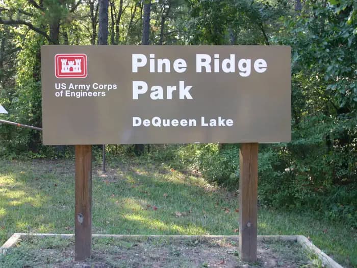
Overview Pine Ridge Campground sits along the shores of DeQueen Lake in southwest Arkansas. Recreation Boating and water sports top the list of recreational actives at the lake, and several boat ramps are provided for campers. Fishing is also a popular pastime, with large mouth bass, small mouth bass, spotted pass, black and white crappie, channel and flathead catfish and various species of sunfish available in abundance. The Arkansas Game and Fish Commission have also stocked hybrid striped bass in the lake. There are plenty of opportunities for hunting on the lands around the lake. Except for developed recreation areas and lands in the vicinity of the dam, all project lands are open to the public for hunting. Game species include bobwhite quail, mourning dove, turkey, fox squirrel, gray squirrel, cottontail rabbit and deer. Although DeQueen Lake does not have a designated hiking trail, the vast expanse of land is open to the public and hiking activities are welcomed anywhere on project lands. Facilities Boating and water sports top the list of recreational actives at the lake, and several boat ramps are provided for campers. Fishing is also a popular pastime, with large mouth bass, small mouth bass, spotted pass, black and white crappie, channel and flathead catfish and various species of sunfish available in abundance. The Arkansas Game and Fish Commission have also stocked hybrid striped bass in the lake. There are plenty of opportunities for hunting on the lands around the lake. Except for developed recreation areas and lands in the vicinity of the dam, all project lands are open to the public for hunting. Game species include bobwhite quail, mourning dove, turkey, fox squirrel, gray squirrel, cottontail rabbit and deer. Although DeQueen Lake does not have a designated hiking trail, the vast expanse of land is open to the public and hiking activities are welcomed anywhere on project lands. Natural Features DeQueen Lake is part of a dam project located on the Rolling Fork River. The dam, completed in 1977, was built for flood control and water supply, and now provides a recreational oasis for thousands of campers each year. The lake boasts 32 miles of shoreline to its visitors, along with 8,700 acres of rolling green landscape. Nearby Attractions The nearby town of DeQueen, Arkansas, offers gas, grocery and medical services.
View details →
Overview Download a Piney Bay park map HERE Piney Bay Campground sits along Dardanelle Lake in western Arkansas. Campers come here to get a break from the city and take advantage of the ample swimming, boating and fishing opportunities. Recreation Picnicking, boating and fishing are favorite pastimes. The lake is brimming with white bass, largemouth bass, bream, crappie and large catfish. Facilities Picnicking, boating and fishing are favorite pastimes. The lake is brimming with white bass, largemouth bass, bream, crappie and large catfish. Natural Features Situated between the Ozark and Ouachita National Forests, Dardanelle Lake creates an excellent setting for nature lovers. The lake stems from the Arkansas River and spans 40,000 acres. Wooded area and hills surround the lake. The region is a favorite destination for bald eagles in wintertime. Nearby Attractions Bona Dea Trails and Sanctuary, with nearly 86 acres of wetlands and low woods, provide an ideal habitat for native wildlife. Visitors can explore the area on the six-mile trail system.
View details →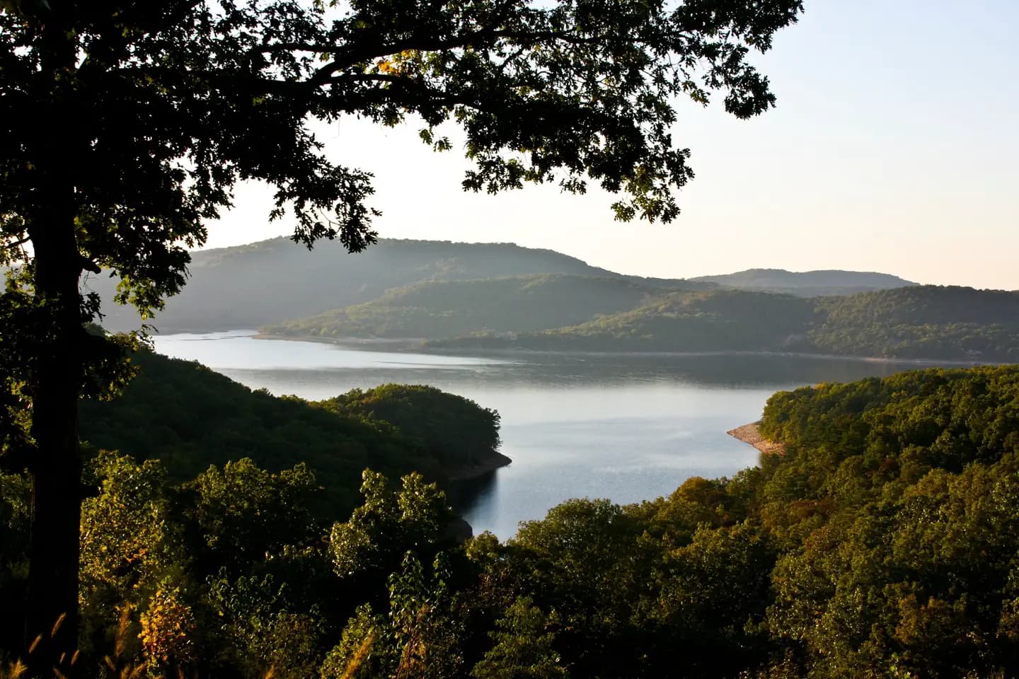
Overview Prairie Creek Campground sits along the vast shores of Beaver Lake in the Ozark Mountains of Northwest Arkansas, offering spacious and sunny campsites and an abundance of recreational activities. Recreation Fishing opportunities are plentiful near Prairie Creek Campground. Beaver Lake has more than 28,000 surface acres of water, and anglers can try their luck at catching large and small-mouth bass, crappie, bream, white bass, stripers, and channel or spoon-bill catfish. Just below the dam, the cold waters of the upper White River provide a perfect habitat for pole-bending rainbow and record-size German brown trout. Several trails snake throughout the Ozark Mountains, offering peaceful hiking, biking and wildlife viewing opportunities for visitors. Hunters will find game plentiful in northwest Arkansas. A mixture of hardwood and evergreen forest provides a good home to many different species of wildlife. While Beaver Lake is conveniently located near several population centers, within a short driving distance hunters can find remote areas filled with upland game animals such as deer, rabbits and squirrels. Many other sports and activities await campers, including boating, swimming, picnicking, scuba diving, water skiing, spelunking and sightseeing. Facilities Fishing opportunities are plentiful near Prairie Creek Campground. Beaver Lake has more than 28,000 surface acres of water, and anglers can try their luck at catching large and small-mouth bass, crappie, bream, white bass, stripers, and channel or spoon-bill catfish. Just below the dam, the cold waters of the upper White River provide a perfect habitat for pole-bending rainbow and record-size German brown trout. Several trails snake throughout the Ozark Mountains, offering peaceful hiking, biking and wildlife viewing opportunities for visitors. Hunters will find game plentiful in northwest Arkansas. A mixture of hardwood and evergreen forest provides a good home to many different species of wildlife. While Beaver Lake is conveniently located near several population centers, within a short driving distance hunters can find remote areas filled with upland game animals such as deer, rabbits and squirrels. Many other sports and activities await campers, including boating, swimming, picnicking, scuba diving, water skiing, spelunking and sightseeing. Natural Features Towering limestone bluffs, natural caves and a variety of trees and flowering shrubs surround Prairie Creek Campground, making it an ideal retreat for outdoor enthusiasts. Beaver Lake and Dam, completed in 1966, was constructed in the White River Basin and boasts 449 miles of beautiful shoreline at the top of the conservation pool. Although the dam was originally built for flood control, hydroelectric power and public water supply, it has also created a popular recreational oasis. Nearby Attractions Several marinas are located around the lake, offering groceries, fuel, boat rentals and storage, fishing guides and camping supplies. Click here for more information.
View details →
Overview Quarry Cove Campground sits along the shores of Nimrod Lake and Dam, cradled between Arkansas' Ouachita and Ozark Mountains. Visitors are greeted with shaded campsites, beautiful scenery and many outdoor recreation opportunities. Nimrod Lake provides the ideal spot to get away from it all, relax and enjoy yourself. Recreation Fishing is one of the most popular activities at the lake, with an abundance of catfish, bluegill, bass and crappie available. Boating, water skiing and tubing are also popular, with 11 boat ramps conveniently located around the lake, however, skiing and tubing are only allowed from the tip of Carden Point eastward toward the dam because areas west of there are too hazardous. Campers are likely to spot white-tailed deer, eastern wild turkey, bobwhite quail, squirrel, rabbit, fox, mink, black bear, dove and waterfowl in the area. Seasonal hunting is also permitted throughout the lake, except in or near recreation areas. Facilities Fishing is one of the most popular activities at the lake, with an abundance of catfish, bluegill, bass and crappie available. Boating, water skiing and tubing are also popular, with 11 boat ramps conveniently located around the lake, however, skiing and tubing are only allowed from the tip of Carden Point eastward toward the dam because areas west of there are too hazardous. Campers are likely to spot white-tailed deer, eastern wild turkey, bobwhite quail, squirrel, rabbit, fox, mink, black bear, dove and waterfowl in the area. Seasonal hunting is also permitted throughout the lake, except in or near recreation areas. Natural Features Nimrod Dam was completed in 1942 as part of a comprehensive plan for flood control and development of water resources in the Fourche LaFave River. Although recreation was not part of the initial mission of the dam project, the lake and surrounding 21,000 acres of pristine land have now become a recreational oasis for outdoor enthusiasts. Nearby Attractions Nimrod Lake is conveniently located adjacent to State Highway 7, a National Scenic Byway and other nearby points of interest like Petit Jean State Park, Mount Nebo State Park and Hot Springs National Park.
View details →
Overview Rising Star Campground is located on the Arkansas River by Pool 3 Lock and Dam. Whether camping, fishing, boating or just relaxing in the sun, this area provides something for everyone. Recreation The campground is popular among fishermen. There is excellent catfish fishing in the tail-waters of Joe Hardin Lock and Dam as well as Emmitt Sanders Lock and Dam at the upstream end of Pool 3. Anglers often catch bass, crappie and bream. Hunting is available in nearby forests, and there is duck hunting on the waterways. On shore, families enjoy picnicking and using the playground. Facilities The campground is popular among fishermen. There is excellent catfish fishing in the tail-waters of Joe Hardin Lock and Dam as well as Emmitt Sanders Lock and Dam at the upstream end of Pool 3. Anglers often catch bass, crappie and bream. Hunting is available in nearby forests, and there is duck hunting on the waterways. On shore, families enjoy picnicking and using the playground. Natural Features The park is in a forested area along the riverfront, close to the rolling fields of cotton farms. It is 193 feet above sea level; winters are generally mild and summer temperatures reach the upper 90s with high humidity. Red fox are frequently seen in the park, and numerous species of waterfowl live in the water and along the shores. Nearby Attractions Rising Star Park is located 12 miles from Pine Bluff, the home for the Arkansas Railroad Museum, Pine Bluff Regional Park, the Martha Mitchell Home and other points of interest, as well as shopping and groceries.
View details →
Overview River Road Campground sits along the shores of Fourche LaFave River and Nimrod Dam, cradled between Arkansas' Ouachita and Ozark Mountains. Visitors are greeted with shaded campsites, beautiful scenery and many outdoor recreation opportunities. Nimrod Lake provides the ideal spot to get away from it all, relax and enjoy yourself. Recreation Fishing is one of the most popular activities at the lake, with an abundance of crappie, largemouth bass, catfish and bream available. Boating, water skiing and tubing are also popular, with 11 boat ramps conveniently located around the lake, however, skiing and tubing are only allowed from the tip of Carden Point eastward toward the dam because areas west of there are too hazardous. Campers are likely to spot white-tailed deer, eastern wild turkey, bobwhite quail, squirrel, rabbit, fox, mink, black bear, dove and waterfowl in the area. Seasonal hunting is also permitted throughout the forested area around the lake, except in or near recreation areas. Facilities Fishing is one of the most popular activities at the lake, with an abundance of crappie, largemouth bass, catfish and bream available. Boating, water skiing and tubing are also popular, with 11 boat ramps conveniently located around the lake, however, skiing and tubing are only allowed from the tip of Carden Point eastward toward the dam because areas west of there are too hazardous. Campers are likely to spot white-tailed deer, eastern wild turkey, bobwhite quail, squirrel, rabbit, fox, mink, black bear, dove and waterfowl in the area. Seasonal hunting is also permitted throughout the forested area around the lake, except in or near recreation areas. Natural Features Nimrod Dam was completed in 1942 as part of a comprehensive plan for flood control and development of water resources in the Fourche LaFave River. Although recreation was not part of the initial mission of the dam project, the lake and surrounding 21,000 acres of pristine land have now become a recreational oasis for outdoor enthusiasts. Nearby Attractions Nimrod Lake is conveniently located adjacent to State Highway 7, a National Scenic Byway and other nearby points of interest like Petit Jean State Park, Mount Nebo State Park and Hot Springs National Park.
View details →
Overview Shiloh Park is located on Greers Ferry Lake in the beautiful Ozark Mountains of north-central Arkansas. The environment provides the ideal location for family camping, fishing, boating and hiking. Recreation Greers Ferry Lake is an outdoor enthusiasts' dream, with boating, sailing, water skiing, swimming, scuba diving and fishing opportunities. Hikers enjoy the area's three National Nature Trails and one multi-purpose fitness trail. The William Carl Garner Visitor Center is just west of the dam, with exhibits, a children's touch table, and a replica of the world record 40 lb. 4 oz. brown trout caught in the Little Red River downstream of the center. Facilities Greers Ferry Lake is an outdoor enthusiasts' dream, with boating, sailing, water skiing, swimming, scuba diving and fishing opportunities. Hikers enjoy the area's three National Nature Trails and one multi-purpose fitness trail. The William Carl Garner Visitor Center is just west of the dam, with exhibits, a children's touch table, and a replica of the world record 40 lb. 4 oz. brown trout caught in the Little Red River downstream of the center. Natural Features A dense mix of red cedar, black gum, red oak, elm, pecan and sweet gum trees forest the area, providing shade in the summer months and beautiful fall colors in autumn. Wildlife is plentiful around Greers Ferry Lake. Visitors commonly see white-tailed deer, wild turkeys, rabbits, squirrels and a wide variety of birds. contact_info For local information, please call (501) 825-8619 or call (501) 362-2416 for general information. Nearby Attractions With over 30,000 acres of water surface, the lake serves as a playground for all kinds of water sports. Eighteen parks around the shoreline provide modern campgrounds, boat ramps, swim areas and marinas.
View details →
Overview Download a Shoal Bay park map HERE This shady campground sits on the scenic Shoal Bay arm of Lake Dardanelle, offering an excellent setting for boating, swimming and wildlife viewing. Recreation The lake, a popular spot for anglers, is brimming with white bass, largemouth bass, bream, crappie and large catfish. The Bridge Rock Trail winds along a rugged slope overlooking the narrows of Shoal Creek, offering excellent hiking opportunities. Dardanelle's Visitor Center is noteworthy for its "Renaissance of a River" theme. Interpretive exhibits express the progression of river valley from the time of early Native Americans to its present day. Facilities The lake, a popular spot for anglers, is brimming with white bass, largemouth bass, bream, crappie and large catfish. The Bridge Rock Trail winds along a rugged slope overlooking the narrows of Shoal Creek, offering excellent hiking opportunities. Dardanelle's Visitor Center is noteworthy for its "Renaissance of a River" theme. Interpretive exhibits express the progression of river valley from the time of early Native Americans to its present day. Natural Features Dardanelle Lake, sourced by the Arkansas River, spans 40,000 acres and boasts 315 miles of shoreline. The lake sits in the river valley between the Ozark and Ouachita National Forests. Nearby Attractions Bona Dea Trails and Sanctuary, with nearly 86 acres of wetlands and low woods, provide an ideal habitat for native wildlife. Visitors can explore the area on the 6 mile trail system.
View details →
Overview Sugar Loaf Park is located on Greers Ferry Lake in the beautiful Ozark Mountains of north-central Arkansas. The environment provides the ideal location for family camping, fishing, boating and hiking. Recreation Greers Ferry Lake is an outdoor enthusiasts' dream, with boating, sailing, water skiing, swimming, scuba diving and fishing opportunities. Sugar Loaf Mountain Island National Nature Trail is adjacent to the campground, on an island within the lake. The trail must be accessed by boat, but visitors who tackle the 1.5-mile hike reach levels 1,001 ft. above sea level, providing impressive panoramic views of the surrounding lake and countryside. Facilities Greers Ferry Lake is an outdoor enthusiasts' dream, with boating, sailing, water skiing, swimming, scuba diving and fishing opportunities. Sugar Loaf Mountain Island National Nature Trail is adjacent to the campground, on an island within the lake. The trail must be accessed by boat, but visitors who tackle the 1.5-mile hike reach levels 1,001 ft. above sea level, providing impressive panoramic views of the surrounding lake and countryside. Natural Features A dense mix of red cedar, black gum, red oak, elm, pecan, and sweet gum trees forest the area, providing shade in the summer months and beautiful fall colors in autumn. Wildlife is plentiful around Greers Ferry Lake. Visitors commonly see white-tailed deer, wild turkeys, rabbits, squirrels and a wide variety of birds. Nearby Attractions With over 30,000 acres of water surface, the lake serves as a playground for all kinds of water sports. Eighteen parks around the shoreline provide modern campgrounds, boat ramps, swim areas and marinas. contact_info For local information, please call (501) 654-2267 or call (501) 362-2416 for general information.
View details →
Overview Sunlight Bay Campground sits along the shores of Nimrod Lake just off of the Fourche Lafave river on Wilson Slough. Nimrod Lake is cradled between Arkansas' Ouachita and Ozark Mountains. Recreation Fishing is one of the most popular activities at the lake, with an abundance of catfish, bluegill, bass and crappie available. Boating, water skiing and tubing are also popular, with 11 boat ramps conveniently located around the lake, however, skiing and tubing are only allowed from the tip of Carden Point eastward toward the dam because areas west of there are too hazardous. Campers are likely to spot white-tailed deer, eastern wild turkey, bobwhite quail, squirrel, rabbit, fox, mink, black bear, dove and waterfowl in the area. Seasonal hunting is also permitted throughout the lake, except in or near recreation areas. Facilities Fishing is one of the most popular activities at the lake, with an abundance of catfish, bluegill, bass and crappie available. Boating, water skiing and tubing are also popular, with 11 boat ramps conveniently located around the lake, however, skiing and tubing are only allowed from the tip of Carden Point eastward toward the dam because areas west of there are too hazardous. Campers are likely to spot white-tailed deer, eastern wild turkey, bobwhite quail, squirrel, rabbit, fox, mink, black bear, dove and waterfowl in the area. Seasonal hunting is also permitted throughout the lake, except in or near recreation areas. Natural Features Nimrod Dam was completed in 1942 as part of a comprehensive plan for flood control and development of water resources in the Fourche LaFave River. Although recreation was not part of the initial mission of the dam project, the lake and surrounding 21,000 acres of pristine land have now become a recreational oasis for outdoor enthusiasts. Nearby Attractions Nimrod Lake is conveniently located adjacent to State Highway 7, a National Scenic Byway and other nearby points of interest like Petit Jean State Park, Mount Nebo State Park and Hot Springs National Park.
View details →
Overview Tar Camp Park is situated near Pool 5 Lock and Dam on the Arkansas River. The campground is known for its beauty and first-class fishing. Whether camping, fishing, boating or just relaxing in the sun, this area provides something for everyone. Recreation The campground is popular among fishermen. There is excellent catfish fishing in the tail-waters of Joe Hardin Lock and Dam as well as Emmitt Sanders Lock and Dam at the upstream end of Pool 3. Anglers often catch bass, crappie and bream. Hunting is available in nearby forests, and there is duck hunting on the waterways. On shore, families enjoy picnicking and using the playground. Facilities The campground is popular among fishermen. There is excellent catfish fishing in the tail-waters of Joe Hardin Lock and Dam as well as Emmitt Sanders Lock and Dam at the upstream end of Pool 3. Anglers often catch bass, crappie and bream. Hunting is available in nearby forests, and there is duck hunting on the waterways. On shore, families enjoy picnicking and using the playground. Natural Features The park is in a forested area along the riverfront, close to the rolling fields of cotton farms. It is 193 feet above sea level; winters are generally mild and summer temperatures reach the upper 90s with high humidity. Red fox are frequently seen in the park, and numerous species of waterfowl live in the water and along the shores. Nearby Attractions Little Rock, the state capital and largest city in Arkansas, is only a short drive away and offers many amenities and cultural attractions. The nearby town of Pine Bluff is the home for the Arkansas Railroad Museum, Pine Bluff Regional Park, the Martha Mitchell Home and other points of interest, as well as shopping and groceries.
View details →
Overview Toad Suck Park Map Customer Comment Card Special Event Application HERE! Toad Suck Campground, situated on the Arkansas River, is a popular destination for families and groups. Picnicking, boating and fishing all draw visitors to this shady campground. Recreation Fishing is excellent year-round, and record fish catches are common in the Arkansas River. The waters have an abundance of bream, crappie, white bass, largemouth bass and several species of catfish. Facilities Fishing is excellent year-round, and record fish catches are common in the Arkansas River. The waters have an abundance of bream, crappie, white bass, largemouth bass and several species of catfish. Natural Features Situated in the eastern edge of both the Ozark and Ouachita Mountains, the area is a haven for nature enthusiasts. Dogwood, redbud, wild plum and other native flowering trees offer breathtaking sights in springtime. Nearby Attractions The nearby Cadron Blockhouse in Cadron Settlement Park, a replica of a structure that was built in the late 18th century, is a popular tourist attraction. The town of Conway hosts an annual Toad Suck Daze Festival, featuring a toad race competition.
View details →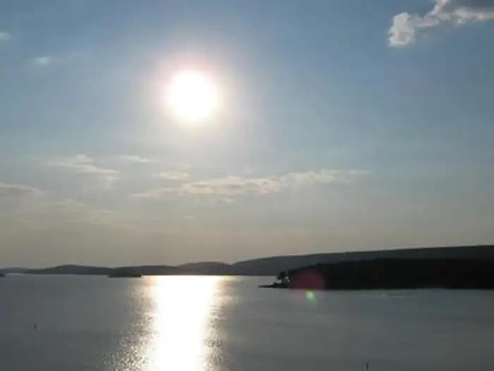
Overview Waveland Park Campground is located on the beautiful Blue Mountain Lake near Waveland, Arkansas. Visitors are greeted with shaded campsites, spectacular scenery and many outdoor recreation opportunities. Blue Mountain Lake provides the ideal spot to get away from it all, relax and enjoy fishing, boating, hunting, hiking and more. Recreation Families, anglers, boaters, hikers, water skiers and hunters are drawn to the lake for its recreational activities. Forests around the lake are also open to hunting. The lakeshore around Waveland Park Campground provides prime bank fishing opportunities for crappie, largemouth and white bass, bream and catfish. Families can make use of the playground and the shady, cypress tree-lined swimming area, as well as the amphitheater, which provides educational programs. The J. Perry Mikels Blue Mountain Special Use Area on the west end of the lake has a world-class bird dog field trial area that attracts visitors from throughout the United States and several other countries. Anyone may use the facilities to train dogs. Facilities Families, anglers, boaters, hikers, water skiers and hunters are drawn to the lake for its recreational activities. Forests around the lake are also open to hunting. The lakeshore around Waveland Park Campground provides prime bank fishing opportunities for crappie, largemouth and white bass, bream and catfish. Families can make use of the playground and the shady, cypress tree-lined swimming area, as well as the amphitheater, which provides educational programs. The J. Perry Mikels Blue Mountain Special Use Area on the west end of the lake has a world-class bird dog field trial area that attracts visitors from throughout the United States and several other countries. Anyone may use the facilities to train dogs. Natural Features Blue Mountain Lake is situated in the shadow of Mt. Magazine, the highest mountain in Arkansas and the tallest between the Rockies and Alleghenies. Farmland, rolling green mountains and two national forests surround the lake, adding to the natural beauty of the area. The lake shore consists of mixed pine and hardwood forests, wetlands and grasslands, which provide habitat for many native wildlife species. Nearby Attractions The lake is situated between the Ozark and Ouachita National Forest, and Mt. Magazine State Park is within a 30-minute drive. Additional information for local attractions is available at chambers of commerce in nearby towns.
View details →
Overview Wilbur D. Mills Campground is a small, quiet campground offering 21 campsites. The park is located just downstream of the Wilbur D. Mills Dam on the right descending bank of the Arkansas River. Recreation Hiking, fishing, hunting, birding, and boating are all popular pastimes in this area. The waters below Wilbur D. Mills Dam can be an excellent place to catch Blue, Channel and Flathead catfish as well as other species such as crappie, white bass, striped bass, and their hybrids. Many outdoor enthusiasts find the whitetail deer hunting to be excellent in the fertile soils of the bottomland hardwoods of the public lands adjacent to the area. Birders find many species to check off their lists as well. Hiking is permitted year round in the area, except during permit drawn hunts outside the park. Hikers are reminded to wear bright colors, such as fluorescent orange or yellow during hunting seasons as well. Facilities Hiking, fishing, hunting, birding, and boating are all popular pastimes in this area. The waters below Wilbur D. Mills Dam can be an excellent place to catch Blue, Channel and Flathead catfish as well as other species such as crappie, white bass, striped bass, and their hybrids. Many outdoor enthusiasts find the whitetail deer hunting to be excellent in the fertile soils of the bottomland hardwoods of the public lands adjacent to the area. Birders find many species to check off their lists as well. Hiking is permitted year round in the area, except during permit drawn hunts outside the park. Hikers are reminded to wear bright colors, such as fluorescent orange or yellow during hunting seasons as well. Natural Features The Wilbur D. Mills Campground is on the lower portion of the Arkansas River, just below the Wilbur D. Mills Dam. This non-commercially navigable portion of the Arkansas River meanders below Wilbur D. Mills Dam as it makes it's 26 mile journey to the confluence with the Mississippi River. Many species of shorebirds find the shallow water and sand bars great feeding and nesting habitat. Federally Endangered Least Terns (Sterna antillarum) can be seen feeding and nesting in this portion of the Arkansas River. Please exercise caution and avoid active nesting sandbars. Nearby Attractions The Arkansas Post National Memorial marks where the first European village west of the Mississippi River was built in 1686. Arkansas Post was also the capital of Arkansas up until the Civil War. Arkansas Post State Park is also close to WIlbur D. Mills Campground and is worth a visit. Arkansas Game and Fish Commission's Trusten Holder Wildlife Management Area is a state managed public land area offering many outdoor activities. The Dale Bumpers White River National Wildlife Refuge also offers many recreational activities on its 160,000 acres of public land.
View details →
Overview Willow Beach Campground is located near the David D.Terry Lock and Dam of the Arkansas River. The wealth of recreational opportunities in the Arkansas River Valley provides visitors with endless fun for the whole family. Outdoor activities such as camping, picnicking, boating and sightseeing are favorite pastimes. Recreation Willow Beach has a boat ramp and offers excellent fishing, especially in the old river cutoffs and the tail-waters of the dam and Murry Lock and Dam upstream. Anglers often catch bass, crappie and bream in the Arkansas River. Hunting is available in nearby forests, and there is duck hunting on the waterways. On shore, families enjoy picnicking and using the playground. Facilities Willow Beach has a boat ramp and offers excellent fishing, especially in the old river cutoffs and the tail-waters of the dam and Murry Lock and Dam upstream. Anglers often catch bass, crappie and bream in the Arkansas River. Hunting is available in nearby forests, and there is duck hunting on the waterways. On shore, families enjoy picnicking and using the playground. Natural Features The park is in a forested area along the riverfront, close to the rolling fields of cotton farms. It is 193 feet above sea level; winters are generally mild and summer temperatures reach the upper 90s with high humidity. Red fox are frequently seen in the park, along with deer and armadillo, and numerous species of waterfowl live in the water and along the shores. Nearby Attractions Little Rock, the state capital and largest city of Arkansas, is just minutes away, offering groceries, gas, restaurants and tourist attractions.
View details →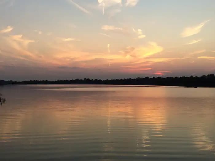
Overview Maumelle Park Map Customer Comment Card Special Event Application HERE All Sites in the UAMS Medical Loop MUST have Approval from a Park Ranger and a Physician Prior to Making Reservations. Recreation The Nuttall Trail runs through the park, offering visitors hiking opportunities. Anglers will find a selection of crappie, bream, hybrid bass, white bass and more. A boat ramp is provided for campers to enjoy the river. Facilities The Nuttall Trail runs through the park, offering visitors hiking opportunities. Anglers will find a selection of crappie, bream, hybrid bass, white bass and more. A boat ramp is provided for campers to enjoy the river. Natural Features The campground is set on the McClellan-Kerr Arkansas River Navigation System, a series of navigation pools used to help ships navigate upstream toward Oklahoma. The Arkansas River is one of the Mississippi's largest tributaries, flowing 1,450 miles from the Rocky Mountains of Colorado, through to Kansas, Oklahoma and Arkansas. Wintering eagles can be seen in large numbers along the Arkansas River. Most of these eagles migrate from Canada and the U.S. Great Lakes region. Nearby Attractions The Pinnacle Mountain State Park is just two miles from the campground. The 13 mountain trails here range from easy to strenuous, and each one promises captivating scenery. They also have several new mountain biking trails. See Pinnacle Mountain State Park for more information. Two Rivers Park is a city park that is also two miles form the campground. This park hase numerous hiking and biking trails, as well as, a bridge that connect the trails to the vast Arkansas River Trail. See Two Rivers Park and Arkansas River Trail Charges & Cancellations Late Cancellations or Cancellations within the Cut-off Window Individual Campsites: A customer who cancels a reservation the day before or on the day of arrival will pay a $10.00 service fee AND forfeit the first night's use fee (not to exceed the total paid for the original reservation). Cancellations for a one-night reservation will forfeit the entire amount paid and will not be subject to an additional service fee. Once a reservation date has begun, customers cannot change a reservation using the online system or through the Call Center For specific information about fees and cancellations/Changes please visit: Rules and Regulations
View details →
Overview Dam Site River Campground sits on the shores of the White River, just below Beaver Dam and Lake in the Ozark Mountains. The campground features spacious and sunny campsites and an abundance of recreational activities. Recreation Fishing opportunities are plentiful near Dam Site River Campground. Just below the dam, the cold waters of the upper White River provide a perfect habitat for pole-bending rainbow and record-sized German brown trout. Nearby Beaver Lake has more than 28,000 surface acres of water, where anglers can try their luck at catching large and small-mouth bass, crappie, bream, white bass, stripers, and channel or spoon-bill catfish. Several trails snake throughout the Ozark Mountains, offering peaceful hiking, biking and wildlife viewing opportunities for visitors. Hunters will find game plentiful in northwest Arkansas. A mixture of hardwood and evergreen forest provides a good home to many different species of wildlife. While Beaver Lake is conveniently located near several population centers, within a short driving distance hunters can find remote areas filled with upland game animals such as deer, rabbits and squirrels. Many other sports and activities await campers, including boating, swimming, picnicking, scuba diving, water skiing, spelunking and sightseeing. Facilities Fishing opportunities are plentiful near Dam Site River Campground. Just below the dam, the cold waters of the upper White River provide a perfect habitat for pole-bending rainbow and record-sized German brown trout. Nearby Beaver Lake has more than 28,000 surface acres of water, where anglers can try their luck at catching large and small-mouth bass, crappie, bream, white bass, stripers, and channel or spoon-bill catfish. Several trails snake throughout the Ozark Mountains, offering peaceful hiking, biking and wildlife viewing opportunities for visitors. Hunters will find game plentiful in northwest Arkansas. A mixture of hardwood and evergreen forest provides a good home to many different species of wildlife. While Beaver Lake is conveniently located near several population centers, within a short driving distance hunters can find remote areas filled with upland game animals such as deer, rabbits and squirrels. Many other sports and activities await campers, including boating, swimming, picnicking, scuba diving, water skiing, spelunking and sightseeing. Natural Features Towering limestone bluffs, natural caves and a variety of trees and flowering shrubs surround Dam Site River Campground, making it an ideal retreat for outdoor enthusiasts. Beaver Lake and Dam, completed in 1966, was constructed in the White River Basin and boasts 449 miles of beautiful shoreline at the top of the conservation pool. Although the dam was originally built for flood control, hydroelectric power and public water supply, it has also created a popular recreational oasis. Nearby Attractions Several marinas are located around the lake, offering groceries, fuel, boat rentals and storage, fishing guides and camping supplies. Click here for more information.
View details →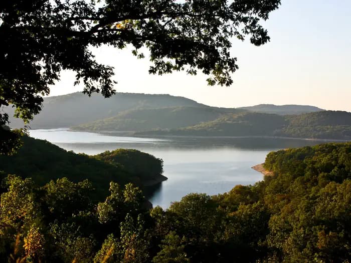
Overview Lost Bridge South Campground sits along the vast shores of Beaver Lake in the Ozark Mountains of Northwest Arkansas, offering spacious and sunny campsites and an abundance of recreational activities. Recreation Fishing opportunities are plentiful near Lost Bridge South Campground. Beaver Lake has more than 28,000 surface acres of water, and anglers can try their luck at catching large and small-mouth bass, crappie, bream, white bass, stripers, and channel or spoon-bill catfish. Just below the dam, the cold waters of the upper White River provide the perfect habitat for pole-bending rainbow and record-sized German brown trout. Several trails snake throughout the Ozark Mountains, offering peaceful hiking, biking and wildlife viewing opportunities for visitors. Hunters will find game plentiful in northwest Arkansas. A mixture of hardwood and evergreen forest provides a good home to many different species of wildlife. While Beaver Lake is conveniently located near several population centers, within a short driving distance hunters can find remote areas filled with upland game such as deer, rabbits and squirrels. Many other sports and activities await campers, including boating, swimming, picnicking, scuba diving, water skiing, spelunking and sightseeing. Facilities Fishing opportunities are plentiful near Lost Bridge South Campground. Beaver Lake has more than 28,000 surface acres of water, and anglers can try their luck at catching large and small-mouth bass, crappie, bream, white bass, stripers, and channel or spoon-bill catfish. Just below the dam, the cold waters of the upper White River provide the perfect habitat for pole-bending rainbow and record-sized German brown trout. Several trails snake throughout the Ozark Mountains, offering peaceful hiking, biking and wildlife viewing opportunities for visitors. Hunters will find game plentiful in northwest Arkansas. A mixture of hardwood and evergreen forest provides a good home to many different species of wildlife. While Beaver Lake is conveniently located near several population centers, within a short driving distance hunters can find remote areas filled with upland game such as deer, rabbits and squirrels. Many other sports and activities await campers, including boating, swimming, picnicking, scuba diving, water skiing, spelunking and sightseeing. Natural Features Towering limestone bluffs, natural caves and a variety of trees and flowering shrubs surround Lost Bridge South Campground, making it an ideal retreat for outdoor enthusiasts. Beaver Lake and Dam, completed in 1966, was constructed in the White River Basin and boasts 449 miles of beautiful shoreline at the top of the conservation pool. Although the dam was originally built for flood control, hydroelectric power and public water supply, it has also created a popular recreational oasis. Nearby Attractions Several marinas are located around the lake, offering groceries, fuel, boat rentals and storage, fishing guides and camping supplies. Click here for more information.
View details →
Overview The Ozark Pavilion sits in the middle of the Ozark Campground near the impressive bluffs of the Buffalo River. Bring a picnic lunch or pack up your grill for a day of fresh air and outdoor activities. The big river isn't just a picturesque backdrop for your picnic - it also offers an array of river sports like canoeing, kayaking, tubing, swimming and fishing. Recreation The Buffalo River Trailhead is next to the pavilion. The scenic trail spans a massive 36.5 miles (59 km) of the Buffalo River from Boxely to Pruitt, and is ideal for hiking or backpacking. Peak season for canoeing, kayaking and tubing is spring to early summer. Facilities The Buffalo River Trailhead is next to the pavilion. The scenic trail spans a massive 36.5 miles (59 km) of the Buffalo River from Boxely to Pruitt, and is ideal for hiking or backpacking. Peak season for canoeing, kayaking and tubing is spring to early summer. Natural Features The pavilion is located along the Buffalo National River with views of lush forests and high, riverside limestone bluffs. It is one of the few free-flowing rivers remaining in the contiguous U.S., with 135 miles (217 km) of undammed waters. It cuts through the Arkansas Ozarks to reach its final destination at the White River. Nearby Attractions The nearby town of Jasper offers restaurants, gas stations and groceries. The Hilary Jones Wildlife Museum and Elk Center is just north of Jasper. It features displays of elk, white-tailed deer and ducks, as well as freshwater aquariums, wildlife paintings and a gift shop. Charges & Cancellations Please visit the Recreation.gov Rules and Reservation Policies page.
View details →
Overview Starkey Campground sits along the vast shores of Beaver Lake in the Ozark Mountains of Northwest Arkansas, offering spacious and sunny campsites and an abundance of recreational activities. Recreation Fishing opportunities are plentiful near Starkey Campground. Beaver Lake has more than 28,000 surface acres of water, and anglers can try their luck at catching large and small-mouth bass, crappie, bream, white bass, stripers, and channel or spoon-bill catfish. Just below the dam, the cold waters of the upper White River provide a perfect habitat for pole-bending rainbow and record-size German brown trout. Several trails snake throughout the Ozark Mountains, offering peaceful hiking, biking and wildlife viewing opportunities for visitors. Hunters will find game plentiful in northwest Arkansas. A mixture of hardwood and evergreen forest provides a good home to many different species of wildlife. While Beaver Lake is conveniently located near several population centers, within a short driving distance hunters can find remote areas filled with upland game animals such as deer, rabbits and squirrels. Many other sports and activities await campers, including boating, swimming, picnicking, scuba diving, water skiing, spelunking and sightseeing. Facilities Fishing opportunities are plentiful near Starkey Campground. Beaver Lake has more than 28,000 surface acres of water, and anglers can try their luck at catching large and small-mouth bass, crappie, bream, white bass, stripers, and channel or spoon-bill catfish. Just below the dam, the cold waters of the upper White River provide a perfect habitat for pole-bending rainbow and record-size German brown trout. Several trails snake throughout the Ozark Mountains, offering peaceful hiking, biking and wildlife viewing opportunities for visitors. Hunters will find game plentiful in northwest Arkansas. A mixture of hardwood and evergreen forest provides a good home to many different species of wildlife. While Beaver Lake is conveniently located near several population centers, within a short driving distance hunters can find remote areas filled with upland game animals such as deer, rabbits and squirrels. Many other sports and activities await campers, including boating, swimming, picnicking, scuba diving, water skiing, spelunking and sightseeing. Natural Features Towering limestone bluffs, natural caves and a variety of trees and flowering shrubs surround Starkey Campground, making it an ideal retreat for outdoor enthusiasts. Beaver Lake and Dam, completed in 1966, was constructed in the White River Basin and boasts 449 miles of beautiful shoreline at the top of the conservation pool. Although the dam was originally built for flood control, hydroelectric power and public water supply, it has also created a popular recreational oasis. Nearby Attractions Several marinas are located around the lake, offering groceries, fuel, boat rentals and storage, fishing guides and camping supplies. Click here for more information.
View details →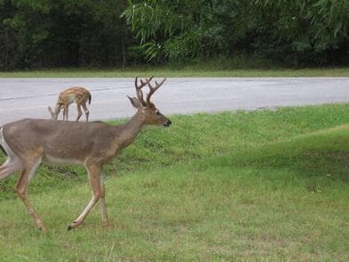
Overview Indian Creek Campground sits along the vast shores of Beaver Lake in the Ozark Mountains of Northwest Arkansas, offering spacious and sunny campsites with an abundance of recreational activities. Recreation Fishing opportunities are plentiful near Indian Creek Campground. Beaver Lake has more than 28,000 surface acres of water, and anglers can try their luck at catching large and small-mouth bass, crappie, bream, white bass, stripers, and channel or spoon-bill catfish. Just below the dam, the chilly waters of the upper White River provide a perfect habitat for pole-bending rainbow and record-size German brown trout. Several trails snake throughout the Ozark Mountains, offering peaceful hiking, biking and wildlife viewing opportunities for visitors. Hunters will find plentiful game in the hardwood and evergreen forests of northwest Arkansas. While Beaver Lake is conveniently located near several population centers, within a short driving distance, hunters can find remote areas filled with upland game such as deer, rabbits and squirrels. Many other sports and activities await campers, including boating, swimming, picnicking, scuba diving, water skiing, spelunking and sightseeing. Facilities Fishing opportunities are plentiful near Indian Creek Campground. Beaver Lake has more than 28,000 surface acres of water, and anglers can try their luck at catching large and small-mouth bass, crappie, bream, white bass, stripers, and channel or spoon-bill catfish. Just below the dam, the chilly waters of the upper White River provide a perfect habitat for pole-bending rainbow and record-size German brown trout. Several trails snake throughout the Ozark Mountains, offering peaceful hiking, biking and wildlife viewing opportunities for visitors. Hunters will find plentiful game in the hardwood and evergreen forests of northwest Arkansas. While Beaver Lake is conveniently located near several population centers, within a short driving distance, hunters can find remote areas filled with upland game such as deer, rabbits and squirrels. Many other sports and activities await campers, including boating, swimming, picnicking, scuba diving, water skiing, spelunking and sightseeing. Natural Features Towering limestone bluffs, natural caves and a variety of trees and flowering shrubs surround Indian Creek Campground, making it an ideal retreat for outdoor enthusiasts. Beaver Lake and Dam, completed in 1966, was constructed in the White River Basin and boasts 449 miles of beautiful shoreline at the top of the conservation pool. Although the dam was originally built for flood control, hydroelectric power and public water supply, it has also created a popular recreational oasis. Nearby Attractions Several marinas are located around the lake, offering groceries, fuel, boat rentals and storage, fishing guides and camping supplies. Click here for more information.
View details →
Overview War Eagle Campground sits along the vast shores of Beaver Lake in the Ozark Mountains of Northwest Arkansas, offering spacious and sunny campsites and an abundance of recreational activities. Recreation Fishing opportunities are plentiful near War Eagle Campground. Beaver Lake has more than 28,000 surface acres of water, and anglers can try their luck at catching large and small-mouth bass, crappie, bream, white bass, stripers, and channel or spoon-bill catfish. Just below the dam, the cold waters of the upper White River provide a perfect habitat for pole-bending rainbow and record-sized German brown trout. Several trails snake throughout the Ozark Mountains, offering peaceful hiking, biking and wildlife viewing opportunities for visitors. Hunters will find game plentiful in northwest Arkansas. A mixture of hardwood and evergreen forest provides a good home to many different species of wildlife. While Beaver Lake is conveniently located near several population centers, within a short driving distance, hunters can find remote areas filled with upland game animals such as deer, rabbits and squirrels. Many other sports and activities await campers, including boating, swimming, picnicking, scuba diving, water skiing, spelunking and sightseeing. Facilities Fishing opportunities are plentiful near War Eagle Campground. Beaver Lake has more than 28,000 surface acres of water, and anglers can try their luck at catching large and small-mouth bass, crappie, bream, white bass, stripers, and channel or spoon-bill catfish. Just below the dam, the cold waters of the upper White River provide a perfect habitat for pole-bending rainbow and record-sized German brown trout. Several trails snake throughout the Ozark Mountains, offering peaceful hiking, biking and wildlife viewing opportunities for visitors. Hunters will find game plentiful in northwest Arkansas. A mixture of hardwood and evergreen forest provides a good home to many different species of wildlife. While Beaver Lake is conveniently located near several population centers, within a short driving distance, hunters can find remote areas filled with upland game animals such as deer, rabbits and squirrels. Many other sports and activities await campers, including boating, swimming, picnicking, scuba diving, water skiing, spelunking and sightseeing. Natural Features Towering limestone bluffs, natural caves and a variety of trees and flowering shrubs surround War Eagle Campground, making it an ideal retreat for outdoor enthusiasts. Beaver Lake and Dam, completed in 1966, was constructed in the White River Basin and boasts 449 miles of beautiful shoreline at the top of the conservation pool. Although the dam was originally built for flood control, hydroelectric power and public water supply, it has created a popular recreational oasis for the area. Nearby Attractions Several marinas are located around the lake, offering groceries, fuel, boat rentals and storage, fishing guides and camping supplies. Click here for more information.
View details →
Overview Rocky Branch Campground sits along the vast shores of Beaver Lake in the Ozark Mountains of Northwest Arkansas, offering spacious and sunny campsites and an abundance of recreational activities. Recreation Fishing opportunities are plentiful near Rocky Branch Campground. Beaver Lake has more than 28,000 surface acres of water, and anglers can try their luck at catching large and small-mouth bass, crappie, bream, white bass, stripers, and channel or spoon-bill catfish. Just below the dam, the cold waters of the upper White River provide a perfect habitat for pole-bending rainbow and record-size German brown trout. Several trails snake throughout the Ozark Mountains, offering peaceful hiking, biking and wildlife viewing opportunities for visitors. Hunters will find game plentiful in northwest Arkansas. A mixture of hardwood and evergreen forest provides a good home to many different species of wildlife. While Beaver Lake is conveniently located near several population centers, within a short driving distance hunters can find remote areas filled with upland game animals such as deer, rabbits and squirrels. Many other sports and activities await campers, including boating, swimming, picnicking, scuba diving, water skiing, spelunking and sightseeing. Facilities Fishing opportunities are plentiful near Rocky Branch Campground. Beaver Lake has more than 28,000 surface acres of water, and anglers can try their luck at catching large and small-mouth bass, crappie, bream, white bass, stripers, and channel or spoon-bill catfish. Just below the dam, the cold waters of the upper White River provide a perfect habitat for pole-bending rainbow and record-size German brown trout. Several trails snake throughout the Ozark Mountains, offering peaceful hiking, biking and wildlife viewing opportunities for visitors. Hunters will find game plentiful in northwest Arkansas. A mixture of hardwood and evergreen forest provides a good home to many different species of wildlife. While Beaver Lake is conveniently located near several population centers, within a short driving distance hunters can find remote areas filled with upland game animals such as deer, rabbits and squirrels. Many other sports and activities await campers, including boating, swimming, picnicking, scuba diving, water skiing, spelunking and sightseeing. Natural Features Towering limestone bluffs, natural caves and a variety of trees and flowering shrubs surround Rocky Branch Campground, making it an ideal retreat for outdoor enthusiasts. Beaver Lake and Dam, completed in 1966, was constructed in the White River Basin and boasts 449 miles of beautiful shoreline at the top of the conservation pool. Although the dam was originally built for flood control, hydroelectric power and public water supply, it has also created a popular recreational oasis. Nearby Attractions Several marinas are located around the lake, offering groceries, fuel, boat rentals and storage, fishing guides and camping supplies. Click here for more information.
View details →
Overview Alpine Ridge Campground sits on the banks of DeGray Lake in the foothills of the Quachita Mountains. The lake attracts visitors far and wide for fishing tournaments, triathlons, water sports and more. Recreation Boating, water skiing, kayaking and other water sports are the biggest draw to the lake, and a boat ramp and sandy swimming beach are provided. The lake is also stocked with a variety of game fish, including plenty of hybrid striped bass, making it an ideal area for both boat and bank fishing. Facilities Boating, water skiing, kayaking and other water sports are the biggest draw to the lake, and a boat ramp and sandy swimming beach are provided. The lake is also stocked with a variety of game fish, including plenty of hybrid striped bass, making it an ideal area for both boat and bank fishing. Natural Features Degray Lake is one of the region's five Diamond Lakes, known for their crystal clear waters. The lake flows from the Caddo River in western Arkansas and spans 13,500 surface acres. The first settlers around the lake were the Caddo Indians, whose remains have been traced back to 700 A.D. The early inhabitants were skilled in agriculture, and grew crops like beans, squash, maize and sunflowers. Nearby Attractions The DeGray Lake Resort State Park offers golf courses, tennis courts, horseback riding trails and more along the 207 miles of lake shoreline. The Ouachita National Forest and Hot Springs National Park are both located nearby.
View details →
Overview Arlie Moore Campground sits on the northern banks of DeGray Lake in the foothills of the Quachita Mountains. Hikers find Arlie Moore particularly inviting. In past years, the National Recreation Reservation Service selected the Arlie Moore Interpretive Trail as one of America's Top 25 Hiking Trails. Recreation Boating, water skiing, kayaking and other water sports are the biggest draw to the lake, and a boat ramp and swimming beach are provided. The lake is also stocked with a variety of game fish, including plenty of hybrid striped bass, making it an ideal area for both boat and bank fishing. Numerous hiking and bike riding trails wind around the lake shore, including the Arlie Moore Interpretive Trail. Facilities Boating, water skiing, kayaking and other water sports are the biggest draw to the lake, and a boat ramp and swimming beach are provided. The lake is also stocked with a variety of game fish, including plenty of hybrid striped bass, making it an ideal area for both boat and bank fishing. Numerous hiking and bike riding trails wind around the lake shore, including the Arlie Moore Interpretive Trail. Natural Features Degray Lake is one of the region's five Diamond Lakes, known for their crystal clear waters. The lake flows from the Caddo River in western Arkansas and spans 13,500 surface acres. Nearby Attractions The DeGray Lake Resort State Park offers golf courses, tennis courts, horseback riding trails and more along the 207 miles of lake shoreline. The Ouachita National Forest and Hot Springs National Park are both located nearby.
View details →
Overview Brady Mountain Campground delights visitors with its family-friendly facilities, fabulous views and idyllic placement on Arkansas's Lake Ouachita. The lake attracts visitors who come for the crystal clear waters and bountiful fishing opportunities. Click here for the Lake Ouachita Virtual Tour. Recreation A unique way to explore the lake is to follow the Geo-Float Trail, coined as the first water-based interpretive trail included in the National Trails System. The self-guided boat tour leads visitors on a 16-mile trip to see incredible geologic features as it stretches from the Spillway Recreation Area to Brady Mountain Recreation Area. Hikers enjoy the scenic land-based nature trail accessible from the campground. Boating, fishing and scuba diving among the remains of the flooded mountain valley are also popular here. Facilities A unique way to explore the lake is to follow the Geo-Float Trail, coined as the first water-based interpretive trail included in the National Trails System. The self-guided boat tour leads visitors on a 16-mile trip to see incredible geologic features as it stretches from the Spillway Recreation Area to Brady Mountain Recreation Area. Hikers enjoy the scenic land-based nature trail accessible from the campground. Boating, fishing and scuba diving among the remains of the flooded mountain valley are also popular here. Natural Features Lake Ouachita sits in the heart of the Ouachita Mountains, just 10 miles west of Hot Springs National Park. The lake stems from the Ouachita River and boasts 692 miles of shoreline with 178 islands. contact_info This location is unstaffed. To speak with our main office for general information, please call: (501) 767-2101. Nearby Attractions Head to Hot Springs National Park and enjoy a traditional bath or modern spa experience with the natural spring water.
View details →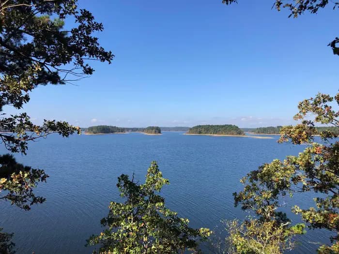
Overview Caddo Drive Campground sits along the pristine shores of Degray Lake in the foothills of the Quachita Mountains. The area offers stunning scenery and panoramic views, and Caddo was awarded one of Americas Top 25 Scenic Views. Recreation DeGray Lake hosts thousands of professional fishing tournaments, triathlons and it is one of the most popular swimming destinations in the region. The area is also ideal for boating and jet skiing. Facilities DeGray Lake hosts thousands of professional fishing tournaments, triathlons and it is one of the most popular swimming destinations in the region. The area is also ideal for boating and jet skiing. Natural Features The campground is situated on a tree-covered ridge that joins a bluff. Degray Lake encompasses 13,500 water acres, with 207 miles of shoreline and an average depth of 47 feet. Nearby Attractions The DeGray Lake State Resort Park lies on the northern shores of the lake, and kayaking tours, golf, tennis courts and a horseback riding trail are available.
View details →
Overview Cowhide Cove Campground is located on Lake Greeson on the beautiful Little Missouri River in Pike County, Arkansas. The lake is approximately 12 miles long with 7,260 surface acres of water for water sports, picnicking and hiking along the forested lake shore. Recreation Lake Greeson is recognized for its rich variety of game fish, including large mouth, stripped, spotted, small mouth and white bass, as well as flathead and channel catfish, black and white crappie, walleye and blue gill. The tail-waters of the Little Missouri River below the dam also support a healthy population of rainbow trout and small mouth bass. Boating is another popular activity. The beautiful clear waters offer an excellent opportunity for many boating activities including water skiing, tubing, cruising and fishing. Four marinas at Lake Greeson offer boaters fuel, boat rentals and picnic and fishing supplies. Lake Greeson offers 30 miles of walking, nature and cycling trails for public use. There is a short nature trail in the campground for naturalists, birders and families to enjoy. The best opportunity for hunting lies within the Lake Greeson Wildlife Management Area. Deer, quail, turkey, squirrel and rabbits are the primary game. Facilities Lake Greeson is recognized for its rich variety of game fish, including large mouth, stripped, spotted, small mouth and white bass, as well as flathead and channel catfish, black and white crappie, walleye and blue gill. The tail-waters of the Little Missouri River below the dam also support a healthy population of rainbow trout and small mouth bass. Boating is another popular activity. The beautiful clear waters offer an excellent opportunity for many boating activities including water skiing, tubing, cruising and fishing. Four marinas at Lake Greeson offer boaters fuel, boat rentals and picnic and fishing supplies. Lake Greeson offers 30 miles of walking, nature and cycling trails for public use. There is a short nature trail in the campground for naturalists, birders and families to enjoy. The best opportunity for hunting lies within the Lake Greeson Wildlife Management Area. Deer, quail, turkey, squirrel and rabbits are the primary game. Natural Features Central Arkansas is mild and somewhat humid in spring and fall, hot and very humid in summer and variable in winter, where temperatures may range from below freezing to the 60s. Loblolly pine, shortleaf pine, sweet gum and oak are the dominant tree species on upland areas of the lake, while bottomland hardwoods are common along rivers, creeks and streams that enter the lake. The public lands around Lake Greeson provide a variety of habitats for numerous species of wildlife, including white-tailed deer, wild turkey, geese, southern bald eagles, migratory waterfowl and songbirds. Bald eagles are an attraction for visitors each winter. Nearby Attractions Ouachita National Forest and Hot Springs National Park are within a two-hour drive from the campground. Crater of Diamonds State Park is within 30 miles of the campground. It is the only diamond-producing site in the world open to the public.
View details →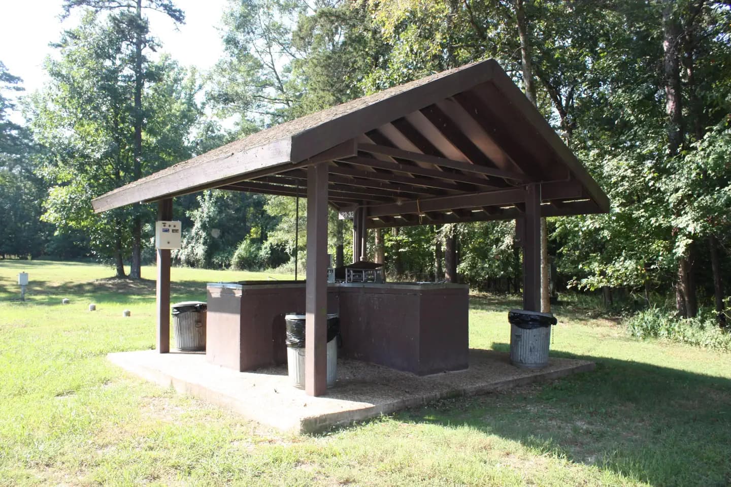
Overview Crystal Springs Campground, perched on the shores of Lake Ouachita in Arkansas, is an ideal spot for families, friends and couples. Approximately 1.2 million people visit the lake each year to explore its crystal clear waters and scenic mountain landscape. Click here for the Lake Ouachita Virtual Tour. Recreation Visitors enjoy fishing, water skiing, hiking and boating. Scuba diving is particularly popular because of the lake's high underwater visibility. Small and rare freshwater jellyfish (non-stinging) can be found, in addition to many types of fish, including the striped bass, lazily drifting between rocks. Bald eagles are a big attraction for bird watchers and photographers in winter months. Facilities Visitors enjoy fishing, water skiing, hiking and boating. Scuba diving is particularly popular because of the lake's high underwater visibility. Small and rare freshwater jellyfish (non-stinging) can be found, in addition to many types of fish, including the striped bass, lazily drifting between rocks. Bald eagles are a big attraction for bird watchers and photographers in winter months. Natural Features Lake Ouachita is nestled in the Ouachita Mountains just 10 miles west of Hot Springs National Park. The pool is fed by the cool waters of the Ouachita River and extends about 30 miles over 40,000 surface acres. Nearby Attractions Part of the scenic 223-mile Ouachita National Recreation Trail runs just north of the lake. Here, hikers and mountain bikers can explore an array of breathtaking views in the Ouachita Mountains. contact_info This location is unstaffed. To speak with our main office for general information, please call: (501) 767-2101.
View details →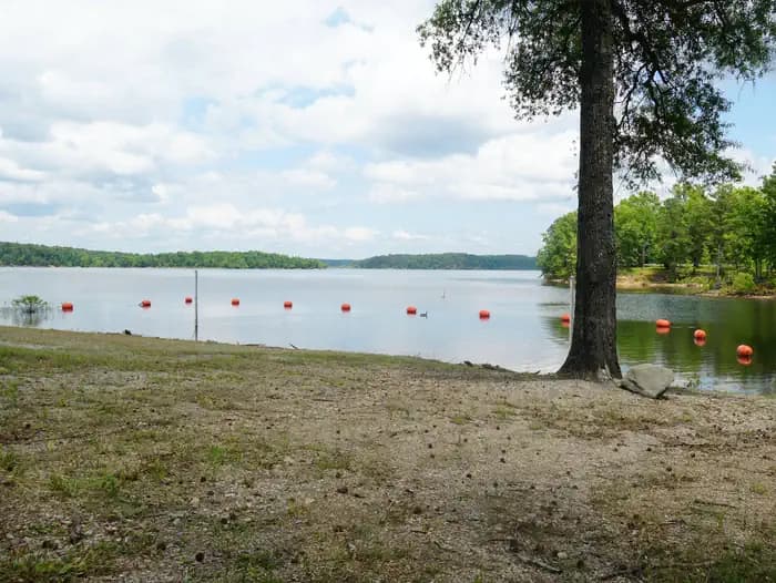
Overview Groups and families of all sizes come to camp at Denby Point for its scenic views, year-round fishing and convenient boating facilities. The campground promises to entertain jet skiers, boaters, hikers and birders alike. Click here for the Lake Ouachita Virtual Tour. Recreation World-class striper fishing brings crowds of anglers year-round, and incredibly clear waters attract scuba divers, hoping to explore the flooded forests and mountain valleys below the lake's surface. Hikers take pleasure in the Lake Ouachita Vista Trail (LOViT), which lines the southern end of the lake. Facilities World-class striper fishing brings crowds of anglers year-round, and incredibly clear waters attract scuba divers, hoping to explore the flooded forests and mountain valleys below the lake's surface. Hikers take pleasure in the Lake Ouachita Vista Trail (LOViT), which lines the southern end of the lake. Natural Features Lake Ouachita sits in the heart of the Ouachita Mountains, just 28 miles west of Hot Springs National Park. The lake stems from the Ouachita River and boasts 692 miles of shoreline and over 40,000 surface acres. Nearby Attractions Explore Ouachita National Forest's 1.8 million acres, surrounding Lake Ouachita and extending across central Arkansas and southeastern Oklahoma. contact_info This location is unstaffed. To speak with our main office for general information, please call: (501) 767-2101.
View details →
Overview Edgewood Campground sits on the banks of DeGray Lake in the foothills of the Quachita Mountains. Jet skiing, wake boarding and swimming are among the family-friendly activities here. The lake area is rich with wildlife spotting and birding. Hawks, woodpeckers, blue birds and wood ducks are among the the lake's residents. Recreation Boating, water skiing, kayaking and other water sports are the biggest draw to the lake, and a sandy swimming beach is provided. The lake is also stocked with a variety of game fish, including plenty of hybrid striped bass, making it an ideal area for both boat and bank fishing. Facilities Boating, water skiing, kayaking and other water sports are the biggest draw to the lake, and a sandy swimming beach is provided. The lake is also stocked with a variety of game fish, including plenty of hybrid striped bass, making it an ideal area for both boat and bank fishing. Natural Features Degray Lake is one of the region's five Diamond Lakes, known for their crystal clear waters. The lake flows from the Caddo River in western Arkansas and spans 13,500 surface acres. Nearby Attractions The DeGray Lake Resort State Park offers golf courses, tennis courts, horseback riding trails and more along the 207 miles of lake shoreline. The Ouachita National Forest and Hot Springs National Park are both located nearby.
View details →
Overview Joplin Campground on Lake Ouachita is an excellent destination for pristine lakefront camping. Joplin is perched on a slender peninsula with plenty of attractive scenic views of the water and surrounding mountain terrain. World-class striper fishing goes on in the lake, and wildlife watchers can find everything from bobcats to rare freshwater jellyfish. Click here for the Lake Ouachita Virtual Tour. Recreation Prized as one of the clearest lakes in the nation, Ouachita Lake is ideal for scuba diving. Visitors also enjoy hiking, biking, scenic driving, water skiing, fishing and hunting, as well. Facilities Prized as one of the clearest lakes in the nation, Ouachita Lake is ideal for scuba diving. Visitors also enjoy hiking, biking, scenic driving, water skiing, fishing and hunting, as well. Natural Features Nestled in the Ouachita Mountains of Central Arkansas, Lake Ouachita spans a surface area of over 40,000 acres, making it the biggest lake completely within the state of Arkansas. The region has a climate with four seasons. Spring and fall are mild, summer is hot and humid, and winter is variable with temperatures ranging from below freezing on up to the 60 degrees Fahrenheit. contact_info This location is unstaffed. To speak with our main office for general information, please call: (501) 767-2101. Nearby Attractions Head to Hot Springs National Park and discover how it earned the nickname, "The American Spa." Or take a scenic drive through the 1.8 million-acres of Ouachita National Forest. Boat rentals, horseback riding rentals and the Hickorynut Mountain Vista are not far from the campground.
View details →
Overview Parker Creek Campground is located on Lake Greeson on the beautiful Little Missouri River in Pike County, Arkansas. The lake is approximately 12 miles long with 7,260 surface acres of water for water sports, picnicking and hiking along the forested lake shore. Recreation Lake Greeson is recognized for its rich variety of game fish, including large mouth, stripped, spotted, small mouth and white bass, as well as flathead and channel catfish, black and white crappie, walleye and blue gill. The tail-waters of the Little Missouri River below the dam also support a healthy population of rainbow trout and small mouth bass. Boating is another popular activity. The beautiful clear waters offer an excellent opportunity for many boating activities including water skiing, tubing, cruising and fishing. Four marinas at Lake Greeson offer boaters fuel, boat rentals and picnic and fishing supplies. Lake Greeson offers 30 miles of walking, nature and cycling trails for public use. There is a short nature trail in the campground for naturalists, birders and families to enjoy. The best opportunity for hunting lies within the Lake Greeson Wildlife Management Area. Deer, quail, turkey, squirrel and rabbits are the primary game. Facilities Lake Greeson is recognized for its rich variety of game fish, including large mouth, stripped, spotted, small mouth and white bass, as well as flathead and channel catfish, black and white crappie, walleye and blue gill. The tail-waters of the Little Missouri River below the dam also support a healthy population of rainbow trout and small mouth bass. Boating is another popular activity. The beautiful clear waters offer an excellent opportunity for many boating activities including water skiing, tubing, cruising and fishing. Four marinas at Lake Greeson offer boaters fuel, boat rentals and picnic and fishing supplies. Lake Greeson offers 30 miles of walking, nature and cycling trails for public use. There is a short nature trail in the campground for naturalists, birders and families to enjoy. The best opportunity for hunting lies within the Lake Greeson Wildlife Management Area. Deer, quail, turkey, squirrel and rabbits are the primary game. Natural Features Central Arkansas is mild and somewhat humid in spring and fall, hot and very humid in summer and variable in winter, where temperatures may range from below freezing to the 60s. Loblolly pine, shortleaf pine, sweet gum and oak are the dominant tree species on upland areas of the lake, while bottomland hardwoods are common along rivers, creeks and streams that enter the lake. The public lands around Lake Greeson provide a variety of habitats for numerous species of wildlife, including white-tailed deer, wild turkey, geese, southern bald eagles, migratory waterfowl and songbirds. Bald eagles are an attraction for visitors each winter. Nearby Attractions Ouachita National Forest and Hot Springs National Park are within a two-hour drive from the campground.
View details →
Overview Shouse Ford Campground sits on the banks of DeGray Lake in the foothills of the Quachita Mountains. Large sandy beaches, world-class fishing and endless water sports make the campground a popular recreation area. Recreation Boating, water skiing, kayaking and other water sports are the biggest draw to the lake, and a boat ramp and large sandy beaches are provided. The lake is also stocked with a variety of game fish, including plenty of hybrid striped bass, making it an ideal area for both boat and bank fishing. Facilities Boating, water skiing, kayaking and other water sports are the biggest draw to the lake, and a boat ramp and large sandy beaches are provided. The lake is also stocked with a variety of game fish, including plenty of hybrid striped bass, making it an ideal area for both boat and bank fishing. Natural Features Degray Lake is one of the region's five Diamond Lakes, known for their crystal clear waters. The lake flows from the Caddo River in western Arkansas and spans 13,500 surface acres. Nearby Attractions The DeGray Lake Resort State Park offers golf courses, tennis courts, horseback riding trails and more along the 207 miles of lake shoreline. The Ouachita National Forest and Hot Springs National Park are both located nearby.
View details →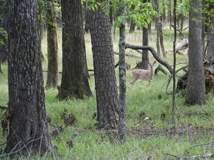
Overview Tompkins Bend on Lake Ouachita, is a great family camping destination. The combination of lush mountain scenery and roomy sites big enough for two camping units, make this quiet location an ideal place for an outdoor getaway. Click here for the Lake Ouachita Virtual Tour. Recreation Water skiers, jet skiers and anglers can all enjoy the crystal clear waters of the lake, while hikers enjoy the campground's location on the Lake Ouachita Vista Trail (LOViT), which meanders across the south end of the lake. Wildlife enthusiasts can find everything from bobcats to black bears and deer in the forested mountains surrounding the lake, and Bald eagles are often spotted in winter. Facilities Water skiers, jet skiers and anglers can all enjoy the crystal clear waters of the lake, while hikers enjoy the campground's location on the Lake Ouachita Vista Trail (LOViT), which meanders across the south end of the lake. Wildlife enthusiasts can find everything from bobcats to black bears and deer in the forested mountains surrounding the lake, and Bald eagles are often spotted in winter. Natural Features Lake Ouachita is fed from the cool waters of the Ouachita River in central Arkansas. Surrounded by the Ouachita Mountains and National Forest, it's crystal waters span over 40,000 acres and extend for 30 miles, making it the largest lake completely in the state of Arkansas. Nearby Attractions Head to Hot Springs National Park and discover how it earned the nickname, "The American Spa." Or take a scenic drive through the 1.8 million-acres of Ouachita National Forest. Here, off-roading enthusiasts can take on the Wolf Pen Gap Off-Highway Vehicle Trail System. contact_info This location is unstaffed. To speak with our main office for general information, please call: (501) 767-2101.
View details →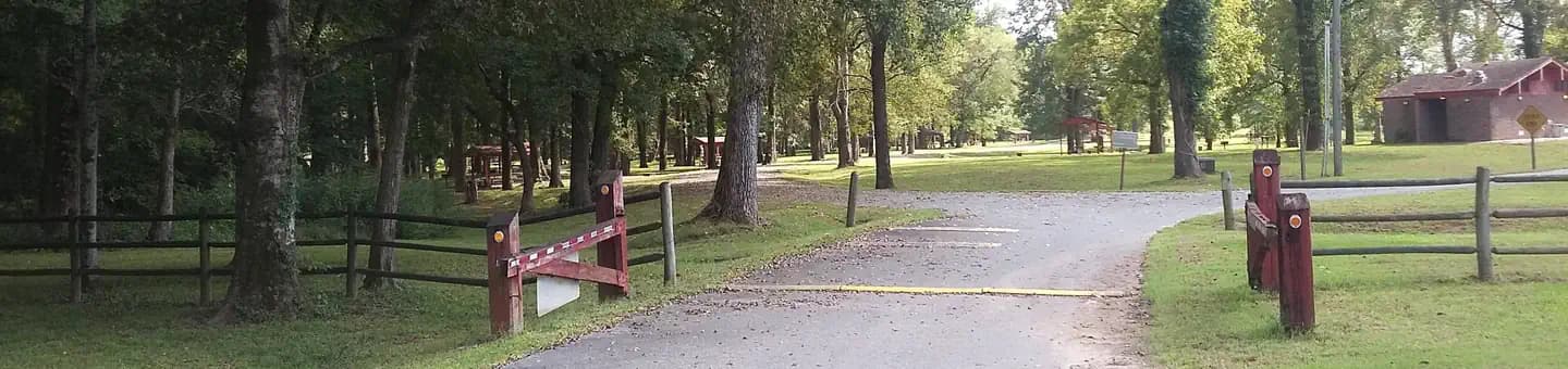
Overview This small, quiet campground contains 30 campsites and sits on the Arkansas River just below Wilbur D. Mills Dam. It is also along the Mississippi Flyway, the route millions of migratory birds take to get to and from the Gulf of Mexico. Recreation Fishing the tailwaters of Wilbur D. Mills Dam attracts anglers with an abundance of largemouth bass, crappie, bream and catfish, with catfish being a priority to many fishers. Boating, hunting, hiking and birding are also popular pastimes in this area. Facilities Fishing the tailwaters of Wilbur D. Mills Dam attracts anglers with an abundance of largemouth bass, crappie, bream and catfish, with catfish being a priority to many fishers. Boating, hunting, hiking and birding are also popular pastimes in this area. Natural Features Notrebes Bend Campground is located on the Arkansas River just below Wilbur D. Mills Dam. The Arkansas River below Wilbur D. Mills meanders for 26 miles before it meets the Mississppi River. Just upriver of the Dam is Pool 2; which includes the Arkansas Post Canal which stretches east to connect with the White River, Merrisach Lake and Coal Pile Lake, a state designated waterfowl rest area. Nearby Attractions The Arkansas Post National Memorial marks the spot for the first European village built west of the Mississippi River in 1686. The Dale Bumpers White River National Wildlife Refuge is also nearby, offering excellent fishing, hunting, and wildlife viewing.
View details →
Overview Buffalo Point is a convenient, fun-filled destination for families and adventurists of all types. It's perched along the Buffalo National River, providing exciting river sports and hiking opportunities. In peak season, a restaurant is open at the facility, serving up meals for those who want a break from preparing them. Recreation The wild river is a gathering place for water activities. Many campers spend their days fishing, hiking, canoeing or kayaking. Evenings are ideal for gathering next to the fire to revamp for another great day out on the river. Facilities The wild river is a gathering place for water activities. Many campers spend their days fishing, hiking, canoeing or kayaking. Evenings are ideal for gathering next to the fire to revamp for another great day out on the river. Natural Features The campground is set along Buffalo National River, one of the few free-flowing rivers remaining in the contiguous United States. The river runs 135 miles without dams and cuts through the Arkansas Ozarks and into the White River. The region is surrounded by droves of lush hardwood trees and grassy open meadows. Nearby Attractions Two popular attractions within the Buffalo Point Area are the Indian Rockhouse Trail and the Rush Historic District. Rush was a zinc mining community until the zinc market collapsed and the settlement was deserted. Tours about the town's history are available. Buffalo Point is the former Buffalo River State Park developed in the 1930's as project of the Civilian Conservation Corps. Blanchard Springs Caverns, an extraordinary living cave, is a one-hour drive from Buffalo Point. Charges & Cancellations Please see the Recreation.gov Rules and Reservation Policies .
View details →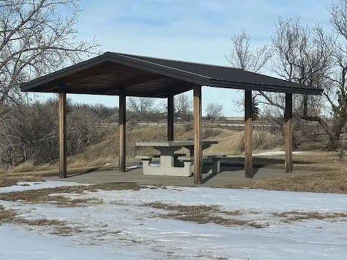
Overview Sainte Marie Park sits on the banks of Lake Langhofer and the Arkansas River by Pool 3 Lock and Dam. Whether boating, fishing, hiking, picnicking or hosting a group event, Sainte Marie has facilities to accommodate a range of activities. Recreation The campground is popular among fishermen. There is excellent catfish fishing in the tail-waters of Joe Hardin Lock and Dam as well as Emmitt Sanders Lock and Dam at the upstream end of Pool 3. Anglers often catch bass, crappie and bream. Hunting is available in nearby forests, and there is duck hunting on the waterways. On shore, families enjoy picnicking and using the playground. Facilities The campground is popular among fishermen. There is excellent catfish fishing in the tail-waters of Joe Hardin Lock and Dam as well as Emmitt Sanders Lock and Dam at the upstream end of Pool 3. Anglers often catch bass, crappie and bream. Hunting is available in nearby forests, and there is duck hunting on the waterways. On shore, families enjoy picnicking and using the playground. Natural Features The park is in a forested area along the riverfront, close to the rolling fields of cotton farms. It is 193 feet above sea level; winters are generally mild and summer temperatures reach the upper 90s with high humidity. Red fox are frequently seen in the park, and numerous species of waterfowl live in the water and along the shores. Nearby Attractions The City of Pine Bluff is the home for the Arkansas Railroad Museum, Pine Bluff Regional Park, the Martha Mitchell Home and other points of interest, as well as shopping and groceries.
View details →
Overview Dam Site Lake Campground sits along the vast shores of Beaver Lake in the Ozark Mountains of Northwest Arkansas, offering spacious and sunny campsites and an abundance of recreational activities. Recreation Fishing opportunities are plentiful near Dam Site Lake Campground. Beaver Lake has more than 28,000 surface acres of water, and anglers can try their luck at catching large and small-mouth bass, crappie, bream, white bass, stripers, and channel or spoon-bill catfish. Just below the dam, the cold waters of the upper White River provide a perfect habitat for pole-bending rainbow and record-sized German brown trout. Several trails snake throughout the Ozark Mountains, offering peaceful hiking, biking and wildlife viewing opportunities for visitors. Hunters will find game plentiful in northwest Arkansas. A mixture of hardwood and evergreen forest provides a good home to many different species of wildlife. While Beaver Lake is conveniently located near several population centers, within a short driving distance, hunters can find remote areas filled with upland game animals such as deer, rabbits and squirrels. Many other sports and activities await campers, including boating, swimming, picnicking, scuba diving, water skiing, spelunking and sightseeing. Facilities Fishing opportunities are plentiful near Dam Site Lake Campground. Beaver Lake has more than 28,000 surface acres of water, and anglers can try their luck at catching large and small-mouth bass, crappie, bream, white bass, stripers, and channel or spoon-bill catfish. Just below the dam, the cold waters of the upper White River provide a perfect habitat for pole-bending rainbow and record-sized German brown trout. Several trails snake throughout the Ozark Mountains, offering peaceful hiking, biking and wildlife viewing opportunities for visitors. Hunters will find game plentiful in northwest Arkansas. A mixture of hardwood and evergreen forest provides a good home to many different species of wildlife. While Beaver Lake is conveniently located near several population centers, within a short driving distance, hunters can find remote areas filled with upland game animals such as deer, rabbits and squirrels. Many other sports and activities await campers, including boating, swimming, picnicking, scuba diving, water skiing, spelunking and sightseeing. Natural Features Towering limestone bluffs, natural caves and a variety of trees and flowering shrubs surround Dam Site Lake Campground, making it an ideal retreat for outdoor enthusiasts. Beaver Lake and Dam, completed in 1966, was constructed in the White River Basin and boasts 449 miles of beautiful shoreline at the top of the conservation pool. Although the dam was originally built for flood control, hydroelectric power and public water supply, it has also created a popular recreational oasis for the area. Nearby Attractions Several marinas are located around the lake, offering groceries, fuel, boat rentals and storage, fishing guides and camping supplies. Click here for more information.
View details →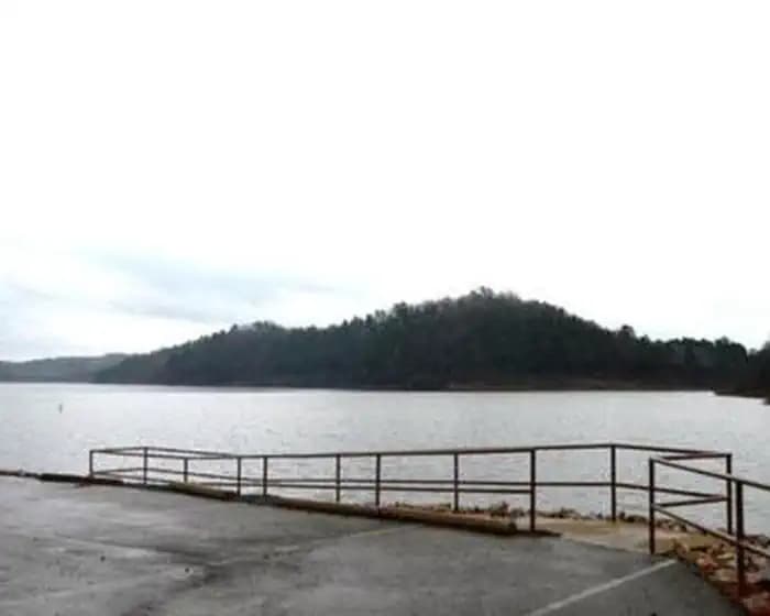
Overview Little Coon Creek Campground is located on Gillham Lake in southwestern Arkansas on the Cossatot River. The rugged terrain around the lake creates stunning views and provides for many opportunities for boating, fishing, hunting, and swimming. Recreation Visitors enjoy the lake for its vast boating opportunities, and a boat ramp is provided for easy water access. Anglers will find smallmouth, largemouth, and spotted bass, saugeye, crappie, channel and flathead catfish and various species of sunfish in the river. Fly fishing is also a popular pastime. Hunting is allowed north of Little Coon Creek Park and on the eastern shore of the lake. Check with the Arkansas Game and Fish for Season Dates and Regulations. Lake maps are also available from any Park Attendant at the lake. Facilities Visitors enjoy the lake for its vast boating opportunities, and a boat ramp is provided for easy water access. Anglers will find smallmouth, largemouth, and spotted bass, saugeye, crappie, channel and flathead catfish and various species of sunfish in the river. Fly fishing is also a popular pastime. Hunting is allowed north of Little Coon Creek Park and on the eastern shore of the lake. Check with the Arkansas Game and Fish for Season Dates and Regulations. Lake maps are also available from any Park Attendant at the lake. Natural Features Gillham Lake spans 1,370 surface acres and boasts 36 miles of shoreline. The Dam was completed in 1975 and stems from the Cossatot River, which has been designated as a National Wild and Scenic River. Nearby Attractions The Cossatot River State Park-Natural Area and the Queen Wilhelmina State Park are both within driving distance just north of Gillham Lake. Both of these attractions offer great scenery, hiking, and interpretive programs that are fun for all ages.
View details →
Overview White Cliffs Campground is located on the east bank of the Little River feeding into Millwood Lake in southwest Arkansas. Recreation Visitors to this area enjoy fishing, duck hunting and relaxing in this peaceful campground. This area affords a great diversity of fish and wildlife habitat. Millwood Lake is one of the top fishing lakes in the country. Some 20,000 acres of submerged timber provide excellent fish habitat for a wide variety of fish including largemouth, white striped and spotted bass, channel and flathead catfish, bluegill, sunfish, buffalo carp and drum. Facilities Visitors to this area enjoy fishing, duck hunting and relaxing in this peaceful campground. This area affords a great diversity of fish and wildlife habitat. Millwood Lake is one of the top fishing lakes in the country. Some 20,000 acres of submerged timber provide excellent fish habitat for a wide variety of fish including largemouth, white striped and spotted bass, channel and flathead catfish, bluegill, sunfish, buffalo carp and drum. Natural Features White Cliffs Campground is located on the Little River and within walking distance of White Cliffs Natural Area. The natural area includes a 100-foot high chalk bluff over the Little River, from which the area derives its name. The area includes the largest, and least disturbed Arkansas occurrences of chalk woodland. A nature trail meanders through unique topography characterized by knolls, ridges and ravines. Nearby Attractions Nearby towns include Ashdown and Nashville, Arkansas, and Texarkana, Texas.
View details →
Overview Cottonshed Park is located off the beaten path, eight miles southwest of Mineral Springs and Tollette. It is a quiet, wooded area with access to some of the best fishing on Millwood Lake. Recreation The campground is located on Millwood Lake with direct access to the Saline River. The area is made navigable by boat lanes which mark the river and other man made paths through the lake. Outside of these channels is submerged timber and aquatic vegetation that entice anglers and duck hunters to the area. Millwood Lake is home to over 300 species of birds including the American Bald Eagle and Great White Pelicans, many of which can be found in the Cottonshed area. Facilities The campground is located on Millwood Lake with direct access to the Saline River. The area is made navigable by boat lanes which mark the river and other man made paths through the lake. Outside of these channels is submerged timber and aquatic vegetation that entice anglers and duck hunters to the area. Millwood Lake is home to over 300 species of birds including the American Bald Eagle and Great White Pelicans, many of which can be found in the Cottonshed area. Natural Features The campground is located directly on Millwood Lake with lake views from most of the campsites. The surrounding landscape is flat, low land areas with dense timber. Nearby Attractions Old Washington Historic State Park is located 25 miles northeast of the park.
View details →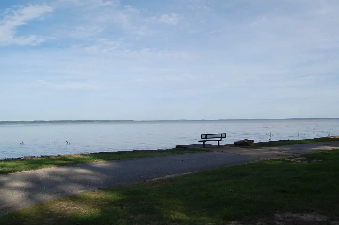
Overview Beard's Bluff is located 13 miles east of Ashdown on State Highway 32. It is a bird watcher's paradise with a birding overlook and access to the best sunset viewing on the lake. Recreation The campground offers open water access to the lake and Little River. The area is made navigable by boat lanes which mark the river and other designated waterways through the lake. Outside of these channels is submerged timber and aquatic vegetation that appeal to anglers and duck hunters alike. Millwood Lake is home to over 300 species of birds including the American Bald Eagle and Great White Pelicans, many of which can be found in the Beard's Bluff area. Facilities The campground offers open water access to the lake and Little River. The area is made navigable by boat lanes which mark the river and other designated waterways through the lake. Outside of these channels is submerged timber and aquatic vegetation that appeal to anglers and duck hunters alike. Millwood Lake is home to over 300 species of birds including the American Bald Eagle and Great White Pelicans, many of which can be found in the Beard's Bluff area. Natural Features The campground is located directly on Millwood Lake with lake views from most of the campsites. Bluffs overlook the lake and the area is surrounded by a variety of dense forest. Nearby Attractions Nearby towns include Nashville, AR, Ashdown, AR, and Texarkana, TX.
View details →
Overview Experience nature and adventure at historic White Rock Mountain! This National Forest Recreation Area features three unique and rustic natural stone cabins and a large natural stone lodge built in the 1930s by the Civilian Conservation Corps (CCC). Each features a stone fireplace new, antique, and original wood furniture handcrafted by the CCC. Wind, rain and natural elements had caused the deterioration of the buildings over the years. In 1987 a volunteer group, Friends of White Rock, began a project to renovate the historic structures. With a lot of commitment and hard work, the lodge and cabins were restored to their original state in 1991. White Rock Mountain also offers nine primitive family camping sites. These easily accessible shaded campsites include tents pads, fire rings, grills, picnic tables and access to restrooms and water. Small RVs or pop-up campers can be accommodated at a few sites. Recreation White Rock Mountain is the hub of several national forest hiking trail systems including the easy 2 mile trail around the mountain top rim, the 17 mile Shores Lake/White Rock loop trail, and the renowned 170 mile Ozark Highlands Trail. Other recreational activities include swimming, boating (non-motorized) or fishing at Shores Lake Recreation Area; swimming, floating or fishing the National Scenic Mulberry River; Mill Creek and other National Forest ATV trails; mountain biking, hunting and more. Facilities White Rock Mountain is the hub of several national forest hiking trail systems including the easy 2 mile trail around the mountain top rim, the 17 mile Shores Lake/White Rock loop trail, and the renowned 170 mile Ozark Highlands Trail. Other recreational activities include swimming, boating (non-motorized) or fishing at Shores Lake Recreation Area; swimming, floating or fishing the National Scenic Mulberry River; Mill Creek and other National Forest ATV trails; mountain biking, hunting and more. Natural Features White Rock Mountain is 2,309 feet above sea level and received its name from the appearance of the lichen on the sheer bluffs that appear white from a distance. Guests at White Rock can enjoy incredible scenic views from the lodge, cabins, campground and bluffs. The forest is home to a large variety of wildlife including deer, bear, bald eagles, turkey and more. In the fall season White Rock Mountain offers unrivaled opportunities for taking in the bright red, orange and yellow autumn foliage that sweeps across the Ozark National Forest. The forest around White Rock is also a waterfall hunter's paradise featuring several great falls located in the surrounding area. contact_info This location is staffed. Please call (479) 369-4128 to speak with local staff. Nearby Attractions Ozark Highlands Trail, Shores Lake Recreation Area, National Scenic Mulberry River, Mill Creek and other ATV Trails, Waterfalls, Scenic Drives, Mountain Biking, Wineries (Altus, AR) and more. Charges & Cancellations Rules & Reservation Policies As you make travel plans that include reservations on Recreation.gov, there are standard policies that apply to most locations of which you should be aware. Do keep in mind, however, that there are many exceptions, so it is best to review reservation information listed on individual facility pages for those policies and procedures that pertain to your specific locations. Booking Window For most locations, you can reserve six months in advance of your stay for individual sites and 12 months in advance for group sites. There are some exceptions, so it is best to check with each facility. Change and Cancellation Policies and Fees Overnight and Day Use Facilities: To ensure fairness, reservation arrival or departure dates may not be changed beyond the booking window until 18 days after booking the reservation. Camping / Day Use: A $10.00 service fee will apply if you change or cancel your reservation (including campsites, cabins, lookouts, group facilities, etc.). The $10.00 service fee will be deducted from the refund amount. You can cancel or change reservations through Recreation.gov or by calling 1-877-444-6777. Late Cancellations Overnight and Day Use Facilities: Late cancellations are those cancelled between 12:01 a.m. (Eastern) on the day before arrival and check out time on the day after arrival. Individual Campsites: If a customer cancels a reservation the day before or on the day of arrival they will be charged a $10.00 service fee and will also forfeit the first night's use fee (not to exceed the total paid for the original reservation). Cancellations for a single night's reservation will forfeit the entire use fee but no cancellation fee will apply. Cabins / Lookouts: Customers will be charged a $10.00 cancellation fee and forfeit the first night's use fee if a cabin or lookout reservation is cancelled within 14 days of the scheduled arrival date. Cancellations for a single night's use will not be assessed a service fee. Group Facility: If a customer cancels a group overnight facility reservation within 14 days of the scheduled arrival date they will be charged the $10.00 service fee and forfeit the first night's use fee. Cancellations for a single night's use will not be assessed a service fee. Group Day Use Area: If a customer cancels a group day use facility reservation within 14 days of the scheduled arrival date, they will forfeit the total day use fee with no service fee charge. No-Shows Camping / Day Use: A camping no-show customer is one who does not arrive at a campground and does not cancel the reservation by check-out time on the day after the scheduled arrival date. Reserved campsites and group overnight facilities will be held until check-out time on the day following your scheduled arrival. Group day-use facilities will be held until check-in time on your scheduled arrival date. If a customer does not arrive at the campground or group facility by check-out time the day after arrival or does not cancel the reservation by the times listed under "Late Cancellations" above, the customer may be assessed a $20.00 service fee and forfeit use fees.
View details →FAQ
Camping in Arkansas
How many campgrounds are listed in Arkansas?
TheCampVerse currently lists 81 campgrounds in Arkansas.
What campground types are most common in Arkansas?
The most common campground types are Campground.
How can I compare campgrounds in Arkansas?
Use the campground cards and featured links on this page to compare descriptions, amenities, and details before opening each campground profile.
Keep exploring