Campgrounds in California
Explore amazing mountain and coastal campgrounds across the Golden State
200
Campgrounds listed
100%
With photos
100%
Detailed descriptions
Campground
Top campground type
Highlights
Featured campgrounds in California
Explore by campground name letter
Jump to A-Z landing hubs for stronger discovery paths beyond California.
All campgrounds
Showing 200 campgrounds
Overview Valley Oak Campground is part of the park system scattered along the lower Stanislaus River within the foothills of the Sierra Nevada. The environmental campground boasts quiet, peaceful tent sites situated next to the river’s edge. The scenic recreation areas and river access points are popular for activities such as rafting, picnicking, hiking and much more. Stanislaus River Parks is often referred to as the “string of pearls” since they serve as charming, quiet oasis running through a number of small towns and cities. Recreation The campground offers an excellent base camp for exciting recreation opportunities. The park boasts walking and hiking trails, picnic areas and river access points for fishing and boating. Facilities The campground offers an excellent base camp for exciting recreation opportunities. The park boasts walking and hiking trails, picnic areas and river access points for fishing and boating. Natural Features The campground scenery is a pleasant mix of Fremont cottonwoods, Valley Oak and the occasional elderberry bush, offering excellent shade with dispersed rays of sunshine. Nearby, grasses, shrubs and seasonal wildflowers fill the open spaces. Wildlife is also plentiful in the park with mule deer, acorn woodpeckers, scrub jays, foxes and squirrels among lots of other fauna. Nearby Attractions Within a short 15 min drive, campers can explore the historic town of Knights Ferry, rich with history of the gold rush era. Within the historic district, lies Knights Ferry Recreation Area, home to the longest covered bridge west of the Mississippi River and a National Historic Landmark dedicated in 2014. The park boasts walking and hiking trails, picnic areas and river access points. Visitors can learn about the area when they visit the Knights Ferry Visitors Center, which contains a small museum highlighting local, natural, and cultural resources. Visitors have a unique opportunity to make reservations with local rafting companies to journey down the Stanislaus River. During the summer months, rafters can enjoy guided and self-guided floats down the lower Stanislaus River. For thrill seekers, the fall season brings perfect flows for advanced white water in the Goodwin Canyon. Fall also brings thousands of Chinook salmon returning to the Stanislaus River to spawn, completing and beginning their lifecycles. Onlookers, can view the spawning salmon from several river access points along the river. Charges & Cancellations Contact Recreation.gov for changes or cancellations.
View details →
Overview Ahart Campground is located on the tree covered banks of the North Fork of the American River near French Meadows Reservoir, about 40 miles from the town of Foresthill, high in the Sierra mountains. Visitors enjoy the area for the rugged mountain beauty, fishing, boating and trail opportunities. This facility is operated and maintained by the Tahoe National Forest. Natural Features The campground is near the north shore of French Meadows Reservoir along the banks of the Middle Fork of the American River while nestled in a Coniferous Forest. Summer days can be warm and pleasant with cool evenings.
View details →
Overview Bullards Bar Reservoir is located on the North Yuba River at an elevation of 2000 feet. It is located approximately 21 miles north of Nevada City, California. It has a maximum surface area of 4,760 acres and a length of over 16 miles and shoreline of more than 60 miles. Recreation Activities include wildlife viewing, hiking, mountain biking, horseback riding, camping, fishing, boating, water skiing, and other water sports. Swimming opportunities are limited because of the steep slopes; however boaters will find numerous opportunities for swimming in various locations around the reservoir. The reservoir provides yearlong fishing opportunities for both warm and cold water fish species. Supplies are available at the marina as well as the nearby communities of Camptonville, North San Juan, and Dobbins. Facilities Activities include wildlife viewing, hiking, mountain biking, horseback riding, camping, fishing, boating, water skiing, and other water sports. Swimming opportunities are limited because of the steep slopes; however boaters will find numerous opportunities for swimming in various locations around the reservoir. The reservoir provides yearlong fishing opportunities for both warm and cold water fish species. Supplies are available at the marina as well as the nearby communities of Camptonville, North San Juan, and Dobbins. Natural Features The sides of the reservoir are generally steep and public access for boating and recreation is limited. The reservoir is surrounded by both conifer and hardwood forests with numerous brush spieces. There is plenty of shade at the campsites contact_info For facility specific information, please call (530) 265-4531. Nearby Attractions There is a beautiful non- motorized trail system in the area, with 5 different trails to choose from. Bullards Bar Trailhead is 14 miles, 7 Ball Trial is 1 mile, 8 Ball Trail is 3.8 miles, Rebel Ridge Trail is 1.6 miles and Schoolhouse Trail is 0.7 miles. Maps are available at the North Yuba Ranger Station just a couple miles east of the reservoir on Marysville Road. Charges & Cancellations No Show Policy A no-show customer is one who does not arrive at a campground and does not cancel the reservation by check-out time on the day after the scheduled arrival date (or for day-use facilities, by check-in time the day of arrival). * No-show customers are only recorded at staffed facilities. At most remote facilities, all customers are noted as automatically checked-in on the date of arrival. * It is recommended that staffed facilities hold a campsite until check-out time on the day following the arrival date. * It is recommended that staffed facilities hold group day-use facilities until check-in time on the arrival date. There is no change fee if a customer extends or shortens a reservation if the change includes dates from the original reservation. If they choose to depart early, they may forfeit some or all of the recreation fees. There is no change fee if the customer changes campsites that are the same price and on the same reservation dates in the same campground. If the campsite the customer is changing to has a price difference, the customer will be responsible for any additional fees or be provided with a refund, based on the price difference. Where recorded, no-show customers are assessed a $20.00 no-show fee and forfeit the first night's recreation fee for a campsite or forfeit the entire day-use recreation fee for a day-use facility. We recommend customers contact the facility if they are en route to their reservation but cannot make it by the check-in date. In these cases, no refund will be issued, but the facility can ensure that a "no-show" fee is not assessed.
View details →
Overview Bullards Bar Reservoir is located on the North Yuba River at an elevation of 2000 feet. It is located approximately 21 miles north of Nevada City, California. It has a maximum surface area of 4,760 acres and a length of over 16 miles and shoreline of more than 60 miles. Recreation This is a boat-in campground. You can not drive to this campground. You must launch a boat a Dark Day boat launch and boat to the campground. Activities include wildlife viewing, hiking, mountain biking, horseback riding, camping, fishing, boating, water skiing, and other water sports. Swimming opportunities are limited because of the steep slopes; however boaters will find numerous opportunities for swimming in various locations around the reservoir. The reservoir provides yearlong fishing opportunities for both warm and cold water fish species. Supplies are available at the marina as well as the nearby communities of Camptonville, North San Juan, and Dobbins. Facilities This is a boat-in campground. You can not drive to this campground. You must launch a boat a Dark Day boat launch and boat to the campground. Activities include wildlife viewing, hiking, mountain biking, horseback riding, camping, fishing, boating, water skiing, and other water sports. Swimming opportunities are limited because of the steep slopes; however boaters will find numerous opportunities for swimming in various locations around the reservoir. The reservoir provides yearlong fishing opportunities for both warm and cold water fish species. Supplies are available at the marina as well as the nearby communities of Camptonville, North San Juan, and Dobbins. Natural Features This is a boat-in campground. You can not drive to this campground. You must launch a boat a Dark Day boat launch and boat to the campground. The sides of the reservoir are generally steep and public access for boating and recreation is limited. The reservoir is surrounded by both conifer and hardwood forests with numerous brush species. There is plenty of shade at the campsites Nearby Attractions There is a beautiful non- motorized trail system in the area, with 5 different trails to choose from. Bullards Bar Trailhead is 14 miles, 7 Ball Trial is 1 mile, 8 Ball Trail is 3.8 miles, Rebel Ridge Trail is 1.6 miles and Schoolhouse Trail is 0.7 miles. Maps are available at the North Yuba Ranger Station just a couple miles east of the reservoir on Marysville Road. contact_info For facility specific information, please call (530) 265-4531. Charges & Cancellations No Show Policy A no-show customer is one who does not arrive at a campground and does not cancel the reservation by check-out time on the day after the scheduled arrival date (or for day-use facilities, by check-in time the day of arrival). * No-show customers are only recorded at staffed facilities. At most remote facilities, all customers are noted as automatically checked-in on the date of arrival. * It is recommended that staffed facilities hold a campsite until check-out time on the day following the arrival date. * It is recommended that staffed facilities hold group day-use facilities until check-in time on the arrival date. There is no change fee if a customer extends or shortens a reservation if the change includes dates from the original reservation. If they choose to depart early, they may forfeit some or all of the recreation fees. There is no change fee if the customer changes campsites that are the same price and on the same reservation dates in the same campground. If the campsite the customer is changing to has a price difference, the customer will be responsible for any additional fees or be provided with a refund, based on the price difference. Where recorded, no-show customers are assessed a $20.00 no-show fee and forfeit the first night's recreation fee for a campsite or forfeit the entire day-use recreation fee for a day-use facility. We recommend customers contact the facility if they are en route to their reservation but cannot make it by the check-in date. In these cases, no refund will be issued, but the facility can ensure that a "no-show" fee is not assessed.
View details →
Overview Bullards Bar Reservoir is located on the North Yuba River at an elevation of 2000 feet. It is located approximately 21 miles north of Nevada City, California. It has a maximum surface area of 4,760 acres and a length of over 16 miles and shoreline of more than 60 miles. Recreation Activities include wildlife viewing, hiking, mountain biking, horseback riding, camping, fishing, boating, water skiing, and other water sports. Swimming opportunities are limited because of the steep slopes; however boaters will find numerous opportunities for swimming in various locations around the reservoir. The reservoir provides yearlong fishing opportunities for both warm and cold water fish species. Supplies are available at the marina as well as the nearby communities of Camptonville, North San Juan, and Dobbins. Facilities Activities include wildlife viewing, hiking, mountain biking, horseback riding, camping, fishing, boating, water skiing, and other water sports. Swimming opportunities are limited because of the steep slopes; however boaters will find numerous opportunities for swimming in various locations around the reservoir. The reservoir provides yearlong fishing opportunities for both warm and cold water fish species. Supplies are available at the marina as well as the nearby communities of Camptonville, North San Juan, and Dobbins. Natural Features The sides of the reservoir are generally steep and public access for boating and recreation is limited. The reservoir is surrounded by both conifer and hardwood forests with numerous brush species. There is plenty of shade at the campsites contact_info For facility specific information, please call (530) 265-4531. Nearby Attractions There is a beautiful non- motorized trail system in the area, with 5 different trails to choose from. Bullards Bar Trailhead is 14 miles, 7 Ball Trial is 1 mile, 8 Ball Trail is 3.8 miles, Rebel Ridge Trail is 1.6 miles and Schoolhouse Trail is 0.7 miles. Maps are available at the North Yuba Ranger Station just a couple miles east of the reservoir on Marysville Road. Charges & Cancellations No Show Policy A no-show customer is one who does not arrive at a campground and does not cancel the reservation by check-out time on the day after the scheduled arrival date (or for day-use facilities, by check-in time the day of arrival). * No-show customers are only recorded at staffed facilities. At most remote facilities, all customers are noted as automatically checked-in on the date of arrival. * It is recommended that staffed facilities hold a campsite until check-out time on the day following the arrival date. * It is recommended that staffed facilities hold group day-use facilities until check-in time on the arrival date. There is no change fee if a customer extends or shortens a reservation if the change includes dates from the original reservation. If they choose to depart early, they may forfeit some or all of the recreation fees. There is no change fee if the customer changes campsites that are the same price and on the same reservation dates in the same campground. If the campsite the customer is changing to has a price difference, the customer will be responsible for any additional fees or be provided with a refund, based on the price difference. Where recorded, no-show customers are assessed a $20.00 no-show fee and forfeit the first night's recreation fee for a campsite or forfeit the entire day-use recreation fee for a day-use facility. We recommend customers contact the facility if they are en route to their reservation but cannot make it by the check-in date. In these cases, no refund will be issued, but the facility can ensure that a "no-show" fee is not assessed.
View details →
Overview Bullards Bar Reservoir is located on the North Yuba River at an elevation of 2000 feet. It is located approximately 21 miles north of Nevada City, California. It has a maximum surface area of 4,760 acres and a length of over 16 miles and shoreline of more than 60 miles. Recreation Activities include wildlife viewing, hiking, mountain biking, horseback riding, camping, fishing, boating, water skiing, and other water sports. Swimming opportunities are limited because of the steep slopes; however boaters will find numerous opportunities for swimming in various locations around the reservoir. The reservoir provides yearlong fishing opportunities for both warm and cold water fish species. Supplies are available at the marina as well as the nearby communities of Camptonville, North San Juan, and Dobbins. Facilities Activities include wildlife viewing, hiking, mountain biking, horseback riding, camping, fishing, boating, water skiing, and other water sports. Swimming opportunities are limited because of the steep slopes; however boaters will find numerous opportunities for swimming in various locations around the reservoir. The reservoir provides yearlong fishing opportunities for both warm and cold water fish species. Supplies are available at the marina as well as the nearby communities of Camptonville, North San Juan, and Dobbins. Natural Features The sides of the reservoir are generally steep and public access for boating and recreation is limited. The reservoir is surrounded by both conifer and hardwood forests with numerous brush species. There is plenty of shade at the campsites Nearby Attractions There is a beautiful non- motorized trail system in the area, with 5 different trails to choose from. Bullards Bar Trailhead is 14 miles, 7 Ball Trial is 1 mile, 8 Ball Trail is 3.8 miles, Rebel Ridge Trail is 1.6 miles and Schoolhouse Trail is 0.7 miles. Maps are available at the North Yuba Ranger Station just a couple miles east of the reservoir on Marysville Road. Charges & Cancellations No Show Policy A no-show customer is one who does not arrive at a campground and does not cancel the reservation by check-out time on the day after the scheduled arrival date (or for day-use facilities, by check-in time the day of arrival). * No-show customers are only recorded at staffed facilities. At most remote facilities, all customers are noted as automatically checked-in on the date of arrival. * It is recommended that staffed facilities hold a campsite until check-out time on the day following the arrival date. * It is recommended that staffed facilities hold group day-use facilities until check-in time on the arrival date. There is no change fee if a customer extends or shortens a reservation if the change includes dates from the original reservation. If they choose to depart early, they may forfeit some or all of the recreation fees. There is no change fee if the customer changes campsites that are the same price and on the same reservation dates in the same campground. If the campsite the customer is changing to has a price difference, the customer will be responsible for any additional fees or be provided with a refund, based on the price difference. Where recorded, no-show customers are assessed a $20.00 no-show fee and forfeit the first night's recreation fee for a campsite or forfeit the entire day-use recreation fee for a day-use facility. We recommend customers contact the facility if they are en route to their reservation but cannot make it by the check-in date. In these cases, no refund will be issued, but the facility can ensure that a "no-show" fee is not assessed.
View details →
Overview Bullards Bar Reservoir is located on the North Yuba River at an elevation of 2000 feet. It is located approximately 21 miles north of Nevada City, California. It has a maximum surface area of 4,760 acres and a length of over 16 miles and shoreline of more than 60 miles. Recreation Activities include wildlife viewing, hiking, mountain biking, horseback riding, camping, fishing, boating, water skiing, and other water sports. Swimming opportunities are limited because of the steep slopes; however boaters will find numerous opportunities for swimming in various locations around the reservoir. The reservoir provides yearlong fishing opportunities for both warm and cold water fish species. Supplies are available at the marina as well as the nearby communities of Camptonville, North San Juan, and Dobbins. Facilities Activities include wildlife viewing, hiking, mountain biking, horseback riding, camping, fishing, boating, water skiing, and other water sports. Swimming opportunities are limited because of the steep slopes; however boaters will find numerous opportunities for swimming in various locations around the reservoir. The reservoir provides yearlong fishing opportunities for both warm and cold water fish species. Supplies are available at the marina as well as the nearby communities of Camptonville, North San Juan, and Dobbins. Natural Features The sides of the reservoir are generally steep and public access for boating and recreation is limited. The reservoir is surrounded by both conifer and hardwood forests with numerous brush species. There is plenty of shade at the campsites contact_info For facility specific information, please call (530) 265-4531. Nearby Attractions There is a beautiful non- motorized trail system in the area, with 5 different trails to choose from. Bullards Bar Trailhead is 14 miles, 7 Ball Trial is 1 mile, 8 Ball Trail is 3.8 miles, Rebel Ridge Trail is 1.6 miles and Schoolhouse Trail is 0.7 miles. Maps are available at the North Yuba Ranger Station just a couple miles east of the reservoir on Marysville Road. Charges & Cancellations No Show Policy A no-show customer is one who does not arrive at a campground and does not cancel the reservation by check-out time on the day after the scheduled arrival date (or for day-use facilities, by check-in time the day of arrival). * No-show customers are only recorded at staffed facilities. At most remote facilities, all customers are noted as automatically checked-in on the date of arrival. * It is recommended that staffed facilities hold a campsite until check-out time on the day following the arrival date. * It is recommended that staffed facilities hold group day-use facilities until check-in time on the arrival date. There is no change fee if a customer extends or shortens a reservation if the change includes dates from the original reservation. If they choose to depart early, they may forfeit some or all of the recreation fees. There is no change fee if the customer changes campsites that are the same price and on the same reservation dates in the same campground. If the campsite the customer is changing to has a price difference, the customer will be responsible for any additional fees or be provided with a refund, based on the price difference. Where recorded, no-show customers are assessed a $20.00 no-show fee and forfeit the first night's recreation fee for a campsite or forfeit the entire day-use recreation fee for a day-use facility. We recommend customers contact the facility if they are en route to their reservation but cannot make it by the check-in date. In these cases, no refund will be issued, but the facility can ensure that a "no-show" fee is not assessed.
View details →
Overview The Mineral King area features the highest elevation campground in the parks. At 7,500 feet (2280 m), it is only open during the summer months. A narrow, winding, largely unpaved road leads to the area and its two campgrounds. RVs and trailers are not recommended on Mineral King Road and are not permitted in campgrounds. Mineral King is not connected to the rest of Sequoia National Park by roads. To get here, turn off of Highway 198 in Three Rivers, California. Recreation Trails to alpine lakes and mountain passes begin nearby. Facilities Trails to alpine lakes and mountain passes begin nearby. Natural Features Hikes into the backcountry out of Mineral King will give visitors an ever deeper understanding of the beauty and uniqueness of Sequoia National Park. Hike to alpine lakes and over mountain passes, or climb a peak. contact_info For facility specific information, please call (559) 565-4404. Nearby Attractions There are limited services at Silver City Resort, 1.7 miles (3 km) east of the campground. More extensive services can be found in Three Rivers, 23 miles (37 km) west of Atwell Mill Campground (approximately 1.5 hours away). Charges & Cancellations Payment in full will be charged to your credit card upon completion of the reservation. A $10.00 service fee will apply if you change or cancel your reservation. Additional fees will apply for late cancellations All cancellations made between midnight on the day before arrival and check out time on the day after arrival are considered late cancellations and will incur a $10.00 cancellation fee and will also forfeit the first night’s use fee. Cancellations for a single night’s reservation will forfeit the entire use fee but no cancellation fee will apply. If your campsite remains vacant for 24 hours after your arrival date it will be cancelled and made available on rec.gov. You will be charged for the first night's campsite fee and a $10 cancellation fee, all other fees after that will be refunded. Recreation.gov policies apply to all reservations, cancellations, refunds and date changes. Call (559) 565-4404 if you will be arriving 24 hours after your arrival date so your site won't be cancelled.
View details →
Overview Moraine Campground in Cedar Grove is nestled in the stunning Kings Canyon, one of the deepest canyons in the United States. With the sound of the Kings River, and glowing mountainsides just beyond the trees, Moraine Campground is a wonderful place for families to spend time in the great outdoors. Recreation Cedar Grove provides a plethora of hiking trails, from the hiking newcomer to the avid backpacker, and everyone in between. Day hikers can hike to Mist Falls, Cedar Grove Overlook, around the peaceful Kanawyer Loop along the Kings River, through Zumwalt Meadow, and more. Visitors can also fish for trout in the Kings River, or take a scenic horseback ride through the canyon with the Cedar Grove Pack Station. Facilities Cedar Grove provides a plethora of hiking trails, from the hiking newcomer to the avid backpacker, and everyone in between. Day hikers can hike to Mist Falls, Cedar Grove Overlook, around the peaceful Kanawyer Loop along the Kings River, through Zumwalt Meadow, and more. Visitors can also fish for trout in the Kings River, or take a scenic horseback ride through the canyon with the Cedar Grove Pack Station. Natural Features Tall granite mountainsides cradle the south fork of the Kings River, as streams and creeks feed the river with snowmelt from higher elevations. Abundant wildlife roam through the tall ponderosa pine and incense cedar trees, meadows and along riversides. Hikes into the backcountry out of Cedar Grove will give visitors an ever deeper understanding of the beauty and uniqueness of Kings Canyon National Park. Nearby Attractions Hume Lake, Grizzly Falls, Mist Falls, Zumwalt Meadow, Roaring River Falls, Sequoia Groves and numerous hiking trails attract visitors to this area. Campfire stories, nature and wildlife presentations, and ranger-led hikes are also available during most of the season. contact_info For facility specific information, please call (559) 565-3792. Charges & Cancellations Payment in full will be charged to your credit card upon completion of the reservation. A $10.00 service fee will apply if you change or cancel your reservation. Additional fees will apply for late cancellations All cancellations made between midnight on the day before arrival and check out time on the day after arrival are considered late cancellations and will incur a $10.00 cancellation fee and will also forfeit the first night’s use fee. Cancellations for a single night’s reservation will forfeit the entire use fee but no cancellation fee will apply. If your campsite remains vacant for 24 hours after your arrival date it will be cancelled and made available on rec.gov. You will be charged for the first night's campsite fee and a $10 cancellation fee, all other fees after that will be refunded. Recreation.gov policies apply to all reservations, cancellations, refunds and date changes. Call (559) 565-3792 if you will be arriving 24 hours after your arrival date so your site won't be cancelled.
View details →
Overview Sheep Creek Campground in Cedar Grove is nestled in the stunning Kings Canyon, one of the deepest canyons in the United States. With the sound of the Kings River, and glowing mountainsides just beyond the trees, Sheep Creek Campground is a wonderful place for families to spend time in the great outdoors. Recreation Cedar Grove provides a plethora of hiking trails, from the hiking newcomer to the avid backpacker, and everyone in between. Day hikers can hike to Mist Falls, Cedar Grove Overlook, around the peaceful Kanawyer Loop along the Kings River, through Zumwalt Meadow, and more. Visitors can also fish for trout in the Kings River, or take a scenic horseback ride through the canyon with the Cedar Grove Pack Station. Facilities Cedar Grove provides a plethora of hiking trails, from the hiking newcomer to the avid backpacker, and everyone in between. Day hikers can hike to Mist Falls, Cedar Grove Overlook, around the peaceful Kanawyer Loop along the Kings River, through Zumwalt Meadow, and more. Visitors can also fish for trout in the Kings River, or take a scenic horseback ride through the canyon with the Cedar Grove Pack Station. Natural Features Tall granite mountainsides cradle the south fork of the Kings River, as streams and creeks feed the river with snowmelt from higher elevations. Abundant wildlife roam through the tall ponderosa pine and incense cedar trees, meadows and along riversides. Hikes into the backcountry out of Cedar Grove will give visitors an ever deeper understanding of the beauty and uniqueness of Kings Canyon National Park. Nearby Attractions Hume Lake, Grizzly Falls, Mist Falls, Zumwalt Meadow, Roaring River Falls, Sequoia Groves and numerous hiking trails attract visitors to this area. Campfire stories, nature and wildlife presentations, and ranger-led hikes are also available during most of the season. contact_info For facility specific information, please call (559) 565-3792. Charges & Cancellations Payment in full will be charged to your credit card upon completion of the reservation. A $10.00 service fee will apply if you change or cancel your reservation. Additional fees will apply for late cancellations All cancellations made between midnight on the day before arrival and check out time on the day after arrival are considered late cancellations and will incur a $10.00 cancellation fee and will also forfeit the first night’s use fee. Cancellations for a single night’s reservation will forfeit the entire use fee but no cancellation fee will apply. If your campsite remains vacant for 24 hours after your arrival date it will be cancelled and made available on rec.gov. You will be charged for the first night's campsite fee and a $10 cancellation fee, all other fees after that will be refunded. Recreation.gov policies apply to all reservations, cancellations, refunds and date changes. Call (559) 565-3792 if you will be arriving 24 hours after your arrival date so your site won't be cancelled.
View details →
Overview Hobo Campground is tucked on the banks of the Lower Kern River, north of the popular Miracle Hot Springs. It sits at 2290 feet elevation on the Sequoia National Forest in the Lower Kern Canyon. The close proximity to the Lower Kern River and the shade provided by the riparian forest make it an ideal summer escape from the heat. It has 23 individual tent only sites and an additional 10 sites across the campground. Recreation White water boating is popular on the Lower Kern and requires a free Kern River Use permit from the Kernville Ranger Station. A trail also exists at the northern end of Hobo Campground that connects visitors to Sandy Flat Campground. The remains of an old resort can be found in the campground and Miracle Hot Springs area. Facilities White water boating is popular on the Lower Kern and requires a free Kern River Use permit from the Kernville Ranger Station. A trail also exists at the northern end of Hobo Campground that connects visitors to Sandy Flat Campground. The remains of an old resort can be found in the campground and Miracle Hot Springs area. Natural Features The campsites are mostly all shaded by majestic sycamores, willows, cottonwoods, alders with views of the Lower Kern River close by.The trees show off a dramatic display of yellow, gold, and orange in the fall. The Kern River flows higher in the late spring and early summer months as water is released from Lake Isabella. The river can appear calm but can be deceiving with it's fast currents under the surface. The Forest Service does not encourage swimming in the river. Nearby Attractions Remington Hot Springs is a free Hot Spring on Forest Service Land located approximately one mile West of Hobo Camppground off Old Kern Canyon Road. White water rafting is a very popular activity on the Kern River, local Rafting Outfitters provide half-day to multi day trips along the Kern River. contact_info This location is unstaffed. To speak with our main office for general information, please call: (760) 376-3781.
View details →
Overview This RV-only campground is located at the popular Brandy Creek Marina of Whiskeytown National Recreation Area, 13.5 miles west of Redding, California, and 3.5 hours north of Sacramento. The beach and the launch ramp are located .25 mile away from the campground, which is partially shaded by oaks and pines. The cool, clear waters of Whiskeytown Lake provide endless water activities. Ample opportunities fro hiking and mountain biking are offered by a network of trails. Recreation During the summer heat, swimming, kayaking, sailing, paddle boarding and water skiing are popular on the 3,200 acre lake. Year round, hiking, mountain biking, horseback riding, gold panning, fishing and picknicking attract visitors. Hunting is allowed during the appropriate season. Facilities During the summer heat, swimming, kayaking, sailing, paddle boarding and water skiing are popular on the 3,200 acre lake. Year round, hiking, mountain biking, horseback riding, gold panning, fishing and picknicking attract visitors. Hunting is allowed during the appropriate season. Natural Features Gentle breezes from the lake, cooling shade from oaks and pines, and the sound of children playing on nearby Brandy Creek Beach make Brandy Creek RV Campground a relaxing retreat. Whiskeytown National Recreation Area is located where the Klamath Mountains, the Cascade and Coast Mountain Ranges, and the Sacramento Valley meet, creating a variety of wildlife and landscapes. contact_info For facility specific information, please call (530) 246-1225. Nearby Attractions Brandy Creek Beach is located a half mile south of the campground and features sandy beaches, a large swimming area, picnicking and barbecuing facilities. From Memorial Day through Labor Day, there are showers, a store with food and supplies and rentals of paddle boards and kayaks.
View details →
Overview Warner Valley campground is a limited development facility in the south eastern area of the park. It has vault toilets and potable water spigots. Numerous trails can be accessed from the campground. Recreation Hiking trails accessible from the campground Facilities Hiking trails accessible from the campground Natural Features Lassen Volcanic national park is known for its volcanic history, as well as its diversity of plants and animals. It contains 300 active volcanic domes, as well as many hydrothermal features, such as mud pots and steam vents. Lassen Peak is the southernmost active volcano in the Cascades, and the second most recent to erupt in the lower 48 of the United States before Mount Saint Helens. Lassen National Park boasts over 700 species of flowering plants and 250 species of birds, mammals, reptiles and fish. The park is at the junction of the Cascade Mountains, the Sierra Nevada Mountains and the Great Basin, thus providing many unique habitats. Nearby Attractions Drakesbad Guest Ranch - half a mile away, at the end of Warner Valley road. Dining room serves meals - please contact the ranch for reservations Charges & Cancellations A customer who cancels a reservation the day before or on the day of arrival will pay a $10.00 service fee AND forfeit the first night's use fee (not to exceed the total paid for the original reservation). Cancellations for a one-night reservation will forfeit the entire amount paid and will not be subject to an additional service fee
View details →
Overview Horseshoe Road Campground is part of the park system scattered along the lower Stanislaus River within the foothills of the Sierra Nevada. The environmental campground boasts quiet, peaceful tent sites situated next to the river’s edge. The scenic recreation areas and river access points are popular for activities such as rafting, picnicking, hiking and much more. Stanislaus River Parks is often referred to as the “string of pearls” since they serve as charming, quiet oasis running through a number of small towns and cities. Recreation The campground offers an excellent base camp for exciting recreation opportunities. The park boasts walking and hiking trails, picnic areas and river access points for fishing and boating. Facilities The campground offers an excellent base camp for exciting recreation opportunities. The park boasts walking and hiking trails, picnic areas and river access points for fishing and boating. Natural Features The campground scenery is a pleasant mix of Fremont cottonwoods, Valley oaks and the occasional Elderberry bush, offering excellent shade with dispersed rays of sunshine. Nearby, grasses, shrubs and seasonal wildflowers fill the open spaces. Wildlife is also plentiful in the park with mule deer, acorn woodpeckers, scrub jays, foxes and squirrels among lots of other fauna. Nearby Attractions Within a short 10 min drive, campers can explore the historic town of Knights Ferry, rich with history of the gold rush era. Within the historic district, lies Knights Ferry Recreation Area, home to the longest covered bridge west of the Mississippi River and a National Historic Landmark dedicated in 2014. The park boasts walking and hiking trails, picnic areas and river access points. Visitors can learn about the area when they visit the Knights Ferry Visitors Center, which contains a small museum highlighting local, natural, and cultural resources. Visitors have a unique opportunity to make reservations with local rafting companies to journey down the Stanislaus River. During the summer months, rafters can enjoy guided and self-guided floats down the lower Stanislaus River. For thrill seekers, the fall season brings perfect flows for advanced white water in the Goodwin Canyon. Fall also brings thousands of Chinook salmon returning to the Stanislaus River to spawn, completing and beginning their lifecycles. Onlookers, can view the spawning salmon from several river access points along the river. Charges & Cancellations Contact Recreation.gov for changes or cancellations.
View details →
Overview Download the NPS app prior to visiting the park – trail maps and more! Indian Cove Campground lies amid the huge, steep rock formations for which Joshua Tree National Park is known. Because of its proximity to many rock climbing routes, it is a popular camping location for climbers. Indian Cove Group is one of three group campgrounds in the park that can be reserved year round. To get the most out of your visit Plan Like a Park Ranger Travelers who enjoy warm, dry winters flock to Joshua Tree from October through May, when temperatures hover between 70-90 degrees during the day and drop to a 40-60 degree range at night. Summer is the park's off-season due to the uncomfortably-high desert heat. Indian Cove is at an elevation of 3,200 feet. Recreation Rock climbers flock to Indian Cove Campground for the variety of routes and warmer temperatures that can be found in the interior of the park. Several hiking trails also leave from the campground. There is a short interpretive nature trail and plenty of rocks for the non-climber to explore within the facility. Clear desert skies are perfect for star-gazing and night photography. Facilities Rock climbers flock to Indian Cove Campground for the variety of routes and warmer temperatures that can be found in the interior of the park. Several hiking trails also leave from the campground. There is a short interpretive nature trail and plenty of rocks for the non-climber to explore within the facility. Clear desert skies are perfect for star-gazing and night photography. Natural Features Campsites are nestled on a flat, sandy surface between large boulders that tower in unique shapes over the campground and rise up from the otherwise uniform desert landscape. The rocks were formed by volcanic activity millions of years ago and have been exposed and shaped by wind and water over time. They brighten with soft pastel hues during the morning and evening sunlight and glow with campfire light by night. Visitors may want to keep their eyes out for typical desert inhabitants such as lizards, rattlesnakes, scorpions, ravens, squirrels and desert tarantulas during the cooler months of the year. Bobcats and mountain lions do live in the park, however they are rarely seen near humans. Charges & Cancellations Individual Site: A $10.00 service fee will apply if you change your reservation. Cancellations more than 48 hours in advance of arrival date incur a $10 cancellation fee. Within 48 hours of arrival, a $10 cancellation fee and the first night's fee are charged. Group Site: Customers who cancel a group overnight reservation less than 14 days before the arrival date will pay a $10.00 service fee AND forfeit the first night's use fee. No-Shows Overnight Facilities: A no-show customer is one who does not arrive at a campground and does not cancel the reservation by check-out (noon) time on the day after the scheduled arrival date. Staff will hold a campsite until check-out time (noon) on the day following the arrival date. No-shows are assessed $20.00 service fee and forfeit the first night’s recreation fee for a campsite. *Note: the entire reservation will be cancelled for no-shows.
View details →
Overview Download the NPS app prior to visiting the park – trail maps and more! Ryan Campground lies amid the huge, steep rock formations for which Joshua Tree National Park is known. In close proximity to many boulders and rock formations, it is a popular camping location for families with kids. Ryan Campground is one of four campgrounds in the park that requires reservations year-round. To get the most out of your visit Plan Like a Park Ranger Travelers who enjoy warm, dry winters flock to Joshua Tree from October through May, when temperatures hover between 70-90 degrees during the day and drop to a 40-60 degree range at night. Summer is the park's off-season due to the uncomfortably-high desert heat. Ryan is at an elevation around 4,400 feet. Recreation Several hiking trails also leave from the campground. There are plenty of rocks and Ryan Mountain to explore outside the facility. Clear desert skies are perfect for star-gazing. Facilities Several hiking trails also leave from the campground. There are plenty of rocks and Ryan Mountain to explore outside the facility. Clear desert skies are perfect for star-gazing. Natural Features Campsites are nestled on a flat, sandy surface between large boulders that tower in unique shapes over the campground and rise up from the otherwise uniform desert landscape. The rocks were formed by volcanic activity millions of years ago and have been exposed and shaped by wind and water over time. They brighten with soft pastel hues during the morning and evening sunlight and low with campfire light by night. Visitors may want to keep their eyes out for typical desert inhabitants such as lizards, rattlesnakes, scorpions, ravens, squirrels and desert tarantulas during the cooler months of the year. Bobcats and mountain lions do live in the park, however they are rarely seen near humans. Nearby Attractions Cape Rock, Ryan Mountain, and Hidden Valley Charges & Cancellations Reservation Cancellations & Changes Cancelling a Reservation: Customers may cancel their reservation prior to arrival both on-line and through the call center. A $10 service fee will be withheld from any refund for a cancellation. Depending on when you cancel in relation to your arrival day, it may be considered a late cancellation (see below). Changing an Existing Reservation: When changes are made prior to the cut-off window: If a customer wants to switch dates that are entirely outside of the original reservation dates, there is a $10 change fee. There is no change fee if a customer extends or shortens a reservation, as long as the change includes dates from the original reservation. If they choose to depart early, they may forfeit the recreation fee for the day of departure. There is no change fee if the customer wants to switch sites that are the same price with the same reservation dates in the same facility. If a reservation is made that includes dates beyond the maximum booking window, that reservation cannot be changed until 18 days have passed from the original booking date. Late Cancellations or Cancellations within the Cut-off Window Individual Campsites: A customer who cancels a reservation the day before or on the day of arrival will pay a $10.00 service fee AND forfeit the first night's use fee (not to exceed the total paid for the original reservation). Cancellations for a one-night reservation will forfeit the entire amount paid and will not be subject to an additional service fee. Changes or Cancellations within the Cut-off Window: Once a reservation date has begun, customers cannot change a reservation using the online system or through the Call Center (see below for early departures). If the location is staffed, on-site personnel may or may not be able to assist with changes or cancellations (check with local staff). No-Shows Overnight Facilities: A no-show customer is one who does not arrive at a campground and does not cancel the reservation by check-out (noon) time on the day after the scheduled arrival date. Staff will hold a campsite until check-out time (noon) on the day following the arrival date. No-shows are assessed $20.00 service fee and forfeit the first night’s recreation fee for a campsite. *Note: the entire reservation will be cancelled for no-shows.
View details →
Overview Haypress Campground is nestled within the coastal scrub of Tennessee Valley, near Mill Valley. The hike to this campground is 0.7 miles from the Tennessee Valley Trail head parking lot, which means car or RV camping is not allowed. Typical Haypress campers enjoy hiking to Tennessee Cove, where they can admire the dramatic geology and colorful sand of this unique beach. Recreation Tennessee Valley and the Marin Headlands are noted for great hiking, and trails are often populated with hikers regardless of the time of the year. Consider hiking to Tennessee Beach (2 miles), Muir Beach (3.5 miles), historic Battery Townsley (3.5 miles), or Rodeo Beach (4 miles). Contact the Marin Headlands Rangers at (415)-331-1540 to inquire about a ranger-led program or guided hike during your stay. Facilities Tennessee Valley and the Marin Headlands are noted for great hiking, and trails are often populated with hikers regardless of the time of the year. Consider hiking to Tennessee Beach (2 miles), Muir Beach (3.5 miles), historic Battery Townsley (3.5 miles), or Rodeo Beach (4 miles). Contact the Marin Headlands Rangers at (415)-331-1540 to inquire about a ranger-led program or guided hike during your stay. Natural Features Haypress Campground spans over a large grassy swath that is lined by eucalyptus trees. California quails frequent the area, and raptors are often soaring overhead. Deer, coyotes, foxes, and bobcats share this open space. The geology that underlies Tennessee Valley is unique and world-renowned; for example, outcrops of radiolarian ribbon chert that line the trails are frequently admired by visitors from near and far. Temperatures are mild year-round. Expect lows from 50-55 degrees and highs from 60-65. Fog is prevalent in the summer months from May-Sept. It is best to bring clothing that can be layered. Lightweight summer clothes are rarely comfortable to wear at Haypress Campground. Nearby Attractions The San Francisco Bay Area has no shortage of fun and interesting things to do and see. The 150-year-old Point Bonita Lighthouse (a secret jewel of the Bay Area) and the historic Cold War era Nike Missile Site are just a 20-minute drive away from the Tennessee Valley trailhead parking lot. Awe-inspiring Muir Woods National Monument, with its old-growth coastal redwood forest and numerous hiking trails, is a 25-minute drive. Mount Tamalpais State Park, with hiking and sweeping views of the Bay Area, is another 10 minutes past Muir Woods. Within the Marin Headlands, consider visiting the historic Battery Townsley, the Point Bonita Lighthouse, or Nike Missile Site SF-88. Charges & Cancellations Group Site Cancellations and Modifications The Haypress Campground Group Site must be cancelled or modified more than 14 days before your check-in date otherwise it will be considered a late cancellation. Refer to Recreation.gov's Rules & Reservation Policies. To initiate a refund request more than 7 days after your reservation, call the recreation.gov call center at 877-444-6777.
View details →
Overview White Wolf typically opens mid-July and closes mid to late September, depending on the opening of the Tioga Road and related seasonal facility and road work. White Wolf Campground is located off the Tioga Road between Tuolumne Meadows and Crane Flat, approximately an hour from Yosemite Valley at 8,000 feet (2,400 m). The campground is tucked into the forest about a mile from Tioga Road near White Wolf Lodge. Trailheads nearby lead to Lukens and Harden Lakes and the area is popular for those accessing other wilderness destinations. Minimal services may be available at White Wolf Lodge (if open). There are no other visitor services close to the campground. Recreation Yosemite's trails, cliffs, roads and rivers provide endless recreational activities for any kind of visitor. Hiking, biking, rock climbing, fishing, horseback riding, rafting, auto touring, and photography are all very popular activities within the park. The White Wolf area has hiking and backpacking opportunities that begin near the campground, such as Lukens Lake, Harden Lake and the Grand Canyon of the Tuolumne. The Crane Flat area, 23 miles west, offers many other hiking opportunities such as Tuolumne and Merced Groves of Giant Sequoias, both of which require a 2.5 to 3-mile roundtrip hike to view. Tuolumne Meadows and all it's High Sierra wonder lie 25 miles to the east, where many beautiful day and overnight excursions await. Facilities Yosemite's trails, cliffs, roads and rivers provide endless recreational activities for any kind of visitor. Hiking, biking, rock climbing, fishing, horseback riding, rafting, auto touring, and photography are all very popular activities within the park. The White Wolf area has hiking and backpacking opportunities that begin near the campground, such as Lukens Lake, Harden Lake and the Grand Canyon of the Tuolumne. The Crane Flat area, 23 miles west, offers many other hiking opportunities such as Tuolumne and Merced Groves of Giant Sequoias, both of which require a 2.5 to 3-mile roundtrip hike to view. Tuolumne Meadows and all it's High Sierra wonder lie 25 miles to the east, where many beautiful day and overnight excursions await. Natural Features Yosemite National Park covers nearly 1,200 square miles (3,100 square km) in the Sierra Nevada, with elevations ranging from about 2,000 feet (600 m) to 13,000 ft (4,000 m). Yosemite receives 95% of its precipitation between October and May (and over 75% between November and March). Most of Yosemite is blanketed in snow from about November through May. The Valley can be rainy or snowy in any given winter storm. Nearby Attractions Groceries: Yosemite Valley, Crane Flat (a small convenience store in the gas station ) and Tuolumne Meadows ( convenience store and grill) or Lee Vining. Restaurants: Yosemite Valley or Lee Vining. Post Office: Yosemite Valley, Tuolumne Meadows Showers: Yosemite Valley at Curry Village and Housekeeping Camp Dump Station: Available all year in Yosemite Valley in Upper Pines Campground. Charges & Cancellations Cancelling your reservation more than 48 hours ahead of your arrival date will result in a refund, less a $10 service fee. If the cancellation is within 48 hours of the arrival date, the first night's fee will also be charged. Cancellations for a single night’s use within 48 hours will not receive a refund, but will not be assessed an additional service fee. No-shows will be charged a $20 service fee and the first night's fee.
View details →
Overview Tucked away among the pines is the hidden gem of Yosemite Creek campground. Accessing this campground is an adventure down a 5-mile, single-lane dirt road. Motorhomes and trailers are NOT allowed. Recreation Your adventure awaits! Hiking, swimming, bouldering, napping (some of us are tired!), bird watching; the possibilities are as great as your imagination. Be sure to bring bug spray and sunscreen, plenty of water, and dress in layers as the weather can rapidly change at this elevation. Facilities Your adventure awaits! Hiking, swimming, bouldering, napping (some of us are tired!), bird watching; the possibilities are as great as your imagination. Be sure to bring bug spray and sunscreen, plenty of water, and dress in layers as the weather can rapidly change at this elevation. Natural Features Granite boulders abound and the peaceful Yosemite Creek meanders through the campground on its way to Yosemite Valley. Bring your comfy chairs and hammocks and let the sounds of nature whisk you away from the busyness of day-to-day life. Nearby Attractions Head to Tuolumne Meadows for breathtaking views and a multitude of day hiking opportunities. Tenaya Lake is a great place to relax and swim or canoe. Yosemite Valley offers restaurants, museums, bike paths, day hikes and world-famous climbing. Don't forget about the Pioneer History center in Wawona, and of course, the Mariposa Grove of giant sequoias. Be prepared to make your own fun here-take delight in the quiet and give your screens a rest.
View details →
Overview Crystal Springs campground is centrally located in Sequoia and Kings Canyon National Parks in central California's rugged Sierra Nevada range. This campground is at an elevation of 6,500 feet. The 14 mid-size group sites are available for reservation on the Crystal Springs Campground Mid-Size Group Sites page . Recreation There are numerous recreation opportunities in the immediate area. From your campsite, you can hike to a Sequoia Grove that includes the General Grant Tree, the Nation's Christmas Tree and only living memorial to our military veterans. Hike to the beautiful Ella Falls, a 50 foot waterfall or to Panoramic Point for a breathtaking view of the high Sierras. Facilities There are numerous recreation opportunities in the immediate area. From your campsite, you can hike to a Sequoia Grove that includes the General Grant Tree, the Nation's Christmas Tree and only living memorial to our military veterans. Hike to the beautiful Ella Falls, a 50 foot waterfall or to Panoramic Point for a breathtaking view of the high Sierras. Natural Features Crystal Springs campground is located in a mixed conifer forest of sugar pines, incense cedar, fir and sequoia trees. Summer days can be warm and dry with cool nights. Wildlife is abundant and includes black bear, mule deer, gray squirrel, golden-mantled ground squirrel, and a variety of resident birds, among many others. The dynamic landscape of the park evolves from geologic processes working over millennia to sculpt granite, marble and other forms of rock. Here in the parks are canyons carved by rivers and glaciers, towering rugged peaks and miles of underground caverns. Found throughout the park are thousands of lakes and ponds and miles of rivers and streams. contact_info For facility specific information, please call (559) 565-4357. Nearby Attractions Crystal Springs campground is within an hour's drive from the Giant Forest in Sequoia National Park, home of the biggest tree in the world, the General Sherman, and the Cedar Grove area of Kings Canyon National Park. Fishing is 30 minutes away at Hume Lake in Sequoia National Forest. The national forest also includes Converse Basin and Chicago Stump, where you can learn the history of logging in the area. Charges & Cancellations Payment in full will be charged to your credit card upon completion of the reservation. A $10.00 service fee will apply if you change or cancel your reservation. Additional fees will apply for late cancellations All cancellations made between midnight on the day before arrival and check out time on the day after arrival are considered late cancellations and will incur a $10.00 cancellation fee and will also forfeit the first night’s use fee. Cancellations for a single night’s reservation will forfeit the entire use fee but no cancellation fee will apply. If your campsite remains vacant for 24 hours after your arrival date it will be cancelled and made available on rec.gov. You will be charged for the first night's campsite fee and a $10 cancellation fee, all other fees after that will be refunded. Recreation.gov policies apply to all reservations, cancellations, refunds and date changes. Call (559) 565-4357 if you will be arriving 24 hours after your arrival date so your site won't be cancelled.
View details →
Overview Azalea campground is centrally located in Sequoia and Kings Canyon National Parks in central California's rugged Sierra Nevada range. This campground is at an elevation of 6,500 feet. Late spring, summer and early fall the campground is on reservations. When it is not on reservations sites are first come first served and paid for by using the rec.gov scan and pay app. Find out more here . Recreation There are numerous recreation opportunities in the immediate area. From your campsite, you can hike to a Sequoia Grove that includes the General Grant Tree, the Nation's Christmas Tree and only living memorial to our military veterans. Hike to the beautiful Ella Falls, a 50 foot waterfall or to Panoramic Point for a breathtaking view of the high Sierras. Facilities There are numerous recreation opportunities in the immediate area. From your campsite, you can hike to a Sequoia Grove that includes the General Grant Tree, the Nation's Christmas Tree and only living memorial to our military veterans. Hike to the beautiful Ella Falls, a 50 foot waterfall or to Panoramic Point for a breathtaking view of the high Sierras. Natural Features Azalea campground is located in a mixed conifer forest of sugar pines, incense cedar, fir and sequoia trees. Summer days can be warm and dry with cool nights. Wildlife is abundant and includes black bear, mule deer, gray squirrel, golden-mantled ground squirrel, and a variety of resident birds, among many others. The dynamic landscape of the park evolves from geologic processes working over millennia to sculpt granite, marble and other forms of rock. Here in the parks are canyons carved by rivers and glaciers, towering rugged peaks and miles of underground caverns. Found throughout the park are thousands of lakes and ponds and miles of rivers and streams. contact_info For facility specific information, please call (559) 565-4357. Nearby Attractions Azalea campground is within an hour's drive from the Giant Forest in Sequoia National Park, home of the biggest tree in the world, the General Sherman, and the Cedar Grove area of Kings Canyon National Park. Fishing is 30 minutes away at Hume Lake in Sequoia National Forest. The national forest also includes Converse Basin and Chicago Stump, where you can learn the history of logging in the area. Charges & Cancellations Payment in full will be charged to your credit card upon completion of the reservation. A $10.00 service fee will apply if you change or cancel your reservation. Additional fees will apply for late cancellations All cancellations made between midnight on the day before arrival and check out time on the day after arrival are considered late cancellations and will incur a $10.00 cancellation fee and will also forfeit the first night’s use fee. Cancellations for a single night’s reservation will forfeit the entire use fee but no cancellation fee will apply. If your campsite remains vacant for 24 hours after your arrival date it will be cancelled and made available on rec.gov. You will be charged for the first night's campsite fee and a $10 cancellation fee, all other fees after that will be refunded. Recreation.gov policies apply to all reservations, cancellations, refunds and date changes. Call (559) 565-4357 if you will be arriving 24 hours after your arrival date so your site won't be cancelled.
View details →
Overview Cottage Creek is a new campground with all new amendities. It has double and triple sites. It has a beautiful view of the Bullards Bar Reservior. Recreation Activities include wildlife viewing, hiking, mountain biking, horseback riding, camping, fishing, boating, water skiing, and other water sports. Swimming opportunities are limited because of the steep slopes; however boaters will find numerous opportunities for swimming in various locations around the reservoir. The reservoir provides yearlong fishing opportunities for both warm and cold water fish species. Supplies are available at the marina as well as the nearby communities of Camptonville, North San Juan, and Dobbins. Facilities Activities include wildlife viewing, hiking, mountain biking, horseback riding, camping, fishing, boating, water skiing, and other water sports. Swimming opportunities are limited because of the steep slopes; however boaters will find numerous opportunities for swimming in various locations around the reservoir. The reservoir provides yearlong fishing opportunities for both warm and cold water fish species. Supplies are available at the marina as well as the nearby communities of Camptonville, North San Juan, and Dobbins. Natural Features The sides of the reservoir are generally steep and public access for boating and recreation is limited. The reservoir is surrounded by both conifer and hardwood forests with numerous brush spieces. There is plenty of shade at the campsites Nearby Attractions There is a beautiful non- motorized trail system in the area, with 5 different trails to choose from. Bullards Bar Trailhead is 14 miles, 7 Ball Trial is 1 mile, 8 Ball Trail is 3.8 miles, Rebel Ridge Trail is 1.6 miles and Schoolhouse Trail is 0.7 miles. Maps are available at the North Yuba Ranger Station just a couple miles east of the reservoir on Marysville Road. contact_info For facility specific information, please call (530) 265-4531. Charges & Cancellations No Show Policy A no-show customer is one who does not arrive at a campground and does not cancel the reservation by check-out time on the day after the scheduled arrival date (or for day-use facilities, by check-in time the day of arrival). * No-show customers are only recorded at staffed facilities. At most remote facilities, all customers are noted as automatically checked-in on the date of arrival. * It is recommended that staffed facilities hold a campsite until check-out time on the day following the arrival date. * It is recommended that staffed facilities hold group day-use facilities until check-in time on the arrival date. There is no change fee if a customer extends or shortens a reservation if the change includes dates from the original reservation. If they choose to depart early, they may forfeit some or all of the recreation fees. There is no change fee if the customer changes campsites that are the same price and on the same reservation dates in the same campground. If the campsite the customer is changing to has a price difference, the customer will be responsible for any additional fees or be provided with a refund, based on the price difference. Where recorded, no-show customers are assessed a $20.00 no-show fee and forfeit the first night's recreation fee for a campsite or forfeit the entire day-use recreation fee for a day-use facility. We recommend customers contact the facility if they are en route to their reservation but cannot make it by the check-in date. In these cases, no refund will be issued, but the facility can ensure that a "no-show" fee is not assessed.
View details →
Overview McCloud Bridge Campground is located on the McCloud Arm of Shasta Lake, it has a total of 14 sites; 3 double sites and 11 single sites with an average back in around 35ft. This campground has vault restrooms and water spigots. There are picnic tables, bear lockers, and fire rings with grills on top located at each site. The campground is on the water when the lake is at full pool. The campground is 17 miles back on Gilman Road making it a more remote campground. This campground has no cell service. This Campground is on a First Come - First Serve Basis, vistors are required to physically be at the campground to purchase and claim a site. You must also occupy the area the day you pay for it, no advance payments. We encourage our visitors to download the recreation.gov app to take advantage of the Scan & Pay Option. There is also a Iron Ranger on site that you can pay with cash or check. Recreation Shasta is perfect for everyone whether you are a boater, angler or camper. There is something for everyone. Enjoy multiple marinas and natural wonders making it the perfect destination for adventure. Different Species of fish in Shasta Lake include rainbow trout, brown trout, largemouth bass, smallmouth bass, spotted bass, Chinook salmon, bluegill, black crappie, Sacramento sucker, white sturgeon, squawfish, white catfish, Threadfin shad, brown bullhead, golden shiner, green sunfish, riffle sculpin. Trout fishing – best during spring fishing on the McCloud Arm north of Hirz Bay, The Sacremento arm, Big Backbone Creek, and Little Squaw Creek, during summer trout move to deeper lake levels – successful baits are live minnows, and marshmallow /egg combinations. Successful lures used for trolling are Kastmasters, Rebels, Thinfins, Z-rays, Z-r or X-5 Flatfish, and Rapalas. Bass Fishing – Good year round but best during spring and early summer, fishing in shallower waters is best. Successful baits are mostly live baits, rubber worms, and spinner baits. Facilities Shasta is perfect for everyone whether you are a boater, angler or camper. There is something for everyone. Enjoy multiple marinas and natural wonders making it the perfect destination for adventure. Different Species of fish in Shasta Lake include rainbow trout, brown trout, largemouth bass, smallmouth bass, spotted bass, Chinook salmon, bluegill, black crappie, Sacramento sucker, white sturgeon, squawfish, white catfish, Threadfin shad, brown bullhead, golden shiner, green sunfish, riffle sculpin. Trout fishing – best during spring fishing on the McCloud Arm north of Hirz Bay, The Sacremento arm, Big Backbone Creek, and Little Squaw Creek, during summer trout move to deeper lake levels – successful baits are live minnows, and marshmallow /egg combinations. Successful lures used for trolling are Kastmasters, Rebels, Thinfins, Z-rays, Z-r or X-5 Flatfish, and Rapalas. Bass Fishing – Good year round but best during spring and early summer, fishing in shallower waters is best. Successful baits are mostly live baits, rubber worms, and spinner baits. Natural Features Shasta-Trinity is the largest national forest in California with a diverse landscape encompassing five wilderness areas, hundreds of mountain lakes and 6,278 miles of streams and rivers. Lake Shasta sits at an elevation of 1,067 feet, with 365 miles of shoreline punctuated by steep mountains blanketed in manzanita and evergreens. A snow-capped Mount Shasta, the second-tallest mountain in the Cascade Range, looms in the distance. Lakeside sites at McCloud Bridge offer excellent views and access to the water when lake is at full pool. Wildlife is abundant in the area. contact_info This location is unstaffed. To speak with our main office for general information, please call: (530) 275-8113. Nearby Attractions There are several attractions in the area for a list view our website: Local Attractions Charges & Cancellations Refunds for Check or Cash Purchases: Refunds for cash payments will be issued a check or cash refund. A refund will be processed within 30 days of receipt and approval. For cash or check refunds please call us at 530-275-8113. Please Note! Refund requests made during or after departure can only be processed when approved by the facility management staff based upon local policy. Refunds for Emergency Closures: In the event of an emergency closure the Recreation.gov will attempt to notify users and offer alternate dates and sites (as appropriate). If this is not possible, reservations will be canceled and all fees paid will be refunded. Refunds for Naturally Occurring Events: Refunds will not be issued for naturally occurring events like rain, snow, wind, smoke, extreme temperature, low lake level, etc. If you are requesting a refund for a walk-up site, please contact the host on-site or call us 530-275-8113. All refunds must be approved and issued through our office or processed though Recreation.gov.
View details →
Overview As San Francisco's only group campground, Rob Hill offers a national park camping experience just minutes from the city. Here you will have access to all of the recreational opportunities the Presidio of San Francisco has to offer, including hiking and biking trails, scenic overlooks, picnic sites, beaches, a golf course, and so much more. The campground's spacious campsites make it a perfect choice for groups of all kinds, including multi-family gatherings, school field trips, and scout troops. To learn more about the campgrouns rules we ask you to please read over the Terms and Conditions . We look forward to welcoming you to Rob Hill! Recreation Located at the Golden Gate, the Presidio of San Francisco is a place to escape in nature and explore key moments in history. The park features San Francisco’s best hiking and biking trails, scenic overlooks, picnic sites, beaches, a golf course, and other top attractions. And the Presidio is home to more than two-dozen visitor-serving businesses , including multiple museums, a golf course, and hotels and venues for celebrations and meetings . There are a dozen major trails in the Presidio and eight scenic overlooks. Whether you are looking for a leisurely stroll or a challenging hike, the Presidio has a trail for everyone. Learn more about hiking and biking trails on the Presidio Trust website . Visitors who wish to take advantage of the Presidio's many scenic bike routes can rent bikes through the Bay Wheels Bike Share program or at the Sports Basement on Crissy Field. Learn more about biking in the park on the Presidio Trust's biking page . In addition to the many hiking and biking trails, the Presidio is home to some of the best beaches in San Francisco. Whether you’re looking to dip your toes in the water and splash with the kids, toss a Frisbee near the Golden Gate Bridge, or watch the sun set over the Pacific Ocean, we’ve got great choices for you. Learn more about our beaches on the Presidio Trust's beach page . Facilities Located at the Golden Gate, the Presidio of San Francisco is a place to escape in nature and explore key moments in history. The park features San Francisco’s best hiking and biking trails, scenic overlooks, picnic sites, beaches, a golf course, and other top attractions. And the Presidio is home to more than two-dozen visitor-serving businesses , including multiple museums, a golf course, and hotels and venues for celebrations and meetings . There are a dozen major trails in the Presidio and eight scenic overlooks. Whether you are looking for a leisurely stroll or a challenging hike, the Presidio has a trail for everyone. Learn more about hiking and biking trails on the Presidio Trust website . Visitors who wish to take advantage of the Presidio's many scenic bike routes can rent bikes through the Bay Wheels Bike Share program or at the Sports Basement on Crissy Field. Learn more about biking in the park on the Presidio Trust's biking page . In addition to the many hiking and biking trails, the Presidio is home to some of the best beaches in San Francisco. Whether you’re looking to dip your toes in the water and splash with the kids, toss a Frisbee near the Golden Gate Bridge, or watch the sun set over the Pacific Ocean, we’ve got great choices for you. Learn more about our beaches on the Presidio Trust's beach page . Natural Features The Presidio is a natural oasis right next door to a big city – a place where you can experience wildflowers, watersheds, and wildlife on an afternoon hike. It is also a where important work is being done to revitalize natural areas and to show how people and the environment can thrive in harmony. At the Presidio, you can explore habitats that have been lost in the urban Bay Area; see a fox or a hawk hunt for their next meal; or stroll around a natural lake that has been brought back to life. Mountain Lake , one of San Francisco's last surviving natural lakes, is located less than two miles south of Rob Hill on the southern edge of the Presidio. Since 2013 the Presidio Trust has been working with scientists, academic institutions, and volunteers to help revitalize the lake. Polluted soil and invasive species were removed from the lake, and native plant and animal species, such as the Western Pond Turtle and Pacific Chorus Frog are being reestablished. In addition to the many resident species that call Mountain Lake home, 65 migratory bird species have been document visiting the lake on their journey along the Pacific Flyway. Experienced and newer birders alike will also want to visit Crissy Marsh and Quartermaster Reach Marsh , located about two miles northwest of Rob Hill. The fresh water that flows through the Presidio's largest watershed, the Tennessee Hollow Watershed ultimately meets the salty waters of San Francisco Bay here, creating a vibrant destination for more than 100 bird species, including those stopping for rest as they make their long journey along the Pacific Flyway. Campers interested in learning more about some of the unique plant life that can be found in the Presidio are encouraged to visit the Ecology Trail . A little over one mile in length, this trail passes through lush restored serpentine grasslands where, from spring to early summer, you may see the endangered Presidio Clarkia and other native wildflowers in bloom. You'll also find yourself amid towering redwoods, oaks, eucalyptus, Monterey pine, and Monterey cypress at various points along the trail. To learn more about the natural history of the Presidio, visit the Nature and Sustainability page on our website. Nearby Attractions In addition to the many places to visit within the Presidio, there is so much to explore in San Francisco itself. You can visit the Golden Gate Bridge, explore endless dining opportunities, visit a museum, and so much more. Visit the SF Travel website for tips to help you plan your visit to the city. Located just over one mile from the Golden Gate Bridge Welcome Center , the campground makes for an excellent base camp for groups wanting to walk or bike across the Golden Gate Bridge. Check with the Golden Gate Bridge Highway and Transportation District for tips to make the most of your visit to this beloved International Orange icon. Campers looking for more national park experiences can explore the other units of the Golden Gate National Recreation Area (GGNRA), including Fort Point National Historic Site , Muir Woods National Monument , and Alcatraz Island . Stretched across 80,000 acres north and south of the Golden Gate Bridge, the 37 parks sites of the GGNRA constitute one of the world’s largest national parks in an urban setting. In total, the GGNRA has more than 130 miles of trails, and 1,200 historic structures, making it a wonderful place to explore for nature lovers and history buffs alike. Charges & Cancellations Reservation holders may make up to two changes per reservation. A service fee may be charged at the time a modification is made depending on the changes. Customers may cancel their reservation prior to arrival both on-line and through the call center. A $10 service fee will be withheld from any refund for a cancellation. Cancellations less than 14 days before the arrival date will pay a $10.00 service fee and forfeit the first night's use fee. Please read Recreation.gov's Rules and Reservations Policies for more information.
View details →
Overview Camp Discovery Group Campground is a reservation only campground located just outside the full service town of Red Bluff, California. The campground has 11 screened sleeping cabins, showers, dish washing facilities, vault toilets, amphitheater, two cabanas with picnic tables, preperation tables, secure storage areas, lighting, and four large grills. Additional tent camping is available under the small conifer forest at the same location. There are Sycamore, Oak, and Cottonwood shade trees. Other visitor facilities include day use areas, campground, 4.2 miles of hiking/walking trails, boat ramp, and the Sacramento River Discovery Center. Recreation Visitors can enjoy the 4-mile paved nature trail, which winds through flowering grasslands, wetlands and oak woodlands, providing access to an abundance of plants and wildlife, as well as incredible views of Mount Shasta, Mount Lassen and the Yolla Bolly Mountains. The nearby river provides visitors with access to a variety of water-related recreation opportunities, including fishing, boating, water skiing, jet skiing, swimming and canoeing. A variety of fish can be seen in the river, including Chinook, Steelhead, and Striped Bass. Facilities Visitors can enjoy the 4-mile paved nature trail, which winds through flowering grasslands, wetlands and oak woodlands, providing access to an abundance of plants and wildlife, as well as incredible views of Mount Shasta, Mount Lassen and the Yolla Bolly Mountains. The nearby river provides visitors with access to a variety of water-related recreation opportunities, including fishing, boating, water skiing, jet skiing, swimming and canoeing. A variety of fish can be seen in the river, including Chinook, Steelhead, and Striped Bass. Natural Features The campground is surrounded by mature Sycamore, Oak, and Cottonwood trees. The Sacramento River is less than a five minute walk away. Nearby Attractions Camp Discovery Group Campground is located in the middle of the Northern Sacramento Valley. It is two miles from the city of Red Bluff, 25 miles from Rolling Hills Casino, 34 Miles from Redding California, 40 miles from Lake Shasta, and 60 miles from Lassen Volcanic National Park. Charges & Cancellations Please review the rules and reservations policies for questions about refunds an d changing your reservation.
View details →
Overview Pines Campground is conveniently located, just 15 miles from the Yosemite National Park boundary in northern California. It is an ideal base camp for visitors to explore not only Yosemite, but also the fantastic wilderness areas within Stanislaus National Forest, including Carson-Iceberg, Emigrant and Mokelumne Wildernesses. Pets are welcome, but must be compliant with Tuolumne County leash laws. Recreation Hike the Little Golden Forest Trail, a half-mile interpretive loop with the option for a longer two-mile loop. A short drive takes visitors to the Tuolumne River for wading and fishing. Winter sports are very popular in the area as well. Dodge Ridge, Bear Valley and Badger Pass Ski Areas offer a variety of winter activities. Facilities Hike the Little Golden Forest Trail, a half-mile interpretive loop with the option for a longer two-mile loop. A short drive takes visitors to the Tuolumne River for wading and fishing. Winter sports are very popular in the area as well. Dodge Ridge, Bear Valley and Badger Pass Ski Areas offer a variety of winter activities. Natural Features The tranquil campground sits at an elevation of 3,200 feet, in a mixed conifer forest. The Tuolumne River is nearby, which flows for 150 mies from the central Sierra Nevada to the San Joaquin River. Nearby Attractions Take a scenic drive through Yosemite National Park to view its legendary waterfalls and scenery.
View details →
Overview At approximately 1,000 feet in elevation, Kirch Flat Campground resides on a large flat area on the river’s edge of the scenic Kings River and is surrounded by rolling, oak-covered foothills and spectacular river canyon and mountain views of the Sierra Nevada. Though it can be very hot in the summer months, Kirch Flat Group Campground is a great place to camp during the spring and fall months and is popular with San Joaquin Valley residents, fisherman, day users, and whitewater enthusiasts who come to enjoy many challenging rapids and beautiful canyon scenery of the King’s River. A good amount of shade is provided by oak and pine trees throughout the area; however, there is no running water or cell service at the campground. Campers are encouraged to bring their own garbage bags, always keep a clean campsite, and keep trash and food packed up so wildlife is not tempted. The nearest services are in Sanger, a decently sized town about 45 miles (1 hour 20 min.) away, with all essential services (i.e., gas, supplies, groceries, restaurants, etc.). Although there is no cell phone coverage at the campground, there is a location with cell phone reception approximately 10 minutes away or the nearest pay phone is at Balch Camp, a PG & E community about a 10-minute drive. Watch out for rattlesnakes and poison oak. Poison Oak abounds in this area. Please avoid plants with three leaf clusters: "Leaves of three, let it be!" Recreation The Kings River offers an enjoyable ten-mile rafting run with Class III and IV rapids. Rafting season is usually from late April to mid-July depending on river runoff. No permit is required to raft the river. The Kings River is a 1 1/2 hour drive east of Fresno towards Pine Flat Reservoir via the Trimmer Springs Road. Put ins are available at Winfrey Mine and Garnet Dike up river from Kirch Flat Group Campground. There are several commercial outfitters that are permitted with the Sierra National Forest, for commercial trips on the Kings River. Please contact the High Sierra Ranger District for more information. A short walk from the Group Campground puts you on the edge of the Kings River, cooling off from the heat or working the water's edge fishing are popular activities. Please always use caution as the rivers current can be stronger than realized. There are several hikes available in the area, including hiking up the Kings River to the wild and scenic portion of the river. To get the trail head, continue driving upriver from the campground past Garnet Dike put in, shortly after the vault toilet there the road ends at the trailhead. Facilities The Kings River offers an enjoyable ten-mile rafting run with Class III and IV rapids. Rafting season is usually from late April to mid-July depending on river runoff. No permit is required to raft the river. The Kings River is a 1 1/2 hour drive east of Fresno towards Pine Flat Reservoir via the Trimmer Springs Road. Put ins are available at Winfrey Mine and Garnet Dike up river from Kirch Flat Group Campground. There are several commercial outfitters that are permitted with the Sierra National Forest, for commercial trips on the Kings River. Please contact the High Sierra Ranger District for more information. A short walk from the Group Campground puts you on the edge of the Kings River, cooling off from the heat or working the water's edge fishing are popular activities. Please always use caution as the rivers current can be stronger than realized. There are several hikes available in the area, including hiking up the Kings River to the wild and scenic portion of the river. To get the trail head, continue driving upriver from the campground past Garnet Dike put in, shortly after the vault toilet there the road ends at the trailhead. Natural Features The Kings River as it pours out of Kings Canyon and into the foothills is the big draw to this area. Upriver from the campgrounds and developed recreation sites, the river is designated by congress as wild and scenic. At the campground, the river is just about to enter Pine Flat reservoir, however there is no motorized boat access from the reservoir. The Sierra Nevada foothills are incredibly beautiful in the spring as the grasses green up and the native orange California poppies paint the hill sides, along with other wildflowers. contact_info This location is unstaffed. To speak with our main office for general information, please call: (559) 855-5355.
View details →
Overview Located in beautiful Napa County, Putah Canyon Campground is approximately 1/2 mile north of Pope Canyon Road, on Berryessa Knoxville Road, Napa, CA. It takes about 45 minutes from both Winters and Napa. Perfect for a quick getaway. Recreation Boating Fishing Swimming Stand-up Paddleboarding (SUPs) Kayaking Facilities Boating Fishing Swimming Stand-up Paddleboarding (SUPs) Kayaking Natural Features Putah Canyon Campground is located on the Northwestern shore of Lake Berryessa in Napa County, a resorvior created by the United States Bureau of Reclamation in 1957. The lake has 165 miles of shoreline and some of the best lake fishing in the state. Three quarters of the campsites at Putah Canyon are waterfront sites, giving campers the option to moor their watercraft below their site and enjoy easy lake access. contact_info This location is staffed. Please call (707) 966-9051 to speak with local staff. Charges & Cancellations There is a $10 cancellation fee when you cancel within the 4-day window prior to the start of your reservation If you cancel after the start of your reservation, you will be charged a $10 cancellation fee + the first nights camping fees Requested changes to reservations dates cannot be guaranteed
View details →
Overview Nestled in a scenic canyon just off the Big Pines Highway, Apple Tree provides a scenic and relaxing destination for camping, hiking, picnicking and wildlife viewing. Within driving distance of Jackson Lake for easy access to fishing, canoeing, and swimming. Just northwest of the Los Angeles metro area. Visitors enjoy exploring the Angeles Crest Scenic Byway, which offers incredible views of oak thickets, high desert landscapes, chaparral and pine forests. Recreation Wildlife viewing is a popular activity, as visitors may see bobcats, mountain lions, bears and Nelson bighorn sheep. Powerboating is not permitted on Jackson Lake, so the setting is peaceful and quiet for swimming, canoeing and fishing. The lake is stocked with trout and bluegill. Facilities Wildlife viewing is a popular activity, as visitors may see bobcats, mountain lions, bears and Nelson bighorn sheep. Powerboating is not permitted on Jackson Lake, so the setting is peaceful and quiet for swimming, canoeing and fishing. The lake is stocked with trout and bluegill. Natural Features Apple Tree Campground sits at an elevation of 6,100 feet in Angeles National Forest. Campsites are shaded with scattered oak trees and Jeffrey pines. Daytime temperatures in the summer are usually in the low 80s and evenings are cool. The Angeles National Forest spans nearly 695,000 acres over most of the San Gabriel Mountain Range in southern California. Vegetation ranges from chaparral and oak at lower elevations to pine forests at higher altitudes. Elevations range from 1,200 to 10,000 feet. The endangered California condor inhabits the forest. The Least Bells vireo and the Southwestern Willow flycatcher are two migratory birds that visitors enjoy spotting in the area. Other local inhabitants include the Arroyo toad, mountain yellow-legged frog, the mountain lion and the two-striped garter snake. Nearby Attractions The Angeles Crest Highway, part of California State Route 2, is a scenic byway that meanders through oak thickets, chaparral, high desert landscapes and pine tree forests. The ski resort town of Wrightwood is very close by. Restaurants and a disc golf course can be found at the North Resort. Take a hike on the Blue Ridge Trail or the Pacific Crest Trail. The Pacific Crest Trail is an impressive path that starts in Mexico and zigzags its way through Angeles and continues north across California, Oregon and Washington.
View details →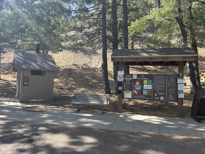
Overview Just northwest of the Los Angeles metro area, Peavine provides a scenic and relaxing destination for camping, hiking, picnicking and wildlife viewing. Within walking distance of Jackson Lake for easy access to fishing, canoeing, and swimming. Visitors enjoy exploring the Angeles Crest Scenic Byway, which offers incredible views of oak thickets, high desert landscapes, chaparral and pine forests. Recreation Wildlife viewing is a popular activity, as visitors may see bobcats, mountain lions, bears and Nelson bighorn sheep. Powerboating is not permitted on Jackson Lake, so the setting is peaceful and quiet for swimming, canoeing and fishing. The lake is stocked with trout and bluegill. Facilities Wildlife viewing is a popular activity, as visitors may see bobcats, mountain lions, bears and Nelson bighorn sheep. Powerboating is not permitted on Jackson Lake, so the setting is peaceful and quiet for swimming, canoeing and fishing. The lake is stocked with trout and bluegill. Natural Features Peavine Campground sits at an elevation of 6,100 feet in Angeles National Forest. Campsites are shaded with scattered oak trees and Jeffrey pines. Daytime temperatures in the summer are usually in the low 80s and evenings are cool. The Angeles National Forest spans nearly 695,000 acres over most of the San Gabriel Mountain Range in southern California. Vegetation ranges from chaparral and oak at lower elevations to pine forests at higher altitudes. Elevations range from 1,200 to 10,000 feet. The endangered California condor inhabits the forest. The Least Bells vireo and the Southwestern Willow flycatcher are two migratory birds that visitors enjoy spotting in the area. Other local inhabitants include the Arroyo toad, mountain yellow-legged frog, the mountain lion and the two-striped garter snake. Nearby Attractions The Angeles Crest Highway, part of California State Route 2, is a scenic byway that meanders through oak thickets, chaparral, high desert landscapes and pine tree forests. The ski resort town of Wrightwood is very close by. Restaurants and a disc golf course can be found at the North Resort. Take a hike on the Blue Ridge Trail or the Pacific Crest Trail. The Pacific Crest Trail is an impressive path that starts in Mexico and zigzags its way through Angeles and continues north across California, Oregon and Washington.
View details →
Overview NO PETS ARE ALLOWED ANYWHERE AT THE RESORT! Meeks Bay Resort has a long tradition as a family vacation and holiday retreat. It is located on western shore of the famed Lake Tahoe (Da ow aga), far away from the hustle and bustle of city life. The Washoe Tribe has been a part of the Meeks Bay area of Lake Tahoe (Da ow aga) for many millenium. Their link to the land is an important part of the Meeks Bay Resort charm. It is the perfect spot to recharge those drained reserves and immerse oneself in the spectacular rustic environment. Enjoy the sandy Meeks Bay beach, or rent a kayak or paddle board and venture out onto blue waters. Explore the hiking trails that lead both north and south along the lake as well as the Meeks Bay Trail which climbs into the Sierra Nevada Desolation Wilderness Area to Phipps Pass and beyond. For more details download the document available from the US Forestry Service. The Resort has abundant Day-Use parking and a grill for the hungry camper. Stop by the main building for supplies, toys and clothes, and perhaps a chat with one of the Washoe Tribe members. The resort offers all levels of vacation facilities from the historic Kehlet Mansion and the Washoe House, several cabins and lodges, full hookup RV spots, and standard tent campsites. Many couples have begun their wedded life together and families regularly hold their reunions at the Resort. Group reservations can be made on Recreation.gov or by phone to the call center. Meeks Bay Campground is now an integral part of the Meeks Bay Resort. NO PETS ARE ALLOWED ANYWHERE AT THE RESORT! Recreation When most people imagine what to do at Lake Tahoe, they think outdoor activities. Enthusiasts will find hundreds of miles of trails to hike, bike, and ride horseback. The Meeks Bay Resort provides sunbathing, beach play, swimming, and scuba diving. Kayak and paddle boards can be rented onsite. While motorized craft are not allowed in the bay, boating and water skiing are readily accessible elsewhere on Lake Tahoe. Anglers can land the big one at dozens of spots. Kokanee salmon and mackinaw, rainbow, Lahontan Cutthroat and brown trout are found throughout the area. The Washoe Tribe has actively helped improve the population of the Lahontan Cutthroat Trout (Ɂímgi). Facilities When most people imagine what to do at Lake Tahoe, they think outdoor activities. Enthusiasts will find hundreds of miles of trails to hike, bike, and ride horseback. The Meeks Bay Resort provides sunbathing, beach play, swimming, and scuba diving. Kayak and paddle boards can be rented onsite. While motorized craft are not allowed in the bay, boating and water skiing are readily accessible elsewhere on Lake Tahoe. Anglers can land the big one at dozens of spots. Kokanee salmon and mackinaw, rainbow, Lahontan Cutthroat and brown trout are found throughout the area. The Washoe Tribe has actively helped improve the population of the Lahontan Cutthroat Trout (Ɂímgi). Natural Features Meeks Bay (mayála wáťa) is located on the west shore of Lake Tahoe at a 6,225-foot elevation and is surrounded by many of Lake Tahoe’s most famous attractions. You won’t need to go far to experience the iconic views that travelers come from around the world to see. The abundant natural features include snow covered peaks of the Sierra Nevada, forested mountainsides, green meadows, miles of pristine shoreline, and impressive granite boulders. The azure lake is rimmed by footpaths, hiking and biking trails. Don’t miss the spectacular views of De ek Wadapush (Cave Rock) across the lake from the beach of mayála wáťa (Meeks Bay). The more adventurous hiker can traverse the Tahoe Rim Trail which offers panoramic views of the basin. Or one can venture deep into the Desolation Wilderness to Phipps Pass from the Meeks Bay Trailhead. contact_info For facility specific information, please call (530) 214-9422. Nearby Attractions South Lake Tahoe, CA Several Casinos and shops at Stateline, NV Boat tours of the lake Emerald Bay State Park and the Vikingsholm Castle D.L. Bliss State Park Tahoe City to the north Several Hiking Trails Charges & Cancellations If I book this reservation today, what are my options to change or cancel? Please remember that reservations at these facilities prevent other visitors from using these sites. Planned changes to your stay should be made as far in advance as possible. You can make changes to your reservation ahead of your arrival date in Reservations. Changes If your new stay dates are completely different from your original stay dates, there is a $10 change fee (per reserved site). There are no additional fees for: Adding or removing nights to your stay. Changing to a different campsite. Balances will adjust based on your new stay's nightly rate. Changes on or after the arrival date are made at the discretion of Resort Management and may result in forfeit of rental fees. Cancellations Meeks Bay Resort will require a non-refundable down payment on all lodging, RV and Tent sites. Reservations will require a down payment equal to 50% of the full daily rental rate. The remaining balance must be paid no later than 30 days prior to check-in. The Recreation.gov site will send the guest up to two reminder emails with links to facilitate payment. Those emails are sent seven days and 24 hours before the 30 day deadline. Down payments are non-refundable. If you do not complete the payment by the 30 day deadline, your reservation will be cancelled and the down payment forfeited. If you place a reservation 30 days or less prior to check-in, you must pay the down payment and the remaining rental fee at the time of reservation. If you cancel after that point you will be responsible for the $10 cancellation fee and forfeit the down payment. If you cancel within 14 days of the check-in date, you will forfeit the down payment and one day at the rental rate, as well as the $10 cancellation fee. This is an automated process and Meeks Bay Resort personnel cannot make changes. Late Check-in and No Show Meeks Bay Resort will hold any paid reservation until the following day at check-out time. Your reservation will be cancelled with no refund. If you have not checked in by that time or contacted Meeks Bay Resort Management to request one additional day to arrive.
View details →
Overview This location is available on a first-come, first-served basis only. Visitors are required to physically arrive at the campground to purchase and claim a site. Scan & Pay option coming Spring 2025! Recreation The Forest Service in cooperation with the State of California Off-Highway Vehicle Fund, (Green Sticker), has developed roads, trails, and facilities for further enjoyment of the OHV user. Remember, these are your facilities and OHV funds are being used to develop and maintain them. Forest Service roads open to Off-Highway Vehicles are considered public roads. All motorcycle riders on public lands in the State of California must wear a safety helmet meeting the standards adopted by the US Department of Transportation. State law requires all vehicles, including motorcycles to be registered. You must have a current Green or Red Sticker, or Highway License. Highway licensed vehicles must meet all standards for operating on a public highway and be operated in accordance with California state law. Your vehicle must be equipped with a properly installed Forest Service approved spark arrester in good working condition. For your safety and the safety of others, Off-Highway Vehicles must never be operated in a manner likely to endanger any person or property. Driving at excessive speeds, careless and reckless driving, racing and "wheelies" are not only prohibited, but also dangerous on forest roads and camping areas. State and Federal law prohibit operating any vehicle while under the influence of alcohol or drugs. This applies equally to the operation on Off-Highway vehicles, including those statutes prohibiting drinking while driving (CVC 23220), and drinking in a motor vehicle (CVC 23221). Motorcycles and ATVs must meet state sound requirement of 96 dba or lower. Unlicensed juveniles operating motorcycles and ATVs must be under the supervision of a licensed adult. The Stonyford Work Center (530) 963-3128 is available to provide Trail Conditions and closure information for the Grindstone District area. Stonyford Area Motor Vehicle Opportunity Guide Facilities The Forest Service in cooperation with the State of California Off-Highway Vehicle Fund, (Green Sticker), has developed roads, trails, and facilities for further enjoyment of the OHV user. Remember, these are your facilities and OHV funds are being used to develop and maintain them. Forest Service roads open to Off-Highway Vehicles are considered public roads. All motorcycle riders on public lands in the State of California must wear a safety helmet meeting the standards adopted by the US Department of Transportation. State law requires all vehicles, including motorcycles to be registered. You must have a current Green or Red Sticker, or Highway License. Highway licensed vehicles must meet all standards for operating on a public highway and be operated in accordance with California state law. Your vehicle must be equipped with a properly installed Forest Service approved spark arrester in good working condition. For your safety and the safety of others, Off-Highway Vehicles must never be operated in a manner likely to endanger any person or property. Driving at excessive speeds, careless and reckless driving, racing and "wheelies" are not only prohibited, but also dangerous on forest roads and camping areas. State and Federal law prohibit operating any vehicle while under the influence of alcohol or drugs. This applies equally to the operation on Off-Highway vehicles, including those statutes prohibiting drinking while driving (CVC 23220), and drinking in a motor vehicle (CVC 23221). Motorcycles and ATVs must meet state sound requirement of 96 dba or lower. Unlicensed juveniles operating motorcycles and ATVs must be under the supervision of a licensed adult. The Stonyford Work Center (530) 963-3128 is available to provide Trail Conditions and closure information for the Grindstone District area. Stonyford Area Motor Vehicle Opportunity Guide Natural Features Vegetation varies from low elevation chaparral to tall pine and fir forest in the high country. contact_info For facility specific information, please call (530) 963-3128. Nearby Attractions The south end of the Grindstone Ranger District offers over 200 miles of some of the most enjoyable and challenging OHV routes in the nation. The "Mendocino OHV Corridor" is a designated 40 mile, east-west route across the south end of the Forest connecting the Stonyford OHV Staging Area and the Upper Lake OHV Staging Area.
View details →
Overview This location is available on a first-come, first-served basis only. Visitors are required to physically arrive at the campground to purchase and claim a site. Scan & Pay option coming Spring 2025! Recreation Whether it be a overnight camping or an extended trail ride by horseback, the Mendocino National Forest will provide you with unique experience. Overnight camping by horseback is a great way to introduce young and old alike to the pleasures of the great outdoors. Facilities Whether it be a overnight camping or an extended trail ride by horseback, the Mendocino National Forest will provide you with unique experience. Overnight camping by horseback is a great way to introduce young and old alike to the pleasures of the great outdoors. Natural Features Vegetation is chaparral amidst ponderosa pine, douglas fir, and oaks. contact_info For facility specific information, please call (530) 963-3128. Nearby Attractions A short trail (0.8 mile) connects to the Deafy Glade Trail providing access to the Snow Mountain Wilderness.
View details →
Overview This location is available on a first-come, first-served basis only. Visitors are required to physically arrive at the campground to purchase and claim a site. Scan & Pay option coming Spring 2025! Recreation The Forest Service in cooperation with the State of California Off-Highway Vehicle Fund, (Green Sticker), has developed roads, trails, and facilities for further enjoyment of the OHV user. Remember, these are your facilities and OHV funds are being used to develop and maintain them. Forest Service roads open to Off-Highway Vehicles are considered public roads. All motorcycle riders on public lands in the State of California must wear a safety helmet meeting the standards adopted by the US Department of Transportation. State law requires all vehicles, including motorcycles to be registered. You must have a current Green or Red Sticker, or Highway License. Highway licensed vehicles must meet all standards for operating on a public highway and be operated in accordance with California state law. Your vehicle must be equipped with a properly installed Forest Service approved spark arrester in good working condition. For your safety and the safety of others, Off-Highway Vehicles must never be operated in a manner likely to endanger any person or property. Driving at excessive speeds, careless and reckless driving, racing and "wheelies" are not only prohibited, but also dangerous on forest roads and camping areas. State and Federal law prohibit operating any vehicle while under the influence of alcohol or drugs. This applies equally to the operation on Off-Highway vehicles, including those statutes prohibiting drinking while driving (CVC 23220), and drinking in a motor vehicle (CVC 23221). Motorcycles and ATVs must meet state sound requirement of 96 dba or lower. Unlicensed juveniles operating motorcycles and ATVs must be under the supervision of a licensed adult. The Stonyford Work Center (530) 963-3128 is available to provide Trail Conditions and closure information for the Grindstone District area. Stonyford Area Motor Vehicle Opportunity Guide Facilities The Forest Service in cooperation with the State of California Off-Highway Vehicle Fund, (Green Sticker), has developed roads, trails, and facilities for further enjoyment of the OHV user. Remember, these are your facilities and OHV funds are being used to develop and maintain them. Forest Service roads open to Off-Highway Vehicles are considered public roads. All motorcycle riders on public lands in the State of California must wear a safety helmet meeting the standards adopted by the US Department of Transportation. State law requires all vehicles, including motorcycles to be registered. You must have a current Green or Red Sticker, or Highway License. Highway licensed vehicles must meet all standards for operating on a public highway and be operated in accordance with California state law. Your vehicle must be equipped with a properly installed Forest Service approved spark arrester in good working condition. For your safety and the safety of others, Off-Highway Vehicles must never be operated in a manner likely to endanger any person or property. Driving at excessive speeds, careless and reckless driving, racing and "wheelies" are not only prohibited, but also dangerous on forest roads and camping areas. State and Federal law prohibit operating any vehicle while under the influence of alcohol or drugs. This applies equally to the operation on Off-Highway vehicles, including those statutes prohibiting drinking while driving (CVC 23220), and drinking in a motor vehicle (CVC 23221). Motorcycles and ATVs must meet state sound requirement of 96 dba or lower. Unlicensed juveniles operating motorcycles and ATVs must be under the supervision of a licensed adult. The Stonyford Work Center (530) 963-3128 is available to provide Trail Conditions and closure information for the Grindstone District area. Stonyford Area Motor Vehicle Opportunity Guide Natural Features General vegetation in the area is brush and gray pine trees. Nearby Attractions Bathhouse Trailhead is located less than a mile from Fouts Springs OHV area and connects to Deafy Glade trail, Dixie Glade Equestrian Campground, Summit Springs trail, and the rest of Snow Mountain Wilderness. contact_info For facility specific information, please call (530) 963-3128.
View details →
Overview This location is available on a first-come, first-served basis only. Visitors are required to physically arrive at the campground to purchase and claim a site. Scan & Pay option coming Spring 2025! Recreation The main feature of the area is a 35-acre lake for non-motorized vessels, trout fishing and swimming. A one-mile accesible trail leads along the lake shore. There are accessible restrooms and a popular fully-accessible fishing pier. Facilities The main feature of the area is a 35-acre lake for non-motorized vessels, trout fishing and swimming. A one-mile accesible trail leads along the lake shore. There are accessible restrooms and a popular fully-accessible fishing pier. Natural Features There is a 35-acre lake filled with trout located within a mixed conifer stand. contact_info For facility specific information, please call (530) 963-3128. Nearby Attractions Across the lake is Big Springs Picnic Area.
View details →
Overview This location is available on a first-come, first-served basis only. Visitors are required to physically arrive at the campground to purchase and claim a site. Scan & Pay option coming Spring 2025! Recreation River and stream fishing is popular in the winter when the stream is in full flow. The Forest Service in cooperation with the State of California Off-Highway Vehicle Fund, (Green Sticker), has developed roads, trails, and facilities for further enjoyment of the OHV user. Remember, these are your facilities and OHV funds are being used to develop and maintain them. Forest Service roads open to Off-Highway Vehicles are considered public roads. All motorcycle riders on public lands in the State of California must wear a safety helmet meeting the standards adopted by the US Department of Transportation. State law requires all vehicles, including motorcycles to be registered. You must have a current Green or Red Sticker, or Highway License. Highway licensed vehicles must meet all standards for operating on a public highway and be operated in accordance with California state law. Your vehicle must be equipped with a properly installed Forest Service approved spark arrester in good working condition. For your safety and the safety of others, Off-Highway Vehicles must never be operated in a manner likely to endanger any person or property. Driving at excessive speeds, careless and reckless driving, racing and "wheelies" are not only prohibited, but also dangerous on forest roads and camping areas. State and Federal law prohibit operating any vehicle while under the influence of alcohol or drugs. This applies equally to the operation on Off-Highway vehicles, including those statutes prohibiting drinking while driving (CVC 23220), and drinking in a motor vehicle (CVC 23221). Motorcycles and ATVs must meet state sound requirement of 96 dba or lower. Unlicensed juveniles operating motorcycles and ATVs must be under the supervision of a licensed adult. The Stonyford Work Center (530) 963-3128 is available to provide Trail Conditions and closure information for the Grindstone District area. Stonyford Area Motor Vehicle Opportunity Guide Facilities River and stream fishing is popular in the winter when the stream is in full flow. The Forest Service in cooperation with the State of California Off-Highway Vehicle Fund, (Green Sticker), has developed roads, trails, and facilities for further enjoyment of the OHV user. Remember, these are your facilities and OHV funds are being used to develop and maintain them. Forest Service roads open to Off-Highway Vehicles are considered public roads. All motorcycle riders on public lands in the State of California must wear a safety helmet meeting the standards adopted by the US Department of Transportation. State law requires all vehicles, including motorcycles to be registered. You must have a current Green or Red Sticker, or Highway License. Highway licensed vehicles must meet all standards for operating on a public highway and be operated in accordance with California state law. Your vehicle must be equipped with a properly installed Forest Service approved spark arrester in good working condition. For your safety and the safety of others, Off-Highway Vehicles must never be operated in a manner likely to endanger any person or property. Driving at excessive speeds, careless and reckless driving, racing and "wheelies" are not only prohibited, but also dangerous on forest roads and camping areas. State and Federal law prohibit operating any vehicle while under the influence of alcohol or drugs. This applies equally to the operation on Off-Highway vehicles, including those statutes prohibiting drinking while driving (CVC 23220), and drinking in a motor vehicle (CVC 23221). Motorcycles and ATVs must meet state sound requirement of 96 dba or lower. Unlicensed juveniles operating motorcycles and ATVs must be under the supervision of a licensed adult. The Stonyford Work Center (530) 963-3128 is available to provide Trail Conditions and closure information for the Grindstone District area. Stonyford Area Motor Vehicle Opportunity Guide Natural Features General vegetation is chaparral with a drainage running through. Mixed conifers are throughout the area. contact_info For facility specific information, please call (530) 963-3128. Nearby Attractions Little Stony OHV Staging Area is located near by.
View details →
Overview This location is available on a first-come, first-served basis only. Visitors are required to physically arrive at the campground to purchase and claim a site. Scan & Pay option coming Spring 2025! Recreation River and stream fishing is popular in the winter and early spring when the stream is in full flow. The Forest Service in cooperation with the State of California Off-Highway Vehicle Fund, (Green Sticker), has developed roads, trails, and facilities for further enjoyment of the OHV user. Remember, these are your facilities and OHV funds are being used to develop and maintain them. Forest Service roads open to Off-Highway Vehicles are considered public roads. All motorcycle riders on public lands in the State of California must wear a safety helmet meeting the standards adopted by the US Department of Transportation. State law requires all vehicles, including motorcycles to be registered. You must have a current Green or Red Sticker, or Highway License. Highway licensed vehicles must meet all standards for operating on a public highway and be operated in accordance with California state law. Your vehicle must be equipped with a properly installed Forest Service approved spark arrester in good working condition. For your safety and the safety of others, Off-Highway Vehicles must never be operated in a manner likely to endanger any person or property. Driving at excessive speeds, careless and reckless driving, racing and "wheelies" are not only prohibited, but also dangerous on forest roads and camping areas. State and Federal law prohibit operating any vehicle while under the influence of alcohol or drugs. This applies equally to the operation on Off-Highway vehicles, including those statutes prohibiting drinking while driving (CVC 23220), and drinking in a motor vehicle (CVC 23221). Motorcycles and ATVs must meet state sound requirement of 96 dba or lower. Unlicensed juveniles operating motorcycles and ATVs must be under the supervision of a licensed adult. The Stonyford Work Center (530) 963-3128 is available to provide Trail Conditions and closure information for the Grindstone District area. Stonyford Area Motor Vehicle Opportunity Guide Facilities River and stream fishing is popular in the winter and early spring when the stream is in full flow. The Forest Service in cooperation with the State of California Off-Highway Vehicle Fund, (Green Sticker), has developed roads, trails, and facilities for further enjoyment of the OHV user. Remember, these are your facilities and OHV funds are being used to develop and maintain them. Forest Service roads open to Off-Highway Vehicles are considered public roads. All motorcycle riders on public lands in the State of California must wear a safety helmet meeting the standards adopted by the US Department of Transportation. State law requires all vehicles, including motorcycles to be registered. You must have a current Green or Red Sticker, or Highway License. Highway licensed vehicles must meet all standards for operating on a public highway and be operated in accordance with California state law. Your vehicle must be equipped with a properly installed Forest Service approved spark arrester in good working condition. For your safety and the safety of others, Off-Highway Vehicles must never be operated in a manner likely to endanger any person or property. Driving at excessive speeds, careless and reckless driving, racing and "wheelies" are not only prohibited, but also dangerous on forest roads and camping areas. State and Federal law prohibit operating any vehicle while under the influence of alcohol or drugs. This applies equally to the operation on Off-Highway vehicles, including those statutes prohibiting drinking while driving (CVC 23220), and drinking in a motor vehicle (CVC 23221). Motorcycles and ATVs must meet state sound requirement of 96 dba or lower. Unlicensed juveniles operating motorcycles and ATVs must be under the supervision of a licensed adult. The Stonyford Work Center (530) 963-3128 is available to provide Trail Conditions and closure information for the Grindstone District area. Stonyford Area Motor Vehicle Opportunity Guide Natural Features General vegetation in the area is chaparral. A stream flows through the campground and is best in winter and early spring. contact_info For facility specific information, please call (530) 963-3128. Nearby Attractions Nail Track OHV Play Area is located near by.
View details →
Overview This location is available on a first-come, first-served basis only. Visitors are required to physically arrive at the campground to purchase and claim a site. Scan & Pay option coming Spring 2025! Recreation The Forest Service in cooperation with the State of California Off-Highway Vehicle Fund, (Green Sticker), has developed roads, trails, and facilities for further enjoyment of the OHV user. Remember, these are your facilities and OHV funds are being used to develop and maintain them. Forest Service roads open to Off-Highway Vehicles are considered public roads. All motorcycle riders on public lands in the State of California must wear a safety helmet meeting the standards adopted by the US Department of Transportation. State law requires all vehicles, including motorcycles to be registered. You must have a current Green or Red Sticker, or Highway License. Highway licensed vehicles must meet all standards for operating on a public highway and be operated in accordance with California state law. Your vehicle must be equipped with a properly installed Forest Service approved spark arrester in good working condition. For your safety and the safety of others, Off-Highway Vehicles must never be operated in a manner likely to endanger any person or property. Driving at excessive speeds, careless and reckless driving, racing and "wheelies" are not only prohibited, but also dangerous on forest roads and camping areas. State and Federal law prohibit operating any vehicle while under the influence of alcohol or drugs. This applies equally to the operation on Off-Highway vehicles, including those statutes prohibiting drinking while driving (CVC 23220), and drinking in a motor vehicle (CVC 23221). Motorcycles and ATVs must meet state sound requirement of 96 dba or lower. Unlicensed juveniles operating motorcycles and ATVs must be under the supervision of a licensed adult. The Stonyford Work Center (530) 963-3128 is available to provide Trail Conditions and closure information for the Grindstone District area. Stonyford Area Motor Vehicle Opportunity Guide Facilities The Forest Service in cooperation with the State of California Off-Highway Vehicle Fund, (Green Sticker), has developed roads, trails, and facilities for further enjoyment of the OHV user. Remember, these are your facilities and OHV funds are being used to develop and maintain them. Forest Service roads open to Off-Highway Vehicles are considered public roads. All motorcycle riders on public lands in the State of California must wear a safety helmet meeting the standards adopted by the US Department of Transportation. State law requires all vehicles, including motorcycles to be registered. You must have a current Green or Red Sticker, or Highway License. Highway licensed vehicles must meet all standards for operating on a public highway and be operated in accordance with California state law. Your vehicle must be equipped with a properly installed Forest Service approved spark arrester in good working condition. For your safety and the safety of others, Off-Highway Vehicles must never be operated in a manner likely to endanger any person or property. Driving at excessive speeds, careless and reckless driving, racing and "wheelies" are not only prohibited, but also dangerous on forest roads and camping areas. State and Federal law prohibit operating any vehicle while under the influence of alcohol or drugs. This applies equally to the operation on Off-Highway vehicles, including those statutes prohibiting drinking while driving (CVC 23220), and drinking in a motor vehicle (CVC 23221). Motorcycles and ATVs must meet state sound requirement of 96 dba or lower. Unlicensed juveniles operating motorcycles and ATVs must be under the supervision of a licensed adult. The Stonyford Work Center (530) 963-3128 is available to provide Trail Conditions and closure information for the Grindstone District area. Stonyford Area Motor Vehicle Opportunity Guide Natural Features General vegetation is mixed coniferous forest with chaparral surroundings. contact_info For facility specific information, please call (530) 963-3128. Nearby Attractions Letts Lake and Big Springs Picnic Area are one mile south of the campground.
View details →
Overview This location is available on a first-come, first-served basis only. Visitors are required to physically arrive at the campground to purchase and claim a site. Scan & Pay option coming Spring 2025! Recreation River and stream fishing is popular in the winter and early spring when the stream is in full flow. The Forest Service in cooperation with the State of California Off-Highway Vehicle Fund, (Green Sticker), has developed roads, trails, and facilities for further enjoyment of the OHV user. Remember, these are your facilities and OHV funds are being used to develop and maintain them. Forest Service roads open to Off-Highway Vehicles are considered public roads. All motorcycle riders on public lands in the State of California must wear a safety helmet meeting the standards adopted by the US Department of Transportation. State law requires all vehicles, including motorcycles to be registered. You must have a current Green or Red Sticker, or Highway License. Highway licensed vehicles must meet all standards for operating on a public highway and be operated in accordance with California state law. Your vehicle must be equipped with a properly installed Forest Service approved spark arrester in good working condition. For your safety and the safety of others, Off-Highway Vehicles must never be operated in a manner likely to endanger any person or property. Driving at excessive speeds, careless and reckless driving, racing and "wheelies" are not only prohibited, but also dangerous on forest roads and camping areas. State and Federal law prohibit operating any vehicle while under the influence of alcohol or drugs. This applies equally to the operation on Off-Highway vehicles, including those statutes prohibiting drinking while driving (CVC 23220), and drinking in a motor vehicle (CVC 23221). Motorcycles and ATVs must meet state sound requirement of 96 dba or lower. Unlicensed juveniles operating motorcycles and ATVs must be under the supervision of a licensed adult. The Stonyford Work Center (530) 963-3128 is available to provide Trail Conditions and closure information for the Grindstone District area. Stonyford Area Motor Vehicle Opportunity Guide Facilities River and stream fishing is popular in the winter and early spring when the stream is in full flow. The Forest Service in cooperation with the State of California Off-Highway Vehicle Fund, (Green Sticker), has developed roads, trails, and facilities for further enjoyment of the OHV user. Remember, these are your facilities and OHV funds are being used to develop and maintain them. Forest Service roads open to Off-Highway Vehicles are considered public roads. All motorcycle riders on public lands in the State of California must wear a safety helmet meeting the standards adopted by the US Department of Transportation. State law requires all vehicles, including motorcycles to be registered. You must have a current Green or Red Sticker, or Highway License. Highway licensed vehicles must meet all standards for operating on a public highway and be operated in accordance with California state law. Your vehicle must be equipped with a properly installed Forest Service approved spark arrester in good working condition. For your safety and the safety of others, Off-Highway Vehicles must never be operated in a manner likely to endanger any person or property. Driving at excessive speeds, careless and reckless driving, racing and "wheelies" are not only prohibited, but also dangerous on forest roads and camping areas. State and Federal law prohibit operating any vehicle while under the influence of alcohol or drugs. This applies equally to the operation on Off-Highway vehicles, including those statutes prohibiting drinking while driving (CVC 23220), and drinking in a motor vehicle (CVC 23221). Motorcycles and ATVs must meet state sound requirement of 96 dba or lower. Unlicensed juveniles operating motorcycles and ATVs must be under the supervision of a licensed adult. The Stonyford Work Center (530) 963-3128 is available to provide Trail Conditions and closure information for the Grindstone District area. Stonyford Area Motor Vehicle Opportunity Guide Natural Features Vegetation in the area is an open grove of oak trees adjacent to a year long stream. contact_info For facility specific information, please call (530) 963-3128.
View details →
Overview This location is available on a first-come, first-served basis only. Visitors are required to physically arrive at the campground to purchase and claim a site. Scan & Pay option coming Spring 2025! Recreation River and stream fishing is popular in the winter and early spring when the stream is in full flow. The Forest Service in cooperation with the State of California Off-Highway Vehicle Fund, (Green Sticker), has developed roads, trails, and facilities for further enjoyment of the OHV user. Remember, these are your facilities and OHV funds are being used to develop and maintain them. Forest Service roads open to Off-Highway Vehicles are considered public roads. All motorcycle riders on public lands in the State of California must wear a safety helmet meeting the standards adopted by the US Department of Transportation. State law requires all vehicles, including motorcycles to be registered. You must have a current Green or Red Sticker, or Highway License. Highway licensed vehicles must meet all standards for operating on a public highway and be operated in accordance with California state law. Your vehicle must be equipped with a properly installed Forest Service approved spark arrester in good working condition. For your safety and the safety of others, Off-Highway Vehicles must never be operated in a manner likely to endanger any person or property. Driving at excessive speeds, careless and reckless driving, racing and "wheelies" are not only prohibited, but also dangerous on forest roads and camping areas. State and Federal law prohibit operating any vehicle while under the influence of alcohol or drugs. This applies equally to the operation on Off-Highway vehicles, including those statutes prohibiting drinking while driving (CVC 23220), and drinking in a motor vehicle (CVC 23221). Motorcycles and ATVs must meet state sound requirement of 96 dba or lower. Unlicensed juveniles operating motorcycles and ATVs must be under the supervision of a licensed adult. The Stonyford Work Center (530) 963-3128 is available to provide Trail Conditions and closure information for the Grindstone District area. Stonyford Area Motor Vehicle Opportunity Guide Facilities River and stream fishing is popular in the winter and early spring when the stream is in full flow. The Forest Service in cooperation with the State of California Off-Highway Vehicle Fund, (Green Sticker), has developed roads, trails, and facilities for further enjoyment of the OHV user. Remember, these are your facilities and OHV funds are being used to develop and maintain them. Forest Service roads open to Off-Highway Vehicles are considered public roads. All motorcycle riders on public lands in the State of California must wear a safety helmet meeting the standards adopted by the US Department of Transportation. State law requires all vehicles, including motorcycles to be registered. You must have a current Green or Red Sticker, or Highway License. Highway licensed vehicles must meet all standards for operating on a public highway and be operated in accordance with California state law. Your vehicle must be equipped with a properly installed Forest Service approved spark arrester in good working condition. For your safety and the safety of others, Off-Highway Vehicles must never be operated in a manner likely to endanger any person or property. Driving at excessive speeds, careless and reckless driving, racing and "wheelies" are not only prohibited, but also dangerous on forest roads and camping areas. State and Federal law prohibit operating any vehicle while under the influence of alcohol or drugs. This applies equally to the operation on Off-Highway vehicles, including those statutes prohibiting drinking while driving (CVC 23220), and drinking in a motor vehicle (CVC 23221). Motorcycles and ATVs must meet state sound requirement of 96 dba or lower. Unlicensed juveniles operating motorcycles and ATVs must be under the supervision of a licensed adult. The Stonyford Work Center (530) 963-3128 is available to provide Trail Conditions and closure information for the Grindstone District area. Stonyford Area Motor Vehicle Opportunity Guide Natural Features Vegetation in the area is an open grove of oak trees adjacent to a year long stream. contact_info For facility specific information, please call (530) 963-3128. Nearby Attractions Davis Flat and Fouts Campgrounds are nearby, including various OHV trails. Bathhouse Trailhead is also nearby.
View details →
Overview *Altitude is 7,080 feet above sea level* Set on the edge of a meadow surrounded by Aspen, Fir and Pine trees, Patterson Guard Station has stood since 1921. It served the Modoc National Forest as a fully staffed fire office and guard station until 1981. Just a few footsteps from the Summit Trail and one-quarter mile from the wilderness boundary, Patterson Guard Station can be your basecamp for trips into the South Warner Wilderness or the perfect place to disconnect and relax. The cabin only has one set of bunkbeds (two mattresses). There is a large turn-around parking area directly adjacent to the cabin which can accommodate camper trailers, smaller RVs and gooseneck horse trailers. No hook-ups . If your party exceeds 8 persons, the adjacent Patterson Campground offers 6 developed campsites for $15/night. Click here to view the full reservation calander and additional details not included on this page. Recreation Hiking & Horseback Riding The nearby trails within the South Warner Wilderness offer wild landscapes and solitude for hikers and horseback riders. The Wilderness Act of 1964 prohibits the use of motorized and/or mechanized equipment within the Wilderness area (limited exceptions are provided by the Americans with Disabilities Act). South Warner WIlderness maps are advised and always available at the Modoc National Forest Supervisor's Office in Alturas, Calif. Maps may also be available at the Likely General Store in Likely, Calif. Off-Highway Vehicles Many of the roads near Patterson Guard Station, outside of the wilderness area, are open to Off-Highway Vehicles. Motor Vehicle Use Maps are available online and at the Modoc National Forest Supervisor's Office in Alturas, Calif. Boating Blue Lake, 9 miles west, features a boat ramp and dock for motorized and non-motorized watercraft. Help keep this lake clean by following the California Invasive Species Prevention Program Please respect the 10 mph speed limit on the lake. If speed-boating is your thing, consider launching your boat at West Valley Reservoir instead. Facilities Hiking & Horseback Riding The nearby trails within the South Warner Wilderness offer wild landscapes and solitude for hikers and horseback riders. The Wilderness Act of 1964 prohibits the use of motorized and/or mechanized equipment within the Wilderness area (limited exceptions are provided by the Americans with Disabilities Act). South Warner WIlderness maps are advised and always available at the Modoc National Forest Supervisor's Office in Alturas, Calif. Maps may also be available at the Likely General Store in Likely, Calif. Off-Highway Vehicles Many of the roads near Patterson Guard Station, outside of the wilderness area, are open to Off-Highway Vehicles. Motor Vehicle Use Maps are available online and at the Modoc National Forest Supervisor's Office in Alturas, Calif. Boating Blue Lake, 9 miles west, features a boat ramp and dock for motorized and non-motorized watercraft. Help keep this lake clean by following the California Invasive Species Prevention Program Please respect the 10 mph speed limit on the lake. If speed-boating is your thing, consider launching your boat at West Valley Reservoir instead. Natural Features The Warner Mountains form a prominent Northwestern boundary of the basin and range geologic province that envelops the entire state of Nevada. This range was once a sedimentary basin between volcanoes of the ancestral Cascade Range until the Warners went through their own phases of active volcanism between ~28 million years ago until as recently as 2 to 3 million years ago. Dramatic uplift on the eastern side of this range provides breathtaking views, best seen from Surprise Valley, east of the Warners. South-facing slopes in the Warner Mountains are often dry and host Lodgepole and Ponderosa Pine, Juniper trees and Sagebrush. North facing slopes are wetter and host Fir trees. Aspen trees are found along streams and boggy areas beside Corn Lillies that can grow up to 5 feet tall before drying up by mid-summer. contact_info This location is unstaffed. To speak with our main office for general information, please call: (530) 233-5811. Nearby Attractions Blue Lake, 9 miles West, offers a boat ramp and dock with a kayak launcher, fishing platform, day use area with grills and picnic tables and a developed campground with 40+ developed campsites at $15/night. Cedarville, California, is a historic western town offering restuarants, a grocery store, and shopping oppourtunities. 31 miles North along County Road 1.
View details →
Overview Juanita Lake campground offers 23 campsites adjacent to Juanita Lake on the Klamath National Forest. The lake offers a unique combination of recreation opportunities including many water-based activities like fishing and swimming. Site map located in photo stream above. Currently, there is non-potable water available for use. Recreation The 55 acre Juanita Lake is excellent for small rowboats, rafts, and canoes. There is a paved boat launch ramp, a dock in the summer, and fish cleaning station. No motors are permitted on the lake. The lake is regularly stocked with trout and has a bass and catfish population. Those wanting to explore will enjoy the 1.5 mile paved, barrier free trail that circles the lake with two fishing jetties for easy lake access. For the more ambitious hiker, there is a 6 mile hike with a 2,700 foot elevation gain climbing up to Ball Mountain Lookout. Visitors interested in cooling off will delight in a swim or simply wading and water-play from the shoreline. Facilities The 55 acre Juanita Lake is excellent for small rowboats, rafts, and canoes. There is a paved boat launch ramp, a dock in the summer, and fish cleaning station. No motors are permitted on the lake. The lake is regularly stocked with trout and has a bass and catfish population. Those wanting to explore will enjoy the 1.5 mile paved, barrier free trail that circles the lake with two fishing jetties for easy lake access. For the more ambitious hiker, there is a 6 mile hike with a 2,700 foot elevation gain climbing up to Ball Mountain Lookout. Visitors interested in cooling off will delight in a swim or simply wading and water-play from the shoreline. Natural Features The partially shaded campground sits at an altitude of 5,130 feet and is located on the shores of Juanita Lake surrounded by a ponderosa pine forest. The lake is a favorite bird watching area with bald eagles and osprey regularly fishing the lake. Sit among the pines and fish or watch a diverse array of wildlife that uses the area. Nearby Attractions The Butte Valley Wildlife Area is within four miles.
View details →
Overview Englebright Lake is nestled in the steep Yuba River canyon, of the Sierra Nevada foothills. This location offers a unique boat-in camping experience, several species of sport fish, abundant wildlife, and year round water-based recreational activities for enthusiasts and families alike. Located between Grass Valley and Yuba City off State Route 20. Recreation Englebright Lake is a destination fishery, providing anglers with a variety of options including small and large mouth bass, trout and Kokanee salmon. The boat-in campground has 51 sites that include a fire ring, lantern hanger, picnic table and tent pad. Facilities Englebright Lake is a destination fishery, providing anglers with a variety of options including small and large mouth bass, trout and Kokanee salmon. The boat-in campground has 51 sites that include a fire ring, lantern hanger, picnic table and tent pad. Natural Features Englebright Lake is located in the Sierra Nevada foothills, within a steep canyon with notable waterfalls and abundant wildlife. A mix of agricultural land and thick forest surround the lake and campgrounds. Nearby Attractions Narrows Day Use Area, Joe Miller Recreation Area, Bridgeport State Park and New Bullards Bar Reservoir are nearby. Charges & Cancellations As per Recreation.gov policy.
View details →
Overview Big Reservoir Campground is adjacent to a privately operated lake and associated Morning Star Campground consisting of an additional 100 campsites. Use of the lake and associated facilities at Morning Star are subject to a $25.00 fee not associated with your reserved campsites at Big Reservoir Campground. Please contact the campground office at (530) 346-3028. contact_info For facility specific information, please call (530) 346-3028. Nearby Attractions Morning Star Campground and Big Reservoir are adjacent to this campground. Sugar pine OHV Staging area nearby provides access to miles of Off Highway Vehicle trails. Sugar pine Reservoir offers fishing, boating, and swimming and is located 9 miles away.
View details →
Overview Badger’s Den Campground provides a Lake Tahoe and Camp Richardson Resort experience unlike any other. Featuring beach access, and all the amenities you can think of within walking distance, guests get to bask in the remarkable beauty of Tahoe without sacrificing the resort experience. The campground has 66 single standard tent sites and 18 standard double tent sites. Each campsite has a bear-proof food locker, picnic table, and fire pit with cooking grate. Recreation Historic Camp Richardson Resort offers everything wonderful about outdoor recreation in Lake Tahoe. Recreational activities include biking, camping, fishing, hiking, sandy beach access, boating, paddling and more! Facilities Historic Camp Richardson Resort offers everything wonderful about outdoor recreation in Lake Tahoe. Recreational activities include biking, camping, fishing, hiking, sandy beach access, boating, paddling and more! Natural Features The resort’s unrivaled location on Lake Tahoe’s southern shore offers access to breathtaking natural wonders at an elevation of 6225 feet. Guests are surrounded by the crystal-clear waters of Lake Tahoe, the towering Sierra Nevada mountains, and the lush, fragrant forests of the surrounding area. The resort’s scenic beauty is a constant invitation for outdoor activities, from hiking and biking to water sports. contact_info For facility specific information, please call (530) 494-2228. Nearby Attractions Tallac Historic Site, Emerald Bay, Pope Beach, Baldwin Beach, Fallen Leaf Lake, Mt. Tallac.
View details →
Overview Eagles Nest Campground provides a Lake Tahoe and Camp Richardson Resort experience unlike any other. Featuring beach access, and all the amenities you can think of within walking distance, guests get to bask in the remarkable beauty of Tahoe without sacrificing the resort experience. The campground has 25 double standard tent sites and 6 standard triple tent sites. Each campsite has a bear-proof food locker, picnic table, and fire pit with cooking grate. Recreation Historic Camp Richardson Resort offers everything wonderful about outdoor recreation in Lake Tahoe. Recreational activities include biking, camping, fishing, hiking, sandy beach access, boating, paddling and more! Facilities Historic Camp Richardson Resort offers everything wonderful about outdoor recreation in Lake Tahoe. Recreational activities include biking, camping, fishing, hiking, sandy beach access, boating, paddling and more! Natural Features The resort’s unrivaled location on Lake Tahoe’s southern shore offers access to breathtaking natural wonders at an elevation of 6225 feet. Guests are surrounded by the crystal-clear waters of Lake Tahoe, the towering Sierra Nevada mountains, and the lush, fragrant forests of the surrounding area. The resort’s scenic beauty is a constant invitation for outdoor activities, from hiking and biking to water sports. contact_info For facility specific information, please call (530) 494-2228. Nearby Attractions Tallac Historic Site, Emerald Bay, Pope Beach, Baldwin Beach, Fallen Leaf Lake, Mt. Tallac.
View details →
Overview The RV Village provides a Lake Tahoe and Camp Richardson Resort experience unlike any other. Featuring beach access, and all the amenities you can think of within walking distance, guests get to bask in the remarkable beauty of Tahoe without sacrificing the resort experience. The campground has 20 Full Hookup RV sites and 78 Water/Electric RV sites. Each RV site has a picnic table, and fire pit with cooking grate. Some sites have a bear-proof food locker. Recreation Historic Camp Richardson Resort offers everything wonderful about outdoor recreation in Lake Tahoe. Recreational activities include biking, camping, fishing, hiking, sandy beach access, boating, paddling and more! Facilities Historic Camp Richardson Resort offers everything wonderful about outdoor recreation in Lake Tahoe. Recreational activities include biking, camping, fishing, hiking, sandy beach access, boating, paddling and more! Natural Features The resort’s unrivaled location on Lake Tahoe’s southern shore offers access to breathtaking natural wonders at an elevation of 6225 feet. Guests are surrounded by the crystal-clear waters of Lake Tahoe, the towering Sierra Nevada mountains, and the lush, fragrant forests of the surrounding area. The resort’s scenic beauty is a constant invitation for outdoor activities, from hiking and biking to water sports. Nearby Attractions Tallac Historic Site, Emerald Bay, Pope Beach, Baldwin Beach, Fallen Leaf Lake, Mt. Tallac. contact_info For facility specific information, please call (530) 494-2228.
View details →
Overview The Indian Well Campground is in the heart of Lava Beds National Monument. The campground is comprised of 43 sites available on a first-come, first serve basis and one group site that is available by reservation April-October. The monument was established as a national monument on November 21, 1925, and includes more than 46,000 acres (190 km2).The monument lies on the northeastern flank of Medicine Lake Volcano, which is the largest volcano by area in the Cascade Range. The Monument has over 800 lava tubes, with 27 having marked entrances and developed trails for public access and exploration. The monument also offers trails through the high Great Basin shrubland desert landscape and vast volcanic fields. Lava Beds National Monument is the site of the Modoc War, involving a band led by Kintpuash (also known as Captain Jack). Recreation Lava Beds National Monument has the largest concentration of lava tubes in North America with over 800 documented in the Monument. 27 caves have marked entrances and developed trails for public access and exploration. Mushpot Cave has electrical lighting; the others are illuminated by ceiling collapse portals or require flashlights. The monument also has 13 hiking trails, all of which cross or enter the backcountry. The most popular trails are short, but lead to a number of historic sites as to several geological areas. This includes sites of the Modoc War that includes Captain Jack's Stronghold. Birding and wildlife viewing is also a popular activity along the north boundary of the monument. Facilities Lava Beds National Monument has the largest concentration of lava tubes in North America with over 800 documented in the Monument. 27 caves have marked entrances and developed trails for public access and exploration. Mushpot Cave has electrical lighting; the others are illuminated by ceiling collapse portals or require flashlights. The monument also has 13 hiking trails, all of which cross or enter the backcountry. The most popular trails are short, but lead to a number of historic sites as to several geological areas. This includes sites of the Modoc War that includes Captain Jack's Stronghold. Birding and wildlife viewing is also a popular activity along the north boundary of the monument. Natural Features Lava Beds National Monument lies on the northeastern flank of Medicine Lake Volcano, which is the largest volcano by area in the Cascade Range. The Monument is geologically significant because of its wide variety of volcanic formations, including over 800 lava tubes, fumaroles, cinder cones, spatter cones, pit craters, hornitos, maars, lava flows, and volcanic fields.The region in and around Lava Beds National Monument lies at the junction of the Sierra-Klamath, Cascade, and Great Basin physiographic provinces. The southern most area of the monument is the highest in elevation and receives the most precipitation, and supports a Ponderosa Pine forest. Farther to the north of the monument, the middle elevations are a juniper and shrub woodland. Extending to the northern boundary are lower grasslands and sagebrush. Despite semi-arid conditions, native wildlife has adapted to the environmental constraints and are abundant and diverse.
View details →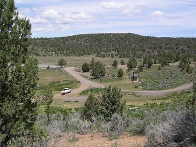
Dodge Reservoir, located approximately 17 miles northeast of Ravendale, California, is a 480 acre water impoundment that was constructed in 1937 by the Dodge Brothers for irrigation. The campground has sites with picnic tables and one wheelchair accessible vault toilet. There is no trash collection or potable water. Donations are welcome but there is no site fee. We recommend calling the Eagle Lake Field Office, for current water conditions before planning a fishing trip The reservoir is located at approximately 5,600 feet in elevation, in a high desert setting of sagebrush hills with scattered junipers. The reservoir has traditionally been stocked with Rainbow Trout, Lahontan Cutthroat throat and brown trout by the California Department of Fish and Game. The prime time for fishing this reservoir is spring and early summer when the water levels are the highest. Title to the land under and adjacent to the reservoir is a combination of Private and Federal ownership. The Dodge Ranch holds the water rights to the reservoir with no minimum pool requirement.
View details →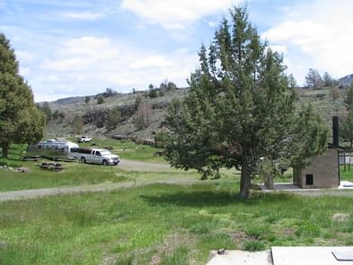
Ramhorn Springs is a small water source located in a high desert setting that has been utilized by travelers and ranchers for many years. A 10 unit campground has been constructed adjacent to it. The facilities include an informational kiosk, picnic tables, fire rings, trash cans, a horse corral and one vault toilet. The surface in the campground is packed earth and gravel. There is no potable water. There is no fee for the use of the campground but a donation is requested to assist with the routine maintenance costs. There is not much shade in the campground, therefore the most enjoyable time to visit this campground is during the cooler months of the year. Campground is open all year, however, access is limited during wet weather. See more photos of the Ramhorn Springs Campground.
View details →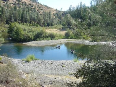
This site will remain closed for the season due to maintenance projects. Douglas City, Steel Bridge, and Junction City are other BLM campgrounds nearby that charge a fee and are open from May through November, weather permitting. Camp on the edge of the Trinity River in one of 8 primitive camping sites, suitable for tent camping or small trailers. Popular for fishing and pleasure boating alike, this clear, cold section of the river is world famous for its fly fishing. Paddlers enjoy the narrow valley with Ponderosa Pine, Douglas fir, Oaks, and Madrone trees coating the walls of the canyons. If you would like more adrenaline rush, the waters below Pigeon Point rage at class III-V for white water enthusiasts. Those interested in a more relaxing experience can enjoy the abundant camping options in the area or head for the trail with your friends, horses, or dog. If you would like to stay at the river's edge, you can always swim, fish or do a little gold panning. The river can be accessed from many locations along this stretch of the Trinity River.
View details →
Overview Rainbow Basin Natural Area is an Area of Critical Environmental Concern with outstanding views and geological and paleontological features.. Many visitors come to see exciting multi-colored rock formations and walk the scenic canyons. A variety of desert adapted wildlife are found here, including the desert tortoise. Owl Canyon Campground is a first-come first-served campground with 22 campsites (no hookups). Campsites include a picnic table and a fire ring. Fee is $6.00 per night. There is a single tap centrally located for potable water that is brought in weekly by truck. It is advised to bring your own drinking water. There are vault toilets , but no dump facilities. Holding tanks can be emptied at facilities in the towns of Baker and Barstow. Please take all trash out with you. Permits are needed to remove fossils. If any are found, please leave them in place and notify the BLM Barstow Field Office at (760) 252-6000. Activities include hiking, camping, photography, sightseeing, and horseback riding. Tell someone where you are going and when you expect to return. Bring sufficient water, food, clothing, equipment, and first aid supplies for your activity. Rainbow Basin is a mix of public and private lands, including those held by the Southern Pacific Railroad. Respect private landownersґ rights. Land ownership status can be found on the "Cuddeback Lake" Desert Access Guide. These BLM maps can be purchased from any of the California Desert District BLM offices. Rainbow Basin has a diverse landscape of hills, canyons and washes. Multicolored rock walls and mesas are accented by changing light conditions, making for many photographic opportunities. The washes are good hiking trails for experiencing the area's natural beauty. Wildlife viewing is best during early morning and evening hours. In Fossil, Coon, and Owl Canyons, birds tend to gather in thick vegetation. Vegetation is critical for wildlife water, food, and shelter. So, washes in Rainbow Basin have been closed to vehicle travel to protect these areas. Within this Area of Critical Environmental Concern, routes are posted with "open" route markers. Use of passenger vehicles and four-wheel drive vehicles is permitted only on designated and signed "open" routes. All routes not signed as "open" are CLOSED to vehicles. Staging of off-highway vehicles (e.g. ATVs) is not allowed in the Rainbow Basin area or at Owl Canyon Campground. The Fossil Canyon Loop Road is an interesting route for vehicle touring. This one-way narrow dirt road is best driven with a high clearance or four-wheel drive vehicles. Weather extremes and poisonous snakes are desert hazards common to this area. Rainbow Basin has a flash flood risk as well. Avoid low-lying areas during storms and remember that rain upstream can cause flooding even though it is not raining in the immediate area.
View details →
Overview Falcon Group Campground has three individual group campsites just off the scenic Ortega Highway in Southern California, which connects San Juan Capistrano and Temecula Valley Highway. The pleasant climate, scenery, trail system and convenient location, make this a popular destination for groups from Los Angeles and San Diego. Hiking is especially popular among campers. Recreation Hikers of any level can find trails that challenge and accommodate their recreational goals around the campground. Among them are the Falcon Trail, a 1.4-mile easy trail that connects to the campground, and Trabuco Canyon Trail, which provides scenic 6.8-mile hike into the backcountry. The San Juan Trial, which is popular with mountain bikers, has a trailhead at Blue Jay campground, adjacent from Falcon Group Campground. The trail climbs a very steep set of stacked switchbacks from the floor of Hot Springs Canyon and traverses briefly before steeply ascending a ridge toward Sugarloaf Mountain. There are also many ideal picnic spots and scenic overlooks along Ortega Highway. Facilities Hikers of any level can find trails that challenge and accommodate their recreational goals around the campground. Among them are the Falcon Trail, a 1.4-mile easy trail that connects to the campground, and Trabuco Canyon Trail, which provides scenic 6.8-mile hike into the backcountry. The San Juan Trial, which is popular with mountain bikers, has a trailhead at Blue Jay campground, adjacent from Falcon Group Campground. The trail climbs a very steep set of stacked switchbacks from the floor of Hot Springs Canyon and traverses briefly before steeply ascending a ridge toward Sugarloaf Mountain. There are also many ideal picnic spots and scenic overlooks along Ortega Highway. Natural Features The campground sits at an elevation of 3,300 ft. off the Ortega Highway scenic drive in the Santa Ana Mountains, a route that offers beautiful views of the surrounding mountains, valleys and forest. The area lies in a mixed forest and chaparral ecosystem and is inhabited by a variety of birds, plants and wildlife. Nearby Attractions The closest town is Lake Elsinore, which has various shops, restaurants and recreation opportunities.
View details →
Overview Boulder Oaks offers equestrian and family sites in the scenic Cleveland National Forest, about an hour away from San Diego, California. Visitors are drawn here for the convenience of horseback riding and day hiking on the Pacific Crest Trail, as well as picnicking in the beautiful mountain setting. Recreation The national forest lends itself well to horseback riding and hiking. Boulder Oaks has direct access to a segment of the 2,650-mile Pacific Crest Trail, a national scenic trail that runs from Mexico to Canada. Horseback riding is also permitted on all Cleveland National Forest roads and trails, except for nature trails. Facilities The national forest lends itself well to horseback riding and hiking. Boulder Oaks has direct access to a segment of the 2,650-mile Pacific Crest Trail, a national scenic trail that runs from Mexico to Canada. Horseback riding is also permitted on all Cleveland National Forest roads and trails, except for nature trails. Natural Features The campground sits at an elevation of 3,300 ft. with oak and manzanita trees providing shade. The surrounding mountains are dotted with sagebrush, and wildflowers add color to the landscape in spring and early summer. The area is home to many species of local and migratory birds. The campground is habitat for the endangered Arroyo Toad. Nearby Attractions Pacific Crest National Scenic Trail
View details →
Overview We apologize, this facility is not currently taking reservations. Day use site hours are from 6 a.m. to 8 p.m. unless otherwise noted at the site. Crestline Picnic Ground is a convenient place for large families, church groups and other social gatherings of up to 50 people. The facility is a popular recreation site for visitors going to the Palomar Observatory, a world-class center of astronomical research by the California Institute of Technology in north San Diego County. Hiking, biking and picnicking are available nearby. Recreation The picnic ground makes a good base camp for visiting the Palomar Observatory Visitor Center and Palomar Mountain State Park or exploring the surrounding forest. Day hiking, backpacking, biking, picnicking and scenic driving are available in the area. Facilities The picnic ground makes a good base camp for visiting the Palomar Observatory Visitor Center and Palomar Mountain State Park or exploring the surrounding forest. Day hiking, backpacking, biking, picnicking and scenic driving are available in the area. Natural Features The campground sits at an elevation of 5,390 feet in the Palomar Mountains of Southern California. The site is forested but has plenty of open space for star gazing and playing. Nearby Attractions The picnic ground is adjacent to Palomar Mountain State Park and less than a two-hour drive from San Diego, California.
View details →
Overview El Prado Group Campground is a great mountain getaway just one hour east of San Diego, California in the Laguna Mountain Recreation Area. Campers can enjoy cooler temperatures, unique natural areas and an extensive trail system at this mountain facility from summer through early fall. Recreation The Laguna Mountain Recreation Area is known for great horseback riding, mountain biking, and hiking trails. Visitors can get their boots dusty on the Laguna Meadow Trail system or access a segment of the 2,650-mile Pacific Crest Trail, which runs from Mexico, through California and north to Canada. Within the campground is the El Prado Cabin which was built in 1911 and was the first Ranger's cabin in the Cleveland National Forest. Step back in time and enjoy this historical feature in the campground. Families can learn about the area's flora and fauna by attending educational programs at nearby Laguna Campground. A visitor center is a few miles down the road. Facilities The Laguna Mountain Recreation Area is known for great horseback riding, mountain biking, and hiking trails. Visitors can get their boots dusty on the Laguna Meadow Trail system or access a segment of the 2,650-mile Pacific Crest Trail, which runs from Mexico, through California and north to Canada. Within the campground is the El Prado Cabin which was built in 1911 and was the first Ranger's cabin in the Cleveland National Forest. Step back in time and enjoy this historical feature in the campground. Families can learn about the area's flora and fauna by attending educational programs at nearby Laguna Campground. A visitor center is a few miles down the road. Natural Features The campground sits at an elevation of 5,600 ft. in the Laguna Mountains. It is forested with pines and oaks that provide plenty of shade. The area is home to many species of birds, as well as the endangered Laguna Skipper butterfly. Nearby Attractions The Pacfic Crest National Scenic Trail, Noble Canyon National Recreation Trail, Mount Laguna Information Center
View details →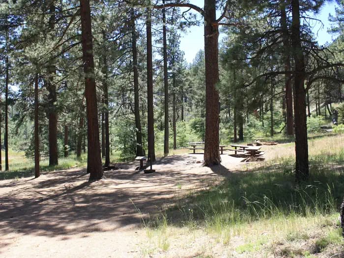
Overview Contrary to its name, Horse Heaven Group Campground has no equestrian sites. Instead, this tent-only facility can accommodate gatherings of up to 100 people. It provides a great mountain getaway for city dwellers to relax and enjoy cool summer temperatures, hiking and other outdoor recreation, just one hour east of San Diego. Recreation The Laguna Mountain region is known for its great horseback riding, mountain biking and hiking trails. Visitors can get their boots dusty on a segment of the 2,650-mile Pacific Crest Trail, which runs from California to the State of Washington, and access other trails within a short drive. Many picnic areas are located nearby. Facilities The Laguna Mountain region is known for its great horseback riding, mountain biking and hiking trails. Visitors can get their boots dusty on a segment of the 2,650-mile Pacific Crest Trail, which runs from California to the State of Washington, and access other trails within a short drive. Many picnic areas are located nearby. Natural Features The campground is nestled in the pines at an elevation of 5,600 feet within the Laguna Mountains in the southern portion of Cleveland National Forest. The area is home to many species of birds and wildlife. Nearby Attractions Pacific Crest National Scenic Trail, Big Laguna Trail System, Storm Canyon Overlook
View details →
Overview Wooded Hill Group Campground is a great mountain getaway for groups of up to 110 people to take a retreat from the city. Just one hour east of San Diego, California, the campground offers cooler temperatures, unique natural areas and an extensive trail system. The facility is a perfect place for groups to gather and enjoy the outdoors from Memorial Day through Labor Day. Recreation The Laguna Mountains are known for great horseback riding, mountain biking and hiking trails. Visitors can get their boots dusty on a segment of the 2,650-mile Pacific Crest Trail, which runs from Mexico to Canada or try other nearby trails such as the Wooded Hills Nature Trail. The Wooded Hills Nature Trail is accessible just west of the campground off of Sunrise Scenic byway. From the trail, visitors can ascend to the highest wooded point on Laguna Mountain, offering views of San Diego, Point Loma and the Channel Islands on a clear day. The drive along Sunrise Highway weaves through woods brimming with pine, spruce, and fir trees, offering travelers many opportunities to enjoy pristine mountain meadows and amazing vistas. Facilities The Laguna Mountains are known for great horseback riding, mountain biking and hiking trails. Visitors can get their boots dusty on a segment of the 2,650-mile Pacific Crest Trail, which runs from Mexico to Canada or try other nearby trails such as the Wooded Hills Nature Trail. The Wooded Hills Nature Trail is accessible just west of the campground off of Sunrise Scenic byway. From the trail, visitors can ascend to the highest wooded point on Laguna Mountain, offering views of San Diego, Point Loma and the Channel Islands on a clear day. The drive along Sunrise Highway weaves through woods brimming with pine, spruce, and fir trees, offering travelers many opportunities to enjoy pristine mountain meadows and amazing vistas. Natural Features The campground sits at an elevation of 6,000 ft. in the Laguna Mountains. It is forested with pines and oaks that provide plenty of shade. The area is a quiet home to many species of birds and wildlife. Nearby Attractions Pacific Crest National Scenic Trail, Wooded Hill Nature Trail, Aqua Dulce Trailhead, Big Laguna Trail System, SDSU Obervatory & Star Party Trail
View details →
Overview Middle Meadows Campground offers a quiet place to camp, far from the hustle and bustle of city life. The campground is isolated from other campgrounds and offers a variety of recreational activities in its vicinity. Its scenic location also provides for beautiful sightseeing, birding and wildlife viewing. Recreation Campers at Middle Meadows enjoy a forested setting and close access to a flowing creek, making it an ideal spot for family trips. Hell Hole Reservoir, located less than 5 miles from the campground, offers a variety of water-related recreation opportunities, including boating and fishing. There is a swimming hole that is located just west of Middle Meadows Group Campground about 0.25 miles. Facilities Campers at Middle Meadows enjoy a forested setting and close access to a flowing creek, making it an ideal spot for family trips. Hell Hole Reservoir, located less than 5 miles from the campground, offers a variety of water-related recreation opportunities, including boating and fishing. There is a swimming hole that is located just west of Middle Meadows Group Campground about 0.25 miles. Natural Features Middle Meadows is located along the South Fork of Long Canyon Creek with a heavily wooded surrounding. Forests include large cedar, pine and fir trees and shrubs. Although the campground has a primitive, undiscovered feel to it, the serene mountain landscape is well worth the long drive from civilization. Nearby Attractions Middle Meadows is located adjacent to Long Canyon Creek for fishing and wading. Hell Hole Reservoir is a short drive north. A boat ramp is available at the reservoir.
View details →
Overview Wrights Lake Campground is situated in the timber belt, close to the lake shore, looking up at the majestic rocky peaks of the Sierra Nevadas and Desolation Wilderness. The area is well-known for its hiking, wildflowers and birding. Recreation The campground provides access to the lake, where visitors enjoy trout fishing, swimming and boating activities. Motorboats are prohibited in the area. Hikers will enjoy access to multiple foot and horseback riding trails within 5 miles of the campground. Various trailheads, including Bloodsucker, Rockbound and Twin Lakes trails, provide access to Desolation Wilderness. Educational programs are offered at the amphitheater, and mountain biking and off-road vehicle use is popular on Barrett Lake Jeep trail. Wilderness permits for day hiking are available at the trailheads, and overnight hiking permits are available at Pacific Ranger Station. Facilities The campground provides access to the lake, where visitors enjoy trout fishing, swimming and boating activities. Motorboats are prohibited in the area. Hikers will enjoy access to multiple foot and horseback riding trails within 5 miles of the campground. Various trailheads, including Bloodsucker, Rockbound and Twin Lakes trails, provide access to Desolation Wilderness. Educational programs are offered at the amphitheater, and mountain biking and off-road vehicle use is popular on Barrett Lake Jeep trail. Wilderness permits for day hiking are available at the trailheads, and overnight hiking permits are available at Pacific Ranger Station. Natural Features At nearly 7,000 feet in elevation, the campground is surrounded by pine and fir trees with a grassy understory. Wildflowers bloom throughout the spring and summer seasons. Some sites are nestled among giant boulders, providing privacy for campers. The campground is close to Wrights Lake, a 40-acre body of water popular for its serene and quiet atmosphere. Charges & Cancellations Change Fee: A service fee may be charged at the time a modification is made depending on the changes. Cancellation Fee: A $10 service fee will be withheld from any refunds for a cancelled reservation. Cut-Off Window: The latest date and/or time that you can make an advanced reservation or a change to an existing reservation. Cut-off windows can vary by location, but are typically 4 days before your arrival date. A customer who cancels a reservation the day before or on the day of arrival will pay a $10.00 service fee AND forfeit the first night's use fee (see Late Cancellation below). Late Cancellation: If you cancel your reservation too close to the start date, additional service fees may be withheld. Refunds: Refund requests made through www.recreation.gov will be charged a $10 processing fee. This fee is retained by the reservation service contractor along with the non-refundable reservation fee. All requests for the return of the non-refundable reservation fee and the cancellation fee will be declined by the campground concessionaire as they did not receive these fees (these are the fees retained by the reservation contractor, a different entity).
View details →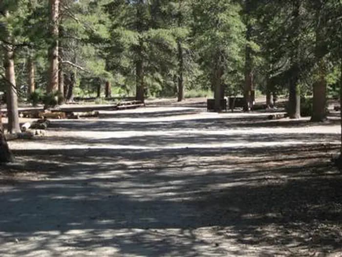
Overview Obsidian Flat Group Campground, located just outside of Mammoth Lakes, California, provides an opportunity for a group to enjoy a secluded getaway in the eastern Sierra Nevada Mountains. With a peaceful forested setting and mountain views, the campground's location is perfect for relaxing and spending time in nature. The area is popular for exploring the surrounding forest and geology, as well as nearby hiking, bicycling, fishing and off-road vehicle riding options. Recreation The eastern Sierras are known for their exceptional trout fishing. Campers can try their luck in Deadman Creek. The majestic scenery and challenging trails are an obvious draw for hikers, mountain bikers and off-road vehicle enthusiasts. Deadman Creek Trail leads hikers into the spectacular Ansel Adams Wilderness. Facilities The eastern Sierras are known for their exceptional trout fishing. Campers can try their luck in Deadman Creek. The majestic scenery and challenging trails are an obvious draw for hikers, mountain bikers and off-road vehicle enthusiasts. Deadman Creek Trail leads hikers into the spectacular Ansel Adams Wilderness. Natural Features The campground is named after an obsidian lava flow nearby. It is situated in a pine forest at an elevation of 7,800 feet. Deadman Creek is adjacent to the facility, and several lakes are down the road. Many species of wildlife call the mountains home, such as black bear, mountain lions, mule deer, pine marten, pika and numerous fish and birds. Nearby Attractions Hikers can access the scenic Ansel Adams Wilderness via nearby trails, and Yosemite National Park is a great day trip. Ansel Adams Wilderness Yosemite National Park
View details →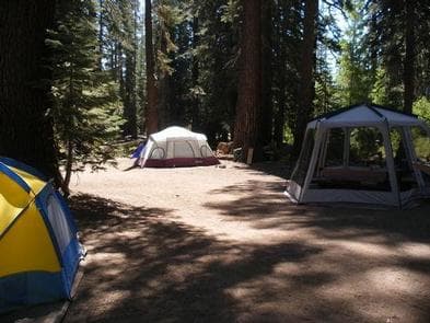
Overview Agnew Meadows Group Campground is located in the Reds Meadow Valley section of the eastern Sierra Nevada Mountains, just west of the full-service community of Mammoth Lakes, California. Popular with large families, this group camping facility provides access to some of the most spectacular wilderness in the Sierras and many outdoor activities such as horseback riding, fishing, hiking and photography. Devils Postpile National Monument and the famous Ansel Adams Wilderness are nearby, and a pack station with horseback riding tours and supplies is just down the road. Recreation This campground is a great base camp for hiking the area's many trails. Within a few miles, campers will find the High Trail, Shadow Creek Trail and River Trail, all open to hiking and horseback riding. Trailheads to the Ansel Adams Wilderness and Pacific Crest Trail are in the vicinity. Hikers are required to ride a shuttle to the trailheads. Fishing enthusiasts can try for trout in the many area lakes or the North Fork of the San Joaquin River. Facilities This campground is a great base camp for hiking the area's many trails. Within a few miles, campers will find the High Trail, Shadow Creek Trail and River Trail, all open to hiking and horseback riding. Trailheads to the Ansel Adams Wilderness and Pacific Crest Trail are in the vicinity. Hikers are required to ride a shuttle to the trailheads. Fishing enthusiasts can try for trout in the many area lakes or the North Fork of the San Joaquin River. Natural Features The campground sits in a lodgepole pine forest surrounded by high mountain peaks, adjacent to creeks and a small lake. The elevation is 8,400 feet. Spring and early summer wildflower displays bring even more color to the landscape. Many species of wildlife call the mountains home, such as black bear, mountain lions, mule deer, pine marten, pika and numerous fish and birds. Nearby Attractions The area is close to Devils Postpile National Monument and the Ansel Adams Wilderness. Both areas have trails, unparalleled photographic opportunities and are great day trips. Reds Meadow Pack Station and Resort has a general store and cafe. The trailhead for Rainbow Falls also begins near Reds Meadow. Devils Postpile National Monument Ansel Adams Wilderness Charges & Cancellations Once your reservation start date has begun, neither the Recreation.gov Contact Center nor the campground manager will be able to modify your reservation.
View details →
Overview Pumice Flat Group Camp is located in the Red's Meadows and Devils Postpile section of the eastern Sierra Nevada Mountains, just west of the full-service community of Mammoth Lakes, California. This group camping facility provides access to some of the most spectacular wilderness in the Sierras and many outdoor activities such as horseback riding, fishing, hiking, photography and geologic study of the dramatic landscape. Devils Postpile National Monument and the famous Ansel Adams Wilderness are nearby for campers to explore. Recreation This campground is a great base camp for hiking the area's many trails. Within a few miles, campers will find trailheads to the Ansel Adams Wilderness, Pacific Crest Trail and John Muir Trails. There is a mandatory shuttle that takes hikers to nearby trailheads. Fishing enthusiasts can try for trout in the lake or the North Fork of the San Joaquin River. Facilities This campground is a great base camp for hiking the area's many trails. Within a few miles, campers will find trailheads to the Ansel Adams Wilderness, Pacific Crest Trail and John Muir Trails. There is a mandatory shuttle that takes hikers to nearby trailheads. Fishing enthusiasts can try for trout in the lake or the North Fork of the San Joaquin River. Natural Features The campground sits in a lodgepole pine forest surrounded by high mountain peaks and adjacent to two creeks. The elevation is 7,700 feet. The area boasts some very interesting geologic features, including numerous lakes and rugged mountains, which lend themselves well to photography. Many species of wildlife call the mountains home, such as black bear, mountain lions, mule deer, pine marten, pika, fish and birds. Nearby Attractions The Red's Meadow Pack Station and Resort are about 2.5 miles away at the end of Red's Meadow Road. A general store and cafe are available. The trailhead for Rainbow Falls also begins here. The area is very close to Devils Postpile National Monument and the Ansel Adams Wilderness. Both areas have numerous trails and unparalleled photographic opportunities. Devils Postpile National Monument Ansel Adams Wilderness Charges & Cancellations Once your reservation start date has begun, neither the Recreation.gov Contact Center nor the campground manager will be able to modify your reservation.
View details →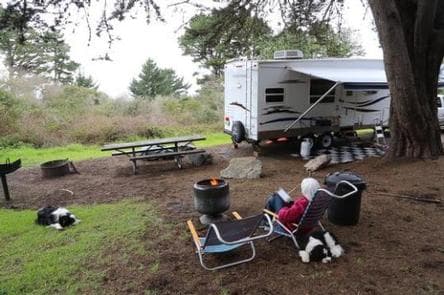
Overview Plaskett Creek Campground offers a beautiful location just minutes from Sand Dollar Beach, one of the largest and most popular beaches in central California. The campground gives visitors access to a variety of outdoor activities, including water play and exploration of the surrounding hills and forests. The family-friendly campground offers comfortably equipped sites, allowing anyone to enjoy a relaxing stay in the Los Padres National Forest. Recreation A short walk leads to Sand Dollar Beach, a very popular spot for surfing, fishing, swimming, exploring, sunbathing and more. Fishing permits are required for anyone over age 16. Anglers can expect a catch of yellow perch and other coastal surf fish. The beach is dog-friendly, as long as dogs are leashed and waste is picked up. A variety of trails exist along the beach, which lead to the bluffs that overlook the beach and coves in the area. Additional hiking, mountain biking and horseback riding trails can be accessed within a short drive from the campground, and offer scenic views of waterfalls, redwood groves and mountain meadows and streams. Facilities A short walk leads to Sand Dollar Beach, a very popular spot for surfing, fishing, swimming, exploring, sunbathing and more. Fishing permits are required for anyone over age 16. Anglers can expect a catch of yellow perch and other coastal surf fish. The beach is dog-friendly, as long as dogs are leashed and waste is picked up. A variety of trails exist along the beach, which lead to the bluffs that overlook the beach and coves in the area. Additional hiking, mountain biking and horseback riding trails can be accessed within a short drive from the campground, and offer scenic views of waterfalls, redwood groves and mountain meadows and streams. Natural Features The campground is located in west-central California, on the east side of Highway 1. Sand Dollar Beach, the largest sandy beach in the Big Sur area, is just south of the campground. The Pacific Ocean borders the campground to the west and the surf can be heard at many campsites. The campground has a park-like setting, under a scattered canopy of mature Monterey pine and cypress trees. Cedar trees provide a fragrant aroma. All sites are grassy. The campground is situated at an elevation of about 200 feet in the Los Padres National Forest. Wildlife in the area includes fox, bobcat, deer and raccoon. Mountain lions and bears are occasionally seen in the area, although they have never entered the campground.
View details →
Overview Nestled in the Santa Ynez Mountain Range, Sage Hill Campground is a great group camping spot with easy access to the Santa Ynez River. Spend time fishing or take in the epic scenery on one of the trails designed for both hikers and horseback riders. One of the campsites is designed for group equestrian camping and includes 12 corrals and a hitching post. Recreation Fishermen are likely to find carp, catfish, bluegill and the occasional bass that swim up from Cachuma. The Aliso Canyon Trail begins at the rear of the facility and continues to Upper Oso Campground, which is where the Santa Cruz Trail begins. The nearby Cachuma Lake Recreation Area is perfect for boating, fishing and kayaking. Facilities Fishermen are likely to find carp, catfish, bluegill and the occasional bass that swim up from Cachuma. The Aliso Canyon Trail begins at the rear of the facility and continues to Upper Oso Campground, which is where the Santa Cruz Trail begins. The nearby Cachuma Lake Recreation Area is perfect for boating, fishing and kayaking. Natural Features The campground sits in a flat area with some sites shaded by oak trees. Sage Hill is near the river, which flows into Cachuma Lake about seven miles west. The Santa Ynez Mountains make up part of the Transverse Range along the Pacific Coast of California. The landscape may become very dry by mid-summer. Nearby Attractions The campground is half an hour from the thriving beach city of Santa Barbara.
View details →
Overview Upper Oso Campground provides ample opportunity for exploration of California's coastal mountains. It is a family-friendly campground, equipped with equestrian sites, and is close to a variety of trails and several mountain streams. Recreation A variety of hiking, mountain biking and horseback riding trails begin in and around the campground, including the Santa Cruz Trail, which traverses 18 miles north to the San Rafael Wilderness. The 2.5-mile Aliso National Recreation Trail leads through scenic areas to a group campsite. Off-road vehicle enthusiasts enjoy the Camuesa OHV Route, which loops about 10 miles through the surrounding forest. Fishing and swimming are available at nearby White Rock Day-Use Area, less than two miles from the campground. The Santa Ynez River is stocked with trout in the springtime. Cachuma Lake Recreation Area, a no-body-contact reservoir, is about 10 miles northwest of the campground. It offers boating, fishing and kayaking. Anglers will find an abundance of annually stocked trout. Carp and bass are also common catches there. Facilities A variety of hiking, mountain biking and horseback riding trails begin in and around the campground, including the Santa Cruz Trail, which traverses 18 miles north to the San Rafael Wilderness. The 2.5-mile Aliso National Recreation Trail leads through scenic areas to a group campsite. Off-road vehicle enthusiasts enjoy the Camuesa OHV Route, which loops about 10 miles through the surrounding forest. Fishing and swimming are available at nearby White Rock Day-Use Area, less than two miles from the campground. The Santa Ynez River is stocked with trout in the springtime. Cachuma Lake Recreation Area, a no-body-contact reservoir, is about 10 miles northwest of the campground. It offers boating, fishing and kayaking. Anglers will find an abundance of annually stocked trout. Carp and bass are also common catches there. Natural Features The campground is located in the lower Santa Ynez Recreation Area, not far from Santa Barbara. The campground has large sites scattered among plentiful oak trees that provide pleasant shade. It is situated alongside a seasonal creek, at an elevation of 1,040 feet. Nearby Attractions The campground is located about 25 miles north of the city of Santa Barbara.
View details →
Overview Big Pine Equestrian Group Campground is a beautiful place to take the horses on a camping outing. The facility is comfortably equipped for the equestrian camper and is close to a variety of hiking, mountain biking and horseback riding trails. It is also not far from the scenic, year-round recreation destination of Big Bear Lake. Recreation Fishing and boating at Big Bear Lake are popular activities. Anglers can look forward to trout, bluegill, crappie, catfish and largemouth bass, among other species. Because of the very cold water and the presence of underwater obstacles near the shorelines, swimming at the lake is discouraged. Visitors also enjoy hiking and mountain biking. A variety of trailheads can be accessed near the campground. Off-road vehicle use is popular as well. Nearby Cactus Flats consists of approximately 68 miles of off-road vehicle and motorcycle trails. A picnic area is available at Cactus Flats. Facilities Fishing and boating at Big Bear Lake are popular activities. Anglers can look forward to trout, bluegill, crappie, catfish and largemouth bass, among other species. Because of the very cold water and the presence of underwater obstacles near the shorelines, swimming at the lake is discouraged. Visitors also enjoy hiking and mountain biking. A variety of trailheads can be accessed near the campground. Off-road vehicle use is popular as well. Nearby Cactus Flats consists of approximately 68 miles of off-road vehicle and motorcycle trails. A picnic area is available at Cactus Flats. Natural Features The campground is located in the San Bernardino Mountains at an elevation of 6,820 feet. It is situated in a hilly area dotted with mature evergreens. Wide open meadows exist throughout the area. The trees provide ample shade within the campground, however, there are some sunny spots. Nearby Attractions Markets and restaurants are available in Fawnskin, about 7 miles from the campground. Charges & Cancellations Rules & Reservation Policies As you make travel plans that include reservations on Recreation.gov, there are standard policies that apply to most locations of which you should be aware. Do keep in mind, however, that there are many exceptions, so it is best to review reservation information listed on individual facility pages for those policies and procedures that pertain to your specific locations. Any location or activity requiring a permit or lottery will have unique requirements and policies. Please check individual facility pages for pertinent information for those sites. Booking Window For most locations, you can reserve six months in advance of your stay for individual sites and 12 months in advance for group sites. There are some exceptions, so it is best to check with each facility. Change and Cancellation Policies and Fees Overnight and Day Use Facilities: To ensure fairness, reservation arrival or departure dates may not be changed beyond the booking window until 18 days after booking the reservation. Camping / Day Use: A $10.00 service fee will apply if you change or cancel your reservation (including campsites, cabins, lookouts, group facilities, etc.). The $10.00 service fee will be deducted from the refund amount. You can cancel or change reservations through Recreation.gov or by calling 1-877-444-6777. Tours & Tickets: You may request changes to tour dates at no cost before the arrival date. If you cancel before your tour date, you may be eligible for a refund. Cancellation fees apply. Please check the tour facility description details page for cancellation policies. Permits: Varies by location. Please check the permit details for the permit location. Late Cancellations Overnight and Day Use Facilities: Late cancellations are those cancelled between 12:01 a.m. (Eastern) on the day before arrival and check out time on the day after arrival. Individual Campsites: If a customer cancels a reservation the day before or on the day of arrival they will be charged a $10.00 service fee and will also forfeit the first night's use fee (not to exceed the total paid for the original reservation). Cancellations for a single night's reservation will forfeit the entire use fee but no cancellation fee will apply. Cabins / Lookouts: Customers will be charged a $10.00 cancellation fee and forfeit the first night's use fee if a cabin or lookout reservation is cancelled within 14 days of the scheduled arrival date. Cancellations for a single night's use will not be assessed a service fee. Group Facility: If a customer cancels a group overnight facility reservation within 14 days of the scheduled arrival date they will be charged the $10.00 service fee and forfeit the first night's use fee. Cancellations for a single night's use will not be assessed a service fee. Group Day Use Area: If a customer cancels a group day use facility reservation within 14 days of the scheduled arrival date, they will forfeit the total day use fee with no service fee charge. No-Shows Camping / Day Use: A camping no-show customer is one who does not arrive at a campground and does not cancel the reservation by check-out time on the day after the scheduled arrival date. Reserved campsites and group overnight facilities will be held until check-out time on the day following your scheduled arrival. Group day-use facilities will be held until check-in time on your scheduled arrival date. If a customer does not arrive at the campground or group facility by check-out time the day after arrival or does not cancel the reservation by the times listed under "Late Cancellations" above, the customer may be assessed a $20.00 service fee and forfeit use fees. Tours: A tour or ticket no-show is one who does not cancel a ticket before arrival and does not arrive for the tour. Tour no-shows are not entitled to a refund. Refunds Customers must request refunds no later than 14 days after the scheduled departure date. Recreation.gov will not grant refund requests after 14 days of departure. Reservation Fee: For some facilities, tours or permits an additional reservation fee is charged. For some overnight and day-use facilities, an additional non-refundable reservation fee may apply. The non-refundable reservation fee for tours and tickets is $1.00. The non-refundable reservation fee for permits varies by location. Refunds for Bankcard Purchases: Refunds for bank card payments will be issued as a credit to the original bank card. Refunds for Check or Cash Purchases: Refunds for Recreation.gov payments made by check or money order, and cash payments at selected campgrounds will be issued a check refund. A refund will be processed within 30 days of receipt and approval. Please Note: Refund requests made during or after departure can only be processed when approved by the facility management staff based upon local policy. Refunds for Emergency Closures: In the event of an emergency closure, the Recreation.gov team will attempt to notify users and offer alternate dates (as appropriate). If this is not possible, reservations will be cancelled and all fees paid will be refunded. Reservation fees for free tickets are non-refundable in the event of an emergency closure. Recreation.gov Billing Information Reservation transaction will appear on customer's credit card statements as "Recreation.gov 877-444-6777." Changes to Policies and Procedures Recreation.gov reserves the right, when necessary, to modify reservation policies. These policies were last updated July
View details →
Overview Bluff Mesa Group Campground is conveniently located for campers to enjoy all the beautiful Big Bear Lake area has to offer. A variety of trailheads are nearby, leading visitors through the scenic forest that surrounds the campground. Recreation A variety of hiking and mountain biking trails can be accessed from the campground, and rock climbing routes can be found nearby. Fishing, boating and swimming at Big Bear Lake are popular activities. Anglers can look forward to trout, bluegill, crappie, catfish and largemouth bass, among other fish. The lake is less than 10 miles from the campground. Facilities A variety of hiking and mountain biking trails can be accessed from the campground, and rock climbing routes can be found nearby. Fishing, boating and swimming at Big Bear Lake are popular activities. Anglers can look forward to trout, bluegill, crappie, catfish and largemouth bass, among other fish. The lake is less than 10 miles from the campground. Natural Features The campground is located 45 miles from San Bernardino at an elevation of 6,800 feet. It is accessed via a dirt road, and is nestled in a secluded, mixed conifer forest with a grassy understory. Mature trees provide much shade throughout the area, but open meadows are also available. Nearby Attractions The Big Bear Discovery Center is located about 10 miles from the campground, on the other side of Big Bear Lake. A visitor center, interpretive trails and educational programs are available, as well as accessible flush restroom facilities. Charges & Cancellations Rules & Reservation Policies As you make travel plans that include reservations on Recreation.gov, there are standard policies that apply to most locations of which you should be aware. Do keep in mind, however, that there are many exceptions, so it is best to review reservation information listed on individual facility pages for those policies and procedures that pertain to your specific locations. Any location or activity requiring a permit or lottery will have unique requirements and policies. Please check individual facility pages for pertinent information for those sites. Booking Window For most locations, you can reserve six months in advance of your stay for individual sites and 12 months in advance for group sites. There are some exceptions, so it is best to check with each facility. Change and Cancellation Policies and Fees Overnight and Day Use Facilities: To ensure fairness, reservation arrival or departure dates may not be changed beyond the booking window until 18 days after booking the reservation. Camping / Day Use: A $10.00 service fee will apply if you change or cancel your reservation (including campsites, cabins, lookouts, group facilities, etc.). The $10.00 service fee will be deducted from the refund amount. You can cancel or change reservations through Recreation.gov or by calling 1-877-444-6777. Tours & Tickets: You may request changes to tour dates at no cost before the arrival date. If you cancel before your tour date, you may be eligible for a refund. Cancellation fees apply. Please check the tour facility description details page for cancellation policies. Permits: Varies by location. Please check the permit details for the permit location. Late Cancellations Overnight and Day Use Facilities: Late cancellations are those cancelled between 12:01 a.m. (Eastern) on the day before arrival and check out time on the day after arrival. Individual Campsites: If a customer cancels a reservation the day before or on the day of arrival they will be charged a $10.00 service fee and will also forfeit the first night's use fee (not to exceed the total paid for the original reservation). Cancellations for a single night's reservation will forfeit the entire use fee but no cancellation fee will apply. Cabins / Lookouts: Customers will be charged a $10.00 cancellation fee and forfeit the first night's use fee if a cabin or lookout reservation is cancelled within 14 days of the scheduled arrival date. Cancellations for a single night's use will not be assessed a service fee. Group Facility: If a customer cancels a group overnight facility reservation within 14 days of the scheduled arrival date they will be charged the $10.00 service fee and forfeit the first night's use fee. Cancellations for a single night's use will not be assessed a service fee. Group Day Use Area: If a customer cancels a group day use facility reservation within 14 days of the scheduled arrival date, they will forfeit the total day use fee with no service fee charge. No-Shows Camping / Day Use: A camping no-show customer is one who does not arrive at a campground and does not cancel the reservation by check-out time on the day after the scheduled arrival date. Reserved campsites and group overnight facilities will be held until check-out time on the day following your scheduled arrival. Group day-use facilities will be held until check-in time on your scheduled arrival date. If a customer does not arrive at the campground or group facility by check-out time the day after arrival or does not cancel the reservation by the times listed under "Late Cancellations" above, the customer may be assessed a $20.00 service fee and forfeit use fees. Tours: A tour or ticket no-show is one who does not cancel a ticket before arrival and does not arrive for the tour. Tour no-shows are not entitled to a refund. Refunds Customers must request refunds no later than 14 days after the scheduled departure date. Recreation.gov will not grant refund requests after 14 days of departure. Reservation Fee: For some facilities, tours or permits an additional reservation fee is charged. For some overnight and day-use facilities, an additional non-refundable reservation fee may apply. The non-refundable reservation fee for tours and tickets is $1.00. The non-refundable reservation fee for permits varies by location. Refunds for Bankcard Purchases: Refunds for bank card payments will be issued as a credit to the original bank card. Refunds for Check or Cash Purchases: Refunds for Recreation.gov payments made by check or money order, and cash payments at selected campgrounds will be issued a check refund. A refund will be processed within 30 days of receipt and approval. Please Note: Refund requests made during or after departure can only be processed when approved by the facility management staff based upon local policy. Refunds for Emergency Closures: In the event of an emergency closure, the Recreation.gov team will attempt to notify users and offer alternate dates (as appropriate). If this is not possible, reservations will be cancelled and all fees paid will be refunded. Reservation fees for free tickets are non-refundable in the event of an emergency closure. Recreation.gov Billing Information Reservation transaction will appear on customer's credit card statements as "Recreation.gov 877-444-6777." Changes to Policies and Procedures Recreation.gov reserves the right, when necessary, to modify reservation policies. These policies were last updated July
View details →
Overview Boulder Group Campground is a great place to bring an extended family or large group for a relaxing camping excursion. Its convenient location provides access to all of the area's greatest recreation opportunities and lets campers relax and enjoy nature in the pine-covered mountains of Southern California. Recreation The campground provides access to a variety of hiking and mountain biking trails, including the Seven Oaks Trail, which is west of Big Bear Lake Village. The 30-year-old trail is overgrown in some areas, but leads to spectacular views of San Gorgonio Peak, the highest point in Southern California. Fishing, boating and swimming at Big Bear Lake are popular activities. Anglers can look forward to trout, bluegill, crappie, catfish and largemouth bass, among other fish. Facilities The campground provides access to a variety of hiking and mountain biking trails, including the Seven Oaks Trail, which is west of Big Bear Lake Village. The 30-year-old trail is overgrown in some areas, but leads to spectacular views of San Gorgonio Peak, the highest point in Southern California. Fishing, boating and swimming at Big Bear Lake are popular activities. Anglers can look forward to trout, bluegill, crappie, catfish and largemouth bass, among other fish. Natural Features The group campground is located in the San Bernardino National Forest, south of Big Bear Lake. It is accessed via a dirt road, just off the main highway through the area. The campground is situated in a somewhat secluded stand of mature conifers, which provide much shade. Nearby Attractions The Big Bear Discovery Center is located about 10 miles from the campground. It provides a variety information about the area, a gift shop, accessible educational programs and restroom facilities. An interpretive trail is available near the center. Charges & Cancellations Rules & Reservation Policies As you make travel plans that include reservations on Recreation.gov, there are standard policies that apply to most locations of which you should be aware. Do keep in mind, however, that there are many exceptions, so it is best to review reservation information listed on individual facility pages for those policies and procedures that pertain to your specific locations. Any location or activity requiring a permit or lottery will have unique requirements and policies. Please check individual facility pages for pertinent information for those sites. Booking Window For most locations, you can reserve six months in advance of your stay for individual sites and 12 months in advance for group sites. There are some exceptions, so it is best to check with each facility. Change and Cancellation Policies and Fees Overnight and Day Use Facilities: To ensure fairness, reservation arrival or departure dates may not be changed beyond the booking window until 18 days after booking the reservation. Camping / Day Use: A $10.00 service fee will apply if you change or cancel your reservation (including campsites, cabins, lookouts, group facilities, etc.). The $10.00 service fee will be deducted from the refund amount. You can cancel or change reservations through Recreation.gov or by calling 1-877-444-6777. Tours & Tickets: You may request changes to tour dates at no cost before the arrival date. If you cancel before your tour date, you may be eligible for a refund. Cancellation fees apply. Please check the tour facility description details page for cancellation policies. Permits: Varies by location. Please check the permit details for the permit location. Late Cancellations Overnight and Day Use Facilities: Late cancellations are those cancelled between 12:01 a.m. (Eastern) on the day before arrival and check out time on the day after arrival. Individual Campsites: If a customer cancels a reservation the day before or on the day of arrival they will be charged a $10.00 service fee and will also forfeit the first night's use fee (not to exceed the total paid for the original reservation). Cancellations for a single night's reservation will forfeit the entire use fee but no cancellation fee will apply. Cabins / Lookouts: Customers will be charged a $10.00 cancellation fee and forfeit the first night's use fee if a cabin or lookout reservation is cancelled within 14 days of the scheduled arrival date. Cancellations for a single night's use will not be assessed a service fee. Group Facility: If a customer cancels a group overnight facility reservation within 14 days of the scheduled arrival date they will be charged the $10.00 service fee and forfeit the first night's use fee. Cancellations for a single night's use will not be assessed a service fee. Group Day Use Area: If a customer cancels a group day use facility reservation within 14 days of the scheduled arrival date, they will forfeit the total day use fee with no service fee charge. No-Shows Camping / Day Use: A camping no-show customer is one who does not arrive at a campground and does not cancel the reservation by check-out time on the day after the scheduled arrival date. Reserved campsites and group overnight facilities will be held until check-out time on the day following your scheduled arrival. Group day-use facilities will be held until check-in time on your scheduled arrival date. If a customer does not arrive at the campground or group facility by check-out time the day after arrival or does not cancel the reservation by the times listed under "Late Cancellations" above, the customer may be assessed a $20.00 service fee and forfeit use fees. Tours: A tour or ticket no-show is one who does not cancel a ticket before arrival and does not arrive for the tour. Tour no-shows are not entitled to a refund. Refunds Customers must request refunds no later than 14 days after the scheduled departure date. Recreation.gov will not grant refund requests after 14 days of departure. Reservation Fee: For some facilities, tours or permits an additional reservation fee is charged. For some overnight and day-use facilities, an additional non-refundable reservation fee may apply. The non-refundable reservation fee for tours and tickets is $1.00. The non-refundable reservation fee for permits varies by location. Refunds for Bankcard Purchases: Refunds for bank card payments will be issued as a credit to the original bank card. Refunds for Check or Cash Purchases: Refunds for Recreation.gov payments made by check or money order, and cash payments at selected campgrounds will be issued a check refund. A refund will be processed within 30 days of receipt and approval. Please Note: Refund requests made during or after departure can only be processed when approved by the facility management staff based upon local policy. Refunds for Emergency Closures: In the event of an emergency closure, the Recreation.gov team will attempt to notify users and offer alternate dates (as appropriate). If this is not possible, reservations will be cancelled and all fees paid will be refunded. Reservation fees for free tickets are non-refundable in the event of an emergency closure. Recreation.gov Billing Information Reservation transaction will appear on customer's credit card statements as "Recreation.gov 877-444-6777." Changes to Policies and Procedures Recreation.gov reserves the right, when necessary, to modify reservation policies. These policies were last updated July
View details →
Overview Buttercup Group Camp is an outdoor oasis nestled in Southern California's pine-covered mountains. Big Bear Lake is nearby, a popular destination for a variety of recreational activities. The campground offers a great escape from city life and it is one of the best locales for group camping. Recreation Fishing and boating at Big Bear Lake are popular activities. Anglers can look forward to trout, bluegill, crappie, catfish and largemouth bass, among other species. Because of the very cold water and the presence of underwater obstacles near the shoreline, swimming at the lake is sometimes discouraged. Visitors also enjoy the area's plentiful hiking, mountain biking and climbing opportunities. The campground provides access to a number of trails and points of exploration. Facilities Fishing and boating at Big Bear Lake are popular activities. Anglers can look forward to trout, bluegill, crappie, catfish and largemouth bass, among other species. Because of the very cold water and the presence of underwater obstacles near the shoreline, swimming at the lake is sometimes discouraged. Visitors also enjoy the area's plentiful hiking, mountain biking and climbing opportunities. The campground provides access to a number of trails and points of exploration. Natural Features The group campground is situated at an elevation of about 7,000 feet and is heavily forested with pine trees. The site is relatively shady and secluded. It is about two miles from Big Bear Lake and is accessed by a dirt road. Nearby Attractions A general store and restaurants can be found in the city of Big Bear Lake.
View details →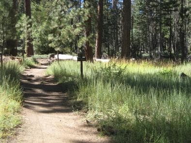
Overview Deer Group Campground is a great place to bring an extended family or large group. Its convenient location provides access to all of the area's greatest recreation opportunities and lets campers relax and enjoy nature in the pine-covered mountains of Southern California. Recreation A variety of hiking and mountain biking trails can be accessed from the campground, including the Seven Oaks Trail, which is located west of the Big Bear Lake Village. The 30-year-old trail is overgrown in some areas, but leads to spectacular views of San Gorgonio Peak, the highest point in Southern California. Fishing and boating at Big Bear Lake are popular activities. Anglers can look forward to trout, bluegill, crappie, catfish and largemouth bass, among other fish. Because of cold water temperatures and the presence of underwater obstacles near the shorelines, swimming at the lake is somewhat discouraged, unless done in designated areas. Facilities A variety of hiking and mountain biking trails can be accessed from the campground, including the Seven Oaks Trail, which is located west of the Big Bear Lake Village. The 30-year-old trail is overgrown in some areas, but leads to spectacular views of San Gorgonio Peak, the highest point in Southern California. Fishing and boating at Big Bear Lake are popular activities. Anglers can look forward to trout, bluegill, crappie, catfish and largemouth bass, among other fish. Because of cold water temperatures and the presence of underwater obstacles near the shorelines, swimming at the lake is somewhat discouraged, unless done in designated areas. Natural Features This group campground is located in the San Bernardino National Forest, south of Big Bear Lake. It is situated in a somewhat secluded stand of conifers. The mature trees provide much shade for the campground. Nearby Attractions The Big Bear Discovery Center is located about 10 miles from the campground. It provides a variety area information, a gift shop, accessible educational programs and restroom facilities. An interpretive trail is available near the center. Charges & Cancellations Rules & Reservation Policies As you make travel plans that include reservations on Recreation.gov, there are standard policies that apply to most locations of which you should be aware. Do keep in mind, however, that there are many exceptions, so it is best to review reservation information listed on individual facility pages for those policies and procedures that pertain to your specific locations. Any location or activity requiring a permit or lottery will have unique requirements and policies. Please check individual facility pages for pertinent information for those sites. Booking Window For most locations, you can reserve six months in advance of your stay for individual sites and 12 months in advance for group sites. There are some exceptions, so it is best to check with each facility. Change and Cancellation Policies and Fees Overnight and Day Use Facilities: To ensure fairness, reservation arrival or departure dates may not be changed beyond the booking window until 18 days after booking the reservation. Camping / Day Use: A $10.00 service fee will apply if you change or cancel your reservation (including campsites, cabins, lookouts, group facilities, etc.). The $10.00 service fee will be deducted from the refund amount. You can cancel or change reservations through Recreation.gov or by calling 1-877-444-6777. Tours & Tickets: You may request changes to tour dates at no cost before the arrival date. If you cancel before your tour date, you may be eligible for a refund. Cancellation fees apply. Please check the tour facility description details page for cancellation policies. Permits: Varies by location. Please check the permit details for the permit location. Late Cancellations Overnight and Day Use Facilities: Late cancellations are those cancelled between 12:01 a.m. (Eastern) on the day before arrival and check out time on the day after arrival. Individual Campsites: If a customer cancels a reservation the day before or on the day of arrival they will be charged a $10.00 service fee and will also forfeit the first night's use fee (not to exceed the total paid for the original reservation). Cancellations for a single night's reservation will forfeit the entire use fee but no cancellation fee will apply. Cabins / Lookouts: Customers will be charged a $10.00 cancellation fee and forfeit the first night's use fee if a cabin or lookout reservation is cancelled within 14 days of the scheduled arrival date. Cancellations for a single night's use will not be assessed a service fee. Group Facility: If a customer cancels a group overnight facility reservation within 14 days of the scheduled arrival date they will be charged the $10.00 service fee and forfeit the first night's use fee. Cancellations for a single night's use will not be assessed a service fee. Group Day Use Area: If a customer cancels a group day use facility reservation within 14 days of the scheduled arrival date, they will forfeit the total day use fee with no service fee charge. No-Shows Camping / Day Use: A camping no-show customer is one who does not arrive at a campground and does not cancel the reservation by check-out time on the day after the scheduled arrival date. Reserved campsites and group overnight facilities will be held until check-out time on the day following your scheduled arrival. Group day-use facilities will be held until check-in time on your scheduled arrival date. If a customer does not arrive at the campground or group facility by check-out time the day after arrival or does not cancel the reservation by the times listed under "Late Cancellations" above, the customer may be assessed a $20.00 service fee and forfeit use fees. Tours: A tour or ticket no-show is one who does not cancel a ticket before arrival and does not arrive for the tour. Tour no-shows are not entitled to a refund. Refunds Customers must request refunds no later than 14 days after the scheduled departure date. Recreation.gov will not grant refund requests after 14 days of departure. Reservation Fee: For some facilities, tours or permits an additional reservation fee is charged. For some overnight and day-use facilities, an additional non-refundable reservation fee may apply. The non-refundable reservation fee for tours and tickets is $1.00. The non-refundable reservation fee for permits varies by location. Refunds for Bankcard Purchases: Refunds for bank card payments will be issued as a credit to the original bank card. Refunds for Check or Cash Purchases: Refunds for Recreation.gov payments made by check or money order, and cash payments at selected campgrounds will be issued a check refund. A refund will be processed within 30 days of receipt and approval. Please Note: Refund requests made during or after departure can only be processed when approved by the facility management staff based upon local policy. Refunds for Emergency Closures: In the event of an emergency closure, the Recreation.gov team will attempt to notify users and offer alternate dates (as appropriate). If this is not possible, reservations will be cancelled and all fees paid will be refunded. Reservation fees for free tickets are non-refundable in the event of an emergency closure. Recreation.gov Billing Information Reservation transaction will appear on customer's credit card statements as "Recreation.gov 877-444-6777." Changes to Policies and Procedures Recreation.gov reserves the right, when necessary, to modify reservation policies. These policies were last updated July
View details →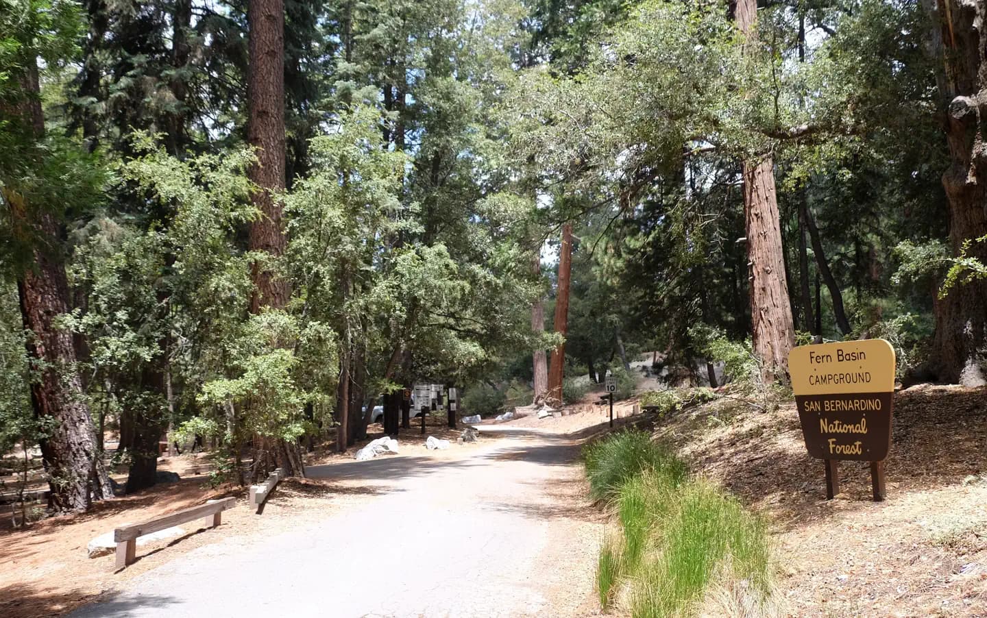
Overview The picturesque Fern Basin Campground is a perfect escape from a busy lifestyle. It provides peace and quiet in the mountains of southern California as well as access to countless recreational opportunities. The San Bernardino National Forest is submitting a proposal to increase fees at various sites across the Forest and is seeking public input. Please visit the https://www.fs.usda.gov/sbnf for more information and to submit comments regarding this proposal. Recreation Visitors to the area enjoy hiking on the Marion Mountain Trail, which leads to San Jacinto Peak. Views from the peak extend to the ocean and across the Palm Desert, as well as the San Bernardino and San Gabriel mountains on a clear day. The 11.8-mile Marion Mountain Trail is the shortest route up the mountain, but is also quite strenuous in areas. Facilities Visitors to the area enjoy hiking on the Marion Mountain Trail, which leads to San Jacinto Peak. Views from the peak extend to the ocean and across the Palm Desert, as well as the San Bernardino and San Gabriel mountains on a clear day. The 11.8-mile Marion Mountain Trail is the shortest route up the mountain, but is also quite strenuous in areas. Natural Features The campground is located in a grove of mixed oaks and shrubs. A surrounding mixed conifer forest provides spotty shade for the campground. It is situated at an elevation of about 6,300 feet, in the mountains overlooking California's desert. Nearby Attractions The campground is located approximately 50 miles southeast of San Bernardino, California, and about seven miles north of the small town of Idyllwild, which is known for its shops and restaurants.
View details →
Overview Grays Peak Group Campground is conveniently located for campers to enjoy all that the Big Bear Lake area has to offer. Many trailheads are nearby, leading visitors through the scenic forest that surrounds the campground. Recreation The campground provides access to a variety of hiking and mountain biking trails, including the Grays Peak Trail, which leads to Hanna Flat Campground. The 3.4-mile trail starts with some steep climbing before easing into a gradual incline after a mile. The Butler Park Fire Lookout is a short, 1-mile hike or bike from the campground. Fishing and boating in nearby Big Bear Lake are popular activities. Anglers can look forward to a catch of trout, bluegill, crappie, catfish and largemouth bass. Because of cold water temperatures and the presence of underwater obstacles near the shorelines, swimming at the lake is somewhat discouraged, unless done in designated areas. Facilities The campground provides access to a variety of hiking and mountain biking trails, including the Grays Peak Trail, which leads to Hanna Flat Campground. The 3.4-mile trail starts with some steep climbing before easing into a gradual incline after a mile. The Butler Park Fire Lookout is a short, 1-mile hike or bike from the campground. Fishing and boating in nearby Big Bear Lake are popular activities. Anglers can look forward to a catch of trout, bluegill, crappie, catfish and largemouth bass. Because of cold water temperatures and the presence of underwater obstacles near the shorelines, swimming at the lake is somewhat discouraged, unless done in designated areas. Natural Features The campground is located 45 miles outside San Bernardino at an elevation of 7,132 feet. It is nestled in a mixed conifer forest with a grassy understory. Mature trees provide much shade throughout the area, but open meadows are also available. Nearby Attractions The Big Bear Discovery Center is located about 5 miles from the campground. A variety of information regarding the area, a gift shop, educational programs, an interpretive trail and restroom facilities are available.
View details →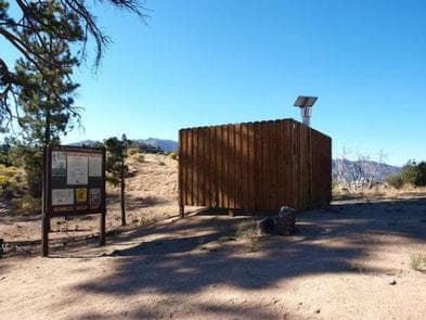
Overview Ironwood Group Campground offers a secluded place for an extended family or large group getaway in the mountains of Southern California. A variety of outdoor recreational opportunities, including hiking, mountain biking, target shooting, fishing and boating, can be found in the surrounding area. Recreation The campground is not far from the Big Pine Flat Recreational Shooting Range, where designated target shooting is available. A variety of hiking, horseback riding and mountain biking trails are in the area. Fishing and boating at nearby Big Bear Lake are also popular activities. Anglers can look forward to a catch of trout, bluegill, crappie, catfish and largemouth bass. Because of cold water temperatures and the presence of underwater obstacles near the shorelines, swimming at the lake is somewhat discouraged, unless done in designated areas. Facilities The campground is not far from the Big Pine Flat Recreational Shooting Range, where designated target shooting is available. A variety of hiking, horseback riding and mountain biking trails are in the area. Fishing and boating at nearby Big Bear Lake are also popular activities. Anglers can look forward to a catch of trout, bluegill, crappie, catfish and largemouth bass. Because of cold water temperatures and the presence of underwater obstacles near the shorelines, swimming at the lake is somewhat discouraged, unless done in designated areas. Natural Features The campground is located near the town of Fawnskin, a few miles north of Big Bear Lake, at an elevation of 6,637 feet. It is situated in a pine forest with a grassy meadow. Mature trees provide ample shade in the campground. Nearby Attractions A general store and restaurants are available in Fawnskin, 7 miles from the campground. Charges & Cancellations Rules & Reservation Policies As you make travel plans that include reservations on Recreation.gov, there are standard policies that apply to most locations of which you should be aware. Do keep in mind, however, that there are many exceptions, so it is best to review reservation information listed on individual facility pages for those policies and procedures that pertain to your specific locations. Any location or activity requiring a permit or lottery will have unique requirements and policies. Please check individual facility pages for pertinent information for those sites. Booking Window For most locations, you can reserve six months in advance of your stay for individual sites and 12 months in advance for group sites. There are some exceptions, so it is best to check with each facility. Change and Cancellation Policies and Fees Overnight and Day Use Facilities: To ensure fairness, reservation arrival or departure dates may not be changed beyond the booking window until 18 days after booking the reservation. Camping / Day Use: A $10.00 service fee will apply if you change or cancel your reservation (including campsites, cabins, lookouts, group facilities, etc.). The $10.00 service fee will be deducted from the refund amount. You can cancel or change reservations through Recreation.gov or by calling 1-877-444-6777. Tours & Tickets: You may request changes to tour dates at no cost before the arrival date. If you cancel before your tour date, you may be eligible for a refund. Cancellation fees apply. Please check the tour facility description details page for cancellation policies. Permits: Varies by location. Please check the permit details for the permit location. Late Cancellations Overnight and Day Use Facilities: Late cancellations are those cancelled between 12:01 a.m. (Eastern) on the day before arrival and check out time on the day after arrival. Individual Campsites: If a customer cancels a reservation the day before or on the day of arrival they will be charged a $10.00 service fee and will also forfeit the first night's use fee (not to exceed the total paid for the original reservation). Cancellations for a single night's reservation will forfeit the entire use fee but no cancellation fee will apply. Cabins / Lookouts: Customers will be charged a $10.00 cancellation fee and forfeit the first night's use fee if a cabin or lookout reservation is cancelled within 14 days of the scheduled arrival date. Cancellations for a single night's use will not be assessed a service fee. Group Facility: If a customer cancels a group overnight facility reservation within 14 days of the scheduled arrival date they will be charged the $10.00 service fee and forfeit the first night's use fee. Cancellations for a single night's use will not be assessed a service fee. Group Day Use Area: If a customer cancels a group day use facility reservation within 14 days of the scheduled arrival date, they will forfeit the total day use fee with no service fee charge. No-Shows Camping / Day Use: A camping no-show customer is one who does not arrive at a campground and does not cancel the reservation by check-out time on the day after the scheduled arrival date. Reserved campsites and group overnight facilities will be held until check-out time on the day following your scheduled arrival. Group day-use facilities will be held until check-in time on your scheduled arrival date. If a customer does not arrive at the campground or group facility by check-out time the day after arrival or does not cancel the reservation by the times listed under "Late Cancellations" above, the customer may be assessed a $20.00 service fee and forfeit use fees. Tours: A tour or ticket no-show is one who does not cancel a ticket before arrival and does not arrive for the tour. Tour no-shows are not entitled to a refund. Refunds Customers must request refunds no later than 14 days after the scheduled departure date. Recreation.gov will not grant refund requests after 14 days of departure. Reservation Fee: For some facilities, tours or permits an additional reservation fee is charged. For some overnight and day-use facilities, an additional non-refundable reservation fee may apply. The non-refundable reservation fee for tours and tickets is $1.00. The non-refundable reservation fee for permits varies by location. Refunds for Bankcard Purchases: Refunds for bank card payments will be issued as a credit to the original bank card. Refunds for Check or Cash Purchases: Refunds for Recreation.gov payments made by check or money order, and cash payments at selected campgrounds will be issued a check refund. A refund will be processed within 30 days of receipt and approval. Please Note: Refund requests made during or after departure can only be processed when approved by the facility management staff based upon local policy. Refunds for Emergency Closures: In the event of an emergency closure, the Recreation.gov team will attempt to notify users and offer alternate dates (as appropriate). If this is not possible, reservations will be cancelled and all fees paid will be refunded. Reservation fees for free tickets are non-refundable in the event of an emergency closure. Recreation.gov Billing Information Reservation transaction will appear on customer's credit card statements as "Recreation.gov 877-444-6777." Changes to Policies and Procedures Recreation.gov reserves the right, when necessary, to modify reservation policies. These policies were last updated July
View details →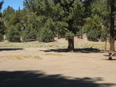
Overview Juniper Springs Group Campground is a primitive facility located about 10 miles from Big Bear Lake, a scenic, year-round recreation destination. The camp offers a great location from which to explore the mountains of Southern California. Recreation Visitors enjoy hiking and mountain biking from a variety of trailheads that can be accessed near the campground. Off-road vehicle use is popular as well. Nearby Cactus Flats contains approximately 68 miles of off-road vehicle trails. A picnic area is also available at Cactus Flats. Fishing and boating are popular activities at nearby Big Bear Lake. Anglers can look forward to a catch of trout, bluegill, crappie, catfish and largemouth bass, among other species. Because of the very cold water and the presence of underwater obstacles near the shorelines, swimming at the lake is discouraged. Facilities Visitors enjoy hiking and mountain biking from a variety of trailheads that can be accessed near the campground. Off-road vehicle use is popular as well. Nearby Cactus Flats contains approximately 68 miles of off-road vehicle trails. A picnic area is also available at Cactus Flats. Fishing and boating are popular activities at nearby Big Bear Lake. Anglers can look forward to a catch of trout, bluegill, crappie, catfish and largemouth bass, among other species. Because of the very cold water and the presence of underwater obstacles near the shorelines, swimming at the lake is discouraged. Natural Features The campground is located in the San Bernardino Mountains at an elevation of 7,739 feet, where ponderosa pines dot the site. A pinyon pine and juniper woodland and meadow surround the area and a small pond is on-site. Nearby Attractions A grocery store, general store and restaurants can be found 11 miles away in Big Bear Lake. Showers are available at Serrano Campground, 15 miles from Juniper Springs. San Bernardino is about 50 miles away. Charges & Cancellations Rules & Reservation Policies As you make travel plans that include reservations on Recreation.gov, there are standard policies that apply to most locations of which you should be aware. Do keep in mind, however, that there are many exceptions, so it is best to review reservation information listed on individual facility pages for those policies and procedures that pertain to your specific locations. Any location or activity requiring a permit or lottery will have unique requirements and policies. Please check individual facility pages for pertinent information for those sites. Booking Window For most locations, you can reserve six months in advance of your stay for individual sites and 12 months in advance for group sites. There are some exceptions, so it is best to check with each facility. Change and Cancellation Policies and Fees Overnight and Day Use Facilities: To ensure fairness, reservation arrival or departure dates may not be changed beyond the booking window until 18 days after booking the reservation. Camping / Day Use: A $10.00 service fee will apply if you change or cancel your reservation (including campsites, cabins, lookouts, group facilities, etc.). The $10.00 service fee will be deducted from the refund amount. You can cancel or change reservations through Recreation.gov or by calling 1-877-444-6777. Tours & Tickets: You may request changes to tour dates at no cost before the arrival date. If you cancel before your tour date, you may be eligible for a refund. Cancellation fees apply. Please check the tour facility description details page for cancellation policies. Permits: Varies by location. Please check the permit details for the permit location. Late Cancellations Overnight and Day Use Facilities: Late cancellations are those cancelled between 12:01 a.m. (Eastern) on the day before arrival and check out time on the day after arrival. Individual Campsites: If a customer cancels a reservation the day before or on the day of arrival they will be charged a $10.00 service fee and will also forfeit the first night's use fee (not to exceed the total paid for the original reservation). Cancellations for a single night's reservation will forfeit the entire use fee but no cancellation fee will apply. Cabins / Lookouts: Customers will be charged a $10.00 cancellation fee and forfeit the first night's use fee if a cabin or lookout reservation is cancelled within 14 days of the scheduled arrival date. Cancellations for a single night's use will not be assessed a service fee. Group Facility: If a customer cancels a group overnight facility reservation within 14 days of the scheduled arrival date they will be charged the $10.00 service fee and forfeit the first night's use fee. Cancellations for a single night's use will not be assessed a service fee. Group Day Use Area: If a customer cancels a group day use facility reservation within 14 days of the scheduled arrival date, they will forfeit the total day use fee with no service fee charge. No-Shows Camping / Day Use: A camping no-show customer is one who does not arrive at a campground and does not cancel the reservation by check-out time on the day after the scheduled arrival date. Reserved campsites and group overnight facilities will be held until check-out time on the day following your scheduled arrival. Group day-use facilities will be held until check-in time on your scheduled arrival date. If a customer does not arrive at the campground or group facility by check-out time the day after arrival or does not cancel the reservation by the times listed under "Late Cancellations" above, the customer may be assessed a $20.00 service fee and forfeit use fees. Tours: A tour or ticket no-show is one who does not cancel a ticket before arrival and does not arrive for the tour. Tour no-shows are not entitled to a refund. Refunds Customers must request refunds no later than 14 days after the scheduled departure date. Recreation.gov will not grant refund requests after 14 days of departure. Reservation Fee: For some facilities, tours or permits an additional reservation fee is charged. For some overnight and day-use facilities, an additional non-refundable reservation fee may apply. The non-refundable reservation fee for tours and tickets is $1.00. The non-refundable reservation fee for permits varies by location. Refunds for Bankcard Purchases: Refunds for bank card payments will be issued as a credit to the original bank card. Refunds for Check or Cash Purchases: Refunds for Recreation.gov payments made by check or money order, and cash payments at selected campgrounds will be issued a check refund. A refund will be processed within 30 days of receipt and approval. Please Note: Refund requests made during or after departure can only be processed when approved by the facility management staff based upon local policy. Refunds for Emergency Closures: In the event of an emergency closure, the Recreation.gov team will attempt to notify users and offer alternate dates (as appropriate). If this is not possible, reservations will be cancelled and all fees paid will be refunded. Reservation fees for free tickets are non-refundable in the event of an emergency closure. Recreation.gov Billing Information Reservation transaction will appear on customer's credit card statements as "Recreation.gov 877-444-6777." Changes to Policies and Procedures Recreation.gov reserves the right, when necessary, to modify reservation policies. These policies were last updated July
View details →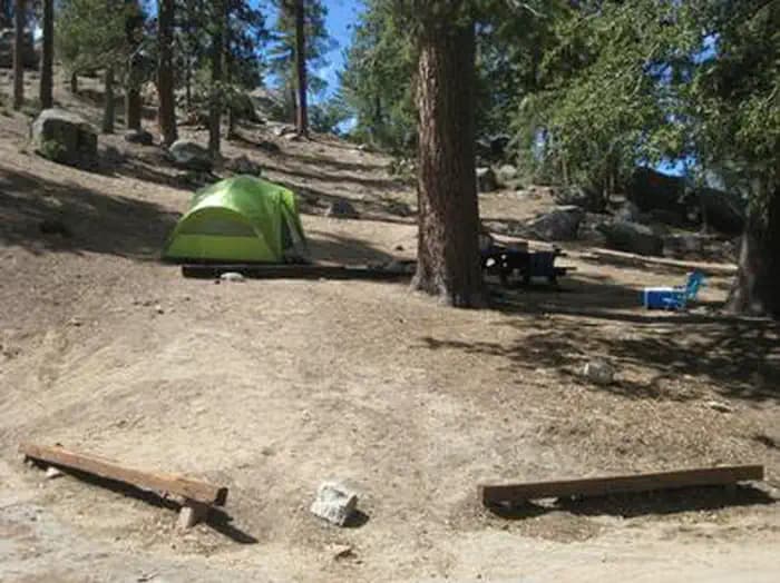
Overview The Marion Mountain Campground offers a beautiful retreat in the San Bernardino National Forest. It provides access to a number of hiking trails that lead to some of the most spectacular views of Southern California. The San Bernardino National Forest is submitting a proposal to increase fees at various sites across the Forest and is seeking public input. Please visit the https://www.fs.usda.gov/sbnf for more information and to submit comments regarding this proposal. Recreation Visitors enjoy sport climbing on rocks within the campground. Hiking on the nearby Marion Mountain Trail, which leads to San Jacinto Peak, is also available. Views from the peak extend to the ocean and across the Palm Desert, as well as the San Bernardino and San Gabriel mountains on a clear day. The 11.8-mile Marion Mountain Trail is the shortest route up the mountain, but also quite strenuous in areas. Shorter hikes can be enjoyed on other nearby trails. Facilities Visitors enjoy sport climbing on rocks within the campground. Hiking on the nearby Marion Mountain Trail, which leads to San Jacinto Peak, is also available. Views from the peak extend to the ocean and across the Palm Desert, as well as the San Bernardino and San Gabriel mountains on a clear day. The 11.8-mile Marion Mountain Trail is the shortest route up the mountain, but also quite strenuous in areas. Shorter hikes can be enjoyed on other nearby trails. Natural Features The campground is located in a forested area at an elevation of 6,400 feet. Mature cedar and pine trees provide ample shade and privacy between campsites. Nearby Attractions The campground is located approximately 50 miles from San Bernardino, California, and seven miles north of Idyllwild, which is popular for its small-town atmosphere and variety of shops and restaurants.
View details →
Overview The Tanglewood Group Campground provides a picturesque spot for an extended family or large group getaway. It is nestled in the pine-covered mountains of Southern California, providing a variety of recreational opportunities for visitors of any age. Recreation A variety of hiking, mountain biking and off-road vehicle trails are nearby, including the scenic Gold Fever Trail. Climbing is also a popular activity. Fishing and boating in the nearby Big Bear Lake are also popular activities enjoyed by visitors to the campground. Anglers can look forward to a catch of trout, bluegill, crappie, catfish and largemouth bass, among other fish. Because of cold water temperatures and the presence of underwater obstacles near the shorelines, swimming at the lake is somewhat discouraged, unless done in designated areas. Facilities A variety of hiking, mountain biking and off-road vehicle trails are nearby, including the scenic Gold Fever Trail. Climbing is also a popular activity. Fishing and boating in the nearby Big Bear Lake are also popular activities enjoyed by visitors to the campground. Anglers can look forward to a catch of trout, bluegill, crappie, catfish and largemouth bass, among other fish. Because of cold water temperatures and the presence of underwater obstacles near the shorelines, swimming at the lake is somewhat discouraged, unless done in designated areas. Natural Features The campground is located northeast of Big Bear Lake at an elevation of 7,542 feet. It is situated in a dense pine forest along the Gold Fever Auto Tour Trail, which provides a variety of interpretive sites that highlight the rich gold mining history of the area. Nearby Attractions A general store and restaurants are available about eight miles southwest of the campground in Fawnskin. The closest available showers are at Serrano Campground, east of Fawnskin. Charges & Cancellations Rules & Reservation Policies As you make travel plans that include reservations on Recreation.gov, there are standard policies that apply to most locations of which you should be aware. Do keep in mind, however, that there are many exceptions, so it is best to review reservation information listed on individual facility pages for those policies and procedures that pertain to your specific locations. Any location or activity requiring a permit or lottery will have unique requirements and policies. Please check individual facility pages for pertinent information for those sites. Booking Window For most locations, you can reserve six months in advance of your stay for individual sites and 12 months in advance for group sites. There are some exceptions, so it is best to check with each facility. Change and Cancellation Policies and Fees Overnight and Day Use Facilities: To ensure fairness, reservation arrival or departure dates may not be changed beyond the booking window until 18 days after booking the reservation. Camping / Day Use: A $10.00 service fee will apply if you change or cancel your reservation (including campsites, cabins, lookouts, group facilities, etc.). The $10.00 service fee will be deducted from the refund amount. You can cancel or change reservations through Recreation.gov or by calling 1-877-444-6777. Tours & Tickets: You may request changes to tour dates at no cost before the arrival date. If you cancel before your tour date, you may be eligible for a refund. Cancellation fees apply. Please check the tour facility description details page for cancellation policies. Permits: Varies by location. Please check the permit details for the permit location. Late Cancellations Overnight and Day Use Facilities: Late cancellations are those cancelled between 12:01 a.m. (Eastern) on the day before arrival and check out time on the day after arrival. Individual Campsites: If a customer cancels a reservation the day before or on the day of arrival they will be charged a $10.00 service fee and will also forfeit the first night's use fee (not to exceed the total paid for the original reservation). Cancellations for a single night's reservation will forfeit the entire use fee but no cancellation fee will apply. Cabins / Lookouts: Customers will be charged a $10.00 cancellation fee and forfeit the first night's use fee if a cabin or lookout reservation is cancelled within 14 days of the scheduled arrival date. Cancellations for a single night's use will not be assessed a service fee. Group Facility: If a customer cancels a group overnight facility reservation within 14 days of the scheduled arrival date they will be charged the $10.00 service fee and forfeit the first night's use fee. Cancellations for a single night's use will not be assessed a service fee. Group Day Use Area: If a customer cancels a group day use facility reservation within 14 days of the scheduled arrival date, they will forfeit the total day use fee with no service fee charge. No-Shows Camping / Day Use: A camping no-show customer is one who does not arrive at a campground and does not cancel the reservation by check-out time on the day after the scheduled arrival date. Reserved campsites and group overnight facilities will be held until check-out time on the day following your scheduled arrival. Group day-use facilities will be held until check-in time on your scheduled arrival date. If a customer does not arrive at the campground or group facility by check-out time the day after arrival or does not cancel the reservation by the times listed under "Late Cancellations" above, the customer may be assessed a $20.00 service fee and forfeit use fees. Tours: A tour or ticket no-show is one who does not cancel a ticket before arrival and does not arrive for the tour. Tour no-shows are not entitled to a refund. Refunds Customers must request refunds no later than 14 days after the scheduled departure date. Recreation.gov will not grant refund requests after 14 days of departure. Reservation Fee: For some facilities, tours or permits an additional reservation fee is charged. For some overnight and day-use facilities, an additional non-refundable reservation fee may apply. The non-refundable reservation fee for tours and tickets is $1.00. The non-refundable reservation fee for permits varies by location. Refunds for Bankcard Purchases: Refunds for bank card payments will be issued as a credit to the original bank card. Refunds for Check or Cash Purchases: Refunds for Recreation.gov payments made by check or money order, and cash payments at selected campgrounds will be issued a check refund. A refund will be processed within 30 days of receipt and approval. Please Note: Refund requests made during or after departure can only be processed when approved by the facility management staff based upon local policy. Refunds for Emergency Closures: In the event of an emergency closure, the Recreation.gov team will attempt to notify users and offer alternate dates (as appropriate). If this is not possible, reservations will be cancelled and all fees paid will be refunded. Reservation fees for free tickets are non-refundable in the event of an emergency closure. Recreation.gov Billing Information Reservation transaction will appear on customer's credit card statements as "Recreation.gov 877-444-6777." Changes to Policies and Procedures Recreation.gov reserves the right, when necessary, to modify reservation policies. These policies were last updated July
View details →
Overview The Barton Flats Campground provides a taste of just about everything the San Bernardino National Forest has to offer. In addition to a nearby lake and river access, a variety hiking, biking and horseback riding trails can be accessed from the campground. Its location also provides a great place for visitors to relax, take in the fresh, mountain air, and enjoy the beautiful scenery. Recreation The campground provides access to the famed Santa Ana River Trail, which will someday run from the mountains to the seaside, providing spectacular views along the way. It is currently popular for hiking, biking and horseback riding. The 2.5-mile Rio Monte Trail is also accessed from the campground and ends at the Rio Monte Panorama, which overlooks the deep gorge of the Santa Ana River Valley. The Jenks Lake Trail begins at the Barton Flats Visitor Center on the Rio Monte Trail. It then follows Barton Road to an old logging road to Jenks Lake. At nearby Jenks Lake visitors can enjoy fishing and non-motorized boating, including canoeing and kayaking. The lake is stocked with rainbow trout and there are also some largemouth bass, bluegill, sunfish and catfish available. Fishing is also available in the nearby Santa Ana River. Facilities The campground provides access to the famed Santa Ana River Trail, which will someday run from the mountains to the seaside, providing spectacular views along the way. It is currently popular for hiking, biking and horseback riding. The 2.5-mile Rio Monte Trail is also accessed from the campground and ends at the Rio Monte Panorama, which overlooks the deep gorge of the Santa Ana River Valley. The Jenks Lake Trail begins at the Barton Flats Visitor Center on the Rio Monte Trail. It then follows Barton Road to an old logging road to Jenks Lake. At nearby Jenks Lake visitors can enjoy fishing and non-motorized boating, including canoeing and kayaking. The lake is stocked with rainbow trout and there are also some largemouth bass, bluegill, sunfish and catfish available. Fishing is also available in the nearby Santa Ana River. Natural Features Located 36 miles northeast of San Bernardino, this campground is nestled in the San Bernardino Mountains, just off the Rim of the World Scenic Byway. The level campsites are tucked among a variety of pine and oak trees, at an elevation of 6,360 feet. contact_info For facility specific information, please call (909) 866-8550. Nearby Attractions The Grayback Amphitheater on State Route 38 provides evening educational programs throughout the summer months. Charges & Cancellations Individual Campsites: A customer who cancels a reservation the day before or on the day of arrival will pay a $10.00 service fee AND forfeit the first night's use fee (not to exceed the total paid for the original reservation). Cancellations for a one-night reservation will forfeit the entire amount paid and will not be subject to an additional service fee. No-shows are assessed $20.00 service fee and forfeit the first night’s recreation fee for a campsite or forfeit the entire day-use fee for a day-use facility.
View details →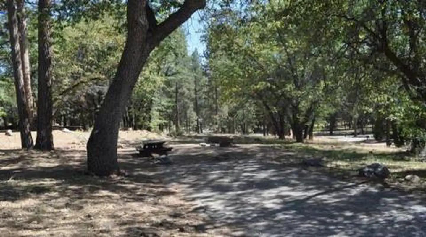
Overview The San Gorgonio Campground provides access to a variety of recreational opportunities, as well as a beautiful location in which to enjoy nature. Its proximity to scenic trails and nearby mountain lakes and streams make the campground a great place to bring the family to relax and get away from it all. Recreation The campground provides access to the famed Santa Ana River Trail, which when completed will run from the mountains all the way to the Pacific Ocean, providing spectacular views along the way. It is currently popular for hiking, biking and horseback riding. The Rio Monte Trail is also accessed from the campground, taking hikers to the Rio Monte Panorama, which overlooks the deep gorge of the Santa Ana River Valley. Visitors to the area also enjoy fishing in nearby mountain streams, as well as bird and wildlife viewing, as a variety of species make their home in the forest. A nearby amphitheater also provides weekend evening educational programs for the public during summer months. Facilities The campground provides access to the famed Santa Ana River Trail, which when completed will run from the mountains all the way to the Pacific Ocean, providing spectacular views along the way. It is currently popular for hiking, biking and horseback riding. The Rio Monte Trail is also accessed from the campground, taking hikers to the Rio Monte Panorama, which overlooks the deep gorge of the Santa Ana River Valley. Visitors to the area also enjoy fishing in nearby mountain streams, as well as bird and wildlife viewing, as a variety of species make their home in the forest. A nearby amphitheater also provides weekend evening educational programs for the public during summer months. Natural Features The campground is located about 36 miles northeast of San Bernardino, at an elevation of 6,600 feet. It is situated in a mixed forest of oak and mature pine trees. The campground is composed of two loops, one loop has sites that are closer together, providing less privacy than the other. Both loops are relatively shaded by Black oak, Jeffrey and Ponderosa pine. Nearby Attractions The Big Bear Lake and its adjoining town are located approximately 25 miles from the campground, offering a variety of water-related recreation opportunities, as well as golf, shopping and restaurant options. Charges & Cancellations Individual Campsites: A customer who cancels a reservation the day before or on the day of arrival will pay a $10.00 service fee AND forfeit the first night's use fee (not to exceed the total paid for the original reservation). Cancellations for a one-night reservation will forfeit the entire amount paid and will not be subject to an additional service fee. No-shows are assessed $20.00 service fee and forfeit the first night’s recreation fee for a campsite or forfeit the entire day-use fee for a day-use facility.
View details →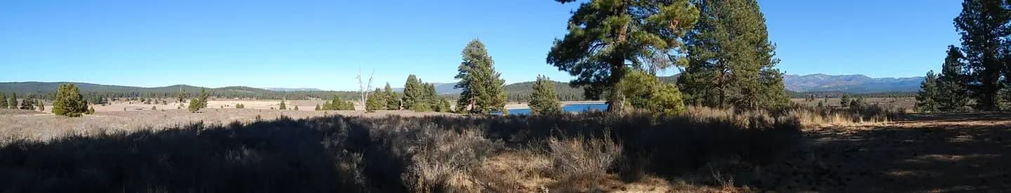
Overview Prosser Ranch Group Campground is located on the picturesque Prosser Reservoir, within the Tahoe National Forest, about 10 minutes north of Truckee. Visitors enjoy the area for its boating, kayaking, swimming, fishing and abundant hiking and off-road trails. This facility is operated and maintained by the Tahoe National Forest. Recreation Prosser Reservoir is a popular location for kayaking, swimming and fishing. Power boating is allowed but a 10-mph speed limit is enforced. A boat ramp is located on-site. The surrounding area offers many hiking, biking, horseback riding and off-road vehicle trails. Facilities Prosser Reservoir is a popular location for kayaking, swimming and fishing. Power boating is allowed but a 10-mph speed limit is enforced. A boat ramp is located on-site. The surrounding area offers many hiking, biking, horseback riding and off-road vehicle trails. Natural Features The campground is situated on the western shore of the reservoir. A scenic forest of Jeffrey pine and fir trees covers the area, while sagebrush dots the forest floor. The site affords views of the reservoir and the surrounding mountains can be seen through the trees. Nearby Attractions Boca Reservoir is 30 minutes east of the campground, offering additional boating, water skiing, swimming and fishing opportunities. Truckee, 10 minutes south, offers all the amenities of a year round recreational mountain town including Interstate highway connectivitiy, top notch restaraunts, resorts and hotels, grocery stores, gas stations, shopping, and historic sites, Lake Tahoe is located 30 minutes south and offers excellent boating, kayaking, fishing, hiking and scenic driving opportunities, as well as dining, shopping and lodging options. Other recreational opportunities include Donner Camp Interpretive Trail, Overland Emigrant Commemorative Trial, Stampede Reservoir Recreation Area, Prosser Pits OHV area, and numerous hiking, mountain biking, and OHV trails.
View details →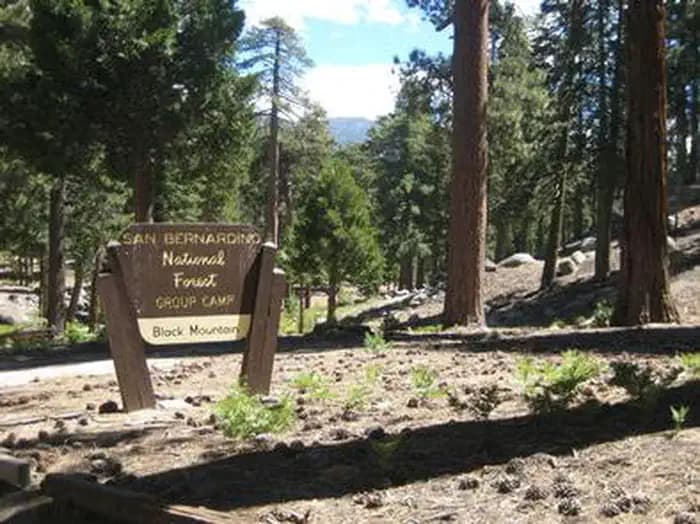
Overview Black Mountain Road is is poor condition at this time. 4 Wheel Drive is recommended. The road is currently a high-priority for maintenance, which should be occuring in June, 2023. The Black Mountain Group Campground provides a picturesque camping location for large groups. Views from the campground encompass the desert divide, San Jacinto Mountains and, on a clear day, as far north as the San Gabriel Mountains. The San Bernardino National Forest is submitting a proposal to increase fees at various sites across the Forest and is seeking public input. Please visit the https://www.fs.usda.gov/sbnf for more information and to submit comments regarding this proposal. The surrounding area provides a variety of outdoor recreation opportunities, including hiking, climbing, fishing, biking and wilderness exploration. Recreation The Fuller Ridge Trail, which serves as part of the famous Pacific Crest Trail, is located just steps away from the campground. Starting at 7,600 feet, the trail follows the high, timbered ridge above Snow Creek, offering spectacular views of the desert. From there, it joins Deer Springs Trail and a strenuous climb to San Jacinto Peak, at 10,804 feet in elevation. Facilities The Fuller Ridge Trail, which serves as part of the famous Pacific Crest Trail, is located just steps away from the campground. Starting at 7,600 feet, the trail follows the high, timbered ridge above Snow Creek, offering spectacular views of the desert. From there, it joins Deer Springs Trail and a strenuous climb to San Jacinto Peak, at 10,804 feet in elevation. Natural Features The campground is located in a heavily forested area of the mountains in southern California at an elevation of about 7,500 feet. The roads to and within the campground are not paved and much of the area is part of classified wilderness area. Nearby Attractions This group site is located approximately 50 miles southeast of San Bernardino, California, and 16 miles north of the small town of Idyllwild, which offers locally owned shops and restaurants.
View details →
Overview Black Oak Campground is group camping destination near Stumpy Meadows Lake on the Eldorado National Forest. The forest boasts over 400 miles of hiking trails and an abundance of lakes and rivers for fishing and swimming. Recreation Stumpy Meadows Lake, with its clear waters and 5-mph speed limit, offers plenty of swimming, kayaking and canoeing opportunities. The lake is regularly stocked with rainbow trout from May to August. Campers also enjoy birding and picnicking. Facilities Stumpy Meadows Lake, with its clear waters and 5-mph speed limit, offers plenty of swimming, kayaking and canoeing opportunities. The lake is regularly stocked with rainbow trout from May to August. Campers also enjoy birding and picnicking. Natural Features Black Oak sits at an elevation of 4,400 feet, within walking distance of the lake in the foothills of the rugged Sierra Nevada Range in California. In the Eldorado National Forest, the climate is similar to that of the Mediterranean, with warm, dry summers and cold, wet winters. Nearby Attractions The El Dorado County Scenic Byway offers miles of scenic driving. Charges & Cancellations Recreation Fee: Recreation fees are the fees a visitor pays for things like overnight camping, a day-use pavilion, group facilities, a tour or a permit. Recreation fees vary by location and/or activity. Reservation Fee: A fee may be charged at the time a reservation is made to cover the cost of reservation services. This fee is in addition to the Recreation Fee and is non-refundable. Fees for camping, day use, group sites, cabins and lookouts: $8 if made on-line; $9 if made through the call center; $3 if made in-person. Change Fee: A service fee may be charged at the time a modification is made depending on the changes. Cancellation Fee: Customers who cancel a group overnight facility reservation less than 14 days before the arrival date will pay a $10.00 service fee AND forfeit the first night's use fee.. Cut-Off Window: The latest date and/or time that you can make an advanced reservation or a change to an existing reservation. Cut-off windows can vary by location, but are typically 14 days before your arrival date. Late Cancellation: If you cancel your reservation too close to the start date, additional service fees may be withheld.
View details →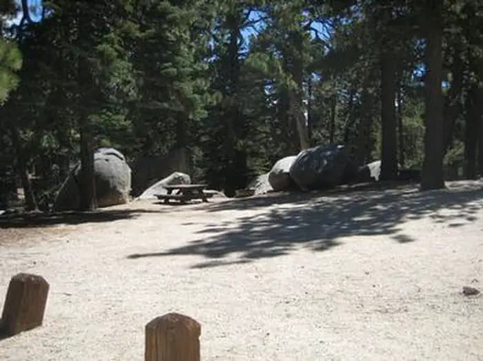
Overview Black Mountain Road is is poor condition at this time. 4 Wheel Drive is recommended. The road is currently a high-priority for maintenance, which should be occuring in June, 2023. The San Bernardino National Forest is submitting a proposal to increase fees at various sites across the Forest and is seeking public input. Please visit the https://www.fs.usda.gov/sbnf for more information and to submit comments regarding this proposal. Boulder Basin Campground offers solitude and primitive camping in a scenic mountain landscape. The area provides ample recreational opportunities, including hiking, mountain biking, boulder climbing and more. Black Mountain Road, which accesses Boulder Basin Campground, is a narrow rough dirt road which may not be suitable for all vehicles. Recreation The campground provides access to a number of trailheads, including the Black Mountain Trail, a 3.6-mile, moderately strenuous hiking, mountain biking and horseback riding trail that travels through the forested slopes of Black Mountain. The trail provides excellent views of the Banning Pass and Mt. San Gorgonio. The trail provides access to the famed Pacific Crest National Scenic Trail, which begins at the Mexico border in Southern California and leads to Washington border of Canada. Facilities The campground provides access to a number of trailheads, including the Black Mountain Trail, a 3.6-mile, moderately strenuous hiking, mountain biking and horseback riding trail that travels through the forested slopes of Black Mountain. The trail provides excellent views of the Banning Pass and Mt. San Gorgonio. The trail provides access to the famed Pacific Crest National Scenic Trail, which begins at the Mexico border in Southern California and leads to Washington border of Canada. Natural Features The campground is located in a mixed conifer forest, which provides ample shade throughout the day. It is situated at an elevation of about 7,300 feet. Roads to and within the campground are not paved. Nearby Attractions This group site is located approximately 50 miles southeast of San Bernardino, California, and 14 miles north of Idyllwild, where fuel and a variety of small town shops and restaurants are available.
View details →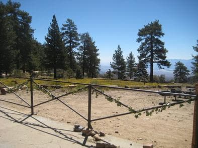
Overview The Coon Creek Group Campground is located in the pine-covered mountains of Southern California. The unique campground is home to three historic cabins and a stunning view into the Coachella Valley on clear days. Recreation The campground is adjacent to a portion of the Pacific Crest Trail, a famous hike that spans more than 2,600 miles from Canada to Mexico. The trail is available for hiking and horseback riding only and offers multiple entry and exit points along its lengthy route, making it ideal for short nature walks or day hikes. In addition to touring the campground's three historic cabins, the campground also offers access to mountain stream fishing and bird and wildlife viewing. The San Gorgonio Wilderness is vast and offers a variety of trailheads and points of exploration. Facilities The campground is adjacent to a portion of the Pacific Crest Trail, a famous hike that spans more than 2,600 miles from Canada to Mexico. The trail is available for hiking and horseback riding only and offers multiple entry and exit points along its lengthy route, making it ideal for short nature walks or day hikes. In addition to touring the campground's three historic cabins, the campground also offers access to mountain stream fishing and bird and wildlife viewing. The San Gorgonio Wilderness is vast and offers a variety of trailheads and points of exploration. Natural Features The campground is situated at an 8,000-foot elevation, overlooking the San Bernardino mountains. Mature pine trees dot the area, but provide little shade over the rocky terrain. Nearby Attractions The campground is less than 20 miles away from Big Bear Lake, which offers a variety of water-related recreation opportunities. The adjoining town provides golf, shopping and restaurant options. Charges & Cancellations Rules & Reservation Policies As you make travel plans that include reservations on Recreation.gov, there are standard policies that apply to most locations of which you should be aware. Do keep in mind, however, that there are many exceptions, so it is best to review reservation information listed on individual facility pages for those policies and procedures that pertain to your specific locations. Any location or activity requiring a permit or lottery will have unique requirements and policies. Please check individual facility pages for pertinent information for those sites. Booking Window For most locations, you can reserve six months in advance of your stay for individual sites and 12 months in advance for group sites. There are some exceptions, so it is best to check with each facility. Change and Cancellation Policies and Fees Overnight and Day Use Facilities: To ensure fairness, reservation arrival or departure dates may not be changed beyond the booking window until 18 days after booking the reservation. Camping / Day Use: A $10.00 service fee will apply if you change or cancel your reservation (including campsites, cabins, lookouts, group facilities, etc.). The $10.00 service fee will be deducted from the refund amount. You can cancel or change reservations through Recreation.gov or by calling 1-877-444-6777. Tours & Tickets: You may request changes to tour dates at no cost before the arrival date. If you cancel before your tour date, you may be eligible for a refund. Cancellation fees apply. Please check the tour facility description details page for cancellation policies. Permits: Varies by location. Please check the permit details for the permit location. Late Cancellations Overnight and Day Use Facilities: Late cancellations are those cancelled between 12:01 a.m. (Eastern) on the day before arrival and check out time on the day after arrival. Individual Campsites: If a customer cancels a reservation the day before or on the day of arrival they will be charged a $10.00 service fee and will also forfeit the first night's use fee (not to exceed the total paid for the original reservation). Cancellations for a single night's reservation will forfeit the entire use fee but no cancellation fee will apply. Cabins / Lookouts: Customers will be charged a $10.00 cancellation fee and forfeit the first night's use fee if a cabin or lookout reservation is cancelled within 14 days of the scheduled arrival date. Cancellations for a single night's use will not be assessed a service fee. Group Facility: If a customer cancels a group overnight facility reservation within 14 days of the scheduled arrival date they will be charged the $10.00 service fee and forfeit the first night's use fee. Cancellations for a single night's use will not be assessed a service fee. Group Day Use Area: If a customer cancels a group day use facility reservation within 14 days of the scheduled arrival date, they will forfeit the total day use fee with no service fee charge. No-Shows Camping / Day Use: A camping no-show customer is one who does not arrive at a campground and does not cancel the reservation by check-out time on the day after the scheduled arrival date. Reserved campsites and group overnight facilities will be held until check-out time on the day following your scheduled arrival. Group day-use facilities will be held until check-in time on your scheduled arrival date. If a customer does not arrive at the campground or group facility by check-out time the day after arrival or does not cancel the reservation by the times listed under "Late Cancellations" above, the customer may be assessed a $20.00 service fee and forfeit use fees. Tours: A tour or ticket no-show is one who does not cancel a ticket before arrival and does not arrive for the tour. Tour no-shows are not entitled to a refund. Refunds Customers must request refunds no later than 14 days after the scheduled departure date. Recreation.gov will not grant refund requests after 14 days of departure. Reservation Fee: For some facilities, tours or permits an additional reservation fee is charged. For some overnight and day-use facilities, an additional non-refundable reservation fee may apply. The non-refundable reservation fee for tours and tickets is $1.00. The non-refundable reservation fee for permits varies by location. Refunds for Bankcard Purchases: Refunds for bank card payments will be issued as a credit to the original bank card. Refunds for Check or Cash Purchases: Refunds for Recreation.gov payments made by check or money order, and cash payments at selected campgrounds will be issued a check refund. A refund will be processed within 30 days of receipt and approval. Please Note: Refund requests made during or after departure can only be processed when approved by the facility management staff based upon local policy. Refunds for Emergency Closures: In the event of an emergency closure, the Recreation.gov team will attempt to notify users and offer alternate dates (as appropriate). If this is not possible, reservations will be cancelled and all fees paid will be refunded. Reservation fees for free tickets are non-refundable in the event of an emergency closure. Recreation.gov Billing Information Reservation transaction will appear on customer's credit card statements as "Recreation.gov 877-444-6777." Changes to Policies and Procedures Recreation.gov reserves the right, when necessary, to modify reservation policies. These policies were last updated July
View details →
Overview The Council Group Campground is a great place to enjoy a large outdoor gathering with just about everything the San Bernardino National Forest has to offer. Its location provides a great place for visitors to relax, take in the fresh mountain air and enjoy the beautiful scenery. In addition to a nearby lake and river access, a variety hiking, biking and horseback riding trails can be accessed from the campground. Recreation The campground provides access to the famed Santa Ana River Trail, which when completed will travel all the way from the mountains to the pacific ocean, providing spectacular views along the way. It is currently popular with hikers, bikers and horseback riders. The Rio Monte Trail is also accessible from the campground, leading visitors to the Rio Monte Panorama, which overlooks the deep gorge of the Santa Ana River Valley. Visitors can also enjoy fishing and non-motorized boating, including kayaking and canoeing at the nearby Jenks Lake, a small mountain lake with a picnic area and access to hiking trails. The lake is stocked with rainbow trout and there are also some largemouth bass, bluegill, sunfish and catfish available. Fishing is also available in the nearby Santa Ana River. Facilities The campground provides access to the famed Santa Ana River Trail, which when completed will travel all the way from the mountains to the pacific ocean, providing spectacular views along the way. It is currently popular with hikers, bikers and horseback riders. The Rio Monte Trail is also accessible from the campground, leading visitors to the Rio Monte Panorama, which overlooks the deep gorge of the Santa Ana River Valley. Visitors can also enjoy fishing and non-motorized boating, including kayaking and canoeing at the nearby Jenks Lake, a small mountain lake with a picnic area and access to hiking trails. The lake is stocked with rainbow trout and there are also some largemouth bass, bluegill, sunfish and catfish available. Fishing is also available in the nearby Santa Ana River. Natural Features The campground is located northeast of San Bernardino, just off of Highway 38, in the Barton Flats area of the San Bernardino Mountains. The highway is part of the Rim of the World Scenic Byway. The campground is situated in a pine forest, at an elevation of about 6,360 feet. Nearby Attractions The Grayback Amphitheater on State Route 38 provides evening educational programs on most Saturdays and Sundays throughout the summer months. Programs are hosted by the San Gorgonio Wilderness Association and pertain to the area's background and rich history. Charges & Cancellations Rules & Reservation Policies As you make travel plans that include reservations on Recreation.gov, there are standard policies that apply to most locations of which you should be aware. Do keep in mind, however, that there are many exceptions, so it is best to review reservation information listed on individual facility pages for those policies and procedures that pertain to your specific locations. Any location or activity requiring a permit or lottery will have unique requirements and policies. Please check individual facility pages for pertinent information for those sites. Booking Window For most locations, you can reserve six months in advance of your stay for individual sites and 12 months in advance for group sites. There are some exceptions, so it is best to check with each facility. Change and Cancellation Policies and Fees Overnight and Day Use Facilities: To ensure fairness, reservation arrival or departure dates may not be changed beyond the booking window until 18 days after booking the reservation. Camping / Day Use: A $10.00 service fee will apply if you change or cancel your reservation (including campsites, cabins, lookouts, group facilities, etc.). The $10.00 service fee will be deducted from the refund amount. You can cancel or change reservations through Recreation.gov or by calling 1-877-444-6777. Tours & Tickets: You may request changes to tour dates at no cost before the arrival date. If you cancel before your tour date, you may be eligible for a refund. Cancellation fees apply. Please check the tour facility description details page for cancellation policies. Permits: Varies by location. Please check the permit details for the permit location. Late Cancellations Overnight and Day Use Facilities: Late cancellations are those cancelled between 12:01 a.m. (Eastern) on the day before arrival and check out time on the day after arrival. Individual Campsites: If a customer cancels a reservation the day before or on the day of arrival they will be charged a $10.00 service fee and will also forfeit the first night's use fee (not to exceed the total paid for the original reservation). Cancellations for a single night's reservation will forfeit the entire use fee but no cancellation fee will apply. Cabins / Lookouts: Customers will be charged a $10.00 cancellation fee and forfeit the first night's use fee if a cabin or lookout reservation is cancelled within 14 days of the scheduled arrival date. Cancellations for a single night's use will not be assessed a service fee. Group Facility: If a customer cancels a group overnight facility reservation within 14 days of the scheduled arrival date they will be charged the $10.00 service fee and forfeit the first night's use fee. Cancellations for a single night's use will not be assessed a service fee. Group Day Use Area: If a customer cancels a group day use facility reservation within 14 days of the scheduled arrival date, they will forfeit the total day use fee with no service fee charge. No-Shows Camping / Day Use: A camping no-show customer is one who does not arrive at a campground and does not cancel the reservation by check-out time on the day after the scheduled arrival date. Reserved campsites and group overnight facilities will be held until check-out time on the day following your scheduled arrival. Group day-use facilities will be held until check-in time on your scheduled arrival date. If a customer does not arrive at the campground or group facility by check-out time the day after arrival or does not cancel the reservation by the times listed under "Late Cancellations" above, the customer may be assessed a $20.00 service fee and forfeit use fees. Tours: A tour or ticket no-show is one who does not cancel a ticket before arrival and does not arrive for the tour. Tour no-shows are not entitled to a refund. Refunds Customers must request refunds no later than 14 days after the scheduled departure date. Recreation.gov will not grant refund requests after 14 days of departure. Reservation Fee: For some facilities, tours or permits an additional reservation fee is charged. For some overnight and day-use facilities, an additional non-refundable reservation fee may apply. The non-refundable reservation fee for tours and tickets is $1.00. The non-refundable reservation fee for permits varies by location. Refunds for Bankcard Purchases: Refunds for bank card payments will be issued as a credit to the original bank card. Refunds for Check or Cash Purchases: Refunds for Recreation.gov payments made by check or money order, and cash payments at selected campgrounds will be issued a check refund. A refund will be processed within 30 days of receipt and approval. Please Note: Refund requests made during or after departure can only be processed when approved by the facility management staff based upon local policy. Refunds for Emergency Closures: In the event of an emergency closure, the Recreation.gov team will attempt to notify users and offer alternate dates (as appropriate). If this is not possible, reservations will be cancelled and all fees paid will be refunded. Reservation fees for free tickets are non-refundable in the event of an emergency closure. Recreation.gov Billing Information Reservation transaction will appear on customer's credit card statements as "Recreation.gov 877-444-6777." Changes to Policies and Procedures Recreation.gov reserves the right, when necessary, to modify reservation policies. These policies were last updated July
View details →
Overview Coyote Group Campground is located on the northeast end of French Meadows Reservoir, near the Middle Fork of American River. The facility is located in a remote area approximately 40 miles from Foresthill. Visitors enjoy the area for its fishing, boating and trail opportunities. This campground is operated and maintained by the Tahoe National Forest. Recreation The Middle Fork of American River provides visitors with ample opportunities for fishing and swimming. Popular activities on the nearby reservoir include boating, canoeing, fishing and swimming. Two boat ramps are located within three miles of the campground. A variety of hiking and biking trails are found in the surrounding area, including some that provide access to the nearby Granite Chief Wilderness and The Western States Trail. Just down the road is the Granite Chief Wilderness which provides amazing hiking opportunities for adventurous party to explore historic aspen tree stands and secluded mountain passes and trail. The Western States Trail provides great opportunity for hiking, horesback riding, dirt biking, and for adventurous mountain bikers. Facilities The Middle Fork of American River provides visitors with ample opportunities for fishing and swimming. Popular activities on the nearby reservoir include boating, canoeing, fishing and swimming. Two boat ramps are located within three miles of the campground. A variety of hiking and biking trails are found in the surrounding area, including some that provide access to the nearby Granite Chief Wilderness and The Western States Trail. Just down the road is the Granite Chief Wilderness which provides amazing hiking opportunities for adventurous party to explore historic aspen tree stands and secluded mountain passes and trail. The Western States Trail provides great opportunity for hiking, horesback riding, dirt biking, and for adventurous mountain bikers. Natural Features The campground is situated near the river, just north of French Meadows Reservoir. A coniferous forest covers the area. At an elevation of 5,200 feet, summertime temperatures are warm throughout the day and cool at night.
View details →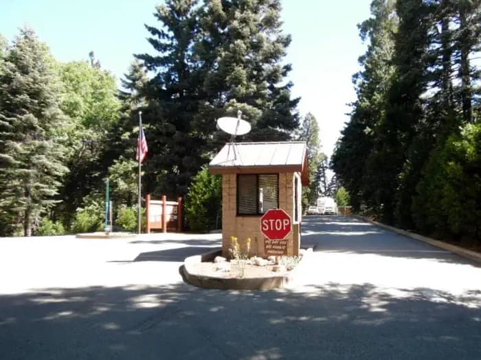
Overview Dogwood Campground is a family-friendly facility located in the heart of the San Bernardino National Forest. All sites must be reserved to enjoy the area's scenic surroundings and plentiful recreational opportunities. Recreation Ample opportunities for short, day hikes exist in the surrounding area. Within the campground, the Dogwood Trail and Enchanted Loop Trail both provide scenic views and are less than a mile in length. Facilities Ample opportunities for short, day hikes exist in the surrounding area. Within the campground, the Dogwood Trail and Enchanted Loop Trail both provide scenic views and are less than a mile in length. Natural Features The campground is located about 20 miles northeast of San Bernardino in a dense forest of cedar, oak, pine and fir trees. The lush forest is home to a variety of wildlife and birds. contact_info For facility specific information, please call (909) 866-8550. Nearby Attractions The nearest community is Lake Arrowhead, which provides a variety of restaurants and quaint shops. It is just five minutes from the campground. Lake Gregory, which offers boating, fishing and a water slide park, is about 15 minutes away. Charges & Cancellations Rules & Reservation Policies As you make travel plans that include reservations on Recreation.gov, there are standard policies that apply to most locations of which you should be aware. Do keep in mind, however, that there are many exceptions, so it is best to review reservation information listed on individual facility pages for those policies and procedures that pertain to your specific locations. Any location or activity requiring a permit or lottery will have unique requirements and policies. Please check individual facility pages for pertinent information for those sites. Booking Window For most locations, you can reserve six months in advance of your stay for individual sites and 12 months in advance for group sites. There are some exceptions, so it is best to check with each facility. Change and Cancellation Policies and Fees Overnight and Day Use Facilities: To ensure fairness, reservation arrival or departure dates may not be changed beyond the booking window until 18 days after booking the reservation. Camping / Day Use: A $10.00 service fee will apply if you change or cancel your reservation (including campsites, cabins, lookouts, group facilities, etc.). The $10.00 service fee will be deducted from the refund amount. You can cancel or change reservations through Recreation.gov or by calling 1-877-444-6777. Tours & Tickets: You may request changes to tour dates at no cost before the arrival date. If you cancel before your tour date, you may be eligible for a refund. Cancellation fees apply. Please check the tour facility description details page for cancellation policies. Permits: Varies by location. Please check the permit details for the permit location. Late Cancellations Overnight and Day Use Facilities: Late cancellations are those cancelled between 12:01 a.m. (Eastern) on the day before arrival and check out time on the day after arrival. Individual Campsites: If a customer cancels a reservation the day before or on the day of arrival they will be charged a $10.00 service fee and will also forfeit the first night's use fee (not to exceed the total paid for the original reservation). Cancellations for a single night's reservation will forfeit the entire use fee but no cancellation fee will apply. Cabins / Lookouts: Customers will be charged a $10.00 cancellation fee and forfeit the first night's use fee if a cabin or lookout reservation is cancelled within 14 days of the scheduled arrival date. Cancellations for a single night's use will not be assessed a service fee. Group Facility: If a customer cancels a group overnight facility reservation within 14 days of the scheduled arrival date they will be charged the $10.00 service fee and forfeit the first night's use fee. Cancellations for a single night's use will not be assessed a service fee. Group Day Use Area: If a customer cancels a group day use facility reservation within 14 days of the scheduled arrival date, they will forfeit the total day use fee with no service fee charge. No-Shows Camping / Day Use: A camping no-show customer is one who does not arrive at a campground and does not cancel the reservation by check-out time on the day after the scheduled arrival date. Reserved campsites and group overnight facilities will be held until check-out time on the day following your scheduled arrival. Group day-use facilities will be held until check-in time on your scheduled arrival date. If a customer does not arrive at the campground or group facility by check-out time the day after arrival or does not cancel the reservation by the times listed under "Late Cancellations" above, the customer may be assessed a $20.00 service fee and forfeit use fees. Tours: A tour or ticket no-show is one who does not cancel a ticket before arrival and does not arrive for the tour. Tour no-shows are not entitled to a refund. Refunds Customers must request refunds no later than 14 days after the scheduled departure date. Recreation.gov will not grant refund requests after 14 days of departure. Reservation Fee: For some facilities, tours or permits an additional reservation fee is charged. For some overnight and day-use facilities, an additional non-refundable reservation fee may apply. The non-refundable reservation fee for tours and tickets is $1.00. The non-refundable reservation fee for permits varies by location. Refunds for Bankcard Purchases: Refunds for bank card payments will be issued as a credit to the original bank card. Refunds for Check or Cash Purchases: Refunds for Recreation.gov payments made by check or money order, and cash payments at selected campgrounds will be issued a check refund. A refund will be processed within 30 days of receipt and approval. Please Note: Refund requests made during or after departure can only be processed when approved by the facility management staff based upon local policy. Refunds for Emergency Closures: In the event of an emergency closure, the Recreation.gov team will attempt to notify users and offer alternate dates (as appropriate). If this is not possible, reservations will be cancelled and all fees paid will be refunded. Reservation fees for free tickets are non-refundable in the event of an emergency closure. Recreation.gov Billing Information Reservation transaction will appear on customer's credit card statements as "Recreation.gov 877-444-6777." Changes to Policies and Procedures Recreation.gov reserves the right, when necessary, to modify reservation policies. These policies were last updated July
View details →
Overview Forbes Creek Group Campground is located near the southeast shore of Sugar Pine Reservoir in the Tahoe National Forest. Visitors enjoy the area for its fishing, canoeing and hiking opportunities. This facility is operated and maintained by the Tahoe National Forest. Recreation Fishing, canoeing, swimming and boating are popular activities on the reservoir. A trail system for walking and non-motorized biking connects the two group sites at the campground, to the lake and nearby boat ramp. The North Fork of the American River is nearby, offering opportunities for additional fishing and swimming. Many miles of hiking, biking and off-road vehicle trails are in the surrounding area. Facilities Fishing, canoeing, swimming and boating are popular activities on the reservoir. A trail system for walking and non-motorized biking connects the two group sites at the campground, to the lake and nearby boat ramp. The North Fork of the American River is nearby, offering opportunities for additional fishing and swimming. Many miles of hiking, biking and off-road vehicle trails are in the surrounding area. Natural Features The 160-acre Sugar Pine Reservoir sits at an elevation of 3,600 feet. Stands of cedar and ponderosa pine provides ample shade in the campground, which overlooks the reservoir. Summertime temperatures are warm during the day and cool at night.
View details →
Overview Gates Group Campground is located on the North Fork American River, at the north end of the French Meadows Reservoir in the Tahoe National Forest. It is 40 miles from the town of Foresthill. Visitors enjoy the area for its fishing, boating and trail opportunities. Recreation The North Fork American River provides fishing and swimming. The reservoir can be accessed nearby. Popular activities include boating, canoeing, fishing and swimming. Two boat ramps are located within three miles of the campground. A variety of hiking and biking trails are found in the surrounding area, including some that provide access to the nearby Granite Chief Wilderness. Just down the road is the Granite Chief Wilderness which provides amazing hiking opportunities for an adventurous party to explore historic aspen trees and secluded mountain passes and trails. The Western States Trail provides great opportunity for hiker, horseback riders, dirt bikers, and for adventurous maintain bikers. Facilities The North Fork American River provides fishing and swimming. The reservoir can be accessed nearby. Popular activities include boating, canoeing, fishing and swimming. Two boat ramps are located within three miles of the campground. A variety of hiking and biking trails are found in the surrounding area, including some that provide access to the nearby Granite Chief Wilderness. Just down the road is the Granite Chief Wilderness which provides amazing hiking opportunities for an adventurous party to explore historic aspen trees and secluded mountain passes and trails. The Western States Trail provides great opportunity for hiker, horseback riders, dirt bikers, and for adventurous maintain bikers. Natural Features The campground is situated along the river, just north of French Meadows Reservoir. A coniferous forest covers the area. At an elevation of 5200 feet, summertime temperatures are warm in the day and cool at night.
View details →
Overview Gerle Creek Campground is nestled on the banks of the Gerle Creek Fork among a lush forest of hardwoods. The area provides lots of opportunity for fishing and water play. Hiking and biking are also popular. Recreation Swimming, canoeing, kayaking and fishing are some of the fun things to do on the creek. Common fish species include brown and rainbow trout. An accessible fishing dock is located on-site. The Gerle Creek Interpretive Trail is fully accessible and provides scenic views and interesting displays. Facilities Swimming, canoeing, kayaking and fishing are some of the fun things to do on the creek. Common fish species include brown and rainbow trout. An accessible fishing dock is located on-site. The Gerle Creek Interpretive Trail is fully accessible and provides scenic views and interesting displays. Natural Features Gerle Creek Campground sits at an elevation of 5,300 feet, upstream of Gerle Creek Divide Reservoir. It is on the Georgetown Divide within the Eldorado National Forest. Gerle Creek was named for two brothers who were early settlers and farmers in the region. Eldorado National Forest boasts over 400 miles of hiking trails, an abundance of lakes and rivers for fishing and swimming, and incredible scenery. The climate is similar to that of the Mediterranean, with warm, dry summers and cold, wet winters. Nearby Attractions Union Valley Reservoir and Loon Lake are within a short drive of the campground, offering additional fishing and boating opportunities. Charges & Cancellations Change Fee: A service fee may be charged at the time a modification is made depending on the changes. Cancellation Fee: A $10 service fee will be withheld from any refunds for a cancelled reservation. Cut-Off Window: The latest date and/or time that you can make an advanced reservation or a change to an existing reservation. Cut-off windows can vary by location, but are typically 4 days before your arrival date. A customer who cancels a reservation the day before or on the day of arrival will pay a $10.00 service fee AND forfeit the first night's use fee (see Late Cancellation below). Late Cancellation: If you cancel your reservation too close to the start date, additional service fees may be withheld. Refunds : Refund requests made through www.recreation.gov will be charged a $10 processing fee. This fee is retained by the reservation service contractor along with the non-refundable reservation fee. All requests for the return of the non-refundable reservation fee and the cancellation fee will be declined by the campground concessionaire as they did not receive these fees (these are the fees retained by the reservation contractor, a different entity).
View details →
Overview Grays Meadows Campground is situated along Independence Creek in the Onion Valley area of the eastern Sierra Nevada Mountains. Its location on the creek and proximity to the rugged John Muir Wilderness make it a popular hub for hikers, anglers, spring skiers and snowboarders. Opening and closing dates may be dependent on weather conditions. Recreation Majestic mountain scenery and challenging trails draw campers to the Onion Valley area for hiking and horseback riding. The well-known and demanding Shepherd Pass Trail, which can be reached just west of Grays Meadows Campground, heads up to alpine lakes and the high peaks of the John Muir Wilderness. Independence Creek is regularly stocked with trophy-size rainbow trout. Anglers flock to the creek for its early trout fishing season, which starts the first weekend in March, ahead of much of the area. Facilities Majestic mountain scenery and challenging trails draw campers to the Onion Valley area for hiking and horseback riding. The well-known and demanding Shepherd Pass Trail, which can be reached just west of Grays Meadows Campground, heads up to alpine lakes and the high peaks of the John Muir Wilderness. Independence Creek is regularly stocked with trophy-size rainbow trout. Anglers flock to the creek for its early trout fishing season, which starts the first weekend in March, ahead of much of the area. Natural Features Grays Meadows Campground offers a wandering creek, both sunny and shaded campsites and a high-desert landscape. It sits at an elevation 6,100 ft. and is bordered on the west by Mt. Williamson and Mt. Whitney, the highest peaks in the contiguous United States. The area is home to abundant wildlife, including black bear, mountain lions, mule deer, pine marten, pika and many species of fish and birds. Nearby Attractions Campers can enter the John Muir Wilderness , a land of lofty snow-capped mountains, deep canyons and vast expanses of glacially carved terrain, via nearby trails. contact_info For facility specific information, please call (602) 726-1102.
View details →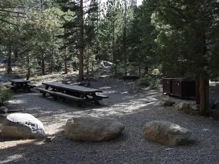
Overview Green Creek Group Campground is located about 12 miles from Bridgeport, California, at an elevation of 7,500 feet. Visitors enjoy fishing on Green Creek and hiking the Green Creek Trail. Recreation Green Creek offers rainbow trout fishing and can be easily accessed from within the campground. Green Creek Trail, for hiking and horseback riding, can be accessed just outside the campground entrance. It leads to Green Lake and further on to East Lake. Rugged peaks surround both large lakes, where hikers are rewarded with good backcountry fishing and spectacular scenery. Facilities Green Creek offers rainbow trout fishing and can be easily accessed from within the campground. Green Creek Trail, for hiking and horseback riding, can be accessed just outside the campground entrance. It leads to Green Lake and further on to East Lake. Rugged peaks surround both large lakes, where hikers are rewarded with good backcountry fishing and spectacular scenery. Natural Features The campground is tucked between Green Creek and a rocky outcropping, among a forest of towering Jeffrey pines, which offer partial shade. Aspens, juniper, sagebrush and summer wildflowers dot the landscape.
View details →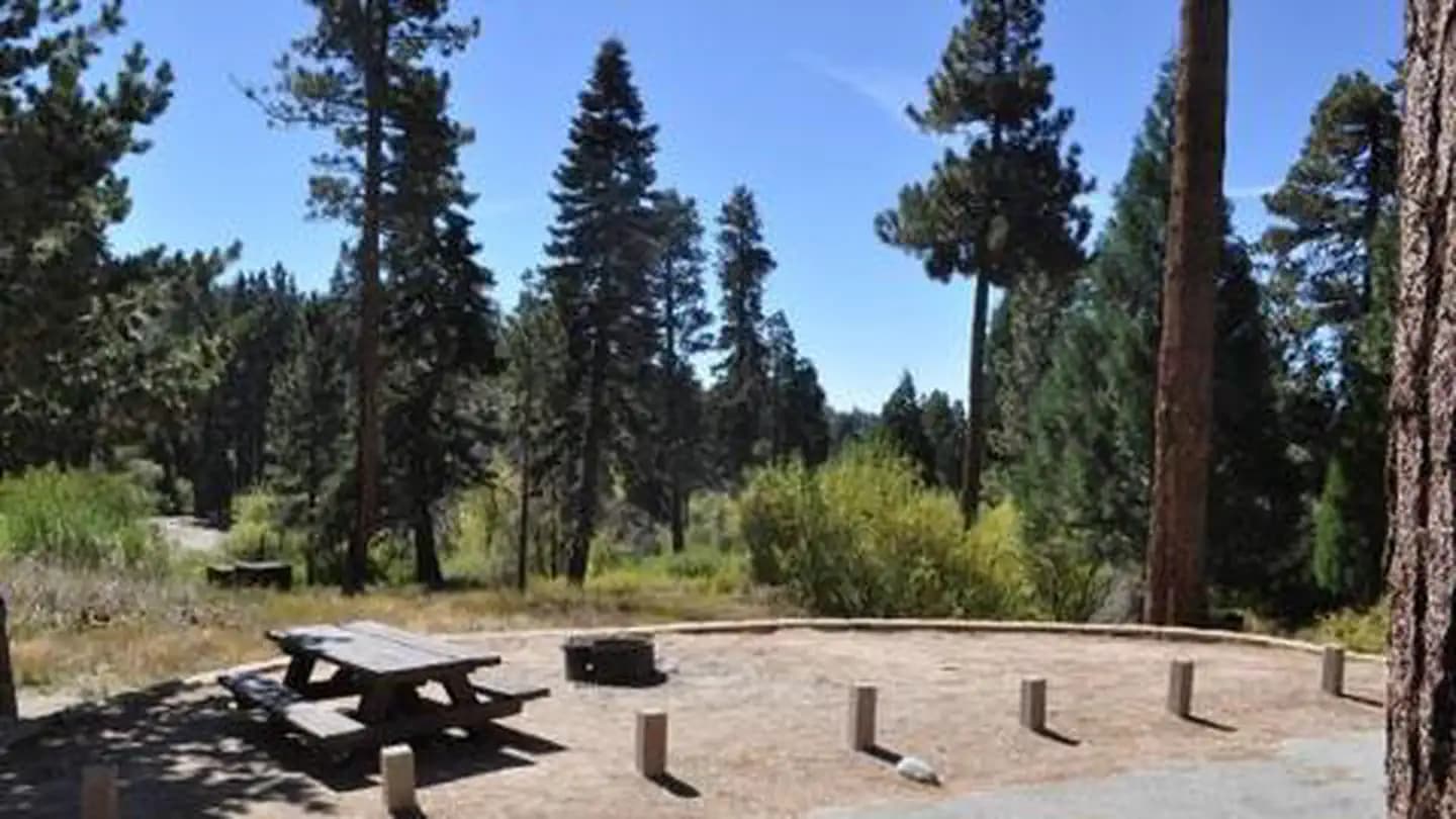
Overview Green Valley Campground is located near Arrowbear in the San Bernardino National Forest in Southern California. It is centered between Lake Arrowhead and Big Bear Lake, providing ample recreational opportunities in the area's pine-covered mountains. Green Valley Lake, known for its exceptional trout fishing, is located about a mile from this beautiful mountain campground. Recreation Green Valley Lake, which is known for its trout fishing, is located just minutes away. Boating and swimming are popular activities as well. The high elevation lake also provides access to a variety of hiking trails. Facilities Green Valley Lake, which is known for its trout fishing, is located just minutes away. Boating and swimming are popular activities as well. The high elevation lake also provides access to a variety of hiking trails. Natural Features The campground is situated in a forest of pine, fir and cedar trees, mixed with open spaces filled shrubbery and grassy meadows. It overlooks a seasonal mountain creek and sits at an elevation of 7,200 feet. Nearby Attractions Lake Arrowhead is about 16 miles west and Big Bear Lake is about 15 miles east. A variety of services and recreational activities are available at each place. Charges & Cancellations Rules & Reservation Policies As you make travel plans that include reservations on Recreation.gov, there are standard policies that apply to most locations of which you should be aware. Do keep in mind, however, that there are many exceptions, so it is best to review reservation information listed on individual facility pages for those policies and procedures that pertain to your specific locations. Any location or activity requiring a permit or lottery will have unique requirements and policies. Please check individual facility pages for pertinent information for those sites. Booking Window For most locations, you can reserve six months in advance of your stay for individual sites and 12 months in advance for group sites. There are some exceptions, so it is best to check with each facility. Change and Cancellation Policies and Fees Overnight and Day Use Facilities: To ensure fairness, reservation arrival or departure dates may not be changed beyond the booking window until 18 days after booking the reservation. Camping / Day Use: A $10.00 service fee will apply if you change or cancel your reservation (including campsites, cabins, lookouts, group facilities, etc.). The $10.00 service fee will be deducted from the refund amount. You can cancel or change reservations through Recreation.gov or by calling 1-877-444-6777. Tours & Tickets: You may request changes to tour dates at no cost before the arrival date. If you cancel before your tour date, you may be eligible for a refund. Cancellation fees apply. Please check the tour facility description details page for cancellation policies. Permits: Varies by location. Please check the permit details for the permit location. Late Cancellations Overnight and Day Use Facilities: Late cancellations are those cancelled between 12:01 a.m. (Eastern) on the day before arrival and check out time on the day after arrival. Individual Campsites: If a customer cancels a reservation the day before or on the day of arrival they will be charged a $10.00 service fee and will also forfeit the first night's use fee (not to exceed the total paid for the original reservation). Cancellations for a single night's reservation will forfeit the entire use fee but no cancellation fee will apply. Cabins / Lookouts: Customers will be charged a $10.00 cancellation fee and forfeit the first night's use fee if a cabin or lookout reservation is cancelled within 14 days of the scheduled arrival date. Cancellations for a single night's use will not be assessed a service fee. Group Facility: If a customer cancels a group overnight facility reservation within 14 days of the scheduled arrival date they will be charged the $10.00 service fee and forfeit the first night's use fee. Cancellations for a single night's use will not be assessed a service fee. Group Day Use Area: If a customer cancels a group day use facility reservation within 14 days of the scheduled arrival date, they will forfeit the total day use fee with no service fee charge. No-Shows Camping / Day Use: A camping no-show customer is one who does not arrive at a campground and does not cancel the reservation by check-out time on the day after the scheduled arrival date. Reserved campsites and group overnight facilities will be held until check-out time on the day following your scheduled arrival. Group day-use facilities will be held until check-in time on your scheduled arrival date. If a customer does not arrive at the campground or group facility by check-out time the day after arrival or does not cancel the reservation by the times listed under "Late Cancellations" above, the customer may be assessed a $20.00 service fee and forfeit use fees. Tours: A tour or ticket no-show is one who does not cancel a ticket before arrival and does not arrive for the tour. Tour no-shows are not entitled to a refund. Refunds Customers must request refunds no later than 14 days after the scheduled departure date. Recreation.gov will not grant refund requests after 14 days of departure. Reservation Fee: For some facilities, tours or permits an additional reservation fee is charged. For some overnight and day-use facilities, an additional non-refundable reservation fee may apply. The non-refundable reservation fee for tours and tickets is $1.00. The non-refundable reservation fee for permits varies by location. Refunds for Bankcard Purchases: Refunds for bank card payments will be issued as a credit to the original bank card. Refunds for Check or Cash Purchases: Refunds for Recreation.gov payments made by check or money order, and cash payments at selected campgrounds will be issued a check refund. A refund will be processed within 30 days of receipt and approval. Please Note: Refund requests made during or after departure can only be processed when approved by the facility management staff based upon local policy. Refunds for Emergency Closures: In the event of an emergency closure, the Recreation.gov team will attempt to notify users and offer alternate dates (as appropriate). If this is not possible, reservations will be cancelled and all fees paid will be refunded. Reservation fees for free tickets are non-refundable in the event of an emergency closure. Recreation.gov Billing Information Reservation transaction will appear on customer's credit card statements as "Recreation.gov 877-444-6777." Changes to Policies and Procedures Recreation.gov reserves the right, when necessary, to modify reservation policies. These policies were last updated July
View details →
Overview The Heart Bar Equestrian Campground is available by reservation and is for equestrian campers only. It provides access to some of Southern California's greatest backcountry horseback riding trails and a variety of other recreational opportunities in the surrounding area as well. Recreation A variety of horseback riding trails can be found near the campground, including the famed Santa Ana River Trail, which is also popular among hikers and bikers and provides miles of scenic mountain views. The Wildhorse Creek Trail, which explores 5 miles of rolling terrain in the area, is accessed just north of the campground and leads to a remote camping area south of Wildhorse Meadow, climbing nearly 1,100 feet in elevation.Creek fishing is also available nearby. Facilities A variety of horseback riding trails can be found near the campground, including the famed Santa Ana River Trail, which is also popular among hikers and bikers and provides miles of scenic mountain views. The Wildhorse Creek Trail, which explores 5 miles of rolling terrain in the area, is accessed just north of the campground and leads to a remote camping area south of Wildhorse Meadow, climbing nearly 1,100 feet in elevation.Creek fishing is also available nearby. Natural Features The campground is located in the pine-covered mountains of Southern California, at an elevation of 6,880 feet. It is not far from the Big Bear Lake, but far enough to retain a remote and secluded atmosphere. contact_info For facility specific information, please call (909) 866-8550. Nearby Attractions The Big Bear Lake and its adjoining town are located approximately 20 miles from the campground, offering a variety of water-related recreation opportunities, as well as golf, shopping and restaurant options. Charges & Cancellations Rules & Reservation Policies As you make travel plans that include reservations on Recreation.gov, there are standard policies that apply to most locations of which you should be aware. Do keep in mind, however, that there are many exceptions, so it is best to review reservation information listed on individual facility pages for those policies and procedures that pertain to your specific locations. Any location or activity requiring a permit or lottery will have unique requirements and policies. Please check individual facility pages for pertinent information for those sites. Booking Window For most locations, you can reserve six months in advance of your stay for individual sites and 12 months in advance for group sites. There are some exceptions, so it is best to check with each facility. Change and Cancellation Policies and Fees Overnight and Day Use Facilities: To ensure fairness, reservation arrival or departure dates may not be changed beyond the booking window until 18 days after booking the reservation. Camping / Day Use: A $10.00 service fee will apply if you change or cancel your reservation (including campsites, cabins, lookouts, group facilities, etc.). The $10.00 service fee will be deducted from the refund amount. You can cancel or change reservations through Recreation.gov or by calling 1-877-444-6777. Tours & Tickets: You may request changes to tour dates at no cost before the arrival date. If you cancel before your tour date, you may be eligible for a refund. Cancellation fees apply. Please check the tour facility description details page for cancellation policies. Permits: Varies by location. Please check the permit details for the permit location. Late Cancellations Overnight and Day Use Facilities: Late cancellations are those cancelled between 12:01 a.m. (Eastern) on the day before arrival and check out time on the day after arrival. Individual Campsites: If a customer cancels a reservation the day before or on the day of arrival they will be charged a $10.00 service fee and will also forfeit the first night's use fee (not to exceed the total paid for the original reservation). Cancellations for a single night's reservation will forfeit the entire use fee but no cancellation fee will apply. Cabins / Lookouts: Customers will be charged a $10.00 cancellation fee and forfeit the first night's use fee if a cabin or lookout reservation is cancelled within 14 days of the scheduled arrival date. Cancellations for a single night's use will not be assessed a service fee. Group Facility: If a customer cancels a group overnight facility reservation within 14 days of the scheduled arrival date they will be charged the $10.00 service fee and forfeit the first night's use fee. Cancellations for a single night's use will not be assessed a service fee. Group Day Use Area: If a customer cancels a group day use facility reservation within 14 days of the scheduled arrival date, they will forfeit the total day use fee with no service fee charge. No-Shows Camping / Day Use: A camping no-show customer is one who does not arrive at a campground and does not cancel the reservation by check-out time on the day after the scheduled arrival date. Reserved campsites and group overnight facilities will be held until check-out time on the day following your scheduled arrival. Group day-use facilities will be held until check-in time on your scheduled arrival date. If a customer does not arrive at the campground or group facility by check-out time the day after arrival or does not cancel the reservation by the times listed under "Late Cancellations" above, the customer may be assessed a $20.00 service fee and forfeit use fees. Tours: A tour or ticket no-show is one who does not cancel a ticket before arrival and does not arrive for the tour. Tour no-shows are not entitled to a refund. Refunds Customers must request refunds no later than 14 days after the scheduled departure date. Recreation.gov will not grant refund requests after 14 days of departure. Reservation Fee: For some facilities, tours or permits an additional reservation fee is charged. For some overnight and day-use facilities, an additional non-refundable reservation fee may apply. The non-refundable reservation fee for tours and tickets is $1.00. The non-refundable reservation fee for permits varies by location. Refunds for Bankcard Purchases: Refunds for bank card payments will be issued as a credit to the original bank card. Refunds for Check or Cash Purchases: Refunds for Recreation.gov payments made by check or money order, and cash payments at selected campgrounds will be issued a check refund. A refund will be processed within 30 days of receipt and approval. Please Note: Refund requests made during or after departure can only be processed when approved by the facility management staff based upon local policy. Refunds for Emergency Closures: In the event of an emergency closure, the Recreation.gov team will attempt to notify users and offer alternate dates (as appropriate). If this is not possible, reservations will be cancelled and all fees paid will be refunded. Reservation fees for free tickets are non-refundable in the event of an emergency closure. Recreation.gov Billing Information Reservation transaction will appear on customer's credit card statements as "Recreation.gov 877-444-6777." Changes to Policies and Procedures Recreation.gov reserves the right, when necessary, to modify reservation policies. These policies were last updated July
View details →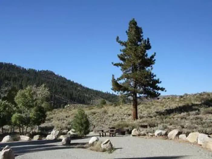
Overview Honeymoon Flat Campground is located just 8 miles from Bridgeport, California, next to Robinson Creek at an elevation of 7,000 feet. The Twin Lakes area is about 2 miles away, where visitors enjoy boating, fishing, hiking and horseback riding. Recreation Robinson Creek offers good rainbow trout fishing and can be easily accessed from both loops. Numerous hiking trails are in the vicinity, including the popular Robinson Creek Trail. Facilities Robinson Creek offers good rainbow trout fishing and can be easily accessed from both loops. Numerous hiking trails are in the vicinity, including the popular Robinson Creek Trail. Natural Features The campground is divided into two loops on either side of Twin Lakes Road. The west loop is partially shaded by Jeffrey and lodgepole pines. The east loop is much more open, with only a few Jeffrey pines towering over the area. Sagebrush, grasses and summer wildflowers dot the landscape on this loop. Nearby Attractions Upper and Lower Twin Lakes are nearby, offering beautiful mountain scenery, boating, canoeing and fishing for Kokanee salmon and rainbow and brown trout. The rugged and scenic Hoover Wilderness Area can be accessed from the Twin Lakes area and offers additional trails for hiking and horseback riding.
View details →
Overview Ice House Campground is surrounded by a mixed conifer forest on the shores of Ice House Reservoir. Just 12 miles from Riverton, CA, the campground offers hiking, biking, jet skiing and fishing. Ponderosa pine is a pleasing part of the surrounding region. The trees fill the air with a vanilla aroma and it's the tallest known pine tree in the country. To date, the tallest Ponderosa measured was an impressive 268.35 feet tall. Recreation Enjoy swimming, fishing, and boating on Ice House Reservoir. Rainbow, brown, and trout swim in these waters. A boat ramp is located on-site. Hike or bike on the Ice House Mountain Bike Trail, which stretches for 3.1 miles along ridge tops and shaded northern slopes. The trail boasts views of the reservoir and the Crystal Range. Facilities Enjoy swimming, fishing, and boating on Ice House Reservoir. Rainbow, brown, and trout swim in these waters. A boat ramp is located on-site. Hike or bike on the Ice House Mountain Bike Trail, which stretches for 3.1 miles along ridge tops and shaded northern slopes. The trail boasts views of the reservoir and the Crystal Range. Natural Features Some campsites at Ice House are right on the shoreline while others are set back just enough for plenty of shade from towering ponderosa pines, cedars and Manzanita bushes. The reservoir spans 700 acres at 5,500 feet elevation. The area is part of the Eldorado National Forest, which stretches across the famed gold mining territory of the 1800s. Its climate is similar to that of the Mediterranean, with warm, dry summers and cold, wet winters. Nearby Attractions Head to Bassi Falls, which can be reached via a 1.2-mile hiking trail. The glorious waterfall cascades over a 109-foot granite cliff. Charges & Cancellations Change Fee: A service fee may be charged at the time a modification is made depending on the changes. Cancellation Fee: A $10 service fee will be withheld from any refunds for a cancelled reservation. Cut-Off Window: The latest date and/or time that you can make an advanced reservation or a change to an existing reservation. Cut-off windows can vary by location, but are typically 4 days before your arrival date. A customer who cancels a reservation the day before or on the day of arrival will pay a $10.00 service fee AND forfeit the first night's use fee (see Late Cancellation below). Late Cancellation: If you cancel your reservation too close to the start date, additional service fees may be withheld. Refunds : Refund requests made through www.recreation.gov will be charged a $10 processing fee. This fee is retained by the reservation service contractor along with the non-refundable reservation fee. All requests for the return of the non-refundable reservation fee and the cancellation fee will be declined by the campground concessionaire as they did not receive these fees (these are the fees retained by the reservation contractor, a different entity).
View details →
Overview The Lobo Group Campground is nestled in the beautiful Barton Flats area of the San Bernardino Mountains. It is surrounded by picturesque pine trees, providing ample shade and miles of scenic landscapes. In addition to a nearby lake and river access, a variety hiking, biking and horseback riding trails can be accessed from the campground. Its location also provides a great place for visitors to relax, take in the fresh mountain air, and enjoy the beautiful scenery. Recreation The campground provides access to the famed Santa Ana River Trail, which when completed will travel all the way from the mountains to the pacific ocean, providing spectacular views along the way. It is currently popular for hiking, biking and horseback riding. The Rio Monte Trail is also accessed from the campground and ends at the Rio Monte Panorama, which overlooks the deep gorge of the Santa Ana River Valley Visitors can also enjoy fishing and non-motorized boating at the nearby Jenks Lake, a small mountain lake with a picnic area and access to hiking trails. The lake is stocked with rainbow trout, as well as largemouth bass, bluegill, sunfish and catfish. Rowboats, canoes and kayaks are permitted and fishing is also available at the nearby Santa Ana River. Facilities The campground provides access to the famed Santa Ana River Trail, which when completed will travel all the way from the mountains to the pacific ocean, providing spectacular views along the way. It is currently popular for hiking, biking and horseback riding. The Rio Monte Trail is also accessed from the campground and ends at the Rio Monte Panorama, which overlooks the deep gorge of the Santa Ana River Valley Visitors can also enjoy fishing and non-motorized boating at the nearby Jenks Lake, a small mountain lake with a picnic area and access to hiking trails. The lake is stocked with rainbow trout, as well as largemouth bass, bluegill, sunfish and catfish. Rowboats, canoes and kayaks are permitted and fishing is also available at the nearby Santa Ana River. Natural Features The campground is located in a dense pine forest, at an elevation of about 6,400 feet. The entrance to the Lobo Group Campground is the same as the neighboring Oso Group Campground. Both share the region with a variety of wildlife and bird species. Nearby Attractions The Grayback Amphitheater on State Route 38 provides evening educational programs on most Saturdays and Sundays throughout the summer months. Programs are hosted by the San Gorgonio Wilderness Association and pertain to the area's background that is rich with history. Charges & Cancellations Rules & Reservation Policies As you make travel plans that include reservations on Recreation.gov, there are standard policies that apply to most locations of which you should be aware. Do keep in mind, however, that there are many exceptions, so it is best to review reservation information listed on individual facility pages for those policies and procedures that pertain to your specific locations. Any location or activity requiring a permit or lottery will have unique requirements and policies. Please check individual facility pages for pertinent information for those sites. Booking Window For most locations, you can reserve six months in advance of your stay for individual sites and 12 months in advance for group sites. There are some exceptions, so it is best to check with each facility. Change and Cancellation Policies and Fees Overnight and Day Use Facilities: To ensure fairness, reservation arrival or departure dates may not be changed beyond the booking window until 18 days after booking the reservation. Camping / Day Use: A $10.00 service fee will apply if you change or cancel your reservation (including campsites, cabins, lookouts, group facilities, etc.). The $10.00 service fee will be deducted from the refund amount. You can cancel or change reservations through Recreation.gov or by calling 1-877-444-6777. Tours & Tickets: You may request changes to tour dates at no cost before the arrival date. If you cancel before your tour date, you may be eligible for a refund. Cancellation fees apply. Please check the tour facility description details page for cancellation policies. Permits: Varies by location. Please check the permit details for the permit location. Late Cancellations Overnight and Day Use Facilities: Late cancellations are those cancelled between 12:01 a.m. (Eastern) on the day before arrival and check out time on the day after arrival. Individual Campsites: If a customer cancels a reservation the day before or on the day of arrival they will be charged a $10.00 service fee and will also forfeit the first night's use fee (not to exceed the total paid for the original reservation). Cancellations for a single night's reservation will forfeit the entire use fee but no cancellation fee will apply. Cabins / Lookouts: Customers will be charged a $10.00 cancellation fee and forfeit the first night's use fee if a cabin or lookout reservation is cancelled within 14 days of the scheduled arrival date. Cancellations for a single night's use will not be assessed a service fee. Group Facility: If a customer cancels a group overnight facility reservation within 14 days of the scheduled arrival date they will be charged the $10.00 service fee and forfeit the first night's use fee. Cancellations for a single night's use will not be assessed a service fee. Group Day Use Area: If a customer cancels a group day use facility reservation within 14 days of the scheduled arrival date, they will forfeit the total day use fee with no service fee charge. No-Shows Camping / Day Use: A camping no-show customer is one who does not arrive at a campground and does not cancel the reservation by check-out time on the day after the scheduled arrival date. Reserved campsites and group overnight facilities will be held until check-out time on the day following your scheduled arrival. Group day-use facilities will be held until check-in time on your scheduled arrival date. If a customer does not arrive at the campground or group facility by check-out time the day after arrival or does not cancel the reservation by the times listed under "Late Cancellations" above, the customer may be assessed a $20.00 service fee and forfeit use fees. Tours: A tour or ticket no-show is one who does not cancel a ticket before arrival and does not arrive for the tour. Tour no-shows are not entitled to a refund. Refunds Customers must request refunds no later than 14 days after the scheduled departure date. Recreation.gov will not grant refund requests after 14 days of departure. Reservation Fee: For some facilities, tours or permits an additional reservation fee is charged. For some overnight and day-use facilities, an additional non-refundable reservation fee may apply. The non-refundable reservation fee for tours and tickets is $1.00. The non-refundable reservation fee for permits varies by location. Refunds for Bankcard Purchases: Refunds for bank card payments will be issued as a credit to the original bank card. Refunds for Check or Cash Purchases: Refunds for Recreation.gov payments made by check or money order, and cash payments at selected campgrounds will be issued a check refund. A refund will be processed within 30 days of receipt and approval. Please Note: Refund requests made during or after departure can only be processed when approved by the facility management staff based upon local policy. Refunds for Emergency Closures: In the event of an emergency closure, the Recreation.gov team will attempt to notify users and offer alternate dates (as appropriate). If this is not possible, reservations will be cancelled and all fees paid will be refunded. Reservation fees for free tickets are non-refundable in the event of an emergency closure. Recreation.gov Billing Information Reservation transaction will appear on customer's credit card statements as "Recreation.gov 877-444-6777." Changes to Policies and Procedures Recreation.gov reserves the right, when necessary, to modify reservation policies. These policies were last updated July
View details →
Overview Lone Pine Campground is located near the base of Mt. Whitney, the highest peak in the continental United States, offering unparalleled views of the mountain and surrounding peaks of the Sierra Nevada Mountains. An abundance of fishing and hiking opportunities can be found both in and around Lone Pine. Recreation Hikers are drawn to the majestic scenery and challenging trails of the Whitney Portal area. Trails lead to the John Muir Wilderness, including Mt. Whitney, and Sequoia and Kings Canyon National Park. The Mt. Whitney trailhead is just 7 miles away. The less challenging National Recreation Trail connects Lone Pine Campground to Whitney Portal and its picnic area and fishing pond. The eastern Sierras are also known for exceptional trout fishing, and anglers can access Lone Pine Creek and a nearby pond. Facilities Hikers are drawn to the majestic scenery and challenging trails of the Whitney Portal area. Trails lead to the John Muir Wilderness, including Mt. Whitney, and Sequoia and Kings Canyon National Park. The Mt. Whitney trailhead is just 7 miles away. The less challenging National Recreation Trail connects Lone Pine Campground to Whitney Portal and its picnic area and fishing pond. The eastern Sierras are also known for exceptional trout fishing, and anglers can access Lone Pine Creek and a nearby pond. Natural Features The campground is nestled in sagebrush alongside Lone Pine Creek. At an elevation of 6,000 feet, the location offers clear views of surrounding granite peaks. Desert wildflowers add brilliant colors to the landscape in spring. The area is home to abundant wildlife, including black bear, mountain lions, mule deer, pine martin, pika and many species of fish and birds. This campground is especially prone to bear activity. contact_info For facility specific information, please call (602) 726-1102. Nearby Attractions Campers can enter the John Muir Wilderness, a land of lofty snow-capped mountains, deep canyons and vast expanses of glacially carved terrain, via nearby trails. Mt. Whitney is within the wilderness area and entry is available by lottery for experienced hikers.
View details →
Overview Loon Lake Campground is situated on the south shores of Loon Lake, and attracts many visitors with its variety of campsites and beautiful waterfront setting. Popular activities include boating, swimming, fishing, hiking, horseback riding and exploring off-road vehicle trails. Recreation Anglers delight in fishing for rainbow and brown trout, while boaters head out for water skiing. Five picnic areas in the campground and a day-use area provide visitors with nice lake views. Facilities Anglers delight in fishing for rainbow and brown trout, while boaters head out for water skiing. Five picnic areas in the campground and a day-use area provide visitors with nice lake views. Natural Features The campground sits just west of Lake Tahoe in the Sierra Nevada Mountains at an elevation of 6,500 feet. The climate is similar to that of the Mediterranean with warm, dry summers and cold, wet winters. contact_info For facility specific information, please call (831) 245-6891. Nearby Attractions The 18-mile Rubicon Jeep Trail begins nearby. An exciting stretch of scenic, un-maintained, rocky road awaits off-road thrill seekers. Charges & Cancellations .Change Fee: A service fee may be charged at the time a modification is made depending on the changes. Cancellation Fee: A $10 service fee will be withheld from any refunds for a cancelled reservation. Customers who cancel a GROUP overnight facility reservation less than 14 days before the arrival date will pay a $10.00 service fee AND forfeit the first night's use fee.. Cut-Off Window: The latest date and/or time that you can make an advanced reservation or a change to an existing reservation. Cut-off windows can vary by location, but are typically 4 days before your arrival date. A customer who cancels a reservation the day before or on the day of arrival will pay a $10.00 service fee AND forfeit the first night's use fee (see Late Cancellation below). Late Cancellation: If you cancel your reservation too close to the start date, additional service fees may be withheld. Refunds : Refund requests made through www.recreation.gov will be charged a $10 processing fee. This fee is retained by the reservation service contractor along with the non-refundable reservation fee. All requests for the return of the non-refundable reservation fee and the cancellation fee will be declined by the campground concessionaire as they did not receive these fees (these are the fees retained by the reservation contractor, a different entity).
View details →
Overview This quiet campground is set amidst breathtaking scenery of rugged mountain peaks, thick forests and waterfalls in the Onion Valley area of the eastern Sierra Nevada Mountains. Its location on the creek and proximity to the John Muir Wilderness make it a popular hub for hikers, anglers, photographers and those who want to relax in a peaceful, natural setting. Recreation Majestic scenery and challenging trails draw campers to the Onion Valley area for hiking and horseback riding. The campground is near Kearsarge Pass, Robinson Lake and Golden Trout Lakes Trailheads, which access several alpine lakes and mountain peaks within the John Muir Wilderness, as well as Sequoia and Kings Canyon National Park. The eastern Sierras are also known for exceptional trout fishing. From the campground, anglers can try for rainbow, brown, brook and Alpers trout in Robinson Lake and a nearby creek. Facilities Majestic scenery and challenging trails draw campers to the Onion Valley area for hiking and horseback riding. The campground is near Kearsarge Pass, Robinson Lake and Golden Trout Lakes Trailheads, which access several alpine lakes and mountain peaks within the John Muir Wilderness, as well as Sequoia and Kings Canyon National Park. The eastern Sierras are also known for exceptional trout fishing. From the campground, anglers can try for rainbow, brown, brook and Alpers trout in Robinson Lake and a nearby creek. Natural Features Situated at an elevation of 9,200 feet, the campground is surrounded by the towering peaks of the John Muir Wilderness and immersed in shrubs, lodgepole pine and aspens. Lovely wildflowers color the landscape in late spring and early summer. The campground is adjacent to a creek and lake. The area is home to abundant wildlife, including black bear,which frequent the campground, mountain lions, mule deer, pine martin, pika and many species of fish and birds. contact_info For facility specific information, please call (602) 726-1102. Nearby Attractions Campers can enter the John Muir Wilderness, a land of lofty snow-capped mountains, deep canyons and vast expanses of glacially carved terrain, via nearby trails. Some trails lead into Sequoia and Kings Canyon National Park to the west.
View details →
Overview Paha Campground is located just 10 miles from Bridgeport, California, next to Robinson Creek at an elevation of 7,000 feet. The Twin Lakes area is close by, offering boating, fishing, hiking and horseback riding opportunities. Reservations are non-transferable. Re-selling of reservations will render the reservation invalid. If you hold an invalid reservation, you will not be permitted to camp on the site. Recreation Robinson Creek offers good rainbow trout fishing and can be easily accessed from within the campground. Numerous hiking trails are in the vicinity, including the popular Robinson Creek Trail. Facilities Robinson Creek offers good rainbow trout fishing and can be easily accessed from within the campground. Numerous hiking trails are in the vicinity, including the popular Robinson Creek Trail. Natural Features The campground is situated alongside Robinson Creek, where a forest of massive Jeffrey pines towers over the site, offering partial shade. Lodgepole pines, sagebrush and summer wildflowers dot the landscape. Nearby Attractions Upper and Lower Twin Lakes are nearby, offering beautiful mountain scenery, boating, canoeing and fishing for Kokanee salmon and rainbow and brown trout. The rugged and scenic Hoover Wilderness Area can be accessed from the Twin Lakes area and offers additional trails for hiking and horseback riding.
View details →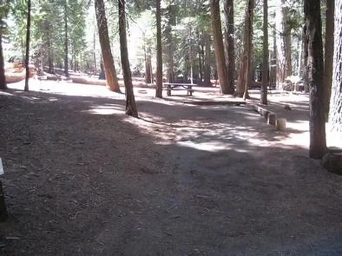
Overview Sunset Campground is situated on the shores of Union Valley Reservoir, among the towering cedar and ponderosa pines of Eldorado National Forest. Aptly named, the campground is a fantastic destination for colorful sunset views over the lake. All water activities are popular here, but it's also fun to bring a bike and explore the neighboring bike trail. Eldorado includes the famed gold mining territory of the 1800s. Remnants of the days of the California Gold Rush can be found all around the region. Recreation On the water, sailing, boating and swimming are very popular. For hikers and bikers, the Union Valley Bike Trail and Bassi Falls Hiking Trail are great for exploring. Fishing in the lake includes rainbow, brown, mackinaw trout and kokanee salmon. The bike trail connects with the campground, near the boat ramp, and stretches for 4.8 miles along the eastern shores of the lake. Facilities On the water, sailing, boating and swimming are very popular. For hikers and bikers, the Union Valley Bike Trail and Bassi Falls Hiking Trail are great for exploring. Fishing in the lake includes rainbow, brown, mackinaw trout and kokanee salmon. The bike trail connects with the campground, near the boat ramp, and stretches for 4.8 miles along the eastern shores of the lake. Natural Features Sunset Campground sits in the Crystal Basin at an elevation of 5,000 feet. Some sites are fully shaded while others sit in a meadow. The climate is similar to that of the Mediterranean with warm, dry summers and cold, wet winters. contact_info This location has limited staffing. Please call (831) 245-6891 for general information. Nearby Attractions Venture to the nearby lake, Ice House Reservoir or hike up Twin Peaks to look down over Union Valley Reservoir. A restaurant and general store are within 5 miles of the campground. Charges & Cancellations Recreation Fee: Recreation fees are the fees a visitor pays for things like overnight camping, a day-use pavilion, group facilities, a tour or a permit. Recreation fees vary by location and/or activity. Reservation Fee: A fee may be charged at the time a reservation is made to cover the cost of reservation services. This fee is in addition to the Recreation Fee and is non-refundable. Fees for camping, day use, group sites, cabins and lookouts: $8 if made on-line; $9 if made through the call center; $3 if made in-person. Change Fee: A service fee may be charged at the time a modification is made depending on the changes. Cancellation Fee: A $10 service fee will be withheld from any refunds for a cancelled reservation. Customers who cancel a group overnight facility reservation less than 14 days before the arrival date will pay a $10.00 service fee AND forfeit the first night's use fee. Cut-Off Window: The latest date and/or time that you can make an advanced reservation or a change to an existing reservation. Cut-off windows can vary by location, but are typically 4 days before your arrival date. A customer who cancels a reservation the day before or on the day of arrival will pay a $10.00 service fee AND forfeit the first night's use fee (see Late Cancellation below). Late Cancellation: If you cancel your reservation too close to the start date, additional service fees may be withheld.
View details →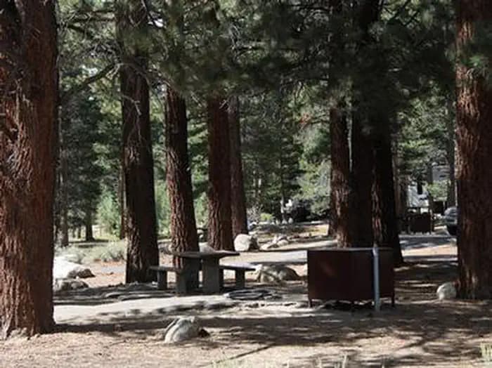
Overview Robinson Creek North Campground is located just 9 miles from Bridgeport, California, next to Robinson Creek at an elevation of 7,000 feet. The Twin Lakes area is close by, offering boating, fishing, hiking and horseback riding opportunities. Recreation Robinson Creek offers good rainbow trout fishing and can be easily accessed from within the campground. Numerous hiking trails are in the vicinity, including the popular Robinson Creek Trail. Facilities Robinson Creek offers good rainbow trout fishing and can be easily accessed from within the campground. Numerous hiking trails are in the vicinity, including the popular Robinson Creek Trail. Natural Features The campground is situated alongside its namesake creek, where a forest of massive Jeffrey pines towers over the site, offering partial shade. Lodgepole pines, sagebrush and summer wildflowers dot the landscape. Nearby Attractions Upper and Lower Twin Lakes are nearby, offering beautiful mountain scenery, boating, canoeing and fishing for Kokanee salmon and rainbow and brown trout. The rugged and scenic Hoover Wilderness Area can be accessed from the Twin Lakes area and offers additional trails for hiking and horseback riding.
View details →
Overview The Skyline Group Campground is a great place to enjoy an extended family or large group camping experience. It is close to a variety of wilderness trails and offers abundant fishing opportunities within the surrounding mountain creeks. Recreation Backcountry hiking, biking and horseback riding trails can be found near the campground, including the famed Santa Ana River Trail, which provides miles of scenic mountain views and points of exploration. Creek fishing is also available nearby. The Wildhorse Creek Trail, which explores 5 miles of rolling terrain in the area, can be accessed north of the campground and leads to a remote camping area south of Wildhorse Meadow, climbing 1,100 feet in elevation. The serene Aspen Grove Trail, which leads to a small remnant grove of quaking aspen, is adjacent to nearby Fish Creek. The scenery is beautiful in the fall, when the leaves turn a golden color. A wilderness permit may be required to hike in the area. Facilities Backcountry hiking, biking and horseback riding trails can be found near the campground, including the famed Santa Ana River Trail, which provides miles of scenic mountain views and points of exploration. Creek fishing is also available nearby. The Wildhorse Creek Trail, which explores 5 miles of rolling terrain in the area, can be accessed north of the campground and leads to a remote camping area south of Wildhorse Meadow, climbing 1,100 feet in elevation. The serene Aspen Grove Trail, which leads to a small remnant grove of quaking aspen, is adjacent to nearby Fish Creek. The scenery is beautiful in the fall, when the leaves turn a golden color. A wilderness permit may be required to hike in the area. Natural Features The campground is nestled among pine-covered mountains, at an elevation of 6,880 feet. It is not far from the Big Bear Lake, but far enough to retain a remote and secluded atmosphere. Plentiful pines tower over the site, but are sparse in some places, allowing daylight to flow in. A variety of mountain creeks and streams are nearby. Nearby Attractions The Big Bear Lake and its adjoining town are located approximately 20 miles from the campground, offering a variety of water-related recreation opportunities, as well as golf, shopping and restaurant options. Charges & Cancellations Rules & Reservation Policies As you make travel plans that include reservations on Recreation.gov, there are standard policies that apply to most locations of which you should be aware. Do keep in mind, however, that there are many exceptions, so it is best to review reservation information listed on individual facility pages for those policies and procedures that pertain to your specific locations. Any location or activity requiring a permit or lottery will have unique requirements and policies. Please check individual facility pages for pertinent information for those sites. Booking Window For most locations, you can reserve six months in advance of your stay for individual sites and 12 months in advance for group sites. There are some exceptions, so it is best to check with each facility. Change and Cancellation Policies and Fees Overnight and Day Use Facilities: To ensure fairness, reservation arrival or departure dates may not be changed beyond the booking window until 18 days after booking the reservation. Camping / Day Use: A $10.00 service fee will apply if you change or cancel your reservation (including campsites, cabins, lookouts, group facilities, etc.). The $10.00 service fee will be deducted from the refund amount. You can cancel or change reservations through Recreation.gov or by calling 1-877-444-6777. Tours & Tickets: You may request changes to tour dates at no cost before the arrival date. If you cancel before your tour date, you may be eligible for a refund. Cancellation fees apply. Please check the tour facility description details page for cancellation policies. Permits: Varies by location. Please check the permit details for the permit location. Late Cancellations Overnight and Day Use Facilities: Late cancellations are those cancelled between 12:01 a.m. (Eastern) on the day before arrival and check out time on the day after arrival. Individual Campsites: If a customer cancels a reservation the day before or on the day of arrival they will be charged a $10.00 service fee and will also forfeit the first night's use fee (not to exceed the total paid for the original reservation). Cancellations for a single night's reservation will forfeit the entire use fee but no cancellation fee will apply. Cabins / Lookouts: Customers will be charged a $10.00 cancellation fee and forfeit the first night's use fee if a cabin or lookout reservation is cancelled within 14 days of the scheduled arrival date. Cancellations for a single night's use will not be assessed a service fee. Group Facility: If a customer cancels a group overnight facility reservation within 14 days of the scheduled arrival date they will be charged the $10.00 service fee and forfeit the first night's use fee. Cancellations for a single night's use will not be assessed a service fee. Group Day Use Area: If a customer cancels a group day use facility reservation within 14 days of the scheduled arrival date, they will forfeit the total day use fee with no service fee charge. No-Shows Camping / Day Use: A camping no-show customer is one who does not arrive at a campground and does not cancel the reservation by check-out time on the day after the scheduled arrival date. Reserved campsites and group overnight facilities will be held until check-out time on the day following your scheduled arrival. Group day-use facilities will be held until check-in time on your scheduled arrival date. If a customer does not arrive at the campground or group facility by check-out time the day after arrival or does not cancel the reservation by the times listed under "Late Cancellations" above, the customer may be assessed a $20.00 service fee and forfeit use fees. Tours: A tour or ticket no-show is one who does not cancel a ticket before arrival and does not arrive for the tour. Tour no-shows are not entitled to a refund. Refunds Customers must request refunds no later than 14 days after the scheduled departure date. Recreation.gov will not grant refund requests after 14 days of departure. Reservation Fee: For some facilities, tours or permits an additional reservation fee is charged. For some overnight and day-use facilities, an additional non-refundable reservation fee may apply. The non-refundable reservation fee for tours and tickets is $1.00. The non-refundable reservation fee for permits varies by location. Refunds for Bankcard Purchases: Refunds for bank card payments will be issued as a credit to the original bank card. Refunds for Check or Cash Purchases: Refunds for Recreation.gov payments made by check or money order, and cash payments at selected campgrounds will be issued a check refund. A refund will be processed within 30 days of receipt and approval. Please Note: Refund requests made during or after departure can only be processed when approved by the facility management staff based upon local policy. Refunds for Emergency Closures: In the event of an emergency closure, the Recreation.gov team will attempt to notify users and offer alternate dates (as appropriate). If this is not possible, reservations will be cancelled and all fees paid will be refunded. Reservation fees for free tickets are non-refundable in the event of an emergency closure. Recreation.gov Billing Information Reservation transaction will appear on customer's credit card statements as "Recreation.gov 877-444-6777." Changes to Policies and Procedures Recreation.gov reserves the right, when necessary, to modify reservation policies. These policies were last updated July
View details →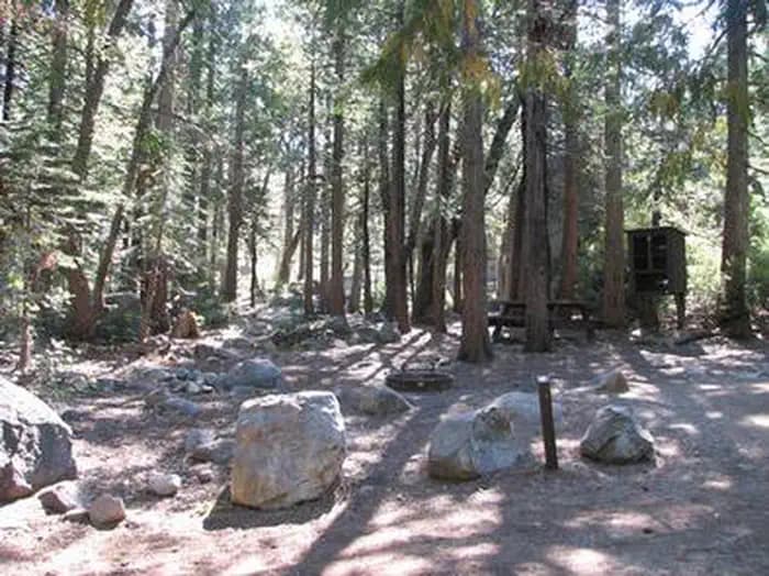
Overview Stumpy Meadows, on the Stumpy Meadows Reservoir, provides an enjoyable setting in a heavy conifer forest with easy access to an array of water activities. Campers come here to while away warm summer days on the lake and enjoy the sights and sounds of the great outdoors. The campground provides easy access to both hiking and biking trails. The historic town of Georgetown is 15 miles away. In the 19th century, the town was a hub of the productive gold mining region, and residents proclaimed the town the "pride of the mountains." Recreation The crystal clear reservoir is stocked with both Rainbow and German Brown Trout, providing excellent fishing during the season. The lake is a grand place for a swim. Kayaking and canoeing are much enjoyed activities on the lake's clear waters. Slow-paced motor boating is allowed, but is restricted to a 5 m.p.h. speed limit. Facilities The crystal clear reservoir is stocked with both Rainbow and German Brown Trout, providing excellent fishing during the season. The lake is a grand place for a swim. Kayaking and canoeing are much enjoyed activities on the lake's clear waters. Slow-paced motor boating is allowed, but is restricted to a 5 m.p.h. speed limit. Natural Features All sites are shaded by groves of towering Ponderosa pine, fir, oak, and cedar trees. The campground is in Eldorado National forest, which boasts over 400 miles of hiking trails, an abundance of lakes and rivers for fishing and swimming, and incredible scenery. Here, the climate is similar to that of the Mediterranean with warm, dry summers and cold, wet winters. Nearby Attractions Take a drive on the El Dorado County Scenic Highway or visit the Marshall Gold Discovery State Historic Park. Charges & Cancellations Recreation Fee: Recreation fees are the fees a visitor pays for things like overnight camping, a day-use pavilion, group facilities, a tour or a permit. Recreation fees vary by location and/or activity. Reservation Fee: A fee may be charged at the time a reservation is made to cover the cost of reservation services. This fee is in addition to the Recreation Fee and is non-refundable. Fees for camping, day use, group sites, cabins and lookouts: $8 if made on-line; $9 if made through the call center; $3 if made in-person. Change Fee: A service fee may be charged at the time a modification is made depending on the changes. Cancellation Fee: A $10 service fee will be withheld from any refunds for a cancelled reservation. Cut-Off Window: The latest date and/or time that you can make an advanced reservation or a change to an existing reservation. Cut-off windows can vary by location, but are typically 4 days before your arrival date. A customer who cancels a reservation the day before or on the day of arrival will pay a $10.00 service fee AND forfeit the first night's use fee (see Late Cancellation below). Late Cancellation: If you cancel your reservation too close to the start date, additional service fees may be withheld.
View details →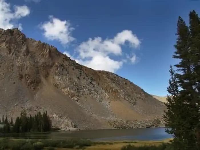
Overview Trumbull Lake Campground is located next to its scenic namesake at an elevation of 9,980 feet. The lake is one of ten alpine lakes in the area. Visitors enjoy fishing, canoeing and exploring local trails. Recreation Trumbull Lake offers canoeing and fishing for rainbow, brown and brook trout in a beautiful natural setting. Facilities Trumbull Lake offers canoeing and fishing for rainbow, brown and brook trout in a beautiful natural setting. Natural Features The campground is situated on the shores of quiet Trumbull Lake, a 100-acre lake surrounded by towering peaks and glacier-carved cirques. A dense forest of lodgepole pine covers the campground, providing ample shade in most campsites. Aspens and summer wildflowers dot the landscape. Nearby Attractions The Virginia Lakes area is very close, offering additional canoeing and fishing. The Virginia Lake Trail, for hiking and horseback riding, provides access into the adjacent Hoover Wilderness Area and Yosemite National Park. Bodie State Park.
View details →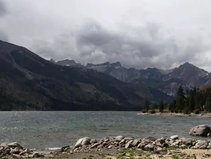
Overview Lower Twin Lakes Campground is located just 10 miles from Bridgeport, California. The Twin Lakes area is close by, offering boating, fishing, hiking and horseback riding opportunities. Recreation Robinson Creek offers good rainbow trout fishing and can be easily accessed from within the campground. Numerous hiking trails are in the vicinity, including the popular Robinson Creek Trail. Facilities Robinson Creek offers good rainbow trout fishing and can be easily accessed from within the campground. Numerous hiking trails are in the vicinity, including the popular Robinson Creek Trail. Natural Features The campground is situated next to Robinson Creek, just below Lower Twin Lake, at an elevation of 7,000 feet. Massive Jeffrey pines tower over the site, offering partial shade. Aspens, sagebrush and summer wildflowers dot the landscape. Nearby Attractions Upper and Lower Twin Lakes are within walking distance, offering beautiful mountain scenery, boating, canoeing and fishing for Kokanee salmon and rainbow and brown trout. A public boat ramp and beach are half-mile from the campground. The rugged and scenic Hoover Wilderness Area can be accessed from the Twin Lakes area and offers additional trails for hiking and horseback riding.
View details →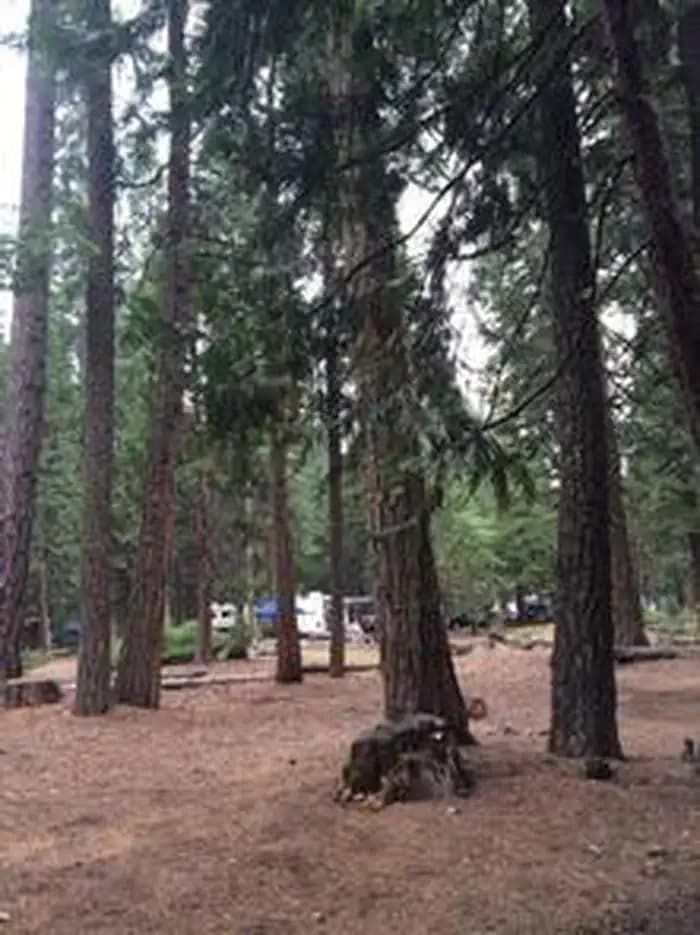
Overview Wench Creek Campground is located in a beautiful ponderosa pine forest on the east shore of Union Valley Reservoir. The campground has 2 group campsites and several single family campsites. Plenty of water activities await at this reservoir in the Sierra Nevada foothills. The Union Valley Bike Trail and Bassi Falls Hiking Trail are worth exploring. The Union Valley Trail runs right through Wench Creek. Recreation The Union Valley Bike Trail spans 4.8 miles with an easy climb of 300 feet. The trail connects campgrounds on the east side of the lake, starting from Wench Creek on to the Jones Fork Campground. Interpretive signs along the trail tell the story of the use and development of water resources in Union Valley. This trail can be used by both hikers and bikers. Anglers delight in seeking kokanee salmon, rainbow, brown, small mouth bass and mackinaw trout. The reservoir also offers opportunities for swimming, water skiing and boating. Boat ramps are located near Sunset and Yellowjacket Campgrounds. Facilities The Union Valley Bike Trail spans 4.8 miles with an easy climb of 300 feet. The trail connects campgrounds on the east side of the lake, starting from Wench Creek on to the Jones Fork Campground. Interpretive signs along the trail tell the story of the use and development of water resources in Union Valley. This trail can be used by both hikers and bikers. Anglers delight in seeking kokanee salmon, rainbow, brown, small mouth bass and mackinaw trout. The reservoir also offers opportunities for swimming, water skiing and boating. Boat ramps are located near Sunset and Yellowjacket Campgrounds. Natural Features Union Valley Reservoir sits in the Crystal Basin at an elevation of 4,900 feet. The area is part of the Eldorado National Forest. Eldorado includes the famed gold mining territory of the 1800s. Protected remnants of the days of the California Gold Rush are all around the region. An abundance of wildlife can be found within the Sierra Nevada Range, including black bears, mule deer, bobcat, gray fox, bighorn sheep, pikas, martens and a variety of squirrels. Several species of reptiles, amphibians and birds also inhabit the area. Nearby Attractions The Desolation Wilderness is nearby, offering the opportunity to get away from the crowds and enjoy the serenity of nature. Charges & Cancellations Change Fee: A service fee may be charged at the time a modification is made depending on the changes. Cancellation Fee: A $10 service fee will be withheld from any refunds for a cancelled reservation. Cut-Off Window: The latest date and/or time that you can make an advanced reservation or a change to an existing reservation. Cut-off windows can vary by location, but are typically 4 days before your arrival date. A customer who cancels a reservation the day before or on the day of arrival will pay a $10.00 service fee AND forfeit the first night's use fee (see Late Cancellation below). Late Cancellation: If you cancel your reservation too close to the start date, additional service fees may be withheld. Refunds : Refund requests made through www.recreation.gov will be charged a $10 processing fee. This fee is retained by the reservation service contractor along with the non-refundable reservation fee. All requests for the return of the non-refundable reservation fee and the cancellation fee will be declined by the campground concessionaire as they did not receive these fees (these are the fees retained by the reservation contractor, a different entity).
View details →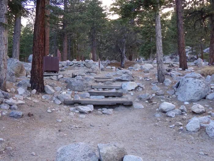
Overview Whitney Portal Campground is in a prime location within the eastern Sierra Nevada Mountains - at the base of Mt. Whitney, the highest peak in the continental United States. With hiking trails to Mt. Whitney and the John Muir Wilderness less than a mile away, the campground is a popular home base for hikers, as well as family, RV and tent campers who wish to explore the area's activities and enjoy unparalleled scenery. Recreation Hikers are drawn to the majestic scenery and challenging trails of the Whitney Portal recreation area. Nearby trails lead into the John Muir Wilderness and Sequoia and Kings Canyon National Park. The campground is only 0.5 miles from trailheads to Mt. Whitney, Meysan Lake and other popular destinations. Visitors should be aware that hiking in this area may require a permit. Visitors can also hike, fish and picnic in the area around the campground. There are numerous lakes, streams and a small pond in the area for trout fishing. Facilities Hikers are drawn to the majestic scenery and challenging trails of the Whitney Portal recreation area. Nearby trails lead into the John Muir Wilderness and Sequoia and Kings Canyon National Park. The campground is only 0.5 miles from trailheads to Mt. Whitney, Meysan Lake and other popular destinations. Visitors should be aware that hiking in this area may require a permit. Visitors can also hike, fish and picnic in the area around the campground. There are numerous lakes, streams and a small pond in the area for trout fishing. Natural Features The facility is situated in a thick pine forest at an elevation of 8,000 ft. Campers can see striking views of the rugged granite peaks surrounding it. The area is home to abundant wildlife, including black bear, mountain lions, mule deer, pine martin, pika and many species of fish and birds. This campground is especially prone to bear activity. Nearby Attractions Campers can enter the John Muir Wilderness, a land of lofty snow-capped mountains, deep canyons and vast expanses of glacially carved terrain, via nearby trails. Mt. Whitney is within the wilderness area and entry is available by lottery for experienced hikers. John Muir Wilderness contact_info For facility specific information, please call (602) 726-1102.
View details →
Overview Yellowjacket Campground provides plenty of opportunities for outdoor fun on Union Valley Reservoir. The water plays host to an array of activities like water skiing and fishing. The surrounding cedar and ponderosa pine forest is a lovely setting for hiking and biking. Recreation The Union Valley Bike Trail spans 4.8 miles with an easy climb of 300 feet. The trail connects campgrounds on the east side of the lake, from Jones Fork Campground to Wench Creek, and is open to hikers and bikers. The Bassi Falls Hiking Trail is also worth exploring. Anglers seek rainbow, brown and mackinaw trout or kokanee salmon. The reservoir also offers opportunities for swimming, water skiing and boating. A boat ramp and boat trailer parking are provided at this campground. Facilities The Union Valley Bike Trail spans 4.8 miles with an easy climb of 300 feet. The trail connects campgrounds on the east side of the lake, from Jones Fork Campground to Wench Creek, and is open to hikers and bikers. The Bassi Falls Hiking Trail is also worth exploring. Anglers seek rainbow, brown and mackinaw trout or kokanee salmon. The reservoir also offers opportunities for swimming, water skiing and boating. A boat ramp and boat trailer parking are provided at this campground. Natural Features Union Valley Reservoir sits in the Crystal Basin within the Sierra Nevada Mountains at an elevation of 4,900 feet. The area is part of the Eldorado National Forest, which includes the famed gold mining territory of the 1800s. Protected remnants of the days of the California Gold Rush are all around the region. The climate is similar to that of the Mediterranean, with warm, dry summers and cold, wet winters. An abundance of wildlife can be found within the Sierra Nevada Range, including black bears, mule deer, bobcat, gray fox, bighorn sheep, pikas, martens and a variety of squirrels. Several species of reptiles, amphibians and birds also inhabit the area. contact_info For facility specific information, please call (831) 245-6891. Nearby Attractions The Desolation Wilderness is nearby, offering the opportunity to get away from the crowds and enjoy the serenity of nature. Charges & Cancellations Change Fee: A service fee may be charged at the time a modification is made depending on the changes. Cancellation Fee: A $10 service fee will be withheld from any refunds for a cancelled reservation. Cut-Off Window: The latest date and/or time that you can make an advanced reservation or a change to an existing reservation. Cut-off windows can vary by location, but are typically 4 days before your arrival date. A customer who cancels a reservation the day before or on the day of arrival will pay a $10.00 service fee AND forfeit the first night's use fee (see Late Cancellation below). Late Cancellation: If you cancel your reservation too close to the start date, additional service fees may be withheld. Refunds: Refund requests made through www.recreation.gov will be charged a $10 processing fee. This fee is retained by the reservation service contractor along with the non-refundable reservation fee. All requests for the return of the non-refundable reservation fee and the cancellation fee will be declined by the campground concessionaire as they did not receive these fees (these are the fees retained by the reservation contractor, a different entity).
View details →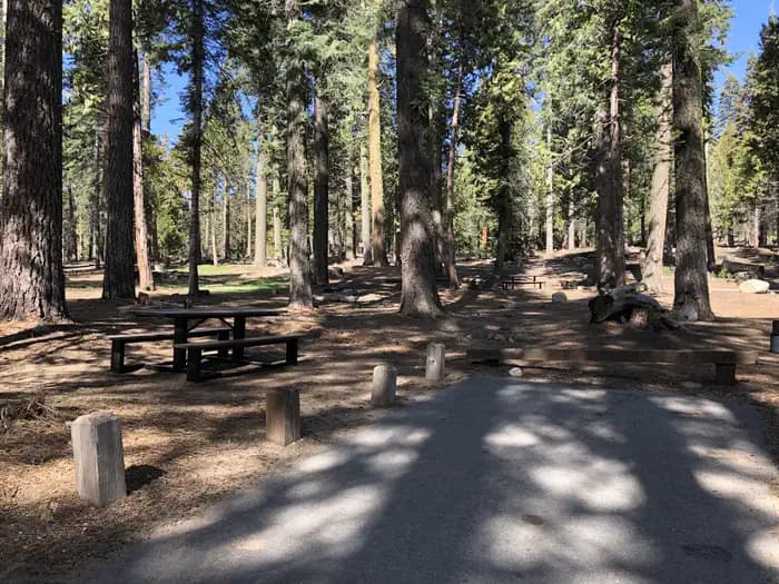
Overview Dinkey Creek is spread out along the banks of its namesake creek in a thick forest of Ponderosa pines and cedars. The facility's high country setting with trees, streams and open space, make it a scenic destination for all types of visitors. Recreation Dinkey Creek has 2 swimming areas: The Slicks and Honeymoon Pool, both of which contain pools carved out of granite. Anglers can fish Dinkey Creek for brown and rainbow trout. Hikers can walk the Dinkey Creek Trail. Mountain bikers also have trail access in this area. Facilities Dinkey Creek has 2 swimming areas: The Slicks and Honeymoon Pool, both of which contain pools carved out of granite. Anglers can fish Dinkey Creek for brown and rainbow trout. Hikers can walk the Dinkey Creek Trail. Mountain bikers also have trail access in this area. Natural Features The Sierra National Forest, located on the western slope of the central Sierra Nevada, is known for its spectacular mountain scenery and abundant natural resources. The terrain includes rolling, oak-covered foothills, heavily forested middle elevation slopes and the starkly beautiful alpine landscape of the High Sierra. contact_info For facility specific information, please call (559) 841-2705. Nearby Attractions McKinley Grove is 6 miles away. Famous for its giant Redwoods, the area offers leisurely hikes and picnicking opportunities. Charges & Cancellations Rules & Reservation Policies As you make travel plans that include reservations on Recreation.gov, there are standard policies that apply to most locations of which you should be aware. Do keep in mind, however, that there are many exceptions, so it is best to review reservation information listed on individual facility pages for those policies and procedures that pertain to your specific locations. Any location or activity requiring a permit or lottery will have unique requirements and policies. Please check individual facility pages for pertinent information for those sites. Booking Window For most locations, you can reserve six months in advance of your stay for individual sites and 12 months in advance for group sites. There are some exceptions, so it is best to check with each facility. Change and Cancellation Policies and Fees Overnight and Day Use Facilities: To ensure fairness, reservation arrival or departure dates may not be changed beyond the booking window until 18 days after booking the reservation. Camping / Day Use: A $10.00 service fee will apply if you change or cancel your reservation (including campsites, cabins, lookouts, group facilities, etc.). The $10.00 service fee will be deducted from the refund amount. You can cancel or change reservations through Recreation.gov or by calling 1-877-444-6777. Tours & Tickets: You may request changes to tour dates at no cost before the arrival date. If you cancel before your tour date, you may be eligible for a refund. Cancellation fees apply. Please check the tour facility description details page for cancellation policies. Permits: Varies by location. Please check the permit details for the permit location. Late Cancellations Overnight and Day Use Facilities: Late cancellations are those cancelled between 12:01 a.m. (Eastern) on the day before arrival and check out time on the day after arrival. Individual Campsites: If a customer cancels a reservation the day before or on the day of arrival they will be charged a $10.00 service fee and will also forfeit the first night's use fee (not to exceed the total paid for the original reservation). Cancellations for a single night's reservation will forfeit the entire use fee but no cancellation fee will apply. Cabins / Lookouts: Customers will be charged a $10.00 cancellation fee and forfeit the first night's use fee if a cabin or lookout reservation is cancelled within 14 days of the scheduled arrival date. Cancellations for a single night's use will not be assessed a service fee. Group Facility: If a customer cancels a group overnight facility reservation within 14 days of the scheduled arrival date they will be charged the $10.00 service fee and forfeit the first night's use fee. Cancellations for a single night's use will not be assessed a service fee. Group Day Use Area: If a customer cancels a group day use facility reservation within 14 days of the scheduled arrival date, they will forfeit the total day use fee with no service fee charge. No-Shows Camping / Day Use: A camping no-show customer is one who does not arrive at a campground and does not cancel the reservation by check-out time on the day after the scheduled arrival date. Reserved campsites and group overnight facilities will be held until check-out time on the day following your scheduled arrival. Group day-use facilities will be held until check-in time on your scheduled arrival date. If a customer does not arrive at the campground or group facility by check-out time the day after arrival or does not cancel the reservation by the times listed under "Late Cancellations" above, the customer may be assessed a $20.00 service fee and forfeit use fees. Tours: A tour or ticket no-show is one who does not cancel a ticket before arrival and does not arrive for the tour. Tour no-shows are not entitled to a refund. Refunds Customers must request refunds no later than 14 days after the scheduled departure date. Recreation.gov will not grant refund requests after 14 days of departure. Reservation Fee: For some facilities, tours or permits an additional reservation fee is charged. For some overnight and day-use facilities, an additional non-refundable reservation fee may apply. The non-refundable reservation fee for tours and tickets is $1.00. The non-refundable reservation fee for permits varies by location. Refunds for Bankcard Purchases: Refunds for bank card payments will be issued as a credit to the original bank card. Refunds for Check or Cash Purchases: Refunds for Recreation.gov payments made by check or money order, and cash payments at selected campgrounds will be issued a check refund. A refund will be processed within 30 days of receipt and approval. Please Note: Refund requests made during or after departure can only be processed when approved by the facility management staff based upon local policy. Refunds for Emergency Closures: In the event of an emergency closure, the Recreation.gov team will attempt to notify users and offer alternate dates (as appropriate). If this is not possible, reservations will be cancelled and all fees paid will be refunded. Reservation fees for free tickets are non-refundable in the event of an emergency closure. Recreation.gov Billing Information Reservation transaction will appear on customer's credit card statements as "Recreation.gov 877-444-6777." Changes to Policies and Procedures Recreation.gov reserves the right, when necessary, to modify reservation policies. These policies were last updated July
View details →
Overview Frenchman Campground (5,700 feet) sites along the shores of its namesake lake, which boasts 21 miles of shoreline. The campground is situated at the southeastern peninsula of the lake. Situated on a pine covered hillside overlooking the lake, this is the place for campers to get in tune with their surroundings. The lake is at the interface between the mountains of the Sierra Nevada and high desert. Frenchman Lake and the surrounding Plumas National Forest together provide ample opportunity for recreation, relaxation and adventure. Recreation During peak camping season, the campground offers a variety of outdoor experiences including hiking, biking, picnicking and hunting. The nearby lake provides ample opportunities for swimming, boating, waterskiing, jet skiing and fishing. Frenchman Lake Boat Launching Facility and a day use area are near the campground. Winter activities range from ice fishing to snowmobiling. Facilities During peak camping season, the campground offers a variety of outdoor experiences including hiking, biking, picnicking and hunting. The nearby lake provides ample opportunities for swimming, boating, waterskiing, jet skiing and fishing. Frenchman Lake Boat Launching Facility and a day use area are near the campground. Winter activities range from ice fishing to snowmobiling. Natural Features As part of California's Plumas National Forest, the campground is located in northern California, between the rugged Sierra Nevada and the fringes of the Cascade ranges. The forest is home to hundreds of high alpine lakes and thousands of miles of clear-running streams. Pine trees provide moderate to good shade in most sites. A variety of wildlife make its home in the area. contact_info For facility specific information, please call (530) 836-2575. Nearby Attractions Little Last Chance Canyon Scenic Area Sierra Valley - Largest valley in the Sierra nevada Stores and services in the towns of Chilcoot and Loyalton many forest roads to explore - take along a map, full tank and dependable vehicle
View details →
Overview Wheeler Gorge Campground is a great place for families to explore the Los Padres National Forest all year long. Informative tours of the area are led by forest rangers at the nearby visitor center. The campground provides scenic views of a nearby stream, as well as vast mountain vistas. Recreation The Wheeler Gorge Nature Trail begins at the upper end of the campground. It is a relatively short loop that leads through thick vegetation along the creek banks and to a hillside view of the area. Wildflowers often bloom along the path. The creek flows near some of the campsites and a small swimming hole is frequented near the side of the highway. Fishing is rough in the area and may produce a catch of trout, but the stream is not stocked. Kayaking or canoeing in the creek is not recommended. Educational programs, including ranger-led hikes, are offered year-round. Facilities The Wheeler Gorge Nature Trail begins at the upper end of the campground. It is a relatively short loop that leads through thick vegetation along the creek banks and to a hillside view of the area. Wildflowers often bloom along the path. The creek flows near some of the campsites and a small swimming hole is frequented near the side of the highway. Fishing is rough in the area and may produce a catch of trout, but the stream is not stocked. Kayaking or canoeing in the creek is not recommended. Educational programs, including ranger-led hikes, are offered year-round. Natural Features The campground is adjacent to Matilija Creek, and is bordered by a mixed forest of oak and sycamore trees and evergreen shrubbery. Most sites are shaded and summer temperatures reach up to 95 degrees. The campground was originally built by Boy Scouts nearly a century ago, as well as a historical stone home that is also on-site. Nearby Attractions Ventura and the Pacific Ocean are about 20 miles south of the campground.
View details →
Overview Hope Valley Campground is located in its beautiful namesake valley at an elevation of 7,300 feet, just 40 minutes south of Lake Tahoe. Visitors enjoy fishing the West Fork Carson River and exploring local trails. Recreation The West Fork Carson River runs nearby, offering rainbow and cutthroat trout fishing. Numerous trails in the area provide excellent hiking and backpacking opportunities. Facilities The West Fork Carson River runs nearby, offering rainbow and cutthroat trout fishing. Numerous trails in the area provide excellent hiking and backpacking opportunities. Natural Features The campground is situated in a forest of Jeffrey and lodgepole pines on the edge of Hope Valley. The area affords views of the scenic valley and surrounding forested mountains. Nearby Attractions Hope Valley is only 40 miles from the beautiful Lake Tahoe. Tahoe offers excellent boating, kayaking, fishing, hiking and scenic driving opportunities.
View details →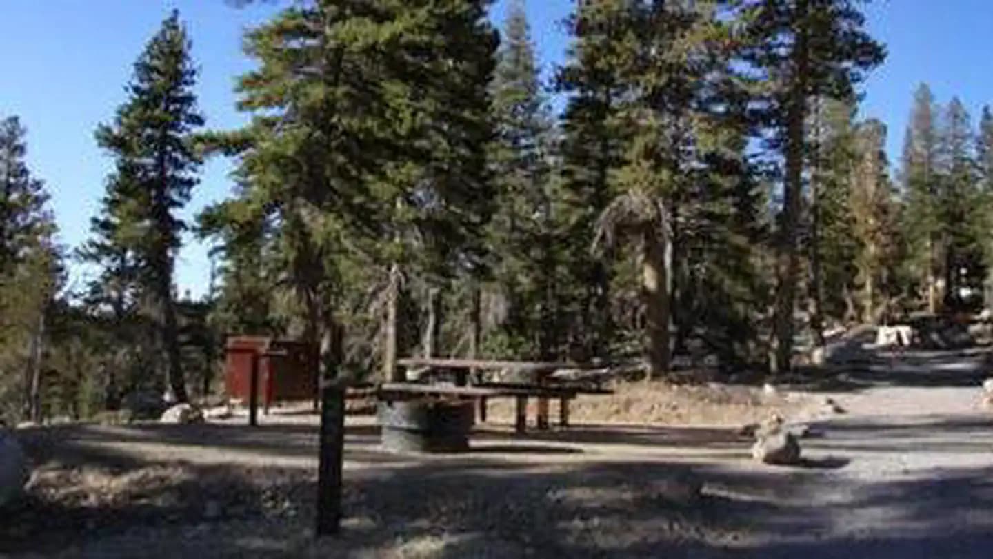
Overview Mount Rose Campground is conveniently located between Reno and Lake Tahoe just off scenic Mount Rose Highway. Visitors love the campground for its proximity to excellent hiking trails and recreational opportunities at Lake Tahoe. Recreation Hiking is the most popular pastime at Mount Rose. Several trails, including the Tahoe Meadows, Tahoe Rim, Mount Rose Wilderness and Mount Rose Summit Trails, begin very close to the campground. Facilities Hiking is the most popular pastime at Mount Rose. Several trails, including the Tahoe Meadows, Tahoe Rim, Mount Rose Wilderness and Mount Rose Summit Trails, begin very close to the campground. Natural Features The campground is situated high on the western slope of Mount Rose at an elevation of 9,300 feet. A scenic forest of lodgepole pine, Jeffrey pine, white pine and red fir covers the campground, offering pleasant shade in most sites. Nearby Attractions Mount Rose is conveniently close to beautiful Lake Tahoe, less than 30 minutes away. Tahoe offers excellent boating, kayaking, fishing, hiking and scenic driving opportunities.
View details →
Overview Silver Creek Campground is located near the town of Markleeville on scenic Highway 4. Visitors enjoy fishing various waterways in the area and exploring the nearby Pacific Crest Trail. Recreation Anglers enjoy fishing the nearby East Fork Carson River, as well as other creeks in the vicinity. The Pacific Crest Trail can be accessed just 3 miles west of the site. Facilities Anglers enjoy fishing the nearby East Fork Carson River, as well as other creeks in the vicinity. The Pacific Crest Trail can be accessed just 3 miles west of the site. Natural Features The campground is situated in a beautiful, shady fir and pine forest on the mountainside just above Noble Creek. The elevation is 7,100 feet.
View details →
Overview Hayward Flat is one of the most popular campgrounds on Trinity Lake, offering excellent lake access and plenty of shade from Ponderosa pines and Douglas firs. Located on one of the best arms of the lake for water skiing, Hayward is favored by visitors interested in water sports. Relics from the area's Placer mining history are scattered throughout the campground, with interpretive signs providing explanations. Recreation A boat ramp and marina are located 3 miles away, but mooring may be available at the campground. Popular activities include power and non-motorized boating, fishing, swimming and water skiing. Anglers can fish for catfish, as well as a variety of bass, trout and salmon. Facilities A boat ramp and marina are located 3 miles away, but mooring may be available at the campground. Popular activities include power and non-motorized boating, fishing, swimming and water skiing. Anglers can fish for catfish, as well as a variety of bass, trout and salmon. Natural Features The Shasta-Trinity is the largest national forest in California with a diverse landscape ranging from 1,000 to 14,162 feet. The 2.1 million acre forest encompasses five wilderness areas, hundreds of mountain lakes and 6,278 miles of streams and rivers. Trinity Lake sits at an elevation of 2,370 feet and is surrounded by the Trinity Alps. Black bears are frequently spotted in the area, as well as bobcats, mountain lions and a variety of bird species. Nearby Attractions The nearby town of Weaverville is listed on the National Register of Historic Places. This former mining town offers restaurants, shopping and self-guided walking tours.
View details →
Overview Tannery Gulch Campground offers four loops of sites shaded by a mix of conifer and deciduous trees on the shores of Trinity Lake. Three of the four loops offer scenic lake views. Campers at Tannery Gulch have access to a wide range of recreational activities, and an on-site amphitheater offers programs during the summer. Recreation Hikers can access the half-mile Trail of the Trees from the campground. Tannery Gulch also features a boat ramp and swim beach that are only open for use by campers at the facility. Popular activities on Trinity Lake include power and non-motorized boating, fishing, sailing and water skiing. Anglers can cast for catfish, as well as a variety of bass, trout and salmon. Facilities Hikers can access the half-mile Trail of the Trees from the campground. Tannery Gulch also features a boat ramp and swim beach that are only open for use by campers at the facility. Popular activities on Trinity Lake include power and non-motorized boating, fishing, sailing and water skiing. Anglers can cast for catfish, as well as a variety of bass, trout and salmon. Natural Features Trinity Lake sits at an elevation of 2,370 feet and is surrounded by the Trinity Alps. Black bears are frequently spotted in the area, as well as bobcats, mountain lions and a variety of bird species. Shasta-Trinity is the largest national forest in California with a diverse landscape encompassing five wilderness areas, hundreds of mountain lakes and 6,278 miles of streams and rivers. Nearby Attractions The nearby town of Weaverville is listed on the National Register of Historic Places. The former mining town offers restaurants, shopping and self-guided walking tours.
View details →
Overview Big Pine Canyon Recreation Area includes two group campground sites. Named for glaciers that can be seen at the end of the valley, Clyde Glacier Group Site and Palisade Glacier Group Site sit along Big Pine Creek. Recreation Fishing is a popular activity in the creek and nearby lakes. Climbers make use of the steep, glacier-carved canyon walls for excellent climbing opportunities. The North Fork Trail climbs past waterfalls and zigzags through Jeffrey pine, manzanita and sage before it reaches Big Pine Lakes with views of Palisade Glacier, the largest glacier. The South Fork Trail climbs to small lakes fed by glacial waters from Norman Clyde and Middle Palisade Glaciers, the southernmost glaciers. Facilities Fishing is a popular activity in the creek and nearby lakes. Climbers make use of the steep, glacier-carved canyon walls for excellent climbing opportunities. The North Fork Trail climbs past waterfalls and zigzags through Jeffrey pine, manzanita and sage before it reaches Big Pine Lakes with views of Palisade Glacier, the largest glacier. The South Fork Trail climbs to small lakes fed by glacial waters from Norman Clyde and Middle Palisade Glaciers, the southernmost glaciers. Natural Features Big Pine Canyon is heralded for having both the largest and southern most glaciers in the Sierra Nevada mountains. Palisade Glacier, the largest, sits above Big Pine Lakes. These impressive glacial lakes at around 10,000 feet elevation are the source of the North Fork of Big Pine Creek. The South Fork is bordered by the Palisade Crest with peaks over 14,000 feet and Middle Palisade Glacier, the southernmost glacier. Nearby Attractions The glaciers in the nearby John Muir Wilderness provide an exciting hiking destination. A commercial pack station is within close proximity for horse enthusiasts looking for an outdoor adventure. A general store, pay showers and pond fishing can be found at a nearby resort.
View details →
Overview Families, friends and special interest groups enjoy Bishop Park for its access to prime fishing and its serene setting on Bishop Creek. The group campground one of the most popular facilities in the Bishop Creek Area. The campground is located near Inyo and John Muir Wilderness areas, with access to several trailheads, glaciers and lakes. Recreation Bishop Park is an ideal setting for horseback riding, wildlife viewing, hiking and fishing. Tent sites back onto the creek, allowing anglers to fish from the comfort of their campsite. The stocked stream contains rainbow, brown, brook and Alpers trout. Similar fishing opportunities can be found just upstream in Intake Lake II. Facilities Bishop Park is an ideal setting for horseback riding, wildlife viewing, hiking and fishing. Tent sites back onto the creek, allowing anglers to fish from the comfort of their campsite. The stocked stream contains rainbow, brown, brook and Alpers trout. Similar fishing opportunities can be found just upstream in Intake Lake II. Natural Features Bishop Park, in the Inyo National Forest, extends along the North Fork of Bishop Creek. It is shaded by aspens, cottonwoods and Jeffrey and lodgepole pines. The Inyo National Forest is home to many natural wonders, including Mt. Whitney, Mono Lake, Mammoth Lakes Basin and the Ancient Bristlecone Pine Forest. Nearby Attractions A nearby resort provides limited groceries, fishing supplies and Internet access.
View details →
Overview McGee Campground provides a pleasant, sunny location for family camping between Bishop and Mammoth Lakes in the eastern Sierra Nevada Mountains. The campground's proximity to U.S. Highway 395 and the adjacent John Muir Wilderness make it a hot spot for hiking, rock climbing, fishing, wildlife viewing, horseback riding, hunting, photography and geology study. Recreation Majestic scenery and challenging trails draw in hikers, mountain bikers and equestrian enthusiasts. The McGee Creek Trailhead, a popular trail for hiking and horseback riding into the McGee Canyon area of the John Muir Wilderness, lies just two miles from the campground. The eastern Sierras are known for exceptional trout fishing. McGee Creek and nearby Crowley Lake have some of the best fishing in the area. The area's interesting geology also makes it popular for rock hounding. Facilities Majestic scenery and challenging trails draw in hikers, mountain bikers and equestrian enthusiasts. The McGee Creek Trailhead, a popular trail for hiking and horseback riding into the McGee Canyon area of the John Muir Wilderness, lies just two miles from the campground. The eastern Sierras are known for exceptional trout fishing. McGee Creek and nearby Crowley Lake have some of the best fishing in the area. The area's interesting geology also makes it popular for rock hounding. Natural Features The campground is situated in an expanse of silvery white sagebrush and near a meadow lined with aspens. It sits at an elevation of 7,600 feet and offers outstanding views of high mountain peaks in the John Muir Wilderness. McGee Creek runs alongside it, with some sites sitting along the banks of the water. Nearby Attractions For campers interested in local events, Mule Days are held in Bishop over Memorial Day weekend, and the Mammoth Jazz Jubilee is hosted in Mammoth in mid-July. Visitors can explore the magnificent John Muir Wilderness, which stretches for 100 miles along the crest of the Sierra Nevada Mountains. It is a land of lofty snow-capped mountains, deep canyons and vast expanses of glacially-carved terrain, and offers extensive hiking, mountain biking and horseback riding trails.
View details →
Overview Rock Creek Lake Group Campground is adjacent to the main Rock Creek Lake Campground. This tent-only site is located near Bishop, Tom's Place and Mammoth Lakes, California in Inyo National Forest. The high-elevation campground offers a private setting on the banks of scenic Rock Creek Lake in the eastern Sierra Nevada Mountains - a perfect location for limitless mountain recreation opportunities. Fishing, camping, hiking, photography, wildlife viewing and horseback riding at the nearby pack station are popular. Recreation Rock Creek and other waterways in the eastern Sierra Nevada Mountains are known for exceptional trout fishing. A catch from the lake may including brook, brown, rainbow and stocked Alpers trout, while anglers may be treated to hook golden trout in the backcountry. Power boats are limited to electric motors on the lake. The area's majestic scenery and challenging trails are an obvious draw for hikers, mountain bikers and horseback riders. The Tamarack Trail begins in the campground and wanders up to several high-elevation, glacially-carved alpine lakes and ponds. Facilities Rock Creek and other waterways in the eastern Sierra Nevada Mountains are known for exceptional trout fishing. A catch from the lake may including brook, brown, rainbow and stocked Alpers trout, while anglers may be treated to hook golden trout in the backcountry. Power boats are limited to electric motors on the lake. The area's majestic scenery and challenging trails are an obvious draw for hikers, mountain bikers and horseback riders. The Tamarack Trail begins in the campground and wanders up to several high-elevation, glacially-carved alpine lakes and ponds. Natural Features The group site is nestled in a pine forest, perched on the shore of Rock Creek Lake with a view of the water through the trees. The area is home to abundant wildlife, including black bear, mountain lions, mule deer, pine martin, pika and many species of fish and birds. Nearby Attractions Near the campground, visitors can access the magnificent John Muir Wilderness, which stretches for 100 miles along the crest of the Sierra Nevada Mountains. It is a land of lofty snow-capped mountains, deep canyons and vast expanses of glacially-carved terrain, and offers extensive hiking, mountain biking and horseback riding trails. contact_info For facility specific information, please call (760) 935-4121.
View details →
Overview Table Mountain Group Campground is located 18 miles southwest of Bishop, California, along the South Fork of Bishop Creek. Here, the creek has bountiful trout to please anglers. Nearby glaciers and lakes make for incredible scenery and wildlife viewing is excellent. With over 2 million acres, the Inyo National Forest is home to many natural wonders, including Mt. Whitney, Mono Lake, Mammoth Lakes Basin and the Ancient Bristlecone Pine Forest. Recreation Located near John Muir Wilderness, the area offers access to several trailheads for hiking and horseback riding. Less than a mile up the road is the trailhead for the Tyee Lakes Trail, highlighting epic views of the Inconsolable Range and the peaks that surround South Lake. Facilities Located near John Muir Wilderness, the area offers access to several trailheads for hiking and horseback riding. Less than a mile up the road is the trailhead for the Tyee Lakes Trail, highlighting epic views of the Inconsolable Range and the peaks that surround South Lake. Natural Features The campground sits adjacent to Bishop Creek among a variety of conifers like Jeffrey pine. Situated on Table Mountain, the campground is part of the White Mountain Ranger District. This district alone boasts he Ancient Bristlecone Pine Forest, numerous 14,000 foot peaks, ancient glaciers and pristine lakes. Nearby Attractions Take the John Muir Trail into the John Muir Wilderness and be swept away by excellent views of Devils Postpile.
View details →
Overview Tuff Campground is situated along Rock Creek in the scenic Sierra Nevada Mountains of California. It is convenient to Tom's Place and U.S. Highway 395. At an elevation of 7,000 ft., it is lower than many of the region's campgrounds and thus frequently one of the first campgrounds to open in the spring. Popular activities include hiking, fishing, wildlife viewing and viewing the area's volcanic rock formations. Opening and closing dates for the season are dependent on weather. The campground usually opens the last weekend in April to coincide with the first day of fishing in the Sierras. Recreation Rock Creek and nearby Rock Creek Lake and Crawley Lake are hot spots for trout fishing. A catch from the creek may including brook, brown, rainbow and stocked Alpers trout. The area's majestic scenery and challenging trails are an obvious draw for hikers and mountain bikers. Facilities Rock Creek and nearby Rock Creek Lake and Crawley Lake are hot spots for trout fishing. A catch from the creek may including brook, brown, rainbow and stocked Alpers trout. The area's majestic scenery and challenging trails are an obvious draw for hikers and mountain bikers. Natural Features This campground is named for the Tuff rock formations that lie in and around it. Most campsites are situated in an open sagebrush landscape, with aspens, cottonwood and Jeffrey pine trees surrounding the area. The clear, cold and cascading Rock Creek runs alongside the campsites, offering a relaxing sound for campers. The area is home to abundant wildlife, including black bear, mountain lions, mule deer, pine martin, pika and many species of fish and birds. Nearby Attractions For campers interested in local events, Mule Days are held in nearby Bishop over Memorial Day weekend, and the Mammoth Jazz Jubilee is hosted in Mammoth in mid-July.
View details →
Overview Take the family to Upper Sage for a pleasant camping trip along the banks of Big Pine Creek. Here, visitors can experience the beauty of the creek that runs along the base of a narrow canyon. Visitors can swim or fish, in the creek that is stocked annually with trout, or head to a nearby lake for power boating. Recreation Rainbow, brown, brook and alpers trout swim in the stream, enticing anglers. Hikers are fans of the Big Pine Creek Trail, a 1.5-mile footpath that provides access to the John Muir Wilderness trails. Facilities Rainbow, brown, brook and alpers trout swim in the stream, enticing anglers. Hikers are fans of the Big Pine Creek Trail, a 1.5-mile footpath that provides access to the John Muir Wilderness trails. Natural Features The campground is sprawled out along Big Pine Creek beneath shady Jeffrey pines and cottonwoods, just 9 miles west of the town of Big Pine. Inyo National Forest is home to many natural wonders, including Mt. Whitney, Mono Lake, Mammoth Lakes Basin, and the Ancient Bristlecone Pine Forest atop the White Mountains. Bristlecone pines rank as the oldest trees in the world and have achieved immense scientific and cultural importance. Nearby Attractions Head to the neighboring John Muir Wilderness for incredible views of Palisades Glacier, the southern-most glacier in the country. Nearby Tinemaha Reservoir provides additional fishing opportunities.
View details →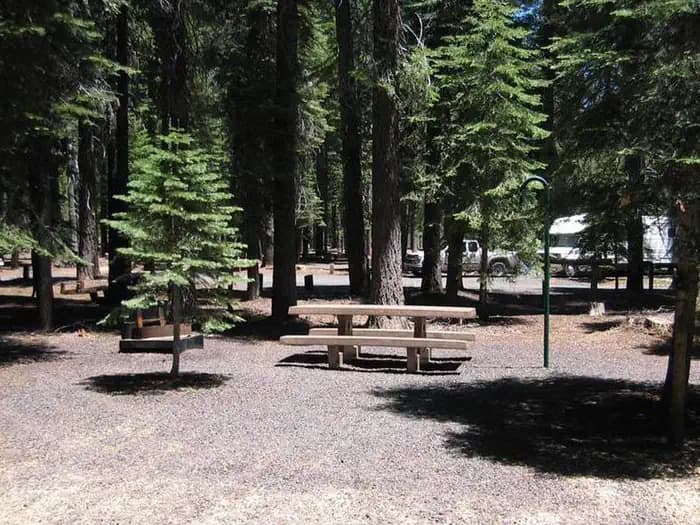
Overview Grassy Flat Campground borders California's northern Redwood Highway in the expansive Six Rivers National Forest. This shady campground provides ample sightseeing and recreation opportunities and is just steps away from the wild whitewater of the Smith River, which is famous for its bright blue waters and scenic pathway through the forest. Recreation Popular activities include swimming and sunbathing, rafting and fishing in the Smith River, which is just steps from the campground. Anglers enjoy healthy fishing populations of salmon, steelhead and cutthroat trout. Visitors also enjoy hiking, horseback riding and biking in the area. There are no trailheads in the campground, but Elk Camp Ridge, High Dome and French Hill trailheads are all within 10 miles of the site. Facilities Popular activities include swimming and sunbathing, rafting and fishing in the Smith River, which is just steps from the campground. Anglers enjoy healthy fishing populations of salmon, steelhead and cutthroat trout. Visitors also enjoy hiking, horseback riding and biking in the area. There are no trailheads in the campground, but Elk Camp Ridge, High Dome and French Hill trailheads are all within 10 miles of the site. Natural Features Grassy Flat is located in a Douglas fir and hardwood forest. Smith River boasts up to Class 5 whitewater rapids. The region, thick with vegetation, is also freckled with huckleberry shrubs. The Six Rivers National Forest lies east of Eureka in northwestern California, stretching southward from the Oregon border for about 140 miles. U.S. 101, the famed "Redwood Highway," parallels the inland Forest along the coastline. The Forest is just east of the Redwood National Park. Nearby Attractions Madrone Flat, located across the bridge, provides excellent river access. Various state parks, providing scenic exploration opportunities, are just a short drive from the campground. Annual events in the area include the Gasquet Raft Race in July and the Del Norte County Fair in August. A small airport is about 6 miles away, in the town of Gasquet.
View details →
Overview Almanor Campground is a large family-friendly facility for individuals and large groups alike. It provides direct access to beautiful Lake Almanor and a variety of recreational opportunities in the area. Recreation The 28,000-acre lake provides ample boating, swimming, water skiing and sailing opportunities. A boat ramp can be found next to the north campground. The adjacent beach is mostly rocky, but contains some sand. Fishing in the lake or nearby streams, is a popular activity. Anglers will find a variety of trout, bass, salmon and catfish, among other species. The Lake Almanor Recreation Trail can be accessed from within the campground. The trail winds through the forest, providing spectacular views of the lake, nearby Dyer Mountain and Lassen Peak. The trail stretches approximately 11 miles along the west shore of the lake. It is a non-motorized trail, open to all non-motorized activity. Facilities The 28,000-acre lake provides ample boating, swimming, water skiing and sailing opportunities. A boat ramp can be found next to the north campground. The adjacent beach is mostly rocky, but contains some sand. Fishing in the lake or nearby streams, is a popular activity. Anglers will find a variety of trout, bass, salmon and catfish, among other species. The Lake Almanor Recreation Trail can be accessed from within the campground. The trail winds through the forest, providing spectacular views of the lake, nearby Dyer Mountain and Lassen Peak. The trail stretches approximately 11 miles along the west shore of the lake. It is a non-motorized trail, open to all non-motorized activity. Natural Features The campground sits on the west shore of Lake Almanor at an elevation of 4,540 feet. A scenic mixed conifer forest covers the area. Parts of the campground are shaded, while other sections have grassy meadows that often contain wildflowers. Nearby Attractions The campground is located 12 miles outside of the town of Chester, California.
View details →
Overview Hat Creek is one of six campgrounds available in the Hat Creek Recreation Area, home to some of the area's best trout fishing. Scenic hiking trails and an active volcanic area can easily be accessed from the facility. Recreation Hat Creek is popular for its trophy trout fishing. The cold waters of the creek allow for a refreshing play on hot summer days. Other popular activities in the area include wildlife viewing, hunting, backpacking, hiking and caving. A variety of day hikes are available in the area, including the Spatter Cones Nature Trail, which is located just across the highway from the campground. The 1.5-mile loop trail provides hikers with a unique opportunity to explore craters, cones and crevices, as well as other geologic features left by the Hat Creek Lava Flow. Nearby, visitors can take a self-guided tour of Subway Cave. The trail is less than a half-mile long and explores the underground world of a lava tube. Visitors are encouraged to bring flashlights for hiking through the cave. Facilities Hat Creek is popular for its trophy trout fishing. The cold waters of the creek allow for a refreshing play on hot summer days. Other popular activities in the area include wildlife viewing, hunting, backpacking, hiking and caving. A variety of day hikes are available in the area, including the Spatter Cones Nature Trail, which is located just across the highway from the campground. The 1.5-mile loop trail provides hikers with a unique opportunity to explore craters, cones and crevices, as well as other geologic features left by the Hat Creek Lava Flow. Nearby, visitors can take a self-guided tour of Subway Cave. The trail is less than a half-mile long and explores the underground world of a lava tube. Visitors are encouraged to bring flashlights for hiking through the cave. Natural Features The campground is situated next to Hat Creek in a mixed conifer forest at an elevation of about 4,390 feet. Pine needles, grasses and volcanic rocks cover the forest floor. Sites are widely spaced for privacy. Nearby Attractions The campground is located about a mile west of the town of Old Station, and 12 miles east of the northwest entrance to Lassen Volcanic National Park, where active, hissing fumaroles and boiling mud pots are continually shaping the landscape. The Pacific Crest National Scenic Trail can be accessed near the Spatter Cones Nature Trailhead.
View details →
Overview Hanna Flat Campground is a family-friendly facility nestled in the pine-covered mountains of Southern California. It offers access to a variety of outdoor recreational opportunities and a beautiful location to enjoy nature. Recreation A number of hiking and biking trails are nearby, including 3.5-mile Gray's Peak Trail that connects to Hanna Flat Trail, and 10 miles of unmarked trails that lead to Coxcomb Creek. Fishing and boating at nearby Big Bear Lake are popular activities. Anglers can look forward to a catch of trout, bluegill, crappie, catfish and largemouth bass. Because of cold water temperatures and the presence of underwater obstacles near the shorelines, swimming at the lake is often discouraged. Facilities A number of hiking and biking trails are nearby, including 3.5-mile Gray's Peak Trail that connects to Hanna Flat Trail, and 10 miles of unmarked trails that lead to Coxcomb Creek. Fishing and boating at nearby Big Bear Lake are popular activities. Anglers can look forward to a catch of trout, bluegill, crappie, catfish and largemouth bass. Because of cold water temperatures and the presence of underwater obstacles near the shorelines, swimming at the lake is often discouraged. Natural Features The campground is located off the Rim of the World Scenic Byway in the San Bernardino Mountains. A dense pine forest covers the area, where portions of the campground are heavily shaded. Some sites offer more privacy due to thick shrub growth. The area is home to a variety of wildlife and birds. Nearby Attractions The town of Fawnskin is less than 3 miles from the campground, offering groceries, restaurants and fuel. contact_info For facility specific information, please call (909) 866-8550. Charges & Cancellations Rules & Reservation Policies As you make travel plans that include reservations on Recreation.gov, there are standard policies that apply to most locations of which you should be aware. Do keep in mind, however, that there are many exceptions, so it is best to review reservation information listed on individual facility pages for those policies and procedures that pertain to your specific locations. Any location or activity requiring a permit or lottery will have unique requirements and policies. Please check individual facility pages for pertinent information for those sites. Booking Window For most locations, you can reserve six months in advance of your stay for individual sites and 12 months in advance for group sites. There are some exceptions, so it is best to check with each facility. Change and Cancellation Policies and Fees Overnight and Day Use Facilities: To ensure fairness, reservation arrival or departure dates may not be changed beyond the booking window until 18 days after booking the reservation. Camping / Day Use: A $10.00 service fee will apply if you change or cancel your reservation (including campsites, cabins, lookouts, group facilities, etc.). The $10.00 service fee will be deducted from the refund amount. You can cancel or change reservations through Recreation.gov or by calling 1-877-444-6777. Tours & Tickets: You may request changes to tour dates at no cost before the arrival date. If you cancel before your tour date, you may be eligible for a refund. Cancellation fees apply. Please check the tour facility description details page for cancellation policies. Permits: Varies by location. Please check the permit details for the permit location. Late Cancellations Overnight and Day Use Facilities: Late cancellations are those cancelled between 12:01 a.m. (Eastern) on the day before arrival and check out time on the day after arrival. Individual Campsites: If a customer cancels a reservation the day before or on the day of arrival they will be charged a $10.00 service fee and will also forfeit the first night's use fee (not to exceed the total paid for the original reservation). Cancellations for a single night's reservation will forfeit the entire use fee but no cancellation fee will apply. Cabins / Lookouts: Customers will be charged a $10.00 cancellation fee and forfeit the first night's use fee if a cabin or lookout reservation is cancelled within 14 days of the scheduled arrival date. Cancellations for a single night's use will not be assessed a service fee. Group Facility: If a customer cancels a group overnight facility reservation within 14 days of the scheduled arrival date they will be charged the $10.00 service fee and forfeit the first night's use fee. Cancellations for a single night's use will not be assessed a service fee. Group Day Use Area: If a customer cancels a group day use facility reservation within 14 days of the scheduled arrival date, they will forfeit the total day use fee with no service fee charge. No-Shows Camping / Day Use: A camping no-show customer is one who does not arrive at a campground and does not cancel the reservation by check-out time on the day after the scheduled arrival date. Reserved campsites and group overnight facilities will be held until check-out time on the day following your scheduled arrival. Group day-use facilities will be held until check-in time on your scheduled arrival date. If a customer does not arrive at the campground or group facility by check-out time the day after arrival or does not cancel the reservation by the times listed under "Late Cancellations" above, the customer may be assessed a $20.00 service fee and forfeit use fees. Tours: A tour or ticket no-show is one who does not cancel a ticket before arrival and does not arrive for the tour. Tour no-shows are not entitled to a refund. Refunds Customers must request refunds no later than 14 days after the scheduled departure date. Recreation.gov will not grant refund requests after 14 days of departure. Reservation Fee: For some facilities, tours or permits an additional reservation fee is charged. For some overnight and day-use facilities, an additional non-refundable reservation fee may apply. The non-refundable reservation fee for tours and tickets is $1.00. The non-refundable reservation fee for permits varies by location. Refunds for Bankcard Purchases: Refunds for bank card payments will be issued as a credit to the original bank card. Refunds for Check or Cash Purchases: Refunds for Recreation.gov payments made by check or money order, and cash payments at selected campgrounds will be issued a check refund. A refund will be processed within 30 days of receipt and approval. Please Note: Refund requests made during or after departure can only be processed when approved by the facility management staff based upon local policy. Refunds for Emergency Closures: In the event of an emergency closure, the Recreation.gov team will attempt to notify users and offer alternate dates (as appropriate). If this is not possible, reservations will be cancelled and all fees paid will be refunded. Reservation fees for free tickets are non-refundable in the event of an emergency closure. Recreation.gov Billing Information Reservation transaction will appear on customer's credit card statements as "Recreation.gov 877-444-6777." Changes to Policies and Procedures Recreation.gov reserves the right, when necessary, to modify reservation policies. These policies were last updated July
View details →
Overview Serrano Campground is a beautiful place for campers to come to enjoy beautiful Big Bear Lake. It is a scenic and fairly modern campground that provides access to a variety of outdoor recreational opportunities. Recreation Visitors enjoy access to a number of hiking and mountain biking trails found within a short distance of the campground. The Alpine Pedal Path and the Cougar Crest Trail are nearby and provide access to the Pacific Crest Trail. The Big Bear Ranger Station is within a mile of the campground. Rangers can provide maps of the area and answer any questions about trails. Fishing and boating at Big Bear Lake are popular activities. The campground does not provide direct access to the lake, but a boat ramp is available about a mile away. Anglers can look forward to a possible catch of trout, bass, catfish, carp, bluegill and crappie, among others. Facilities Visitors enjoy access to a number of hiking and mountain biking trails found within a short distance of the campground. The Alpine Pedal Path and the Cougar Crest Trail are nearby and provide access to the Pacific Crest Trail. The Big Bear Ranger Station is within a mile of the campground. Rangers can provide maps of the area and answer any questions about trails. Fishing and boating at Big Bear Lake are popular activities. The campground does not provide direct access to the lake, but a boat ramp is available about a mile away. Anglers can look forward to a possible catch of trout, bass, catfish, carp, bluegill and crappie, among others. Natural Features The campground is located in the San Bernardino Mountains, within walking distance of the lake. Accessed by the Rim of the World Scenic Byway, the campground is situated in a mountainous, pine forest setting. Sagebrush grows alongside the paved roads. contact_info For facility specific information, please call (909) 866-8550. Nearby Attractions The Big Bear Discovery Center is located across the street from the entrance of the campground. A visitor center, interpretive trails and educational programs are available, as well as accessible flush restroom facilities. Charges & Cancellations Rules & Reservation Policies As you make travel plans that include reservations on Recreation.gov, there are standard policies that apply to most locations of which you should be aware. Do keep in mind, however, that there are many exceptions, so it is best to review reservation information listed on individual facility pages for those policies and procedures that pertain to your specific locations. Any location or activity requiring a permit or lottery will have unique requirements and policies. Please check individual facility pages for pertinent information for those sites. Booking Window For most locations, you can reserve six months in advance of your stay for individual sites and 12 months in advance for group sites. There are some exceptions, so it is best to check with each facility. Change and Cancellation Policies and Fees Overnight and Day Use Facilities: To ensure fairness, reservation arrival or departure dates may not be changed beyond the booking window until 18 days after booking the reservation. Camping / Day Use: A $10.00 service fee will apply if you change or cancel your reservation (including campsites, cabins, lookouts, group facilities, etc.). The $10.00 service fee will be deducted from the refund amount. You can cancel or change reservations through Recreation.gov or by calling 1-877-444-6777. Tours & Tickets: You may request changes to tour dates at no cost before the arrival date. If you cancel before your tour date, you may be eligible for a refund. Cancellation fees apply. Please check the tour facility description details page for cancellation policies. Permits: Varies by location. Please check the permit details for the permit location. Late Cancellations Overnight and Day Use Facilities: Late cancellations are those cancelled between 12:01 a.m. (Eastern) on the day before arrival and check out time on the day after arrival. Individual Campsites: If a customer cancels a reservation the day before or on the day of arrival they will be charged a $10.00 service fee and will also forfeit the first night's use fee (not to exceed the total paid for the original reservation). Cancellations for a single night's reservation will forfeit the entire use fee but no cancellation fee will apply. Cabins / Lookouts: Customers will be charged a $10.00 cancellation fee and forfeit the first night's use fee if a cabin or lookout reservation is cancelled within 14 days of the scheduled arrival date. Cancellations for a single night's use will not be assessed a service fee. Group Facility: If a customer cancels a group overnight facility reservation within 14 days of the scheduled arrival date they will be charged the $10.00 service fee and forfeit the first night's use fee. Cancellations for a single night's use will not be assessed a service fee. Group Day Use Area: If a customer cancels a group day use facility reservation within 14 days of the scheduled arrival date, they will forfeit the total day use fee with no service fee charge. No-Shows Camping / Day Use: A camping no-show customer is one who does not arrive at a campground and does not cancel the reservation by check-out time on the day after the scheduled arrival date. Reserved campsites and group overnight facilities will be held until check-out time on the day following your scheduled arrival. Group day-use facilities will be held until check-in time on your scheduled arrival date. If a customer does not arrive at the campground or group facility by check-out time the day after arrival or does not cancel the reservation by the times listed under "Late Cancellations" above, the customer may be assessed a $20.00 service fee and forfeit use fees. Tours: A tour or ticket no-show is one who does not cancel a ticket before arrival and does not arrive for the tour. Tour no-shows are not entitled to a refund. Refunds Customers must request refunds no later than 14 days after the scheduled departure date. Recreation.gov will not grant refund requests after 14 days of departure. Reservation Fee: For some facilities, tours or permits an additional reservation fee is charged. For some overnight and day-use facilities, an additional non-refundable reservation fee may apply. The non-refundable reservation fee for tours and tickets is $1.00. The non-refundable reservation fee for permits varies by location. Refunds for Bankcard Purchases: Refunds for bank card payments will be issued as a credit to the original bank card. Refunds for Check or Cash Purchases: Refunds for Recreation.gov payments made by check or money order, and cash payments at selected campgrounds will be issued a check refund. A refund will be processed within 30 days of receipt and approval. Please Note: Refund requests made during or after departure can only be processed when approved by the facility management staff based upon local policy. Refunds for Emergency Closures: In the event of an emergency closure, the Recreation.gov team will attempt to notify users and offer alternate dates (as appropriate). If this is not possible, reservations will be cancelled and all fees paid will be refunded. Reservation fees for free tickets are non-refundable in the event of an emergency closure. Recreation.gov Billing Information Reservation transaction will appear on customer's credit card statements as "Recreation.gov 877-444-6777." Changes to Policies and Procedures Recreation.gov reserves the right, when necessary, to modify reservation policies. These policies were last updated July
View details →
Overview Pinecrest features a large campground by Pinecrest Lake, just 30 miles east of Sonora, at an elevation of 5600 feet. The area includes a day-use beach and a marina, a small shopping center and recreation cabins. The campground caters to all ages and is within walking distance of the lake, an amphitheater, visitor center, swimming beach and spectacular hiking trails. Pets are welcome, but must be compliant with Tuolumne County leash laws. Recreation The Pinecrest Lake National Recreation Trail takes hikers on an easy 4-mile stroll around Pinecrest Lake. Rainbow trout is a common catch in the lake and swimming is enjoyed at the sandy beach. Educational programs are also a highlight of the recreation area. Bike rentals are on hand so campers can bike around the area. Dodge Ridge Mountain Resort is open for summer operations offering mountain bike trails, hiking, disc golf, indoor and outdoor games and more! Facilities The Pinecrest Lake National Recreation Trail takes hikers on an easy 4-mile stroll around Pinecrest Lake. Rainbow trout is a common catch in the lake and swimming is enjoyed at the sandy beach. Educational programs are also a highlight of the recreation area. Bike rentals are on hand so campers can bike around the area. Dodge Ridge Mountain Resort is open for summer operations offering mountain bike trails, hiking, disc golf, indoor and outdoor games and more! Natural Features Many campsites are shaded by trees and sit near the southwest side of the 300-acre Pinecrest Lake in Stanislaus National Forest. In this beautiful mountain landscape, wildlife viewing opportunities include marmots, squirrels, coyotes and deer. Stanislaus National Forest is situated in the central Sierra Nevada Mountains, between Lake Tahoe and Yosemite. The area boasts gorgeous views of snow-capped mountain peaks and California's Great Central Valley. Nearby Attractions Located in the nearby area are several activities. There are ample hiking trails, horseback riding, fishing, mountain bike riding, and water activities. Pinecrest lake is a boating and swimming recreation area with restaurants, stores, boat rentals, and an outdoor movie theater. Dodge Ridge Mountain Resort is a ski area in the winter and in the summer is a basecamp for mountain biking, hiking, and a great indoor/outdoor BBQ. Aspen Meadow Pack Station is three miles from Pinecrest Lake and offers horseback rides and trail head for hiking. Kennedy Meadows is 30 miles east of Pinecrest and offers great river access for fishing, horse bike rides, hiking, and restaurants. Sonora Pass, a scenic winding highway that has guided people across the Sierra Nevada since 1852, is located nearby.
View details →
Overview Big Meadow Campground lies at about 6,400 feet elevation on the Stanislaus National Forest. It is located 21 miles east of Arnold, California. Breathtaking views abound, and wildlife viewing opportunities include marmots, squirrels, coyotes and deer. Recreation Picnicking, birding and hiking are popular pastimes at Big Meadow. Lake Alpine and Spicer Meadow Reservoir, both just a 15 minute drive away, offer fishing and other water activities. Facilities Picnicking, birding and hiking are popular pastimes at Big Meadow. Lake Alpine and Spicer Meadow Reservoir, both just a 15 minute drive away, offer fishing and other water activities. Natural Features Situated in the central Sierra Nevada Mountains, Stanislaus National Forest is sandwiched between the well-known destinations, Lake Tahoe and Yosemite. It boasts gorgeous views of snow-capped mountain peaks and California's Great Central Valley.
View details →
Overview Hampshire Rocks Campground is located in the Tahoe National Forest on the banks of the South Yuba River, near the Rainbow/Big Bend exit along Interstate 80. Visitors enjoy the area for its cool temperatures, access to the South Yuba River, fishing, and trail opportunities, as well as its historic significance along the California Emigrant Trail. This facility is operated and maintained by the Tahoe National Forest. Recreation The South Yuba River offers swimming, and rainbow trout fishing. The surrounding area offers hiking, road biking, mountain biking, and off-road vehicle trails. The historic California Emigrant Trail passes through the campground. Facilities The South Yuba River offers swimming, and rainbow trout fishing. The surrounding area offers hiking, road biking, mountain biking, and off-road vehicle trails. The historic California Emigrant Trail passes through the campground. Natural Features The campground is situated on the north bank of the upper South Yuba River in a forest of lodgepole pines. Some sites are adjacent to the river, which flows gently through this particular area. Nearby Attractions Donner Lake is located 14 miles east of the campground via Historic Route 40/Lincoln Highway, known as the nation's first transcontinental highway. Many points of interest lie along Route 40, including China Wall, Rainbow Bridge, Sugar Bowl, Lake Van Norden and Ice Lakes. Other attractions include Donner Summit PCT, Loch Leven, and Castle Peak Trailheads, Fordyce 4x4 jeep trail, and Grouse Ridge Non-Motorized Area. contact_info For facility specific information, please call (530) 265-4531. Charges & Cancellations No Show Policy A no-show customer is one who does not arrive at a campground and does not cancel the reservation by check-out time on the day after the scheduled arrival date (or for day-use facilities, by check-in time the day of arrival). * No-show customers are only recorded at staffed facilities. At most remote facilities, all customers are noted as automatically checked-in on the date of arrival. * It is recommended that staffed facilities hold a campsite until check-out time on the day following the arrival date. * It is recommended that staffed facilities hold group day-use facilities until check-in time on the arrival date. There is no change fee if a customer extends or shortens a reservation if the change includes dates from the original reservation. If they choose to depart early, they may forfeit some or all of the recreation fees. There is no change fee if the customer changes campsites that are the same price and on the same reservation dates in the same campground. If the campsite the customer is changing to has a price difference, the customer will be responsible for any additional fees or be provided with a refund, based on the price difference. Where recorded, no-show customers are assessed a $20.00 no-show fee and forfeit the first night's recreation fee for a campsite or forfeit the entire day-use recreation fee for a day-use facility. We recommend customers contact the facility if they are en route to their reservation but cannot make it by the check-in date. In these cases, no refund will be issued, but the facility can ensure that a "no-show" fee is not assessed.
View details →
Overview Pipi Campground (pronounced "pie pie") offers RV and tent camping along the Middle Fork of the Cosumnes River, offering great fishing and swimming opportunities. The Cosumnes River flows from the western slopes of the Sierra Nevada and runs for about 52 miles through California's Central Valley and into the Mokelumne River. Historically, the native Miwok people of northern California used to camp in this region in summertime. Recreation Rainbow trout are regularly stocked in the river and wheelchair accessible fishing is provided from the paved river walkway. The walkway meanders along the river for just under a mile. Facilities Rainbow trout are regularly stocked in the river and wheelchair accessible fishing is provided from the paved river walkway. The walkway meanders along the river for just under a mile. Natural Features At an elevation of 4,100 feet, PiPi boasts three camp loops with a dense mixture of conifers like cedar and fir. The area is part of the Eldorado National Forest located in the central Sierra Nevada. A Mediterranean climate extends over most of the forest with warm, dry summers and cold, wet winters. Charges & Cancellations Recreation Fee: Recreation fees are the fees a visitor pays for things like overnight camping, a day-use pavilion, group facilities, a tour or a permit. Recreation fees vary by location and/or activity. Reservation Fee: A fee may be charged at the time a reservation is made to cover the cost of reservation services. This fee is in addition to the Recreation Fee and is non-refundable. Fees for camping, day use, group sites, cabins and lookouts: $8 if made on-line; $9 if made through the call center; $3 if made in-person. Change Fee: A service fee may be charged at the time a modification is made depending on the changes. Cancellation Fee: A $10 service fee will be withheld from any refunds for a cancelled reservation. Cut-Off Window: The latest date and/or time that you can make an advanced reservation or a change to an existing reservation. Cut-off windows can vary by location, but are typically 4 days before your arrival date. A customer who cancels a reservation the day before or on the day of arrival will pay a $10.00 service fee AND forfeit the first night's use fee (see Late Cancellation below). Late Cancellation: If you cancel your reservation too close to the start date, additional service fees may be withheld.
View details →
Overview Silver Lake East is located 50 miles east of Jackson, California, just a short distance from the shores of Silver lake, where activities like boating, fishing, swimming and hiking, provide campers with the perfect outdoors retreat. Numerous trails leaving the campground connect with the lake and swimming beaches. Silver Lake West is adjacent to Silver Lake East on the other side of Highway 88, and offers additional trails and access to the Silver Fork of the American River. Recreation Because the campground is already at such a high elevation, hiking is particularly popular, allowing visitors to access high alpine lakes and other destinations through short but spectacular hikes. In addition to the trails which connect this campground to Silver Lake and other swimming areas, the Granite Lake Trail, which gives way to the Hidden Lake Trail, begins on the east shore of Silver Lake at the Minkalo TH. The trail ascends and crosses Squaw Creek on a wooden bridge. Approximately one-half mile beyond the bridge is a junction. The right fork will take you to Plasse's and the left fork will take you to Granite Lake. At the southeast end of the lake you will find the trail to Hidden Lake. Anglers will be happy to know that Silver Lake boasts stocked populations of Rainbow, German Brown and Mackinaw trout. Facilities Because the campground is already at such a high elevation, hiking is particularly popular, allowing visitors to access high alpine lakes and other destinations through short but spectacular hikes. In addition to the trails which connect this campground to Silver Lake and other swimming areas, the Granite Lake Trail, which gives way to the Hidden Lake Trail, begins on the east shore of Silver Lake at the Minkalo TH. The trail ascends and crosses Squaw Creek on a wooden bridge. Approximately one-half mile beyond the bridge is a junction. The right fork will take you to Plasse's and the left fork will take you to Granite Lake. At the southeast end of the lake you will find the trail to Hidden Lake. Anglers will be happy to know that Silver Lake boasts stocked populations of Rainbow, German Brown and Mackinaw trout. Natural Features The campground is situated at the base of Thunder Mountain at an elevation of 7,200 feet, on the north end of beautiful Silver Lake. A small pond in the middle of the campground attracts ducks, but cannot be seen from any of the camp sites. Silver Lake spans 200 acres in a large granite basin surrounded by a forest of mixed conifers. The lake's mirror-like waters are known to reflect the colors of the sky above, attracting both hikers and photographers to its scenic shores. The Silver Lake area blooms with bright wildflowers in the summer months, delighting visitors with their presence around the lakes and high in the mountain meadows. Nearby Attractions Take a scenic drive on Carson Pass Highway, which runs past Silver Lake along the mountains and crosses the picturesque Carson Pass. It is a must-do activity for those who love mountain views and landscape photography. The campground is an easy drive south of Lake Tahoe, the popular lake and ski area. Charges & Cancellations Recreation Fee: Recreation fees are the fees a visitor pays for things like overnight camping, a day-use pavilion, group facilities, a tour or a permit. Recreation fees vary by location and/or activity. Reservation Fee: A fee may be charged at the time a reservation is made to cover the cost of reservation services. This fee is in addition to the Recreation Fee and is non-refundable. Fees for camping, day use, group sites, cabins and lookouts: $8 if made on-line; $9 if made through the call center; $3 if made in-person. Change Fee: A service fee may be charged at the time a modification is made depending on the changes. Cancellation Fee: A $10 service fee will be withheld from any refunds for a cancelled reservation. Cut-Off Window: The latest date and/or time that you can make an advanced reservation or a change to an existing reservation. Cut-off windows can vary by location, but are typically 4 days before your arrival date. A customer who cancels a reservation the day before or on the day of arrival will pay a $10.00 service fee AND forfeit the first night's use fee (see Late Cancellation below). Late Cancellation: If you cancel your reservation too close to the start date, additional service fees may be withheld.
View details →
Overview Tunnel Mills Group Campground is located along the East Fork of the North Fork of the North Fork American River in the Tahoe National Forest. It can be accessed off of Interstate 80, at the Emigrant Gap exit. Visitors enjoy fishing, hiking and hunting in this scenic area. Recreation Rainbow trout fishing is a popular activity on the river. Hiking and OHV trails and hunting opportunities are found in the surrounding area. Facilities Rainbow trout fishing is a popular activity on the river. Hiking and OHV trails and hunting opportunities are found in the surrounding area. Natural Features The campground is near the creek-sized East Fork of the North Fork of the North Fork American River, in a remote location of north central California. A forest of cedar, pine and fir trees shades the campground. Nearby Attractions Many hiking, and OHV trails are located nearby as well as foot trail access into the North Fork American Wild and Scenic River canyon. Many more trails can be found a short distance east on Interstate 80 at Grouse Ridge Non-Motorized Area and Donner Summit. Charges & Cancellations No Show Policy A no-show customer is one who does not arrive at a campground and does not cancel the reservation by check-out time on the day after the scheduled arrival date (or for day-use facilities, by check-in time the day of arrival). * No-show customers are only recorded at staffed facilities. At most remote facilities, all customers are noted as automatically checked-in on the date of arrival. * It is recommended that staffed facilities hold a campsite until check-out time on the day following the arrival date. * It is recommended that staffed facilities hold group day-use facilities until check-in time on the arrival date. There is no change fee if a customer extends or shortens a reservation if the change includes dates from the original reservation. If they choose to depart early, they may forfeit some or all of the recreation fees. There is no change fee if the customer changes campsites that are the same price and on the same reservation dates in the same campground. If the campsite the customer is changing to has a price difference, the customer will be responsible for any additional fees or be provided with a refund, based on the price difference. Where recorded, no-show customers are assessed a $20.00 no-show fee and forfeit the first night's recreation fee for a campsite or forfeit the entire day-use recreation fee for a day-use facility. We recommend customers contact the facility if they are en route to their reservation but cannot make it by the check-in date. In these cases, no refund will be issued, but the facility can ensure that a "no-show" fee is not assessed.
View details →
Overview Hallsted campground is conveniently situated in the Feather River Canyon, just off the main road in the northern Sierra Nevada Mountains. At an elevation of 2,300 feet, it offers a cool getaway from the summer heat, as well as a variety of outdoor activities The route on the nearby Feather River National Scenic Byway traverses a steeply carved river gorge that encapsulates the historic railroad system from Oroville to Quincy and impressive powerhouses built to provide hydroelectricity. Recreation Fly fishing for trout and swimming are popular activities in the nearby north fork of the Feather River. Facilities Fly fishing for trout and swimming are popular activities in the nearby north fork of the Feather River. Natural Features Mature pine and fir trees provide ample shade for the campground, as well as a perfect atmosphere for mountain camping. Several sites parallel the north fork of the Feather River. A variety of wildlife make its home in the area. Nearby Attractions A general store is available in Twain, less than a half-mile from the campground. Quincy is approximately 17 miles east, providing the nearest source of fuel.
View details →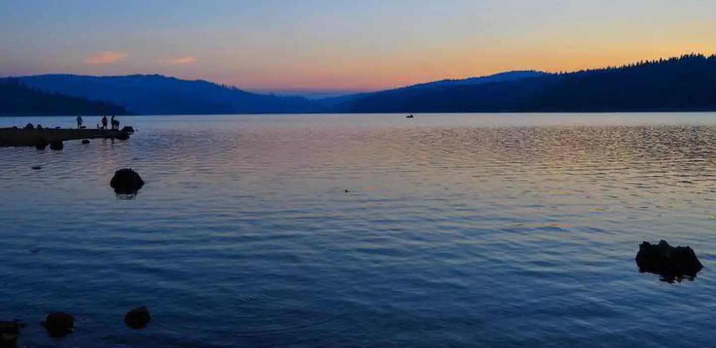
Overview Red Feather Campground is located on the eastern shore of Little Grass Valley Reservoir, providing visitors with ample opportunity to fish, swim, boat, and enjoy nature. It is one of eight campgrounds in the area, providing access to a beautiful mountain lake and various hiking trails that meander through the scenic hills and valleys. Recreation The 1,615-acre lake provides ample opportunities for visitors to fish, boat, swim, and water ski. Anglers can expect a catch of a variety of trout and kokanee salmon, among other species of fish. Fishing licenses are required. The Lakeshore Trail, which loops 13.5 miles around the lake, is available for hiking, mountain biking and horseback riding. The trail connects to the Pacific Crest National Scenic Trail, which stretches from 2,650 miles, across three states from Canada to Mexico. The Lakeshore Trail is popular among day hikers. Facilities The 1,615-acre lake provides ample opportunities for visitors to fish, boat, swim, and water ski. Anglers can expect a catch of a variety of trout and kokanee salmon, among other species of fish. Fishing licenses are required. The Lakeshore Trail, which loops 13.5 miles around the lake, is available for hiking, mountain biking and horseback riding. The trail connects to the Pacific Crest National Scenic Trail, which stretches from 2,650 miles, across three states from Canada to Mexico. The Lakeshore Trail is popular among day hikers. Natural Features The campground is located in the Northern Sierra Nevada Mountains of northern California at an elevation of about 5,100 feet. It is on the eastern shore of the Little Grass Valley Reservoir, which was formed by dam construction and subsequent flooding of the valley in the 1960s. The campground and the lake are surrounded by thick stands of pine and fir trees. Several public campgrounds are located around the lake, as well as private cabins on the south side. Nearby Attractions About 12 miles northeast of the lake at an elevation of 5,446 feet lies a small, natural lily pond, called Fowler Lake. This beautiful site is perfect for day hikes and picnics.
View details →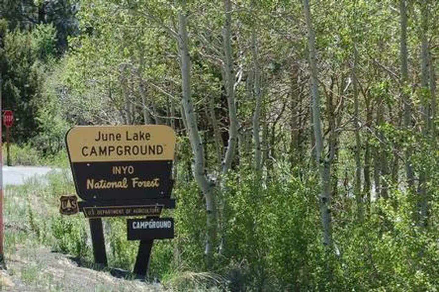
Overview Easy access to fishing, a marina and boat rentals make June Lake Campground a favorite spot for both families and anglers. The facility sits in the eastern Sierra Nevada Mountains in close proximity to the Ansel Adams Wilderness, Yosemite National Park and Mono Lake. The town of June Lake offers the convenience of shopping and dining, while the surrounding land and lakes provide ample outdoor recreation opportunities. Recreation Campers have no problem staying busy and enjoying the outdoors. Fishing for rainbow and Alpers trout, canoeing, boating and walking are just some of the activities available around the lake. Numerous trails lie minutes away, an obvious draw for hikers, mountain bikers and off-road vehicle enthusiasts. The Fern Lake Trail, a short drive away, leads into the scenic Ansel Adams Wilderness. Skiing is a major winter pastime in the area. A drive along the June Lake Loop results in expansive views of rugged mountain peaks and several lakes. Facilities Campers have no problem staying busy and enjoying the outdoors. Fishing for rainbow and Alpers trout, canoeing, boating and walking are just some of the activities available around the lake. Numerous trails lie minutes away, an obvious draw for hikers, mountain bikers and off-road vehicle enthusiasts. The Fern Lake Trail, a short drive away, leads into the scenic Ansel Adams Wilderness. Skiing is a major winter pastime in the area. A drive along the June Lake Loop results in expansive views of rugged mountain peaks and several lakes. Natural Features Campsites are located in a mixed aspen and pine forest above the eastern shoreline of beautiful, 257-acre June Lake. Many points in the campground have views of the surrounding 11,000 and 12,000' peaks. The campground's elevation is 7,600 feet. Many species of wildlife call the mountains home, such as black bear, mountain lions, mule deer, pine marten, pika and numerous fish and birds. Nearby Attractions Mono Lake and its many activities are minutes away. Hikers can access the scenic Ansel Adams Wilderness via nearby trails, and Yosemite National Park is a great day trip. Ansel Adams Wilderness Yosemite National Park Charges & Cancellations Once your reservation start date has begun, neither the Recreation.gov Contact Center nor the campground manager will be able to modify your reservation.
View details →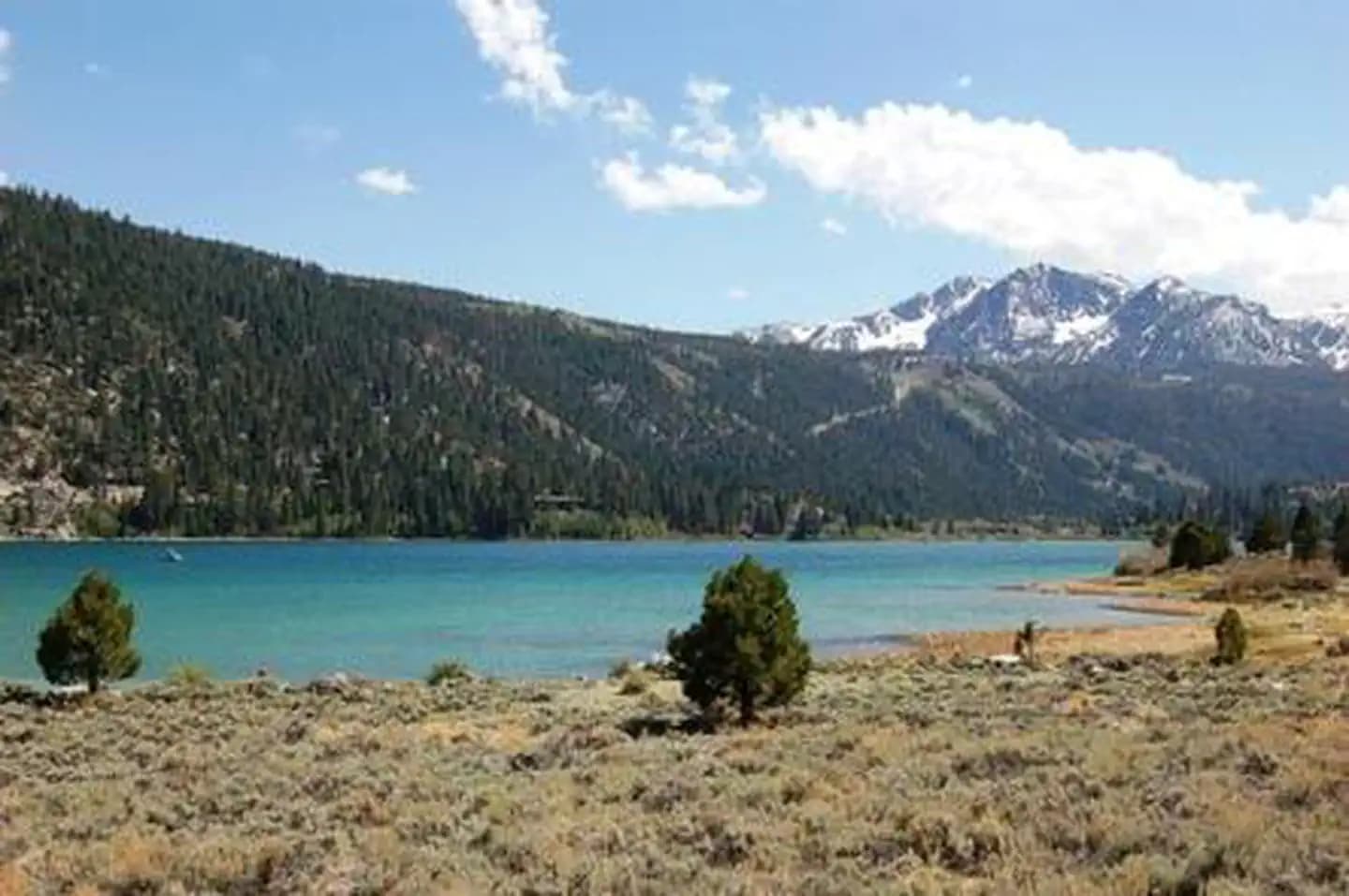
Overview The outstanding lake and mountain views at Oh Ridge Campground make it a favorite spot for both families and anglers. It sits in the eastern Sierra Nevada Mountains in close proximity to the Ansel Adams Wilderness, Yosemite National Park and Mono Lake. The nearby town of June Lake offers the convenience of shopping and dining, while the surrounding land and lakes provide ample outdoor recreation opportunities. Recreation Oh Ridge campers have no problem staying busy and enjoying the outdoors. Within the facility, they can swim in the lake's clear waters, fish for rainbow and Alpers trout, go canoeing and boating or walk to the Oh Ridge viewpoint, after which the campground was named. Numerous trails lie minutes away, an obvious draw for hikers, mountain bikers and off-road vehicle enthusiasts. The Fern Lake Trail leads into the scenic Ansel Adams Wilderness. Skiing is a major winter pastime in the area. A scenic drive along the June Lake Loop results in expansive views of rugged mountain peaks and several lakes. Facilities Oh Ridge campers have no problem staying busy and enjoying the outdoors. Within the facility, they can swim in the lake's clear waters, fish for rainbow and Alpers trout, go canoeing and boating or walk to the Oh Ridge viewpoint, after which the campground was named. Numerous trails lie minutes away, an obvious draw for hikers, mountain bikers and off-road vehicle enthusiasts. The Fern Lake Trail leads into the scenic Ansel Adams Wilderness. Skiing is a major winter pastime in the area. A scenic drive along the June Lake Loop results in expansive views of rugged mountain peaks and several lakes. Natural Features Campsites are located in a mostly open area above the shoreline of beautiful June Lake. Save for some scattered pine and aspen trees, the campground has little shade. Nearly every point in the facility has a view of the surrounding 11,000-12,000' peaks. The campground's elevation is 7,600 feet. Many species of wildlife call the mountains home, such as black bear, mountain lions, mule deer, pine marten, pika and numerous fish and birds. Nearby Attractions Mono Lake and its many activities are minutes away. Hikers can access the scenic Ansel Adams Wilderness via nearby trails, and Yosemite National Park is a great day trip. Ansel Adams Wilderness Yosemite National Park Charges & Cancellations Rules & Reservation Policies As you make travel plans that include reservations on Recreation.gov, there are standard policies that apply to most locations of which you should be aware. Do keep in mind, however, that there are many exceptions, so it is best to review reservation information listed on individual facility pages for those policies and procedures that pertain to your specific locations. Any location or activity requiring a permit or lottery will have unique requirements and policies. Please check individual facility pages for pertinent information for those sites. Booking Window For most locations, you can reserve six months in advance of your stay for individual sites and 12 months in advance for group sites. There are some exceptions, so it is best to check with each facility. Change and Cancellation Policies and Fees Overnight and Day Use Facilities: To ensure fairness, reservation arrival or departure dates may not be changed beyond the booking window until 18 days after booking the reservation. Camping / Day Use: A $10.00 service fee will apply if you change or cancel your reservation (including campsites, cabins, lookouts, group facilities, etc.). The $10.00 service fee will be deducted from the refund amount. You can cancel or change reservations through Recreation.gov or by calling 1-877-444-6777. Tours & Tickets: You may request changes to tour dates at no cost before the arrival date. If you cancel before your tour date, you may be eligible for a refund. Cancellation fees apply. Please check the tour facility description details page for cancellation policies. Permits: Varies by location. Please check the permit details for the permit location. Late Cancellations Overnight and Day Use Facilities: Late cancellations are those cancelled between 12:01 a.m. (Eastern) on the day before arrival and check out time on the day after arrival. Individual Campsites: If a customer cancels a reservation the day before or on the day of arrival they will be charged a $10.00 service fee and will also forfeit the first night's use fee (not to exceed the total paid for the original reservation). Cancellations for a single night's reservation will forfeit the entire use fee but no cancellation fee will apply. Cabins / Lookouts: Customers will be charged a $10.00 cancellation fee and forfeit the first night's use fee if a cabin or lookout reservation is cancelled within 14 days of the scheduled arrival date. Cancellations for a single night's use will not be assessed a service fee. Group Facility: If a customer cancels a group overnight facility reservation within 14 days of the scheduled arrival date they will be charged the $10.00 service fee and forfeit the first night's use fee. Cancellations for a single night's use will not be assessed a service fee. Group Day Use Area: If a customer cancels a group day use facility reservation within 14 days of the scheduled arrival date, they will forfeit the total day use fee with no service fee charge. No-Shows Camping / Day Use: A camping no-show customer is one who does not arrive at a campground and does not cancel the reservation by check-out time on the day after the scheduled arrival date. Reserved campsites and group overnight facilities will be held until check-out time on the day following your scheduled arrival. Group day-use facilities will be held until check-in time on your scheduled arrival date. If a customer does not arrive at the campground or group facility by check-out time the day after arrival or does not cancel the reservation by the times listed under "Late Cancellations" above, the customer may be assessed a $20.00 service fee and forfeit use fees. Tours: A tour or ticket no-show is one who does not cancel a ticket before arrival and does not arrive for the tour. Tour no-shows are not entitled to a refund. Refunds Customers must request refunds no later than 14 days after the scheduled departure date. Recreation.gov will not grant refund requests after 14 days of departure. Reservation Fee: For some facilities, tours or permits an additional reservation fee is charged. For some overnight and day-use facilities, an additional non-refundable reservation fee may apply. The non-refundable reservation fee for tours and tickets is $1.00. The non-refundable reservation fee for permits varies by location. Refunds for Bankcard Purchases: Refunds for bank card payments will be issued as a credit to the original bank card. Refunds for Check or Cash Purchases: Refunds for Recreation.gov payments made by check or money order, and cash payments at selected campgrounds will be issued a check refund. A refund will be processed within 30 days of receipt and approval. Please Note: Refund requests made during or after departure can only be processed when approved by the facility management staff based upon local policy. Refunds for Emergency Closures: In the event of an emergency closure, the Recreation.gov team will attempt to notify users and offer alternate dates (as appropriate). If this is not possible, reservations will be cancelled and all fees paid will be refunded. Reservation fees for free tickets are non-refundable in the event of an emergency closure. Recreation.gov Billing Information Reservation transaction will appear on customer's credit card statements as "Recreation.gov 877-444-6777." Changes to Policies and Procedures Recreation.gov reserves the right, when necessary, to modify reservation policies. These policies were last updated July
View details →
Overview Recreation The Mammoth Lakes area has much to keep campers busy. The majestic scenery and challenging trails are an obvious draw for hikers, mountain bikers and off-road vehicle enthusiasts. The eastern Sierras are known for their exceptional trout fishing, and several creeks and lakes are within a short drive from the campground. Campers enjoy visiting the nearby visitor center and learning about the area, or taking a paved walking and bicycling trail to adjacent campgrounds, as well as Shady Rest Town Park and the town of Mammoth Lakes. Facilities The Mammoth Lakes area has much to keep campers busy. The majestic scenery and challenging trails are an obvious draw for hikers, mountain bikers and off-road vehicle enthusiasts. The eastern Sierras are known for their exceptional trout fishing, and several creeks and lakes are within a short drive from the campground. Campers enjoy visiting the nearby visitor center and learning about the area, or taking a paved walking and bicycling trail to adjacent campgrounds, as well as Shady Rest Town Park and the town of Mammoth Lakes. Natural Features The campsites are located under the shady canopy of a mature Jeffery pine forest at an elevation of 7,800 feet. Many species of wildlife call the mountains home, such as black bear, mountain lions, mule deer, pine marten, pika and numerous fish and birds. Nearby Attractions For campers interested in local events, the Mammoth Lakes Jazz Jubilee is hosted in Mammoth annually in mid-July. Several other events and amenities are available in town. Many great day trips for sightseers are available in the area, such as Yosemite National Park, Mono Basin and Devils Postpile National Monument. Charges & Cancellations Once your reservation start date has begun, neither the Recreation.gov Contact Center nor the campground manager will be able to modify your reservation.
View details →
Overview Sherwin Creek Campground is located in the eastern Sierra Nevada Mountains within 2 miles of the full-service community of Mammoth Lakes, California. Popular among anglers, hikers, off-road vehicle enthusiasts and photographers, the campground is near some of the most spectacular wilderness and outdoor recreation areas in the Sierras. Recreation With a motocross track and trails, Sherwin Creek is a hot spot for off-road vehicle enthusiasts. The area's majestic scenery and challenging trails are also a draw for hikers. The Valentine Lake Trail and additional trailheads provide access to the John Muir Wilderness. The eastern Sierra Nevada Mountains are known for their exceptional trout fishing. Anglers can try for rainbow trout in the creek. Facilities With a motocross track and trails, Sherwin Creek is a hot spot for off-road vehicle enthusiasts. The area's majestic scenery and challenging trails are also a draw for hikers. The Valentine Lake Trail and additional trailheads provide access to the John Muir Wilderness. The eastern Sierra Nevada Mountains are known for their exceptional trout fishing. Anglers can try for rainbow trout in the creek. Natural Features The campground is situated in a shady forest of Jeffery pine, bordered by aspen-lined Sherwin Creek. The elevation is 7,600 feet. Wild roses and other flowers bring color to the landscape in spring and early summer. Many species of wildlife call the mountains home, such as black bear, mountain lions, mule deer, pine marten, pika and numerous fish and birds. Nearby Attractions For campers interested in local events, the Mammoth Lakes Jazz Jubilee is hosted in Mammoth annually in mid-July. Several other events and amenities are available in town. Many great day trips for sightseers are available in the area, such as Yosemite National Park, Mono Basin and Devils Postpile National Monument. Charges & Cancellations Once your reservation start date has begun, neither the Recreation.gov Contact Center nor the campground manager will be able to modify your reservation.
View details →
Overview Burnt Rancheria Campground is located 50 miles east of San Diego at the Laguna Mountain Recreation Area in Southern California, right off the Sunrise Scenic Byway. Campers can enjoy hiking, viewing unique birds and wildlife and enjoying cooler temperatures at this mountain facility in Cleveland National Forest, open from mid-April through October. Recreation Day hiking and picnicking are most popular at Burnt Rancheria. The facility provides easy access to a segment of the Pacific Crest Trail, a 2,650-mile national scenic trail that runs from Mexico to Canada. Hiking and horseback riding are allowed on the trail. Biking is not allowed on any portion of the Pacific Crest Trail. A short hike to the nearby Desert View Picnic Site provides visitors with a bird's-eye view of the desert 6,000 feet below. On most days, the Salton Sea is clearly visible to the southeast. Restrooms and potable water are available. Families with children will enjoy activities, campfire programs and guided hikes available during summer. In addition to the guided hikes, a visitor might take the self-guided interpretive trail hike; brochures are available from the camp host. Campers can also get a glimpse of the amazing night sky at "star parties" organized by the San Diego State University Observatory. These gatherings are conducted on most Saturday evenings during the summer months (schedule can be obtained at the Visitor Information Center on Laguna Mountain or by calling 619-473-8547). Facilities Day hiking and picnicking are most popular at Burnt Rancheria. The facility provides easy access to a segment of the Pacific Crest Trail, a 2,650-mile national scenic trail that runs from Mexico to Canada. Hiking and horseback riding are allowed on the trail. Biking is not allowed on any portion of the Pacific Crest Trail. A short hike to the nearby Desert View Picnic Site provides visitors with a bird's-eye view of the desert 6,000 feet below. On most days, the Salton Sea is clearly visible to the southeast. Restrooms and potable water are available. Families with children will enjoy activities, campfire programs and guided hikes available during summer. In addition to the guided hikes, a visitor might take the self-guided interpretive trail hike; brochures are available from the camp host. Campers can also get a glimpse of the amazing night sky at "star parties" organized by the San Diego State University Observatory. These gatherings are conducted on most Saturday evenings during the summer months (schedule can be obtained at the Visitor Information Center on Laguna Mountain or by calling 619-473-8547). Natural Features Pines and oaks abound throughout the campground, which sits at an elevation of 6,000 ft. The site is heavily wooded and surrounded by an open oak grove with spectacular desert views.
View details →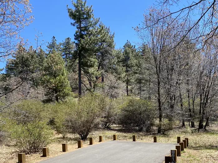
Overview Laguna Campground is a great mountain getaway just one hour east of San Diego, California in the Laguna Mountain Recreation Area. Campers can enjoy cooler temperatures, unique natural areas and an extensive trail system at this mountain facility from summer through early fall. Recreation The Laguna Mountain Recreation Area is known for great horseback riding, mountain biking and hiking trails. Visitors can get their boots dusty on the Laguna Meadow Trail system or access a segment of the 2,650-mile Pacific Crest Trail, which runs from California to the State of Washington. Wildflowers are usually abundant in April and May on the Big Laguna Trail, which takes visitors past Big Laguna Lake. In wet years there is water in Big Laguna Lake by December or January and ducks and other birds can be found. The trail presents a number of options to the user. A return to the trailhead parking can be made by cutting through the Laguna Campground or by taking the Pacific Crest Trail north. Families can learn about the area's flora and fauna by attending educational programs at the facility's amphitheater. Or for history buffs, the El Prado Cabin located at nearby El Prado Campground, is the first ranger cabin built in the Cleveland National Forest in 1911. The San Diego State University Observatory also sponsors "Star Parties" for campers most Saturday evenings during the summer (schedule can be obtained at the nearby visitor center or by calling 619-473-8547). Facilities The Laguna Mountain Recreation Area is known for great horseback riding, mountain biking and hiking trails. Visitors can get their boots dusty on the Laguna Meadow Trail system or access a segment of the 2,650-mile Pacific Crest Trail, which runs from California to the State of Washington. Wildflowers are usually abundant in April and May on the Big Laguna Trail, which takes visitors past Big Laguna Lake. In wet years there is water in Big Laguna Lake by December or January and ducks and other birds can be found. The trail presents a number of options to the user. A return to the trailhead parking can be made by cutting through the Laguna Campground or by taking the Pacific Crest Trail north. Families can learn about the area's flora and fauna by attending educational programs at the facility's amphitheater. Or for history buffs, the El Prado Cabin located at nearby El Prado Campground, is the first ranger cabin built in the Cleveland National Forest in 1911. The San Diego State University Observatory also sponsors "Star Parties" for campers most Saturday evenings during the summer (schedule can be obtained at the nearby visitor center or by calling 619-473-8547). Natural Features The campground sits at an elevation of 6,000 ft. in the Laguna Mountains. It is forested with pines and oaks that provide plenty of shade, in addition to a meadow. The area is home to many species of birds, as well as the endangered Laguna Skipper butterfly. Little Laguna lake is located just a short distance from the campground and is an excellent hiking destination for photographers and visitors looking to explore the area.
View details →
Overview Pineknot Campground is located in the mountains of San Bernardino at Big Bear Lake. It is a popular destination for many outdoor enthusiasts looking for respite from the busy cities nearby. While the campground can accommodate RVs, it is best situated for tent camping. It is in a prime location for mountain biking. Recreation Its location at the base of a ski mountain provides visitors with unlimited access to popular lift-served mountain biking trails. Hikers also enjoy the campground's proximity to a number of trails that vary in levels of difficulty. Big Bear Lake offers a variety of water-related recreation opportunities, including boating and fishing. A marina is located about five miles from the campground. The cold waters of the lake aren't too popular for swimming, but canoeing and sailing on the lake are viable options. Facilities Its location at the base of a ski mountain provides visitors with unlimited access to popular lift-served mountain biking trails. Hikers also enjoy the campground's proximity to a number of trails that vary in levels of difficulty. Big Bear Lake offers a variety of water-related recreation opportunities, including boating and fishing. A marina is located about five miles from the campground. The cold waters of the lake aren't too popular for swimming, but canoeing and sailing on the lake are viable options. Natural Features The campground sits at the base of Snow Summit Ski Resort at an elevation of 6,900 feet. It is nestled in a dense forest of fir, pine and oak trees, which provide ample shade in the campground. Nearby Attractions The adjacent town of Big Bear Lake provides opportunities for shopping and dining. Charges & Cancellations Rules & Reservation Policies As you make travel plans that include reservations on Recreation.gov, there are standard policies that apply to most locations of which you should be aware. Do keep in mind, however, that there are many exceptions, so it is best to review reservation information listed on individual facility pages for those policies and procedures that pertain to your specific locations. Any location or activity requiring a permit or lottery will have unique requirements and policies. Please check individual facility pages for pertinent information for those sites. Booking Window For most locations, you can reserve six months in advance of your stay for individual sites and 12 months in advance for group sites. There are some exceptions, so it is best to check with each facility. Change and Cancellation Policies and Fees Overnight and Day Use Facilities: To ensure fairness, reservation arrival or departure dates may not be changed beyond the booking window until 18 days after booking the reservation. Camping / Day Use: A $10.00 service fee will apply if you change or cancel your reservation (including campsites, cabins, lookouts, group facilities, etc.). The $10.00 service fee will be deducted from the refund amount. You can cancel or change reservations through Recreation.gov or by calling 1-877-444-6777. Tours & Tickets: You may request changes to tour dates at no cost before the arrival date. If you cancel before your tour date, you may be eligible for a refund. Cancellation fees apply. Please check the tour facility description details page for cancellation policies. Permits: Varies by location. Please check the permit details for the permit location. Late Cancellations Overnight and Day Use Facilities: Late cancellations are those cancelled between 12:01 a.m. (Eastern) on the day before arrival and check out time on the day after arrival. Individual Campsites: If a customer cancels a reservation the day before or on the day of arrival they will be charged a $10.00 service fee and will also forfeit the first night's use fee (not to exceed the total paid for the original reservation). Cancellations for a single night's reservation will forfeit the entire use fee but no cancellation fee will apply. Cabins / Lookouts: Customers will be charged a $10.00 cancellation fee and forfeit the first night's use fee if a cabin or lookout reservation is cancelled within 14 days of the scheduled arrival date. Cancellations for a single night's use will not be assessed a service fee. Group Facility: If a customer cancels a group overnight facility reservation within 14 days of the scheduled arrival date they will be charged the $10.00 service fee and forfeit the first night's use fee. Cancellations for a single night's use will not be assessed a service fee. Group Day Use Area: If a customer cancels a group day use facility reservation within 14 days of the scheduled arrival date, they will forfeit the total day use fee with no service fee charge. No-Shows Camping / Day Use: A camping no-show customer is one who does not arrive at a campground and does not cancel the reservation by check-out time on the day after the scheduled arrival date. Reserved campsites and group overnight facilities will be held until check-out time on the day following your scheduled arrival. Group day-use facilities will be held until check-in time on your scheduled arrival date. If a customer does not arrive at the campground or group facility by check-out time the day after arrival or does not cancel the reservation by the times listed under "Late Cancellations" above, the customer may be assessed a $20.00 service fee and forfeit use fees. Tours: A tour or ticket no-show is one who does not cancel a ticket before arrival and does not arrive for the tour. Tour no-shows are not entitled to a refund. Refunds Customers must request refunds no later than 14 days after the scheduled departure date. Recreation.gov will not grant refund requests after 14 days of departure. Reservation Fee: For some facilities, tours or permits an additional reservation fee is charged. For some overnight and day-use facilities, an additional non-refundable reservation fee may apply. The non-refundable reservation fee for tours and tickets is $1.00. The non-refundable reservation fee for permits varies by location. Refunds for Bankcard Purchases: Refunds for bank card payments will be issued as a credit to the original bank card. Refunds for Check or Cash Purchases: Refunds for Recreation.gov payments made by check or money order, and cash payments at selected campgrounds will be issued a check refund. A refund will be processed within 30 days of receipt and approval. Please Note: Refund requests made during or after departure can only be processed when approved by the facility management staff based upon local policy. Refunds for Emergency Closures: In the event of an emergency closure, the Recreation.gov team will attempt to notify users and offer alternate dates (as appropriate). If this is not possible, reservations will be cancelled and all fees paid will be refunded. Reservation fees for free tickets are non-refundable in the event of an emergency closure. Recreation.gov Billing Information Reservation transaction will appear on customer's credit card statements as "Recreation.gov 877-444-6777." Changes to Policies and Procedures Recreation.gov reserves the right, when necessary, to modify reservation policies. These policies were last updated July
View details →
Overview Gurnsey Creek Campground is located in the mountains of northern California. It offers access to a variety of nearby recreational opportunities, including hiking, fishing and picnicking. Recreation The area provides access to plentiful hiking trails, picnic spots and rainbow trout fishing. Facilities The area provides access to plentiful hiking trails, picnic spots and rainbow trout fishing. Natural Features The campground is nestled in a mixed conifer forest in the Lassen National Forest at an elevation of 4,700 feet. It is located next to Gurnsey Creek. Nearby Attractions The campground is located 14 miles west of the town of Chester and Lake Almanor, where boating, fishing, sailing and water skiing are popular activities. The southwest entrance to Lassen Volcanic National Park is about 14 miles north. The park is known for its active hissing fumaroles and boiling mud pots that continually shape and alter the landscape.
View details →
Overview Pioneer Trail Group Campground offers groups of up to 100 people the opportunity to camp near the beautiful Pinecrest Lake. The campground is located within the Pinecrest Recreational Area just 2 miles from the lake, which beckons visitors with excellent fishing, boating, hiking and swimming opportunities. In this spectacular mountain region, wildlife viewing opportunities include marmots, squirrels, coyotes and deer. Recreation The Pinecrest Lake National Recreation Trail takes hikers on an easy 4-mile stroll around Pinecrest Lake. Rainbow trout is a common catch in the lake and swimming is enjoyed in designated beach areas. Facilities The Pinecrest Lake National Recreation Trail takes hikers on an easy 4-mile stroll around Pinecrest Lake. Rainbow trout is a common catch in the lake and swimming is enjoyed in designated beach areas. Natural Features Pioneer Trail sits at an elevation of 5,600 feet, in a wooded area near the southwest side of the 300-acre Pinecrest Lake in Stanislaus National Forest. Stanislaus National Forest is located in the central Sierra Nevada Mountains, between Lake Tahoe and Yosemite. It boasts gorgeous views of snow-capped mountain peaks and California's Great Central Valley. Nearby Attractions The nearby Sonora Pass is a scenic winding highway that has guided people across the Sierra Nevada since 1852.
View details →
Overview The Heart Bar Campground provides access to some of southern California's greatest backcountry hiking, biking and horseback riding trails, as well as a nice play to experience nature. A variety of recreation opportunities are available in the surrounding area as well, leaving little more to be desired from a campsite. Recreation A variety of backcountry hiking, biking and horseback riding trails can be found near the campground, including the famed Santa Ana River Trail, which provides miles of scenic mountain views and points of exploration. The Wildhorse Creek Trail, which explores 5 miles of rolling terrain in the area, is accessed just north of the campground and leads to a remote camping area south of Wildhorse Meadow. It climbs nearly 1,100 feet in elevation and is moderately difficult. Creek fishing is also available nearby. Facilities A variety of backcountry hiking, biking and horseback riding trails can be found near the campground, including the famed Santa Ana River Trail, which provides miles of scenic mountain views and points of exploration. The Wildhorse Creek Trail, which explores 5 miles of rolling terrain in the area, is accessed just north of the campground and leads to a remote camping area south of Wildhorse Meadow. It climbs nearly 1,100 feet in elevation and is moderately difficult. Creek fishing is also available nearby. Natural Features The campground is nestled among pine-covered mountains, at an elevation of 6,880 feet. It is not far from Big Bear Lake, but far enough to retain a remote and secluded atmosphere. The mature trees provide some shade to the area, but understory is limited, leaving campsites with little privacy in some places. Nearby Attractions Big Bear Lake and its adjoining town are located approximately 20 miles from the campground, offering a variety of water-related recreation opportunities, as well as golf, shopping and restaurant options. Charges & Cancellations Rules & Reservation Policies As you make travel plans that include reservations on Recreation.gov, there are standard policies that apply to most locations of which you should be aware. Do keep in mind, however, that there are many exceptions, so it is best to review reservation information listed on individual facility pages for those policies and procedures that pertain to your specific locations. Any location or activity requiring a permit or lottery will have unique requirements and policies. Please check individual facility pages for pertinent information for those sites. Booking Window For most locations, you can reserve six months in advance of your stay for individual sites and 12 months in advance for group sites. There are some exceptions, so it is best to check with each facility. Change and Cancellation Policies and Fees Overnight and Day Use Facilities: To ensure fairness, reservation arrival or departure dates may not be changed beyond the booking window until 18 days after booking the reservation. Camping / Day Use: A $10.00 service fee will apply if you change or cancel your reservation (including campsites, cabins, lookouts, group facilities, etc.). The $10.00 service fee will be deducted from the refund amount. You can cancel or change reservations through Recreation.gov or by calling 1-877-444-6777. Tours & Tickets: You may request changes to tour dates at no cost before the arrival date. If you cancel before your tour date, you may be eligible for a refund. Cancellation fees apply. Please check the tour facility description details page for cancellation policies. Permits: Varies by location. Please check the permit details for the permit location. Late Cancellations Overnight and Day Use Facilities: Late cancellations are those cancelled between 12:01 a.m. (Eastern) on the day before arrival and check out time on the day after arrival. Individual Campsites: If a customer cancels a reservation the day before or on the day of arrival they will be charged a $10.00 service fee and will also forfeit the first night's use fee (not to exceed the total paid for the original reservation). Cancellations for a single night's reservation will forfeit the entire use fee but no cancellation fee will apply. Cabins / Lookouts: Customers will be charged a $10.00 cancellation fee and forfeit the first night's use fee if a cabin or lookout reservation is cancelled within 14 days of the scheduled arrival date. Cancellations for a single night's use will not be assessed a service fee. Group Facility: If a customer cancels a group overnight facility reservation within 14 days of the scheduled arrival date they will be charged the $10.00 service fee and forfeit the first night's use fee. Cancellations for a single night's use will not be assessed a service fee. Group Day Use Area: If a customer cancels a group day use facility reservation within 14 days of the scheduled arrival date, they will forfeit the total day use fee with no service fee charge. No-Shows Camping / Day Use: A camping no-show customer is one who does not arrive at a campground and does not cancel the reservation by check-out time on the day after the scheduled arrival date. Reserved campsites and group overnight facilities will be held until check-out time on the day following your scheduled arrival. Group day-use facilities will be held until check-in time on your scheduled arrival date. If a customer does not arrive at the campground or group facility by check-out time the day after arrival or does not cancel the reservation by the times listed under "Late Cancellations" above, the customer may be assessed a $20.00 service fee and forfeit use fees. Tours: A tour or ticket no-show is one who does not cancel a ticket before arrival and does not arrive for the tour. Tour no-shows are not entitled to a refund. Refunds Customers must request refunds no later than 14 days after the scheduled departure date. Recreation.gov will not grant refund requests after 14 days of departure. Reservation Fee: For some facilities, tours or permits an additional reservation fee is charged. For some overnight and day-use facilities, an additional non-refundable reservation fee may apply. The non-refundable reservation fee for tours and tickets is $1.00. The non-refundable reservation fee for permits varies by location. Refunds for Bankcard Purchases: Refunds for bank card payments will be issued as a credit to the original bank card. Refunds for Check or Cash Purchases: Refunds for Recreation.gov payments made by check or money order, and cash payments at selected campgrounds will be issued a check refund. A refund will be processed within 30 days of receipt and approval. Please Note: Refund requests made during or after departure can only be processed when approved by the facility management staff based upon local policy. Refunds for Emergency Closures: In the event of an emergency closure, the Recreation.gov team will attempt to notify users and offer alternate dates (as appropriate). If this is not possible, reservations will be cancelled and all fees paid will be refunded. Reservation fees for free tickets are non-refundable in the event of an emergency closure. Recreation.gov Billing Information Reservation transaction will appear on customer's credit card statements as "Recreation.gov 877-444-6777." Changes to Policies and Procedures Recreation.gov reserves the right, when necessary, to modify reservation policies. These policies were last updated July
View details →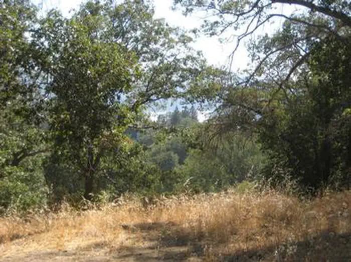
Overview North Shore Campground is a quiet place to camp, away from the hustle and bustle of nearby cities. The campground is nestled among Southern California's pine-covered mountains, providing ample opportunity for outdoor relaxation and recreation. Recreation The North Shore National Recreation Trail connects the campground with Papoose Lake (trail is not accessible). The 1.7-mile trail descends through a mixed conifer forest and settles along Little Bear Creek, providing scenic views of the surrounding area . Please note, nearby Lake Arrowhead is a private lake. Facilities The North Shore National Recreation Trail connects the campground with Papoose Lake (trail is not accessible). The 1.7-mile trail descends through a mixed conifer forest and settles along Little Bear Creek, providing scenic views of the surrounding area . Please note, nearby Lake Arrowhead is a private lake. Natural Features The campground is located 23 miles northeast of San Bernardino in the San Bernardino National Forest. It is about 3 miles from the community of Lake Arrowhead. Settled in an oak woodland environment, the campground is close to many outdoor amenities. Lake Arowhead is a private lake, no access available. Nearby Attractions Lake Gregory is located 40 minute away and offers fishing, boat rentals and a waterslide park. Lake Arrowhead is a private lake, no public access. Charges & Cancellations Rules & Reservation Policies As you make travel plans that include reservations on Recreation.gov, there are standard policies that apply to most locations of which you should be aware. Do keep in mind, however, that there are many exceptions, so it is best to review reservation information listed on individual facility pages for those policies and procedures that pertain to your specific locations. Any location or activity requiring a permit or lottery will have unique requirements and policies. Please check individual facility pages for pertinent information for those sites. Booking Window For most locations, you can reserve six months in advance of your stay for individual sites and 12 months in advance for group sites. There are some exceptions, so it is best to check with each facility. Change and Cancellation Policies and Fees Overnight and Day Use Facilities: To ensure fairness, reservation arrival or departure dates may not be changed beyond the booking window until 18 days after booking the reservation. Camping / Day Use: A $10.00 service fee will apply if you change or cancel your reservation (including campsites, cabins, lookouts, group facilities, etc.). The $10.00 service fee will be deducted from the refund amount. You can cancel or change reservations through Recreation.gov or by calling 1-877-444-6777. Tours & Tickets: You may request changes to tour dates at no cost before the arrival date. If you cancel before your tour date, you may be eligible for a refund. Cancellation fees apply. Please check the tour facility description details page for cancellation policies. Permits: Varies by location. Please check the permit details for the permit location. Late Cancellations Overnight and Day Use Facilities: Late cancellations are those cancelled between 12:01 a.m. (Eastern) on the day before arrival and check out time on the day after arrival. Individual Campsites: If a customer cancels a reservation the day before or on the day of arrival they will be charged a $10.00 service fee and will also forfeit the first night's use fee (not to exceed the total paid for the original reservation). Cancellations for a single night's reservation will forfeit the entire use fee but no cancellation fee will apply. Cabins / Lookouts: Customers will be charged a $10.00 cancellation fee and forfeit the first night's use fee if a cabin or lookout reservation is cancelled within 14 days of the scheduled arrival date. Cancellations for a single night's use will not be assessed a service fee. Group Facility: If a customer cancels a group overnight facility reservation within 14 days of the scheduled arrival date they will be charged the $10.00 service fee and forfeit the first night's use fee. Cancellations for a single night's use will not be assessed a service fee. Group Day Use Area: If a customer cancels a group day use facility reservation within 14 days of the scheduled arrival date, they will forfeit the total day use fee with no service fee charge. No-Shows Camping / Day Use: A camping no-show customer is one who does not arrive at a campground and does not cancel the reservation by check-out time on the day after the scheduled arrival date. Reserved campsites and group overnight facilities will be held until check-out time on the day following your scheduled arrival. Group day-use facilities will be held until check-in time on your scheduled arrival date. If a customer does not arrive at the campground or group facility by check-out time the day after arrival or does not cancel the reservation by the times listed under "Late Cancellations" above, the customer may be assessed a $20.00 service fee and forfeit use fees. Tours: A tour or ticket no-show is one who does not cancel a ticket before arrival and does not arrive for the tour. Tour no-shows are not entitled to a refund. Refunds Customers must request refunds no later than 14 days after the scheduled departure date. Recreation.gov will not grant refund requests after 14 days of departure. Reservation Fee: For some facilities, tours or permits an additional reservation fee is charged. For some overnight and day-use facilities, an additional non-refundable reservation fee may apply. The non-refundable reservation fee for tours and tickets is $1.00. The non-refundable reservation fee for permits varies by location. Refunds for Bankcard Purchases: Refunds for bank card payments will be issued as a credit to the original bank card. Refunds for Check or Cash Purchases: Refunds for Recreation.gov payments made by check or money order, and cash payments at selected campgrounds will be issued a check refund. A refund will be processed within 30 days of receipt and approval. Please Note: Refund requests made during or after departure can only be processed when approved by the facility management staff based upon local policy. Refunds for Emergency Closures: In the event of an emergency closure, the Recreation.gov team will attempt to notify users and offer alternate dates (as appropriate). If this is not possible, reservations will be cancelled and all fees paid will be refunded. Reservation fees for free tickets are non-refundable in the event of an emergency closure. Recreation.gov Billing Information Reservation transaction will appear on customer's credit card statements as "Recreation.gov 877-444-6777." Changes to Policies and Procedures Recreation.gov reserves the right, when necessary, to modify reservation policies. These policies were last updated July
View details →
Overview Situated on the north side of the Loon Lake Reservoir, Red Fir Group Campground offers a primitive group camping experience in the lush Eldorado National Forest. Recreation The nearby lake provides fishing, swimming and boating, and the campground is just a short walk across the road to the water's edge. Visitors also enjoy off-road vehicle and motorcycle riding on the popular Rubicon Jeep trail. Hiking and wilderness backpacking are popular activities. Day permits are available at the nearby Loon Lake trailhead and overnight permits are available at the Eldorado Information Center. Facilities The nearby lake provides fishing, swimming and boating, and the campground is just a short walk across the road to the water's edge. Visitors also enjoy off-road vehicle and motorcycle riding on the popular Rubicon Jeep trail. Hiking and wilderness backpacking are popular activities. Day permits are available at the nearby Loon Lake trailhead and overnight permits are available at the Eldorado Information Center. Natural Features The campground is part of the Crystal Basin Recreation Area, situated at a 6,400-foot elevation and nestled in a forest of tall pine trees. Nearby Attractions The campground is not far from the Desolation Wilderness. Charges & Cancellations Change Fee: A service fee may be charged at the time a modification is made depending on the changes. Cancellation Fee: A $10 service fee will be withheld from any refunds for a cancelled reservation. Cut-Off Window: The latest date and/or time that you can make an advanced reservation or a change to an existing reservation. Cut-off windows can vary by location, but are typically 4 days before your arrival date. A customer who cancels a reservation the day before or on the day of arrival will pay a $10.00 service fee AND forfeit the first night's use fee (see Late Cancellation below). Late Cancellation: If you cancel your reservation too close to the start date, additional service fees may be withheld. Refunds : Refund requests made through www.recreation.gov will be charged a $10 processing fee. This fee is retained by the reservation service contractor along with the non-refundable reservation fee. All requests for the return of the non-refundable reservation fee and the cancellation fee will be declined by the campground concessionaire as they did not receive these fees (these are the fees retained by the reservation contractor, a different entity).
View details →
Overview Big Pine Creek Campground, surrounded by sprawling meadows and towering trees, is perfectly situated in the scenic Big Pine Canyon. Campsites are perched along the cool, fish-filled waters of Big Pine Creek. Big Pine Canyon is heralded for having both the largest and southern most glaciers in the Sierra Nevada mountains. The campground sits at 7,700 feet elevation among vegetation like Jeffrey pine, sagebrush, aspen and cottonwood trees. Recreation The creek and nearby Big Pine Lakes are great for fishing. Both water spots have rainbow, brown and brook trout. The North Fork Trail gives hikers access to Big Pine Lakes and the Palisade Glacier. The trail climbs past waterfalls and zigzags through Jeffrey pine, manzanita and sage before it reaches Big Pine Lakes. Facilities The creek and nearby Big Pine Lakes are great for fishing. Both water spots have rainbow, brown and brook trout. The North Fork Trail gives hikers access to Big Pine Lakes and the Palisade Glacier. The trail climbs past waterfalls and zigzags through Jeffrey pine, manzanita and sage before it reaches Big Pine Lakes. Natural Features Big Pine Canyon is heralded for having both the largest and southern most glaciers in the Sierra Nevada mountains. Palisade Glacier, the largest, sits above Big Pine Lakes. These impressive glacial lakes at around 10,000 feet elevation are the source of the North Fork of Big Pine Creek. The South Fork is bordered by the Palisade Crest with peaks over 14,000 feet and Middle Palisade Glacier, the southernmost glacier. Nearby Attractions Glaciers in the nearby John Muir Wilderness make an exciting hiking destination. A commercial pack station is within close proximity for horse enthusiasts looking for an outdoor adventure. A general store, pay showers and pond fishing can be found at a nearby resort.
View details →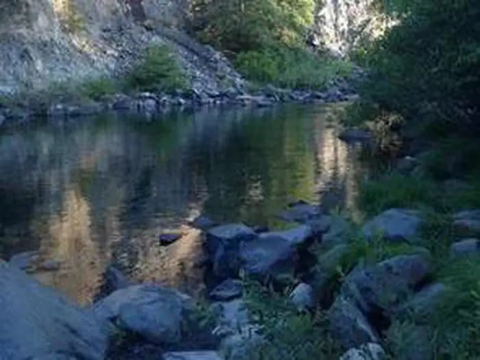
Overview Patrick Creek Campground sits at the confluence of Patrick Creek and the middle fork of Smith River in the vast Six Rivers National Forest of northern California. The campground has a special charm, with steps, rock walls, restrooms and sunken campfire circles built in the 1930s by the Civilian Conservation Corps. Recreation Popular activities include swimming, sunbathing, rafting and fishing in the Smith River, which is just adjacent to the campground. Anglers can expect healthy fishing populations of salmon, steelhead and cutthroat trout. Visitors also enjoy hiking, horseback riding and biking in the area. There are no trailheads in the campground, but Elk Camp Ridge, High Dome and French Hill trailheads are all within 10 miles of the site. Facilities Popular activities include swimming, sunbathing, rafting and fishing in the Smith River, which is just adjacent to the campground. Anglers can expect healthy fishing populations of salmon, steelhead and cutthroat trout. Visitors also enjoy hiking, horseback riding and biking in the area. There are no trailheads in the campground, but Elk Camp Ridge, High Dome and French Hill trailheads are all within 10 miles of the site. Natural Features Patrick Creek is located in a mature forest of Douglas firs in the northernmost part of California. A popular historic lodge and restaurant lie just across the highway from the campground. The Six Rivers National Forest lies east of Eureka in northwestern California, stretching southward from the Oregon border for about 140 miles. U.S. 101, the famed "Redwood Highway," parallels the inland Forest along the coastline. The Forest is just east of the Redwood National Park.
View details →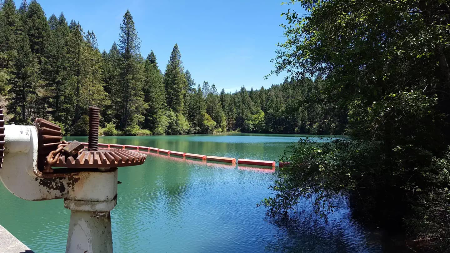
Overview White Cloud Campground is located in the Tahoe National Forest along Highway 20 near Nevada City. The area provides a great escape from urban life. Recreation The Pioneer Trail stretches 25 miles through the Tahoe National Forest and can be accessed from the campground. The popular path was designated a National Recreation Trail in 2003. Horseback riding, hiking, mountain biking and cross-country skiing are favorite activities on this popular trail. Facilities The Pioneer Trail stretches 25 miles through the Tahoe National Forest and can be accessed from the campground. The popular path was designated a National Recreation Trail in 2003. Horseback riding, hiking, mountain biking and cross-country skiing are favorite activities on this popular trail. Natural Features The campground is situated in a forest of cedar, pine, and Douglas fir trees, at an elevation of 4,200 feet. contact_info For facility specific information, please call (530) 265-4531. Nearby Attractions White Cloud Campground is located on the Highway 20 portion of the Yuba Donner Scenic Byway near many gold rush era historical sites and old mining towns such as Washington and Nevada City. Nevada City, about 14 miles west, is a scenic historical mining town with many historical attractions, top notch restaraunts, various lodging options, shopping, and stores for everything you may need. Other attractions include the Pioneer Trail, South Yuba River, Washintong Scenic Overlook, Alpha and Omega Scenic Overlook and Interpretive Trail, Rock Creek Nature Trail, Chalk Bluff OHV trails, and Grouse Ridge Non-Motorized Area. Charges & Cancellations No Show Policy A no-show customer is one who does not arrive at a campground and does not cancel the reservation by check-out time on the day after the scheduled arrival date (or for day-use facilities, by check-in time the day of arrival). * No-show customers are only recorded at staffed facilities. At most remote facilities, all customers are noted as automatically checked-in on the date of arrival. * It is recommended that staffed facilities hold a campsite until check-out time on the day following the arrival date. * It is recommended that staffed facilities hold group day-use facilities until check-in time on the arrival date. There is no change fee if a customer extends or shortens a reservation if the change includes dates from the original reservation. If they choose to depart early, they may forfeit some or all of the recreation fees. There is no change fee if the customer changes campsites that are the same price and on the same reservation dates in the same campground. If the campsite the customer is changing to has a price difference, the customer will be responsible for any additional fees or be provided with a refund, based on the price difference. Where recorded, no-show customers are assessed a $20.00 no-show fee and forfeit the first night's recreation fee for a campsite or forfeit the entire day-use recreation fee for a day-use facility. We recommend customers contact the facility if they are en route to their reservation but cannot make it by the check-in date. In these cases, no refund will be issued, but the facility can ensure that a "no-show" fee is not assessed.
View details →
Overview Panther Flat Campground sits in the vast Six Rivers National Forest in northern California. This shady, secluded campground is just steps from the Smith River, which is famous for its bright blue waters and scenic pathway through the forest. Recreation Popular activities include swimming, sunbathing, rafting and fishing in the Smith River. Anglers enjoy healthy fishing populations of salmon, steelhead and cutthroat trout. Visitors also enjoy hiking, horseback riding and biking in the area. There are no trailheads in the campground, but Elk Camp Ridge, High Dome and French Hill trailheads are all within 10 miles of the site. A Botanical trail to a unique Darlingtonia bog is just a mile away. Facilities Popular activities include swimming, sunbathing, rafting and fishing in the Smith River. Anglers enjoy healthy fishing populations of salmon, steelhead and cutthroat trout. Visitors also enjoy hiking, horseback riding and biking in the area. There are no trailheads in the campground, but Elk Camp Ridge, High Dome and French Hill trailheads are all within 10 miles of the site. A Botanical trail to a unique Darlingtonia bog is just a mile away. Natural Features Set in a mature forest of Douglas fir, cedar and Pacific madrone trees, the campground is a short walk from the pristine Smith River. The river boasts up to Class 5 whitewater rapids. The region, thick with vegetation, is also freckled with huckleberry shrubs. The Six Rivers National Forest lies east of Eureka in northwestern California, stretching southward from the Oregon border for about 140 miles. U.S. 101, the famed "Redwood Highway," parallels the inland Forest along the coastline. The Forest is just east of the Redwood National Park. Nearby Attractions California's Redwood National Park and the Pacific Ocean are within 20 miles of the campground. Annual events include Gasquet Raft Race in July and Del Norte County Fair in August.
View details →
Overview Holiday Group Campground is a relaxing location to enjoy nature all year long; a quick escape from the bustle of the city. It provides access to a variety of recreational opportunities, including hiking, biking and horseback riding. Surrounding trails are also fun for off-road vehicle enthusiasts. Recreation The Wheeler Gorge Nature Trail begins not far from the campground. It is a relatively short, loop trail that leads through thick vegetation along the river banks and to a scenic hillside view of the area. Wildflowers are often located along the path. The 10-mile Ortega Trail, for off-road vehicle use, is popular among experienced riders. Rocky, steep terrain takes the trail to the ridgetop. The creek flows near some of the campsites and a small swimming hole is available nearby. Fishing is rough in the area and may produce a catch of trout, but the stream is not stocked. Kayaking or canoeing in the creek is not recommended. Facilities The Wheeler Gorge Nature Trail begins not far from the campground. It is a relatively short, loop trail that leads through thick vegetation along the river banks and to a scenic hillside view of the area. Wildflowers are often located along the path. The 10-mile Ortega Trail, for off-road vehicle use, is popular among experienced riders. Rocky, steep terrain takes the trail to the ridgetop. The creek flows near some of the campsites and a small swimming hole is available nearby. Fishing is rough in the area and may produce a catch of trout, but the stream is not stocked. Kayaking or canoeing in the creek is not recommended. Natural Features The campground is situated at the bottom of Live Oak Canyon at an elevation of 2,120 feet. It is heavily shaded and the Matilija Creek runs nearby. Nearby Attractions Ojai is the nearest town, about 15 miles from the campground. The larger city of Ventura is about 20 miles south of the campground. The Pacific Ocean is not far from there.
View details →
Overview Lodgepole Group Campground is located just two miles west of Lake Alpine in northern California. The campground affords breathtaking views of the surrounding Stanislaus National Forest. Campground may open earlier and close later on a first come first serve basis as weather (snow level) allows. This information will be posted on this page as soon as it becomes available. The current dates for reservations have historically allowed for comfortable camping, but please take into consideration the high alpine location when making a reservation. It is possible to have snow, rain, mud, and overall cold/wet conditions any time of year. Recreation Lake Alpine provides a wide variety of recreation opportunities. Hike, bike, or ride a horse on Bear Valley, an accessible trail that winds along the lakeshore to the community of Bear Valley. It connects with the historic Emigrant Trail, the route pioneers once traveled via covered wagon to settle in California. Interpretive programs are offered by Forest Service rangers during the summer months. Facilities Lake Alpine provides a wide variety of recreation opportunities. Hike, bike, or ride a horse on Bear Valley, an accessible trail that winds along the lakeshore to the community of Bear Valley. It connects with the historic Emigrant Trail, the route pioneers once traveled via covered wagon to settle in California. Interpretive programs are offered by Forest Service rangers during the summer months. Natural Features Lodgepole Campground is situated on a large, flat plain, not far from a creek. It sits at an elevation of 7,290 feet, within the Stanislaus National Forest in the central Sierra Nevada Mountains. The forest lies between Lake Tahoe and Yosemite and boasts gorgeous views of snow-capped peaks and California's Great Central Valley. A wide variety of wildlife makes its home in the area, including marmots, squirrels, coyotes, deer and many birds. Nearby Attractions A restaurant, bar, general store, and boat rentals can be found at nearby Lake Alpine Lodge. The immediate area is suited for forest and wilderness recreation. A short car ride away is Big Trees State Park, Grover Hot Springs, Mercer Caverns, Mountain Adventure Seminars, and the wine country of Calaveras County.
View details →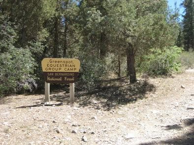
Overview Green Spot Equestrian Group Campground provides access to a number of recreational activities in the area, namely horseback riding trails. The large campground gives campers and horses ample space to move around and enjoy the scenic surroundings. Recreation Visitors enjoy a variety of recreational opportunities, including fishing, boating and swimming at the nearby Big Bear Lake. Access to the Sugarloaf National Recreation Trail is also available near the campground. It is a fairly difficult trek to the highest point in Big Bear Valley, and a climb to an altitude of 9,952 feet. Facilities Visitors enjoy a variety of recreational opportunities, including fishing, boating and swimming at the nearby Big Bear Lake. Access to the Sugarloaf National Recreation Trail is also available near the campground. It is a fairly difficult trek to the highest point in Big Bear Valley, and a climb to an altitude of 9,952 feet. Natural Features The campground is located in the San Bernardino Mountains at an elevation of 7,224 feet. It is situated in a pinyon pine and juniper forest carpeted with grassy meadows. The road to the campground is rough and rocky, suitable for four-wheel drive vehicles. Nearby Attractions The campground is approximately 45 minutes from San Bernardino. Charges & Cancellations Rules & Reservation Policies As you make travel plans that include reservations on Recreation.gov, there are standard policies that apply to most locations of which you should be aware. Do keep in mind, however, that there are many exceptions, so it is best to review reservation information listed on individual facility pages for those policies and procedures that pertain to your specific locations. Any location or activity requiring a permit or lottery will have unique requirements and policies. Please check individual facility pages for pertinent information for those sites. Booking Window For most locations, you can reserve six months in advance of your stay for individual sites and 12 months in advance for group sites. There are some exceptions, so it is best to check with each facility. Change and Cancellation Policies and Fees Overnight and Day Use Facilities: To ensure fairness, reservation arrival or departure dates may not be changed beyond the booking window until 18 days after booking the reservation. Camping / Day Use: A $10.00 service fee will apply if you change or cancel your reservation (including campsites, cabins, lookouts, group facilities, etc.). The $10.00 service fee will be deducted from the refund amount. You can cancel or change reservations through Recreation.gov or by calling 1-877-444-6777. Tours & Tickets: You may request changes to tour dates at no cost before the arrival date. If you cancel before your tour date, you may be eligible for a refund. Cancellation fees apply. Please check the tour facility description details page for cancellation policies. Permits: Varies by location. Please check the permit details for the permit location. Late Cancellations Overnight and Day Use Facilities: Late cancellations are those cancelled between 12:01 a.m. (Eastern) on the day before arrival and check out time on the day after arrival. Individual Campsites: If a customer cancels a reservation the day before or on the day of arrival they will be charged a $10.00 service fee and will also forfeit the first night's use fee (not to exceed the total paid for the original reservation). Cancellations for a single night's reservation will forfeit the entire use fee but no cancellation fee will apply. Cabins / Lookouts: Customers will be charged a $10.00 cancellation fee and forfeit the first night's use fee if a cabin or lookout reservation is cancelled within 14 days of the scheduled arrival date. Cancellations for a single night's use will not be assessed a service fee. Group Facility: If a customer cancels a group overnight facility reservation within 14 days of the scheduled arrival date they will be charged the $10.00 service fee and forfeit the first night's use fee. Cancellations for a single night's use will not be assessed a service fee. Group Day Use Area: If a customer cancels a group day use facility reservation within 14 days of the scheduled arrival date, they will forfeit the total day use fee with no service fee charge. No-Shows Camping / Day Use: A camping no-show customer is one who does not arrive at a campground and does not cancel the reservation by check-out time on the day after the scheduled arrival date. Reserved campsites and group overnight facilities will be held until check-out time on the day following your scheduled arrival. Group day-use facilities will be held until check-in time on your scheduled arrival date. If a customer does not arrive at the campground or group facility by check-out time the day after arrival or does not cancel the reservation by the times listed under "Late Cancellations" above, the customer may be assessed a $20.00 service fee and forfeit use fees. Tours: A tour or ticket no-show is one who does not cancel a ticket before arrival and does not arrive for the tour. Tour no-shows are not entitled to a refund. Refunds Customers must request refunds no later than 14 days after the scheduled departure date. Recreation.gov will not grant refund requests after 14 days of departure. Reservation Fee: For some facilities, tours or permits an additional reservation fee is charged. For some overnight and day-use facilities, an additional non-refundable reservation fee may apply. The non-refundable reservation fee for tours and tickets is $1.00. The non-refundable reservation fee for permits varies by location. Refunds for Bankcard Purchases: Refunds for bank card payments will be issued as a credit to the original bank card. Refunds for Check or Cash Purchases: Refunds for Recreation.gov payments made by check or money order, and cash payments at selected campgrounds will be issued a check refund. A refund will be processed within 30 days of receipt and approval. Please Note: Refund requests made during or after departure can only be processed when approved by the facility management staff based upon local policy. Refunds for Emergency Closures: In the event of an emergency closure, the Recreation.gov team will attempt to notify users and offer alternate dates (as appropriate). If this is not possible, reservations will be cancelled and all fees paid will be refunded. Reservation fees for free tickets are non-refundable in the event of an emergency closure. Recreation.gov Billing Information Reservation transaction will appear on customer's credit card statements as "Recreation.gov 877-444-6777." Changes to Policies and Procedures Recreation.gov reserves the right, when necessary, to modify reservation policies. These policies were last updated July
View details →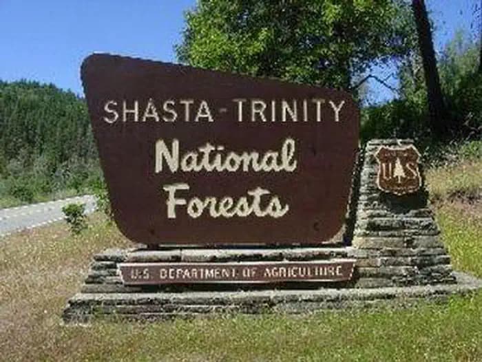
Overview Located on the Stuart Fork Arm of Trinity Lake, Fawn Group Campground is the most popular group site in the area. Well-shaded by oaks, Douglas firs and pines, this campground provides direct lake access and is conveniently located near other recreational sites. Recreation A boat ramp and marina are 1 mile away. Nearby Stoney Creek Swim Area is popular spot, offering a beach and picnic area. Popular activities include lakeside camping, hiking, fishing, swimming, boating and other watersports. Facilities A boat ramp and marina are 1 mile away. Nearby Stoney Creek Swim Area is popular spot, offering a beach and picnic area. Popular activities include lakeside camping, hiking, fishing, swimming, boating and other watersports. Natural Features Shasta-Trinity is the largest national forest in California with a diverse landscape encompassing five wilderness areas, hundreds of mountain lakes and 6,278 miles of streams and rivers. Lake Shasta sits at an elevation of 1,067 feet, with 365 miles of shoreline punctuated by steep mountains blanketed in manzanita and evergreens. A snow-capped Mount Shasta, the second-tallest mountain in the Cascade Range, looms in the distance. Nearby Attractions The town of Weaverville is listed on the National Register of Historic Places and is only a 20 minute drive from the campground. This former mining town offers restaurants, shopping and self-guided walking tours.
View details →
Overview Stoney Group Campground is nestled on the banks of Stoney Creek on the Stuart Fork Arm of Trinity Lake. This group camp can accommodate up to 60 people with tents. The sites are given some shade from tall trees, and two popular recreation areas on Trinity Lake are located nearby. Recreation The campground is adjacent to the popular Stoney Creek Swim Area, which offers a beach and picnic tables. A boat ramp and marina are located less than a mile away. Popular activities in the area include power and non-motorized boating, fishing and water skiing. Anglers can cast for catfish, as well as a variety of bass, trout and salmon. Facilities The campground is adjacent to the popular Stoney Creek Swim Area, which offers a beach and picnic tables. A boat ramp and marina are located less than a mile away. Popular activities in the area include power and non-motorized boating, fishing and water skiing. Anglers can cast for catfish, as well as a variety of bass, trout and salmon. Natural Features Trinity Lake sits at an elevation of 2,370 feet and is surrounded by the Trinity Alps. Black bears are frequently spotted in the area, as well as bobcats, mountain lions and a variety of bird species. Shasta-Trinity is the largest national forest in California with a diverse landscape encompassing five wilderness areas, hundreds of mountain lakes and 6,278 miles of streams and rivers. Nearby Attractions The nearby town of Weaverville is listed on the National Register of Historic Places. The former mining town offers restaurants, shopping and self-guided walking tours.
View details →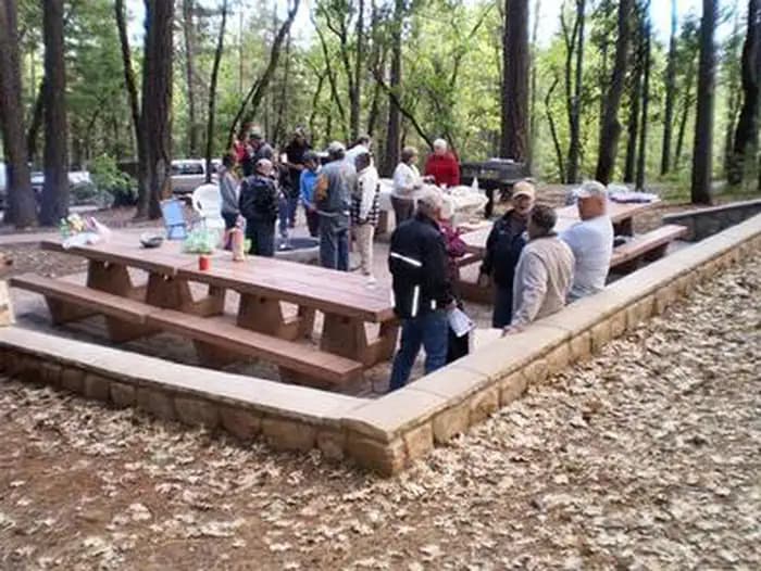
Overview Bushytail Campground is nestled in a grove of tall Douglas firs and Ponderosa Pines, just a short distance from Trinity Lake. This campground makes an excellent base for enjoying a variety of water sports, sightseeing and other activities and is ideal for single families and small groups. Recreation Trinity Lake offers a variety of recreational opportunities, including boating, water skiing, sailing, swimming and fishing. Anglers can catch catfish, in addition to a variety of salmon, trout and bass. The Clark Springs Public Boat Ramp is less than a mile from Bushytail Campground. Hikers may be interested in the 4-mile Trinity Lakeshore Trail, which starts at the nearby Clark Springs Campground. Facilities Trinity Lake offers a variety of recreational opportunities, including boating, water skiing, sailing, swimming and fishing. Anglers can catch catfish, in addition to a variety of salmon, trout and bass. The Clark Springs Public Boat Ramp is less than a mile from Bushytail Campground. Hikers may be interested in the 4-mile Trinity Lakeshore Trail, which starts at the nearby Clark Springs Campground. Natural Features Shasta-Trinity is the largest national forest in California with a diverse landscape encompassing five wilderness areas, hundreds of mountain lakes and 6,278 miles of streams and rivers. Bushytail Campground is part of the Whiskeytown-Shasta-Trinity National Recreation Area. Nearby Trinity Lake sits at an elevation of 2,370 feet and is surrounded by the Trinity Alps. Black bears are frequently spotted in the area, as well as bobcats, mountain lions and a variety of bird species. Nearby Attractions The nearby town of Weaverville is listed on the National Register of Historic Places. This former mining town offers restaurants, shopping and self-guided walking tours.
View details →
Overview Wolf Creek Campground is a modern facility on the north shore of Union Valley Reservoir. The reservoir offers plenty of opportunities for water activities like sailing, boating, swimming and fishing. Bring a bike to explore the neighboring bike trail. Eldorado National Forest includes the famed gold mining territory of the 1800s. Remnants of the days of the California Gold Rush are all around the region. Recreation The paved Union Valley Bike Trail spans 4.8 miles with an easy climb of 300 feet. The trail connects campgrounds on the east side of the lake, starting from Wench Creek on down to Jones Fork Campground. Interpretive signs along the trail tell the story of the use and development of water resources in Union Valley. This trail can be used by both hikers and bikers. Anglers seek rainbow, brown and mackinaw trout or kokanee salmon. The reservoir also offers opportunities for swimming, water skiing and boating. The nearest boat ramp is at Yellowjacket Campground. Facilities The paved Union Valley Bike Trail spans 4.8 miles with an easy climb of 300 feet. The trail connects campgrounds on the east side of the lake, starting from Wench Creek on down to Jones Fork Campground. Interpretive signs along the trail tell the story of the use and development of water resources in Union Valley. This trail can be used by both hikers and bikers. Anglers seek rainbow, brown and mackinaw trout or kokanee salmon. The reservoir also offers opportunities for swimming, water skiing and boating. The nearest boat ramp is at Yellowjacket Campground. Natural Features At an elevation of 4,900 feet, Wolf Creek sits in the Crystal Basin of the Sierra Nevadas. This is an area known for granite peaks, alpine lakes and pine forest. The climate is similar to that of the Mediterranean with warm, dry summers and cold, wet winters. An abundance of wildlife can be found within the Sierra Nevada Range, including black bears, mule deer, bobcat, gray fox, bighorn sheep, pikas, martens and a variety of squirrels. Several species of reptiles, amphibians and birds also inhabit the area. Nearby Attractions The Desolation Wilderness is nearby, offering the opportunity to get away from the crowds and enjoy the serenity of nature. Charges & Cancellations Change Fee: A service fee may be charged at the time a modification is made depending on the changes. Cancellation Fee: A $10 service fee will be withheld from any refunds for a cancelled reservation. Cut-Off Window: The latest date and/or time that you can make an advanced reservation or a change to an existing reservation. Cut-off windows can vary by location, but are typically 4 days before your arrival date. A customer who cancels a reservation the day before or on the day of arrival will pay a $10.00 service fee AND forfeit the first night's use fee (see Late Cancellation below). Late Cancellation: If you cancel your reservation too close to the start date, additional service fees may be withheld. Refunds: Refund requests made through www.recreation.gov will be charged a $10 processing fee. This fee is retained by the reservation service contractor along with the non-refundable reservation fee. All requests for the return of the non-refundable reservation fee and the cancellation fee will be declined by the campground concessionaire as they did not receive these fees (these are the fees retained by the reservation contractor, a different entity).
View details →
Overview Crags Campground is located just 10 miles from Bridgeport, California, at an elevation of 7,000 feet. The Twin Lakes area is close by, offering boating, fishing, hiking and horseback riding opportunities. Recreation Robinson Creek offers good rainbow trout fishing and can be easily accessed from within the campground. Numerous hiking trails are in the vicinity, including the popular Robinson Creek Trail. Facilities Robinson Creek offers good rainbow trout fishing and can be easily accessed from within the campground. Numerous hiking trails are in the vicinity, including the popular Robinson Creek Trail. Natural Features The campground offers views of the rugged Sawtooth Ridge, with craggy peaks topping out at over 10,500 feet in elevation. A forest of Jeffrey pines towers over the campground, offering limited shade. Sagebrush and summer wildflowers dot the area. Nearby Attractions Upper and Lower Twin Lakes are within walking distance, offering beautiful mountain scenery, boating, canoeing and fishing for Kokanee salmon and rainbow and brown trout. Twin Lakes Resort is just across the road. The rugged and scenic Hoover Wilderness Area can be accessed from the Twin Lakes area and offers additional trails for hiking and horseback riding.
View details →
Overview Yuba Pass Campground is located in the North Yuba River area, atop Yuba Pass on Highway 49. Visitors enjoy a wide variety of recreational activities in the area, including birding, hiking, biking, hunting, and fishing. This facility is operated and maintained by the Tahoe National Forest Recreation Bird watching is a favorite activity on Yuba Pass. The peaceful and scenic surroundings attract a wide variety of birds, including sandhill cranes, hermit warblers, black-backed woodpeckers, sapsuckers, calliope hummingbirds, sooty grouse, northern pygmy-owls, mountain quail, bald eagles, osprey, hawks and geese. A large network of trails is available in the area, including the Pacific Crest Trail in the Lakes Basin area. Facilities Bird watching is a favorite activity on Yuba Pass. The peaceful and scenic surroundings attract a wide variety of birds, including sandhill cranes, hermit warblers, black-backed woodpeckers, sapsuckers, calliope hummingbirds, sooty grouse, northern pygmy-owls, mountain quail, bald eagles, osprey, hawks and geese. A large network of trails is available in the area, including the Pacific Crest Trail in the Lakes Basin area. Natural Features A forest of old-growth red fir provides ample shade for campsites. A variety of wildlife make its home in the area. contact_info For facility specific information, please call (530) 362-8259. Nearby Attractions Yuba Pass Campground is located on the Yuba Donner Scenic Byway (Highway 49) near many gold rush era historical sites and scenic mountain vistas. Many points of interest lie along Highway 49 and are part of the 49 miles of Highway 49 driving tour; look for interpretive signs and other historical sites along this tour route. Gold Lakes Basin offers boating, fishing, biking, and hiking. Boating, fishing and swimming are available at nearby Sardine Lakes, about nine miles west of the campground. Sardine Lakes Resort offers boat rentals. Anglers will find rainbow and brook trout in many of the lakes, streams, and rivers throughout the basin. Over 30 miles of maintained trails for hiking, mountain biking, and motorcycle singletrack branch out across the area and the Pacific Crest Trail can be accessed at a few spots in the Lakes Basin area. The historic towns of Sierra City and Sierraville offer historic and cultural attractions, restaurants, shops, churches, and vistor information. Charges & Cancellations No Show Policy A no-show customer is one who does not arrive at a campground and does not cancel the reservation by check-out time on the day after the scheduled arrival date (or for day-use facilities, by check-in time the day of arrival). * No-show customers are only recorded at staffed facilities. At most remote facilities, all customers are noted as automatically checked-in on the date of arrival. * It is recommended that staffed facilities hold a campsite until check-out time on the day following the arrival date. * It is recommended that staffed facilities hold group day-use facilities until check-in time on the arrival date. There is no change fee if a customer extends or shortens a reservation if the change includes dates from the original reservation. If they choose to depart early, they may forfeit some or all of the recreation fees. There is no change fee if the customer changes campsites that are the same price and on the same reservation dates in the same campground. If the campsite the customer is changing to has a price difference, the customer will be responsible for any additional fees or be provided with a refund, based on the price difference. Where recorded, no-show customers are assessed a $20.00 no-show fee and forfeit the first night's recreation fee for a campsite or forfeit the entire day-use recreation fee for a day-use facility. We recommend customers contact the facility if they are en route to their reservation but cannot make it by the check-in date. In these cases, no refund will be issued, but the facility can ensure that a "no-show" fee is not assessed.
View details →
Overview Crab Flats Campground is an off-roaders paradise, with plenty of off-road vehicle trails nearby for both beginner and experienced riders. Its location not only provides plentiful recreation, but also a secluded escape in Southern California's pine-covered mountains. Campground is difficult to reach without a high clearance vehicle. Recreation A variety of hiking, mountain biking and off-road vehicle trails surround the campground, including the Crab Creek Trail, which provides access to nearby Fisherman's Campground. The scenery along the trail is exceptional. Other off-road vehicle trails in the area include the 9.7-mile Redonda Ridge Trail, and Holcomb Valley Road, which runs about 26 miles and begins west of the campground. The Crab Flat Loop is also west of the campground. Green Valley Lake is approximately 6 miles away and offers boating, fishing and swimming opportunities. The 9-acre lake is regularly stocked with a variety of fish. Snowshoeing and cross country skiing are available in the winter. Facilities A variety of hiking, mountain biking and off-road vehicle trails surround the campground, including the Crab Creek Trail, which provides access to nearby Fisherman's Campground. The scenery along the trail is exceptional. Other off-road vehicle trails in the area include the 9.7-mile Redonda Ridge Trail, and Holcomb Valley Road, which runs about 26 miles and begins west of the campground. The Crab Flat Loop is also west of the campground. Green Valley Lake is approximately 6 miles away and offers boating, fishing and swimming opportunities. The 9-acre lake is regularly stocked with a variety of fish. Snowshoeing and cross country skiing are available in the winter. Natural Features The campground is located 8 miles from Green Valley Lake in the San Bernardino National Forest, near the town of Arrowhead. I t is accessed by a dirt road that crosses Deep Creek. The campground is situated among tall pine, oak and cedar trees. A variety of birds and wildlife make their home in the area. Nearby Attractions The closest communities are Arrowhead and Running Springs. contact_info For facility specific information, please call (909) 866-8550. Charges & Cancellations Rules & Reservation Policies As you make travel plans that include reservations on Recreation.gov, there are standard policies that apply to most locations of which you should be aware. Do keep in mind, however, that there are many exceptions, so it is best to review reservation information listed on individual facility pages for those policies and procedures that pertain to your specific locations. Any location or activity requiring a permit or lottery will have unique requirements and policies. Please check individual facility pages for pertinent information for those sites. Booking Window For most locations, you can reserve six months in advance of your stay for individual sites and 12 months in advance for group sites. There are some exceptions, so it is best to check with each facility. Change and Cancellation Policies and Fees Overnight and Day Use Facilities: To ensure fairness, reservation arrival or departure dates may not be changed beyond the booking window until 18 days after booking the reservation. Camping / Day Use: A $10.00 service fee will apply if you change or cancel your reservation (including campsites, cabins, lookouts, group facilities, etc.). The $10.00 service fee will be deducted from the refund amount. You can cancel or change reservations through Recreation.gov or by calling 1-877-444-6777. Tours & Tickets: You may request changes to tour dates at no cost before the arrival date. If you cancel before your tour date, you may be eligible for a refund. Cancellation fees apply. Please check the tour facility description details page for cancellation policies. Permits: Varies by location. Please check the permit details for the permit location. Late Cancellations Overnight and Day Use Facilities: Late cancellations are those cancelled between 12:01 a.m. (Eastern) on the day before arrival and check out time on the day after arrival. Individual Campsites: If a customer cancels a reservation the day before or on the day of arrival they will be charged a $10.00 service fee and will also forfeit the first night's use fee (not to exceed the total paid for the original reservation). Cancellations for a single night's reservation will forfeit the entire use fee but no cancellation fee will apply. Cabins / Lookouts: Customers will be charged a $10.00 cancellation fee and forfeit the first night's use fee if a cabin or lookout reservation is cancelled within 14 days of the scheduled arrival date. Cancellations for a single night's use will not be assessed a service fee. Group Facility: If a customer cancels a group overnight facility reservation within 14 days of the scheduled arrival date they will be charged the $10.00 service fee and forfeit the first night's use fee. Cancellations for a single night's use will not be assessed a service fee. Group Day Use Area: If a customer cancels a group day use facility reservation within 14 days of the scheduled arrival date, they will forfeit the total day use fee with no service fee charge. No-Shows Camping / Day Use: A camping no-show customer is one who does not arrive at a campground and does not cancel the reservation by check-out time on the day after the scheduled arrival date. Reserved campsites and group overnight facilities will be held until check-out time on the day following your scheduled arrival. Group day-use facilities will be held until check-in time on your scheduled arrival date. If a customer does not arrive at the campground or group facility by check-out time the day after arrival or does not cancel the reservation by the times listed under "Late Cancellations" above, the customer may be assessed a $20.00 service fee and forfeit use fees. Tours: A tour or ticket no-show is one who does not cancel a ticket before arrival and does not arrive for the tour. Tour no-shows are not entitled to a refund. Refunds Customers must request refunds no later than 14 days after the scheduled departure date. Recreation.gov will not grant refund requests after 14 days of departure. Reservation Fee: For some facilities, tours or permits an additional reservation fee is charged. For some overnight and day-use facilities, an additional non-refundable reservation fee may apply. The non-refundable reservation fee for tours and tickets is $1.00. The non-refundable reservation fee for permits varies by location. Refunds for Bankcard Purchases: Refunds for bank card payments will be issued as a credit to the original bank card. Refunds for Check or Cash Purchases: Refunds for Recreation.gov payments made by check or money order, and cash payments at selected campgrounds will be issued a check refund. A refund will be processed within 30 days of receipt and approval. Please Note: Refund requests made during or after departure can only be processed when approved by the facility management staff based upon local policy. Refunds for Emergency Closures: In the event of an emergency closure, the Recreation.gov team will attempt to notify users and offer alternate dates (as appropriate). If this is not possible, reservations will be cancelled and all fees paid will be refunded. Reservation fees for free tickets are non-refundable in the event of an emergency closure. Recreation.gov Billing Information Reservation transaction will appear on customer's credit card statements as "Recreation.gov 877-444-6777." Changes to Policies and Procedures Recreation.gov reserves the right, when necessary, to modify reservation policies. These policies were last updated July
View details →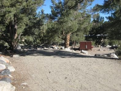
Overview French Camp lies in the Rock Creek area of the scenic Sierra Nevada Mountains, near Tom's Place and midway between Bishop and Mammoth Lakes, California. Its ideal location makes this campground a good stop for travelers on U.S. Highway 395 to rest overnight. Hiking opportunities are vast, and the creekside campground is convenient for fishing. The facility is large and inviting, with forest and mountain views and several amenities. Opening and closing dates for the season are dependent on weather. Recreation Rock Creek and other waterways in the eastern Sierra Nevada Mountains are known for their exceptional trout fishing. A catch from the creek may includ brook, brown, rainbow and stocked Alpers trout. The area's majestic scenery and challenging trails are an obvious draw for hikers and mountain bikers. Because of the region's interesting geology, rockhounding is also popular. Facilities Rock Creek and other waterways in the eastern Sierra Nevada Mountains are known for their exceptional trout fishing. A catch from the creek may includ brook, brown, rainbow and stocked Alpers trout. The area's majestic scenery and challenging trails are an obvious draw for hikers and mountain bikers. Because of the region's interesting geology, rockhounding is also popular. Natural Features Campers will experience the beauty of pines and fragrant junipers that have come to represent Inyo National Forest. The campground sits among aspens, pinyon and ponderosa and Jeffrey pines at an elevation of 7,500 ft. The clear, cold and cascading Rock Creek, which originates in the John Muir Wilderness, runs alongside it. Brushy landscape and ample boulders in the area are fun to explore and traverse. The area is home to abundant wildlife, including black bear, mountain lions, mule deer, pine marten, pika and many species of fish and birds. Nearby Attractions For campers interested in local events, Mule Days are held in nearby Bishop over Memorial Day weekend, and the Mammoth Jazz Jubilee is hosted in Mammoth in mid-July. contact_info For facility specific information, please call (760) 935-4824.
View details →
Overview East Fork Canyon is in a beautiful wooded section of Rock Creek Canyon, near Lower Rock Creek. Anglers, hikers and photographers enjoy this scenic location in the eastern Sierra Nevada Mountains of California. The facility is large and accommodating, with several loops of campsites.Opening and closing dates for the season are dependent on weather. Recreation Rock Creek and other waterways in the eastern Sierra Nevada Mountains are known for their exceptional trout fishing. A catch from the creek may include brook, brown, rainbow and stocked Alpers trout, while anglers in the backcountry are treated to populations of golden trout. The area's majestic scenery and challenging trails are an obvious draw for hikers and mountain bikers. There are several trails in and around Rock Creek Canyon, some of which meander around high-elevation alpine lakes. Facilities Rock Creek and other waterways in the eastern Sierra Nevada Mountains are known for their exceptional trout fishing. A catch from the creek may include brook, brown, rainbow and stocked Alpers trout, while anglers in the backcountry are treated to populations of golden trout. The area's majestic scenery and challenging trails are an obvious draw for hikers and mountain bikers. There are several trails in and around Rock Creek Canyon, some of which meander around high-elevation alpine lakes. Natural Features This beautifully wooded area is dense with pine and fir trees, with aspens that turn golden and shimmer in the fall. Sitting at an elevation of 8,900 ft., East Fork offers views of the taller mountain peaks that surround it. The campground is adjacent to the clear, cold and cascading Rock Creek, which originates in the John Muir Wilderness and runs for 22 miles through the bottom of Rock Creek Canyon. The area is home to abundant wildlife, including black bear, mountain lions, mule deer, pine marten, pika and many species of fish and birds. contact_info For facility specific information, please call (760) 935-4012. Nearby Attractions For campers interested in local events, Mule Days are held in nearby Bishop over Memorial Day weekend, and the Mammoth Jazz Jubilee is hosted in Mammoth in mid-July.
View details →
Overview Agnew Horse Camp is located in Reds Meadow Valley, just west of the full-service community of Mammoth Lakes, California. This equestrian camp provides access to some of the most spectacular wilderness in the Sierras and many outdoor activities such as horseback riding, fishing, hiking and photography. Devils Postpile National Monument and the famous Ansel Adams Wilderness are nearby, and a pack station with several amenities is just down the road. Recreation The campground is a great base camp for hiking the area's many trails. Within a few miles, campers will find the High Trail, Shadow Creek Trail and River Trail, all for hiking and horseback riding. Trailheads to the Ansel Adams Wilderness and Pacific Crest Trail are also in the vicinity. Some of the terrain can be challenging for horses, especially due to the high elevation. Fishing enthusiasts can try for trout in the many area lakes or the North Fork of the San Joaquin River. Facilities The campground is a great base camp for hiking the area's many trails. Within a few miles, campers will find the High Trail, Shadow Creek Trail and River Trail, all for hiking and horseback riding. Trailheads to the Ansel Adams Wilderness and Pacific Crest Trail are also in the vicinity. Some of the terrain can be challenging for horses, especially due to the high elevation. Fishing enthusiasts can try for trout in the many area lakes or the North Fork of the San Joaquin River. Natural Features The campground sits in a lodgepole pine forest surrounded by high peaks, adjacent to creeks and a small lake, at an elevation of 8,400 feet. Spring and early summer wildflower displays bring even more color to the landscape. Many species of wildlife call the mountains home, such as black bear, mountain lions, mule deer, pine marten, pika and many species of fish and birds. Nearby Attractions The area is close to Devils Postpile National Monument and the Ansel Adams Wilderness. Both areas provide great day trips, offering horseback riding and hiking trails, as well as unparalleled photographic opportunities. Reds Meadow Pack Station and Resort has a general store and cafe. The trailhead for Rainbow Falls also begins near Reds Meadow. Devils Postpile National Monument Ansel Adams Wilderness Charges & Cancellations Once your reservation start date has begun, neither the Recreation.gov Contact Center nor the campground manager will be able to modify your reservation.
View details →
Overview Trailhead Group Campground is located in the eastern high Sierra Nevada Mountains of California at just over 10,000 feet in elevation. Also known as Saddlebag Lake Group Campground, the facility is adjacent to the scenic lake and provides a quiet mountain getaway for groups of up to 25 people. It is within a two-hour drive of Yosemite National Park and Mono Lake, and lies next to the Hoover Wilderness. Recreation Campers might like to relax and unwind by picnicking in the forested camping area or around the lake. The eastern Sierras are well-known for trout fishing, and Saddlebag Lake is no exception. Anglers can access a boat ramp nearby or try their luck for rainbow, brook and brown trout from shore. The lake has a 15 mph speed limit. The majestic scenery and challenging trails are a big draw for hikers. Close by, campers can access the Twenty Lakes Basin Trail, which leads into the Hoover Wilderness. Facilities Campers might like to relax and unwind by picnicking in the forested camping area or around the lake. The eastern Sierras are well-known for trout fishing, and Saddlebag Lake is no exception. Anglers can access a boat ramp nearby or try their luck for rainbow, brook and brown trout from shore. The lake has a 15 mph speed limit. The majestic scenery and challenging trails are a big draw for hikers. Close by, campers can access the Twenty Lakes Basin Trail, which leads into the Hoover Wilderness. Natural Features The campground is situated in a high elevation pine forest next to scenic 600-acre Saddlebag Lake, though not directly on the lake shore. Many species of wildlife call the mountains home, such as black bear, mountain lions, mule deer, pine marten, pika and numerous fish and birds. Nearby Attractions The Mono Lake area and Yosemite National Park are great day trips, and hikers can access the spectacular scenery of the Hoover Wilderness via nearby trails. Hoover Wilderness Yosemite National Park Charges & Cancellations Once your reservation start date has begun, neither the Recreation.gov Contact Center nor the campground manager will be able to modify your reservation.
View details →
Overview Wawona Campground is located in breathtaking Yosemite National Park in Central California's rugged Sierra Nevada Mountain Range. The site is situated at the southern end of the park, 27 miles and approximately 45 minutes from Yosemite Valley, at an elevation of 4000 feet. Wawona was home to the park's headquarters in 1904 and historic structures still stand today. The majestic Mariposa Grove of Giant Sequoias is just a short drive away. Within Yosemite, visitors gaze upon waterfalls, sheer granite cliffs, deep valleys, grand meadows, ancient giant sequoias, a vast wilderness area and much more. When on reservation, Wawona campsites are available to reserve up to five months in advance on the 15th of each month at 7:00 a.m. PST. For example, on January 15, arrival dates for the period May 15 to June 14 become available to reserve, and therefore, the full arrival date window would be from the campground open date to June 14. Reservation Tips! Campsites in Yosemite are extremely popular and typically sell out in minutes. Login to your account or create a new account before the 7:00 a.m. (PST) release time. You may only add reservations to your cart and proceed with your reservation if you are logged into your account. The recreation.gov call center does NOT have access to additional sites or additional information beyond what is published on recreation.gov. Yosemite National Park Campground Reservation Dates Recreation Yosemite's trails, cliffs, roads, and rivers provide endless recreational activities for any kind of visitor. Hiking, biking, rock climbing, fishing, horseback riding, rafting, auto touring, and photography are all very popular activities within the park. The Pioneer Yosemite History Center is like stepping back in time. A visit to the Mariposa Grove of Giant Sequoias, just four miles away, is a must-do. A network of hiking trails within the grove leads to stately trees with names like Grizzly Giant, Faithful Couple, and California Tunnel Tree. Wawona offers several additional hiking trails, including the Wawona Meadow Loop, Swinging Bridge Loop, Alder Creek and Chilnualna Falls. Facilities Yosemite's trails, cliffs, roads, and rivers provide endless recreational activities for any kind of visitor. Hiking, biking, rock climbing, fishing, horseback riding, rafting, auto touring, and photography are all very popular activities within the park. The Pioneer Yosemite History Center is like stepping back in time. A visit to the Mariposa Grove of Giant Sequoias, just four miles away, is a must-do. A network of hiking trails within the grove leads to stately trees with names like Grizzly Giant, Faithful Couple, and California Tunnel Tree. Wawona offers several additional hiking trails, including the Wawona Meadow Loop, Swinging Bridge Loop, Alder Creek and Chilnualna Falls. Natural Features The area is forested with a diverse mix of ponderosa pine, incense-cedar, white fir, and whiteleaf manzanita, which offers a pleasant combination of sun and shade. The gentle South Fork of the Merced River flows alongside the campground. Nearby Attractions Just 45 minutes away is Yosemite Valley, an awe-inspiring landscape containing many of the famous features for which Yosemite National Park is known. Hiking trails and bike paths are abundant in the valley. Rafting the Merced River is a fun way to cool down on a summer day when water levels are sufficient. Yosemite Valley also offers numerous guided bus tours, educational programs, museums, ranger-led activities, and an art center with workshops. A scenic 45-minute drive leads to Glacier Point, with its sweeping views of Yosemite Valley, Little Yosemite Valley, Half Dome, Vernal and Nevada Falls, and Clouds Rest, among other notable landmarks. The Tioga Road, in the central region of the park, offers a 39-mile scenic drive past forests, meadows, lakes, and granite domes. Tuolumne Meadows embodies the high-country of the Sierra Nevada, with its broad sub-alpine meadows and granite domes and peaks. Beautiful Hetch Hetchy Reservoir is home to spectacular scenery and numerous wilderness trailheads. Charges & Cancellations Cancellation of individual or equestrian site reservations will be charged a $10 service fee. If the cancellation is within 48 hours of the arrival date, the first night's fee will also be charged. Cancellations for a single night’s use within 48 hours will not receive a refund, but will not be assessed an additional service fee. Cancellation of a group site reservation will incur a $10.00 service fee plus the first night’s use fee when the reservation is cancelled within 14 days of the scheduled arrival date. No-shows for any type of reservation will be charged a $20 service fee and the first night's fee.
View details →
Overview Upper Pines remains on reservations during the winter season (11/3/24 through 4/14/25) with only the first two loops open (sites 1-94). Upper Pines campsites are available to reserve up to five months in advance on the 15th of each month at 7:00 a.m. PST. For example, on January 15, arrival dates for the period May 15 to June 14 become available to reserve, and therefore, the full arrival date window would be from January 15 to June 14. Reservation Tips! Campsites in Yosemite are extremely popular and typically sell out in minutes. Login to your account or create a new account before the 7:00 a.m. (PST) release time. You may only add reservations to your cart and proceed with your reservation if you are logged into your account. The recreation.gov call center does NOT have access to additional sites or additional information beyond what is published on recreation.gov. Upper Pines Campground is located in breathtaking Yosemite National Park in Central California's rugged Sierra Nevada Mountain Range at an elevation of 4,000 feet. The site is situated in the heart of Yosemite Valley, an awe-inspiring landscape containing many of the famous features for which Yosemite National Park is known. Within Yosemite, visitors can gaze upon waterfalls, sheer granite cliffs, deep valleys, grand meadows, ancient giant sequoias, vast wilderness areas and much more. Yosemite National Park Campground Reservation Dates For additional park information, call (209)372-0200 or visit www.nps.gov/yose Recreation Yosemite's trails, cliffs, roads and rivers provide endless recreational activities for any kind of visitor. Hiking, biking, rock climbing, fishing, horseback riding, rafting, auto touring, cross-country skiing and photography are all very popular activities within the park. Hiking trails range from the easy paved, two-mile roundtrip walk to Mirror Lake/Meadow, to the grueling but rewarding 14- to 16-mile trek to Half Dome (permit required). Both of these trails begin near the Pines Campgrounds, and there are many additional trailheads within Yosemite Valley. Rafting the Merced River is a fun way to cool down on a summer day when water levels are sufficient. Yosemite Valley also offers numerous guided bus tours, educational programs, museums, ranger-led activities and an art center with workshops. Facilities Yosemite's trails, cliffs, roads and rivers provide endless recreational activities for any kind of visitor. Hiking, biking, rock climbing, fishing, horseback riding, rafting, auto touring, cross-country skiing and photography are all very popular activities within the park. Hiking trails range from the easy paved, two-mile roundtrip walk to Mirror Lake/Meadow, to the grueling but rewarding 14- to 16-mile trek to Half Dome (permit required). Both of these trails begin near the Pines Campgrounds, and there are many additional trailheads within Yosemite Valley. Rafting the Merced River is a fun way to cool down on a summer day when water levels are sufficient. Yosemite Valley also offers numerous guided bus tours, educational programs, museums, ranger-led activities and an art center with workshops. Natural Features Yosemite Valley is forested with a diverse mix of California black oak, Ponderosa pine, incense-cedar, White fir, and Whiteleaf Manzanita, which offers a pleasant combination of sun and shade. Through the trees, Yosemite's telltale granite cliffs peek through, and the gentle, refreshing Merced River flows nearby. Nearby Attractions Glacier Point offers sweeping views of Yosemite Valley, Little Yosemite Valley, Half Dome, Vernal and Nevada Falls, and Clouds Rest, among other notable landmarks. The Tioga Road offers a 39-mile scenic drive past forests, meadows, lakes and granite domes. Beautiful Hetch Hetchy Reservoir is home to spectacular scenery and numerous wilderness trailheads. Charges & Cancellations Cancellations more than 48 hours in advance of arrival date only incur a $10 transaction fee. Within 48 hours, $10 and the first night's fee are charged (Exception: 1 night reservations do not incur an additional $10 fee, but do not receive a refund). No-shows will be assessed a $20 service fee along with the loss of the first night's fee.
View details →
Overview Tuolumne Meadows Campground is undergoing a major rehabilitation project and will remain closed in 2024 . Tuolumne Meadows Campground is located in breathtaking Yosemite National Park in Central California's rugged Sierra Nevada Mountain Range at an elevation of 8,600 feet. The site is situated along the scenic Tioga Road just five miles from the Tioga Pass Entrance Station. Within Yosemite, visitors can gaze upon waterfalls, sheer granite cliffs, deep valleys, grand meadows, ancient giant sequoias, vast wilderness areas, and so much more. Reservation Tips! Campsites in Yosemite are extremely popular and typically sell out in minutes. Login to your account or create a new account before the 7:00 a.m. (PST) release time. You may only add reservations to your cart and proceed with your reservation if you are logged into your account. The recreation.gov call center does NOT have access to additional sites or additional information beyond what is published on recreation.gov. Yosemite's reservable campsites are available up to five months in advance on the 15th of each month at 7:00 a.m. (PT) or 10:00 a.m. (ET). For example, on January 15, the time period May 15 to June 14 becomes available to reserve, and therefore, the full booking window would be from January 16 to June 14. Yosemite National Park Campground Reservation Dates Recreation Popular activities in the area include hiking, rock climbing, backpacking and fishing. The 4.8-mile roundtrip trail to Elizabeth Lake begins in the campground and climbs to a glacier-carved lake at the base of Unicorn Peak. Other trails in Tuolumne Meadows include Soda Springs and Parsons Lodge, Lyell Canyon via the John Muir Trail, Cathedral Lakes, Mono Pass, and Glen Aulin. Nearby Tenaya Lake is a magnificent spot for picnicking, swimming and canoeing. Facilities Popular activities in the area include hiking, rock climbing, backpacking and fishing. The 4.8-mile roundtrip trail to Elizabeth Lake begins in the campground and climbs to a glacier-carved lake at the base of Unicorn Peak. Other trails in Tuolumne Meadows include Soda Springs and Parsons Lodge, Lyell Canyon via the John Muir Trail, Cathedral Lakes, Mono Pass, and Glen Aulin. Nearby Tenaya Lake is a magnificent spot for picnicking, swimming and canoeing. Natural Features Tuolumne Meadows embodies the high-country of the Sierra Nevada, with its broad sub-alpine meadows and granite domes and peaks. The gentle Tuolumne River, Lyell For, and Dana Fork flow through the vast, colorful meadows bursting with seasonal wildflowers. The meadows are surrounded by stands of Western White pine, Mountain hemlock, and Lodgepole pine. Nearby Attractions Yosemite Valley, an awe-inspiring landscape containing many of the famous features for which Yosemite National Park is known, is 55 miles and two hours from Tuolumne Meadows. Hiking trails and bike paths are abundant in the valley. Rafting the Merced River is a fun way to cool down on a summer day when water levels are sufficient. Yosemite Valley also offers numerous guided bus tours, educational programs, museums, ranger-led activities, and an art center with workshops. Glacier Point is an hour from Yosemite Valley, with sweeping views of both Yosemite and Little Yosemite Valley, Half Dome, Vernal and Nevada Falls, and Clouds Rest, among other notable landmarks. A visit to Wawona and the Pioneer Yosemite History Center is like stepping back in time. Charges & Cancellations Cancellation of individual or equestrian site reservations will be charged a $10 service fee. If the cancellation is within 48 hours of the arrival date, the first night's fee will also be charged. Cancellation of a group site reservation will incur a $10.00 service fee plus the first night’s use fee when the reservation is cancelled within 14 days of the scheduled arrival date. Cancellations for a single night’s use will not be assessed a service fee. No-shows for any type of reservation will be charged a $20 service fee and the first night's fee.
View details →
Overview North Pines campground will be utilizing a one-time Early Access Lottery which will allow successful applicants to make a reservation within the entire 2025 season. See information and instructions below. Additional information may be found on Yosemite’s website. Any remaining availability will be released during normal on-sale dates beginning with the February 15 on-sale. When not on a lottery, campsites at North Pines are available up to five months in advance on the 15th of each month at 7:00 a.m. (PT). For example, on February 15, arrival dates for the time period June 15 to July 14 become available to reserve, and therefore, the full arrival date window would be from season opening to July 14. North Pines Campground is located in breathtaking Yosemite National Park in Central California's rugged Sierra Nevada Mountain Range at an elevation of 4000 feet. The site is situated in the heart of Yosemite Valley, an awe-inspiring landscape containing many of the famous features for which Yosemite National Park is known. Within Yosemite, visitors can gaze upon waterfalls, sheer granite cliffs, deep valleys, grand meadows, ancient giant sequoias, vast wilderness areas and so much more. Reservation tips! Campsites in Yosemite are extremely popular and typically sell out in minutes on the regular on-sale dates. Login to your account or create a new account before the 7:00 a.m. (PST) release time. You may only add reservations to your cart and proceed with your reservation if you are logged into your account. The recreation.gov call center does NOT have access to additional sites or additional information beyond what is published on recreation.gov. Yosemite National Park Campground Reservation Dates Recreation Yosemite's trails, cliffs, roads and rivers provide endless recreational activities for any kind of visitor. Hiking, biking, rock climbing, fishing, horseback riding, rafting, auto touring, and photography are all very popular activities within the park. Hiking trails range from the easy paved, two-mile roundtrip walk to Mirror Lake/Meadow, to the grueling but rewarding 14- to 16-mile trek to Half Dome (permit required). Both of these trails begin near the Pines Campgrounds, and many additional trailheads are within Yosemite Valley. Rafting the Merced River is a fun way to cool down on a summer day when water levels are sufficient. Yosemite Valley also offers numerous guided bus tours, educational programs, museums, ranger-led activities,and an art center with workshops. Facilities Yosemite's trails, cliffs, roads and rivers provide endless recreational activities for any kind of visitor. Hiking, biking, rock climbing, fishing, horseback riding, rafting, auto touring, and photography are all very popular activities within the park. Hiking trails range from the easy paved, two-mile roundtrip walk to Mirror Lake/Meadow, to the grueling but rewarding 14- to 16-mile trek to Half Dome (permit required). Both of these trails begin near the Pines Campgrounds, and many additional trailheads are within Yosemite Valley. Rafting the Merced River is a fun way to cool down on a summer day when water levels are sufficient. Yosemite Valley also offers numerous guided bus tours, educational programs, museums, ranger-led activities,and an art center with workshops. Natural Features Yosemite Valley is forested with a diverse mix of California black oak, Ponderosa pine, Incense-cedar, White fir, and Whiteleaf Manzanita, which offers a pleasant combination of sun and shade. Through the trees, Yosemite's telltale granite cliff faces are visible, and the gentle, refreshing Merced River flows nearby. Nearby Attractions Within one to two hours, visitors can drive or ride a shuttle bus to some of Yosemite's most grand viewpoints and historic sites. Glacier Point offers sweeping views of Yosemite Valley, Little Yosemite Valley, Half Dome, Vernal and Nevada Falls, and Clouds Rest, among other notable landmarks. A visit to Wawona and the Pioneer Yosemite History Center is like stepping back in time. The Tioga Road offers a 39-mile scenic drive past forests, meadows, lakes, and granite domes. Tuolumne Meadows embodies the high-country of the Sierra Nevada, with its broad sub-alpine meadows and granite domes and peaks. Beautiful Hetch Hetchy Reservoir is home to spectacular scenery and numerous wilderness trailheads. Charges & Cancellations Cancellations more than 48 hours in advance of arrival date only incur a $10 transaction fee. Within 48 hours, $10 and the first night's fee are charged (Exception: 1 night reservations do not incur an additional $10 fee, but do not receive a refund). No-shows will be assessed a $20 service fee along with the loss of the first night's fee.
View details →
Overview Lower Pines campsites are available to reserve up to five months in advance on the 15th of each month at 7:00 a.m. PST. For example, on January 15, arrival dates for the period May 15 to June 14 become available to reserve, and therefore, the full arrival date window would be from the campground open date to June 14. Reservation tips! Campsites in Yosemite are extremely popular and typically sell out in minutes. Login to your account or create a new account before the 7:00 a.m. PST release time. You may only add reservations to your cart and proceed with your reservation if you are logged into your account. The recreation.gov call center does NOT have access to additional sites or additional information beyond what is published on recreation.gov. Lower Pines Campground is located in breathtaking Yosemite National Park in Central California's rugged Sierra Nevada Mountain Range at an elevation of 4,000 feet. The site is situated in the heart of Yosemite Valley, an awe-inspiring landscape containing many of the famous features for which Yosemite National Park is known. Within Yosemite, visitors gaze upon waterfalls, sheer granite cliffs, deep valleys, grand meadows, ancient giant sequoias, vast wilderness areas and much more. Yosemite National Park Campground Reservation Dates For additional park information, call (209) 372-0200 or visit www.nps.gov/yose Recreation Yosemite's trails, cliffs, roads and rivers provide endless recreational activities for any kind of visitor. Hiking, biking, rock climbing, fishing, horseback riding, rafting, auto touring and photography are all very popular activities within the park. Hiking trails range from the easy, paved, two-mile round-trip walk to Mirror Lake/Meadow, to the grueling but rewarding 14- to 16-mile trek to Half Dome (advanced permit required). Both of these trails begin near the Pines Campgrounds, and there are many additional trailheads within Yosemite Valley. Rafting the Merced River is a fun way to cool down on a summer day when water levels are sufficient. Yosemite Valley also offers numerous guided bus tours, educational programs, museums, ranger-led activities,and an art center with workshops. Facilities Yosemite's trails, cliffs, roads and rivers provide endless recreational activities for any kind of visitor. Hiking, biking, rock climbing, fishing, horseback riding, rafting, auto touring and photography are all very popular activities within the park. Hiking trails range from the easy, paved, two-mile round-trip walk to Mirror Lake/Meadow, to the grueling but rewarding 14- to 16-mile trek to Half Dome (advanced permit required). Both of these trails begin near the Pines Campgrounds, and there are many additional trailheads within Yosemite Valley. Rafting the Merced River is a fun way to cool down on a summer day when water levels are sufficient. Yosemite Valley also offers numerous guided bus tours, educational programs, museums, ranger-led activities,and an art center with workshops. Natural Features Yosemite Valley is forested with a diverse mix of California black oak, ponderosa pine, incense-cedar, white fir and whiteleaf manzanita, which offers a pleasant combination of sun and shade. Through the trees, Yosemite's telltale granite cliffs peek through, and the gentle, refreshing Merced River flows nearby. Nearby Attractions Glacier Point offers sweeping views of Yosemite Valley, Little Yosemite Valley, Half Dome, Vernal and Nevada Falls, and Clouds Rest, among other notable landmarks and a visit to Wawona and the Pioneer Yosemite History Center is like stepping back in time. The Tioga Road offers a 39-mile scenic drive past forests, meadows, lakes, and granite domes. Tuolumne Meadows embodies the high-country of the Sierra Nevada, with its broad sub-alpine meadows and granite domes and peaks and the beautiful Hetch Hetchy Reservoir is home to spectacular scenery and numerous wilderness trailheads. Charges & Cancellations Cancellations more than 48 hours in advance of arrival date only incur a $10 transaction fee. Within 48 hours, $10 and the first night's fee are charged (Exception: 1 night reservations do not incur an additional $10 fee, but do not receive a refund). No-shows will be assessed a $20 service fee along with the loss of the first night's fee.
View details →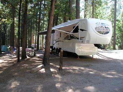
Overview Hodgdon Meadow campground is located in breathtaking Yosemite National Park in Central California's rugged Sierra Nevada Mountain Range. The site is 25 miles from Yosemite Valley at an elevation of 4,875 feet. Within Yosemite, visitors can gaze upon waterfalls, sheer granite cliffs, deep valleys, grand meadows, ancient giant sequoias, vast wilderness areas and much more. Hodgdon Meadow campsites are available to reserve up to five months in advance on the 15th of each month at 7:00 a.m. PST. For example, on January 15, arrival dates for the period May 15 to June 14 become available to reserve, and therefore, the full arrival date window would be from January 15 to June 14. Reservation Tips! Campsites in Yosemite are extremely popular and typically sell out in minutes. Login to your account or create a new account before the 7:00 a.m. (PST) release time. You may only add reservations to your cart and proceed with your reservation if you are logged into your account. The recreation.gov call center does NOT have access to additional sites or additional information beyond what is published on recreation.gov. Yosemite National Park Campground Reservation Dates Recreation Yosemite's trails, cliffs, roads and rivers provide endless recreational activities for any kind of visitor. Hiking, biking, rock climbing, fishing, horseback riding, rafting, auto touring, cross-country skiing and photography are all very popular activities within the park. Hiking the 2.5 to 3-mile roundtrip trails to the Tuolumne and Merced Groves of Giant Sequoias are a popular activity at Hodgdon Meadow. The White Wolf area on Tioga Road also offers many hiking opportunities. Facilities Yosemite's trails, cliffs, roads and rivers provide endless recreational activities for any kind of visitor. Hiking, biking, rock climbing, fishing, horseback riding, rafting, auto touring, cross-country skiing and photography are all very popular activities within the park. Hiking the 2.5 to 3-mile roundtrip trails to the Tuolumne and Merced Groves of Giant Sequoias are a popular activity at Hodgdon Meadow. The White Wolf area on Tioga Road also offers many hiking opportunities. Natural Features The area is forested with mixed stands of Red fir, incense-cedar, Ponderosa pine and Lodgepole pine, offering a pleasant combination of sun and shade. Vibrant wildflowers fill the open meadows each summer. Nearby Attractions Just 45 minutes away is Yosemite Valley, an awe-inspiring landscape containing many of the famous features for which Yosemite National Park is known. Hiking trails and bike paths are abundant in the valley. Rafting the Merced River is a fun way to cool down on a summer day when water levels are sufficient. Yosemite Valley also offers numerous guided bus tours, educational programs, museums, ranger-led activities, and an art center with workshops. The Tioga Road offers a 39-mile scenic drive past forests, meadows, lakes and granite domes. Tuolumne Meadows embodies the high-country of the Sierra Nevada, with its broad sub-alpine meadows and granite domes and peaks. Other sites of interest include the beautiful Hetch Hetchy Reservoir. It's home to spectacular scenery and numerous wilderness trailheads. Glacier Point has sweeping views of Yosemite Valley, Little Yosemite Valley, Half Dome, Vernal and Nevada Falls and Clouds Rest, among other notable landmarks. Wawona and the Pioneer Yosemite History Center is like stepping back in time. Charges & Cancellations Cancellation of individual site reservations will be charged a $10 service fee. If the cancellation is within 48 hours of the arrival date, the first night's fee will also be charged. Cancellation of a group site reservation will incur a $10.00 service fee plus the first night’s use fee when the reservation is cancelled within 14 days of the scheduled arrival date. Cancellations for a single night’s use will not be assessed a service fee. No-shows for any type of reservation will be charged a $20 service fee and the first night's fee.
View details →
Overview Crane Flat is reopening after a four year hiatus due to the pandemic and a complete overhaul and rehabilitation of the campsites. Please be mindful of young plants and shrubs by keeping all wheels on parking pads and camping equipment within established campsites. Thank you and welcome back! Crane Flat Campground is located in breathtaking Yosemite National Park in Central California's rugged Sierra Nevada Mountain Range. The site is conveniently located 17 miles from Yosemite Valley at an elevation of 6,200 feet. Within Yosemite, visitors can gaze upon waterfalls, sheer granite cliffs, deep valleys, grand meadows, ancient giant sequoias, vast wilderness areas and so much more. Reservation Tips! Campsites in Yosemite are extremely popular and typically sell out in minutes. Login to your account or create a new account before the 7:00 a.m. (PST) release time. You may only add reservations to your cart and proceed with your reservation if you are logged into your account. The recreation.gov call center does NOT have access to additional sites or additional information beyond what is published on recreation.gov. Yosemite National Park Campground Reservation Dates Recreation Yosemite's trails, cliffs, roads and rivers provide endless recreational activities for any kind of visitor. Hiking, biking, rock climbing, fishing, horseback riding, rafting, auto touring, and photography are all very popular activities within the park. Crane Flat is located between the Tuolumne and Merced Groves of Giant Sequoias, both of which require a 2.5 to 3-mile roundtrip hike to view. The White Wolf area on Tioga Road also offers many hiking opportunities. Facilities Yosemite's trails, cliffs, roads and rivers provide endless recreational activities for any kind of visitor. Hiking, biking, rock climbing, fishing, horseback riding, rafting, auto touring, and photography are all very popular activities within the park. Crane Flat is located between the Tuolumne and Merced Groves of Giant Sequoias, both of which require a 2.5 to 3-mile roundtrip hike to view. The White Wolf area on Tioga Road also offers many hiking opportunities. Natural Features The area is forested with stands of Sugar pine, Red fir and Lodgepole pine, offering a pleasant combination of sun and shade. Vanilla-scented Jeffrey pine and picturesque western Juniper dot the landscape. Vibrant summer wildflowers fill the open meadows nearby. Nearby Attractions Just 30 minutes away is Yosemite Valley, an awe-inspiring landscape containing many of the famous features for which Yosemite National Park is known. Hiking trails and bike paths are abundant in the valley. Rafting the Merced River is a fun way to cool down on a summer day when water levels are sufficient. Yosemite Valley also offers numerous guided bus tours, educational programs, museums, ranger-led activities, and an art center with workshops. The Tioga Road offers a 39-mile scenic drive past forests, meadows, lakes and granite domes. Tuolumne Meadows embodies the high-country of the Sierra Nevada, with its broad sub-alpine meadows and granite peaks. Beautiful Hetch Hetchy Reservoir, just 23 miles from Crane Flat, is home to spectacular scenery and numerous wilderness trailheads. Glacier Point has sweeping views of Yosemite Valley, Little Yosemite Valley, Half Dome, Vernal and Nevada Falls and Clouds Rest, among other notable landmarks. Wawona and the Pioneer Yosemite History Center is like stepping back in time. Charges & Cancellations Cancellations more than 48 hours in advance of arrival date only incur a $10 transaction fee. Within 48 hours, $10 and the first night's fee are charged. No-shows will be charged a $20 service fee along with the first night's fee.
View details →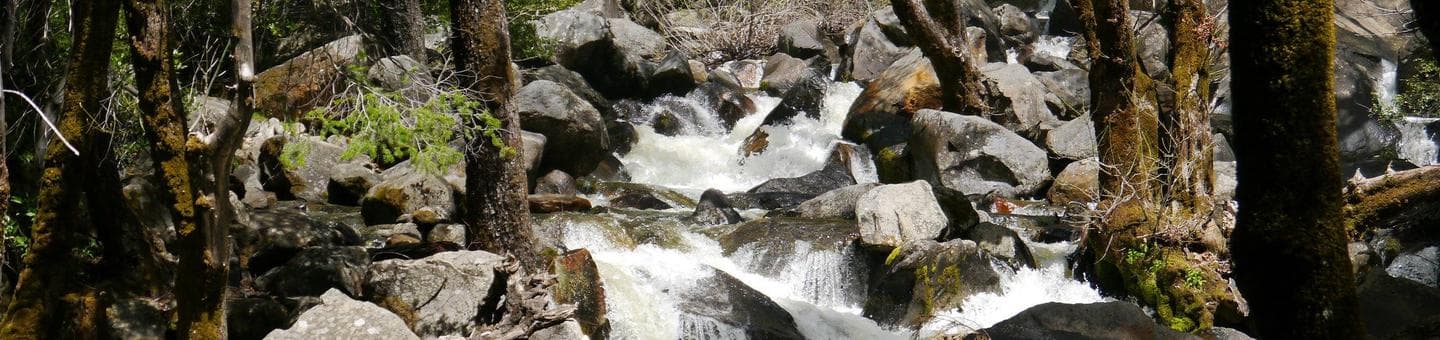
Overview Bridalveil Creek Campground is located in breathtaking Yosemite National Park in Central California's rugged Sierra Nevada Mountain Range. The site is situated on Glacier Point Road at an elevation of 7,200 feet, 26 miles from Yosemite Valley. Within Yosemite, visitors can gaze upon waterfalls, sheer granite cliffs, deep valleys, grand meadows, ancient giant sequoias, vast wilderness areas and much more. Reservation Tips! Campsites in Yosemite are extremely popular and typically sell out in minutes. Login to your account or create a new account before the 7:00 a.m. (PST) release time. You may only add reservations to your cart and proceed with your reservation if you are logged into your account. The recreation.gov call center does NOT have access to additional sites or additional information beyond what is published on recreation.gov. Yosemite National Park Campground Reservation Dates For additional park information, call (209)372-0200 or visit www.nps.gov/yose Recreation Yosemite's trails, cliffs, roads and rivers provide endless recreational activities for any kind of visitor. Hiking, biking, rock climbing, fishing, horseback riding, rafting, auto touring and photography are all very popular activities within the park. Hiking trails near Bridalveil Creek Campground are plentiful, ranging in length from a half-mile to nearly 13 miles. Popular hikes include the 4-Mile Trail, Panorama Trail, Taft Point, Sentinel Dome and Ostrander Lake. Facilities Yosemite's trails, cliffs, roads and rivers provide endless recreational activities for any kind of visitor. Hiking, biking, rock climbing, fishing, horseback riding, rafting, auto touring and photography are all very popular activities within the park. Hiking trails near Bridalveil Creek Campground are plentiful, ranging in length from a half-mile to nearly 13 miles. Popular hikes include the 4-Mile Trail, Panorama Trail, Taft Point, Sentinel Dome and Ostrander Lake. Natural Features The area is forested with pure stands of Red fir and Lodgepole pine, offering a pleasant combination of sun and shade. Vanilla-scented Jeffrey pine and picturesque western Juniper dot the landscape. Through the trees, Yosemite's craggy granite peaks are visible, and the gentle, refreshing Bridalveil Creek flows near the site. Nearby Attractions A scenic, 7-mile drive leads to Glacier Point, with sweeping views of Yosemite Valley, Little Yosemite Valley, Half Dome, Vernal and Nevada Falls and Clouds Rest, among other notable landmarks. Just 45 minutes away is Yosemite Valley, an awe-inspiring landscape containing many of the famous features for which Yosemite National Park is known. Hiking trails and bike paths are abundant in the valley. Rafting the Merced River is a fun way to cool down on a summer day when water levels are sufficient. Yosemite Valley also offers numerous guided bus tours, educational programs, museums, ranger-led activities, and an art center with workshops. The Tioga Road offers a 39-mile scenic drive past forests, meadows, lakes and granite domes. Tuolumne Meadows embodies the high-country of the Sierra Nevada, with its broad sub-alpine meadows and granite domes and peaks. Beautiful Hetch Hetchy Reservoir is home to spectacular scenery and numerous wilderness trailheads. Charges & Cancellations Cancellation of individual or equestrian site reservations will be charged a $10 service fee. If the cancellation is within 48 hours of the arrival date, the first night's fee will also be charged. Cancellations for a single night’s use within 48 hours will not receive a refund, but will not be assessed an additional service fee. Cancellation of a group site reservation will incur a $10.00 service fee plus the first night’s use fee when the reservation is cancelled within 14 days of the scheduled arrival date. No-shows for any type of reservation will be charged a $20 service fee and the first night's fee.
View details →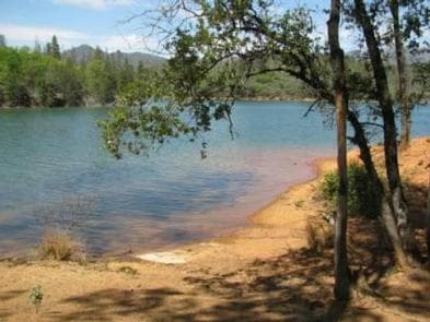
Overview This tent-only group campground is located on the southern shore of Whiskeytown Lake in Whiskeytown National Recreation Area, 14 miles west of Redding, California and three hours north of Sacramento. The cool, clear waters of Whiskeytown Lake provide endless water activities. The picturesque mountain setting and extensive forested backcountry offer ample opportunities for hiking and biking. Recreation During the summer heat, swimming, kayaking, sailing, paddle boarding and water skiing are popular on the 3,200 acre lake. Year round, hiking, mountain biking, horseback riding, gold panning, fishing and picknicking attract visitors. Boats may be launched at nearby Brandy Creek Marina and moored at the campground. Facilities During the summer heat, swimming, kayaking, sailing, paddle boarding and water skiing are popular on the 3,200 acre lake. Year round, hiking, mountain biking, horseback riding, gold panning, fishing and picknicking attract visitors. Boats may be launched at nearby Brandy Creek Marina and moored at the campground. Natural Features Dry Creek Group Campground affords beautiful lake-side views and a canopy of conifer, oak and maple trees, which offer pleasant shade for campers. Whiskeytown Lake is located where the Klamath Mountains, Cascade and Coast Mountain Ranges, and the Sacramento Valley meet, creating a wide variety of wildlife and landscapes. contact_info For facility specific information, please call (530) 246-1225. Nearby Attractions Brandy Creek Beach is located one mile from the campground and features sandy beaches and a large swimming area. From Memorial Day through Labor Day, there are showers, a store with food and supplies and rentals of paddleboards and kayaks. The trailhead for Brandy Creek Falls is located four miles away.
View details →
Overview Dorst Creek Campground is located in the breathtaking Sequoia and Kings Canyon National Parks in central California's rugged Sierra Nevada range. The campground is perched at an elevation of 6,700 ft., on the banks of scenic Dorst Creek. Several meadows surround the campground and a number of small streams flow through the site. A handful of popular day-hikes begin from or near the campground, including the trail to Lost Grove, a 57-acre grove containing 15 beautiful sequoias. Recreation Dorst Creek lies in the Giant Forest region of Sequoia National Park, where forty miles of trails invite visitors to immerse themselves in the majesty of the ancient groves. Several additional popular hiking and wilderness trailheads are close by, including the Big Trees Trail and the trail to Moro Rock, a granite dome with spectacular views of the Great Western Divide and western half of the park. Tokopah Falls Trail is an easy walk along the Marble Fork of the Kaweah River, leading to an impressive 1,200 ft. waterfall. Fly-fishing is a popular activity on Dorst Creek and the Marble Fork of the Kaweah River. Facilities Dorst Creek lies in the Giant Forest region of Sequoia National Park, where forty miles of trails invite visitors to immerse themselves in the majesty of the ancient groves. Several additional popular hiking and wilderness trailheads are close by, including the Big Trees Trail and the trail to Moro Rock, a granite dome with spectacular views of the Great Western Divide and western half of the park. Tokopah Falls Trail is an easy walk along the Marble Fork of the Kaweah River, leading to an impressive 1,200 ft. waterfall. Fly-fishing is a popular activity on Dorst Creek and the Marble Fork of the Kaweah River. Natural Features Lodgepole pine, red fir, and shrubs forest the campground, while towering groves of giant sequoias and craggy granite peaks dot the landscape. This region is characterized by warm days and cool nights in the summer and deep snow and cold days in the winter. contact_info For facility specific information, please call (559) 565-4404. Nearby Attractions The inspiring Giant Forest Grove, General Sherman Tree, General Grant Tree, Moro Rock and Tunnel Log are just 9-17 miles away, as well as the informative Lodgepole Visitor Center and Giant Forest Museum. Colorful Crescent Meadow offers views of vivid summer wildflowers and access to Tharp's Log, a cabin in a fallen sequoia. Tours into Crystal Cave, one of hundreds of marble caves in the park, give visitors an interesting view of rock formations, fossils, rare minerals and unique wildlife. Tickets are required. Reserve in advance on www.recreation.gov. Tickets may also be purchased same day, if available, at the Lodgepole Visitor Center. Tickets are not sold at the cave entrance. The Crystal Cave is about about a one hour drive (21 miles/34 km) from the campground. Vehicles longer than 22 feet long are prohibited on the narrow winding Crystal Cave Road. Charges & Cancellations Payment in full will be charged to your credit card upon completion of the reservation. A $10.00 service fee will apply if you change or cancel your reservation. Additional fees will apply for late cancellations. For individual campsites: All cancellations made between midnight on the day before arrival and check out time on the day after arrival are considered late cancellations and will incur a $10.00 cancellation fee and will also forfeit the first night’s use fee. Cancellations for a single night’s reservation will forfeit the entire use fee but no cancellation fee will apply. For group campsites: All cancellations made within 14 days of the scheduled arrival date are considered late cancellations and will incur the $10.00 service fee and forfeit the first night's use fee. Cancellations for a single night's use will forfeit the entire use fee but no cancellation fee will apply. If your campsite remains vacant for 24 hours after your arrival date it will be cancelled and made available on rec.gov. You will be charged for the first night's campsite fee and a $10 cancellation fee, all other fees after that will be refunded. Recreation.gov policies apply to all reservations, cancellations, refunds and date changes. Call (559) 565-4404 if you will be arriving 24 hours after your arrival date so your site won't be cancelled.
View details →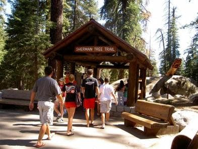
Overview Lodgepole Campground is located in the breathtaking Sequoia and Kings Canyon National Parks in central California's rugged Sierra Nevada range. Lodgepole is perched on the banks of the scenic and lengthy Marble Fork of the Kaweah River, at an elevation of 6,700 ft. The inspiring Giant Forest Grove and the mighty General Sherman Tree - the world's largest tree in volume - are just two miles from the campground. Recreation Forty miles of trails , including the paved Big Trees Trail , invite visitors to immerse themselves in the majesty of the ancient grove. Several additional popular hiking and wilderness trailheads are close by, including the trail to Moro Rock , a granite dome with spectacular views of the Great Western Divide and western half of the park. Tokopah Falls Trail is an easy walk along the Marble Fork of the Kaweah River , leading to an impressive 1200 ft. waterfall. Fly-fishing is also a popular activity on the Marble Fork. Facilities Forty miles of trails , including the paved Big Trees Trail , invite visitors to immerse themselves in the majesty of the ancient grove. Several additional popular hiking and wilderness trailheads are close by, including the trail to Moro Rock , a granite dome with spectacular views of the Great Western Divide and western half of the park. Tokopah Falls Trail is an easy walk along the Marble Fork of the Kaweah River , leading to an impressive 1200 ft. waterfall. Fly-fishing is also a popular activity on the Marble Fork. Natural Features Lodgepole pine, Red fir, and shrubs forest the campground, while towering groves of giant sequoias and craggy granite peaks dot the landscape. The Marble Fork of the Kaweah River is fed by snowmelt and flows seasonally through the site. This region is characterized by warm days and cool nights in the summer and deep snow and cold days in the winter. contact_info For facility specific information, please call (559) 565-4404. Nearby Attractions The General Sherman Tree, General Grant Tree, Moro Rock and Tunnel Log are nearby, as is the informative Giant Forest Museum and the Lodgepole Visitor Center. Colorful Crescent Meadow offers views of vivid summer wildflowers and access to Tharp's Log, a cabin in a fallen sequoia. Crystal Cave is Closed for the 2023 season. Tours into Crystal Cave , one of hundreds of marble caves in the park, give visitors an interesting view of rock formations, fossils, rare minerals, and unique wildlife. Tickets are required, but are not sold at the cave entrance. Reserve in advance on www.recreation.gov. Tickets may also be purchased same day, if available, at the Lodgepole Visitor Center. Crystal Cave is about a 45 minute drive (13 miles/21 km) from the campground. Vehicles longer than 22 feet long are prohibited on the narrow, winding Crystal Cave Road. Charges & Cancellations Payment in full will be charged to your credit card upon completion of the reservation. A $10.00 service fee will apply if you change or cancel your reservation. Additional fees will apply for late cancellations. All cancellations made between midnight on the day before arrival and check out time on the day after arrival are considered late cancellations and will incur a $10.00 cancellation fee and will also forfeit the first night’s use fee. Cancellations for a single night’s reservation will forfeit the entire use fee but no cancellation fee will apply. If your campsite remains vacant for 24 hours after your arrival date it will be cancelled and made available on rec.gov. You will be charged for the first night's campsite fee and a $10 cancellation fee, all other fees after that will be refunded. Recreation.gov policies apply to all reservations, cancellations, refunds and date changes. Call (559) 565-4404 if you will be arriving 24 hours after your arrival date so your site won't be cancelled.
View details →
Overview Download the NPS app prior to visiting the park – trail maps and more! Sheep Pass Group Campground is centrally located within Joshua Tree National Park in Southern California and is easily accessible to hiking trails and rock climbing routes. It is one of three group campgrounds in the park. Towering rock formations and uniquely-shaped Joshua trees surround the facility. To get the most out of your visit Plan Like a Park Ranger Travelers who enjoy warm, dry winters flock to Joshua Tree from October through May, when temperatures hover in the 70 to 90-degree range during the day and drop to a 40 to 60-degree range at night. Summer is the park's off-season due to the uncomfortably-high desert heat. Sheep Pass is at an elevation of 4,500 feet and has a mix of both sun and shade. Recreation Sheep Pass is very close to many hiking trails, popular rock climbing routes and a central location for sightseeing within the park. Facilities Sheep Pass is very close to many hiking trails, popular rock climbing routes and a central location for sightseeing within the park. Natural Features The distinctive shape of Joshua trees and the huge rocks that surround them draw tourists and scientists alike to the national park. Joshua trees are a member of the yucca family that have long evergreen leaves, shaggy bark and bunches of white flowers that bloom in spring. The rocks were formed by volcanic activity millions of years ago and have been exposed and shaped by wind and water over time. They brighten with soft pastel hues in the morning and evening sunlight and glow with campfire light at night. Visitors may want to keep their eyes out for typical desert inhabitants such as lizards, rattlesnakes, scorpions, ravens, squirrels, coyotes and desert tarantulas during the cooler months of the year. Bobcats and mountain lions do live in the park, however they are rarely seen near humans. Charges & Cancellations Reservation Cancellations & Changes Cancelling a Reservation: Customers may cancel their reservation prior to arrival both on-line and through the call center. A $10 service fee will be withheld from any refund for a cancellation. Depending on when you cancel in relation to your arrival day, it may be considered a late cancellation (see below). Changing an Existing Reservation: When changes are made prior to the cut-off window: If a customer wants to switch dates that are entirely outside of the original reservation dates, there is a $10 change fee. There is no change fee if a customer extends or shortens a reservation, as long as the change includes dates from the original reservation. If they choose to depart early, they may forfeit the recreation fee for the day of departure. There is no change fee if the customer wants to switch sites that are the same price with the same reservation dates in the same facility. If a reservation is made that includes dates beyond the maximum booking window, that reservation cannot be changed until 18 days have passed from the original booking date. Late Cancellations or Cancellations within the Cut-off Window Group Facility (including Cabins and Lookouts): Customers who cancel a group overnight facility reservation less than 14 days before the arrival date will pay a $10.00 service fee AND forfeit the first night's use fee. Changes or Cancellations within the Cut-off Window: Once a reservation date has begun, customers cannot change a reservation using the online system or through the Call Center (see below for early departures). If the location is staffed, on-site personnel may or may not be able to assist with changes or cancellations (check with local staff). No-Shows Overnight Facilities: A no-show customer is one who does not arrive at a campground and does not cancel the reservation by check-out (noon) time on the day after the scheduled arrival date. Staff will hold a campsite until check-out time (noon) on the day following the arrival date. No-shows are assessed $20.00 service fee and forfeit the first night’s recreation fee for a campsite. *Note: the entire reservation will be cancelled for no-shows.
View details →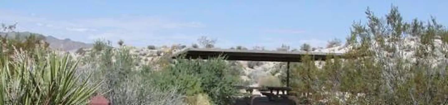
Overview Download the NPS app prior to visiting the park – trail maps and more! Cottonwood Group Campground is one of the best places in Joshua Tree National Park for stargazing and wildflower viewing. The group campground is part of the main Cottonwood Campground and has three sites that are by reservation only. It is one of three group campgrounds in the park and the only campground that lies in the southern section. To get the most out of your visit Plan Like a Park Ranger Travelers who enjoy warm, dry winters flock to Joshua Tree from October through May, when temperatures reach between 70 to 90-degrees during the day and drop to 40 to 60-degrees at night. Summer is the park's off-season due to the uncomfortably high desert heat. Cottonwood Group Campground is at an elevation of 3,000 ft. and has little shade from vegetation; however, there are picnic shelters that provide shade at each site. Recreation Stargazing and wildflower viewing are among the most popular activities at this facility. Several hiking trails leave from the campground and several more trailheads are within a 1-2 hour drive. Facilities Stargazing and wildflower viewing are among the most popular activities at this facility. Several hiking trails leave from the campground and several more trailheads are within a 1-2 hour drive. Natural Features The landscape around Cottonwood is that of the Colorado Desert, which encompasses the southern edge of the park and a large portion of Southern California. Rather than being surrounded by large rock formations and uniquely-shaped Joshua trees, like campgrounds in the northern section, this facility overlooks flat, open-desert shrubland. It is also further from towns or cities that would contribute light pollution. As a result, it offers wide, dark and uninterrupted views of the night sky that draw astronomers and amateur sky watchers alike. Cottonwood is at a lower elevation than other campgrounds within the park, so desert wildflowers begin to bloom earlier in the spring than in other locations. Flowering occurs anytime between the beginning of February to the end of March; timing varies depending on the amount of winter precipitation and the arrival of warm temperatures. Nearby Attractions The General Patton Memorial Museum, a U.S. military history museum, is just over 12 miles away in the town of Chiriaco. Charges & Cancellations Reservation Cancellations & Changes Cancelling a Reservation: Customers may cancel their reservation prior to arrival both on-line and through the call center. A $10 service fee will be withheld from any refund for a cancellation. Depending on when you cancel in relation to your arrival day, it may be considered a late cancellation (see below). Changing an Existing Reservation: When changes are made prior to the cut-off window: If a customer wants to switch dates that are entirely outside of the original reservation dates, there is a $10 change fee. There is no change fee if a customer extends or shortens a reservation, as long as the change includes dates from the original reservation. If they choose to depart early, they may forfeit the recreation fee for the day of departure. There is no change fee if the customer wants to switch sites that are the same price with the same reservation dates in the same facility. If a reservation is made that includes dates beyond the maximum booking window, that reservation cannot be changed until 18 days have passed from the original booking date. Late Cancellations or Cancellations within the Cut-off Window Group Facility : Customers who cancel a group overnight facility reservation less than 14 days before the arrival date will pay a $10.00 service fee AND forfeit the first night's use fee. No-Shows Overnight Facilities: A no-show customer is one who does not arrive at a campground and does not cancel the reservation by check-out (noon) time on the day after the scheduled arrival date. Staff will hold a campsite until check-out time (noon) on the day following the arrival date. No-shows are assessed $20.00 service fee and forfeit the first night’s recreation fee for a campsite. *Note: the entire reservation will be cancelled for no-shows.
View details →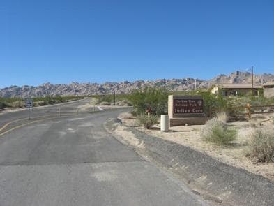
Overview Download the NPS app prior to visiting the park – trail maps and more! Indian Cove Campground lies amid the huge, steep rock formations for which Joshua Tree National Park is known. Because of its proximity to many rock climbing routes, it is a popular camping location for climbers. Indian Cove is one of four campgrounds in the park that requires reservations year-round. To get the most out of your visit Plan Like a Park Ranger Travelers who enjoy warm, dry winters flock to Joshua Tree from October through May, when temperatures hover between 70-90 degrees during the day and drop to a 40-60 degree range at night. Summer is the park's off-season due to the uncomfortably-high desert heat. Indian Cove is at an elevation of 3,200 feet. Recreation Rock climbers flock to Indian Cove Campground for the variety of routes and warmer temperatures that can be found in the interior of the park. Several hiking trails also leave from the campground. There is a short interpretive nature trail and plenty of rocks for the non-climber to explore within the facility. Clear desert skies are perfect for star-gazing and night photography. Facilities Rock climbers flock to Indian Cove Campground for the variety of routes and warmer temperatures that can be found in the interior of the park. Several hiking trails also leave from the campground. There is a short interpretive nature trail and plenty of rocks for the non-climber to explore within the facility. Clear desert skies are perfect for star-gazing and night photography. Natural Features Campsites are nestled on a flat, sandy surface between large boulders that tower in unique shapes over the campground and rise up from the otherwise uniform desert landscape. The rocks were formed by volcanic activity millions of years ago and have been exposed and shaped by wind and water over time. They brighten with soft pastel hues during the morning and evening sunlight and glow with campfire light by night. Visitors may want to keep their eyes out for typical desert inhabitants such as lizards, rattlesnakes, scorpions, ravens, squirrels and desert tarantulas during the cooler months of the year. Bobcats and mountain lions do live in the park, however they are rarely seen near humans. Charges & Cancellations Cancelling a Reservation: Customers may cancel their reservation prior to arrival both on-line and through the call center. A $10 service fee will be withheld from any refund for a cancellation. Depending on when you cancel in relation to your arrival day, it may be considered a late cancellation. Changing an Existing Reservation: When changes are made prior to the cut-off window: If a customer wants to switch dates that are entirely outside of the original reservation dates, there is a $10 change fee. There is no change fee if a customer extends or shortens a reservation, as long as the change includes dates from the original reservation. If they choose to depart early, they may forfeit the recreation fee for the day of departure. There is no change fee if the customer wants to switch sites that are the same price with the same reservation dates in the same facility. If a reservation is made that includes dates beyond the maximum booking window, that reservation cannot be changed until 18 days have passed from the original booking date. Late Cancellations or Cancellations within the Cut-off Window Individual Campsites: A customer who cancels a reservation the day before or on the day of arrival will pay a $10.00 service fee AND forfeit the first night's use fee (not to exceed the total paid for the original reservation). Cancellations for a one-night reservation will forfeit the entire amount paid and will not be subject to an additional service fee. Group Campsites: Customers who cancel a group overnight facility reservation less than 14 days before the arrival date will pay a $10.00 service fee AND forfeit the first night's use fee. No-Shows Overnight Facilities: A no-show customer is one who does not arrive at a campground and does not cancel the reservation by check-out (noon) time on the day after the scheduled arrival date. Staff will hold a campsite until check-out time (noon) on the day following the arrival date. No-shows are assessed $20.00 service fee and forfeit the first night’s recreation fee for a campsite. *Note: the entire reservation will be cancelled for no-shows.
View details →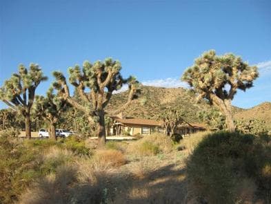
Overview Download the NPS app prior to visiting the park – trail maps and more! Black Rock Campground lies among one of the thickest Joshua tree forests in Joshua Tree National Park. Its location on the park's northern perimeter makes it a popular rest stop for hikers, birders, horseback riders and RV campers. Black Rock is one of four campgrounds in the national park that requires reservations year-round. To get the most out of your visit, Plan Like a Park Ranger Travelers who enjoy warm, dry winters flock to Joshua Tree from October through May, when temperatures hover between 70 to 90 degrees during the day and drop anywhere between 40 to 60 degrees at night. Summer is the park's off-season due to uncomfortably high desert heat. Black Rock is at an elevation of 4,000 feet and has a mix of both sun and shade. Recreation There are many great hiking trails around Black Rock, including some with spectacular views of the low desert and high peaks around Palm Springs. Popular rock climbing sites are within a half-hour drive from the campground. Facilities There are many great hiking trails around Black Rock, including some with spectacular views of the low desert and high peaks around Palm Springs. Popular rock climbing sites are within a half-hour drive from the campground. Natural Features The unique shape of Joshua trees and the huge rocks that surround them draw tourists and scientists alike to the national park. Within the Black Rock facility, the surrounding trees form silhouettes against the landscape during sunrise and sunset and display bunches of blooming white flowers in early spring. Campers staying at Black Rock may have the chance to view the elusive desert tortoise, found only in the southwestern United States and northwestern Mexico. Visitors may also want to keep their eyes out for more typical desert inhabitants such as lizards, rattlesnakes, scorpions, coyotes, ravens and desert tarantulas during the cooler months of the year. Bobcats and mountain lions do live in the park, however they are rarely seen near humans. Birders may also be pleasantly surprised at the variety of species found around the campground. contact_info This location is staffed. Please call (760) 367-3001 to speak with local staff. Charges & Cancellations Reservation Cancellations & Changes Cancelling a Reservation: Customers may cancel their reservation prior to arrival both on-line and through the call center. A $10 service fee will be withheld from any refund for a cancellation. Depending on when you cancel in relation to your arrival day, it may be considered a late cancellation (see below). Changing an Existing Reservation: When changes are made prior to the cut-off window: If a customer wants to switch dates that are entirely outside of the original reservation dates, there is a $10 change fee. There is no change fee if a customer extends or shortens a reservation, as long as the change includes dates from the original reservation. If they choose to depart early, they may forfeit the recreation fee for the day of departure. There is no change fee if the customer wants to switch sites that are the same price with the same reservation dates in the same facility. If a reservation is made that includes dates beyond the maximum booking window, that reservation cannot be changed until 18 days have passed from the original booking date. Late Cancellations or Cancellations within the Cut-off Window Individual Campsites: A customer who cancels a reservation the day before or on the day of arrival will pay a $10.00 service fee AND forfeit the first night's use fee (not to exceed the total paid for the original reservation). Cancellations for a one-night reservation will forfeit the entire amount paid and will not be subject to an additional service fee. Changes or Cancellations within the Cut-off Window: Once a reservation date has begun, customers cannot change a reservation using the online system or through the Call Center (see below for early departures). If the location is staffed, on-site personnel may or may not be able to assist with changes or cancellations (check with local staff). No-Shows Overnight Facilities: A no-show customer is one who does not arrive at a campground and does not cancel the reservation by check-out (noon) time on the day after the scheduled arrival date. Staff will hold a campsite until check-out time (noon) on the day following the arrival date. No-shows are assessed $20.00 service fee and forfeit the first night’s recreation fee for a campsite. *Note: the entire reservation will be cancelled for no-shows.
View details →
Overview Kirby Cove is located just north of the Golden Gate Bridge at historic Battery Kirby. Visitors are awarded breathtaking views of San Francisco, its famous Golden Gate Bridge, and the rugged Pacific Coast of northern California. Please note: The parking area for the campground is a short walk from the campsites, so RV or car camping is not allowed at Kirby Cove Campground. Recreation Hiking, picnicking and taking in the beautiful views from Kirby Cove are among the park's most popular activities. Visitors also enjoy exploring Battery Kirby, a historic army battery in use from 1898-1934. The Point Bonita Lighthouse and Nike Missile Site SF-88 are also close to the campsite. Facilities Hiking, picnicking and taking in the beautiful views from Kirby Cove are among the park's most popular activities. Visitors also enjoy exploring Battery Kirby, a historic army battery in use from 1898-1934. The Point Bonita Lighthouse and Nike Missile Site SF-88 are also close to the campsite. Natural Features Kirby Cove offers a coarse-sand beach with spectacular views - when it's not foggy - of the iconic Golden Gate Bridge and northern San Francisco, including the historic Presidio. The cove is nestled at the foot of the craggy Marin Headlands and has beach access. A steep, mile-long trail to the cove begins at the parking area above Battery Spencer on Conzelman Road. The path descends through a stately grove of Monterey, cypress, pine and Blue Gum eucalyptus. Coastal sage and colorful Lupine dot the hillsides. Temperatures are mild year-round. Expect lows from 50-55 degrees and highs from 60-65. Fog is prevalent in the summer months from May-Sept. It is best to bring clothing that can be layered. Lightweight summer clothes are rarely comfortable to wear at Kirby Cove. contact_info For facility specific information, please call (415) 331-1540. Nearby Attractions The San Francisco Bay Area has no shortage of fun and interesting things to do and see. Awe-inspiring Muir Woods National Monument, with its old-growth coastal redwood forest and numerous hiking trails, is just a 20-minute drive from Kirby Cove. Mount Tamalpais State Park, with hiking and sweeping views of the Bay Area, is another 10 minutes past Muir Woods. Downtown San Francisco offers a myriad of restaurants, shops, museums and tourist attractions. Fisherman's Wharf, Alcatraz Island and Chinatown are popular destinations. Visitors love riding San Francisco's world famous cable cars up and down the city's hilly streets. Charges & Cancellations The Kirby Cove Day Use Site must be cancelled or modified more than 14 days before your check-in date otherwise it will be considered a late cancellation. You may also refer to Recreation.gov's Rules & Reservation Policies . To initiate a refund request more than 7 days after your reservation, call the recreation.gov call center at 877-444-6777.
View details →
Overview Furnace Creek Campground is the only NPS campground in the park that is reservable. All other NPS campgrounds operate on a first-come, first-serve basis. Advance reservations are highly recommended for Furnace Creek Campground during the reservation window (October 15 - April 15). First-come, first-served sites (FF) at Furnace Creek Campground are rare and fill quickly on weekends, around holidays, and in days preceding and just after the reservation season. PLEASE NOTE: The actual availability of any first-come, first served-sites (FF) IS NOT reflected on the Recreation.gov website in real time. When arriving without reservations, we recommend tent campers pack camp chairs and a propane stove for cooking as not all campsites in other park campgrounds offer picnic tables and fire rings. Death Valley has a total of 9 National Park Service campgrounds to choose from in this beautiful land of extremes. Six are open year-round. Three others are closed during summer months. Please visit our official park website to assist with trip planning and to check out all of our camping options: https://www.nps.gov/deva/planyourvisit/camping.htm Recreation There are over 3.4 million acres of Death Valley to explore. The popular main attractions are accessible by paved roads and more remote areas of the park will require high clearance, 4wd. Please visit our website for helpful tips when planning your trip: www.nps.gov/deva Facilities There are over 3.4 million acres of Death Valley to explore. The popular main attractions are accessible by paved roads and more remote areas of the park will require high clearance, 4wd. Please visit our website for helpful tips when planning your trip: www.nps.gov/deva Natural Features Despite its morbid name, a great diversity of life survives in Death Valley! In this below-sea-level basin, steady drought and record summer heat make Death Valley a land of extremes. Yet, each extreme has a striking contrast. Towering peaks are frosted with winter snow. Rare rainstorms bring vast fields of wildflowers. Lush oases harbor tiny fish and refuge for wildlife and humans. Death Valley has sunk below sea level through geologic processes over time. It lies within the Mojave Desert and is the hottest, driest and lowest location in North America. Despite its extreme climate, the park boasts a diversity of ecosystems, including colorful badlands, snow-covered peaks, desolate sand dunes, rugged canyons and flat, dry basins called playas. Furnace Creek Campground is located on the valley floor. The terrain is fairly open with sparse vegetation. Some campsites do have trees that provide shade, but most are unshaded. The facility offers a wide mountan views to the east and west, which glow with hues of orange, red and yellow during sunrise and sunset. contact_info Between 10/15/2020 and 04/15/2021 this location is staffed. Please call (760) 786-2441 to speak with local staff. From 04/16/2021 to 10/14/2021 this location is unstaffed. Please call (760) 786-3200 for general information. Nearby Attractions Explorers of all ages can enjoy educational programs and exhibits at the Visitor Center, just a short walk from the campground. Birders may have luck spotting local and migratory birds around the campground and along Airport Road, especially in the cooler months. Visitors can bike, walk their dog, or run along a one-mile bike path to an interpretive trail from the campground to the Harmony Borax Works, an abandoned borax refinery from the late 1800s. The campground is also within walking distance of the private resort, Furnace Creek Oasis and Ranch. Charges & Cancellations Reservation Cancellations & Changes Cancelling a Reservation: Customers may cancel their reservation prior to arrival both on-line and through the call center. A $10 service fee will be withheld from any refund for a cancellation. Depending on when you cancel in relation to your arrival day, it may be considered a late cancellation (see below). Changing an Existing Reservation: When changes are made prior to the cut-off window: If a customer wants to switch dates that are entirely outside of the original reservation dates, there is a $10 change fee. There is no change fee if a customer extends or shortens a reservation, as long as the change includes dates from the original reservation. If they choose to depart early, they may forfeit the recreation fee for the day of departure. There is no change fee if the customer wants to switch sites that are the same price with the same reservation dates in the same facility. If a reservation is made that includes dates beyond the maximum booking window, that reservation cannot be changed until 18 days have passed from the original booking date. Late Cancellations or Cancellations within the Cut-off Window Individual Campsites: A customer who cancels a reservation the day before or on the day of arrival will pay a $10.00 service fee AND forfeit the first night's use fee (not to exceed the total paid for the original reservation). Cancellations for a one-night reservation will forfeit the entire amount paid and will not be subject to an additional service fee. No-Shows Overnight and Day-Use Facilities: A no-show customer is one who does not arrive at a campground and does not cancel the reservation by check-out time on the day after the scheduled arrival date (or for day-use facilities, by check-in time the day of arrival). Staff will hold a campsite until check-out time on the day following the arrival date. No-shows are assessed $20.00 service fee and forfeit the first night’s recreation fee for a campsite. Early Departures If a customer departs prior to the scheduled check-out date, they may be eligible for a partial refund. Please notify staff at the facility if you depart early to allow others to use the site. Customers may notify the call center to request a refund of remaining unused nights. If a customer requests a refund for an early departure after the facility check-out time has passed, the customer will not be refunded for that night and is eligible for a refund on any additional nights that will not be used.
View details →
Overview Tucked away in a canyon to protect visitors from strong northwest winds, Water Canyon Campground offers exceptional island views, access to spectacular hiking opportunities and a nearby white sand beach. Located 40 nautical miles from the Channel Islands National Park visitor center in Ventura, Santa Rosa is the second largest island in California at approximately 53,000 acres in size. The island landforms support a diverse array of plant and animal species including six plant species found nowhere on earth but Santa Rosa Island. The island also hosts over 100 bird and three land mammal species, including the endemic island fox. Remains of an ancient species like the pygmy mammoth have been uncovered on Santa Rosa Island. These miniature mammoths, reaching just four to six feet tall, roamed the island's grasslands and forests during the Pleistocene Age. The island has rich archeological resources as well. It is home to thousands of significant archeological sites of the Chumash Native Americans, who inhabited the island until 1820. Others have come to the island during more recent centuries to exploit its rich resources, sometimes making it their home. In addition to the native Chumash, European explorers, Aleut sea otter hunters, Chinese abalone fishermen, Spanish missionaries, Mexican and American ranchers, and the US military all have left their mark on the Santa Rosa landscape. Visitors can see relics of these occupations in remnants of fishing camps, water troughs and fence lines, the pier where cattle were loaded and unloaded, buildings and equipment of the historic Vail and Vickers ranch at Bechers Bay, and remains of the military installations. Recreation Several trails and roads traverse the island, providing visitors with spectacular hiking opportunities, including the relatively flat route to Water Canyon Beach to the rugged, mountainous path to Black Mountain. Due to the strong, persistent wind, swimming, snorkeling, diving and kayaking are limited and recommended for the experienced visitor only. Despite the wind, Santa Rosa Island offers exceptional beach walking on white sand beaches. Access to one of the best beaches, Water Canyon Beach, is just over a mile from the pier in Bechers Bay and just down canyon from the campground. Beach access is also available near the pier. No fishing is allowed within the marine reserves located around the island. Fishing is allowed outside of these areas. For more information about recreational activities in the park, visit https://www.nps.gov/chis/planyourvisit/index.htm . Facilities Several trails and roads traverse the island, providing visitors with spectacular hiking opportunities, including the relatively flat route to Water Canyon Beach to the rugged, mountainous path to Black Mountain. Due to the strong, persistent wind, swimming, snorkeling, diving and kayaking are limited and recommended for the experienced visitor only. Despite the wind, Santa Rosa Island offers exceptional beach walking on white sand beaches. Access to one of the best beaches, Water Canyon Beach, is just over a mile from the pier in Bechers Bay and just down canyon from the campground. Beach access is also available near the pier. No fishing is allowed within the marine reserves located around the island. Fishing is allowed outside of these areas. For more information about recreational activities in the park, visit https://www.nps.gov/chis/planyourvisit/index.htm . Natural Features Santa Rosa has a landscape of remarkable contrasts. High mountains with deeply cut canyons give way to gently rolling grass-covered hills, extensive beaches and coastal wetlands. The altitude ranges from sea level to 1,589 feet. Nearby Attractions Good tidepooling spots are located within Bechers Bay, including just east of the pier, the east end of Southeast Anchorage, and near East Point. A short hike from the campground is the Santa Rosa Island Torrey pine grove. This pine is considered one of the rarest pines in the world-the last enduring members of a once widespread Pleistocene forest. Near the pier, visitors can see buildings and equipment of the historic Vail and Vickers ranch. Access to a highly recommended beach, Water Canyon Beach, is just over a mile from the Bechers Bay pier. The sandy beach lies on the northeastern shore of the island. Bechers Bay is a destination in itself, with buildings and equipment at the historic Vail and Vickers ranch.
View details →
Overview Fantastic ocean views and relaxing beach time is practically guaranteed at Scorpion Canyon Campground, the most family-friendly campsite on Santa Cruz Island. Set on the eastern part of the island, the campground is a short hike from the pier and is sheltered from harsh ocean winds. The largest of California's Channel Islands, Santa Cruz Island is one of the five islands that make up the Channel Islands National Park. The island is rich in cultural history, magnificent landscapes, and unique flora and fauna. Native American Indians inhabited the island for over 10,000 years and Europeans explored and ranched on the island for over 150 years. Over 600 plant species, 140 land birds, 11 land mammals and a handful of amphibians and reptiles call the island their home. The island fox and island scrub-jay are exciting finds, as they're unique to the island, found nowhere else in the world. For more information about Santa Cruz Island visit: https://www.nps.gov/chis/planyourvisit/santa-cruz-island.htm . Recreation With its easy beach access and generally good weather, this area offers the most recreational activities in the park, including hiking, swimming, snorkeling, diving, kayaking and wildlife/wildflower viewing. There are no services on the island, so all gear has to be brought to the island. Guided kayak trips and kayak rentals must be arranged before arriving on the island. For more information about recreational activities in the park, visit https://www.nps.gov/chis/planyourvisit/index.htm . Facilities With its easy beach access and generally good weather, this area offers the most recreational activities in the park, including hiking, swimming, snorkeling, diving, kayaking and wildlife/wildflower viewing. There are no services on the island, so all gear has to be brought to the island. Guided kayak trips and kayak rentals must be arranged before arriving on the island. For more information about recreational activities in the park, visit https://www.nps.gov/chis/planyourvisit/index.htm . Natural Features The beach near the campground is a mix of sand and rocks, and faces the Santa Barbara Channel. The campground is located in a valley with a mixture of trees and shrubs. Rugged mountain peaks rise above the campground to 1,808 feet. Nearby Attractions Hiking options are unlimited and offer spectacular coastal views. Try the 2 mile round-trip Cavern Point Loop hike for views of the island's mountain peaks, and the southern California coastline. This popular hike takes you past antique ranching equipment and historic buildings for a taste of island ranch history. For more advanced hikers, tackle the 7.5-mile round-trip hike from the campground to Smugglers Cove.
View details →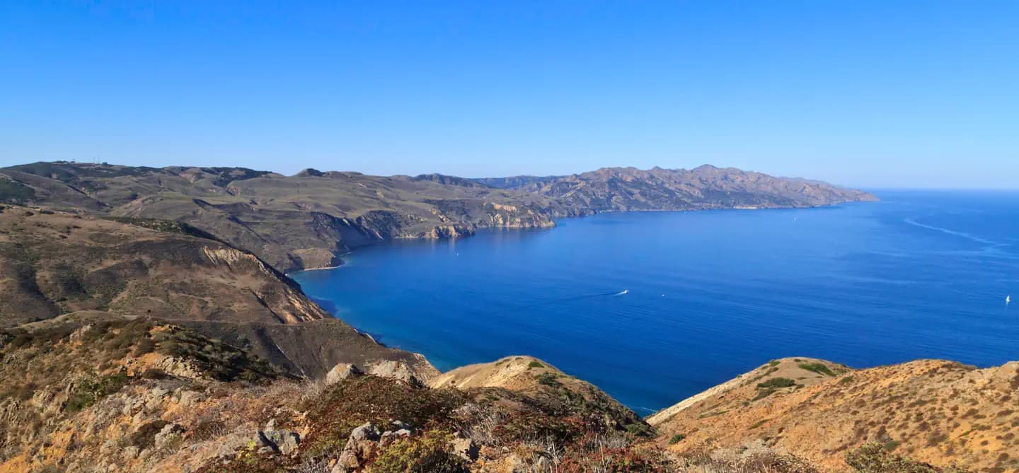
Overview For a truly remote getaway full of backpacking and breathtaking scenery, take a backcountry trip to Santa Cruz Island's Del Norte Campground. Del Norte is currently the only backcountry campground on Santa Cruz Island. The National Park Service opened this backcountry site in recognition of its rare wilderness values. As you explore these wild areas, please take the responsibility to help us protect and preserve these delicate natural resources for future generations. While backcountry camping is an incredible experience, it is not for the inexperienced backpacker. Due to difficult weather, rugged terrain, and off-trail hiking, backcountry camping is an arduous endeavor and should be undertaken only by experienced, well-conditioned backpackers. To reach this backcountry site, visitors will backpack along a historic ranch road/trail through a series of canyons and ridges, to a vista about 700 feet above sea level. This moderate to strenuous 3.5-mile hike from Prisoners Harbor travels through island oak woodlands and coastal sage scrub plant communities. Recreation From Prisoners Harbor, the shortest route to the Del Norte Campground is 3.5 miles via the Del Norte Trail. Follow the Navy Road out of Prisoners Harbor for 1.5 miles (600-foot elevation gain; strenuous). This gravel road is still used daily by vehicles, so please use caution while hiking along it. During winter and spring, visitors need to be prepared for a wet creek crossing at Canada del Puerto in Prisoner's Harbor. At the signed turn-off for Del Norte Trail, leave the gravel road and continue east (left) along the trail for 1.8 miles. The trail winds up and down two canyons (Cañada del Agua and Cañada del Muro)) to the signed junction with the Del Norte Road that leads .2 miles to the campground. The longer route (5 miles), which provides views of the south side of the island, follows the Navy Road as it climbs 1,200 feet over 4 miles and eventually reaches the junction with the Del Norte Road. At the signed junction, turn north (left) and descend 1 mile to the campground. From Scorpion Anchorage, Del Norte Campground is approximately 12 miles via the Navy Road. Beach access is at Prisoners Harbor. There is no access to the beach at Del Norte Campground. Recreational activities on Santa Cruz Island include hiking, swimming, snorkeling, diving, kayaking and wildlife/wildflower viewing. There are no services on the island, so all gear has to be brought to the island. Guided kayak trips and kayak rentals must be arranged before arriving on the island. For more information about recreational activities in the park, visit https://www.nps.gov/chis/planyourvisit/index.htm . Facilities From Prisoners Harbor, the shortest route to the Del Norte Campground is 3.5 miles via the Del Norte Trail. Follow the Navy Road out of Prisoners Harbor for 1.5 miles (600-foot elevation gain; strenuous). This gravel road is still used daily by vehicles, so please use caution while hiking along it. During winter and spring, visitors need to be prepared for a wet creek crossing at Canada del Puerto in Prisoner's Harbor. At the signed turn-off for Del Norte Trail, leave the gravel road and continue east (left) along the trail for 1.8 miles. The trail winds up and down two canyons (Cañada del Agua and Cañada del Muro)) to the signed junction with the Del Norte Road that leads .2 miles to the campground. The longer route (5 miles), which provides views of the south side of the island, follows the Navy Road as it climbs 1,200 feet over 4 miles and eventually reaches the junction with the Del Norte Road. At the signed junction, turn north (left) and descend 1 mile to the campground. From Scorpion Anchorage, Del Norte Campground is approximately 12 miles via the Navy Road. Beach access is at Prisoners Harbor. There is no access to the beach at Del Norte Campground. Recreational activities on Santa Cruz Island include hiking, swimming, snorkeling, diving, kayaking and wildlife/wildflower viewing. There are no services on the island, so all gear has to be brought to the island. Guided kayak trips and kayak rentals must be arranged before arriving on the island. For more information about recreational activities in the park, visit https://www.nps.gov/chis/planyourvisit/index.htm . Natural Features Del Norte is nestled in a shaded oak grove and provides scenic views of the island's pristine coastline. The largest of California's Channel Islands, Santa Cruz Island is one of the five islands that make up the Channel Islands National Park. The island is rich in cultural history, magnificent landscapes, and unique flora and fauna. Native American Indians inhabited the island for over 10,000 years and Europeans explored and ranched on the island for over 150 years. Over 600 plant species, 140 land birds, 11 land mammals and a handful of amphibians and reptiles call the island their home. The island fox and island scrub-jay are exciting finds, as they're unique to the island, found nowhere else in the world.
View details →
Overview Once visitors have scaled the rugged cliffs using the steep trail from the Landing Cove, they will be rewarded with a campground perched on the bluffs with magnificent coastal views. Santa Barbara lies much further south than the other four northern Channel Islands and is the smallest, measuring just one square mile. The islands' native vegetation is recovering slowly with the help of the National Park Service's restoration efforts. This recovery, along with the removal of nonnative predators, has aided in the reestablishment of nesting land birds and seabirds. The island is one of the most important seabird nesting sites within the Channel Islands, with 11 nesting species, including western gulls, California brown pelicans, three species of cormorants, three species of storm-petrels, and one of the world's largest colonies of Scripps's murrelets. The rocky shores of Santa Barbara Island also provide resting and breeding areas for California sea lions, harbor seals and northern elephant seals. Recreation With five miles of hiking trails, ocean access nearby the campground and generally good weather, Santa Barbara Island offers a variety of recreational activities, including hiking, swimming, snorkeling, diving, kayaking and wildlife/wildflower viewing. Since Santa Barbara Island is a cliff island, access to the water is only at the Landing Cove via a dock. There are no other accessible beaches unless you have a watercraft. There are no services on the island, so all gear has to be brought to the island. For more information about recreational activities in the park, visit https://www.nps.gov/chis/planyourvisit/index.htm . Facilities With five miles of hiking trails, ocean access nearby the campground and generally good weather, Santa Barbara Island offers a variety of recreational activities, including hiking, swimming, snorkeling, diving, kayaking and wildlife/wildflower viewing. Since Santa Barbara Island is a cliff island, access to the water is only at the Landing Cove via a dock. There are no other accessible beaches unless you have a watercraft. There are no services on the island, so all gear has to be brought to the island. For more information about recreational activities in the park, visit https://www.nps.gov/chis/planyourvisit/index.htm . Natural Features Steep cliffs on this small island rise above rocky shores and give way to a grassy mesa flanked with twin peaks. The highest point, Signal Peak, is 635 feet in elevation. Nearby Attractions The Landing Cove near the campground is an ideal place for swimming, diving, snorkeling and kayaking, but there are no lifeguards on the island. The island is also home to just over five miles of trails that meander over gentle slopes and low mountain tops to dramatic overlooks and magnificent coastal views. All hikers must stay on the trails for visitor safety and to protect fragile vegetation and nesting seabirds. No off-trail hiking is allowed. Portions of trails are subject to closure when pelicans are nesting from January through August.
View details →
Overview Wind and weather constantly sweep across the North Pacific to batter the shores of this westernmost of all the islands. This extreme weather creates a harsh but profoundly beautiful environment. Although it can be challenging to reach the San Miguel Island Campground, it's always worth the effort. Perched on a plateau, the campground offers incredible island views and access to a variety of recreational activities and unique natural and cultural resources. Although a century's worth of sheep ranching and overgrazing caused scientists in 1875 to describe the island as "a barren lump of sand," with the grazing animals removed, vegetative recovery is in progress. Giant coreopsis, dudleya, locoweed, lupine, buckwheat, coastal sagebrush, and poppies are all recolonizing the island to their former extent, returning San Miguel to its more natural state. Also making a comeback, after years of hunting, are the thousands of pinnipeds (seals and sea lions) that breed, pup, and haul out on the island's 27 miles of isolated coastline. Other wildlife include a variety of landbirds, 13 nesting seabird species, and unique animals like the island fox and deer mouse. Both of these little creatures are endemics -- they are found only on the Channel Islands. In addition to the variety of natural resources, San Miguel hosts an array of cultural resources as well. The Chumash and their ancestors lived on San Miguel almost continuously for nearly 12,000 years. Juan Rodriguez Cabrillo and his men laid eyes on San Miguel Island in 1542 which is commemorated by a monument on the island. Other outstanding island resources that visitors may experience on San Miguel include the caliche forest (sand-castings of ancient vegetation), fossil bones of the Pleistocene pygmy mammoths that stood four to six feet at the shoulders, 150 years of ranching history and numerous shipwrecks. Recreation A permit (including liability waiver) is required to visit the island. If you are traveling to San Miguel Island with Island Packers, Channel Islands Aviation, or Truth Aquatics, they will provide the forms to you upon your reservation. Private boaters can obtain the forms at a self-registration station at the Nidever Canyon trailhead entry on San Miguel Island. Several trails traverse San Miguel Island providing visitors with spectacular hiking opportunities. While many parts of the island are closed to protect wildlife, fragile plants, and geological features, several areas are open for you to explore. Visitors may explore the two-mile-long Cuyler Harbor beach and one-mile-long trail to the ranger station on their own. To see other parts of the island, such as Point Bennett or the caliche forest, you must go with a ranger or volunteer. If arriving with a concessionaire, park staff are usually available to offer guided hikes. However, there is no guarantee that hikes will be offered to all locations. Visitors must coordinate with island staff upon arrival. All hikers must stay on the trails to protect fragile vegetation and for visitor safety. No off-trail hiking is allowed. Due to the strong, persistent wind, swimming, snorkeling, diving and kayaking are limited and recommended for the experienced visitor only. In addition, landing and beach access is only allowed at Cuyler Harbor. No fishing is allowed within the marine reserves located around the island. Fishing is allowed outside of these areas. For more information about recreational activities in the park, visit https://www.nps.gov/chis/planyourvisit/index.htm . Facilities A permit (including liability waiver) is required to visit the island. If you are traveling to San Miguel Island with Island Packers, Channel Islands Aviation, or Truth Aquatics, they will provide the forms to you upon your reservation. Private boaters can obtain the forms at a self-registration station at the Nidever Canyon trailhead entry on San Miguel Island. Several trails traverse San Miguel Island providing visitors with spectacular hiking opportunities. While many parts of the island are closed to protect wildlife, fragile plants, and geological features, several areas are open for you to explore. Visitors may explore the two-mile-long Cuyler Harbor beach and one-mile-long trail to the ranger station on their own. To see other parts of the island, such as Point Bennett or the caliche forest, you must go with a ranger or volunteer. If arriving with a concessionaire, park staff are usually available to offer guided hikes. However, there is no guarantee that hikes will be offered to all locations. Visitors must coordinate with island staff upon arrival. All hikers must stay on the trails to protect fragile vegetation and for visitor safety. No off-trail hiking is allowed. Due to the strong, persistent wind, swimming, snorkeling, diving and kayaking are limited and recommended for the experienced visitor only. In addition, landing and beach access is only allowed at Cuyler Harbor. No fishing is allowed within the marine reserves located around the island. Fishing is allowed outside of these areas. For more information about recreational activities in the park, visit https://www.nps.gov/chis/planyourvisit/index.htm . Natural Features The 9,500-acre island is a plateau at 500 feet in elevation, with two 800-ft. rounded hills and 27 miles of coastline. As the westernmost island in the park, the weather can be windy anytime of the year -- 30 knots of wind is not uncommon. Nearby Attractions Despite the wind, Cuyler Harbor (one-mile from the campground) is one of the most scenic beaches in the park. Beach access is only allowed at Cuyler Harbor. The guided, 16-mile roundtrip hike to Point Bennett requires some stamina, but visitors are rewarded with the chance to see one of the largest congregations of wildlife in the world-over 30,000 animals and up to five different species. All hikers must stay on the trails for visitor safety and to protect fragile vegetation and nesting seabirds. No off-trail hiking is allowed.
View details →
Overview Once visitors have scaled the rugged cliffs using the stairwell from the Landing Cove, they will be rewarded with a campground perched on the bluffs with magnificent coastal views. Anacapa Island, the closest Channel Island to the mainland of California, is comprised of three islets (appropriately named East, Middle, and West Anacapa Islands). Waves have eroded the volcanic island, creating towering sea cliffs, sea caves, and natural bridges, such as forty-foot-high Arch Rock -- a symbol of Anacapa and Channel Islands National Park. Exploring East Anacapa's two-mile trail system allows visitors to experience the island's native vegetation, wildlife, and cultural history. The islands' native vegetation is recovering slowly with the help of the National Park Service's restoration efforts. This recovery, along with the removal of nonnative predators, has aided in the reestablishment of nesting land birds and seabirds. The island is one of the most important seabird nesting sites within the Channel Islands. While the steep cliffs of West Anacapa are home to the largest breeding colony of endangered California brown pelicans, all the islets of Anacapa host the largest breeding colony of western gulls in the world. The rocky shores of Anacapa are perfect resting and breeding areas for California sea lions and harbor seals. Anacapa's rich kelp forests (ideal for kayaking, snorkeling, and diving) and tidepool areas provide visitors with the opportunity to meet some of the resident ocean animals up close. Anacapa Island has a rich human history as well. Shell midden sites indicate where Chumash people camped on the islands thousands of years ago. In addition, visitors can view the 1932 light station. The original lead-crystal Fresnel lens, which served as a beacon to ships until an automated light replaced it in 1990, is on exhibit in the East Anacapa Visitor Center. Recreation With two miles of hiking trails, ocean access nearby the campground, and generally good weather, Anacapa Island offers a variety of recreational activities, including hiking, swimming, snorkeling, diving, kayaking and wildlife/wildflower viewing. In summer, rangers lead an underwater video program. The program includes live video footage of sea life which is projected for visitors to see. It's a great way to stay dry while viewing colorful sea creatures. Since Anacapa Island is a cliff island, access to the water is only at the Landing Cove via a dock. There are no other accessible beaches unless you have a watercraft. There are no services on the island, so all gear has to be brought to the island. For more information about recreational activities in the park, visit https://www.nps.gov/chis/planyourvisit/index.htm. Facilities With two miles of hiking trails, ocean access nearby the campground, and generally good weather, Anacapa Island offers a variety of recreational activities, including hiking, swimming, snorkeling, diving, kayaking and wildlife/wildflower viewing. In summer, rangers lead an underwater video program. The program includes live video footage of sea life which is projected for visitors to see. It's a great way to stay dry while viewing colorful sea creatures. Since Anacapa Island is a cliff island, access to the water is only at the Landing Cove via a dock. There are no other accessible beaches unless you have a watercraft. There are no services on the island, so all gear has to be brought to the island. For more information about recreational activities in the park, visit https://www.nps.gov/chis/planyourvisit/index.htm. Natural Features Waves have eroded the 5-mile volcanic island, creating steep, towering sea cliffs, sea caves and natural bridges. Much of the year, the island vegetation looks brown, but the winter rain brings brightly-colored terrain. The altitude is low and ranges from sea level to 250 feet. Nearby Attractions The Landing Cove near the campground is an ideal place for swimming, diving, snorkeling and kayaking, but there are no lifeguards on the island. The island is also home to just over two miles of trails that meander to dramatic overlooks and magnificent coastal views. All hikers must stay on the trails for visitor safety and to protect fragile vegetation and nesting seabirds. No off- trail hiking is allowed.
View details →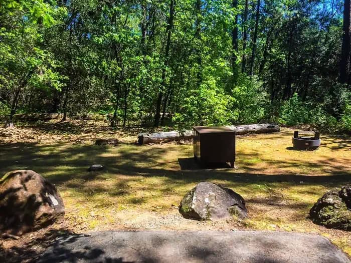
Overview Antlers Campground is situated on a bluff above the Sacramento arm of Shasta Lake. The campground has beautiful views of the lake. There is no access to the water from this campground. The Public Boat Launch is right next to the campground for great outdoor activitites. The grounds are heavily forested with pine trees, oak and Manzanita that provide shade and some privacy. Easy access from I-5 makes Antlers is a very popular campground. Recreation Shasta is perfect for everyone whether you are a boater, angler or camper. There is something for everyone. Enjoy multiple marinas and natural wonders making it the perfect destination for adventure. Different Species of fish in Shasta Lake include rainbow trout, brown trout, largemouth bass, smallmouth bass, spotted bass, Chinook salmon, bluegill, black crappie, Sacramento sucker, white sturgeon, squawfish, white catfish, Threadfin shad, brown bullhead, golden shiner, green sunfish, riffle sculpin. Trout fishing – best during spring fishing on the McCloud Arm north of Hirz Bay, The Sacremento arm, Big Backbone Creek, and Little Squaw Creek, during summer trout move to deeper lake levels – successful baits are live minnows, and marshmallow /egg combinations. Successful lures used for trolling are Kastmasters, Rebels, Thinfins, Z-rays, Z-r or X-5 Flatfish, and Rapalas. Bass Fishing – Good year round but best during spring and early summer, fishing in shallower waters is best. Successful baits are mostly live baits, rubber worms, and spinner baits. Facilities Shasta is perfect for everyone whether you are a boater, angler or camper. There is something for everyone. Enjoy multiple marinas and natural wonders making it the perfect destination for adventure. Different Species of fish in Shasta Lake include rainbow trout, brown trout, largemouth bass, smallmouth bass, spotted bass, Chinook salmon, bluegill, black crappie, Sacramento sucker, white sturgeon, squawfish, white catfish, Threadfin shad, brown bullhead, golden shiner, green sunfish, riffle sculpin. Trout fishing – best during spring fishing on the McCloud Arm north of Hirz Bay, The Sacremento arm, Big Backbone Creek, and Little Squaw Creek, during summer trout move to deeper lake levels – successful baits are live minnows, and marshmallow /egg combinations. Successful lures used for trolling are Kastmasters, Rebels, Thinfins, Z-rays, Z-r or X-5 Flatfish, and Rapalas. Bass Fishing – Good year round but best during spring and early summer, fishing in shallower waters is best. Successful baits are mostly live baits, rubber worms, and spinner baits. Natural Features The Shasta-Trinity is the largest national forest in California with a diverse landscape, encompassing five wilderness areas, hundreds of mountain lakes and 6,278 miles of streams and rivers. Lake Shasta sits at an elevation of 1,067 feet and has 365 miles of shoreline punctuated by steep mountains blanketed in Manzanita and evergreens. Snow-capped Mount Shasta, the second-tallest mountain in the Cascade Range, looms in the distance. Nearby Attractions Tours are available at the nearby Lake Shasta Caverns. Antlers is located in the town of Lakehead, which offers restaurants and shopping. Charges & Cancellations If the reservation was made through recreation.gov please call 1-877-444-6777 to make a refund request. Refunds must be requested no later than 14 days before your scheduled arrival date for a full refund (excluding recreation.gov fee’s). Refunds for Check or Cash Purchases: Refunds for cash payments will be issued a check refund. A refund will be processed within 30 days of receipt and approval. For cash or check refunds please call us at 530-275-8113. Please Note! Refund requests made during or after departure can only be processed when approved by the facility management staff based upon local policy. Refunds for Emergency Closures: In the event of an emergency closure the Recreation.gov will attempt to notify users and offer alternate dates and sites (as appropriate). If this is not possible, reservations will be canceled and all fees paid will be refunded. Refunds for Naturally Occurring Events: Refunds will not be issued for naturally occurring events like rain, snow, wind, smoke, extreme temperature, low lake level, etc. If you are requesting a refund for a walk-up site, please contact the host on-site or call us 530-275-8113. All refunds must be approved and issued through our office or processed though Recreation.gov.
View details →
Overview Dekkas Rock Campground provides scenic views of the mountainous shoreline from the McCloud Arm of Lake Shasta. This group campground offers sites adjacent to the lake and is open for reservations year-round. Recreation Hikers can access the trailhead for the 1-mile Hirz Bay Trail at the camp. This trail is for hikers only. The Hirz Bay public boat ramp is nearby and offers access for both motorized and non-motorized boats. Lake Shasta offers excellent fishing for trout, catfish, Chinook salmon, crappie, bluegill, white sturgeon, brown bullhead and bass. Water skiing is also a popular pastime. Facilities Hikers can access the trailhead for the 1-mile Hirz Bay Trail at the camp. This trail is for hikers only. The Hirz Bay public boat ramp is nearby and offers access for both motorized and non-motorized boats. Lake Shasta offers excellent fishing for trout, catfish, Chinook salmon, crappie, bluegill, white sturgeon, brown bullhead and bass. Water skiing is also a popular pastime. Natural Features Shasta-Trinity is the largest national forest in California with a diverse landscape encompassing five wilderness areas, hundreds of mountain lakes and 6,278 miles of streams and rivers. Lake Shasta sits at an elevation of 1,067 feet, with 365 miles of shoreline punctuated by steep mountains blanketed in manzanita and evergreens. A snow-capped Mount Shasta, the second-tallest mountain in the Cascade Range, looms in the distance. Nearby Attractions Lake Shasta Caverns are also located on the McCloud Arm of Shasta Lake in an area known as the Grey Rocks. Tours are given daily at this privately owned facility. The nearby Hirz Mountain Lookout offers panoramic views of Mt. Shasta, Mt. Lassen and the surrounding area at an elevation of 3,500 feet.
View details →
Overview Goose Meadow Campground is located along the Truckee River adjacent to Highway 89, about half-way between Tahoe City and Truckee. Visitors enjoy the area for its fishing and hiking opportunities, as well as its proximity to Lake Tahoe and Olympic Valley. This facility is operated and maintained by the Tahoe National Forest. Recreation Fly-fishing for rainbow trout in the Truckee River is a popular activity enjoyed by visitors to the campground. Campers also enjoy swimming and tubing. The surrounding area offers hiking and biking trails, including the Western States Trail, Five Lakes Trail, and Pacific Crest Trail. Facilities Fly-fishing for rainbow trout in the Truckee River is a popular activity enjoyed by visitors to the campground. Campers also enjoy swimming and tubing. The surrounding area offers hiking and biking trails, including the Western States Trail, Five Lakes Trail, and Pacific Crest Trail. Natural Features The campground is situated on the banks of the Truckee River. A scenic forest of lodgepole pine and fir trees covers the area. Nearby Attractions Goose Meadow Campground is centrally located between the Prosser, Boca and Stampede reservoirs to the north, and Lake Tahoe and Olympic Valley to the south. A variety of outdoor recreational activities are available at each location. Truckee, 10 minutes north, offers all the amenities of a year round recreational mountain town including interstate highway connectivity, top notch restaurants, resorts and hotels, grocery stores, gas stations, shopping, and historic sites. Lake Tahoe is located 30 minutes south and offers excellent boating, kayaking, fishing, hiking and scenic driving opportunities, as well as dining, shopping and lodging options. Other recreational opportunities include Donner Camp Interpretive Trail, Overland Emigrant Commemorative Trail, Stampede Reservoir Recreation Area, Prosser Pits OHV area, and numerous hiking, mountain biking, and OHV trails.
View details →
Overview Fir Top Campground is located alongside the scenic Jackson Meadow Reservoir, in the Tahoe National Forest. The location, part of the Woodcamp Recreation Area, makes a great base camp for a wide range of recreational activities available in the surrounding area, including boating, fishing, hiking and hunting. Fir Top Campground is operated and maintained by the Tahoe National Forest Recreation The reservoir offers excellent opportunities for boating, canoeing, water skiing, swimming and fishing. Anglers will find rainbow and brown trout. A boat ramp and designated swim beach are located within the recreation area. A half-mile interpretive nature trail wanders through the adjacent Woodcamp Campground. A portion of the Pacific Crest Trail meanders along the east side of the lake. Hunting and biking are popular activities in the surrounding area. Facilities The reservoir offers excellent opportunities for boating, canoeing, water skiing, swimming and fishing. Anglers will find rainbow and brown trout. A boat ramp and designated swim beach are located within the recreation area. A half-mile interpretive nature trail wanders through the adjacent Woodcamp Campground. A portion of the Pacific Crest Trail meanders along the east side of the lake. Hunting and biking are popular activities in the surrounding area. Natural Features Jackson Meadow Reservoir is situated in a rolling forested valley, where visitors are awarded beautiful views of the Sierra Crest and English Mountain. The campground lies on the western shore in a forest of pine and fir trees. contact_info For facility specific information, please call (530) 994-3401.
View details →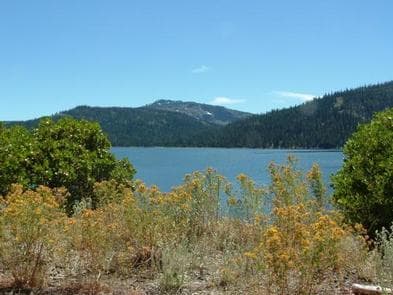
Overview Findley Campground is located alongside the scenic Jackson Meadow Reservoir in the Tahoe National Forest. The location, part of the Woodcamp Recreation Area, makes a great base camp for a wide range of recreational activities found in the surrounding area, including boating, fishing, hiking and hunting. Findley Campground is operated and maintained by the Tahoe National Forest. Recreation The reservoir offers excellent opportunities for boating, canoeing, water skiing, swimming and fishing. Anglers will find rainbow and brown trout. A boat ramp and designated swim beach are located within the Woodcamp Recreation Area. A half-mile interpretive nature trail wanders through adjacent Woodcamp Campground. A portion of the Pacific Crest Trail meanders along the east side of the lake. Hunting and biking are popular activities in the surrounding area. Facilities The reservoir offers excellent opportunities for boating, canoeing, water skiing, swimming and fishing. Anglers will find rainbow and brown trout. A boat ramp and designated swim beach are located within the Woodcamp Recreation Area. A half-mile interpretive nature trail wanders through adjacent Woodcamp Campground. A portion of the Pacific Crest Trail meanders along the east side of the lake. Hunting and biking are popular activities in the surrounding area. Natural Features Jackson Meadow Reservoir is situated in a rolling forested valley, where visitors are awarded beautiful views of the Sierra Crest and English Mountain. The campground lies on the western shore of the lake, in a forest of pine and fir trees. contact_info For facility specific information, please call (530) 994-3401.
View details →
Overview Lakeshore East sits along the shore of the Sacramento Arm of Shasta Lake. The facility is partially shaded by oak and pine and provides some privacy between sites with an undergrowth of grass and raspberry bushes. Lakeshore East is easily accessible from I-5 and offers direct access to the lake from a number of sites. Walk-ins are accepted year-round. Recreation Both the Antlers and Sugar Loaf public boat ramps are nearby. Antlers is approximately 2 miles from the campground. Power and non-motorized boating, fishing and waterskiing are all popular pastimes. Visitors may be able to informally moor their boats at the campground. Anglers can fish for trout, catfish, Chinook salmon, crappie, bluegill, white sturgeon, brown bullhead and bass. Facilities Both the Antlers and Sugar Loaf public boat ramps are nearby. Antlers is approximately 2 miles from the campground. Power and non-motorized boating, fishing and waterskiing are all popular pastimes. Visitors may be able to informally moor their boats at the campground. Anglers can fish for trout, catfish, Chinook salmon, crappie, bluegill, white sturgeon, brown bullhead and bass. Natural Features Shasta-Trinity is the largest national forest in California with a diverse landscape encompassing five wilderness areas, hundreds of mountain lakes and 6,278 miles of streams and rivers. Lake Shasta sits at an elevation of 1,067 feet, with 365 miles of shoreline punctuated by steep mountains blanketed in manzanita and evergreens. A snow-capped Mount Shasta, the second-tallest mountain in the Cascade Range, looms in the distance. Nearby Attractions Lake Shasta Caverns are located on the McCloud Arm of Shasta Lake in an area known as the Grey Rocks. Tours are given daily at this privately owned facility.
View details →
Overview Woodcamp Campground is located on the scenic Jackson Meadow Reservoir, in the Tahoe National Forest. Its location, part of the Woodcamp Recreation Area, provides a great base camp for a wide range of recreational activities, including boating, fishing, hiking. Woodcamp Campground is operated by Nevada Irrigation District in cooperation with the Tahoe National Forest. Recreation Jackson Meadow Reservoir offers excellent opportunities for boating, canoeing, water skiing, swimming and fishing. Anglers will find rainbow and brown trout. A boat ramp and designated swim beach are located within the recreation area. A half-mile interpretive nature trail wanders through the campground. A portion of the Pacific Crest Trail meanders along the east side of the lake. Hunting and biking are popular activities in the surrounding area. Facilities Jackson Meadow Reservoir offers excellent opportunities for boating, canoeing, water skiing, swimming and fishing. Anglers will find rainbow and brown trout. A boat ramp and designated swim beach are located within the recreation area. A half-mile interpretive nature trail wanders through the campground. A portion of the Pacific Crest Trail meanders along the east side of the lake. Hunting and biking are popular activities in the surrounding area. Natural Features Jackson Meadow Reservoir is situated in a rolling forested valley, where visitors are awarded beautiful views of the Sierra Crest and English Mountain. The campground lies on the western shore in a forest of pine and fir trees. Nearby Attractions Grouse Ridge Non-Motorized area, Bowman corridor lakes, camping, and hiking. PCT access on the east side of the lake. contact_info For facility specific information, please call (530) 994-3401.
View details →
Overview Bailey Cove Campground is nestled in a forested area on the McCloud Arm of Shasta Lake. The site is a popular destination due to its convenient access from I-5 and the adjacent public boat ramp. The area surrounding the campground offers an abundance of recreational and sightseeing opportunities. Recreation The campground provides access to the 3-mile Bailey Cove Trail. This trail hugs the shoreline and is open to both hikers and mountain bikers. Lake Shasta attracts anglers due to its wide variety of fish. Boaters can access the lake via the adjacent boat ramp, and boat rentals are available nearby. Facilities The campground provides access to the 3-mile Bailey Cove Trail. This trail hugs the shoreline and is open to both hikers and mountain bikers. Lake Shasta attracts anglers due to its wide variety of fish. Boaters can access the lake via the adjacent boat ramp, and boat rentals are available nearby. Natural Features Shasta-Trinity is the largest national forest in California with a diverse landscape encompassing five wilderness areas, hundreds of mountain lakes and 6,278 miles of streams and rivers. Lake Shasta sits at an elevation of 1,067 feet, with 365 miles of shoreline punctuated by steep mountains blanketed in manzanita and evergreens. A snow-capped Mount Shasta, the second-tallest mountain in the Cascade Range, looms in the distance. This area boasts abundant wildlife. Osprey nests are often seen in the area around Bailey Cove Campground. Nearby Attractions Lake Shasta Caverns are also located on the McCloud Arm of Shasta Lake in an area know as the Grey Rocks. Tours are given daily at this privately owned facility. At an elevation of 3,500 feet, the nearby Hirz Mountain Lookout offers panoramic views of Mt. Shasta, Mt. Lassen and the surrounding area.
View details →
Overview Ellery Creek is located on the McCloud Arm of Shasta Lake. The campground is terraced, providing views of the lake from all of the lower sites and some of the upper sites. At certain water levels, boats can be moored on the shore within sight of the campground, making Ellery Creek a very popular place to camp among boaters. Recreation A public boat ramp is located approximately 4 miles away at Hirz Bay, but informal mooring is allowed at Ellery Creek if the water levels are sufficient. This area is popular for water skiing and jet skiing. Lake Shasta offers excellent fishing for trout, catfish, Chinook salmon, crappie, bluegill, white sturgeon, brown bullhead and bass. Facilities A public boat ramp is located approximately 4 miles away at Hirz Bay, but informal mooring is allowed at Ellery Creek if the water levels are sufficient. This area is popular for water skiing and jet skiing. Lake Shasta offers excellent fishing for trout, catfish, Chinook salmon, crappie, bluegill, white sturgeon, brown bullhead and bass. Natural Features Shasta-Trinity is the largest national forest in California with a diverse landscape encompassing five wilderness areas, hundreds of mountain lakes and 6,278 miles of streams and rivers. Lake Shasta sits at an elevation of 1,067 feet, with 365 miles of shoreline punctuated by steep mountains blanketed in manzanita and evergreens. A snow-capped Mount Shasta, the second-tallest mountain in the Cascade Range, looms in the distance. Lakeside sites at Ellery Creek offer excellent views and access to the water. Wildlife is abundant in the area. Nearby Attractions The Lake Shasta Caverns are also located on the McCloud Arm of Shasta Lake in an area know as the Grey Rocks. Tours are given daily at this privately owned facility. The nearby Hirz Mountain Lookout offers panoramic views of Mt. Shasta, Mt. Lassen and the surrounding area at an elevation of 3,500 feet. The nearest store is 21 miles away in Lakehead.
View details →FAQ
Camping in California
How many campgrounds are listed in California?
TheCampVerse currently lists 200 campgrounds in California.
What campground types are most common in California?
The most common campground types are Campground.
How can I compare campgrounds in California?
Use the campground cards and featured links on this page to compare descriptions, amenities, and details before opening each campground profile.
Keep exploring