Directory
All Campgrounds
Browse featured campgrounds from across the U.S.
Top states for campground options
Campground landing hubs (A-Z)
Jump to alphabetical landing pages to discover campgrounds faster and improve crawl paths.
Worth exploring
Popular campgrounds
Browse
All campgrounds

The Tail Race Campground features three campsites with fire rings and a vault toilet. This campground is wedged between Fontenelle Reservoir and Seedskadee National Wildlife Refuge, and so makes a fantastic site for birding, fishing, or non-motorized water sports. Historically, this area was a gathering place for trappers during their annual rendezvous, and the modern day explorer can still see the lure of such a rich and welcoming area.
View details →
Overview The Burro Creek Campground (1,960’ elevation) is situated along the 57 mile Burro Creek in a transition zone between the upper reaches of the scenic Sonoran Desert and lower reaches of the scenic Mojave Desert. The campground offers visitors a variety of scenery including saguaro-studded cliffs along steep canyon walls that contrast Burro Creek’s dense vegetation and flowing waters that form deep pools of water just adjacent to the campground. Recreation To enhance the visitor experience, the campground features a Watchable Wildlife Exhibit and an Interpretive Desert Garden as well as access to Burro Creek via hiking trails from the campground. The creek offers opportunities for rockhounding, wading, and wildlife viewing especially for birding with a wide-array of raptors and other species of birds. Sites 7, 8, and 9 are best for bird watching. Facilities To enhance the visitor experience, the campground features a Watchable Wildlife Exhibit and an Interpretive Desert Garden as well as access to Burro Creek via hiking trails from the campground. The creek offers opportunities for rockhounding, wading, and wildlife viewing especially for birding with a wide-array of raptors and other species of birds. Sites 7, 8, and 9 are best for bird watching. Natural Features The campground scenery features an adjacent canyon carved by the flow of Burro Creek with other mountains and mesas visible in the background as well as a diverse Sonoran desert plant community including saguaros, a variety of cholla and barrel cacti, creosote bushes, Palo Verde trees, and catclaw. Nearby, on the banks of Burro Creek, visitors will also see willow and cottonwood trees as well as a wide-variety of riparian shrubs. Wildlife is frequent in the campground and include occasional sightings of desert bighorn sheep on the cliffs above Burro Creek and a variety of birds including cactus wren, Gambel’s quail, Gila woodpecker, great horned owl, great blue heron, Vermilion flycatcher, and cliff swallow to name a few. Javelina, raccoons, coyotes, and foxes have been known to use the area as the creek serves an important role in the harsh desert environment. Nearby Attractions The public lands surrounding the Burro Creek Campground are readily available for visitors interested in sightseeing via use of a four-wheel drive vehicle along county-maintained dirt roads. These roads wind through a variety of interesting geologic scenery combined with unique vegetative communities including Sonoran and Mojave deserts intermingled with areas of interior chaparral and pinyon-juniper woodlands. County roads are maintained regularly, but it is always a good idea to check with the local BLM office prior to planning your trip as well as exercising caution when travelling on any of these unimproved dirt roads as visitors travel at their own risk. The area, while desolate during the warm summer months, gives way to cooler temperatures from October through April annually and provides exceptional opportunities for hunting, off-highway vehicle use, wildlife watching, photography, sightseeing, and a variety of other dispersed recreational opportunities. Depending upon winter and spring precipitation, the area surrounding the Burro Creek Campground provides visitors with excellent spring wildflower displays March through May. Charges & Cancellations Recreation.gov Reservation Cancellations & Changes Cancelling a Reservation: Customers may cancel their reservation prior to arrival both on-line and through the call center. A $10 service fee will be withheld from any refund for a cancellation. Depending on when you cancel in relation to your arrival day, it may be considered a late cancellation (see below). Recreation.gov Late Cancellations or Cancellations within the Cut-off Window Individual Campsites: A customer who cancels a reservation the day before or on the day of arrival will pay a $10.00 service fee AND forfeit the first night's use fee (not to exceed the total paid for the original reservation). Cancellations for a one-night reservation will forfeit the entire amount paid and will not be subject to an additional service fee. Group Facility (including Cabins and Lookouts): Customers who cancel a group overnight facility reservation less than 14 days before the arrival date will pay a $10.00 service fee AND forfeit the first night's use fee. Recreation.gov No-Shows -Overnight and Day-Use Facilities: A no-show customer is one who does not arrive at a campground and does not cancel the reservation by check-out time on the day after the scheduled arrival date (or for day-use facilities, by check-in time the day of arrival). Staff will hold a campsite until check-out time on the day following the arrival date and will hold group day-use facilities until check-in time on the arrival date. -No-shows are assessed $20.00 service fee and forfeit the first night’s recreation fee.
View details →
Located south of Prineville, Oregon, this six-site campground offers year-round camping and Crooked River access along the Lower Crooked Back Country Byway. Castle Rock looms above its namesake campground on the Chimney Rock section of the Crooked WIld and Scenic River. An ADA-accessible vault toilet is onsite. Know Before You Go: Open year-round on a first-come, first-served basis; no potable water available. Cell phone service is not available in the campground. Watch for bicyclists: the section of State Highway 27 between Prineville and Bowman dam is a state scenic bikeway Point of Interest: Castle Rock Campground is the first in a series of twelve Bureau of Land Management recreation sites along the Crooked Wild and Scenic River, south of Prineville, Oregon. Eight additional campgrounds, two day-use areas and a trailhead offer ample access to camping, fishing, hiking and photography.
View details →
Overview Located less than 1 mile north of Hot Springs, South Dakota sits one of the area's most perferred campgrounds. At the south end of Cold Brook Campground sits Cold Brook Lake, a popular destination for those looking to take a swim at the beach, snorkel in the crystal clear water or wet a line while trying to catch a variety of fish species. At the north end of the campground sits a wildlife area with a two-track trail that is good for a morning stroll or a short bike ride with the possibility of seeing wildlife. Recreation Cold Brook Lake is about 33 acres in size and it provides a quiet opportunity to wet a line and possibly catch a large mouth bass, northern pike, catfish, carp, rainbow trout, or various pan fish. Canoes, kayaks, paddleboards, or any other small non-gas motorized boat can commonly be seen on the lake. As the summer heats up, the beach tends to be a popular hangout for both locals and tourists. The non-motorized two-track path in the wildlife area is a great spot for a short hike or letting pets enjoy being off a leash. Other popular outdoor recreational opportunities include picnicking, playing at the playground, wildlife viewing, photography, and archery hunting. Archery hunting is permitted in designated areas only and both hunting and fishing regulations are established and enforced by the State of South Dakota. Facilities Cold Brook Lake is about 33 acres in size and it provides a quiet opportunity to wet a line and possibly catch a large mouth bass, northern pike, catfish, carp, rainbow trout, or various pan fish. Canoes, kayaks, paddleboards, or any other small non-gas motorized boat can commonly be seen on the lake. As the summer heats up, the beach tends to be a popular hangout for both locals and tourists. The non-motorized two-track path in the wildlife area is a great spot for a short hike or letting pets enjoy being off a leash. Other popular outdoor recreational opportunities include picnicking, playing at the playground, wildlife viewing, photography, and archery hunting. Archery hunting is permitted in designated areas only and both hunting and fishing regulations are established and enforced by the State of South Dakota. Natural Features Located in the Southern Black Hills of South Dakota, construction of Cold Brook Dam began in 1949 and was completed in 1953, under the Flood Control Act of 1941. Although the dam was originally built for flood control, it has created a park with approximately 450 acres of public lands and water that provides a variety of benefits to both the public and wildlife. Once here you will see how the rugged hills, crystal clear water and evergreen trees create a picturesque site. contact_info For local information, please call (605) 745-5476 or call (605) 450-8000 for general information. Nearby Attractions Popular nearby attractions include: Black Hills National Forest Wind Cave National Park The Mammoth Site Evans Plunge Jewel Cave National Monument Charges & Cancellations Reservation changes and cancellations can be made on Recreation.gov or by calling 1-877-444-6777. For more information on rules and policies regarding reservation cancellations and changes, please visit: https://www.recreation.gov/rules-reservation-policies .
View details →
Overview Located just 5 miles west of Hot Springs, SD is a hidden gem of a campground. Cottonwood Springs Campground is a quiet, peaceful campground tucked away in the southern part of the Black Hills of South Dakota. It offers beautiful scenic views within a short walk of each campsite. Recreation While Cottonwood Springs Lake is a small lake, it provides a quiet opportunity to wet a line and possibly catch a large mouth bass, rainbow trout, or various pan fish. Canoes, kayaks, paddleboards, or any other small non-gas motorized boat can commonly be seen on the lake. The non-motorized gravel path in the wildlife area is a great spot for a short hike or for letting pets enjoy being off a leash. Other popular outdoor recreational opportunities include picnicking, playing at the playground, wildlife viewing, photography, and archery hunting. Archery hunting is permitted in designated areas only and both hunting and fishing regulations are established and enforced by the State of South Dakota. Facilities While Cottonwood Springs Lake is a small lake, it provides a quiet opportunity to wet a line and possibly catch a large mouth bass, rainbow trout, or various pan fish. Canoes, kayaks, paddleboards, or any other small non-gas motorized boat can commonly be seen on the lake. The non-motorized gravel path in the wildlife area is a great spot for a short hike or for letting pets enjoy being off a leash. Other popular outdoor recreational opportunities include picnicking, playing at the playground, wildlife viewing, photography, and archery hunting. Archery hunting is permitted in designated areas only and both hunting and fishing regulations are established and enforced by the State of South Dakota. Natural Features Located in the Southern Black Hills of South Dakota, construction of Cottonwood Springs Dam began in 1968 and was completed in 1969. Cottonwood Springs Dam began construction in 1968 and was completed in 1969. Although the dam was originally built for flood control, it has created a park with approximately 600 acres of public lands and water that provides a variety of benefits to both the public and wildlife. Once here you will see how the rugged hills and evergreen trees create a picturesque site. contact_info For local information, please call (605) 745-5476 or call (605) 450-8000 for general information. Nearby Attractions Popular nearby attractions include: Wind Cave National Park Black Hills National Forest The Mammoth Site Evans Plunge Buffalo Gap National Grassland Jewel Cave National Monument Badlands National Park Custer State Park Crazy Horse Memorial Mount Rushmore National Memorial Charges & Cancellations Reservation changes and cancellations can be made on Recreation.gov or by calling 1-877-444-6777. For more information on rules and policies regarding reservation cancellations and changes, please visit: https://www.recreation.gov/rules-reservation-policies .
View details →
Overview Steel Creek Campground is situated along the Buffalo River under the towering and picturesque Roark Bluff. One section of the campground offers 26 walk-in tent sites and another section of the campground offers 14 sites for those camping with horses. Half of the sites in the campground are available for reservations. Steel Creek is located about 3 miles (5 km) east of Ponca, just off Highway 74. Recreation Floating conditions in the upper (westernmost) district of Buffalo National River are extremely dependent upon rainfall. On an average year, the upper river is only navigable by boat in the spring and early summer when consistent rainfall feeds into the watershed. Some sections on the upper end of the river are technical and should not be attempted by novices. For current floating conditions, please check with an outfitter (visit our Guided Services web page ), call the Steel Creek Ranger Station at 870-861-2570, or check the USGS Buffalo River Floating Conditions web page. Facilities Floating conditions in the upper (westernmost) district of Buffalo National River are extremely dependent upon rainfall. On an average year, the upper river is only navigable by boat in the spring and early summer when consistent rainfall feeds into the watershed. Some sections on the upper end of the river are technical and should not be attempted by novices. For current floating conditions, please check with an outfitter (visit our Guided Services web page ), call the Steel Creek Ranger Station at 870-861-2570, or check the USGS Buffalo River Floating Conditions web page. Natural Features The Buffalo National River flows free over swift running rapids and quiet pools for its 135-mile (217 km) length. One of the few remaining rivers in the lower 48 states without dams, the Buffalo cuts its way through massive limestone bluffs traveling eastward through the Arkansas Ozarks and into the White River. Nearby Attractions The Buffalo River Trail runs through Steel Creek and offers great day hiking or overnight backcountry opportunities. Boxley Valley is nearby and is home to Lost Valley, an easy to moderate trail that leads hikers past geologic and water formations. Call the Steel Creek Ranger Station at 870-861-2570 or visit the park's Hiking Trails web page for more information.. Charges & Cancellations rules and reservation policies
View details →
Stillwater Campground offers ten large, partially-shaded campsites along a placid stretch of the Lower Crooked Wild and Scenic River. Some pull-through campsites as well as day-use parking are available in the recreation site. Know Before You Go: Open year-round on a first-come, first-served basis; no potable water is available. Cell phone service is not available in the campground. When recreating on public lands, practice Leave-No-Trace Principles. Watch for bicyclists: the section of road between Prineville and Bowman Dam is a state scenic bikeway Point of Interest: The Chimney Rock segment of the Crooked River is characterized by a mostly steady gradient in the wild and scenic segment. Stillwater Campground is situated along one of the quiet locations of flatwater alluding to its name.
View details →
Overview Review campsite details -- RV's larger than 20 feet long maybe be to large for many of the campsites. This Campground is located at the very northern end of Canyon Ferry Reservoir, 30 miles east of Helena, Montana, along Montana Highway 284 and offers year-round access to a wide range of recreational opportunities. The Canyon Ferry area has a rich mining history. In the 1850’s the gold rush hit the Canyon Ferry area attracting miners from all over the United States in the hopes of striking it rich. Recreation Canyon Ferry Reservoir offers a wide range of year-round recreational opportunities. Water related activities include everything from swimming and fishing to sailing and motor-boating. Canoeists and kayakers explore the many quiet backwater bays. Jet skiers, windsurfers and water skiers skim the summer waves, while winter draws ice fishermen, ice boaters and ice skaters. Facilities Canyon Ferry Reservoir offers a wide range of year-round recreational opportunities. Water related activities include everything from swimming and fishing to sailing and motor-boating. Canoeists and kayakers explore the many quiet backwater bays. Jet skiers, windsurfers and water skiers skim the summer waves, while winter draws ice fishermen, ice boaters and ice skaters. Natural Features This Campground sits at the north end of Canyon Ferry Reservoir between the Big Belt and Elkhorn’s mountain ranges. Nearby Attractions Canyon Ferry Reservoir is located halfway between Yellowstone National Park and Glacier National Park along with the capital city of Helena, Montana. For up to date events visit, www.helenamt.com. contact_info For facility specific information, please call (406) 475-3920.
View details →
Overview Jo Bonner Campground is located at the Northeastern end of Canyon Ferry Reservoir; 30 miles east of Helena, Montana and offers year-round access to a wide range of recreational opportunities. Jo Bonner Campground is named for Josephine Agnes Martin Bonner (1907-1965) by Montana's Governor John Bonner (1902-1970). Today, Jo Bonner Campground is a small quaint campground that offers easy access. Recreation Canyon Ferry Reservoir offers a wide range of year-round recreational opportunities. Water related activities include everything from swimming and fishing to sailing and motor-boating. Canoeists and kayakers explore the many quiet backwater bays. Jet skiers, windsurfers and water skiers skim the summer waves, while winter draws ice fishermen, ice boaters and ice skaters. Facilities Canyon Ferry Reservoir offers a wide range of year-round recreational opportunities. Water related activities include everything from swimming and fishing to sailing and motor-boating. Canoeists and kayakers explore the many quiet backwater bays. Jet skiers, windsurfers and water skiers skim the summer waves, while winter draws ice fishermen, ice boaters and ice skaters. Natural Features Jo Bonner Campground is located at northern end of Canyon Ferry Reservoir between the Big Belt and Elkhorns mountain ranges. contact_info For facility specific information, please call (406) 475-3920. Nearby Attractions Jo Bonner Campground on Canyon Ferry Reservoir is located halfway between Yellowstone National Park and Glacier National Park along with the capital city of Helena, Montana. For up to date events visit, www.helenamt.com.
View details →
Overview Station Camp Campground (also known as Station Camp Horse Camp) is located on the Tennessee side of the park. Recreation Numerous trails snake through the recreation area, offering mountain biking, hiking and horseback riding for visitors. The Big South Fork River provides opportunities for all water-sports. Facilities Numerous trails snake through the recreation area, offering mountain biking, hiking and horseback riding for visitors. The Big South Fork River provides opportunities for all water-sports. Natural Features Big South Fork is located in north-central Tennessee and southeastern Kentucky in some of the most rugged terrain of the Cumberland Plateau. The park encompasses approximately 125,000 acres including rocky gorges and forested plateaus. contact_info This location is unstaffed. To speak with our main office for general information, please call: (423) 569-9778. Nearby Attractions Just a few miles down the road is the Station Camp River Access where most horseback riders cross the river to access numerous trails. The river access has a picnic area and vault toilets.
View details →
Overview $10.00 per site per night. No reservations. Open all year. Tuttle Creek Campground offers 83 RV/tent sites, with ten pull-through trailer spaces, maximum recommended RV length is 30 feet. All sites include a fire pit, picnic table and a lantern holder. No hook-up. Potable water is available seasonally. Dump station fee is $10.00, no passes accepted, closed in winter. Closest amenities are 5 miles northeast in Lone Pine. Tuttle Creek Campground SignTuttle Creek Campground siteTuttle Creek Campground equestrian site One group site is available for $30.00 per night. The group camping area is approximately the size of four sites combined, with six picnic tables and four fire pits. Tent camping will accommodate up to 15 people comfortably. RV and trailer space within the group site is limited to approximately four. Adjacent sites may be rented upon arrival. Please call for group site reservations (760) 872-5000. Two horse corrals are available for $10.00 per night, including the associated site. Weed-free hay is required. Reservations accepted. Camping for a period longer than 14 days at any one campground, not to exceed 28 days per calendar year for all Bishop Field Office campgrounds, is prohibited without the written permission from the Field Office Manager. A California Campfire Permit is not required for fires within established fire rings in developed campgrounds. Seasonal fire restrictions may prohibit campfires during periods of high fire danger. Please check the BLM’s website for information on current fire restrictions or call the Bishop Field Office at (760) 872-5000. Off Highway Vehicle Regulations Visitors are responsible for knowing area rules and regulations. The regulations are enforceable under U.S. Code of Federal Regulations and violations are punishable with fines up to $1,000 and/or imprisonment for not longer than 12 months. Within the campgrounds, all motor vehicles must adhere to the 10 mph speed limit. No motor vehicle shall exceed 15 mph within 50 feet of any campground, campsite, or concentration of people or animals. Emergency Information: In case of an emergency, call 9-1-1 Inyo County Sheriff (760) 873-7887 Mono County Sheriff (760) 932-7549 Private Lands Surrounding the BLM lands throughout the Bishop Field Office Resource Management Area is land owned by the Los Angeles Department of Water and Power or private landowners. Please obey signs and stay on trails. Please respect the rights of private landowners and signs posted in these areas.
View details →
Overview Located just minutes from the popular city of Asheville, North Carolina, Lake Powhatan Glamping is the perfect, all inclusive getaway. The campground is convenient to a variety of cultural and natural attractions, including art and music venues, shopping, breweries, restaurants, and scenic drives on the Blue Ridge Parkway. Onsite you'll enjoy numerous hiking and biking trails as well as lakeside recreational opportunities. Learn more to prepare for your trip HERE . The custom designed glamping sites are brand new at Lake Powhatan! Choose one of 12 fully furnished canvas platform tents in the heart of the national forest for your next mountain adventure. Experience nature and outdoor recreation without sacrificing the comforts and luxuries of home. Learn more about glamping near Asheville . Recreation Visitors have a number of different activities to choose from. Kids love the lake's sandy swimming beach and anglers enjoy the calm waters for trout fishing. The French Broad River, popular for fishing, wading and tubing is also nearby. The use of personal watercraft in the lake is STRICTLY PROHIBITED due to potential introduction of foreign material to the Lake Powhatan riprarian ecosystem. The forest is known for its hiking and mountain biking trails (44 miles of them!), several of which are located near the campground. Facilities Visitors have a number of different activities to choose from. Kids love the lake's sandy swimming beach and anglers enjoy the calm waters for trout fishing. The French Broad River, popular for fishing, wading and tubing is also nearby. The use of personal watercraft in the lake is STRICTLY PROHIBITED due to potential introduction of foreign material to the Lake Powhatan riprarian ecosystem. The forest is known for its hiking and mountain biking trails (44 miles of them!), several of which are located near the campground. Natural Features The campground is situated in a heavily wooded area on the banks of Lake Powhatan in the Appalachian Mountains of western North Carolina. The elevation is 2,200 feet. The surrounding land boasts mile-high peaks, cascading waterfalls and slopes thickly forested with hardwoods and conifers. Nearby Attractions Among the more popular nearby destinations are Sliding Rock, Looking Glass Falls, the scenic Blue Ridge Parkway, The NC Arboretum and the Biltmore Estate. contact_info For facility specific information, please call (828) 577-7278.
View details →
Overview Gorge Lake Campground is a small, primitive campground with 8 sites. The campground is set on a steep bank overlooking Gorge Lake. The sites are small and do not accommodate large RVs or trailers. There is an accessible boat ramp at the lower end of the campground. Recreation The campground has an accessible boat launch and small dock. This boat launch is not recommended for large powerboats. Ideal for canoes, kayaks, paddle boards, and small power boats. Practice boating safety while on the water. Fishing is allowed in Gorge Lake with a Washington State Fishing license. The nearest location to purchase a license is in the town of Marblemount, WA. Follow Washington State Fishing Regulations when recreating. Hiking and other recreation opportunities can be found across the park. Black bears are active in this campground and the surrounding trails. Be aware of your surroundings while hiking, picnicking, and camping. Use the provided bear boxes in your campsite to store coolers, cookware, and other odorants when not in use. If you encounter a bear around the campground or on a trail, inform campground staff or go to the North Cascades Visitor Center and fill out a bear report. Facilities The campground has an accessible boat launch and small dock. This boat launch is not recommended for large powerboats. Ideal for canoes, kayaks, paddle boards, and small power boats. Practice boating safety while on the water. Fishing is allowed in Gorge Lake with a Washington State Fishing license. The nearest location to purchase a license is in the town of Marblemount, WA. Follow Washington State Fishing Regulations when recreating. Hiking and other recreation opportunities can be found across the park. Black bears are active in this campground and the surrounding trails. Be aware of your surroundings while hiking, picnicking, and camping. Use the provided bear boxes in your campsite to store coolers, cookware, and other odorants when not in use. If you encounter a bear around the campground or on a trail, inform campground staff or go to the North Cascades Visitor Center and fill out a bear report. Natural Features Gorge Lake Campground is a minimally forested campground with surrounding views of the Gorge Lake. At an elevation of 900’ this campground experiences bouts of powerful winds from the Fraser Valley Outflow. contact_info For facility specific information, please call (360) 854-7200. Nearby Attractions Traveling west on State Route 20: The North Cascades Visitor Center is 7.5 miles (12 km) west on State Route 20 from Gorge Lake Campground, operating seasonally, typically from May to September. Campers can find the passport stamps, exhibits, park film, park store, and much more. Traveling east on State Route 20: Diablo Lake Overlook is 6.5 miles (10 km) east on State Route 20. There is ample day use parking and vault toilets. Ross Lake Overlook is 10 miles (16 km) east on State Route 20, this is a less developed vista point. There are two pull off areas with interpretive way sides and with views of the Ross Dam and the Ross Lake.
View details →
Overview Log Gulch Campground is situated on the picturesque Holter Lake in west central Montana. All sites are reservation only. The site is located approximately 45 miles north of Helena, Montana, and 60 miles south of Great Falls, Montana, along the Missouri River. The area offers stunning views of the Sleeping Giant Wilderness Study Area. Gates of the Mountains Historic Site is in close proximity to the campground, which is accessible via watercraft. The area is overflowing with outdoor adventure opportunities. Whether you're into fishing, hunting, wildlife viewing, hiking, boating, water skiing, or all of the above, all of these activities are in close proximity to Log Gulch Campground. There is surely an activity for everyone! Recreation Log Gulch Campground offers excellent recreational opportunities. Activities in the area include camping, boating (motorized and non-motorized), fishing, water skiing, hiking, scenic/wildlife photography, wildlife viewing, and bird watching. There are trails within the general vicinity, as well as multiple fishing access sites and hunting access points. The recreation opportunities in the area are truly boundless. Facilities Log Gulch Campground offers excellent recreational opportunities. Activities in the area include camping, boating (motorized and non-motorized), fishing, water skiing, hiking, scenic/wildlife photography, wildlife viewing, and bird watching. There are trails within the general vicinity, as well as multiple fishing access sites and hunting access points. The recreation opportunities in the area are truly boundless. Natural Features Every campsite is in close proximity to the lake and mountains. The campground and day-use area have poplar and green ash trees throughout the campground, which provide shade during the height of the summer. The site is situated in a shrub-steppe landscape, mostly comprised of ponderosa pine and bunch grasses. The campground is surrounded by sparsely wooded hills. Nearby Attractions Log Gulch Campground is located in a prime location to get out and recreate outdoors. There is access to public lands, where multiple recreation opportunities and experiences are available. The campground is adjacent to the Missouri River, which was also the historical travel corridor for The Lewis and Clark Trail. Log Gulch Campground is situated between Helena and Great Falls. In Helena, there are great restaurants, museums, the capitol building, old mining settlements, Last Chance Gulch, Reeder's Alley, and a vibrant downtown area. In or near Great Falls, there is the First People's Buffalo Jump and Interpretive Center, Charlie Russell Museum, Lewis and Clark Interpretive Center, Giant Springs Fish Hatchery and State Park, and Tower Rock State Park. The Continental Divide Trail is nearby. Charges & Cancellations Reservation Cancellations & Changes • Cancelling a Reservation: Customers may cancel their reservation prior to arrival both on-line and through the call center. A $10 service fee will be withheld from any refund for a cancellation. Depending on when you cancel in relation to your arrival day, it may be considered a late cancellation (see below). • The $8 reservation fee is non-refundable. • Group Facility (including Cabins and Lookouts): Customers who cancel a group overnight facility reservation less than 14 days before the arrival date will pay a $10.00 service fee AND forfeit the first night's use fee. Late Cancellations or Cancellations within the Cut-off Window • Individual Campsites: A customer who cancels a reservation the day before or on the day of arrival will pay a $10.00 service fee AND forfeit the first night's use fee (not to exceed the total paid for the original reservation). Cancellations for a one-night reservation will forfeit the entire amount paid and will not be subject to an additional service fee. The recreation.gov cancellation policy can be found here: https://www.recreation.gov/rules-reservation-policies
View details →
Jackman Park Campground is located on the flanks of Steens Mountain, within the Steens Mountain Cooperative Management and Protective Area (CMPA). This area encompasses an extraordinary landscape with deep glacier carved-gorges, stunning scenery, wilderness, wild rivers, a rich diversity of plant and animal species, and a way of life for all who live there. At 7,800-foot elevation and set among aspen stands, Jackson Park Campground offers some of the best fall color viewing on Steens Mountain. Know Before You Go: Open Season Jackman Park Campground is open mid-June through October. High clearance vehicles recommended on some portions of the Steens Mountain Loop. 6 Campsites with picnic tables and fire grates; first come, first serve. Universal Access Restroom available. Please pack out your trash. Mountain weather can be unpredictable and change suddenly. Ticks, mosquitos, and rattlesnakes may be present during summer months. The nearest services are in the communities of Fields, Frenchglen, Crane, or Narrows, Oregon. Point of Interest: The Jackman Park Campground is located near the Kiger Gorge Overlook with views of the Gorge’s glacially-carved, U-shaped valley and, if you are lucky, it’s famous herd of wild horses.
View details →
Situated on the banks of the Deschutes Wild and Scenic River, Mecca Flat Campground is located just a mile and a half from Oregon State HIghway 26 near Warm Springs. The site features 13 individual campsites and one group use area. The southern terminus of the 7-mile long Trout Creek Trail can be accessed directly from the campground. Know Before You Go: All campsites, including the group use area are open year-round on a first-come, first-served basis; no potable water is available. The 1.6 mile Mecca Flat Road is narrow with few pullouts; use caution particularly when pulling a trailer. Access the nearby non-motorized Trout Creek Trail which fronts the Deschutes Wild and Scenic River for 7 miles where it terminates at Trout Creek Campground . Cell phone service is not available in the campground. Goathead, also known as puncturevine, is present in the area; protect your pets and bicycle tires Point of Interest: The Deschutes Railroad ran on portions of the nearby Trout Creek trail and Mecca Flat Road for several decades, competing with the Oregon Trunk Railroad before abandonment in the early 20th century. Look for the historic, now-abandoned tunnel near Highway 26 - but stay clear of this degrading and unstable structure.
View details →
Overview Woodcock Creek Lake is operated by the U.S. Army Corps of Engineers. Woodcock Creek Lake provides visitors with the chance to enjoy a number of outdoor recreational opportunities. There is a new, reservable picnic shelter located in the Overlook Recreation Area. The shelter is reservable for a $50 fee but is also available as first-come-first-serve with no fees attached. The US Army Corps of Engineers Recreation Areas and facilities are Day Use Only Recreation Woodcock Creek Lake provides walking/hiking trails, swimming, canoeing, kayaking, walking across the 1 mile long dam, disc golf course, picnic shelter and picnic tables/grills, playground and fishing both in the lake (9hp limit) and in the Ourflow Recreation Area stocked stream. Other recreational activities are managed by our partners. Crawford County Conservation District manages Stainbrook Park below the dam. They have reservable picnic shelters, walking paths, a visitor center with interpretive programs. Woodcock Lake Park, on the South side of the lake is managed by Crawford County Commissioners. Woodcock Lake Park manages a campground with shower/restroom facilities, playground, reservable picnic shelters, swim beach and boat launch (9 hp limit). The park also has walking/hiking paths that connect to the Dams paths. Facilities Woodcock Creek Lake provides walking/hiking trails, swimming, canoeing, kayaking, walking across the 1 mile long dam, disc golf course, picnic shelter and picnic tables/grills, playground and fishing both in the lake (9hp limit) and in the Ourflow Recreation Area stocked stream. Other recreational activities are managed by our partners. Crawford County Conservation District manages Stainbrook Park below the dam. They have reservable picnic shelters, walking paths, a visitor center with interpretive programs. Woodcock Lake Park, on the South side of the lake is managed by Crawford County Commissioners. Woodcock Lake Park manages a campground with shower/restroom facilities, playground, reservable picnic shelters, swim beach and boat launch (9 hp limit). The park also has walking/hiking paths that connect to the Dams paths. Natural Features Woodcock Creek Lake is located in NW Pennsylvania offering rolling hills, beautiful woodlands and a beautiful lake. Nearby Attractions Nearby communities include Sagertown, Meadville, Cambridge Springs, Conneaut Lake, Edinboro and Erie. We are just minutes from I-79 and easy to get to.
View details →
Overview Oak Creek Campground is located high on the Colorado Plateau at an elevation of 8300 feet. Torrey, Utah is just 20 miles northwest. Visitors enjoy exploring miles of local ATV trails. Recreation Lower Bowns Reservoir near by offers fishing and boating opportunities. Facilities The campground has pit toilets and drinking water. Natural Features The campground is situated in a scenic ponderosa pine forest on teh east side of the Boulder Mountain. Nearby Attractions Capital Reef National Park is approximately 30 miles from Oak Creek Campground. This unique park offers excellent hiking trails, historic sites, scenic driving and breathtaking scenery. Sightseeing along Utah Highway 12, a National Scenic Byway, is very popular. Travelers visit from every corner of the world to gaze upon stunning red rock canyons and desert landscapes.
View details →
Overview $10.00 per site per night. No reservations. Open May - October. Horton Creek Campground offers 49 RV/tent sites, with four pull-through trailer spaces, maximum recommended RV length is 30 feet. All sites include a fire pit, picnic table and a lantern holder. No hook-up. Potable water is available. Dump station fee is $10.00, no passes accepted. Closest amenities are 12 miles south in Bishop. Camping for a period longer than 14 days at any one campground, not to exceed 28 days per calendar year for all Bishop Field Office campgrounds, is prohibited without the written permission from the Field Office Manager. A California Campfire Permit is not required for fires within established fire rings in developed campgrounds. Seasonal fire restrictions may prohibit campfires during periods of high fire danger. Please check the BLM's website for information on current fire restrictions or call the Bishop Field Office at (760) 872-5000. DIRECTIONS: Travel 8.5 miles north on U.S. Highway 395 from Bishop to Sawmill Road and turn left, take an immediate right onto South Round Valley Road and travel 3 miles, campground is on the left.
View details →
Overview Crowley Lake Campground offers 47 RV/tent sites, maximum recommended RV length is 30 feet. All sites include a fire pit, picnic table and a lantern holder. No hook-up. Potable water is available. Dump station fee is $10.00, no passes accepted. Closest amenities are 2 miles south in Crowley, or 10 miles north in Mammoth Lakes. Recreation Popular activities include lake and stream fishing, boating, windsurfing, horseback riding, hiking, and wildlife viewing. Facilities Popular activities include lake and stream fishing, boating, windsurfing, horseback riding, hiking, and wildlife viewing. Natural Features This campground offers stunning views of Crowley Lake and the Glass Mountains to the east. To the west is the Sierra Nevada mountains and McGee Mountain and Canyon. Popular activities include lake and stream fishing, boating, windsurfing, horseback riding, hiking, and wildlife viewing. Nearby Attractions Mammoth Lakes is approximately 10 miles away.
View details →
Overview Brushkana Creek Campground is located at MP 104.5 along the Denali Highway. The 22-unit camping area with fire rings and picnic tables also provides three double vaulted accessible toilets, numerous bear-proof trash receptacles and food lockers, parking for vehicles and trailers, potable water, trails, picnic area with shelter, and interpretive panels dispersed throughout the site. This site is mostly utilized during the snow free season, May through September. Winter physically closes the campground road access, and it is only reached by foot, dog sled or snowmachine. Its location along the Denali Highway has made it a destination for travelers along the gravel road connecting Paxson to Cantwell. Brushkana Creek and Tangle Lakes Campgrounds are the only developed, public campground facilities along the 135-mile road. Recreation https://www.blm.gov/programs/recreation/recreation-activities/alaska Facilities https://www.blm.gov/programs/recreation/recreation-activities/alaska Natural Features The Denali Highway offers some of the most spectacular scenery and recreational opportunities in Alaska. For those with a heart for adventure and a little extra time, the highway is an historic and archaeological glimpse of the Last Frontier – wild landscapes in all directions. With planning, an abundance of camping, fishing, wildlife viewing and hiking opportunities can be yours. https://www.blm.gov/documents/alaska/public-room/brochure/denali-highway-points-interest-brochure Nearby Attractions Brushkana Creek Campground is located at MP 104.5 along the Denali Highway. The 22-unit camping area with fire rings and picnic tables also provides three double vaulted accessible toilets, numerous bear-proof trash receptacles and food lockers, parking for vehicles and trailers, potable water, trails, picnic area with shelter, and interpretive panels dispersed throughout the site. This site is mostly utilized during the snow free season, May through September. Winter physically closes the campground road access, and it is only reached by foot, dog sled or snowmachine. Its location along the Denali Highway has made it a destination for travelers along the gravel road connecting Paxson to Cantwell. Brushkana Creek and Tangle Lakes Campgrounds are the only developed, public campground facilities along the 135-mile road. https://www.blm.gov/sites/blm.gov/files/documents/files/Maps_GeoPDF_Alaska_Denali_Highway.pdf
View details →
Overview Wolf Ford Horse Camp is a reservation only campground located in the Pisgah Ranger District of Pisgah National Forest, near the town of Brevard. The campground is designed and intended for equestrian use. This campground provides access to a comprehensive network of multiple use trails, as well as creeks, streams, and waterfalls, which the Pisgah is known for. In addition to its many waterfalls, Pisgah Ranger District is famous for its scenic vistas and the Cradle of Forestry, which is located only a short 4 mile drive from the campground itself. Wolf Ford Horse Camp is located 3.2 miles down Yellow Gap Road, gravel Forest Service Road 1206, therein providing a serene escape from the main visiting traffic on Highway 276. Consequently, this campground provides the perfect launching point to explore many different destinations in the Forest, including the Blue Ridge Parkway, 276 Corridor, and countless other waterfalls accessed off of the district's many gravel Forest Service roads. After you make your reservations online, we highly reccomend a stop to our visitor center located right off Route 276 near the forest entrance for help in creating your itinerary. The visitor center provides a wide variety of resources and local experts happy to answer any of your questions. Recreation Pisgah Ranger District contains over 100 miles of equestrian use trails. Beyond trails, there are also plenty of Forest Service roads that enable miles more of recreational use. Wolf Ford provides the perfect access point for many of these trails and roads, enabling a variety of lengths and difficulty levels. The forest provides a perfect blend of natural and cultural history, best seen through the Forest Heritage National Scenic Byway and a trip to the Cradle of Forestry, the first school of forestry in America. In addition, the nearby Blue Ridge Parkway affords hundreds of miles worth of scenic views, including long mountain vistas, roadside waterfalls, and pastoral farmland. Finally, all National Forests in North Carolina property is considered North Carolina gamelands. See the North Carolina Wildlife Resources Commission for rules and restrictions. Facilities Pisgah Ranger District contains over 100 miles of equestrian use trails. Beyond trails, there are also plenty of Forest Service roads that enable miles more of recreational use. Wolf Ford provides the perfect access point for many of these trails and roads, enabling a variety of lengths and difficulty levels. The forest provides a perfect blend of natural and cultural history, best seen through the Forest Heritage National Scenic Byway and a trip to the Cradle of Forestry, the first school of forestry in America. In addition, the nearby Blue Ridge Parkway affords hundreds of miles worth of scenic views, including long mountain vistas, roadside waterfalls, and pastoral farmland. Finally, all National Forests in North Carolina property is considered North Carolina gamelands. See the North Carolina Wildlife Resources Commission for rules and restrictions. Natural Features This campground is located near the confluence of many creeks, as well as the South Fork of the Mills River. Additionally, the area is home to a wide variety of bird species and animal species ranging from chipmunks to black bears. Finally, the campground affords plenty of shade with large trees including maples, oaks, poplars, birches, and pines, that create a patchwork quilt of beauty in the fall season. Nearby Attractions Wolf Ford Horse Campround is within a short distance of the Cradle of Forestry, Pisgah Inn & Restaurant on the Blue Ridge Parkway, North Carolina Wildlife Education Center and Fish Hatchery, Dupont State Forest, and the town of Brevard just down the mountain from this strategic location. Within Brevard one can enjoy blocks of shops and restaurants on Main Street, or seek out guides for fishing, riding, hiking, or floating expeditions in and around Pisgah National Forest. contact_info This location is unstaffed. To speak with our main office for general information, please call: (828) 577-4910. Charges & Cancellations If Yellow Gap Road (FSR 1206) is administratively closed, all reservations will be refunded.
View details →
Overview Point Cedar Campground sits on the banks of DeGray Lake in the foothills of the Ouachita Mountains. World-class fishing and endless water sports make the campground a popular recreation area. Recreation Boating, water skiing, kayaking and other water sports are the biggest draw to the lake, and a boat ramp is provided. The lake is also stocked with a variety of game fish, including plenty of hybrid striped bass, making it an ideal area for both boat and bank fishing. Facilities Boating, water skiing, kayaking and other water sports are the biggest draw to the lake, and a boat ramp is provided. The lake is also stocked with a variety of game fish, including plenty of hybrid striped bass, making it an ideal area for both boat and bank fishing. Natural Features Degray Lake is one of the region's five Diamond Lakes, known for their crystal clear waters. The lake flows from the Caddo River in Western Arkansas and spans 13,500 surface acres. Nearby Attractions The DeGray Lake Resort State Park offers golf courses, tennis courts, horseback riding trails and more along the 207 miles of lake shoreline. The Ouachita National Forest and Hot Springs National Park are both located nearby.
View details →
Overview Big Bend's vast undeveloped areas provide excellent opportunities for backcountry experiences if you seek solitude, wilderness, and adventure! The backcountry sites listed here are primitive backcountry road campsites and primitive backpacking sites in the Chisos Mountains. All are designated sites located in remote locations. Campers must be self-sufficient. Visit the park's Backcountry Use web page to learn about proper planning and trip preparation for this remote area. Backcountry Regulations are strictly enforced. These are primitive sites and do not offer water, electricity, toilet access, or any amenities. Primitive Chisos campsites are BACKPACK-ONLY campsites with NO vehicle access. Campsites are from 1-6 miles (1.6 to 10 km) from the trailhead. Maximum group size is 15 people . Overnight backpackers may park in the large amphitheater lot adjacent to the Chisos Basin Campground. Most primitive roadside campsites require a high clearance vehicle. The park highly recommends a four wheel drive vehicle. Road conditions can change quickly. High clearance vehicles are defined as an SUV or truck with at least 15 inch (38 cm) tire rims AND at least 8 inches (20 cm) of ground clearance from the lowest point of the frame, body, or suspension. Recreation Splendid Isolation! Big Bend National Park is beloved as one of the few large public land areas in Texas. Major activities include camping, backpacking, hiking, birdwatching, river trips, enjoying the spring bloom, and adventuring along backcountry roads. The spring months of March and April are the busiest, as well as the Thanksgiving and New Year’s holidays, although the park is open and visited year round. Facilities Splendid Isolation! Big Bend National Park is beloved as one of the few large public land areas in Texas. Major activities include camping, backpacking, hiking, birdwatching, river trips, enjoying the spring bloom, and adventuring along backcountry roads. The spring months of March and April are the busiest, as well as the Thanksgiving and New Year’s holidays, although the park is open and visited year round. Natural Features From an elevation of less than 1,800 feet (550 m) along the Rio Grande to nearly 8,000 feet (2438 m) in the Chisos Mountains, Big Bend includes massive canyons, vast desert expanses, forested mountains, and an ever-changing river. Here you can explore one of the last remaining wild corners of the United States Nearby Attractions Charges & Cancellations Changes/Modifications Changes may be made prior to the day the reservation begins. If a customer wants to switch dates that are entirely outside of the original reservation dates, there is a $10 change fee. There is no change fee if a customer extends or shortens a reservation, as long as the change includes dates from the original reservation. If a reservation is made that includes dates beyond the maximum booking window, that reservation cannot be changed until 18 days have passed from the original booking date. Cancellations Customers may cancel their reservation prior to day of arrival both on-line and through the call center. A $10 cancellation fee will be withheld from any refund due back the customer. Depending on when you cancel in relation to your arrival day, it may be considered a late cancellation (see below). Late Cancellations or Cancellations within the Cut-off Window A customer who cancels a reservation the day before or on the day of arrival will have a $10.00 cancellation fee withheld from their refund AND will forfeit the first night's use fee (not to exceed the total paid for the original reservation). Cancellations for a one-night reservation will forfeit the entire amount paid and will not be subject to an additional service fee.
View details →
Overview Valley Oak Campground is part of the park system scattered along the lower Stanislaus River within the foothills of the Sierra Nevada. The environmental campground boasts quiet, peaceful tent sites situated next to the river’s edge. The scenic recreation areas and river access points are popular for activities such as rafting, picnicking, hiking and much more. Stanislaus River Parks is often referred to as the “string of pearls” since they serve as charming, quiet oasis running through a number of small towns and cities. Recreation The campground offers an excellent base camp for exciting recreation opportunities. The park boasts walking and hiking trails, picnic areas and river access points for fishing and boating. Facilities The campground offers an excellent base camp for exciting recreation opportunities. The park boasts walking and hiking trails, picnic areas and river access points for fishing and boating. Natural Features The campground scenery is a pleasant mix of Fremont cottonwoods, Valley Oak and the occasional elderberry bush, offering excellent shade with dispersed rays of sunshine. Nearby, grasses, shrubs and seasonal wildflowers fill the open spaces. Wildlife is also plentiful in the park with mule deer, acorn woodpeckers, scrub jays, foxes and squirrels among lots of other fauna. Nearby Attractions Within a short 15 min drive, campers can explore the historic town of Knights Ferry, rich with history of the gold rush era. Within the historic district, lies Knights Ferry Recreation Area, home to the longest covered bridge west of the Mississippi River and a National Historic Landmark dedicated in 2014. The park boasts walking and hiking trails, picnic areas and river access points. Visitors can learn about the area when they visit the Knights Ferry Visitors Center, which contains a small museum highlighting local, natural, and cultural resources. Visitors have a unique opportunity to make reservations with local rafting companies to journey down the Stanislaus River. During the summer months, rafters can enjoy guided and self-guided floats down the lower Stanislaus River. For thrill seekers, the fall season brings perfect flows for advanced white water in the Goodwin Canyon. Fall also brings thousands of Chinook salmon returning to the Stanislaus River to spawn, completing and beginning their lifecycles. Onlookers, can view the spawning salmon from several river access points along the river. Charges & Cancellations Contact Recreation.gov for changes or cancellations.
View details →
Overview The Moqui Group Campground sits in a beautiful setting surrounded by ponderosa, oak, and aspen at an elevation of 6,915'. The campground consists of 3 individual group sites: Simmons, Spooner, and Ernst. Each site can accomodate up to 50 people offering picnic tables, fire rings, grills, vault tolets, trash collections, and piped drinking water. For groups larger than 50 people, multiple sites can be reserved. The Simmons and Spooner Group sites can each accomodate a maximum of 3 trailers or RV's up to 22'. The Earnst Group site is best suited for tents and smaller equipment. Recreation Many visitors spend time relaxing and exploring the area. The nearby C.C. Cragin Reservoir and Knoll Lake offer opportunities for water based recreation, while the Arizona National Scenic Trail, General Crook National Recreation Trail, and historic Cabin Loop Trail System offer opportunities for hikers, bicyclist, and equestrian users. There are also several Fire Lookout Towers in the area. Facilities Many visitors spend time relaxing and exploring the area. The nearby C.C. Cragin Reservoir and Knoll Lake offer opportunities for water based recreation, while the Arizona National Scenic Trail, General Crook National Recreation Trail, and historic Cabin Loop Trail System offer opportunities for hikers, bicyclist, and equestrian users. There are also several Fire Lookout Towers in the area. Natural Features The campground is in a forested setting. The nearby Mogollon Rim is one of the most striking geologic features in the state. This steep escarpment, measured in thousands of feet, stretches from New Mexico diagonally accross two thirds of Arizona and offers sweeping views of the landscape. Nearby Attractions The community of Happy Jack, Arizona has a gas station, two convenience stores and two restaurants.
View details →
Overview Card Creek Campground is located 5 miles west of Independence Kansas. Recreation There is very good fishing at Card Creek and there is a hiking trail adjacent to the campground. Camping is available year round. It is located near the Kansas Department of Wildlife, Parks and Tourism hunting areas. Facilities There is very good fishing at Card Creek and there is a hiking trail adjacent to the campground. Camping is available year round. It is located near the Kansas Department of Wildlife, Parks and Tourism hunting areas. Natural Features Card Creek Campground is located along Card Creek which flows into Elk City Lake. Nearby Attractions The City of Independence is located 5 miles east of the park. Located near the Elk River Hiking Trail, for more information visit www.kansastrailscouncil.org.
View details →
Overview Worn by time and nature, the Wichita Mountains loom large above the prairie in southwest Oklahoma—a lasting refuge for wildlife. Situated just outside the Lawton/Ft. Sill area, Wichita Mountains Wildlife Refuge preserves approximately 60,000 acres of mixed grass prairie, ancient granite mountains, and fresh water lakes and streams for the benefit of wildlife and the American people. Best known for its roaming herds of bison, longhorn, and Rocky Mountain elk, Wichita Mountains also offers quality opportunities for wildlife dependent recreation including fishing, bird watching, wildlife photography, hiking, camping, and kayaking. Recreation Doris Campground is a recreational hub for visitors to the Wichita Mountains. Situated along the shoreline of Quanah Parker Lake, it’s a stone’s throw away from quality fishing, canoeing, kayaking, and hiking. Campers can toss a line in the water or start up the Little Baldly trail for a picturesque hike. The Visitor Center, additional trails, and notable features like Mt. Scott are just a few miles down the road. Facilities Doris Campground is a recreational hub for visitors to the Wichita Mountains. Situated along the shoreline of Quanah Parker Lake, it’s a stone’s throw away from quality fishing, canoeing, kayaking, and hiking. Campers can toss a line in the water or start up the Little Baldly trail for a picturesque hike. The Visitor Center, additional trails, and notable features like Mt. Scott are just a few miles down the road. Natural Features Explore ancient granite mountains. Find yourself in a cedar forest. Dare to discover wide open spaces and fresh water lakes meant to support wildlife like the American bison and Rocky Mountain elk. Fish. Hike. Photograph. Immerse yourself in the wild. contact_info This location has limited staffing. Please call (580) 429-3222 for general information. Nearby Attractions Wichita Mountains Wildlife Refuge encompasses roughly 60,000 acres. Doris Campground is centrally located allowing visitors opportunities to explore all areas of the refuge with a short drive. Head up Mount Scott or hang out at Prairie Dog Town. Bring your fishing pole, a set of binoculars, or your camera. The possibilities are endless.
View details →
Overview Ivans sits just below the Red Rock Dam and Lake on the south side of the Des Moines River, across the river from Howell Station Campground. Lake Red Rock is Iowa's largest lake, located just 10 minutes from Pella, known for its Dutch heritage and 15 minutes from Knoxville, the Sprint car capital of the world. Visitors enjoy boating, fishing, hiking, biking and viewing wildlife. For more information regarding the Army Corps of Engineers and the Lake Red Rock Project, click here: Lake Red Rock Website Recreation Lake Red Rock offers excellent boating, water skiing, wakeboarding and swimming opportunities. Miles of water trails for kayakers and canoeists are designated along the shoreline. Anglers will find crappie, walleye, largemouth and striped bass, channel and flathead catfish, northern pike and bluegill. Several miles of trails for hiking and biking are in the area. The 15 mile paved Volksweg Trail stretches west from Pella to the Des Moines River and the the Corova Recreation Area. Facilities Lake Red Rock offers excellent boating, water skiing, wakeboarding and swimming opportunities. Miles of water trails for kayakers and canoeists are designated along the shoreline. Anglers will find crappie, walleye, largemouth and striped bass, channel and flathead catfish, northern pike and bluegill. Several miles of trails for hiking and biking are in the area. The 15 mile paved Volksweg Trail stretches west from Pella to the Des Moines River and the the Corova Recreation Area. Natural Features Hardwood forests cover the riverbanks at Ivans, offering shade and scenic views. Wildlife is abundant around the lake. A wide variety of waterfowl, including the American White Pelican, migrates through the area in the spring and fall. Bald eagles can be observed from November through March. White-tailed deer, turkeys and other small animals are commonly viewed around the lake. Nearby Attractions Des Moines, Iowa's capital, is an hour away, with numerous shopping and dining opportunities, museums and the Blank Park Zoo. Charges & Cancellations A $10.00 service fee will apply if you change or cancel your reservation. The $10.00 service fee will be deducted from the refund amount. Cancel or change reservations through recreation.gov or by calling 1-877-444-6777. Late cancellations are subject to additional fees.
View details →
Overview Rattan Landing is small, peaceful campground on the bank of the Kiamichi River. The campground is just north of where the Kiamichi River opens up into the Hugo Lake Resevior located in southeast Oklahoma. Thirteen campsites are nestled into this quiet getaway location; and each site offers a view and a short walk to the river bank. With a boatramp in the park, this is a fishermans' all-in-one place to come relax. Recreation Hugo offers activities for many different types of recreation. There are always fish to be caught in the Kiamichi River and in Hugo Lake. The northern half of Hugo Lake is flooded timber, which offers exceptional fishing opportunities. From early sand bass and slab crappie to late season fall bass, anglers will always find opportunities. The catfishing is excellent during the summer. Hunters are welcome to enjoy over 25,000 acres of land managed by either the Army Corps of Engineers or Oklahoma Department of Wildlife Conservation. Bow hunting is permitted in and around most of the park areas. Kiamichi Park features an archery practice range, and a 3,000-acre Quality Deer Management Area. Recreational boaters enjoy the wide open lower lake,with its open water, beautiful limestone rock walls, and sandy banks. Nature abounds at Hugo Lake. Wildlife around the lake includes waterfowl, bobwhite quail, dove, whitetail deer, mink, fox and beaver. There are miles of road to view from, as well as trails to get off the beaten path. Facilities Hugo offers activities for many different types of recreation. There are always fish to be caught in the Kiamichi River and in Hugo Lake. The northern half of Hugo Lake is flooded timber, which offers exceptional fishing opportunities. From early sand bass and slab crappie to late season fall bass, anglers will always find opportunities. The catfishing is excellent during the summer. Hunters are welcome to enjoy over 25,000 acres of land managed by either the Army Corps of Engineers or Oklahoma Department of Wildlife Conservation. Bow hunting is permitted in and around most of the park areas. Kiamichi Park features an archery practice range, and a 3,000-acre Quality Deer Management Area. Recreational boaters enjoy the wide open lower lake,with its open water, beautiful limestone rock walls, and sandy banks. Nature abounds at Hugo Lake. Wildlife around the lake includes waterfowl, bobwhite quail, dove, whitetail deer, mink, fox and beaver. There are miles of road to view from, as well as trails to get off the beaten path. Natural Features Rattan Landing is around a 40 acre property that offers woodland wilds, clear fields, and river access. The Kiamichi River is known for good fishing and variable scenery. The river flows into Hugo Lake Reservior, and 18 river miles past the dam it meets up with the Red River. The dam, completed in 1974, provides flood control, water supply and fish and wildlife management for nearby communities. It also provides a recreational oasis for outdoor enthusiasts of all types. Nearby Attractions A number of historical attractions are located near Hugo Lake, including Native American cultural centers, Civil War headquarters, historic churches and schools. Visit the lake website for more information. Charges & Cancellations A $10.00 service fee will apply if you change or cancel your reservation. Late cancellations are subject to additional fees. For full details see Recreatoin1Stop Reservation Policy.
View details →
Unlike most of the other campgrounds along the Crooked River, this 14.5-acre campground is set back some from the Lower Crooked Back Country Byway, providing some isolation. Campground facilities include fourteen mostly broad, spacious campsites, vault toilets and an accessible fishing pier. All but one of the campsites are at river level and accessed by a single-lane road. Know Before You Go: Open year-round on a first-come, first-served basis. No reservations are accepted. Potable water is available year-round at the upriver Chimney Rock Campground, 0.8 miles north on State HIghway 27. Cell phone service is not available in the campground. Watch for bicyclists: the section of State Highway 27 between Prineville and Bowman Dam is designated as the Crooked River Canyon Scenic Bikeway. Point of Interest: The site takes its name from nearby rock outcrops composed of basaltic lava which form the steep, formidable cliff faces across the river from the campground.
View details →
Centered around a single, sentinel Ponderosa Pine tree, this small campground features six campsites and a group use area. Across the Crooked River, the photogenic Rocky Canyon and it’s vertical rimrock cliffs offer photographers a variety of ever-changing light and depth perspectives. Know Before You Go: Open year-round on a first-come, first-served basis. No reservations are accepted. Potable water is available year-round at Chimney Rock Campground, 1.7 miles miles west (upriver) on State HIghway 27. Cell phone service is not available in the campground. Watch for bicyclists: the section of State Highway 27 between Prineville and Bowman Dam is designated as the Crooked River Canyon Scenic Bikeway. Point of Interest: Since 2008, reintroduction of Steelhead trout has been underway in the Deschutes River Basin, which includes the wild and scenic Chimney Rock segment of the Crooked River. The success of this reintroduction is in part dependent on stresses placed on this fish. Anglers should keep them in the water and release them immediately; the harvesting of Steelhead in the Crooked River is unlawful.
View details →
This sprawling 4.4-acre campground offers year-round camping and Crooked Wild and Scenic River access along the Lower Crooked Back Country Byway. Campground facilities include fourteen campsites, some with riverside shading beneath large Ponderosa pine trees. Know Before You Go: Open year-round on a first-come, first-served basis. No reservations are accepted. Potable water is available year-round at the nearby Chimney Rock Campground, one mile north on State HIghway 27. Cell phone service is not available in the campground. Watch for bicyclists: the section of State Highway 27 between Prineville and Bowman Dam is designated as the Crooked River Canyon Scenic Bikeway. Point of Interest: Situated on a bench above the Chimney Rock section of the Crooked River, Cobble Rock Campground is a popular basecamp for fly fishing enthusiasts.
View details →
With views of nearby Chimney Rock, this campground offers year-round camping and Crooked River access along the Lower Crooked Back Country Byway. Campground facilities include seven campsites with excellent access to the Crooked Wild and Scenic River. Know Before You Go: Open year-round on a first-come, first-served basis. No reservations are accepted. Potable water is available year-round at the nearby Chimney Rock Campground, 1.3 miles north on State Highway 27. Cell phone service is not available in the campground. Watch for bicyclists: the section of State Highway 27 between Prineville and Bowman Dam is designated as the Crooked River Canyon Scenic Bikeway. Point of Interest: The campground takes its name from nearby rock outcrops composed of basaltic lava. As these formations cooled, a multi-sided joint pattern formed which seemingly resulted in the appearance of a pile of posts stacked vertically. The geologic phenomena is known as columnar basalt.
View details →
Located south of Prineville, Oregon, this campground offers year-round camping and Crooked Wild and Scenic River access along the Lower Crooked Back Country Byway. Cooperatively managed in partnership with the Bureau of Reclamation and Oregon Parks and Recreation Department, this campground's facilities include 13 campsites, one group use area and a day-use area with access to the Crooked Wild and Scenic River. Know Before You Go: Open year-round on a first-come, first-served basis. No reservations are accepted. Potable water is available during the warmer spring and summer months. Cell phone service is not available in the campground. Watch for bicyclists: the section of State Highway 27 between Prineville and Bowman Dam is designated as the Crooked River Canyon Scenic Bikeway. Point of Interest: Looming 240 feet above the campground, the mighty Arthur R. Bowman Dam retains the waters of the 3,030-acre Prineville Reservoir, a popular spot for fishing and other water-based activities. At 1.6 miles away from Big Bend Campground, the boat ramp at Powderhouse Cove provides the nearest reservoir access.
View details →
Overview Ahart Campground is located on the tree covered banks of the North Fork of the American River near French Meadows Reservoir, about 40 miles from the town of Foresthill, high in the Sierra mountains. Visitors enjoy the area for the rugged mountain beauty, fishing, boating and trail opportunities. This facility is operated and maintained by the Tahoe National Forest. Natural Features The campground is near the north shore of French Meadows Reservoir along the banks of the Middle Fork of the American River while nestled in a Coniferous Forest. Summer days can be warm and pleasant with cool evenings.
View details →
Overview Gull Lake Campground is a small, shaded and private facility in the June Lake area of the eastern Sierra Nevada Mountains. Within a few miles, campers can access two lakes with fishing and boating opportunities, scenic views and the small town of June Lake. Recreation A variety of water and land-based activities surround the campground. Nearby June Lake offer great rainbow trout fishing. Campers also enjoy paddling down Mono Creek or hiking the area's various trails, including one to Mammoth Rock and scenic Sherwin Lakes and Gaylor Lake Trails. A drive along the June Lake Loop results in expansive views of rugged mountain peaks and several lakes. Facilities A variety of water and land-based activities surround the campground. Nearby June Lake offer great rainbow trout fishing. Campers also enjoy paddling down Mono Creek or hiking the area's various trails, including one to Mammoth Rock and scenic Sherwin Lakes and Gaylor Lake Trails. A drive along the June Lake Loop results in expansive views of rugged mountain peaks and several lakes. Natural Features The campground sits at an elevation of 7,600 feet in a stand of mature aspen trees. The area is surrounded by 11,000 and 12,000' peaks. Many species of wildlife call the mountains home, such as black bear, mountain lions, mule deer, pine marten, pika and numerous fish and birds. Nearby Attractions Hikers can access the scenic Ansel Adams Wilderness via nearby trails, and Mono Lake and Yosemite National Park are great day trips. Ansel Adams Wilderness Yosemite National Park Charges & Cancellations Once your reservation start date has begun, neither the Recreation.gov Contact Center nor the campground manager will be able to modify your reservation.
View details →
Overview If you are looking for a campground with a family atmosphere or a base camp to explore area trails, try Anvil Lake Campground off State Highway 70, just minutes east of Eagle River, within the Chequamegon-Nicolet National Forest. The campground is in a beautiful setting, among tall maples, pines and hemlocks, perched above Anvil Lake. In addition to its scenic landscape, the campground offers access to a variety of hiking and biking trails. Recreation The lake provides visitors with ample opportunities for boating, fishing, and swimming. Anglers can expect a catch of walleye, northern pike, bass, and pan fish. The lake is open to all types of boating, motorized and non-motorized. Numerous trails exist in the area, with Anvil National Recreation Trail leaving from the campground itself. From the Anvil National Recreation Trail, visitors are able to connect to the Nicolet North Trail, Hidden Lakes Trail, Franklin Lake Interpretive Trail, and the Luna White Deer Trail system. In total, this campground is connected to approximately 40 miles of hiking trail, most of which is open to mountain biking. Although the campground is not open during the winter months, the Anvil National Recreation Trail is groomed as both a classic and skate cross country ski trail. It is well known among the ski community as it was once the site of USA Olympic training. A variety of wildlife make its home in the area and visitors are encouraged to keep watch. So, if you like to swim, boat, fish, hike, picnic or enjoy being close to town, then the Anvil Lake Recreation Area is the place for you, conveniently located just 10 minutes east of Eagle River. Facilities The lake provides visitors with ample opportunities for boating, fishing, and swimming. Anglers can expect a catch of walleye, northern pike, bass, and pan fish. The lake is open to all types of boating, motorized and non-motorized. Numerous trails exist in the area, with Anvil National Recreation Trail leaving from the campground itself. From the Anvil National Recreation Trail, visitors are able to connect to the Nicolet North Trail, Hidden Lakes Trail, Franklin Lake Interpretive Trail, and the Luna White Deer Trail system. In total, this campground is connected to approximately 40 miles of hiking trail, most of which is open to mountain biking. Although the campground is not open during the winter months, the Anvil National Recreation Trail is groomed as both a classic and skate cross country ski trail. It is well known among the ski community as it was once the site of USA Olympic training. A variety of wildlife make its home in the area and visitors are encouraged to keep watch. So, if you like to swim, boat, fish, hike, picnic or enjoy being close to town, then the Anvil Lake Recreation Area is the place for you, conveniently located just 10 minutes east of Eagle River. Natural Features The campground is situated in a stand of large sugar maple, hemlock and white pine trees, at an elevation of 1,740 feet. A historic stone and log picnic shelter, built by the Civilian Conservation Corps, is located at the picnic area. The adjacent 377-acre Anvil Lake is crystal clear and is a popular swimming site as the campground boasts a large sandy beach area. Nearby Attractions The City of Eagle River is located about 9 miles west of the campground. A varitey of services are offered there.
View details →
Overview Bullards Bar Reservoir is located on the North Yuba River at an elevation of 2000 feet. It is located approximately 21 miles north of Nevada City, California. It has a maximum surface area of 4,760 acres and a length of over 16 miles and shoreline of more than 60 miles. Recreation Activities include wildlife viewing, hiking, mountain biking, horseback riding, camping, fishing, boating, water skiing, and other water sports. Swimming opportunities are limited because of the steep slopes; however boaters will find numerous opportunities for swimming in various locations around the reservoir. The reservoir provides yearlong fishing opportunities for both warm and cold water fish species. Supplies are available at the marina as well as the nearby communities of Camptonville, North San Juan, and Dobbins. Facilities Activities include wildlife viewing, hiking, mountain biking, horseback riding, camping, fishing, boating, water skiing, and other water sports. Swimming opportunities are limited because of the steep slopes; however boaters will find numerous opportunities for swimming in various locations around the reservoir. The reservoir provides yearlong fishing opportunities for both warm and cold water fish species. Supplies are available at the marina as well as the nearby communities of Camptonville, North San Juan, and Dobbins. Natural Features The sides of the reservoir are generally steep and public access for boating and recreation is limited. The reservoir is surrounded by both conifer and hardwood forests with numerous brush spieces. There is plenty of shade at the campsites contact_info For facility specific information, please call (530) 265-4531. Nearby Attractions There is a beautiful non- motorized trail system in the area, with 5 different trails to choose from. Bullards Bar Trailhead is 14 miles, 7 Ball Trial is 1 mile, 8 Ball Trail is 3.8 miles, Rebel Ridge Trail is 1.6 miles and Schoolhouse Trail is 0.7 miles. Maps are available at the North Yuba Ranger Station just a couple miles east of the reservoir on Marysville Road. Charges & Cancellations No Show Policy A no-show customer is one who does not arrive at a campground and does not cancel the reservation by check-out time on the day after the scheduled arrival date (or for day-use facilities, by check-in time the day of arrival). * No-show customers are only recorded at staffed facilities. At most remote facilities, all customers are noted as automatically checked-in on the date of arrival. * It is recommended that staffed facilities hold a campsite until check-out time on the day following the arrival date. * It is recommended that staffed facilities hold group day-use facilities until check-in time on the arrival date. There is no change fee if a customer extends or shortens a reservation if the change includes dates from the original reservation. If they choose to depart early, they may forfeit some or all of the recreation fees. There is no change fee if the customer changes campsites that are the same price and on the same reservation dates in the same campground. If the campsite the customer is changing to has a price difference, the customer will be responsible for any additional fees or be provided with a refund, based on the price difference. Where recorded, no-show customers are assessed a $20.00 no-show fee and forfeit the first night's recreation fee for a campsite or forfeit the entire day-use recreation fee for a day-use facility. We recommend customers contact the facility if they are en route to their reservation but cannot make it by the check-in date. In these cases, no refund will be issued, but the facility can ensure that a "no-show" fee is not assessed.
View details →
Overview Bullards Bar Reservoir is located on the North Yuba River at an elevation of 2000 feet. It is located approximately 21 miles north of Nevada City, California. It has a maximum surface area of 4,760 acres and a length of over 16 miles and shoreline of more than 60 miles. Recreation This is a boat-in campground. You can not drive to this campground. You must launch a boat a Dark Day boat launch and boat to the campground. Activities include wildlife viewing, hiking, mountain biking, horseback riding, camping, fishing, boating, water skiing, and other water sports. Swimming opportunities are limited because of the steep slopes; however boaters will find numerous opportunities for swimming in various locations around the reservoir. The reservoir provides yearlong fishing opportunities for both warm and cold water fish species. Supplies are available at the marina as well as the nearby communities of Camptonville, North San Juan, and Dobbins. Facilities This is a boat-in campground. You can not drive to this campground. You must launch a boat a Dark Day boat launch and boat to the campground. Activities include wildlife viewing, hiking, mountain biking, horseback riding, camping, fishing, boating, water skiing, and other water sports. Swimming opportunities are limited because of the steep slopes; however boaters will find numerous opportunities for swimming in various locations around the reservoir. The reservoir provides yearlong fishing opportunities for both warm and cold water fish species. Supplies are available at the marina as well as the nearby communities of Camptonville, North San Juan, and Dobbins. Natural Features This is a boat-in campground. You can not drive to this campground. You must launch a boat a Dark Day boat launch and boat to the campground. The sides of the reservoir are generally steep and public access for boating and recreation is limited. The reservoir is surrounded by both conifer and hardwood forests with numerous brush species. There is plenty of shade at the campsites Nearby Attractions There is a beautiful non- motorized trail system in the area, with 5 different trails to choose from. Bullards Bar Trailhead is 14 miles, 7 Ball Trial is 1 mile, 8 Ball Trail is 3.8 miles, Rebel Ridge Trail is 1.6 miles and Schoolhouse Trail is 0.7 miles. Maps are available at the North Yuba Ranger Station just a couple miles east of the reservoir on Marysville Road. contact_info For facility specific information, please call (530) 265-4531. Charges & Cancellations No Show Policy A no-show customer is one who does not arrive at a campground and does not cancel the reservation by check-out time on the day after the scheduled arrival date (or for day-use facilities, by check-in time the day of arrival). * No-show customers are only recorded at staffed facilities. At most remote facilities, all customers are noted as automatically checked-in on the date of arrival. * It is recommended that staffed facilities hold a campsite until check-out time on the day following the arrival date. * It is recommended that staffed facilities hold group day-use facilities until check-in time on the arrival date. There is no change fee if a customer extends or shortens a reservation if the change includes dates from the original reservation. If they choose to depart early, they may forfeit some or all of the recreation fees. There is no change fee if the customer changes campsites that are the same price and on the same reservation dates in the same campground. If the campsite the customer is changing to has a price difference, the customer will be responsible for any additional fees or be provided with a refund, based on the price difference. Where recorded, no-show customers are assessed a $20.00 no-show fee and forfeit the first night's recreation fee for a campsite or forfeit the entire day-use recreation fee for a day-use facility. We recommend customers contact the facility if they are en route to their reservation but cannot make it by the check-in date. In these cases, no refund will be issued, but the facility can ensure that a "no-show" fee is not assessed.
View details →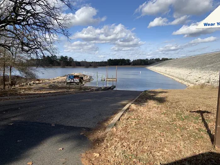
Overview Bullards Bar Reservoir is located on the North Yuba River at an elevation of 2000 feet. It is located approximately 21 miles north of Nevada City, California. It has a maximum surface area of 4,760 acres and a length of over 16 miles and shoreline of more than 60 miles. Recreation Activities include wildlife viewing, hiking, mountain biking, horseback riding, camping, fishing, boating, water skiing, and other water sports. Swimming opportunities are limited because of the steep slopes; however boaters will find numerous opportunities for swimming in various locations around the reservoir. The reservoir provides yearlong fishing opportunities for both warm and cold water fish species. Supplies are available at the marina as well as the nearby communities of Camptonville, North San Juan, and Dobbins. Facilities Activities include wildlife viewing, hiking, mountain biking, horseback riding, camping, fishing, boating, water skiing, and other water sports. Swimming opportunities are limited because of the steep slopes; however boaters will find numerous opportunities for swimming in various locations around the reservoir. The reservoir provides yearlong fishing opportunities for both warm and cold water fish species. Supplies are available at the marina as well as the nearby communities of Camptonville, North San Juan, and Dobbins. Natural Features The sides of the reservoir are generally steep and public access for boating and recreation is limited. The reservoir is surrounded by both conifer and hardwood forests with numerous brush species. There is plenty of shade at the campsites contact_info For facility specific information, please call (530) 265-4531. Nearby Attractions There is a beautiful non- motorized trail system in the area, with 5 different trails to choose from. Bullards Bar Trailhead is 14 miles, 7 Ball Trial is 1 mile, 8 Ball Trail is 3.8 miles, Rebel Ridge Trail is 1.6 miles and Schoolhouse Trail is 0.7 miles. Maps are available at the North Yuba Ranger Station just a couple miles east of the reservoir on Marysville Road. Charges & Cancellations No Show Policy A no-show customer is one who does not arrive at a campground and does not cancel the reservation by check-out time on the day after the scheduled arrival date (or for day-use facilities, by check-in time the day of arrival). * No-show customers are only recorded at staffed facilities. At most remote facilities, all customers are noted as automatically checked-in on the date of arrival. * It is recommended that staffed facilities hold a campsite until check-out time on the day following the arrival date. * It is recommended that staffed facilities hold group day-use facilities until check-in time on the arrival date. There is no change fee if a customer extends or shortens a reservation if the change includes dates from the original reservation. If they choose to depart early, they may forfeit some or all of the recreation fees. There is no change fee if the customer changes campsites that are the same price and on the same reservation dates in the same campground. If the campsite the customer is changing to has a price difference, the customer will be responsible for any additional fees or be provided with a refund, based on the price difference. Where recorded, no-show customers are assessed a $20.00 no-show fee and forfeit the first night's recreation fee for a campsite or forfeit the entire day-use recreation fee for a day-use facility. We recommend customers contact the facility if they are en route to their reservation but cannot make it by the check-in date. In these cases, no refund will be issued, but the facility can ensure that a "no-show" fee is not assessed.
View details →
Overview The Long Valley Work Center Group Campground sits among stately ponderosa pines at an elevation of 6,950 feet offering a cool respite from the summer heat of the valley below. It is also the site of a historic Forest Service work center. The campground is designed to meet the needs of large groups and can accommodate 300 people, offering picnic tables, grills, and a large fire pit. There are vault toilets. For every 25 people after the first 50, the group will need to provide additional port-a-pots. Recreation Many visitors spend time relaxing and exploring the area. The nearby C.C. Cragin Reservoir and Knoll Lake offer opportunities for water based recreation, while the Arizona National Scenic Trail, General Crook National Recreation Trail, and historic Cabin Loop Trail System offer opportunities for hikers, bicyclist, and equestrian users. There are also several Fire Lookout Towers in the area. Facilities Many visitors spend time relaxing and exploring the area. The nearby C.C. Cragin Reservoir and Knoll Lake offer opportunities for water based recreation, while the Arizona National Scenic Trail, General Crook National Recreation Trail, and historic Cabin Loop Trail System offer opportunities for hikers, bicyclist, and equestrian users. There are also several Fire Lookout Towers in the area. Natural Features The campground is in a forested setting adjacent to a meadow. The nearby Mogollon Rim is one of the most striking geologic features in the state. This steep escarpment, measured in thousands of feet, stretches from New Mexico diagonally across two thirds of Arizona and offers sweeping views of the landscape. Nearby Attractions The community of Happy Jack, Arizona has a gas station, two convenience stores and two restaurants.
View details →
Overview Bullards Bar Reservoir is located on the North Yuba River at an elevation of 2000 feet. It is located approximately 21 miles north of Nevada City, California. It has a maximum surface area of 4,760 acres and a length of over 16 miles and shoreline of more than 60 miles. Recreation Activities include wildlife viewing, hiking, mountain biking, horseback riding, camping, fishing, boating, water skiing, and other water sports. Swimming opportunities are limited because of the steep slopes; however boaters will find numerous opportunities for swimming in various locations around the reservoir. The reservoir provides yearlong fishing opportunities for both warm and cold water fish species. Supplies are available at the marina as well as the nearby communities of Camptonville, North San Juan, and Dobbins. Facilities Activities include wildlife viewing, hiking, mountain biking, horseback riding, camping, fishing, boating, water skiing, and other water sports. Swimming opportunities are limited because of the steep slopes; however boaters will find numerous opportunities for swimming in various locations around the reservoir. The reservoir provides yearlong fishing opportunities for both warm and cold water fish species. Supplies are available at the marina as well as the nearby communities of Camptonville, North San Juan, and Dobbins. Natural Features The sides of the reservoir are generally steep and public access for boating and recreation is limited. The reservoir is surrounded by both conifer and hardwood forests with numerous brush species. There is plenty of shade at the campsites Nearby Attractions There is a beautiful non- motorized trail system in the area, with 5 different trails to choose from. Bullards Bar Trailhead is 14 miles, 7 Ball Trial is 1 mile, 8 Ball Trail is 3.8 miles, Rebel Ridge Trail is 1.6 miles and Schoolhouse Trail is 0.7 miles. Maps are available at the North Yuba Ranger Station just a couple miles east of the reservoir on Marysville Road. Charges & Cancellations No Show Policy A no-show customer is one who does not arrive at a campground and does not cancel the reservation by check-out time on the day after the scheduled arrival date (or for day-use facilities, by check-in time the day of arrival). * No-show customers are only recorded at staffed facilities. At most remote facilities, all customers are noted as automatically checked-in on the date of arrival. * It is recommended that staffed facilities hold a campsite until check-out time on the day following the arrival date. * It is recommended that staffed facilities hold group day-use facilities until check-in time on the arrival date. There is no change fee if a customer extends or shortens a reservation if the change includes dates from the original reservation. If they choose to depart early, they may forfeit some or all of the recreation fees. There is no change fee if the customer changes campsites that are the same price and on the same reservation dates in the same campground. If the campsite the customer is changing to has a price difference, the customer will be responsible for any additional fees or be provided with a refund, based on the price difference. Where recorded, no-show customers are assessed a $20.00 no-show fee and forfeit the first night's recreation fee for a campsite or forfeit the entire day-use recreation fee for a day-use facility. We recommend customers contact the facility if they are en route to their reservation but cannot make it by the check-in date. In these cases, no refund will be issued, but the facility can ensure that a "no-show" fee is not assessed.
View details →
Overview Bullards Bar Reservoir is located on the North Yuba River at an elevation of 2000 feet. It is located approximately 21 miles north of Nevada City, California. It has a maximum surface area of 4,760 acres and a length of over 16 miles and shoreline of more than 60 miles. Recreation Activities include wildlife viewing, hiking, mountain biking, horseback riding, camping, fishing, boating, water skiing, and other water sports. Swimming opportunities are limited because of the steep slopes; however boaters will find numerous opportunities for swimming in various locations around the reservoir. The reservoir provides yearlong fishing opportunities for both warm and cold water fish species. Supplies are available at the marina as well as the nearby communities of Camptonville, North San Juan, and Dobbins. Facilities Activities include wildlife viewing, hiking, mountain biking, horseback riding, camping, fishing, boating, water skiing, and other water sports. Swimming opportunities are limited because of the steep slopes; however boaters will find numerous opportunities for swimming in various locations around the reservoir. The reservoir provides yearlong fishing opportunities for both warm and cold water fish species. Supplies are available at the marina as well as the nearby communities of Camptonville, North San Juan, and Dobbins. Natural Features The sides of the reservoir are generally steep and public access for boating and recreation is limited. The reservoir is surrounded by both conifer and hardwood forests with numerous brush species. There is plenty of shade at the campsites contact_info For facility specific information, please call (530) 265-4531. Nearby Attractions There is a beautiful non- motorized trail system in the area, with 5 different trails to choose from. Bullards Bar Trailhead is 14 miles, 7 Ball Trial is 1 mile, 8 Ball Trail is 3.8 miles, Rebel Ridge Trail is 1.6 miles and Schoolhouse Trail is 0.7 miles. Maps are available at the North Yuba Ranger Station just a couple miles east of the reservoir on Marysville Road. Charges & Cancellations No Show Policy A no-show customer is one who does not arrive at a campground and does not cancel the reservation by check-out time on the day after the scheduled arrival date (or for day-use facilities, by check-in time the day of arrival). * No-show customers are only recorded at staffed facilities. At most remote facilities, all customers are noted as automatically checked-in on the date of arrival. * It is recommended that staffed facilities hold a campsite until check-out time on the day following the arrival date. * It is recommended that staffed facilities hold group day-use facilities until check-in time on the arrival date. There is no change fee if a customer extends or shortens a reservation if the change includes dates from the original reservation. If they choose to depart early, they may forfeit some or all of the recreation fees. There is no change fee if the customer changes campsites that are the same price and on the same reservation dates in the same campground. If the campsite the customer is changing to has a price difference, the customer will be responsible for any additional fees or be provided with a refund, based on the price difference. Where recorded, no-show customers are assessed a $20.00 no-show fee and forfeit the first night's recreation fee for a campsite or forfeit the entire day-use recreation fee for a day-use facility. We recommend customers contact the facility if they are en route to their reservation but cannot make it by the check-in date. In these cases, no refund will be issued, but the facility can ensure that a "no-show" fee is not assessed.
View details →
Overview Brush Creek is located downstream of Keystone Dam, just 10 minutes from Tulsa, Oklahoma. This park features campground provided activities such as horseshoes, cornholes, a basketball court, a sand volleyball court, a mile-long fitness trail, and quick access to nearby multi-purpose trails. This is a popular destination for fishermen as they have the ability to cross along the pedestrian bridge from the campground to the fishing berm below the dam. In additon to fishing, this area offers prime opportunities to observe multiple wildlife species. Please note when camping here, while typically quiet, water releases from the dam are preceded by several warning signals from a horn. This is a brief safety measure for anyone in or near the water below the dam, and there is no danger to the campground. Recreation This park features fishing opportunities with disabled access, a pedestrian bridge, playground, horseshoe, cornhole, basketball court, volleyball court, and a fitness trail. Recreation opportunities that are offered nearby include the Two Rivers Trail, Keystone Singletrack Trail, and White Water Off Road Vehicle Area. Facilities This park features fishing opportunities with disabled access, a pedestrian bridge, playground, horseshoe, cornhole, basketball court, volleyball court, and a fitness trail. Recreation opportunities that are offered nearby include the Two Rivers Trail, Keystone Singletrack Trail, and White Water Off Road Vehicle Area. Natural Features The park is nestled along the Arkansas River, downstream from Keystone Dam. This location is popular for striped bass, white bass, white crappie, and various catfish species. Nearby Attractions BOK Center The Gathering Place Tulsa Zoo Jenks Aquarium White Water and Appalachia Bay Off Road Vehicle Areas Multi-purpose trails OneOK Field Downtown Tulsa Turkey Mountain Urban Wilderness Area Various casinos, malls and shopping centers
View details →
Overview Grout Pond is a popular destination for camping, hiking, paddling, and fishing. Located in a beautiful mixed conifer and hardwood forest, the campground has 12 reservable sites and offers easy access to over 10 miles of mulituse trails. The Green Mountain National Forest in partnership with the Vermont Huts Association has a cabin located at the Grout Pond Campground available for reservations. The Grout Pond Hut (pictured above) is open for year-round use and is located within the semi-remote campground on the Green Mountain National Forest. To make reservations and learn more please visit the Grout Pond Hut website: Grout Pond Hut Recreation Grout Pond offers a variety of recreation opportunities year-round. In the warmer months, fishing and non-motorized boating is popular on the pond. A 200-foot carry-in boat launch is accessible from an unloading pull-out just before the parking lot. Please help prevent the spread of non-native invasive species, such as Eurasian watermilfoil, by cleaning and drying your boat between each use. Hiking is another popular activity at Grout Pond. Over 10 miles of relatively flat trails are accessible from the campground. These trails connect with a more extensive system off National Forest lands around Somerset Reservoir to the south. Trails that are marked with blue diamond blazes are designed for cross-country skiing and can be very wet and muddy in the spring, summer, and even fall. Facilities Grout Pond offers a variety of recreation opportunities year-round. In the warmer months, fishing and non-motorized boating is popular on the pond. A 200-foot carry-in boat launch is accessible from an unloading pull-out just before the parking lot. Please help prevent the spread of non-native invasive species, such as Eurasian watermilfoil, by cleaning and drying your boat between each use. Hiking is another popular activity at Grout Pond. Over 10 miles of relatively flat trails are accessible from the campground. These trails connect with a more extensive system off National Forest lands around Somerset Reservoir to the south. Trails that are marked with blue diamond blazes are designed for cross-country skiing and can be very wet and muddy in the spring, summer, and even fall. Natural Features Grout Pond is 84 acres and 28 feet deep. The water can be chilly but refreshing on a hot summer day. The campground is located along the pond and is shaded by red maple, yellow birch and red spruce. Fall foliage viewing in the autumn months is excellent. Nearby Attractions Nearby attractions include hiking trails accessible from the site and paddling on the pond. The campground is also in close proximity to Appalachian/Long Trail trailheads off Kelly Stand Road and Stratton Mountain Resort and Village.
View details →
Overview Located approximately 14 miles eat of Basalt, CO, in the White River National Forest, Little Mattie Campground is situated on the Ruedi Reservoir at an elevation of 7800 feet. Sites are open to the starry nighttime skies and access to the lake and trails. It sits amid a mixed conifer forest and offers an ideal setting for guest seeking recreation and relaxation. Little Mattie has 19 standard sites suitable for tents, trailers and RVs. There is a maximum length of 30 feet for RVs & trailers. The sites are equipped with picnic tables, campfire rings and bear boxes (food storage lockers). Guests also have access to vault toilets and drinking water, but electrical hook-ups are not available. Recreation Renown for its fly fishing, Frying pan River flows below Ruedi Dam. Here, large rainbow, brown, cutthroat and brook trout are plentiful in an area nicknamed the “toilet bowl.” The fish feed on Mysis shrimp, a small freshwater shrimp stocked in the lake. The stretch of rive from below the dam down to the confluence of Frying Pan and the Roaring Fork River has been designated as Gold Medal Waters by the Colorado Wildlife Commission. Special regulations in this area include fishing only with artificial flies and lures, and releasing all trout except brown trout, with a limit of two fish over 14 inches. For hikers and bikers, the Ruedi Trail, located north of the reservoir, climbs to the top of Red Mountain. The trailhead is located 200 feet north of the Jeep trail near the boat ramp and parking lot. This eight mile trail gains over 3,000 feet in elevation, leading hikers to a spectacular panoramic view of the area. Boating, swimming, and water skiing are all possible. Interpretive programs are popular activities. Facilities Renown for its fly fishing, Frying pan River flows below Ruedi Dam. Here, large rainbow, brown, cutthroat and brook trout are plentiful in an area nicknamed the “toilet bowl.” The fish feed on Mysis shrimp, a small freshwater shrimp stocked in the lake. The stretch of rive from below the dam down to the confluence of Frying Pan and the Roaring Fork River has been designated as Gold Medal Waters by the Colorado Wildlife Commission. Special regulations in this area include fishing only with artificial flies and lures, and releasing all trout except brown trout, with a limit of two fish over 14 inches. For hikers and bikers, the Ruedi Trail, located north of the reservoir, climbs to the top of Red Mountain. The trailhead is located 200 feet north of the Jeep trail near the boat ramp and parking lot. This eight mile trail gains over 3,000 feet in elevation, leading hikers to a spectacular panoramic view of the area. Boating, swimming, and water skiing are all possible. Interpretive programs are popular activities. contact_info For facility specific information, please call (801) 226-3564. Charges & Cancellations Once your reservation start date has begun, neither the Recreation.gov Contact Center nor the campground manager will be able to modify your reservation.
View details →
Overview Approximately 5 miles from Crested Butte, Colorado, Oh Be Joyful Campground is a 30-unit campground along the Slate River. The campground itself gets its name from nearby Oh Be Joyful Creek that features massive waterfalls and colorful wildflowers in the summer months. The campground is located at approximately 9,000 feet in elevation and the views are spectacular. Recreation This premier area is known for camping, fishing, horseback riding, sight-seeing, hiking/walking, water play, kayaking, mountain biking, wildflower viewing, and motorized recreational uses. A foot bridge allows visitors to access the west side of the Slate River to hike along Oh Be Joyful Creek and into the Raggeds Wilderness. Facilities This premier area is known for camping, fishing, horseback riding, sight-seeing, hiking/walking, water play, kayaking, mountain biking, wildflower viewing, and motorized recreational uses. A foot bridge allows visitors to access the west side of the Slate River to hike along Oh Be Joyful Creek and into the Raggeds Wilderness. Natural Features The campground sits directly on the east bank of the Slate River and is nestled in a valley with mountains on either side of the valley. Due to the abundance of moisture in the spring and early summer, wildflowers are abundant. Look for our State flower the Columbine and other species including Indian Paintbrush and Avalanche Lilies. Nearby Attractions
View details →
Overview ATTENTION: Loop A campsites are available by reservation only through Recreation.gov. Reservations can be made the day of, up to 6 months in advance from anywhere service is available. This is the only option, cash and check payments are NOT available onsite. There is cell service for most providers at the campground entrance. Loop B campsites are available first-come, first serve only . Payments can be made by cash, check, or scan and pay through the Recreation.gov mobile app. Please contact the BLM Moab Field Office with questions by email: blm_ut_mb_mail@blm.gov or phone: 435-259-2100. Ken's Lake Campground is a part of the Ken's Lake Recreation Area. The area includes Ken's Lake, a man made reservoir (electric motors only - gas powered engines are prohibited), day use area with a gravel boat ramp, campground, and hiking/equestrian trails. Construction of the reservoir was part of the Mill Creek Project, completed in 1981, which also included a pressurized irrigation water delivery system. In 2000, the site was constructed into a campground and day use area for visitors to enjoy the surrounding recreational activities and scenic vistas. Located 10 miles south of Moab, Ken's Lake is surrounded by red rock fins to the east, sage brush flats to the south and west, and a reservoir to the north. Distant views from the campground also include the La Sal Mountains and red rock Moab Rim. This site is located at 5,085 feet elevation, similar to Moab. Be prepared October to March for lows below freezing and from June to August highs from 95 to above 100 degrees Fahrenheit. This campground is comprised of loops A and B. Loop A has no vegetation providing shade and is closed during low use season (summer and winter; exact dates vary each year). Loop B stays open year round and has a variety of sites with juniper and cottonwood trees providing shade and privacy. Loop A is popular with visitors that have large motorhomes and trailers. Loop B has smaller sites and it is difficult for large motorhomes and trailers to turn-around. The south end of the Steel Bender Jeep Safari Route runs next to the campground, so Off Highway Vehicle (OHV) users are also drawn to this area. Other popular activities originating from the campground or day use area include: hiking, horseback riding, fishing, and non-motorized boating. There are over 3 miles of trails in the lake vicinity with views of the Moab Valley, Faux Falls, La Sal Mountains, and Ken's Lake. Recreation The town of Moab is a hub for recreation. Tour operators offer guided hikes, rentals and evening entertainment. The area abounds with trails, dirt roads and canyons waiting to be explored. Facilities The town of Moab is a hub for recreation. Tour operators offer guided hikes, rentals and evening entertainment. The area abounds with trails, dirt roads and canyons waiting to be explored. Natural Features A few miles east of the campground, Mill Creek flows out of the La Sal Mountains. Water from this creek has been diverted to flow along a creek on the north side of the campground and is captured at Ken's Lake Reservoir. Along the diverted creek's path is Faux Falls. From the campground, visitors can hike or ride horseback on a trail to the falls or directly to the lake. Nearby Attractions Arches and Canyonlands National Parks and Hovenweep and Natural Bridges National Monuments are nearby. Also in the area are the Manti-La Sal National Forest and the La Sal Mountain Loop Road, which provide interesting exploration opportunities and cooler temperatures during the summer months. Charges & Cancellations You may contact the BLM Moab Field Office for assistance with changes and cancellations at 435-259-2100. Changes You can make changes to a reservation through your online Recreation.gov user account any time prior to the arrival/first date of the reservation. There is a $10 change fee If you wish to change to dates entirely outside of the original reservation dates. There is no change fee if you wish to extend or shorten the original reservation dates as long as the changes include dates from the original reservation. There is no change fee if you wish to change to another site that is the same price, for the same dates, and in the same campground. You cannot make changes to your reservation after the arrival/first day through your Recreation.gov account. However, the BLM Moab Field Office may be able to assist you, 435-259-2100. For reservations with dates at the end of the available booking window (a.k.a. sliding window), you will not be able to make changes or cancellations until the site has been available to the general public for 18 days. Cancellations Please cancel your reservation if you do not plan to use it. This opens highly sought-after campsites for others to reserve. You can cancel your reservation online through your Recreation.gov user account or through the call center (the call center incurs an additional fee). You may also contact the BLM Moab Field Office for assistance. A $10 service fee will be withheld from any refund for a cancellation. Late Cancellations A late cancellation occurs starting from midnight 1 calendar day before your scheduled check-in. Late cancellations will incur a $10.00 service fee AND forfeit the first night's use fee. Cancellations for a one night reservation will forfeit the entire amount but will not be charged a service fee. Early Departures If you spend at least one night and then leave prior to the scheduled departure check-out date, please contact the BLM Moab Field Office (435-259-2100) to open the remaining nights for others to use. You will not be able to cancel these nights through your Recreation.gov account. You will be eligible for a partial refund of the nights AFTER you depart that you did not use. If you depart after the facility check-out time (Noon), you will not be eligible for a refund for that night. No-Shows A No Show occurs if you do not arrive at your campsite or cancel your reservation by check-out time (Noon) on the day after the scheduled arrival date. Staff will hold a campsite until check-out time (Noon) on the day following the arrival date. No-shows are assessed a $20.00 Recreation.gov service fee and forfeit the first night’s use fee. Refunds You can submit a refund request through your Recreation.gov account within 7 days of the departure/end date of your reservation. Applicable fees, such as the Recreation.gov reservation fees, service/cancellation fees, lottery application fees, and change fees, are non-refundable. Refunds cannot be issued to any card other than the one used to pay. In the event of an emergency closure, all fees will be refunded. Attempts will be made to notify you using the contact information within your Recreation.gov customer profile. Interagency Pass Discounts The following are the only Interagency Passes that provide a discount on camping reservations: Senior Annual Pass Senior Lifetime Pass Access Pass Golden Age Pass Golden Access Pass Pass discounts only apply to the recreation (or use) fee for the facility. Other charges such as reservation or other fees are not eligible for a discount. The holder of the pass must occupy the site for which the discount is applied. The pass can only be used for one site during a time period.
View details →
Overview Damsite Texas is a relatively small campground which consists of a total of 19 campsites. Each of the campsites do have water and electric. The campground is located right along the Red River which gives easy access to popular outdoor activities like fishing. Most of all the campsites are covered by pecan trees within the campground which allows for great shade during the summer time. Before the enterance to the camground you will notice there are multiple picnic tables and a pavillion to be able to utilize for the day, this allows visitors to spend the day along the Red River and enjoy the scenary while not having to pay the cost for overnight camping within the campground. If a visitor does choose to bring a boat to explore lake Texoma, there is a popular spillway boat ramp area that is located at the Denison dam. Recreation Even though the Damsite Texas campground is located along the Red River, Lake Texoma is located just right on the other side of the Dension Dam. Lake Texoma is a large reservoir with an excellent fishery and many access points. Boating, swimming, water skiing, hunting, birding and relaxing on the sandy beaches are the typical pursuits of most visitors. The lake is known as the "Striper Capital of the World," one of the few reservoirs in the nation where Striped bass reproduce naturally. Other popular species include largemouth and smallmouth bass, white bass, hybrid striped bass, white crappie, black crappie, channel catfish and blue catfish. Many visitors fish in the Red River in which they catch a vaiety of differnt species like Striped Bass, Blue Catfish, Channel Catfish, Alligator Gar, and occasionally American Paddlefish. Facilities Even though the Damsite Texas campground is located along the Red River, Lake Texoma is located just right on the other side of the Dension Dam. Lake Texoma is a large reservoir with an excellent fishery and many access points. Boating, swimming, water skiing, hunting, birding and relaxing on the sandy beaches are the typical pursuits of most visitors. The lake is known as the "Striper Capital of the World," one of the few reservoirs in the nation where Striped bass reproduce naturally. Other popular species include largemouth and smallmouth bass, white bass, hybrid striped bass, white crappie, black crappie, channel catfish and blue catfish. Many visitors fish in the Red River in which they catch a vaiety of differnt species like Striped Bass, Blue Catfish, Channel Catfish, Alligator Gar, and occasionally American Paddlefish. Natural Features The campground is situated right along the Texas side of the Red River by the Denison Dam. Deer, turkeys, bobcats, hawks, waterfowl and songbirds are abundant around the river. Nearby Attractions Lake Texoma features two wildlife refuges, two state parks and 23 commercial concession areas dedicated to the enjoyment of over six million visitors annually.
View details →
Overview Located next to one of the most popular creeks in the Great Smoky Mountains National Park, Deep Creek Group Camp provides traditional primitive camping with the stunning backdrop of the mountains. Whether blanketed in bright wildflowers in the spring or vivid colors in the fall, the scenery at Deep Creek never disappoints. The camp offers 92 individual sites, all with grills, tables and campfire rings, perfect for a meal or a late-night s'mores session. Hookups and showers are not provided, but flush toilets and drinking water are available. Recreation Great Smoky Mountains National Park is a hiker's paradise, offering over 800 miles of maintained trails ranging from short, leg-stretchers to strenuous treks, with a number of those trails easily accessible from the picnic area. But hiking is not the only reason for visiting the Smokies: Fishing, picnicking, wildlife viewing and auto touring are also popular activities. Campers can enjoy high-quality backcountry fishing in the cool waters of the countless streams and rivers that snake through the mountains, with trout available in abundance. The nearby Bradley Fork River provides a great place to go for a dip or fish for trout. Wildlife viewing is a popular pastime, and with around 1,500 bears living in the park, it's not uncommon for visitors to spot one. The park is a sanctuary for a magnificent array of animal and plant life, all of which is protected for future generations to enjoy. The park also holds one of the best collections of log buildings in the eastern United States. Over 90 historic structures, including houses, barns, outbuildings, churches, schools and grist mills, have been preserved or rehabilitated in the park. Facilities Great Smoky Mountains National Park is a hiker's paradise, offering over 800 miles of maintained trails ranging from short, leg-stretchers to strenuous treks, with a number of those trails easily accessible from the picnic area. But hiking is not the only reason for visiting the Smokies: Fishing, picnicking, wildlife viewing and auto touring are also popular activities. Campers can enjoy high-quality backcountry fishing in the cool waters of the countless streams and rivers that snake through the mountains, with trout available in abundance. The nearby Bradley Fork River provides a great place to go for a dip or fish for trout. Wildlife viewing is a popular pastime, and with around 1,500 bears living in the park, it's not uncommon for visitors to spot one. The park is a sanctuary for a magnificent array of animal and plant life, all of which is protected for future generations to enjoy. The park also holds one of the best collections of log buildings in the eastern United States. Over 90 historic structures, including houses, barns, outbuildings, churches, schools and grist mills, have been preserved or rehabilitated in the park. Natural Features Deep Creek is in the southeastern portion of the park and provides a moderate climate, typified by mild winters and hot, humid summers. Because of its proximity to water, Deep Creek is an ideal campground for water recreation and books up quickly during summer months. Nearby Attractions Great Smoky Mountains National Park is a hiker's paradise, with plenty of trails easily accessible from the Deep Creek Group Site. An easy 1.6 mile roundtrip hike will allow you to enjoy two beautiful waterfalls in the Deep Creek area. Walk Deep Creek Trail 0.7 mile to the junction with Indian Creek Trail. On your way you can view elegant Tom Branch Falls located on the far side of Deep Creek. Turn right at the junction with Indian Creek Trail and proceed approximately 200' to Indian Creek Falls. The falls are 25 feet in height. Deep Creek runs on the edge of the campground and provides easily accessible fishing, wading and tubing. Visitors can also enjoy high-quality backcountry fishing in the cool waters of the countless streams and rivers that snake through the mountains, with trout available in abundance. contact_info This location is staffed. Please call (828) 488-3184 to speak with local staff.
View details →
Overview Painted Rock Petroglyph Site, approximately 90 miles southwest of Phoenix, Arizona, provides visitors the opportunity to view an archaeological site containing hundreds of figures and designs carved into rocks, known as petroglyphs. These were produced centuries ago by indigenous peoples. This site is considered important and even sacred to many of the Native American tribes in southern Arizona. Please keep this in mind when you visit and be respectful. There are also inscriptions made by people who passed through during historic times. Many important trails are near the site, some of which have been traveled for thousands of years. The 1775 expedition of Juan Bautista de Anza passed nearby on his way to deliver soldiers, padres, settlers, and their livestock to a new home in northern California to secure the area for Spain. In 1846, the Mormon Battalion passed through, following Philip St. George Cooke along some segments of this trail to help secure California from Mexico. This venture included road building tasks along the trail, assuring that future trips could accommodate wagons. A need to improve communication and travel from east to west prompted Congress to fund a stage line. The result was the Butterfield Overland Stage Route, which began service in 1858 and traveled by this site. This mail and freight service guaranteed that the mail, freight, or passengers would be able to travel from Saint Louis to San Francisco in 25 days. Use was halted when the railroad was constructed in 1879. Formerly a unit of the Arizona State Park system, jurisdiction of Painted Rock Petroglyph Site returned to the Bureau of Land Management in 1989. Recreation The day-use site is right next door to the campground and offers two shaded picnic areas and a small interpretive trail around the petroglyph site with informational displays. The petroglyphs face the east-southeast primarily and would have been noticed by any travelers approaching from that direction. Hiking, birdwatching, and star gazing opportunities all present themselves at this site. Facilities The day-use site is right next door to the campground and offers two shaded picnic areas and a small interpretive trail around the petroglyph site with informational displays. The petroglyphs face the east-southeast primarily and would have been noticed by any travelers approaching from that direction. Hiking, birdwatching, and star gazing opportunities all present themselves at this site. Natural Features Set between impressive geologic features such as Oatman Mountain, a few miles to the northwest and the Painted Rock Mountains, situated on the eastern horizon, this campground offers scenic panoramic views and plenty of opportunities for solitude and vast night skies. The surrounding area features a diverse Sonoran Desert plant community including the iconic saguaro cactus, various cholla species, barrel cactus, creosote bush, and both ironwood and palo verde trees. The area is home to a large population of desert mule deer and many other desert species such as kit fox, Gambel’s quail, chuckwalla, and desert iguana. Nearby Attractions Woolsey Peak Wilderness Woolsey Peak Wilderness offers rugged topography, colorful scenic vistas, rich variety of wildlife and vegetation, and outstanding opportunities for solitude and unconfined recreation. Woolsey Peak stands 3,270 feet above sea level and about 2,500 feet above the Gila River (to the south). It is a landmark visible from much of southwestern Arizona. The Painted Rock Dam flood- control dam is situated on the Gila River not far from the southwestern corner of the area. Encompassing a major portion of the Gila Bend Mountains, it is barely separated from the smaller Signal Mountain Wilderness to the north. You will find sloping lava flows, basalt mesas, ragged peaks, and broken ridges dotted with saguaro, cholla, palo verde , creosote, and bursage. Desert mesquite, paloverde, and ironwood grow in the washes throughout this rugged and expansive desert wilderness. The region is especially inviting for its desert backpacking. Desert bighorn sheep, mule deer, bobcats, mountain lions, hawks, and owls might make an appearance. Signal Mountain Wilderness A narrow, four-wheel-drive road is all that separates Signal Mountain Wilderness from Woolsey Peak Wilderness to the south. Signal Mountain itself, rising just north of the center of the area, reaches a summit of 2,182 feet (1,200 feet above the surrounding desert floor). Here you will find sharp volcanic peaks, steep-walled canyons, ragged ridgelines, arroyos (slim, usually dry riverways), and plains spreading out from the washes. Paloverde, saguaro, and creosote are scattered throughout the bajadas and upland regions. Washes are lined with mesquite, ironwood, acacia, and palo verde. Wildlife watchers may see desert bighorn sheep, desert tortoises, and several species of raptors. Wildlife game species are common, and quail and mule deer hunters are frequent visitors. contact_info For facility specific information, please call (602) 867-5400.
View details →
Overview The Mineral King area features the highest elevation campground in the parks. At 7,500 feet (2280 m), it is only open during the summer months. A narrow, winding, largely unpaved road leads to the area and its two campgrounds. RVs and trailers are not recommended on Mineral King Road and are not permitted in campgrounds. Mineral King is not connected to the rest of Sequoia National Park by roads. To get here, turn off of Highway 198 in Three Rivers, California. Recreation Trails to alpine lakes and mountain passes begin nearby. Facilities Trails to alpine lakes and mountain passes begin nearby. Natural Features Hikes into the backcountry out of Mineral King will give visitors an ever deeper understanding of the beauty and uniqueness of Sequoia National Park. Hike to alpine lakes and over mountain passes, or climb a peak. contact_info For facility specific information, please call (559) 565-4404. Nearby Attractions There are limited services at Silver City Resort, 1.7 miles (3 km) east of the campground. More extensive services can be found in Three Rivers, 23 miles (37 km) west of Atwell Mill Campground (approximately 1.5 hours away). Charges & Cancellations Payment in full will be charged to your credit card upon completion of the reservation. A $10.00 service fee will apply if you change or cancel your reservation. Additional fees will apply for late cancellations All cancellations made between midnight on the day before arrival and check out time on the day after arrival are considered late cancellations and will incur a $10.00 cancellation fee and will also forfeit the first night’s use fee. Cancellations for a single night’s reservation will forfeit the entire use fee but no cancellation fee will apply. If your campsite remains vacant for 24 hours after your arrival date it will be cancelled and made available on rec.gov. You will be charged for the first night's campsite fee and a $10 cancellation fee, all other fees after that will be refunded. Recreation.gov policies apply to all reservations, cancellations, refunds and date changes. Call (559) 565-4404 if you will be arriving 24 hours after your arrival date so your site won't be cancelled.
View details →
Overview Moraine Campground in Cedar Grove is nestled in the stunning Kings Canyon, one of the deepest canyons in the United States. With the sound of the Kings River, and glowing mountainsides just beyond the trees, Moraine Campground is a wonderful place for families to spend time in the great outdoors. Recreation Cedar Grove provides a plethora of hiking trails, from the hiking newcomer to the avid backpacker, and everyone in between. Day hikers can hike to Mist Falls, Cedar Grove Overlook, around the peaceful Kanawyer Loop along the Kings River, through Zumwalt Meadow, and more. Visitors can also fish for trout in the Kings River, or take a scenic horseback ride through the canyon with the Cedar Grove Pack Station. Facilities Cedar Grove provides a plethora of hiking trails, from the hiking newcomer to the avid backpacker, and everyone in between. Day hikers can hike to Mist Falls, Cedar Grove Overlook, around the peaceful Kanawyer Loop along the Kings River, through Zumwalt Meadow, and more. Visitors can also fish for trout in the Kings River, or take a scenic horseback ride through the canyon with the Cedar Grove Pack Station. Natural Features Tall granite mountainsides cradle the south fork of the Kings River, as streams and creeks feed the river with snowmelt from higher elevations. Abundant wildlife roam through the tall ponderosa pine and incense cedar trees, meadows and along riversides. Hikes into the backcountry out of Cedar Grove will give visitors an ever deeper understanding of the beauty and uniqueness of Kings Canyon National Park. Nearby Attractions Hume Lake, Grizzly Falls, Mist Falls, Zumwalt Meadow, Roaring River Falls, Sequoia Groves and numerous hiking trails attract visitors to this area. Campfire stories, nature and wildlife presentations, and ranger-led hikes are also available during most of the season. contact_info For facility specific information, please call (559) 565-3792. Charges & Cancellations Payment in full will be charged to your credit card upon completion of the reservation. A $10.00 service fee will apply if you change or cancel your reservation. Additional fees will apply for late cancellations All cancellations made between midnight on the day before arrival and check out time on the day after arrival are considered late cancellations and will incur a $10.00 cancellation fee and will also forfeit the first night’s use fee. Cancellations for a single night’s reservation will forfeit the entire use fee but no cancellation fee will apply. If your campsite remains vacant for 24 hours after your arrival date it will be cancelled and made available on rec.gov. You will be charged for the first night's campsite fee and a $10 cancellation fee, all other fees after that will be refunded. Recreation.gov policies apply to all reservations, cancellations, refunds and date changes. Call (559) 565-3792 if you will be arriving 24 hours after your arrival date so your site won't be cancelled.
View details →
Overview Sheep Creek Campground in Cedar Grove is nestled in the stunning Kings Canyon, one of the deepest canyons in the United States. With the sound of the Kings River, and glowing mountainsides just beyond the trees, Sheep Creek Campground is a wonderful place for families to spend time in the great outdoors. Recreation Cedar Grove provides a plethora of hiking trails, from the hiking newcomer to the avid backpacker, and everyone in between. Day hikers can hike to Mist Falls, Cedar Grove Overlook, around the peaceful Kanawyer Loop along the Kings River, through Zumwalt Meadow, and more. Visitors can also fish for trout in the Kings River, or take a scenic horseback ride through the canyon with the Cedar Grove Pack Station. Facilities Cedar Grove provides a plethora of hiking trails, from the hiking newcomer to the avid backpacker, and everyone in between. Day hikers can hike to Mist Falls, Cedar Grove Overlook, around the peaceful Kanawyer Loop along the Kings River, through Zumwalt Meadow, and more. Visitors can also fish for trout in the Kings River, or take a scenic horseback ride through the canyon with the Cedar Grove Pack Station. Natural Features Tall granite mountainsides cradle the south fork of the Kings River, as streams and creeks feed the river with snowmelt from higher elevations. Abundant wildlife roam through the tall ponderosa pine and incense cedar trees, meadows and along riversides. Hikes into the backcountry out of Cedar Grove will give visitors an ever deeper understanding of the beauty and uniqueness of Kings Canyon National Park. Nearby Attractions Hume Lake, Grizzly Falls, Mist Falls, Zumwalt Meadow, Roaring River Falls, Sequoia Groves and numerous hiking trails attract visitors to this area. Campfire stories, nature and wildlife presentations, and ranger-led hikes are also available during most of the season. contact_info For facility specific information, please call (559) 565-3792. Charges & Cancellations Payment in full will be charged to your credit card upon completion of the reservation. A $10.00 service fee will apply if you change or cancel your reservation. Additional fees will apply for late cancellations All cancellations made between midnight on the day before arrival and check out time on the day after arrival are considered late cancellations and will incur a $10.00 cancellation fee and will also forfeit the first night’s use fee. Cancellations for a single night’s reservation will forfeit the entire use fee but no cancellation fee will apply. If your campsite remains vacant for 24 hours after your arrival date it will be cancelled and made available on rec.gov. You will be charged for the first night's campsite fee and a $10 cancellation fee, all other fees after that will be refunded. Recreation.gov policies apply to all reservations, cancellations, refunds and date changes. Call (559) 565-3792 if you will be arriving 24 hours after your arrival date so your site won't be cancelled.
View details →
Overview Riggs Flat Lake is located at the end of Swift Trail, a road that winds along the top of the Pinaleno Mountains. It is a small picturesque lake, 11 acres in size, set in alpine forest and meadow. Its cold waters are stocked during the summer with rainbow, brown and brook trout, and anglers report that the fishing is usually good. Best baits for the rainbows are corn, cheese, garlic cheese, salmon eggs, and worms. The brown and brook trout are taken on artificial lures and flies as well. Small boats are permitted on the lake, but most people fish from the shoreline. If the big ones aren’t biting, there is always plenty of scenery to enjoy. In addition to the views of the lake and the surrounding forest, West Peak is visible from the vicinity of the lake. So are Aravaipa Valley and the Galiuro Mountains to the west if you don't mind taking a short hike to get to an overlook. Recreation Day use: A Coronado National Forest or Interagency (America the Beautiful) pass must be displayed. Day use passes can be purchased at the site for $8. For visitors who do not want to use facilities, there is a small fee-free parking area outside of the campground. A valid Arizona fishing license and trout stamp (available at outdoor stores around the state) is required for all anglers 14 years of age and older. Six trout is the daily limit and the possession limit. Using live bait fish is prohibited. Fishing season is May to October, day and night. Boats are permitted on the lake, but only single electric motors may be used. Facilities Day use: A Coronado National Forest or Interagency (America the Beautiful) pass must be displayed. Day use passes can be purchased at the site for $8. For visitors who do not want to use facilities, there is a small fee-free parking area outside of the campground. A valid Arizona fishing license and trout stamp (available at outdoor stores around the state) is required for all anglers 14 years of age and older. Six trout is the daily limit and the possession limit. Using live bait fish is prohibited. Fishing season is May to October, day and night. Boats are permitted on the lake, but only single electric motors may be used. contact_info This location is unstaffed. To speak with our main office for general information, please call: (928) 428-4150. Nearby Attractions
View details →
Overview Hobo Campground is tucked on the banks of the Lower Kern River, north of the popular Miracle Hot Springs. It sits at 2290 feet elevation on the Sequoia National Forest in the Lower Kern Canyon. The close proximity to the Lower Kern River and the shade provided by the riparian forest make it an ideal summer escape from the heat. It has 23 individual tent only sites and an additional 10 sites across the campground. Recreation White water boating is popular on the Lower Kern and requires a free Kern River Use permit from the Kernville Ranger Station. A trail also exists at the northern end of Hobo Campground that connects visitors to Sandy Flat Campground. The remains of an old resort can be found in the campground and Miracle Hot Springs area. Facilities White water boating is popular on the Lower Kern and requires a free Kern River Use permit from the Kernville Ranger Station. A trail also exists at the northern end of Hobo Campground that connects visitors to Sandy Flat Campground. The remains of an old resort can be found in the campground and Miracle Hot Springs area. Natural Features The campsites are mostly all shaded by majestic sycamores, willows, cottonwoods, alders with views of the Lower Kern River close by.The trees show off a dramatic display of yellow, gold, and orange in the fall. The Kern River flows higher in the late spring and early summer months as water is released from Lake Isabella. The river can appear calm but can be deceiving with it's fast currents under the surface. The Forest Service does not encourage swimming in the river. Nearby Attractions Remington Hot Springs is a free Hot Spring on Forest Service Land located approximately one mile West of Hobo Camppground off Old Kern Canyon Road. White water rafting is a very popular activity on the Kern River, local Rafting Outfitters provide half-day to multi day trips along the Kern River. contact_info This location is unstaffed. To speak with our main office for general information, please call: (760) 376-3781.
View details →
Overview This RV-only campground is located at the popular Brandy Creek Marina of Whiskeytown National Recreation Area, 13.5 miles west of Redding, California, and 3.5 hours north of Sacramento. The beach and the launch ramp are located .25 mile away from the campground, which is partially shaded by oaks and pines. The cool, clear waters of Whiskeytown Lake provide endless water activities. Ample opportunities fro hiking and mountain biking are offered by a network of trails. Recreation During the summer heat, swimming, kayaking, sailing, paddle boarding and water skiing are popular on the 3,200 acre lake. Year round, hiking, mountain biking, horseback riding, gold panning, fishing and picknicking attract visitors. Hunting is allowed during the appropriate season. Facilities During the summer heat, swimming, kayaking, sailing, paddle boarding and water skiing are popular on the 3,200 acre lake. Year round, hiking, mountain biking, horseback riding, gold panning, fishing and picknicking attract visitors. Hunting is allowed during the appropriate season. Natural Features Gentle breezes from the lake, cooling shade from oaks and pines, and the sound of children playing on nearby Brandy Creek Beach make Brandy Creek RV Campground a relaxing retreat. Whiskeytown National Recreation Area is located where the Klamath Mountains, the Cascade and Coast Mountain Ranges, and the Sacramento Valley meet, creating a variety of wildlife and landscapes. contact_info For facility specific information, please call (530) 246-1225. Nearby Attractions Brandy Creek Beach is located a half mile south of the campground and features sandy beaches, a large swimming area, picnicking and barbecuing facilities. From Memorial Day through Labor Day, there are showers, a store with food and supplies and rentals of paddle boards and kayaks.
View details →
Overview Planning a trip to the Lake Ottawa Campground? Watch for Alerts at the top of the page for any Alerts regarding this facility. Lake Ottawa Campground is in a beautiful forested northwoods setting located 5 miles southwest of Iron River, MI, on the Iron River Ranger District. Recreation Located adjacent to the Campground is Lake Ottawa, a deep cold water lake that provides fishermen with a good variety of game fish. There is a boat ramp with ample parking for trailers. Ge-Che Trail - Length is approximately 9 miles on a dirt trail. This trail provides scenery of primarily hardwood forest. The trail can be accessed from Lake Ottawa boat landing, and from within the campground. Lake Ottawa Recreation Area day use area provides indoor facilities for a group picnic, and a large outdoor picnic area complete with picnic tables and grills. The area is large enough to provide plenty of space for all. Also located in the same area is an athletic field. The day use building provides indoor seating for eating or parties. The building has a fireplace, electricity, and flush toilets. Facilities Located adjacent to the Campground is Lake Ottawa, a deep cold water lake that provides fishermen with a good variety of game fish. There is a boat ramp with ample parking for trailers. Ge-Che Trail - Length is approximately 9 miles on a dirt trail. This trail provides scenery of primarily hardwood forest. The trail can be accessed from Lake Ottawa boat landing, and from within the campground. Lake Ottawa Recreation Area day use area provides indoor facilities for a group picnic, and a large outdoor picnic area complete with picnic tables and grills. The area is large enough to provide plenty of space for all. Also located in the same area is an athletic field. The day use building provides indoor seating for eating or parties. The building has a fireplace, electricity, and flush toilets. Nearby Attractions Stateline-Mile Post Zero Trail - Scenery is hardwood, forested with two destination points on the Brule River. The trail is not a loop, it is a relatively flat dirt trail. The length of the trial is approximately 4/10 of a mile and takes you to the historic Stateline Mile Post Zero location indicating the border between Michgian and Wisconsin. The combination of topography and thousands of miles of rivers and streams have created hundreds of waterfalls throughout the Upper Peninsula, with several of the waterfalls located on the Ottawa. The Ottawa National Forest has 18 named waterfalls, 53,637 acres of lakes, 2,366 miles of perennial streams, 2,890 miles of intermittent (occasional) streams, and 210,761 acres of wetlands. The falls vary in size and some are easier to get to than others. For more information on the most visited waterfalls on and around the Ottawa National Forest, visit the Ottawa National Forest website waterfall page .
View details →
Overview Warner Valley campground is a limited development facility in the south eastern area of the park. It has vault toilets and potable water spigots. Numerous trails can be accessed from the campground. Recreation Hiking trails accessible from the campground Facilities Hiking trails accessible from the campground Natural Features Lassen Volcanic national park is known for its volcanic history, as well as its diversity of plants and animals. It contains 300 active volcanic domes, as well as many hydrothermal features, such as mud pots and steam vents. Lassen Peak is the southernmost active volcano in the Cascades, and the second most recent to erupt in the lower 48 of the United States before Mount Saint Helens. Lassen National Park boasts over 700 species of flowering plants and 250 species of birds, mammals, reptiles and fish. The park is at the junction of the Cascade Mountains, the Sierra Nevada Mountains and the Great Basin, thus providing many unique habitats. Nearby Attractions Drakesbad Guest Ranch - half a mile away, at the end of Warner Valley road. Dining room serves meals - please contact the ranch for reservations Charges & Cancellations A customer who cancels a reservation the day before or on the day of arrival will pay a $10.00 service fee AND forfeit the first night's use fee (not to exceed the total paid for the original reservation). Cancellations for a one-night reservation will forfeit the entire amount paid and will not be subject to an additional service fee
View details →
Overview Hoop Lake Trailhead Campground is a high elevation campground, 9,000 feet, in the north east corner of the state of Utah, between Flaming Gorge and Evanston, Wyoming. It offers lake access and access to the High Uinta Wilderness. Campers are drawn to the area to boat and fish in the lake and to hike or horseback ride on the many trails. Recreation This off-the-beaten path area is a kind of recreationists paradise, with boating and fishing in Hoop Lake, more fishing in nearby Beaver Meadow Reservoir, and trails galore. There is easy access to Hoop Lake trailhead, and access to the High Uintas Wilderness. Facilities This off-the-beaten path area is a kind of recreationists paradise, with boating and fishing in Hoop Lake, more fishing in nearby Beaver Meadow Reservoir, and trails galore. There is easy access to Hoop Lake trailhead, and access to the High Uintas Wilderness. Natural Features The campground is timbered and has great views of the lake with access for fishing and boating. There is plenty of sightseeing and wildlife watching for the numerous birds, elk, deer, moose, and beaver who frequent the area. Nearby Attractions Charges & Cancellations Reservation Cancellations & Changes Cancelling a Reservation: Customers may cancel their reservation prior to arrival both on-line and through the call center. A $10 service fee will be withheld from any refund for a cancellation. Depending on when you cancel in relation to your arrival day, it may be considered a late cancellation (see below). Changing an Existing Reservation: When changes are made prior to the cut-off window: If a customer wants to switch dates that are entirely outside of the original reservation dates, there is a $10 change fee. There is no change fee if a customer extends or shortens a reservation, as long as the change includes dates from the original reservation. If they choose to depart early, they may forfeit the recreation fee for the day of departure. There is no change fee if the customer wants to switch sites that are the same price with the same reservation dates in the same facility. If a reservation is made that includes dates beyond the maximum booking window, that reservation cannot be changed until 18 days have passed from the original booking date. Late Cancellations or Cancellations within the Cut-off Window Individual Campsites: A customer who cancels a reservation the day before or on the day of arrival will pay a $10.00 service fee AND forfeit the first night's use fee (not to exceed the total paid for the original reservation). Cancellations for a one-night reservation will forfeit the entire amount paid and will not be subject to an additional service fee. Cabins / Lookouts: Customers who cancel a cabin or lookout reservation less than 14 days before the arrival date will pay a $10.00 service fee AND forfeit the first night's use fee. Group Facility (including Cabins and Lookouts): Customers who cancel a group overnight facility reservation less than 14 days before the arrival date will pay a $10.00 service fee AND forfeit the first night's use fee. Group Day Use Area: Customers who cancel a group day-use facility reservation less than 14 days before the arrival date will forfeit the total day-use fee. Changes or Cancellations within the Cut-off Window: Once a reservation date has begun, customers cannot change a reservation using the online system or through the Call Center (see below for early departures). If the location is staffed, on-site personnel may or may not be able to assist with changes or cancellations (check with local staff). No-Shows Overnight and Day-Use Facilities: A no-show customer is one who does not arrive at a campground and does not cancel the reservation by check-out time on the day after the scheduled arrival date (or for day-use facilities, by check-in time the day of arrival). Staff will hold a campsite until check-out time on the day following the arrival date and will hold group day-use facilities until check-in time on the arrival date. No-shows are assessed $20.00 service fee and forfeit the first night’s recreation fee for a campsite or forfeit the entire day-use fee for a day-use facility. Early Departures If a customer departs prior to the scheduled check-out date, they may be eligible for a partial refund. Please notify staff at the facility if you depart early to allow others to use the site. Customers may notify the call center to request a refund of remaining unused nights. If a customer requests a refund for an early departure after the facility check-out time has passed, the customer will not be refunded for that night and is eligible for a refund on any additional nights that will not be used. Interagency Pass Discounts The following are the only Interagency Passes that provide a discount on camping reservations and some tickets: Senior Annual Pass Senior Lifetime Pass Access Pass Golden Age Pass Golden Access Pass Eligible pass discounts only apply to individual campsites and may apply to a ticket for the pass holder. Interagency Pass discounts do not apply to group reservations, cabins, shelters, and multi-use sites (doubles, triples, etc.). Pass discounts only apply to the recreation (or use) fee for the facility. Other charges such as electricity or water hookups, reservation or other fees are not eligible for a discount. The holder of the pass must occupy the site for which the discount is applied. The pass can only be used for one site during a time period. Refunds Customers may submit a refund request through their Recreation.gov profile within 7 days of the end date of their reservation. Customers may also initiate a refund request through the call center at any time after their reservation has ended. Fees: Applicable fees, such as reservation fees, service/cancellation fees, lottery application fees, and change fees, are non-refundable. Debit or Credit Card Purchases: Refunds for debit or credit card payments made after October 1, 2018 will be issued as a credit to the original bank or credit card used to pay. In the event that a customer has cancelled this card, they will need to contact their card company to have the funds released. We cannot issue refunds to any card other than the one used to pay. If a customer paid with a debit or credit card prior to October 1, 2018 their refund will be issued in the form of a Treasury check. Check or Cash Purchases: Recreation.gov will mail a Treasury check for refunds of cash, check, or money order payments to the address associated with the reservation. You may update the address at the time you request the refund. It may take up to 6-8 weeks for the Treasury check to arrive. Please make sure your address is up to date in your customer profile. Emergency Closures: In the event of an emergency closure, the Recreation.gov team or facility manager will refund all fees and will attempt to notify you using the contact information within your Recreation.gov customer profile. Reservation fees for free tickets are non-refundable in the event of an emergency closure. Recreation.gov Billing Information Reservation transactions will appear on customer's credit card statements as "Recreation.gov 877-444-6777 NM" Changes to Policies and Procedures Recreation.gov reserves the right, when necessary, to modify reservation policies. These policies were last updated September 2019.
View details →
Overview Hoop Lake Campground is located 35 miles south of Mountain View, WY at an elevation of 9,000 feet. It’s located in the Uinta Mountains on the shores of its beautiful mountain lake namesake. Campers are drawn to the area to boat and fish in the lake and to hike or horseback ride on the many trails. Recreation This off-the-beaten path area is a kind of recreationists paradise, with boating and fishing in Hoop Lake, more fishing in nearby Beaver Meadow Reservoir, and trails galore. There is easy access to Hoop Lake trailhead, and access to the High Uintas Wilderness. Facilities This off-the-beaten path area is a kind of recreationists paradise, with boating and fishing in Hoop Lake, more fishing in nearby Beaver Meadow Reservoir, and trails galore. There is easy access to Hoop Lake trailhead, and access to the High Uintas Wilderness. Natural Features The campground is timbered and has great views of the lake with access for fishing and boating. There is plenty of sightseeing and wildlife watching for the numerous birds, elk, deer, moose, and beaver who frequent the area. Nearby Attractions Charges & Cancellations Reservation Cancellations & Changes Cancelling a Reservation: Customers may cancel their reservation prior to arrival both on-line and through the call center. A $10 service fee will be withheld from any refund for a cancellation. Depending on when you cancel in relation to your arrival day, it may be considered a late cancellation (see below). Changing an Existing Reservation: When changes are made prior to the cut-off window: If a customer wants to switch dates that are entirely outside of the original reservation dates, there is a $10 change fee. There is no change fee if a customer extends or shortens a reservation, as long as the change includes dates from the original reservation. If they choose to depart early, they may forfeit the recreation fee for the day of departure. There is no change fee if the customer wants to switch sites that are the same price with the same reservation dates in the same facility. If a reservation is made that includes dates beyond the maximum booking window, that reservation cannot be changed until 18 days have passed from the original booking date. Late Cancellations or Cancellations within the Cut-off Window Individual Campsites: A customer who cancels a reservation the day before or on the day of arrival will pay a $10.00 service fee AND forfeit the first night's use fee (not to exceed the total paid for the original reservation). Cancellations for a one-night reservation will forfeit the entire amount paid and will not be subject to an additional service fee. Cabins / Lookouts: Customers who cancel a cabin or lookout reservation less than 14 days before the arrival date will pay a $10.00 service fee AND forfeit the first night's use fee. Group Facility (including Cabins and Lookouts): Customers who cancel a group overnight facility reservation less than 14 days before the arrival date will pay a $10.00 service fee AND forfeit the first night's use fee. Group Day Use Area: Customers who cancel a group day-use facility reservation less than 14 days before the arrival date will forfeit the total day-use fee. Changes or Cancellations within the Cut-off Window: Once a reservation date has begun, customers cannot change a reservation using the online system or through the Call Center (see below for early departures). If the location is staffed, on-site personnel may or may not be able to assist with changes or cancellations (check with local staff). No-Shows Overnight and Day-Use Facilities: A no-show customer is one who does not arrive at a campground and does not cancel the reservation by check-out time on the day after the scheduled arrival date (or for day-use facilities, by check-in time the day of arrival). Staff will hold a campsite until check-out time on the day following the arrival date and will hold group day-use facilities until check-in time on the arrival date. No-shows are assessed $20.00 service fee and forfeit the first night’s recreation fee for a campsite or forfeit the entire day-use fee for a day-use facility. Early Departures If a customer departs prior to the scheduled check-out date, they may be eligible for a partial refund. Please notify staff at the facility if you depart early to allow others to use the site. Customers may notify the call center to request a refund of remaining unused nights. If a customer requests a refund for an early departure after the facility check-out time has passed, the customer will not be refunded for that night and is eligible for a refund on any additional nights that will not be used. Interagency Pass Discounts The following are the only Interagency Passes that provide a discount on camping reservations and some tickets: Senior Annual Pass Senior Lifetime Pass Access Pass Golden Age Pass Golden Access Pass Eligible pass discounts only apply to individual campsites and may apply to a ticket for the pass holder. Interagency Pass discounts do not apply to group reservations, cabins, shelters, and multi-use sites (doubles, triples, etc.). Pass discounts only apply to the recreation (or use) fee for the facility. Other charges such as electricity or water hookups, reservation or other fees are not eligible for a discount. The holder of the pass must occupy the site for which the discount is applied. The pass can only be used for one site during a time period. Refunds Customers may submit a refund request through their Recreation.gov profile within 7 days of the end date of their reservation. Customers may also initiate a refund request through the call center at any time after their reservation has ended. Fees: Applicable fees, such as reservation fees, service/cancellation fees, lottery application fees, and change fees, are non-refundable. Debit or Credit Card Purchases: Refunds for debit or credit card payments made after October 1, 2018 will be issued as a credit to the original bank or credit card used to pay. In the event that a customer has cancelled this card, they will need to contact their card company to have the funds released. We cannot issue refunds to any card other than the one used to pay. If a customer paid with a debit or credit card prior to October 1, 2018 their refund will be issued in the form of a Treasury check. Check or Cash Purchases: Recreation.gov will mail a Treasury check for refunds of cash, check, or money order payments to the address associated with the reservation. You may update the address at the time you request the refund. It may take up to 6-8 weeks for the Treasury check to arrive. Please make sure your address is up to date in your customer profile. Emergency Closures: In the event of an emergency closure, the Recreation.gov team or facility manager will refund all fees and will attempt to notify you using the contact information within your Recreation.gov customer profile. Reservation fees for free tickets are non-refundable in the event of an emergency closure. Recreation.gov Billing Information Reservation transactions will appear on customer's credit card statements as "Recreation.gov 877-444-6777 NM" Changes to Policies and Procedures Recreation.gov reserves the right, when necessary, to modify reservation policies. These policies were last updated September 2019.
View details →
Overview Lilly Lake Campground located just off the Mirror Lake Scenic Byway on the shores of Lost Lake at an elevation of 10,000 feet. The byway cuts through the Uinta Mountains, which are known for their abundant recreational opportunities and scenic beauty. Recreation The campground is situated near 3 lakes (Lilly Lake, Lost Lake and Teapot Lake). Hiking, Fishing and canoeing opportunities are available in the area. Facilities The campground is situated near 3 lakes (Lilly Lake, Lost Lake and Teapot Lake). Hiking, Fishing and canoeing opportunities are available in the area. Natural Features A dense forest of Engelmann spruce and lodgepole pine covers the campground, providing ample shade. Summer wildflowers dot the landscape. Summer temperatures range from 65-75 degrees during the day to 40-50 degrees at night. Nearby Attractions Heading east from Kamas into the Uinta Mountains, through the Wasatch-Cache National Forest is the Mirror Lake Scenic Byway. In addition to scenic viewpoints and picnic areas, numerous lakes and campgrounds line this high-mountain byway. Much of the journey parallels the Provo River. The byway climbs to an elevation of 10,687 feet at Bald Mountain Pass before descending past Mirror Lake, then to Bear River Ranger Station with its Historical Tie Hack Cabin. From here the route parallels the Bear River and on to Evanston. Recreational activities along the byway include camping, fishing, cross-country skiing, hiking, riding ATVs and snowmobiling. Charges & Cancellations Reservation Cancellations & Changes Cancelling a Reservation: Customers may cancel their reservation prior to arrival both on-line and through the call center. A $10 service fee will be withheld from any refund for a cancellation. Depending on when you cancel in relation to your arrival day, it may be considered a late cancellation (see below). Changing an Existing Reservation: When changes are made prior to the cut-off window: If a customer wants to switch dates that are entirely outside of the original reservation dates, there is a $10 change fee. There is no change fee if a customer extends or shortens a reservation, as long as the change includes dates from the original reservation. If they choose to depart early, they may forfeit the recreation fee for the day of departure. There is no change fee if the customer wants to switch sites that are the same price with the same reservation dates in the same facility. If a reservation is made that includes dates beyond the maximum booking window, that reservation cannot be changed until 18 days have passed from the original booking date. Late Cancellations or Cancellations within the Cut-off Window Individual Campsites: A customer who cancels a reservation the day before or on the day of arrival will pay a $10.00 service fee AND forfeit the first night's use fee (not to exceed the total paid for the original reservation). Cancellations for a one-night reservation will forfeit the entire amount paid and will not be subject to an additional service fee. Cabins / Lookouts: Customers who cancel a cabin or lookout reservation less than 14 days before the arrival date will pay a $10.00 service fee AND forfeit the first night's use fee. Group Facility (including Cabins and Lookouts): Customers who cancel a group overnight facility reservation less than 14 days before the arrival date will pay a $10.00 service fee AND forfeit the first night's use fee. Group Day Use Area: Customers who cancel a group day-use facility reservation less than 14 days before the arrival date will forfeit the total day-use fee. Changes or Cancellations within the Cut-off Window: Once a reservation date has begun, customers cannot change a reservation using the online system or through the Call Center (see below for early departures). If the location is staffed, on-site personnel may or may not be able to assist with changes or cancellations (check with local staff). No-Shows Overnight and Day-Use Facilities: A no-show customer is one who does not arrive at a campground and does not cancel the reservation by check-out time on the day after the scheduled arrival date (or for day-use facilities, by check-in time the day of arrival). Staff will hold a campsite until check-out time on the day following the arrival date and will hold group day-use facilities until check-in time on the arrival date. No-shows are assessed $20.00 service fee and forfeit the first night’s recreation fee for a campsite or forfeit the entire day-use fee for a day-use facility. Early Departures If a customer departs prior to the scheduled check-out date, they may be eligible for a partial refund. Please notify staff at the facility if you depart early to allow others to use the site. Customers may notify the call center to request a refund of remaining unused nights. If a customer requests a refund for an early departure after the facility check-out time has passed, the customer will not be refunded for that night and is eligible for a refund on any additional nights that will not be used. Interagency Pass Discounts The following are the only Interagency Passes that provide a discount on camping reservations and some tickets: Senior Annual Pass Senior Lifetime Pass Access Pass Golden Age Pass Golden Access Pass Eligible pass discounts only apply to individual campsites and may apply to a ticket for the pass holder. Interagency Pass discounts do not apply to group reservations, cabins, shelters, and multi-use sites (doubles, triples, etc.). Pass discounts only apply to the recreation (or use) fee for the facility. Other charges such as electricity or water hookups, reservation or other fees are not eligible for a discount. The holder of the pass must occupy the site for which the discount is applied. The pass can only be used for one site during a time period. Refunds Customers may submit a refund request through their Recreation.gov profile within 7 days of the end date of their reservation. Customers may also initiate a refund request through the call center at any time after their reservation has ended. Fees: Applicable fees, such as reservation fees, service/cancellation fees, lottery application fees, and change fees, are non-refundable. Debit or Credit Card Purchases: Refunds for debit or credit card payments made after October 1, 2018 will be issued as a credit to the original bank or credit card used to pay. In the event that a customer has cancelled this card, they will need to contact their card company to have the funds released. We cannot issue refunds to any card other than the one used to pay. If a customer paid with a debit or credit card prior to October 1, 2018 their refund will be issued in the form of a Treasury check. Check or Cash Purchases: Recreation.gov will mail a Treasury check for refunds of cash, check, or money order payments to the address associated with the reservation. You may update the address at the time you request the refund. It may take up to 6-8 weeks for the Treasury check to arrive. Please make sure your address is up to date in your customer profile. Emergency Closures: In the event of an emergency closure, the Recreation.gov team or facility manager will refund all fees and will attempt to notify you using the contact information within your Recreation.gov customer profile. Reservation fees for free tickets are non-refundable in the event of an emergency closure. Recreation.gov Billing Information Reservation transactions will appear on customer's credit card statements as "Recreation.gov 877-444-6777 NM" Changes to Policies and Procedures Recreation.gov reserves the right, when necessary, to modify reservation policies. These policies were last updated September 2019.
View details →
Overview Meeks Cabin Campground is on the banks of Meeks Cabin Reservoir at an 8,700 foot elevation. Meeks Cabin Reservoir is situated in both Utah and the southwest corner of Wyoming. Recreation The 470-acre dam, though not a swimmer’s destination, allows for boating and fishing. The campground has lake access, however the boat ramp is closer to the dam. Facilities The 470-acre dam, though not a swimmer’s destination, allows for boating and fishing. The campground has lake access, however the boat ramp is closer to the dam. Natural Features This pine and aspen-filled campground is a single loop overlooking the water. Nearby Attractions Charges & Cancellations Reservation Cancellations & Changes Cancelling a Reservation: Customers may cancel their reservation prior to arrival both on-line and through the call center. A $10 service fee will be withheld from any refund for a cancellation. Depending on when you cancel in relation to your arrival day, it may be considered a late cancellation (see below). Changing an Existing Reservation: When changes are made prior to the cut-off window: If a customer wants to switch dates that are entirely outside of the original reservation dates, there is a $10 change fee. There is no change fee if a customer extends or shortens a reservation, as long as the change includes dates from the original reservation. If they choose to depart early, they may forfeit the recreation fee for the day of departure. There is no change fee if the customer wants to switch sites that are the same price with the same reservation dates in the same facility. If a reservation is made that includes dates beyond the maximum booking window, that reservation cannot be changed until 18 days have passed from the original booking date. Late Cancellations or Cancellations within the Cut-off Window Individual Campsites: A customer who cancels a reservation the day before or on the day of arrival will pay a $10.00 service fee AND forfeit the first night's use fee (not to exceed the total paid for the original reservation). Cancellations for a one-night reservation will forfeit the entire amount paid and will not be subject to an additional service fee. Cabins / Lookouts: Customers who cancel a cabin or lookout reservation less than 14 days before the arrival date will pay a $10.00 service fee AND forfeit the first night's use fee. Group Facility (including Cabins and Lookouts): Customers who cancel a group overnight facility reservation less than 14 days before the arrival date will pay a $10.00 service fee AND forfeit the first night's use fee. Group Day Use Area: Customers who cancel a group day-use facility reservation less than 14 days before the arrival date will forfeit the total day-use fee. Changes or Cancellations within the Cut-off Window: Once a reservation date has begun, customers cannot change a reservation using the online system or through the Call Center (see below for early departures). If the location is staffed, on-site personnel may or may not be able to assist with changes or cancellations (check with local staff). No-Shows Overnight and Day-Use Facilities: A no-show customer is one who does not arrive at a campground and does not cancel the reservation by check-out time on the day after the scheduled arrival date (or for day-use facilities, by check-in time the day of arrival). Staff will hold a campsite until check-out time on the day following the arrival date and will hold group day-use facilities until check-in time on the arrival date. No-shows are assessed $20.00 service fee and forfeit the first night’s recreation fee for a campsite or forfeit the entire day-use fee for a day-use facility. Early Departures If a customer departs prior to the scheduled check-out date, they may be eligible for a partial refund. Please notify staff at the facility if you depart early to allow others to use the site. Customers may notify the call center to request a refund of remaining unused nights. If a customer requests a refund for an early departure after the facility check-out time has passed, the customer will not be refunded for that night and is eligible for a refund on any additional nights that will not be used. Interagency Pass Discounts The following are the only Interagency Passes that provide a discount on camping reservations and some tickets: Senior Annual Pass Senior Lifetime Pass Access Pass Golden Age Pass Golden Access Pass Eligible pass discounts only apply to individual campsites and may apply to a ticket for the pass holder. Interagency Pass discounts do not apply to group reservations, cabins, shelters, and multi-use sites (doubles, triples, etc.). Pass discounts only apply to the recreation (or use) fee for the facility. Other charges such as electricity or water hookups, reservation or other fees are not eligible for a discount. The holder of the pass must occupy the site for which the discount is applied. The pass can only be used for one site during a time period. Refunds Customers may submit a refund request through their Recreation.gov profile within 7 days of the end date of their reservation. Customers may also initiate a refund request through the call center at any time after their reservation has ended. Fees: Applicable fees, such as reservation fees, service/cancellation fees, lottery application fees, and change fees, are non-refundable. Debit or Credit Card Purchases: Refunds for debit or credit card payments made after October 1, 2018 will be issued as a credit to the original bank or credit card used to pay. In the event that a customer has cancelled this card, they will need to contact their card company to have the funds released. We cannot issue refunds to any card other than the one used to pay. If a customer paid with a debit or credit card prior to October 1, 2018 their refund will be issued in the form of a Treasury check. Check or Cash Purchases: Recreation.gov will mail a Treasury check for refunds of cash, check, or money order payments to the address associated with the reservation. You may update the address at the time you request the refund. It may take up to 6-8 weeks for the Treasury check to arrive. Please make sure your address is up to date in your customer profile. Emergency Closures: In the event of an emergency closure, the Recreation.gov team or facility manager will refund all fees and will attempt to notify you using the contact information within your Recreation.gov customer profile. Reservation fees for free tickets are non-refundable in the event of an emergency closure. Recreation.gov Billing Information Reservation transactions will appear on customer's credit card statements as "Recreation.gov 877-444-6777 NM" Changes to Policies and Procedures Recreation.gov reserves the right, when necessary, to modify reservation policies. These policies were last updated September 2019.
View details →
Overview Loop Campground is located southwest of Grantsville, Utah, in South Willow Canyon at an elevation of 7,400 feet. It’s located in the Stansbury Range where visitors enjoy exploring local trails. Recreation The multi-use Stansbury Front Trail and Medina Flat Trail begin across the road from the entrance, offering access to the rugged Deseret Peak Wilderness. Willow Creek offers rainbow and brown trout fishing. Facilities The multi-use Stansbury Front Trail and Medina Flat Trail begin across the road from the entrance, offering access to the rugged Deseret Peak Wilderness. Willow Creek offers rainbow and brown trout fishing. Natural Features The remote desert canyon is forested with oak, maple and juniper trees, which offer partial shade. Willow Creek runs alongside the site. Nearby Attractions South Willow Canyon Road is a very scenic drive in the Tooele County, in western Utah, USA. The road is mostly paved but becomes gravel at the National Forest boundary and winds through some very interesting narrows, but any vehicle should be able to make it. The road is 7.1 miles long. The last 4 miles are unpaved. It’s noted for its fantastic wildlife. Along the road there are five forest service campgrounds. Snow can usually be found on the upper part of the trail from November to the middle of June. The road is pretty steep and narrow. Although the South Willow Canyon road is paved, it is pitted with chuckholes and is not recommended for trailer use. The road ends at an elevation of 7,470ft (2.276m) above the sea level, at the beginning of the Deseret Peak Trail. Charges & Cancellations Reservation Cancellations & Changes Cancelling a Reservation: Customers may cancel their reservation prior to arrival both on-line and through the call center. A $10 service fee will be withheld from any refund for a cancellation. Depending on when you cancel in relation to your arrival day, it may be considered a late cancellation (see below). Changing an Existing Reservation: When changes are made prior to the cut-off window: If a customer wants to switch dates that are entirely outside of the original reservation dates, there is a $10 change fee. There is no change fee if a customer extends or shortens a reservation, as long as the change includes dates from the original reservation. If they choose to depart early, they may forfeit the recreation fee for the day of departure. There is no change fee if the customer wants to switch sites that are the same price with the same reservation dates in the same facility. If a reservation is made that includes dates beyond the maximum booking window, that reservation cannot be changed until 18 days have passed from the original booking date. Late Cancellations or Cancellations within the Cut-off Window Individual Campsites: A customer who cancels a reservation the day before or on the day of arrival will pay a $10.00 service fee AND forfeit the first night's use fee (not to exceed the total paid for the original reservation). Cancellations for a one-night reservation will forfeit the entire amount paid and will not be subject to an additional service fee. Cabins / Lookouts: Customers who cancel a cabin or lookout reservation less than 14 days before the arrival date will pay a $10.00 service fee AND forfeit the first night's use fee. Group Facility (including Cabins and Lookouts): Customers who cancel a group overnight facility reservation less than 14 days before the arrival date will pay a $10.00 service fee AND forfeit the first night's use fee. Group Day Use Area: Customers who cancel a group day-use facility reservation less than 14 days before the arrival date will forfeit the total day-use fee. Changes or Cancellations within the Cut-off Window: Once a reservation date has begun, customers cannot change a reservation using the online system or through the Call Center (see below for early departures). If the location is staffed, on-site personnel may or may not be able to assist with changes or cancellations (check with local staff). No-Shows Overnight and Day-Use Facilities: A no-show customer is one who does not arrive at a campground and does not cancel the reservation by check-out time on the day after the scheduled arrival date (or for day-use facilities, by check-in time the day of arrival). Staff will hold a campsite until check-out time on the day following the arrival date and will hold group day-use facilities until check-in time on the arrival date. No-shows are assessed $20.00 service fee and forfeit the first night’s recreation fee for a campsite or forfeit the entire day-use fee for a day-use facility. Early Departures If a customer departs prior to the scheduled check-out date, they may be eligible for a partial refund. Please notify staff at the facility if you depart early to allow others to use the site. Customers may notify the call center to request a refund of remaining unused nights. If a customer requests a refund for an early departure after the facility check-out time has passed, the customer will not be refunded for that night and is eligible for a refund on any additional nights that will not be used. Interagency Pass Discounts The following are the only Interagency Passes that provide a discount on camping reservations and some tickets: Senior Annual Pass Senior Lifetime Pass Access Pass Golden Age Pass Golden Access Pass Eligible pass discounts only apply to individual campsites and may apply to a ticket for the pass holder. Interagency Pass discounts do not apply to group reservations, cabins, shelters, and multi-use sites (doubles, triples, etc.). Pass discounts only apply to the recreation (or use) fee for the facility. Other charges such as electricity or water hookups, reservation or other fees are not eligible for a discount. The holder of the pass must occupy the site for which the discount is applied. The pass can only be used for one site during a time period. Refunds Customers may submit a refund request through their Recreation.gov profile within 7 days of the end date of their reservation. Customers may also initiate a refund request through the call center at any time after their reservation has ended. Fees: Applicable fees, such as reservation fees, service/cancellation fees, lottery application fees, and change fees, are non-refundable. Debit or Credit Card Purchases: Refunds for debit or credit card payments made after October 1, 2018 will be issued as a credit to the original bank or credit card used to pay. In the event that a customer has cancelled this card, they will need to contact their card company to have the funds released. We cannot issue refunds to any card other than the one used to pay. If a customer paid with a debit or credit card prior to October 1, 2018 their refund will be issued in the form of a Treasury check. Check or Cash Purchases: Recreation.gov will mail a Treasury check for refunds of cash, check, or money order payments to the address associated with the reservation. You may update the address at the time you request the refund. It may take up to 6-8 weeks for the Treasury check to arrive. Please make sure your address is up to date in your customer profile. Emergency Closures: In the event of an emergency closure, the Recreation.gov team or facility manager will refund all fees and will attempt to notify you using the contact information within your Recreation.gov customer profile. Reservation fees for free tickets are non-refundable in the event of an emergency closure. Recreation.gov Billing Information Reservation transactions will appear on customer's credit card statements as "Recreation.gov 877-444-6777 NM" Changes to Policies and Procedures Recreation.gov reserves the right, when necessary, to modify reservation policies. These policies were last updated September 2019.
View details →
Overview Upper Narrows Campground is located southwest of Grantsville, Utah, in South Willow Canyon at an elevation of 6,840 feet. Visitors enjoy exploring local trails. Recreation The multi-use Stansbury Front and Medina Flat Trails begin nearby, offering access to the rugged Deseret Peak Wilderness. Willow Creek offers rainbow and brown trout fishing. Facilities The multi-use Stansbury Front and Medina Flat Trails begin nearby, offering access to the rugged Deseret Peak Wilderness. Willow Creek offers rainbow and brown trout fishing. Natural Features The remote desert canyon is forested with oak, maple, and juniper trees, which offer partial shade. Willow Creek runs alongside the site. Nearby Attractions South Willow Canyon Road is a very scenic drive in the Tooele County, in western Utah, USA. The road is mostly paved but becomes gravel at the National Forest boundary and winds through some very interesting narrows, but any vehicle should be able to make it. The road is 7.1 miles long. The last 4 miles are unpaved. It’s noted for its fantastic wildlife. Along the road there are five forest service campgrounds. Snow can usually be found on the upper part of the trail from November to the middle of June. The road is pretty steep and narrow. Although the South Willow Canyon road is paved, it is pitted with chuckholes and is not recommended for trailer use. The road ends at an elevation of 7,470ft (2.276m) above the sea level, at the beginning of the Deseret Peak Trail. Charges & Cancellations Reservation Cancellations & Changes Cancelling a Reservation: Customers may cancel their reservation prior to arrival both on-line and through the call center. A $10 service fee will be withheld from any refund for a cancellation. Depending on when you cancel in relation to your arrival day, it may be considered a late cancellation (see below). Changing an Existing Reservation: When changes are made prior to the cut-off window: If a customer wants to switch dates that are entirely outside of the original reservation dates, there is a $10 change fee. There is no change fee if a customer extends or shortens a reservation, as long as the change includes dates from the original reservation. If they choose to depart early, they may forfeit the recreation fee for the day of departure. There is no change fee if the customer wants to switch sites that are the same price with the same reservation dates in the same facility. If a reservation is made that includes dates beyond the maximum booking window, that reservation cannot be changed until 18 days have passed from the original booking date. Late Cancellations or Cancellations within the Cut-off Window Individual Campsites: A customer who cancels a reservation the day before or on the day of arrival will pay a $10.00 service fee AND forfeit the first night's use fee (not to exceed the total paid for the original reservation). Cancellations for a one-night reservation will forfeit the entire amount paid and will not be subject to an additional service fee. Cabins / Lookouts: Customers who cancel a cabin or lookout reservation less than 14 days before the arrival date will pay a $10.00 service fee AND forfeit the first night's use fee. Group Facility (including Cabins and Lookouts): Customers who cancel a group overnight facility reservation less than 14 days before the arrival date will pay a $10.00 service fee AND forfeit the first night's use fee. Group Day Use Area: Customers who cancel a group day-use facility reservation less than 14 days before the arrival date will forfeit the total day-use fee. Changes or Cancellations within the Cut-off Window: Once a reservation date has begun, customers cannot change a reservation using the online system or through the Call Center (see below for early departures). If the location is staffed, on-site personnel may or may not be able to assist with changes or cancellations (check with local staff). No-Shows Overnight and Day-Use Facilities: A no-show customer is one who does not arrive at a campground and does not cancel the reservation by check-out time on the day after the scheduled arrival date (or for day-use facilities, by check-in time the day of arrival). Staff will hold a campsite until check-out time on the day following the arrival date and will hold group day-use facilities until check-in time on the arrival date. No-shows are assessed $20.00 service fee and forfeit the first night’s recreation fee for a campsite or forfeit the entire day-use fee for a day-use facility. Early Departures If a customer departs prior to the scheduled check-out date, they may be eligible for a partial refund. Please notify staff at the facility if you depart early to allow others to use the site. Customers may notify the call center to request a refund of remaining unused nights. If a customer requests a refund for an early departure after the facility check-out time has passed, the customer will not be refunded for that night and is eligible for a refund on any additional nights that will not be used. Interagency Pass Discounts The following are the only Interagency Passes that provide a discount on camping reservations and some tickets: Senior Annual Pass Senior Lifetime Pass Access Pass Golden Age Pass Golden Access Pass Eligible pass discounts only apply to individual campsites and may apply to a ticket for the pass holder. Interagency Pass discounts do not apply to group reservations, cabins, shelters, and multi-use sites (doubles, triples, etc.). Pass discounts only apply to the recreation (or use) fee for the facility. Other charges such as electricity or water hookups, reservation or other fees are not eligible for a discount. The holder of the pass must occupy the site for which the discount is applied. The pass can only be used for one site during a time period. Refunds Customers may submit a refund request through their Recreation.gov profile within 7 days of the end date of their reservation. Customers may also initiate a refund request through the call center at any time after their reservation has ended. Fees: Applicable fees, such as reservation fees, service/cancellation fees, lottery application fees, and change fees, are non-refundable. Debit or Credit Card Purchases: Refunds for debit or credit card payments made after October 1, 2018 will be issued as a credit to the original bank or credit card used to pay. In the event that a customer has cancelled this card, they will need to contact their card company to have the funds released. We cannot issue refunds to any card other than the one used to pay. If a customer paid with a debit or credit card prior to October 1, 2018 their refund will be issued in the form of a Treasury check. Check or Cash Purchases: Recreation.gov will mail a Treasury check for refunds of cash, check, or money order payments to the address associated with the reservation. You may update the address at the time you request the refund. It may take up to 6-8 weeks for the Treasury check to arrive. Please make sure your address is up to date in your customer profile. Emergency Closures: In the event of an emergency closure, the Recreation.gov team or facility manager will refund all fees and will attempt to notify you using the contact information within your Recreation.gov customer profile. Reservation fees for free tickets are non-refundable in the event of an emergency closure. Recreation.gov Billing Information Reservation transactions will appear on customer's credit card statements as "Recreation.gov 877-444-6777 NM" Changes to Policies and Procedures Recreation.gov reserves the right, when necessary, to modify reservation policies. These policies were last updated September 2019.
View details →
Overview Wolverine ATV Trailhead Campground is located just a few miles off the Mirror Lake Scenic Byway, 35 miles from Evanston, Wyoming. The byway cuts through the Uinta Mountains, which are known for their abundant recreational opportunities and scenic beauty. Recreation This campground has quick access to a number of ATV trails and adventures. Christmas Meadows Trail, for hiking and horseback riding, begins a few miles away. Numerous additional hiking, biking, horseback and off-road vehicle riding trails crisscross this beautiful region. Fly-fishing for cutthroat and brook trout is a popular activity on Stillwater Fork, which can be accessed nearby. Facilities This campground has quick access to a number of ATV trails and adventures. Christmas Meadows Trail, for hiking and horseback riding, begins a few miles away. Numerous additional hiking, biking, horseback and off-road vehicle riding trails crisscross this beautiful region. Fly-fishing for cutthroat and brook trout is a popular activity on Stillwater Fork, which can be accessed nearby. Natural Features This small campground is situated among a thin forest of pine and aspen trees, which provide only limited shade. Summer wildflowers and grasses dot the landscape. Nearby Attractions Mirror Lake Scenic Byway parallels the Lower Provo River as it snakes across a portion of the Uinta Mountains, leading to numerous high alpine lakes and streams, countless trails, breathtaking scenic viewpoints and various campgrounds. Fishing, canoeing, hiking, backpacking, horseback riding and biking are popular activities. The High Uintas Wilderness can be accessed from several trails along the byway.
View details →
Overview Lodge Campground, located in Logan Canyon, stretches out along the Right Hand Fork of the Logan River at an elevation of 5,600 feet. Recreation All Terrain Vehicle (ATV) and four-wheel drive enthusiasts will find hours of adventure as they explore the network of back-country roads that link this road to Cowley and Blacksmith Fork Canyons. A trailhead at the end of the road accesses the Great Western Trail (Canada to Mexico), as well as a network of other trails. Visitors also enjoy fishing for Rainbow and Cutthroat trout in the river. Facilities All Terrain Vehicle (ATV) and four-wheel drive enthusiasts will find hours of adventure as they explore the network of back-country roads that link this road to Cowley and Blacksmith Fork Canyons. A trailhead at the end of the road accesses the Great Western Trail (Canada to Mexico), as well as a network of other trails. Visitors also enjoy fishing for Rainbow and Cutthroat trout in the river. Natural Features The campground is well shaded and off the beaten path with the Right Hand Fork of the Logan River nearby. This is a pretty, rustic campground with sounds of the river heard throughout the area. Because of the heavy understory and middlestory, camping sites enjoy good privacy.
View details →
Overview Mammoth Cave National Park encompasses 52,830 acres in south central Kentucky and protects the diverse geological, biological and historical features associated with the longest known cave in the world. Backcountry camping is one of the many outdoor pleasures that visitors enjoy. There are 13 designated peaceful and scenic backcountry campsites. There is also the option of riverbank/island camping. Permits for Backcountry Camping and Riverbank Camping may be purchased online in advance on www.recreation.gov or obtained at Park (Please see * below for details.) Riverbank camping permits are not released to purchase till 7 days out. Also, Riverbank camping permits are not issued or released if river level is 20 feet or above. For any questions, please call the Visitor Center at 270-758-2180. *Please Note: Your Camping Permit must be downloaded and printed by accessing your Recreation.gov account up to 14 days prior to arrival. You can not modify your reservation after it is printed. If you cannot print your permit or save to your phone, you may visit Mammoth Cave Campground Kiosk during March 1st through November 30th. During the closed season December 1 through February 28 please go to the Visitor Center for all camping permits. Please Note: There is a $10.00 non-refundable reservation fee regardless of number of nights booked, specific to backcountry and/or floodplain/riverside camping. No discounts are applied towards the $10.00 non-refundable reservation fee. Recreation The parks backcountry, 37 square miles of this rugged, inviting landscape await you along more than 66 miles of trails, and the winding turns of the Green and Nolin Rivers. Popular activities include hiking, mountain biking, horseback riding, canoeing and kayaking, birding, and photography. Facilities The parks backcountry, 37 square miles of this rugged, inviting landscape await you along more than 66 miles of trails, and the winding turns of the Green and Nolin Rivers. Popular activities include hiking, mountain biking, horseback riding, canoeing and kayaking, birding, and photography. Natural Features Backcountry camping offers opportunities to find solitude and appreciate the beauty and diversity of Mammoth Cave National Park's rugged hills, majestic woodlands, and scenic rivers. Soluble limestone, sinkholes, sinking streams and cave create a landform called Karst Topography. Nearby Attractions Nearly 30 miles of the Green and Nolin rivers offer canoeing and boating through the park. Commercial outfitters outside the park rent canoes, kayaks and safety equipment. https://www.nps.gov/maca/planyourvisit/canoeliveries.htm Most trails north of the Green River are open for horseback riding. Commercial liveries outside the park rent horses and some may provide organized excursions. https://www.nps.gov/maca/planyourvisit/horseback.htm Mammoth Cave offers tours, check the park website for schedules and reservations. www.nps.gov/maca Charges & Cancellations For rules and reservation policies please follow the link below: https://www.recreation.gov/rules-reservation-policies
View details →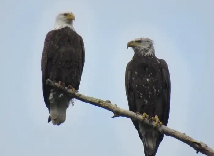
Overview Horseshoe Road Campground is part of the park system scattered along the lower Stanislaus River within the foothills of the Sierra Nevada. The environmental campground boasts quiet, peaceful tent sites situated next to the river’s edge. The scenic recreation areas and river access points are popular for activities such as rafting, picnicking, hiking and much more. Stanislaus River Parks is often referred to as the “string of pearls” since they serve as charming, quiet oasis running through a number of small towns and cities. Recreation The campground offers an excellent base camp for exciting recreation opportunities. The park boasts walking and hiking trails, picnic areas and river access points for fishing and boating. Facilities The campground offers an excellent base camp for exciting recreation opportunities. The park boasts walking and hiking trails, picnic areas and river access points for fishing and boating. Natural Features The campground scenery is a pleasant mix of Fremont cottonwoods, Valley oaks and the occasional Elderberry bush, offering excellent shade with dispersed rays of sunshine. Nearby, grasses, shrubs and seasonal wildflowers fill the open spaces. Wildlife is also plentiful in the park with mule deer, acorn woodpeckers, scrub jays, foxes and squirrels among lots of other fauna. Nearby Attractions Within a short 10 min drive, campers can explore the historic town of Knights Ferry, rich with history of the gold rush era. Within the historic district, lies Knights Ferry Recreation Area, home to the longest covered bridge west of the Mississippi River and a National Historic Landmark dedicated in 2014. The park boasts walking and hiking trails, picnic areas and river access points. Visitors can learn about the area when they visit the Knights Ferry Visitors Center, which contains a small museum highlighting local, natural, and cultural resources. Visitors have a unique opportunity to make reservations with local rafting companies to journey down the Stanislaus River. During the summer months, rafters can enjoy guided and self-guided floats down the lower Stanislaus River. For thrill seekers, the fall season brings perfect flows for advanced white water in the Goodwin Canyon. Fall also brings thousands of Chinook salmon returning to the Stanislaus River to spawn, completing and beginning their lifecycles. Onlookers, can view the spawning salmon from several river access points along the river. Charges & Cancellations Contact Recreation.gov for changes or cancellations.
View details →
Overview Backpackers' Campground is located on the East end of Lake Alpine, CA. All sites are walk-in tent sites. Cars cannot be parked in camp, parking is available on the adjacent street. Backpackers' Campground is located in the Calveras Ranger District, in a timbered setting near several trailheads. Campground may open earlier and close later as weather (snow level) allows. This information will be posted on this page as soon as it becomes available. The current dates for reservations have historically allowed for comfortable camping, but please take into consideration the high alpine location when making a reservation. It is possible to have snow, rain, mud, and overall cold/wet conditions any time of year. Recreation Lake Alpine provides a wide variety of recreational opportunities: fishing, hiking, biking, kayaking, paddle-boarding, boating, OHV trails, swimming, rock climbing, and wildlife watching. Interpretive programs are offered by Forest Service rangers during the summer months. Facilities Lake Alpine provides a wide variety of recreational opportunities: fishing, hiking, biking, kayaking, paddle-boarding, boating, OHV trails, swimming, rock climbing, and wildlife watching. Interpretive programs are offered by Forest Service rangers during the summer months. Natural Features SIlver Valley Campground sits at an elevation of 7,400 feet on the east end of Lake Alpine within the Stanislaus National Forest. The forest lies between Lake Tahoe and Yosemite and boasts gorgeous views. Nearby Attractions A restaurant, bar, general store, and boat rentals can be found at nearby Lake Alpine Lodge. The immediate area is suited for forest and wilderness recreation. A short car ride away is Big Trees State Park, Grover Hot Springs, Mercer Caverns, Mountain Adventure Seminars, and the wine country of Calaveras County.
View details →
Overview Pinon Campground is a mix of first come, first served campsites and reservable group sites. The campground is located across from Juniper Campground and is less than 2 miles from Quemado Lake. For more information, you can visit our website: https://www.fs.usda.gov/recarea/gila/recarea/?recid=1964 Recreation Recreational opportunities include fishing and boating on Quemado Lake, hiking forest and lakeside trails, and RV and tent camping. Facilities Recreational opportunities include fishing and boating on Quemado Lake, hiking forest and lakeside trails, and RV and tent camping. Natural Features Forested / Unrestricted Night Sky Views contact_info For facility specific information, please call (575) 773-4678. Nearby Attractions -El Caso I-3 Campgrounds -El Caso 4 & 5 Campgrounds -Juniper Campground -Quemado Lake and Day Use Area -Boat Ramp at Quemado Lake
View details →
Overview 23 miles east of Placerville on Highway 50 and 31 miles north on Ice House Road (Forest Road 3), take the Loon Lake fork. Recreation Swimming and Fishing Boat Ramp at Loon Lake Campground Picnic Area (5 sites) at the Loon Lake Boat Ramp Rubicon OHV Trail (summer) Hiking and horseback riding in Desolation Wilderness, permits available in Recreation.gov or the Placerville Ranger Station on Highway 50, Exit 54 in Camino. Day use permits area available at the Loon Lake trailhead in the summer and Placerville Ranger Station year‐round. Loon Lake Chalet rental cabin, reservations required. Facilities Swimming and Fishing Boat Ramp at Loon Lake Campground Picnic Area (5 sites) at the Loon Lake Boat Ramp Rubicon OHV Trail (summer) Hiking and horseback riding in Desolation Wilderness, permits available in Recreation.gov or the Placerville Ranger Station on Highway 50, Exit 54 in Camino. Day use permits area available at the Loon Lake trailhead in the summer and Placerville Ranger Station year‐round. Loon Lake Chalet rental cabin, reservations required. Nearby Attractions contact_info For facility specific information, please call (831) 245-6891. Charges & Cancellations Change Fee: A service fee may be charged at the time a modification is made depending on the changes. Cancellation Fee: A $10 service fee will be withheld from any refunds for a cancelled reservation. Cut-Off Window: The latest date and/or time that you can make an advanced reservation or a change to an existing reservation. Cut-off windows can vary by location, but are typically 4 days before your arrival date. A customer who cancels a reservation the day before or on the day of arrival will pay a $10.00 service fee AND forfeit the first night's use fee (see Late Cancellation below). Late Cancellation: If you cancel your reservation too close to the start date, additional service fees may be withheld. Refunds : Refund requests made through www.recreation.gov will be charged a $10 processing fee. This fee is retained by the reservation service contractor along with the non-refundable reservation fee. All requests for the return of the non-refundable reservation fee and the cancellation fee will be declined by the campground concessionaire as they did not receive these fees (these are the fees retained by the reservation contractor, a different entity).
View details →
Overview Blue Ridge campground, located on the north end of Dierks Lake, offers a natural feel with incredible fishing in the flooded timberlands along the Saline River. Situated in the heart of the Howard County Wildlife Management Area this area peaks in spring and fall when fishing and hunting are at their best. Blue Ridge is a local hotspot for camping and fishing, with two boat ramps located right in the heart of crappie country. Recreation Camping Day use Boating Swimming Facilities Camping Day use Boating Swimming Natural Features The 1360-acre lake offers excellent boating, canoeing, kayaking and swimming opportunities. Dierks Lake is known for its excellent bass and crappie fishing. Hunters will find nearly 600 acres of public hunting lands in the upper reaches of the project. Game species include white-tail deer, bobwhite quail, mourning dove, grey and fox squirrel, cottontail rabbit, and a variety of waterfowl. Nearby Attractions A day trip to Crater of Diamonds State Park in Murfreesboro, Arkansas, just 30 miles from the park, is a popular activity. The diamond mine is the only one of its kind in the country, where visitors get to keep any diamonds and semi-precious stones they unearth, regardless of value. Hot Springs National Park known for its naturally headed springs ust an hours drive away offers a multiple bathouses, resturants, and activies. Choctaw nation located just an hour away at Brokenbow offers world class gaming casino as well a variet of natural features and resturants
View details →
Overview Reservations are only allowed on the day of arrival. Overnight occupany is required. Booking a campsite and not arriving will result in a No-Show per the rules and regulations. This location is not staffed by gate attendants. Check in/out with the camphost or via text. West End Tent and Trailer was historically a first come first serve campground. We have mirrored this with the ability to claim your campsite with an online reservation. You can only claim a campsite today for up to 14 nights from today. No advanced reservations are allowed. West End Tent and Trailer Campground is nestled on a hill on the north shore of Fort Peck Lake. The campground features 13 campsites with electrical hook-ups as well as an overflow section. West End Tent and Trailer tends to be quieter than our main campground and is popular with fishermen thanks to its proximity to a few boat ramps. Fort Peck Dam, which impounds Fort Peck Lake is the first dam built in the upper Missouri River Basin. The area surrounding Fort Peck was first charted by Lewis and Clark in 1804, and the pristine natural condition of the river and surrounding area awed the renowned explorers. When President Franklin D. Roosevelt authorized the Fort Peck project in 1933, thousands of people from all over the country migrated to Montana during the midst of the Great Depression in hopes of earning a living. Today, Fort Peck Lake is a sportsman's paradise with excellent fishing, wildlife viewing and other countless outdoor recreation opportunities. Recreation Fort Peck Lake provides almost 400 square miles of recreation opportunities. These include boating, fishing, canoeing, kayaking, and swimming. There are two boat ramps located within two miles of the campground to provide access. The Beaver Creek Nature Area is five miles away and provide three miles of trails to hike and bike on. Fishing: Fort Peck Lake enjoys nationwide recognition as a hot spot for walleye fishing. Fort Peck Lake provides excellent boating and fishing opportunities. The lake also offers excellent fishing for sauger, smallmouth bass, lake trout, chinook salmon and northern pike. The introduction of cisco as a forage fish in 1983 proved successful and has increased both the size and number of game fish. Wildlife Viewing/Hunting: The Fort Peck Lake Area and the Charles M. Russell Wildlife Refuge provide superb hunting of deer, elk, big horn sheep, and prong horn. The Missouri River Breaks are known for producing large elk and other game animals. Facilities Fort Peck Lake provides almost 400 square miles of recreation opportunities. These include boating, fishing, canoeing, kayaking, and swimming. There are two boat ramps located within two miles of the campground to provide access. The Beaver Creek Nature Area is five miles away and provide three miles of trails to hike and bike on. Fishing: Fort Peck Lake enjoys nationwide recognition as a hot spot for walleye fishing. Fort Peck Lake provides excellent boating and fishing opportunities. The lake also offers excellent fishing for sauger, smallmouth bass, lake trout, chinook salmon and northern pike. The introduction of cisco as a forage fish in 1983 proved successful and has increased both the size and number of game fish. Wildlife Viewing/Hunting: The Fort Peck Lake Area and the Charles M. Russell Wildlife Refuge provide superb hunting of deer, elk, big horn sheep, and prong horn. The Missouri River Breaks are known for producing large elk and other game animals. Natural Features The campground is located on a hill overlooking Fort Peck Lake. Most campsites provide at least a partial view of the lake. It is not uncommon to see deer visit the campground in the evening. The location provides a great view of thunderstorms as they pass over the lake from the safety of a camper. contact_info For facility specific information, please call (406) 526-3411. Nearby Attractions Fort Peck Lake is a Montana treasure for its vast size and outdoor recreation opportunities. Six recreation areas within a few miles of the dam provide access for water sports, fishing and hunting. The Fort Peck Interpretive Center and Museum is located just downstream of Fort Peck Dam. For more information, call 406-526-3411. Tours of the Fort Peck Powerhouse are regulalry scheduled, call 406-526-3411 for more information. The Leo B. Coleman Wildlife Pasture , located just outside the Town of Fort Peck and Downstream Campground is home to Fort Peck's Bison herd and provides an excellent wildlife viewing auto route. The Historic Fort Peck Theater is located in the town of Ft. Peck is a popular historic destination in summer months. The 1.1 million acre Charles M. Russell National Wildlife Refuge surrounds Fort Peck Lake and helps preserve the natural habitat for numerous wildlife species. Charges & Cancellations Reservation changes and cancellations can be made on Recreation.gov or by calling 1-877-444-6777. For more information on rules and policies regarding reservation cancellations and changes, please visit: https://www.recreation.gov/rules-reservation-policies .
View details →
Overview Beard's Lake Park is located off of River Run East access on Highway 32 E, approximately 12 miles northeast of Ashdown, in southwest Arkansas. Recreation Visitors to this area enjoy fishing, duck hunting and relaxing in this peaceful campground. This area affords a great diversity of fish and wildlife habitat. Millwood Lake is one of the top fishing lakes in the country. Some 20,000 acres of submerged timber provide excellent fish habitat for a wide variety of fish including crappie, largemouth, white striped and spotted bass, channel and flathead catfish, bluegill, sunfish, buffalo carp and drum. Facilities Visitors to this area enjoy fishing, duck hunting and relaxing in this peaceful campground. This area affords a great diversity of fish and wildlife habitat. Millwood Lake is one of the top fishing lakes in the country. Some 20,000 acres of submerged timber provide excellent fish habitat for a wide variety of fish including crappie, largemouth, white striped and spotted bass, channel and flathead catfish, bluegill, sunfish, buffalo carp and drum. Natural Features Beard's Lake Park is located on Beard's Lake; an oxbow lake located adjacent to the Little River, below Millwood Dam. Open fields, swampy grasslands, thick hardwood forests, and an abundance of fresh water has created one of the most unique and diverse habitats in the southern part of the country. Nearby Attractions Nearby towns include Nashville, AR, Ashdown, AR and Texarkana, TX. contact_info For facility specific information, please call (870) 898-3343.
View details →
Overview Fawn Creek is a designated youth group campground, available only to organized youth groups . For more information or determine if your youth group qualifies please contact the Refuge Visitor's Center at 580-429-3222, before making a reservation. Examples of quilified groups: Boy Scouts Girl Scouts Church Youth Groups School Groups Civic Youth Groups University Organizations and Clubs Worn by time and nature, the Wichita Mountains loom large above the prairie in southwest Oklahoma—a lasting refuge for wildlife. Situated just outside the Lawton/Ft. Sill area, Wichita Mountains Wildlife Refuge preserves approximately 60,000 acres of mixed grass prairie, ancient granite mountains, and fresh water lakes and streams for the benefit of wildlife and the American people. Best known for its roaming herds of bison, longhorn, and Rocky Mountain elk, Wichita Mountains also offers quality opportunities for wildlife dependent recreation including fishing, bird watching, wildlife photography, hiking, camping, and kayaking. Recreation Fawn Creek Youth Campground is a primative campground, reserved for organized youth groups located on the west side of the Wichita Mountains Wildlife Refuge. Fawn Creek is within walking distance of quality fishing, canoeing, kayaking, and hiking. The Dog Run Hollow Trail System trailheads and French Lake offer visitors hours of outdoor recreational activities. Facilities Fawn Creek Youth Campground is a primative campground, reserved for organized youth groups located on the west side of the Wichita Mountains Wildlife Refuge. Fawn Creek is within walking distance of quality fishing, canoeing, kayaking, and hiking. The Dog Run Hollow Trail System trailheads and French Lake offer visitors hours of outdoor recreational activities. Natural Features Explore ancient granite mountains. Find yourself in a cedar forest. Dare to discover wide open spaces and fresh water lakes meant to support wildlife like the American bison and Rocky Mountain elk. Fish. Hike. Photograph. Immerse yourself in the wild. Nearby Attractions Wichita Mountains Wildlife Refuge encompasses roughly 60,000 acres. Fawn Creek Youth Campground offers visitors opportunities to explore all areas of the refuge with a short drive. Head up Mount Scott or hang out at Prairie Dog Town. Bring your fishing pole, a set of binoculars, or your camera. The possibilities are endless.
View details →
Overview South Abutment East sits upstream of Bayou Bodcau Dam. The small quiet campground is a Class B campground, and is open year-round to visitors. Bodcau Creek and Reservoir provides fishing and boating opportunities, along with hiking/biking trails and other recreation. Bayou Bodcau is a large wildlife management area, and is very popular during hunting season for deer and other wild game. Downtown Bossier City and Shreveport are only a 30-45 minute drive away, and have many opportunities for other interests such as museums and restaurants. Bodcau is well off the main travel roads, so traffic and other noise issues are of no concern. The campground has no designated fee booth and is by-reservation-only, so all reservations must be made through recreation.gov. Reservations can be made up to 6 months in advance or upon arrival; we recommend reserving prior to entering the campground. For more information on Bayou Bodcau, please visit the following website. (https://www.mvk.usace.army.mil/Missions/Recreation/Bayou-Bodcau/) Recreation South Abutment East offers visitors many recreation opportunities. Within the immediate recreation area, a boat ramp gives access to Bayou Bodcau Reservoir; a life jacket loaner station is available free of charge. A mountain bike/hiking trail starts just across the street in Tom Merrill Recreation area. The trail system loops back and forth and is approximately 7 miles long. A playground/exercise area is located just outside the campground and within walking distance. Additionally, there is a large picnic shelter which can be rented out for special events. Water activities, such as boating, kayaking/canoing and fishing are available on both sides of the dam. Gravel boat ramps allow for small boats to put in on either side. The Bayou is home to numerous fish species including Black Bass, Spotted Bass, Crappie, Catfish, Buffalo, Carp, Gar, Bowfin and various species of bream and sunfish. Hunting is available in the wildlife management areas around the project during regular hunting season. Numerous game species can be hunted, including squirrel, rabbits, dove, quail and other species of small game, deer, turkey, and waterfowl. For the non-consumptive users, bird watching is a common recreational activity with the opportunity to observe non-game species such as great blue herons, several species of hawks, and owls. Yellow, black and white, yellow-throated, magnolia, prairie and yellow-rumped warblers are birds regularly seen on the area. Numerous species of reptiles, amphibian and insects can also be studied. The Louisiana Dept. of Wildlife & Fisheries operates a free rifle range on the area. The range is 200 yards long and has covered rests for shooting. The range can accommodate rifles, handguns, shot guns and archery. It is supervised by an approved Range Officer and is open to the public on regularly scheduled days. Targets, sand bags and ear plugs are provided. Finally, the John Haygood Nature Trail is located near the Durden House Environmental Education Center and consists of a .75 mile paved trail. The Durden House is a historical site, and Rangers can provide interpretive opportunities with special emphasis on history, cultural resources, natural resources, water safety, and environmental education. Facilities South Abutment East offers visitors many recreation opportunities. Within the immediate recreation area, a boat ramp gives access to Bayou Bodcau Reservoir; a life jacket loaner station is available free of charge. A mountain bike/hiking trail starts just across the street in Tom Merrill Recreation area. The trail system loops back and forth and is approximately 7 miles long. A playground/exercise area is located just outside the campground and within walking distance. Additionally, there is a large picnic shelter which can be rented out for special events. Water activities, such as boating, kayaking/canoing and fishing are available on both sides of the dam. Gravel boat ramps allow for small boats to put in on either side. The Bayou is home to numerous fish species including Black Bass, Spotted Bass, Crappie, Catfish, Buffalo, Carp, Gar, Bowfin and various species of bream and sunfish. Hunting is available in the wildlife management areas around the project during regular hunting season. Numerous game species can be hunted, including squirrel, rabbits, dove, quail and other species of small game, deer, turkey, and waterfowl. For the non-consumptive users, bird watching is a common recreational activity with the opportunity to observe non-game species such as great blue herons, several species of hawks, and owls. Yellow, black and white, yellow-throated, magnolia, prairie and yellow-rumped warblers are birds regularly seen on the area. Numerous species of reptiles, amphibian and insects can also be studied. The Louisiana Dept. of Wildlife & Fisheries operates a free rifle range on the area. The range is 200 yards long and has covered rests for shooting. The range can accommodate rifles, handguns, shot guns and archery. It is supervised by an approved Range Officer and is open to the public on regularly scheduled days. Targets, sand bags and ear plugs are provided. Finally, the John Haygood Nature Trail is located near the Durden House Environmental Education Center and consists of a .75 mile paved trail. The Durden House is a historical site, and Rangers can provide interpretive opportunities with special emphasis on history, cultural resources, natural resources, water safety, and environmental education. Natural Features Bayou Bodcau is 33,500 acres of public land, much of which consists of moss-laden cypress swamps. The area also consists of lowland and upland areas, consisting of mixed deciduous or pine forests. Bayou Bodcau is considered a "dry reservoir", and only fills up during periods of high rainfall. The creek can be slow moving and almost stagnant during the dry summer, but a swift and deep torrent during the cooler winter. The area is home to a diverse group of natural areas, and hosts some rare and endangered species. Alligators, beaver and more can be found amongst the forest and swamps. Cypress Swamps, Bottomland Forests, Morse Clay Calcareous Prairies and more can be found within the project boundaries. The project is also home to some of the largest trees in the state, and such "Champion Trees" have been found and recorded at multiple locations throughout the park. Bodcau is also home to 500 acre Ivan Lake, which is a small but well-maintained lake for fishing and boating. The lake is known to be popular with local fisherman, and wildlife such as Bald Eagles can be spotted there. Nearby Attractions There are many other nearby attractions including Tom Merrill Recreation Area, the Durden House, the Rifle Range, a Horse Camp and Horse Trails, ATV/UTV Trails, and Ivan Lake. Ivan Lake is a small local lake well known for fishing, boating and birding. Bossier City and Shreveport are within 30 to 45 minutes drive of the campground. The area consists of many different attractions, including museums, a minor league Hockey team, and Barksdale Air Force Base, which has a small museum attached to it. Bossier City also has a large Convention Center where events are often held. There's also other natural attractions, including Red River Wildlife Refuge in Bossier City. Charges & Cancellations Last minute changes and cancellations may be subject to additional fees.
View details →
Overview Tom Merrill Recreation Area sits downstream of Bayou Bodcau Dam, along the Bodcau Creek. The small quiet campground provides all the facilities of a Class A campground, and is open year-round to visitors. Bodcau Creek provides fishing and boating opportunities, along with hiking/biking trails and other recreation. Bayou Bodcau is a large wildlife management area, and is very popular during hunting season for deer and other wild game. Downtown Bossier City and Shreveport are only a 30-45 minute drive away, and have many opportunities for other interests such as museums and restaurants. Bodcau is well off the main travel roads, so traffic and other noise issues are of no concern. The campground has no designated fee booth and is by-reservation-only, so all reservations must be made through recreation.gov. Reservations can be made up to 6 months in advance or upon arrival; we recommend reserving prior to entering the campground. For more information on Bayou Bodcau, please visit the following website. (https://www.mvk.usace.army.mil/Missions/Recreation/Bayou-Bodcau/) Natural Features Bayou Bodcau is 33,500 acres of public land, much of which consists of moss-laden cypress swamps. The area also consists of lowland and upland areas, consisting of mixed deciduous or pine forests. Bayou Bodcau is considered a "dry reservoir", and only fills up during periods of high rainfall. The creek can be slow moving and almost stagnant during the dry summer, but a swift and deep torrent during the cooler winter. The area is home to a diverse group of natural areas, and hosts some rare and endangered species. Alligators, beaver and more can be found amongst the forest and swamps. Cypress Swamps, Bottomland Forests, Morse Clay Calcareous Prairies and more can be found within the project boundaries. The project is also home to some of the largest trees in the state, and such "Champion Trees" have been found and recorded at multiple locations throughout the park. Bodcau is also home to 500 acre Ivan Lake, which is a small but well-maintained lake for fishing and boating. The lake is known to be popular with local fisherman, and wildlife such as Bald Eagles can be spotted there. Nearby Attractions There are many other nearby attractions including South Abundant East Recreation Area, the Durden House, the Rifle Range, a Horse Camp and Horse Trails, ATV/UTV Trails, and Ivan Lake. Ivan Lake is a small local lake well known for fishing, boating and birding. Bossier City and Shreveport are within 30 to 45 minutes drive of the campground. The area consists of many different attractions, including museums, a minor league Hockey team, and Barksdale Air Force Base, which has a small museum attached to it. Bossier City also has a large Convention Center where events are often held. There's also other natural attractions, including Red River Wildlife Refuge in Bossier City. Charges & Cancellations Last minute changes and cancellations may be subject to additional fees.
View details →
Overview Wenks Landing sits upstream of Bayou Bodcau Dam, alongside Bayou Bodcau. The small quiet campground is a Class B campground, and is open year-round to visitors. Bodcau provides fishing and boating opportunities, along with hiking/biking trails and other recreation. Bayou Bodcau is a large wildlife management area, and is very popular during hunting season for deer and other wild game. The small towns of Cotton Valley and Sarepta are close by, and the larger town of Springhill can provide most immediate needs. Downtown Bossier City and Shreveport are only a 1 hour drive away, and have many opportunities for other interests such as museums and restaurants. Bodcau is well off the main travel roads, so traffic and other noise issues are of no concern. The campground has no designated fee booth and is by-reservation-only, so all reservations must be made through recreation.gov. Reservations can be made up to 6 months in advance or upon arrival; we recommend reserving prior to entering the campground. For more information on Bayou Bodcau, please visit the following website. (https://www.mvk.usace.army.mil/Missions/Recreation/Bayou-Bodcau/) Natural Features Bayou Bodcau is 33,500 acres of public land, much of which consists of moss-laden cypress swamps. The area also consists of lowland and upland areas, consisting of mixed deciduous or pine forests. Bayou Bodcau is considered a "dry reservoir", and only fills up during periods of high rainfall. The creek can be slow moving and almost stagnant during the dry summer, but a swift and deep torrent during the cooler winter. The area is home to a diverse group of natural areas, and hosts some rare and endangered species. Alligators, beaver and more can be found amongst the forest and swamps. Cypress Swamps, Bottomland Forests, Morse Clay Calcareous Prairies and more can be found within the project boundaries. The project is also home to some of the largest trees in the state, and such "Champion Trees" have been found and recorded at multiple locations throughout the park. Bodcau is also home to 500 acre Ivan Lake, which is a small but well-maintained lake for fishing and boating. The lake is known to be popular with local fisherman, and wildlife such as Bald Eagles can be spotted there. Nearby Attractions Ivan Lake is a nearby attraction, and provides for additional boating, fishing and animal viewing opportunities. Ivan Lake is not directly accessible by boat, and must be removed from Bayou Bodcau and re-launched at Ivan. Muddy Bottoms ATV Park is located just up the road in Springhill. Leaving Wenk's Landing, heading left towards Serepta, you will find a delicious local bakery called A Piece of Heaven Cakery, this stop is a must if you have a sweet tooth! About 5 miles south of the recreation facility, there is a nice gas station in Cotton Valley that serves breakfast, lunch and dinner. In addition, they sell any supplies you may need for your camping trip. There is also a Family Dollar right across the street. About 5 miles north of the recreation facility, is the town of Sarepta where you will find some great local restaurants! Charges & Cancellations Last minute changes and cancellations may be subject to additional fees.
View details →
Overview Juniper Campground is Quemado Ranger District's most popular campground. It offers electric RV hookups (no water, no sewer), leveled tent sites, and easy lake access. This campground is a mix of first come, first served sites and reservable sites. For more information, you can visit our website: https://www.fs.usda.gov/recarea/gila/recarea/?recid=1964 Recreation Recreational opportunities include fishing and boating on Quemado Lake, hiking forest and lakeside trails, and RV and tent camping. Facilities Recreational opportunities include fishing and boating on Quemado Lake, hiking forest and lakeside trails, and RV and tent camping. Natural Features Lake Access/ Forested / Unrestricted Night Sky Views contact_info For facility specific information, please call (575) 773-4678. Nearby Attractions El Caso I-3 Campgrounds El Caso 4 & 5 Campgrounds Piñon Campground Quemado Lake and Day Use Area Boat Ramp at Quemado Lake Charges & Cancellations Cancellation Policy: A customer who cancels a reservation the day before or the day of arrival will pay a $10.00 service fee AND forfeit the first night's use fee (not to exceed the total paid for the original reservation). Cancellations for a one-night reservation will forfeit the entire amount paid and will not be subject to an additional service fee.
View details →
Overview Saratoga Park is a beautiful, quiet campground located on the east side of Millwood Lake. Recreation Visitors to this area enjoy fishing, duck hunting, and relaxing in this peaceful campground. This area affords a great diversity of fish and wildlife habitat. Millwood Lake is one of the top fishing lakes in the country. Facilities Visitors to this area enjoy fishing, duck hunting, and relaxing in this peaceful campground. This area affords a great diversity of fish and wildlife habitat. Millwood Lake is one of the top fishing lakes in the country. Natural Features Saratoga Park is located in a dense grove of hardwood trees on the east side of Millwood Lake, within walking distance of the Blackland Prairie. The area is beautiful, quiet, and shaded with campsite views looking out across Millwood Lake. Nearby Attractions Nearby towns include Ashdown and Nashville, Arkansas and Texarkana, Texas.
View details →
Overview Redbud Bay Campground is located on Oologah Lake, less than 30 miles from Tulsa. prevailing winds make Oologah Lake one of the most popular lakes in the area for sailing. Recreation Oologah Lake is a prime location for boating, sailing water skiing and swimming. Oologah offers several boat ramps and docks around the lake. Facilities Oologah Lake is a prime location for boating, sailing water skiing and swimming. Oologah offers several boat ramps and docks around the lake. Natural Features Oologah Lake sits on the Verdigris River with a surface area of nearly 30,000 acres. Over 200 miles of shoreline are domintaed by old-growth post oak, and blackjack oak forests, which provide habitat fo a variety of wildlife and birds, including deers, turkey, rabbits, quail, squirrels, ducks, geese and doves. Nearby Attractions Dog Iron Ranch, the birthplace of Will Rogers, is nearby. The ranch is a living history museum featuring Rogers' two-story post-Civil War birth home, educational programs, picnic areas and a 400-acre pasture on the lake shore with Texas Longhorn Cattle and other livestock. The ranch is open year-round.
View details →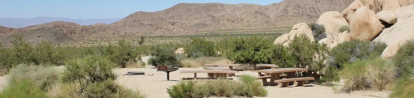
Overview Download the NPS app prior to visiting the park – trail maps and more! Indian Cove Campground lies amid the huge, steep rock formations for which Joshua Tree National Park is known. Because of its proximity to many rock climbing routes, it is a popular camping location for climbers. Indian Cove Group is one of three group campgrounds in the park that can be reserved year round. To get the most out of your visit Plan Like a Park Ranger Travelers who enjoy warm, dry winters flock to Joshua Tree from October through May, when temperatures hover between 70-90 degrees during the day and drop to a 40-60 degree range at night. Summer is the park's off-season due to the uncomfortably-high desert heat. Indian Cove is at an elevation of 3,200 feet. Recreation Rock climbers flock to Indian Cove Campground for the variety of routes and warmer temperatures that can be found in the interior of the park. Several hiking trails also leave from the campground. There is a short interpretive nature trail and plenty of rocks for the non-climber to explore within the facility. Clear desert skies are perfect for star-gazing and night photography. Facilities Rock climbers flock to Indian Cove Campground for the variety of routes and warmer temperatures that can be found in the interior of the park. Several hiking trails also leave from the campground. There is a short interpretive nature trail and plenty of rocks for the non-climber to explore within the facility. Clear desert skies are perfect for star-gazing and night photography. Natural Features Campsites are nestled on a flat, sandy surface between large boulders that tower in unique shapes over the campground and rise up from the otherwise uniform desert landscape. The rocks were formed by volcanic activity millions of years ago and have been exposed and shaped by wind and water over time. They brighten with soft pastel hues during the morning and evening sunlight and glow with campfire light by night. Visitors may want to keep their eyes out for typical desert inhabitants such as lizards, rattlesnakes, scorpions, ravens, squirrels and desert tarantulas during the cooler months of the year. Bobcats and mountain lions do live in the park, however they are rarely seen near humans. Charges & Cancellations Individual Site: A $10.00 service fee will apply if you change your reservation. Cancellations more than 48 hours in advance of arrival date incur a $10 cancellation fee. Within 48 hours of arrival, a $10 cancellation fee and the first night's fee are charged. Group Site: Customers who cancel a group overnight reservation less than 14 days before the arrival date will pay a $10.00 service fee AND forfeit the first night's use fee. No-Shows Overnight Facilities: A no-show customer is one who does not arrive at a campground and does not cancel the reservation by check-out (noon) time on the day after the scheduled arrival date. Staff will hold a campsite until check-out time (noon) on the day following the arrival date. No-shows are assessed $20.00 service fee and forfeit the first night’s recreation fee for a campsite. *Note: the entire reservation will be cancelled for no-shows.
View details →
Overview Pat Mayse East Campground is on the banks of Pat Mayse Lake in the Red River Basin in Lamar County, Texas. Easy access to developed park areas has made the lake a haven for families who enjoy camping, picnicking, swimming, boating, fishing and other outdoor recreation. Recreation The lake provides excellent opportunities for boating, swimming and fishing. Anglers fish for largemouth bass, white crappie, sunfish, striped bass and channel and flathead catfish, among other species. Hunting is a very popular activity in the area. The surrounding lands are managed for upland game and whitetail deer. Other species present include fox squirrel, gray squirrel, bobwhite quail, mourning dove, cottontail rabbit, raccoon and fox. Opossum, beaver, mink, skunk and nutria are also present. The lake also provides resting and feeding habitat for migratory waterfowl. A few miles north of the project area are the famed Red River Bottoms where waterfowl congregate in impressive numbers. Equestrian trails are available right next to the campground. Facilities The lake provides excellent opportunities for boating, swimming and fishing. Anglers fish for largemouth bass, white crappie, sunfish, striped bass and channel and flathead catfish, among other species. Hunting is a very popular activity in the area. The surrounding lands are managed for upland game and whitetail deer. Other species present include fox squirrel, gray squirrel, bobwhite quail, mourning dove, cottontail rabbit, raccoon and fox. Opossum, beaver, mink, skunk and nutria are also present. The lake also provides resting and feeding habitat for migratory waterfowl. A few miles north of the project area are the famed Red River Bottoms where waterfowl congregate in impressive numbers. Equestrian trails are available right next to the campground. Natural Features Pat Mayse Lake covers almost 6,000 acres and has 67 miles of shoreline. It is situated among gently rolling grasslands and mixed hardwood forests studded with mature pines. Wildlife is abundant in the surrounding area.
View details →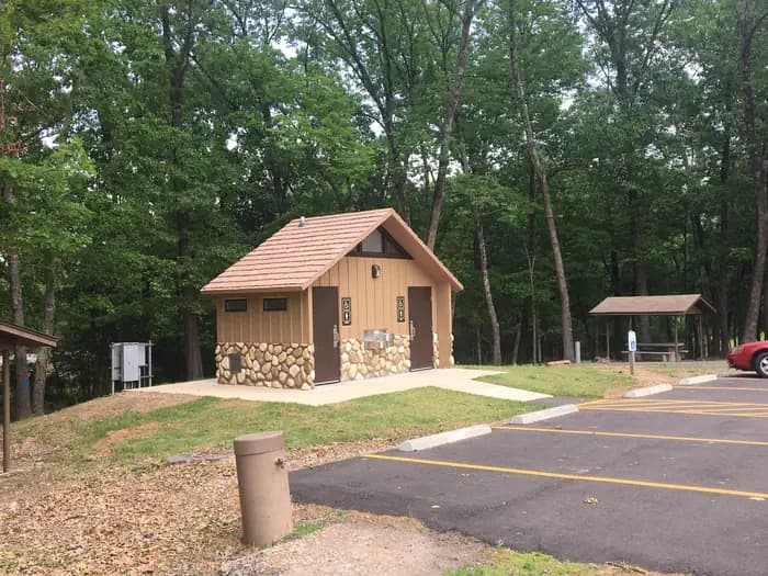
Overview Download a Spadra park map HERE Beautiful campground on the Arkansas river providing excellent opportunities for recreation, boating, fishing, and watefowl viewing. Recreation This quaint park offers great opportunities for fishing and has an excellent day use area with multiple picnic areas. Campsites with available electric and water, boat launching ramps, and an adjacent marina make recreating easy. Facilities This quaint park offers great opportunities for fishing and has an excellent day use area with multiple picnic areas. Campsites with available electric and water, boat launching ramps, and an adjacent marina make recreating easy. Natural Features Sitting next to the Arkansas River, a major interstate waterway, this park is an excellent entry to Little Spadra Creek and Higskin Creek. Nearby Attractions A short drive into the nearby city of Clarksville, Arkansas provides ample shopping opportunities. A marina is also close by for the last minute boating and fishing needs.
View details →
Overview Cherokee Park is located on Greers Ferry Lake in the beautiful Ozark Mountains of north-central Arkansas. The environment provides the ideal location for family camping, fishing, boating and hiking. Recreation Greers Ferry Lake is an outdoor enthusiasts' dream, with boating, sailing, water skiing, swimming, scuba diving and fishing opportunities. Hikers enjoy the area's three National Nature Trails and one multi-purpose fitness trail. Facilities Greers Ferry Lake is an outdoor enthusiasts' dream, with boating, sailing, water skiing, swimming, scuba diving and fishing opportunities. Hikers enjoy the area's three National Nature Trails and one multi-purpose fitness trail. Natural Features A dense mix of red cedar, black gum, red oak, elm, pecan and sweet gum trees forest the area, providing shade in the summer months and beautiful fall colors in autumn. Wildlife is plentiful around Greers Ferry Lake. Visitors commonly see white-tailed deer, wild turkeys, rabbits, squirrels and a wide variety of birds. contact_info This location is unstaffed. To speak with our main office for general information, please call: (501) 362-2416. Nearby Attractions With over 30,000 acres of water surface, the lake serves as a playground for all kinds of water sports. Eighteen parks around the shoreline provide modern campgrounds, boat ramps, swim areas and marinas. The William Carl Garner Visitor Center is just west of the dam, with exhibits, a children's touch table, and a replica of the world record 40 lb. 4 oz. brown trout caught in the Little Red River downstream of the center.
View details →
Overview Cove Creek Park is located on Greers Ferry Lake in the beautiful Ozark Mountains of north-central Arkansas. The environment provides the ideal location for family camping, fishing, boating and hiking. Recreation Greers Ferry Lake is an outdoor enthusiasts' dream, with boating, sailing, water skiing, swimming, scuba diving and fishing opportunities. Hikers enjoy the area's three National Nature Trails and one multi-purpose fitness trail. The William Carl Garner Visitor Center is just west of the dam, with exhibits, a children's touch table, and a replica of the world record 40 lb. 4 oz. brown trout caught in the Little Red River downstream of the center. Facilities Greers Ferry Lake is an outdoor enthusiasts' dream, with boating, sailing, water skiing, swimming, scuba diving and fishing opportunities. Hikers enjoy the area's three National Nature Trails and one multi-purpose fitness trail. The William Carl Garner Visitor Center is just west of the dam, with exhibits, a children's touch table, and a replica of the world record 40 lb. 4 oz. brown trout caught in the Little Red River downstream of the center. Natural Features A dense mix of red cedar, black gum, red oak, elm, pecan and sweet gum trees forest the area, providing shade in the summer months and beautiful fall colors in autumn. Wildlife is plentiful around Greers Ferry Lake. Visitors commonly see white-tailed deer, wild turkeys, rabbits, squirrels and a wide variety of birds. Nearby Attractions With over 30,000 acres of water surface, the lake serves as a playground for all kinds of water sports. Eighteen parks around the shoreline provide modern campgrounds, boat ramps, swim areas and marinas. contact_info For local information, please call (501) 589-3568 or call (501) 362-2416 for general information.
View details →
Overview Mill Creek Park is located on Greers Ferry Lake in the beautiful Ozark Mountains of north-central Arkansas. The environment provides the ideal location for family camping, fishing, boating and hiking. Recreation Greers Ferry Lake is an outdoor enthusiasts' dream, with boating, sailing, water skiing, swimming, scuba diving and fishing opportunities. Hikers enjoy the area's three National Nature Trails and one multi-purpose fitness trail. The William Carl Garner Visitor Center is just west of the dam, with exhibits, a children's touch table, and a replica of the world record 40 lb. 4 oz. brown trout caught in the Little Red River downstream of the center. Facilities Greers Ferry Lake is an outdoor enthusiasts' dream, with boating, sailing, water skiing, swimming, scuba diving and fishing opportunities. Hikers enjoy the area's three National Nature Trails and one multi-purpose fitness trail. The William Carl Garner Visitor Center is just west of the dam, with exhibits, a children's touch table, and a replica of the world record 40 lb. 4 oz. brown trout caught in the Little Red River downstream of the center. Natural Features A dense mix of red cedar, black gum, red oak, elm, pecan and sweet gum trees forest the area, providing shade in the summer months and beautiful fall colors in autumn. Wildlife is plentiful around Greers Ferry Lake. Visitors commonly see white-tailed deer, wild turkeys, rabbits, squirrels and a wide variety of birds. contact_info This location is unstaffed. To speak with our main office for general information, please call: (501) 362-2416. Nearby Attractions With over 30,000 acres of water surface, the lake serves as a playground for all kinds of water sports. Eighteen parks around the shoreline provide modern campgrounds, boat ramps, swim areas and marinas.
View details →
Overview Download the NPS app prior to visiting the park – trail maps and more! Ryan Campground lies amid the huge, steep rock formations for which Joshua Tree National Park is known. In close proximity to many boulders and rock formations, it is a popular camping location for families with kids. Ryan Campground is one of four campgrounds in the park that requires reservations year-round. To get the most out of your visit Plan Like a Park Ranger Travelers who enjoy warm, dry winters flock to Joshua Tree from October through May, when temperatures hover between 70-90 degrees during the day and drop to a 40-60 degree range at night. Summer is the park's off-season due to the uncomfortably-high desert heat. Ryan is at an elevation around 4,400 feet. Recreation Several hiking trails also leave from the campground. There are plenty of rocks and Ryan Mountain to explore outside the facility. Clear desert skies are perfect for star-gazing. Facilities Several hiking trails also leave from the campground. There are plenty of rocks and Ryan Mountain to explore outside the facility. Clear desert skies are perfect for star-gazing. Natural Features Campsites are nestled on a flat, sandy surface between large boulders that tower in unique shapes over the campground and rise up from the otherwise uniform desert landscape. The rocks were formed by volcanic activity millions of years ago and have been exposed and shaped by wind and water over time. They brighten with soft pastel hues during the morning and evening sunlight and low with campfire light by night. Visitors may want to keep their eyes out for typical desert inhabitants such as lizards, rattlesnakes, scorpions, ravens, squirrels and desert tarantulas during the cooler months of the year. Bobcats and mountain lions do live in the park, however they are rarely seen near humans. Nearby Attractions Cape Rock, Ryan Mountain, and Hidden Valley Charges & Cancellations Reservation Cancellations & Changes Cancelling a Reservation: Customers may cancel their reservation prior to arrival both on-line and through the call center. A $10 service fee will be withheld from any refund for a cancellation. Depending on when you cancel in relation to your arrival day, it may be considered a late cancellation (see below). Changing an Existing Reservation: When changes are made prior to the cut-off window: If a customer wants to switch dates that are entirely outside of the original reservation dates, there is a $10 change fee. There is no change fee if a customer extends or shortens a reservation, as long as the change includes dates from the original reservation. If they choose to depart early, they may forfeit the recreation fee for the day of departure. There is no change fee if the customer wants to switch sites that are the same price with the same reservation dates in the same facility. If a reservation is made that includes dates beyond the maximum booking window, that reservation cannot be changed until 18 days have passed from the original booking date. Late Cancellations or Cancellations within the Cut-off Window Individual Campsites: A customer who cancels a reservation the day before or on the day of arrival will pay a $10.00 service fee AND forfeit the first night's use fee (not to exceed the total paid for the original reservation). Cancellations for a one-night reservation will forfeit the entire amount paid and will not be subject to an additional service fee. Changes or Cancellations within the Cut-off Window: Once a reservation date has begun, customers cannot change a reservation using the online system or through the Call Center (see below for early departures). If the location is staffed, on-site personnel may or may not be able to assist with changes or cancellations (check with local staff). No-Shows Overnight Facilities: A no-show customer is one who does not arrive at a campground and does not cancel the reservation by check-out (noon) time on the day after the scheduled arrival date. Staff will hold a campsite until check-out time (noon) on the day following the arrival date. No-shows are assessed $20.00 service fee and forfeit the first night’s recreation fee for a campsite. *Note: the entire reservation will be cancelled for no-shows.
View details →
Overview Paint Creek Recreation Area (elevation 1760 feet) is located in Greene County in a mountain cove along Paint Creek. A majority of the widely-spaced campsites have streamside views and are screened by a variety of native plants, including rhododendron, hemlock and laurel. Be Bear Wise: Food storage compliance is strictly enforced. Store all food and trash in hard-sided containers and vehicles while not in use. Never have attractants in your tent. Violations of the food storage order are ticketable offenses and subject to fines. Food and trash left unattended will be impounded by campground staff. Recreation Recreation opportunities abound along the Paint Creek corridor. Paint Creek is a popular stream for swimming, wading and fly fishing. TWRA stocks Paint Creek with Rainbow trout throughout the summer. Warm water fishing is a short drive away at Paint Creek Pond. Two hiking trails begin within walking distance of the campground: Paint Mountain Trail (#7) and Paint Creek Trail (#10). Bike riding along the Paint Creek corridor to Hot Springs, NC is becoming a favorite pastime. Several scenic auto loops can begin at Paint Creek campground. Facilities Recreation opportunities abound along the Paint Creek corridor. Paint Creek is a popular stream for swimming, wading and fly fishing. TWRA stocks Paint Creek with Rainbow trout throughout the summer. Warm water fishing is a short drive away at Paint Creek Pond. Two hiking trails begin within walking distance of the campground: Paint Mountain Trail (#7) and Paint Creek Trail (#10). Bike riding along the Paint Creek corridor to Hot Springs, NC is becoming a favorite pastime. Several scenic auto loops can begin at Paint Creek campground. Natural Features Waterfalls: Kelly, Dudley and Ricker Falls can be seen from Forest Road 41 along Paint Creek. Cascades: 15 feet each. Paint Creek Pond: Among the cattails and other aquatic plants, watch for beavers and listen for frog calls. In the early morning, watch mist rise from the placid surface of the pond. The pond is an easy drive or bicycle ride from Paint Creek Campground. contact_info Nearby Attractions French Broad River: Class I-III rapids. A popular commercial section runs 13 miles from Hot Springs, North Carolina, to Del Rio, Tennessee, with local rafting services. Scenic drives along Paint Creek Corridor with Hot Springs Loops - Meander along 5-mile Paint Creek Corridor to historic Paint Rock. Stop for a picnic, check out scenic waterfalls or splash in the ripples along the way. Extend your trip by travelling along French Broad River via River Road to the community of Hot Springs, North Carolina. Two overmountain routes will bring you back to Paint Creek: From Hot Springs, take US 25/70 west to TN 107 to Forest Road 54. Catch scenic mountain vistas along this winding gravel road that intersects Forest Road 41 near Paint Rock. From Hot Springs, take US 25/70 east to Forest Road 467 and wind through Pisgah National Forest to Hurricane Gap. Forest Road 31 brings you back to Paint Creek at Moses Turn trailhead. Take a side trip at Hurricane Gap to Pisgah National Forest’s Rich Mountain Firetower or catch the Appalachian National Scenic Trail #1.
View details →
Overview Enjoy nature at its finest. Located at the entrance of Bussey Point wilderness recreation area- a 2,545 acre peninsula on J. Strom Thurmond Lake- the campground provides a relaxing getaway for the nature enthusiast for hiking, mountain biking, or horseback riding. The Bussey Point horse trail was created by horseback riders for horseback riders. This trail circles the peninsula and is 12.5 miles long. Along with the horse trail, there are an additional 20 miles of roads and trails located within the area that all are welcome to use (no motor vehicles please). Located within the area are 15 food plots, six hike/bike/ride/boat in camping/picnic sites, and several natural beaches. Ample deer and turkey inhabit the area along wiht other mammals and birds to provide one of the best opportunities on the lake to view wildlife in its natural setting. Adjacent to the area is the campground with 14 primitive campsites without water or electic, however, there are picnic tables, fire rings, and grills located at each site. There is also a boat launching ramp, hand pump for non-potable water, and rustic toilets locatd throughout the area. Recreation The area has 12.5 miles of equestrian trails that cross through the adjacent wilderness recration area. There is a boat launching ramp on site. Thurmond Lake provides some of the best fishing, hunting, and water sports in the southeastern United States. Anglers fish for largemouth bass, bream, crappie, catfish and striped bass. The large lake offers endless boating, water skiing, jet skiing, canoeing and swimming opportunities. Facilities The area has 12.5 miles of equestrian trails that cross through the adjacent wilderness recration area. There is a boat launching ramp on site. Thurmond Lake provides some of the best fishing, hunting, and water sports in the southeastern United States. Anglers fish for largemouth bass, bream, crappie, catfish and striped bass. The large lake offers endless boating, water skiing, jet skiing, canoeing and swimming opportunities. Natural Features Hot, humid summers and mild, pleasant winters characterize this heavily wooded area on the shore of Thurmond Lake. A mixed pine and hardwood forest covers the site, providing summer shade and fall color. Wildlife is abundant around the lake. Visitors regularly see southern bald eagles, migratory waterfowl, wild turkeys and whitetail deer. contact_info This location is unstaffed. To speak with our main office for general information, please call: (800) 533-3478. Nearby Attractions The campground is just outside of Lincolnton, GA. Cherokee Recreation Area is nearby. Nearby golf course.
View details →
Recreation Thurmond Lake provides some of the best fishing, hunting, and water sports in the southeastern United States. Anglers fish for largemouth bass, bream, crappie, catfish and striped bass. The large lake offers endless boating, water skiing, jet skiing, canoeing and swimming opportunities. Facilities Thurmond Lake provides some of the best fishing, hunting, and water sports in the southeastern United States. Anglers fish for largemouth bass, bream, crappie, catfish and striped bass. The large lake offers endless boating, water skiing, jet skiing, canoeing and swimming opportunities. Natural Features LeRoys Ferry Campground is located on J. Strom Thurmond Lake, north of the town of McCormick. It is a primitive campground with 10 campsites and a boat ramp. The 70,000 acre lake and its 1,000+ miles of shoreline provide excellent boating, water skiing, swimming, fishing, hiking and picnicking opportunities. Nearby Attractions Numerous parks and recreation areas lie around Thurmond Lake, providing additional boating, swimming, hunting, and hiking opportunities. Nearby cities house museums, art galleries, zoos, restaurants, and shopping areas.
View details →
Overview The Crescent Lake Yurts are located within Crescent Lake Campground on the northwestern shore of Crescent Lake at the eastern base of the Cascade mountain range. Yurts are managed by the Crescent Ranger District of the Deschutes National Forest. Recreation The Crescent Lake area offers a wide-variety of recreation opportunities. The Crescent Lake Day Use Area provides boat launch access to the lake. Crescent Lake is a popular destination for boating, swimming, fishing and paddling. Fawn Lake Trailhead departs from the Crescent Lake Campground and Day Use Area providing hiking access into the Diamond Peak Wilderness. Facilities The Crescent Lake Yurts feature three individual yurt sites located within the Crescent Lake Campground. Furnished yurts include one bunkbed with one double and one single mattress, one double futon, table and chairs and a wood stove. Each yurt site also features a fire ring and picnic table. During summer months, visitors have access to drinking water within the Crescent Lake Campground. Yurts do not have electricity. Visitors should be prepared to bring their own linens, cooking utensils and lighting source. Natural Features Crescent Lake sits within a glaciated basin behind a moraine dam east of the Cascade mountain range in northern Klamath County. From within the Crescent Lake basin, visitors will catch views of Diamond Peak and the unique Cowhorn Mountain. Crescent Lake is a popular recreation destination with brilliant blue-green water and sandy beaches. The Crescent Lake Yurts are situated within a predominately ponderosa pine stand on the western edge of the Crescent Lake Campground. contact_info This location is unstaffed. To speak with our main office for general information, please call: (541) 433-3200. Nearby Attractions Cascade Lakes Scenic Byway Crescent Lake Diamond Peak Wilderness Odell Lake Charges & Cancellations A customer who cancels a reservation the day before or on the day of arrival will pay a $10.00 service fee AND forfeit the first night's use fee (not to exceed the total paid for the original reservation). Cancellations for a one-night reservation will forfeit the entire amount paid and will not be subject to an additional service fee. Changes or Cancellations within the Cut-off Window: Once a reservation date has begun, customers cannot change a reservation using the online system or through the Call Center.
View details →
Overview Rob Jaggers Camping Area: This site consists of 2 large day use parking areas, 2 vault toilets, and facilities for staging horseback riding. There are 27 campsites with electricity and potable water hookups, and other potable water outlets scattered throughout. Campites and horse corrals are first-come, first-served . Camping is restricted to the campground only and no camping is permitted in the day use parking area. Occasionally the campground is rented out for Special Recreation Permitted events. When this happens notification will be made to the public in the form of a news release. BLM requires a Special Recreation Permit for some events. Please contact the Roswell Field Office to determine if a Special Recreation Permit is required for your event . There is water and electricity located at the group shelter. To make group shelter reservations or for any other Rob Jaggers Campground information, please contact the camp host at 575-322-0030. For other information please contact the Roswell Field Office at 575-627-0272 . Recreation RECREATION OPPORTUNITIES This unique NCA has many opportunities for hiking, caving, horseback riding, mountain biking, camping, visiting cultural and historic sites, picnicking, hunting, wildlife viewing, nature study, and photography. There is drinking water and toilets at the Rob Jaggers Camping Area and at the Cave Campgrounds. Trails (Hiking, Biking, Horseback Riding) Fort Stanton NCA has 73 miles of sustainable horseback, mountain biking, and hiking trails that wind through open meadows and canyons. Trails are marked with flexible fiberglass markers with the trail name or an arrow attached to the marker. Cross-country horse and foot travel is allowed. Mountain bikes are strongly encouraged to stay on established trails to protect the rider as well as the landscape. The trails offer great views of the surrounding Sacramento and Capitan Mountains. The majority of the trails start at the Rob Jaggers Camping Area on NM 220 where you will find hitching rails, water for your animals, and a vault toilet. Rio Bonito Petroglyph National Recreation Trail Hike the Petroglyph Trail along the Rio Bonito and glimpse into the past. At the midpoint of the Trail, in the river bed, is Petroglyph Rock. Etched on this rock are depictions of an ancient people known as the Jornada Mogollon who have long since left the area. Very little evidence has stood the test of time, but here on the Petroglyph Trail remains a link to the culture and lifestyle of these ancient people. The Trail can be reached from NM 220, west of the Sierra Blanca Regional Airport. Follow the highway signs stating “Upper Rio Bonito” to the bottom of the hill and turn right for approximately 250 ft then take the next left until you reach the trailhead (high-clearance vehicles are recommended). Petroglyph Rock is a short 450 ft walk from the parking area. The loop trail is approximately 2.1 miles in total length and is easy-to-moderate hiking with a few hills and areas with loose footing. Plan to spend approximately one hour on the Trail. Historical Sites Historic Fort Stanton is one of very few intact frontier forts in the West. Many of the original Fort buildings still stand. From 1855 to 1896, the Fort played host to some of the most colorful units and personalities of the West, including the 9th Cavalry, and the 24th, 57th, and 125th Infantry Buffalo Soldiers, Billy the Kid, Lew Wallace, Colonel Kit Carson, and General “Black Jack” Pershing. The post was also a Merchant Marine hospital & tuberculosis sanatorium, and World War II prisoner of war camp. In 1953, the Fort and 1,320 surrounding acres were transferred from Federal to State ownership, becoming a state hospital and training school until 1955. Today, the Fort area is active with other State activities and the Fort Stanton Museum is open on a daily basis (http://fortstanton.org/). Caving Fort Stanton Cave With over 40 miles of mapped passages, the Cave is normally open for recreational caving under permit from April 15 to November 1. However, due to the threat of White Nose Syndrome (WNS), which has killed 8 million bats in the eastern and southern states, and has been identified nearby in Texas, the Cave has been placed in a recreational caving moratorium pending research and monitoring of the unwanted arrival of WNS. The Cave is widely known for its rare velvet formations, and there are also interesting helictites, aragonite, selenite needles, and various forms of gypsum. During the winter months the Cave is closed to protect hibernating bats. The Cave is gated to protect other unique resources and to prevent unsupervised visitation. Please check back with this website for any changes to the recreational caving moratorium. Snowy River Very slow moving groundwater dissolved the grayish-brown limestone in which the Cave is formed and recrystallized that limestone into a white-colored mineral called calcite. Through numerous infillings of groundwater saturated with calcite, followed by draining and drying, repeated coats of calcite were laid on the bottom of the Cave through the entire 11 miles of Snowy River passage that has been surveyed to date. This unique white crystalline deposit glistens like snow and may be the longest calcite formation in North America. Several endemic microorganisms have been discovered in this new section of the Cave. In this sunless environment, species living here do not get their energy from the sun. Instead, they chemically break down rock. In the process, they create chemical byproducts that could have pharmaceutical uses. There are also several species that have formed symbiotic relationships with each other. Continuing exploration and scientific research will help us better understand the formation of caves in this area, improve our understanding of groundwater hydrology of the region, and increase our knowledge of the biology of the Cave. In the years to come, many new biological discoveries are anticipated. Due to the scientific importance of the Cave, the Snowy River passage is not open to the public. BLM is planning interpretive products in the future so the public can enjoy and better understand this unique resource. Camping The Fort Stanton NCA is open to overnight camping with a 14-day maximum length of stay. To camp, vehicles may pull off any of the dirt roads, but no more than 90 feet from the road. There are two formal camping areas: The Rob Jaggers Camping Area on NM 220 and the small Cave Campground near Fort Stanton Cave entrance. Cave Campground - Several tables and fire rings are located here, as well as a vault toilet. The access road is graveled. Facilities RECREATION OPPORTUNITIES This unique NCA has many opportunities for hiking, caving, horseback riding, mountain biking, camping, visiting cultural and historic sites, picnicking, hunting, wildlife viewing, nature study, and photography. There is drinking water and toilets at the Rob Jaggers Camping Area and at the Cave Campgrounds. Trails (Hiking, Biking, Horseback Riding) Fort Stanton NCA has 73 miles of sustainable horseback, mountain biking, and hiking trails that wind through open meadows and canyons. Trails are marked with flexible fiberglass markers with the trail name or an arrow attached to the marker. Cross-country horse and foot travel is allowed. Mountain bikes are strongly encouraged to stay on established trails to protect the rider as well as the landscape. The trails offer great views of the surrounding Sacramento and Capitan Mountains. The majority of the trails start at the Rob Jaggers Camping Area on NM 220 where you will find hitching rails, water for your animals, and a vault toilet. Rio Bonito Petroglyph National Recreation Trail Hike the Petroglyph Trail along the Rio Bonito and glimpse into the past. At the midpoint of the Trail, in the river bed, is Petroglyph Rock. Etched on this rock are depictions of an ancient people known as the Jornada Mogollon who have long since left the area. Very little evidence has stood the test of time, but here on the Petroglyph Trail remains a link to the culture and lifestyle of these ancient people. The Trail can be reached from NM 220, west of the Sierra Blanca Regional Airport. Follow the highway signs stating “Upper Rio Bonito” to the bottom of the hill and turn right for approximately 250 ft then take the next left until you reach the trailhead (high-clearance vehicles are recommended). Petroglyph Rock is a short 450 ft walk from the parking area. The loop trail is approximately 2.1 miles in total length and is easy-to-moderate hiking with a few hills and areas with loose footing. Plan to spend approximately one hour on the Trail. Historical Sites Historic Fort Stanton is one of very few intact frontier forts in the West. Many of the original Fort buildings still stand. From 1855 to 1896, the Fort played host to some of the most colorful units and personalities of the West, including the 9th Cavalry, and the 24th, 57th, and 125th Infantry Buffalo Soldiers, Billy the Kid, Lew Wallace, Colonel Kit Carson, and General “Black Jack” Pershing. The post was also a Merchant Marine hospital & tuberculosis sanatorium, and World War II prisoner of war camp. In 1953, the Fort and 1,320 surrounding acres were transferred from Federal to State ownership, becoming a state hospital and training school until 1955. Today, the Fort area is active with other State activities and the Fort Stanton Museum is open on a daily basis (http://fortstanton.org/). Caving Fort Stanton Cave With over 40 miles of mapped passages, the Cave is normally open for recreational caving under permit from April 15 to November 1. However, due to the threat of White Nose Syndrome (WNS), which has killed 8 million bats in the eastern and southern states, and has been identified nearby in Texas, the Cave has been placed in a recreational caving moratorium pending research and monitoring of the unwanted arrival of WNS. The Cave is widely known for its rare velvet formations, and there are also interesting helictites, aragonite, selenite needles, and various forms of gypsum. During the winter months the Cave is closed to protect hibernating bats. The Cave is gated to protect other unique resources and to prevent unsupervised visitation. Please check back with this website for any changes to the recreational caving moratorium. Snowy River Very slow moving groundwater dissolved the grayish-brown limestone in which the Cave is formed and recrystallized that limestone into a white-colored mineral called calcite. Through numerous infillings of groundwater saturated with calcite, followed by draining and drying, repeated coats of calcite were laid on the bottom of the Cave through the entire 11 miles of Snowy River passage that has been surveyed to date. This unique white crystalline deposit glistens like snow and may be the longest calcite formation in North America. Several endemic microorganisms have been discovered in this new section of the Cave. In this sunless environment, species living here do not get their energy from the sun. Instead, they chemically break down rock. In the process, they create chemical byproducts that could have pharmaceutical uses. There are also several species that have formed symbiotic relationships with each other. Continuing exploration and scientific research will help us better understand the formation of caves in this area, improve our understanding of groundwater hydrology of the region, and increase our knowledge of the biology of the Cave. In the years to come, many new biological discoveries are anticipated. Due to the scientific importance of the Cave, the Snowy River passage is not open to the public. BLM is planning interpretive products in the future so the public can enjoy and better understand this unique resource. Camping The Fort Stanton NCA is open to overnight camping with a 14-day maximum length of stay. To camp, vehicles may pull off any of the dirt roads, but no more than 90 feet from the road. There are two formal camping areas: The Rob Jaggers Camping Area on NM 220 and the small Cave Campground near Fort Stanton Cave entrance. Cave Campground - Several tables and fire rings are located here, as well as a vault toilet. The access road is graveled. Natural Features Fort Stanton Snowy River Cave National Conservation Area: Surrounding the Rob Jagger's campground is the Fort Stanton Snowy River Cave National Conservation Area (NCA). At around 6300' elevation the NCA offers a diverse habitat of High Desert cedar/juniper hillsides with Ponderosa Pine stringers and hardwoods meandering through the canyon bottoms. Petroglyph Rock: Along the Rio Bonito River petroglyph trail is Petroglyph Rock. Etched on this rock are depictions of an ancient people known as the Jornada Mogollon who have long since left the area. Very little evidence has stood the test of time, but here on the Petroglyph Trail remains a link to the culture and lifestyle of these ancient people. Snowy River Cave: The Cave is widely known for its rare velvet formations, and there are also interesting helictites, aragonite, selenite needles, and various forms of gypsum. During the winter months the Cave is closed to protect hibernating bats. The Cave is gated to protect other unique resources and to prevent unsupervised visitation. Nearby Attractions Nearby camping/recreation opportunities: The BLM's Fort Stanton National Conservation Area has 93 miles of sustainable horseback, mountain biking, and hiking trails that wind through open meadows and canyons. Trails are marked with flexible fiberglass markers with the trail name or an arrow attached to the marker. Cross-country horse and foot travel is allowed. Mountain bikes are strongly encouraged to stay on established trails to protect the rider as well as the landscape. The trails offer great views of the surrounding Sacramento and Capitan Mountains. The majority of the trails start at the Rob Jaggers Camping Area on NM 220 where you will find hitching rails, water for your animals, and a vault toilet. Additonal nearby attractions include Capitan, Lincoln, and Ruidoso. Capitan, located approximately 5 miles west of the Rob Jagger's Campground on U.S. Highway 380, is known as the birthplace of Smokey Bear, and features a popular visitor center. Lincoln, located 8 miles east on U.S. Highway 380, is famous as the site of the historic Lincoln County Wars as well as the exploits of Billy the Kid and Sheriff Pat Garrett. Ruidoso is a popular resort town that features a horse racetrack, the Ski Apache skiing resort, and the Inn of the Mountain Gods casino Valley of Fires Recreation Area: The Bureau of Land Management maintains and manages the Valley of Fires Recreation area, which is located four miles west of Carrizozo, NM, on US Highway 380 approximatley 27 miles west of Rob Jagger's Campground. Valley of Fires offers both camping and day use. Most of the campsites have 30 and 50 amp electrical hookups, water hookups, picnic shelters, tables, trash cans and barbeque grills.Other water hydrants are scattered throughut the recreation area. Two of the RV sites are accessible, as are the restrooms. Showers are provided in the main restroom/shower house. An RV dump station is also available. Two group shelters are wheelchair accessible and available for rental. The 3/4 mile Malpais Nature Trail offers a close-up look of the lava surface. Carrizozo Land Partnership: The Carrizozo Land Partnership (CLP) provides access to recreators wishing to enter public lands managed by the BLM, between the Carrizozo Lava Flow and the White Sands Missile Range which can only be reached by crossing private land. The CLP, a partnership between the BLM, private land owners and ranchers of this area, has arranged for public access to BLM lands in this area by a vehicle pass process. The form required for applying for access can be found here: https://www.blm.gov/programs/recreation/permits-and-passes/lotteries-and-permit-systems/new-mexico/carrizozo-land-partnership Please note that a vehicle pass is required for each vehicle (including OHVs) that will be entering the partnership area. Once on the BLM lands in the area, the public is allowed to hunt, camp, hike, observe wildlife and other appropriate recreational activities. This partnership provides access to many miles of roads and thousands of acres of public lands for recreational enjoyment. The roads are extremly rocky and rough and a high clearance 4x4 vehicle or side by side is recomended. Terrain is from flat to rolling, with some bluffy/hilly country overlooking the lava flows. High desert plant species inhabit this area, ranging from desert shrubs, multiple varieties of cactus and cedar/juniper trees. contact_info
View details →
Overview Valley of Fires recreation area is located immediately adjacent to the Malpais Lava Flow. Approximately 5,000 years ago, Little Black Peak erupted and flowed 44 miles into the Tularosa Basin, filling the basin with molten rock. The resulting lava flow is four to six miles wide, 160 feet thick and covers 125 square miles. The lava flow is considered to be one of the youngest lava flows in the continental United States. The Bureau of Land Management maintains and manages the Valley of Fires Recreation area, which is located four miles west of Carrizozo, NM, on US Highway 380. Valley of Fires offers both camping and day use. 20 of the campsites have 30 and 50 amp electrical hookups and water hookups, all sites have picnic shelters, tables, trashcans and barbeque grills. Two of the RV sites are accessible, as are the restrooms. Showers are provided in the main restroom/shower house. An RV dump station is also available. Two group shelters are accessible and available for rental. The 3/4 mile Malpais Nature Trail offers a close-up look of the lava surface. Recreation Valley of Fires Recreation area offers opportunities for RV Camping (both full-service and primitive camp sites), tent camping and day use. The Malpais Nature trail offers a unique experience of getting trail users out into the lava. The trail is paved and accessible. Each campsite and group shelter is equipped with picnic shelter and picnic table(s) for the public's enjoyment. Facilities Valley of Fires Recreation area offers opportunities for RV Camping (both full-service and primitive camp sites), tent camping and day use. The Malpais Nature trail offers a unique experience of getting trail users out into the lava. The trail is paved and accessible. Each campsite and group shelter is equipped with picnic shelter and picnic table(s) for the public's enjoyment. Natural Features From a distance, Valley of Fires appears as barren rock but when you walk through the nature trail there are many varieties of flowers, cactus, trees and bushes typical of the Chihuahuan desert. Animals include bats, roadrunners, quail, cottontails, mule deer, barbary sheep, and lizards. It's also a virtual birdwatcher's paradise with great horned owls, burrowing owls, turkey vultures, hawks, gnat catchers, cactus wrens, sparrows and golden eagles. Nearby Attractions Carrizozo Land Partnership **The Carrizozo Land Partnership vehicle pass page is temporarily unavailable and the Roswell Field Office is currently unable to issue vehicle passes to cross private lands while collection policies for personal identifiable information are updated. All other open BLM lands remain accessible during this time. For more information please contact the Roswell Field Office at 575-627-0272.** The Carrizozo Land Partnership provides access to recreators wishing to enter public lands managed by the BLM, between the Carrizozo Lava Flow and the White Sands Missile Range which can only be reached by crossing private land. The CLP, a partnership between the BLM, private land owners and ranchers of this area, has arranged for public access to BLM lands in this area by a vehicle pass process. Once on the BLM lands in the area, the public is allowed to hunt, camp, hike, observe wildlife and other appropriate recreational activities. This partnership provides access to many miles of roads and thousands of acres of public lands for recreational enjoyment. Terrain is from flat to rolling, with some bluffy/hilly country overlooking the lava flows. High desert plant species inhabit this area, ranging from desert shrubs, multiple varieties of cactus and cedar/juniper trees. Other nearby camping/recreation opportunities: Other nearby fee areas include campgrounds in the Lincoln National Forest, and the BLM Rob Jagger's Campground. There are numerous private RV Campgrounds in the area as well. Additonal nearby attractions include Capitan, Lincoln, and Ruidoso. Capitan, located 24 miles east of the Valley of Fires on U.S. Highway 380, is known as the birthplace of Smokey Bear, and features a popular visitor center. Lincoln, located 37 miles east on U.S. Highway 380, is famous as the site of the historic Lincoln County Wars as well as the exploits of Billy the Kid and Sheriff Pat Garrett. Ruidoso is a popular resort town that features a horse racetrack, the Ski Apache skiing resort, and the Inn of the Mountain Gods casino. The BLM's Fort Stanton National Conservation Area, located approximately 27 miles east of the Valley of Fires on U.S. Highway 380, has 93 miles of sustainable horseback, mountain biking, and hiking trails that wind through open meadows and canyons. Trails are marked with flexible fiberglass markers with the trail name or an arrow attached to the marker. Cross-country horse and foot travel is allowed. Mountain bikes are strongly encouraged to stay on established trails to protect the rider as well as the landscape. The trails offer great views of the surrounding Sacramento and Capitan Mountains. The majority of the trails start at the Rob Jaggers Campground on NM 220 where you will find excellent camping opportunities, water for your animals, and vault toilets.
View details →
Overview The Needles is a remote district located within the southern portion of Canyonlands National Park in southeastern Utah. The Needles District is 1.25 hours driving time from Monticello, Utah, and 1.5 hours from Moab, Utah, and sits at an elevation of approximately 4,900 feet. Group sites have limited services and are best suited to tents and small, self-contained campers and RVs. If you are looking for individual campsites, visit the Canyonlands Needles District Campground page. You may book group campsites up to six months in advance throughout the peak season – March 15 – November 15. Please, also read “ Facilities ” below and the “ Need to Know ” tab for important information. Recreation The Needles District's extensive Hiking trail system provides many opportunities for both short and long day hikes as well as overnight backpacking trips. Foot trails and four-wheel-drive/mountain biking roads lead to such features as Confluence Overlook, Druid Arch, the Joint Trail, and Chesler Park. Facilities The Needles District's extensive Hiking trail system provides many opportunities for both short and long day hikes as well as overnight backpacking trips. Foot trails and four-wheel-drive/mountain biking roads lead to such features as Confluence Overlook, Druid Arch, the Joint Trail, and Chesler Park. Natural Features The Needles District group sites lie within the slick rock and sand that give this region its character. The dominant forest type consist of stands of Utah Juniper and Pinyon Pine. Flowering prickly pear cacti, yucca, and other desert wildflowers dot the landscape in the spring, adding to the vivid colors of the surrounding red rock desert. The Needles District forms the southeast corner of Canyonlands National Park and was named for the colorful spires of Cedar Mesa Sandstone that dominate the area. The park is within an arid, high desert environment with hot summers and cold winters. Nearby Attractions Southeastern Utah offers breathtaking scenery, hiking, road and mountain biking opportunities, rafting and scenic driving routes. Arches and Mesa Verde National Parks, the Island in the Sky district of Canyonlands National Park, Hovenweep and Natural Bridges National Monuments and Dead Horse Point and Edge of the Cedars State Parks are all within three hours drive of the Needles Campground. Moab, Utah, (1.5 hours away) offers numerous restaurants, shops, and museums. Charges & Cancellations Changes or Cancellations once the reservation has started: Once a reservation date has begun, customers cannot change a reservation using the online system or through the Call Center (see below for early departures). If the location is staffed, on-site personnel may or may not be able to assist with changes or cancellations (check with local staff). Camping no-show: Customers who do not arrive at the campground or group facility by check-out time (10:00 a.m.) the day after the scheduled arrival date or does not cancel the reservation by check out time on the day after the scheduled arrival date will be assessed a $20.00 service fee and forfeit the first night use fee. If the no-show service fee is greater than the reservation amount, the customer will not be charged any additional service fees. In addition, the campsite will become available to other customers at this point. Make sure to plan accordingly to avoid any unexpected changes to your travel plans. Early Departures: An early departure occurs when a customer spends at least one night of their reservation at the facility but leaves the facility prior to the reservation departure date. If a customer departs prior to the scheduled check-out date, they may be eligible for a partial refund. Early departures are treated as a cancellation of the remaining days. There will be no refunds for days used prior to the departure date, regardless of whether the customer was present for all those days, i.e., the customer arrived a day late. Campers must notify the facility that they are leaving early, as required by local policy. If a customer requests a refund for an early departure after the facility check-out time has passed, the customer will not be refunded for that night and is eligible for a refund on any additional nights that will not be used. Field location procedures may vary depending on agency policy.
View details →
Overview River Run Park is conveniently located just below Powersite Dam allowing quick lake access for fishing or recreational watersports. Recreation Hiking, birding, all types of water sports, and in-season hunting are featured attractions. Spring and fall are the best seasons for fishing, but spotted bass, crappie and similar fish can be sought throughout the year. Facilities Hiking, birding, all types of water sports, and in-season hunting are featured attractions. Spring and fall are the best seasons for fishing, but spotted bass, crappie and similar fish can be sought throughout the year. Natural Features The campground in in south-central Missouri just below the Powersite Dam on Bull Shoals Lake. Nearby, sturdy, green hardwoods and cedar glades encompass the rocky bluffs and unique rock formations of the mountains. contact_info For facility specific information, please call (870) 425-2700. Nearby Attractions Visit the Jones Point State Wildlife Management Area for promising wildlife spotting and birding. The lively tourist town of Branson is just minutes away. Here, visitors can shop, dine and find live music. Charges & Cancellations Cancellations up to 2 days before a reservation start date incur a $10.00 cancellation fee.
View details →
Overview Udall Park is for those looking for a more primitive campground conveniently located on the north end of Norfork Lake in Missouri. Recreation Sailing the open waters makes for an exciting water activity. Scuba diving in the lake is common, attracting divers from neighboring U.S. states. For visitors interested in fishing, Norfork Lake is stocked annually, and it's not unheard of to catch striped bass over 40 pounds. Facilities Sailing the open waters makes for an exciting water activity. Scuba diving in the lake is common, attracting divers from neighboring U.S. states. For visitors interested in fishing, Norfork Lake is stocked annually, and it's not unheard of to catch striped bass over 40 pounds. Natural Features Norfork Lake stems from the North Fork River in northern Arkansas and southern Missouri. It's about 25 miles east of Bull Shoals lake, and cuts through the Ozark Mountains. The Ozarks are made from a heavily eroded plateau, shaped and carved by hundreds of streams over thousands of years. The region attracts a wide array of plants and animals. Nearby Attractions Head south to see the Ozark National Forest and head west to see Bull Shoals Lake, a similar man-made lake that's larger in size and equally entertaining as Norfork. contact_info For facility specific information, please call (870) 425-2700. Charges & Cancellations Cancellations up to 2 days before a reservation start date incur a $10.00 cancellation fee.
View details →
Overview Evans Campground, is located along the northeastern shoreline of Lake Roosevelt. The site is long and narrow, an orientation that allows for a fantastic, clear view of the lake from every vantage point. There are 44 individual campsites. Lake Roosevelt is a 130-mile lake on the Columbia River created by the Grand Coulee Dam. Named after President Franklin D. Roosevelt, it is part of the Lake Roosevelt National Recreation Area and managed by the National Park Service. Recreation The boat launch provides year-round access to the lake. Boating, fishing, swimming and water skiing are activities that can easily take place from the campground. Campers might also enjoy relaxing and taking in the beautiful view or attending educational ranger programs. Facilities The boat launch provides year-round access to the lake. Boating, fishing, swimming and water skiing are activities that can easily take place from the campground. Campers might also enjoy relaxing and taking in the beautiful view or attending educational ranger programs. Natural Features Evans provides ample shade with thick forests of ponderosa pine, douglas fir and maple trees. The lake area is abundant with wildlife, including moose, elk and deer. Quite a few bald eagles have been spotted around Evans, and dozens of species of fish inhabit the lake, such as walleye, bass, rainbow trout, salmon and sturgeon. Fishing for sturgeon is now allowed during a short season. Much of the water in the originates from glaciers and snow in the cold, high Canadian Rockies, though temperatures are pleasant to swim in during summer. Nearby Attractions The historic St. Paul's Mission, which is run by the National Park Service, is located about eleven south of the campground in the town of Kettle Falls. Also in the area are Fort Colville and the Hudson Bay Company Post on the Upper Columbia. St. Paul's Mission. Sherman drive, a scenic loop, is nearby. contact_info This location is unstaffed. To speak with our main office for general information, please call: (509) 754-7889. Charges & Cancellations All changes and cancellations need to be made through recreation.gov Late Cancellations or Cancellations within the Cut-off Window Individual Campsites: A customer who cancels a reservation the day before or on the day of arrival will pay a $10.00 service fee AND forfeit the first night's use fee (not to exceed the total paid for the original reservation). Cancellations for a one-night reservation will forfeit the entire amount paid and will not be subject to an additional service fee.
View details →
Overview Gifford Campground sits along the northern shoreline of Lake Roosevelt. The facility is popular among hunters and fishermen, but is also comfortable for families. There is a clear view of the lake from most sites in the campground. A boat launch and beach are located within the facility. Lake Roosevelt is a 130-mile lake on the Columbia River created by the Grand Coulee Dam. Named after President Franklin D. Roosevelt, it is part of the Lake Roosevelt National Recreation Area managed by the National Park Service. Recreation This campground is popular for hunters (hunting is allowed in certain areas of the park) and fishermen. The lake is abundant with walleye, bass, rainbow trout and salmon. Sturgeon also live in the lake; fishing for sturgeon is now allowed For a limited season. The boat launch is open year-round. Families and visitors can attend educational programs, enjoy a leisurely walk to the lake or relax by the beach. Facilities This campground is popular for hunters (hunting is allowed in certain areas of the park) and fishermen. The lake is abundant with walleye, bass, rainbow trout and salmon. Sturgeon also live in the lake; fishing for sturgeon is now allowed For a limited season. The boat launch is open year-round. Families and visitors can attend educational programs, enjoy a leisurely walk to the lake or relax by the beach. Natural Features The site is situated in a thick Ponderosa pine forest that provides plenty of shade. The lake area is abundant with wildlife, including moose, elk, deer osprey and bald eagles. Dozens of species of fish inhabit the lake. Much of the water in the lake originates from glaciers and snowmelt from the cold, high Canadian Rockies. Although, lake temperatures are pleasant to swim in during summer. contact_info This location is unstaffed. To speak with our main office for general information, please call: (509) 754-7889. Nearby Attractions The Gifford Ferry is a free ferry offered by the Colville Confederated Tribes that can take passengers across the river. It runs daily and departs every 15 minutes. Charges & Cancellations All changes and cancellations need to be made through recreation.gov Late Cancellations or Cancellations within the Cut-off Window Individual Campsites: A customer who cancels a reservation the day before or on the day of arrival will pay a $10.00 service fee AND forfeit the first night's use fee (not to exceed the total paid for the original reservation). Cancellations for a one-night reservation will forfeit the entire amount paid and will not be subject to an additional service fee.
View details →
Overview Hunters Campground sits along the northern shoreline of Lake Roosevelt. The facility is popular among hunters and fishermen, but is also comfortable for families. Although there is no view of the lake directly from the campground, a boat launch and beach are located within the facility. Lake Roosevelt is a 130-mile lake on the Columbia River created by the Grand Coulee Dam. Named after President Franklin D. Roosevelt, it is part of the Lake Roosevelt National Recreation Area managed by the National Park Service. Recreation This campground is popular for hunters (hunting is allowed in certain areas of the park) and fishermen. The lake is abundant with walleye, bass, rainbow trout and salmon. Sturgeon also live in the lake; fishing for sturgeon is now allowed For a limited season. The boat launch is open year-round. Families and visitors can attend educational programs, enjoy a leisurely walk to the lake or relax by the beach. Facilities This campground is popular for hunters (hunting is allowed in certain areas of the park) and fishermen. The lake is abundant with walleye, bass, rainbow trout and salmon. Sturgeon also live in the lake; fishing for sturgeon is now allowed For a limited season. The boat launch is open year-round. Families and visitors can attend educational programs, enjoy a leisurely walk to the lake or relax by the beach. Natural Features The site is situated in a thick Ponderosa pine forest that provides plenty of shade. The lake area is abundant with wildlife, including moose, elk, deer osprey and bald eagles. Dozens of species of fish inhabit the lake. Much of the water in the lake originates from glaciers and snowmelt from the cold, high Canadian Rockies. Although, lake temperatures are pleasant to swim in during summer. contact_info This location is unstaffed. To speak with our main office for general information, please call: (509) 754-7889. Charges & Cancellations All changes and cancellations need to be made through recreation.gov Late Cancellations or Cancellations within the Cut-off Window Individual Campsites: A customer who cancels a reservation the day before or on the day of arrival will pay a $10.00 service fee AND forfeit the first night's use fee (not to exceed the total paid for the original reservation). Cancellations for a one-night reservation will forfeit the entire amount paid and will not be subject to an additional service fee.
View details →
Overview Porcupine Bay Campground is a popular amoung campers and boaters alike. It is nestled amount ponderosa pines and shrubs along the Spokane Arm of Lake Roosevelt National Recreation Area. Lake Roosevelt is a 130-mile lake of the Columbia River created by the Grand Coulee Dam. Named after President Franklin D. Roosevelt, it is part of the Lake Roosevelt National Recreation Area and managed by the National Park Service. Recreation Porcupine Bay is located along the shoreline of the Spokane River giving it a secluded feel. Birders often see Peregrine falcons, Blue herons, finches, Bald eagles, osprey and even the occasional Golden eagle. The lake is abundant with walleye, bass, rainbow trout and salmon, making it a popular place for fishing throughout the year; however, the bay does freeze in winter. Facilities Porcupine Bay is located along the shoreline of the Spokane River giving it a secluded feel. Birders often see Peregrine falcons, Blue herons, finches, Bald eagles, osprey and even the occasional Golden eagle. The lake is abundant with walleye, bass, rainbow trout and salmon, making it a popular place for fishing throughout the year; however, the bay does freeze in winter. Natural Features Porcupine Bay lies on the water amidst Ponderosa pines and shrubs. It is located on the Spokane Arm of Lake Roosevelt. The lake has comfortable temperatures during summer, even though much of the water originates from glaciers and snow in the cold, high Canadian Rockies. The lake area is abundant with wildlife, including moose, elk, deer, bighorn sheep, birds and fish. Nearby Attractions Ft. Spokane Visitor center is 10 miles north on HWY 25 from the turn off to Porcupine Bay Campground. It is open during the day From Memorial Day through Labor Day. contact_info This location is unstaffed. To speak with our main office for general information, please call: (509) 754-7889. Charges & Cancellations All changes and cancellations must be made through recreation.gov Late Cancellations or Cancellations within the Cut-off Window Individual Campsites: A customer who cancels a reservation the day before or on the day of arrival will pay a $10.00 service fee AND forfeit the first night's use fee (not to exceed the total paid for the original reservation). Cancellations for a one-night reservation will forfeit the entire amount paid and will not be subject to an additional service fee.
View details →
Overview Authorized by the Flood Control Acts of 1936 and 1938, Crooked Creek Lake is one of 16 flood control projects in the Pittsburgh District. An important link in a system of flood control projects, Crooked Creek provides flood protection for the lower Allegheny and Ohio rivers. The construction cost of over $4 million appears small when compared to the giant saving which have resulted. Since its completion in 1940, the project has prevented flood damages estimated to be in excess of $548 million. Crooked creek also stores water and releases it downstream during dry periods to improve water quality and quantity for domestic and industrial use, navigation, recreation, aesthetics and aquatic life. Recreation The lake and its miles of scenic shoreline provide unlimited opportunities for water-based recreation. A boat launch with ample trailer parking is available for boating and waterskiing enthusiasts. Swimmers and sunbathers will especially appreciate the lake's sandy, peninsula beach. The great variety and abundance of fish found in the lake have lured many fishermen to its waters. Crooked Creek Lake has yielded many fine catches of bass, muskie, sunfish and crappie. Picnicking is well liked at Crooked Creek. There are several picnic areas maintained by the Corps that are provided with tables and charcoal grills. There are six picnic shelters with picnic tables and grills, along with a 46 site family campground Crooked Creek Lake also offers a 9 hole disc golf course located at the Justice Pavilion. Facilities The lake and its miles of scenic shoreline provide unlimited opportunities for water-based recreation. A boat launch with ample trailer parking is available for boating and waterskiing enthusiasts. Swimmers and sunbathers will especially appreciate the lake's sandy, peninsula beach. The great variety and abundance of fish found in the lake have lured many fishermen to its waters. Crooked Creek Lake has yielded many fine catches of bass, muskie, sunfish and crappie. Picnicking is well liked at Crooked Creek. There are several picnic areas maintained by the Corps that are provided with tables and charcoal grills. There are six picnic shelters with picnic tables and grills, along with a 46 site family campground Crooked Creek Lake also offers a 9 hole disc golf course located at the Justice Pavilion. Natural Features Nestled among the rolling hills of western Pennsylvania, Crooked Creek Lake is an ideal setting for year round outdoor activities. Located only 30 miles northeast of Pittsburgh, the U.S. Army Corps of Engineers invites you to discover the scenic beauty of the lake and surrounding countryside at the Crooked Creek project. Nearby Attractions The long distance hiker will enjoy the 141-mile Baker Trail which crosses Crooked Creek Lake on its course through western Pennsylvania. The Crooked Creek Outdoor Discovery Center is operated by the Armstrong Center for Community Learning. It is used by groups and agencies interested in environmental stewardship and offers a variety of educational programs. To learn more, please visit: www.armstrongcenter.org/environmental-learning-center/ . Approximately two miles away from the park, Crooked Creek Horse Park, operated by the Fort Armstrong Horsemen's Association, offers horse staging facilities, stalls, and miles of horseback riding trails.
View details →
Overview Haypress Campground is nestled within the coastal scrub of Tennessee Valley, near Mill Valley. The hike to this campground is 0.7 miles from the Tennessee Valley Trail head parking lot, which means car or RV camping is not allowed. Typical Haypress campers enjoy hiking to Tennessee Cove, where they can admire the dramatic geology and colorful sand of this unique beach. Recreation Tennessee Valley and the Marin Headlands are noted for great hiking, and trails are often populated with hikers regardless of the time of the year. Consider hiking to Tennessee Beach (2 miles), Muir Beach (3.5 miles), historic Battery Townsley (3.5 miles), or Rodeo Beach (4 miles). Contact the Marin Headlands Rangers at (415)-331-1540 to inquire about a ranger-led program or guided hike during your stay. Facilities Tennessee Valley and the Marin Headlands are noted for great hiking, and trails are often populated with hikers regardless of the time of the year. Consider hiking to Tennessee Beach (2 miles), Muir Beach (3.5 miles), historic Battery Townsley (3.5 miles), or Rodeo Beach (4 miles). Contact the Marin Headlands Rangers at (415)-331-1540 to inquire about a ranger-led program or guided hike during your stay. Natural Features Haypress Campground spans over a large grassy swath that is lined by eucalyptus trees. California quails frequent the area, and raptors are often soaring overhead. Deer, coyotes, foxes, and bobcats share this open space. The geology that underlies Tennessee Valley is unique and world-renowned; for example, outcrops of radiolarian ribbon chert that line the trails are frequently admired by visitors from near and far. Temperatures are mild year-round. Expect lows from 50-55 degrees and highs from 60-65. Fog is prevalent in the summer months from May-Sept. It is best to bring clothing that can be layered. Lightweight summer clothes are rarely comfortable to wear at Haypress Campground. Nearby Attractions The San Francisco Bay Area has no shortage of fun and interesting things to do and see. The 150-year-old Point Bonita Lighthouse (a secret jewel of the Bay Area) and the historic Cold War era Nike Missile Site are just a 20-minute drive away from the Tennessee Valley trailhead parking lot. Awe-inspiring Muir Woods National Monument, with its old-growth coastal redwood forest and numerous hiking trails, is a 25-minute drive. Mount Tamalpais State Park, with hiking and sweeping views of the Bay Area, is another 10 minutes past Muir Woods. Within the Marin Headlands, consider visiting the historic Battery Townsley, the Point Bonita Lighthouse, or Nike Missile Site SF-88. Charges & Cancellations Group Site Cancellations and Modifications The Haypress Campground Group Site must be cancelled or modified more than 14 days before your check-in date otherwise it will be considered a late cancellation. Refer to Recreation.gov's Rules & Reservation Policies. To initiate a refund request more than 7 days after your reservation, call the recreation.gov call center at 877-444-6777.
View details →
Overview Callville Bay Campground is located just minutes from Las Vegas along the northern edge of the Boulder Basin of Lake Mead. It’s open year-round and features paved sites that can accommodate tents or RVs, along with tables, fire pits and/or grills. Restrooms and water spigots are located throughout the campsite. Temperatures usually surpass 100F (37C) degrees June-August. In May and September, daytime highs are around 90F (32C). October-April, temperatures are much cooler. Lows can dip to freezing temps December-February. The area averages 4 inches of rain each year. There is lush vegetation that provides shade. A few sites provide views of the lake. Recreation When you stay at Callville Bay Campground, you can enjoy the area on land or on water. A nearby shaded picnic area has cool grass, grills, restrooms and panels explaining the history of the area. Across the street, you’ll find the trailhead to the Callville Summit Trail. This 2.7-mile moderate hike requires a short climb, but yields a spectacular view of Lake Mead, Fortification Hill, the Hemenway Valley and the River Mountains. The Callville Bay Resort is within walking distance and has a dine-in restaurant and lounge, a café and store with many amenities. Down at the marina, you can rent boats by the hour or launch your own at the launch ramp. Although fishing and swimming are not allowed in the harbor where the marina is located, you can hike throughout the backcountry to find your own secluded cove. Facilities When you stay at Callville Bay Campground, you can enjoy the area on land or on water. A nearby shaded picnic area has cool grass, grills, restrooms and panels explaining the history of the area. Across the street, you’ll find the trailhead to the Callville Summit Trail. This 2.7-mile moderate hike requires a short climb, but yields a spectacular view of Lake Mead, Fortification Hill, the Hemenway Valley and the River Mountains. The Callville Bay Resort is within walking distance and has a dine-in restaurant and lounge, a café and store with many amenities. Down at the marina, you can rent boats by the hour or launch your own at the launch ramp. Although fishing and swimming are not allowed in the harbor where the marina is located, you can hike throughout the backcountry to find your own secluded cove. Natural Features Callville Bay Campground has lush vegetation that shades nearly every campsite. There is a mix of palm trees, oleanders, mature cottonwood trees and native vegetation that also helps provide privacy between sites. A few campsites offer views of Lake Mead. Wildlife in the area includes many species of birds and lizards along with antelope squirrels and the occasional coyote. Nearby Attractions Located just minutes from Henderson, North Las Vegas, and Las Vegas, Nevada, where the attractions range from museums to mega resorts and casinos with headliner acts and an array of dining options. Charges & Cancellations Please have cancellations processed in the system three days in advance of your visit.
View details →
Overview Each campsite allows a maximum of one vehicle in designated parking spaces with one additional vehicle allowed in overflow parking. Each campsite has one picnic table and a grill (bring charcoal, no wood collecting permitted). Contained camp stoves are allowed. These campsites are for tents only – Camping trailers or pop-up campers permitted only in allowed parking spaces with reservation, which allows use of campsite picnic table and grill. . The use of hammocks is considered a camping style and will be permitted, but limited to trees more than 10 inches in diameter with adequate padding and within the footprint of the campsite. No more than two attachments to any single tree. Temporary slacklines will also be permitted under the same conditions as hammocks provided they do not create any other safety hazard. There are no showers or electrical outlets. There is a water station and vault toilets. Pets are not permitted in or around campsite facilities. Camping is limited to 3 nights in any 30-day period. Quiet hours are 10 pm to 8 am. Check out time is 11 am. Recreation Hikers will find more than 30 miles of trails that journey down into the crater for exploring its many features. There is no shade or water on the crater floor, and temperatures can vary significantly, so pack along plenty of water and sunscreen. Also, due to the soft sandy nature of the trails, plan on spending twice as much time to hike out as to hike in. A self-guided trail begins at the Hosmer Grove campground and ends at the campground. If you are a bird watcher the early dawn is great viewing of the many native birds in the area, making this a beautiful early morning hike. Facilities Hikers will find more than 30 miles of trails that journey down into the crater for exploring its many features. There is no shade or water on the crater floor, and temperatures can vary significantly, so pack along plenty of water and sunscreen. Also, due to the soft sandy nature of the trails, plan on spending twice as much time to hike out as to hike in. A self-guided trail begins at the Hosmer Grove campground and ends at the campground. If you are a bird watcher the early dawn is great viewing of the many native birds in the area, making this a beautiful early morning hike. Natural Features Located in the Summit District of Haleakala National Park, high on the slopes of Haleakala at nearly 7000 ft in elevation. Be prepared for rain and cold weather. Nighttime temperatures can drop to near freezing in the winter. Daytime temperatures range from 50 degrees to 65 degrees F. Temperatures are comfortable in the summer, but be prepared for rain at any time. A self-guided trail begins and ends at the campground. The forest comes to life in the early dawn with the many native birds in the area, making this a beautiful early morning hike. Enjoy the sunrise at the Summit of Haleakala. Nearby Attractions A Visitor center is located a short distance up the summit road. Additional hiking information is available at the visitor center where you will find an array of displays with Rangers to speak with. Junior Ranger program available for families with young children. Public flush toilets are located at the visitor center. A second visitor center is located at the rim of the volcano. Grocery stores and shopping are located in Pukalani or historic Makawao town. These are at least a 45 minute drive back down the road towards the Kahului airport. contact_info For facility specific information, please call (808) 572-4400.
View details →
Overview Main Campground: Two comfort stations provide two vault toilets each (4 total). No water or showers available. No electrical outlets. Pets are allowed on a leash no longer than six feet and hiking in the park with pets is allowed only on the roads and within the designated campground boundaries. Quiet hours are 10 pm to 8 am. Camping is limited to 3 nights in any 30-day period. Recreation Hiking is the major attraction for the Kipahulu District of the Park. The campground overlooks ocean cliffs and is a short walk to ‘Ohe’o Gulch and Kuloa Point along the Coastline Trail. The Kuloa Point Loop Trail loops around and leads to the Pipi Wai trail which goes across the road and will go through a dense bamboo forest with views of Makahiku Falls and Waimoku Falls. The hike is a nature trail with a boardwalk going through the bamboo forest. The hike is 2 miles one-way and takes approximately 2 and1/2 hours to complete, taking your time to enjoy the scenery. Make sure to pack plenty of water and be prepared for rain at any time. Please keep in mind, these waterfalls are for viewing only. Adhere to all signs and be safe on your hike. Venturing off trails can lead to unwanted accidents. Junior Ranger programs are available for young children. Join our Rangers at the Visitor Center for information. Facilities Hiking is the major attraction for the Kipahulu District of the Park. The campground overlooks ocean cliffs and is a short walk to ‘Ohe’o Gulch and Kuloa Point along the Coastline Trail. The Kuloa Point Loop Trail loops around and leads to the Pipi Wai trail which goes across the road and will go through a dense bamboo forest with views of Makahiku Falls and Waimoku Falls. The hike is a nature trail with a boardwalk going through the bamboo forest. The hike is 2 miles one-way and takes approximately 2 and1/2 hours to complete, taking your time to enjoy the scenery. Make sure to pack plenty of water and be prepared for rain at any time. Please keep in mind, these waterfalls are for viewing only. Adhere to all signs and be safe on your hike. Venturing off trails can lead to unwanted accidents. Junior Ranger programs are available for young children. Join our Rangers at the Visitor Center for information. Natural Features The campground is located in an open field area overlooking the ocean. The area is rocky coastline and is a short walk to ‘Ohe’o Gulch and Kuloa Point along the Coastline Trail. There are no beaches located at this campground. contact_info For facility specific information, please call (808) 572-4400. Nearby Attractions
View details →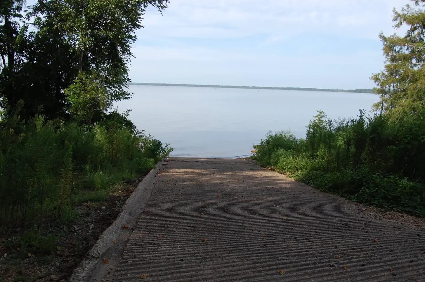
Overview Paraloma Park is located in a secluded, low traffic area on the North portion of Millwood Lake, in the small community of Paraloma. Recreation Visitors to this area enjoy fishing, duck hunting and relaxing in this peaceful campground. This area affords a great diversity of fish and wildlife habitat. Millwood Lake is one of the top fishing lakes in the country. Some 20,000 acres of submerged timber provide excellent fish habitat for a wide variety of fish including largemouth, white striped and spotted bass, channel and flathead catfish, bluegill, sunfish, buffalo carp, crappie, and drum. Facilities Visitors to this area enjoy fishing, duck hunting and relaxing in this peaceful campground. This area affords a great diversity of fish and wildlife habitat. Millwood Lake is one of the top fishing lakes in the country. Some 20,000 acres of submerged timber provide excellent fish habitat for a wide variety of fish including largemouth, white striped and spotted bass, channel and flathead catfish, bluegill, sunfish, buffalo carp, crappie, and drum. Natural Features Paraloma campground is located directly on Millwood Lake with lake views from most of the campsites. The surrounding landscape is flat, low land areas with dense timber. Known as a catfishing "hotspot", Paraloma Park attracts many visitors in the spring and early fall. Nearby Attractions Nearby towns include Ashdown and Nashville, Arkansas, and Texarkana, Texas.
View details →
Overview Deer Island is a boat-access only campground with 21 primitive sites available by reservation only. The sites are non-site specific. The closest launch ramp for Deer Island, from April 1st through October 31st, is located in the Salthouse Branch campground. During our non-peak season, from November 1st until March 31st, you may launch from Twin Ridge, Goose Point, or Ramp 1. Potable water and pit toilets are located on the island. Philpott Lake Virtual Tour: https://corpslakes.erdc.dren.mil/visitors/virtual/philpott/tour.html Recreation The lake provides visitors with great boating and swimming opportunities. Anglers enjoy fishing for large and smallmouth bass, walleye, bluegill, crappie and catfish. Many miles of hiking and biking trails surround Philpott Lake, allowing visitors to get out and explore this scenic area. Facilities The lake provides visitors with great boating and swimming opportunities. Anglers enjoy fishing for large and smallmouth bass, walleye, bluegill, crappie and catfish. Many miles of hiking and biking trails surround Philpott Lake, allowing visitors to get out and explore this scenic area. Natural Features Philpott Lake covers 2,900 acres and has 100 miles of shoreline. The lake's steep, rocky banks meet beautiful mixed forests of oak, maple, hickory, pine and cedar. Wildlife is abundant throughout the area: Deer, turkeys, squirrels, raccoons, and a variety of songbirds and waterfowl are commonly viewed. Nearby Attractions The lake is adjacent to Fairystone State Park and Fairystone Farms Wildlife Management Area, which includes 5,300 acres of public recreational lands.
View details →
Overview Panchuela Campground is nestled at the edge of the Pecos Wilderness, with Panchuela Creek flowing gracefully along its eastern side. Situated at over 8,300 feet in the Santa Fe National Forest, this campground offers a refreshing escape from the warmer temperatures of the city, allowing visitors to enjoy the moderate climate of the Sangre de Cristo Mountains. The campground features six units, all within walking distance of the parking lot, making it easily accessible. Typically open from mid-May to mid-November, Panchuela Campground serves as an ideal base camp for those looking to embark on day hikes into the surrounding wilderness, providing a perfect blend of comfort and adventure. Recreation With the nearby Panchuela Trailhead, visitors have easy access to the expansive trail system of the Pecos Wilderness, making it simple to explore the natural beauty. Panchuela Campground is also just a short drive from the Winsor Trailheads each offerings cenic views of the surrounding mountains. For those who enjoy fishing, Cowles Fishing Pond and the wild and scenic Pecos River are popular nearby spots. Excellent fishing opportunities can be found along Panchuela Creek and the Pecos River, all just minutes from the campground, making it a perfect destination for anglers seeking a tranquil retreat. Visit New Mexico Game and Fish for updates on stocking and regulations. Facilities With the nearby Panchuela Trailhead, visitors have easy access to the expansive trail system of the Pecos Wilderness, making it simple to explore the natural beauty. Panchuela Campground is also just a short drive from the Winsor Trailheads each offerings cenic views of the surrounding mountains. For those who enjoy fishing, Cowles Fishing Pond and the wild and scenic Pecos River are popular nearby spots. Excellent fishing opportunities can be found along Panchuela Creek and the Pecos River, all just minutes from the campground, making it a perfect destination for anglers seeking a tranquil retreat. Visit New Mexico Game and Fish for updates on stocking and regulations. Natural Features The campsites at Panchuela Campground are surrounded by mountain views with mixed conifer and aspen trees. In the fall, the landscape transforms as the aspen leaves turn a brilliant gold. Wildlife is abundant in the surrounding forests, with deer, elk, various songbirds, raptors, and the occasional black bear often spotted nearby. Just a short distance from the campground, an open meadow reveals rustic cabins used by forest service volunteers and employees while they work in the wilderness, adding a unique touch to the serene environment. Nearby Attractions There are several State Park fishing areas along the Pecos River, offering great opportunities for anglers. Just 50 minutes away, Pecos National Historical Park features prehistoric archaeological ruins, 19th-century ranches, and a Civil War battlefield, providing a rich glimpse into the area’s history. For those seeking similar scenic camping experiences to Panchuela, nearby options include Cowles Campground and Holy Ghost Campground, both available on a first-come, first-served basis. These locations offer the same beautiful landscapes and outdoor activities, making them perfect alternatives for your adventure.
View details →
Overview Eliott Key is only accessible by boat. No services are available on the island. Elliott Key is the park's largest island. Restrooms with sinks and cold water showers, picnic tables and grills are available. Drinking water is available, but bring water as a precaution if the system goes down. There are 33 boat slips in the marina. This location is available on a first-come, first-served basis only. Visitors are required to physically arrive at the campground to purchase and claim a site. Once on-site, you can pay for your campsite(s) by scanning a QR code using the Recreation.gov mobile app. There is limited cellular connectivity at this location. Please download the free Recreation.gov mobile app and create an account prior to arrival. Recreation Daytime use and overnight camping - the campground is located on the Biscayne Bay side. Overnight camping and docking fees are required. Picknicking - tables and barbecue grills are available in the campground and marina. Hiking - a mile-long loop trail starts near the campground. Also, "Spite Highway" runs approximately six miles down the center of the island. It affords a good opportunity to see a variety of habitats in the martime forest. Fishing - permitted from the maintenance dock (south of the harbor) or from the shoreline outside of the no-wake zone. Fishing regulations apply. Facilities Daytime use and overnight camping - the campground is located on the Biscayne Bay side. Overnight camping and docking fees are required. Picknicking - tables and barbecue grills are available in the campground and marina. Hiking - a mile-long loop trail starts near the campground. Also, "Spite Highway" runs approximately six miles down the center of the island. It affords a good opportunity to see a variety of habitats in the martime forest. Fishing - permitted from the maintenance dock (south of the harbor) or from the shoreline outside of the no-wake zone. Fishing regulations apply. Natural Features The largest island in the park was once a thriving community of pioneers engaged in pineapple farming, sponging, wrecking, and other pursuits. Today the island offers camping, picnicking, wildlife watching and a hiking trail. A mile-long loop trail starts near the campground. Also, "Spite Highway" runs approximately six miles down the center of the island. It affords a good opportunity to see a variety of habitats in the martime forest. Nearby Attractions Elliott Key is located just south of Boca Chita Key. Charges & Cancellations Ensure one of the designated campsites is available prior to paying. Once payment is made on-site, we do not offer refunds or modifications.
View details →
Overview McFadden Cove is a small campground situated along the banks of Kaw Lake in north central Oklahoma. It is located near Kaw Lake dam and Hideaway Marina and convenient to several recreational day use areas. Recreation The lake and river are known for producing some of Oklahoma's largest catfish, as well as crappie, white bass and walleye, making it a popular destination for anglers. Hunters' skills are tested with excellent populations of whitetail deer, turkey, quail, rabbit and squirrel. During the fall waterfowl seasons Kaw Lake often attracts large numbers of migrating ducks and geese. During the winter visitors are likely to spot migrating bald eagles, as Kaw Lake has one of the biggest populations in the state. Facilities The lake and river are known for producing some of Oklahoma's largest catfish, as well as crappie, white bass and walleye, making it a popular destination for anglers. Hunters' skills are tested with excellent populations of whitetail deer, turkey, quail, rabbit and squirrel. During the fall waterfowl seasons Kaw Lake often attracts large numbers of migrating ducks and geese. During the winter visitors are likely to spot migrating bald eagles, as Kaw Lake has one of the biggest populations in the state. Natural Features The lake covers 17,000 surface acres and has 168 miles of shoreline. Completed in 1976, the dam and lake help provide a recreational oasis for outdoor enthusiasts of all types. Nearby Attractions The area holds a number of historical sites, including several Native American settlements, archeological sites and the Pioneer Woman Museum.
View details →
Overview Las Vegas Bay Campground is located just minutes from Las Vegas on the western edge of the park. It’s open year-round and features paved sites that can accommodate tents or RVs, along with tables, fire pits and/or grills. Restrooms and water spigots are located throughout the campsite. Temperatures usually surpass 100F (37C) degrees June-August. In May and September, daytime highs are around 90F (32C). October-April, temperatures are much cooler. Lows can dip to freezing temps December-February. The area averages 4 inches of rain each year. There is lush vegetation that provides shade. Recreation Las Vegas Bay is a location where you can quickly get away from the hustle and bustle of the city to just relax and enjoy the outdoors. Bluffs Trail is a well-defined trail leads along the bluffs with grand views overlooking Las Vegas Wash. The trailhead starts next to site #72 in the campground. This area is ideal to bird watch, so be sure to bring your binoculars and camera. Air tour noise may be present throughout the day. There are no services within walking distance and no access to the lake. However, trails, launch ramps, fishing piers, marinas and restaurants can be reached by car in about 20 minutes. Facilities Las Vegas Bay is a location where you can quickly get away from the hustle and bustle of the city to just relax and enjoy the outdoors. Bluffs Trail is a well-defined trail leads along the bluffs with grand views overlooking Las Vegas Wash. The trailhead starts next to site #72 in the campground. This area is ideal to bird watch, so be sure to bring your binoculars and camera. Air tour noise may be present throughout the day. There are no services within walking distance and no access to the lake. However, trails, launch ramps, fishing piers, marinas and restaurants can be reached by car in about 20 minutes. Natural Features Las Vegas Bay Campground has lush vegetation that shades nearly every campsite. There is a mix of palm trees, oleanders, mature cottonwood trees and native vegetation that also helps provide privacy between sites. Wildlife in the area includes many species of birds and lizards along with antelope squirrels and the occasional coyote. Nearby Attractions Located just minutes from Henderson, North Las Vegas, and Las Vegas, Nevada, where the attractions range from museums to mega resorts and casinos with headliner acts and an array of dining options. Charges & Cancellations Please have cancellations processed in the system three days in advance of your visit.
View details →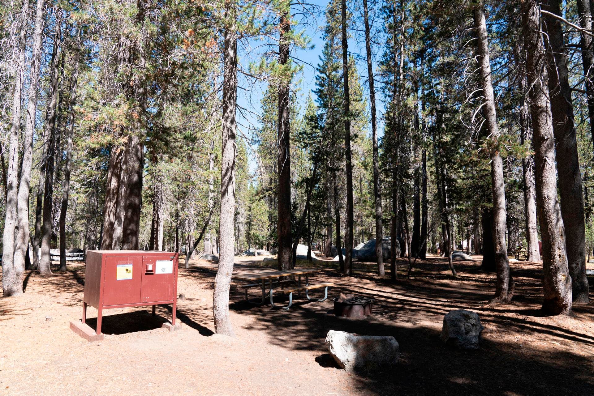
Overview White Wolf typically opens mid-July and closes mid to late September, depending on the opening of the Tioga Road and related seasonal facility and road work. White Wolf Campground is located off the Tioga Road between Tuolumne Meadows and Crane Flat, approximately an hour from Yosemite Valley at 8,000 feet (2,400 m). The campground is tucked into the forest about a mile from Tioga Road near White Wolf Lodge. Trailheads nearby lead to Lukens and Harden Lakes and the area is popular for those accessing other wilderness destinations. Minimal services may be available at White Wolf Lodge (if open). There are no other visitor services close to the campground. Recreation Yosemite's trails, cliffs, roads and rivers provide endless recreational activities for any kind of visitor. Hiking, biking, rock climbing, fishing, horseback riding, rafting, auto touring, and photography are all very popular activities within the park. The White Wolf area has hiking and backpacking opportunities that begin near the campground, such as Lukens Lake, Harden Lake and the Grand Canyon of the Tuolumne. The Crane Flat area, 23 miles west, offers many other hiking opportunities such as Tuolumne and Merced Groves of Giant Sequoias, both of which require a 2.5 to 3-mile roundtrip hike to view. Tuolumne Meadows and all it's High Sierra wonder lie 25 miles to the east, where many beautiful day and overnight excursions await. Facilities Yosemite's trails, cliffs, roads and rivers provide endless recreational activities for any kind of visitor. Hiking, biking, rock climbing, fishing, horseback riding, rafting, auto touring, and photography are all very popular activities within the park. The White Wolf area has hiking and backpacking opportunities that begin near the campground, such as Lukens Lake, Harden Lake and the Grand Canyon of the Tuolumne. The Crane Flat area, 23 miles west, offers many other hiking opportunities such as Tuolumne and Merced Groves of Giant Sequoias, both of which require a 2.5 to 3-mile roundtrip hike to view. Tuolumne Meadows and all it's High Sierra wonder lie 25 miles to the east, where many beautiful day and overnight excursions await. Natural Features Yosemite National Park covers nearly 1,200 square miles (3,100 square km) in the Sierra Nevada, with elevations ranging from about 2,000 feet (600 m) to 13,000 ft (4,000 m). Yosemite receives 95% of its precipitation between October and May (and over 75% between November and March). Most of Yosemite is blanketed in snow from about November through May. The Valley can be rainy or snowy in any given winter storm. Nearby Attractions Groceries: Yosemite Valley, Crane Flat (a small convenience store in the gas station ) and Tuolumne Meadows ( convenience store and grill) or Lee Vining. Restaurants: Yosemite Valley or Lee Vining. Post Office: Yosemite Valley, Tuolumne Meadows Showers: Yosemite Valley at Curry Village and Housekeeping Camp Dump Station: Available all year in Yosemite Valley in Upper Pines Campground. Charges & Cancellations Cancelling your reservation more than 48 hours ahead of your arrival date will result in a refund, less a $10 service fee. If the cancellation is within 48 hours of the arrival date, the first night's fee will also be charged. Cancellations for a single night’s use within 48 hours will not receive a refund, but will not be assessed an additional service fee. No-shows will be charged a $20 service fee and the first night's fee.
View details →
Overview Porcupine Flat Campground will be available by reservation only in 2024. No first come, first serve sites are available. The campground typically opens in late-June and closes mid-October. The opening date varies depending on the opening of the Tioga Road and related seasonal facility and road work. Porcupine Flat Campground is located off the Tioga Road about 30 minutes west of Tuolumne Meadows and over an hour from Yosemite Valley. RVs and Trailers are not recommended for the narrow roads in this more primitive campground. At an elevation of 8,100 feet (2,500 m) elevation, the campground is near Porcupine Creek, which is the only water source (must be filtered, treated, or boiled). The Porcupine Creek Trailhead is nearby. There are no visitor services close to the campground. For additional park information, call (209)372-0200 or visit www.nps.gov/yose Recreation Yosemite's trails, cliffs, roads and rivers provide endless recreational activities for any kind of visitor. Hiking, biking, rock climbing, fishing, horseback riding, rafting, auto touring, and photography are all very popular activities within the park. The White Wolf area has hiking and backpacking opportunities that begin near the campground, such as Lukens Lake, Harden Lake and the Grand Canyon of the Tuolumne. The Crane Flat area, 23 miles west, offers many other hiking opportunities such as Tuolumne and Merced Groves of Giant Sequoias, both of which require a 2.5 to 3-mile roundtrip hike to view. Tuolumne Meadows and all it's High Sierra wonder lie 25 miles to the east, where many beautiful day and overnight excursions await. The Tioga Road offers a 39-mile scenic drive past forests, meadows, lakes, and granite domes. The road’s elevation ranges from 6,200 feet to just under 10,000 feet. Tuolumne Meadows embodies the high-country of the Sierra Nevada and is a good starting point for countless hikes. There is little to no cell service along the road. Facilities Yosemite's trails, cliffs, roads and rivers provide endless recreational activities for any kind of visitor. Hiking, biking, rock climbing, fishing, horseback riding, rafting, auto touring, and photography are all very popular activities within the park. The White Wolf area has hiking and backpacking opportunities that begin near the campground, such as Lukens Lake, Harden Lake and the Grand Canyon of the Tuolumne. The Crane Flat area, 23 miles west, offers many other hiking opportunities such as Tuolumne and Merced Groves of Giant Sequoias, both of which require a 2.5 to 3-mile roundtrip hike to view. Tuolumne Meadows and all it's High Sierra wonder lie 25 miles to the east, where many beautiful day and overnight excursions await. The Tioga Road offers a 39-mile scenic drive past forests, meadows, lakes, and granite domes. The road’s elevation ranges from 6,200 feet to just under 10,000 feet. Tuolumne Meadows embodies the high-country of the Sierra Nevada and is a good starting point for countless hikes. There is little to no cell service along the road. Natural Features Yosemite National Park covers nearly 1,200 square miles (3,100 square km) in the Sierra Nevada, with elevations ranging from about 2,000 feet (600 m) to 13,000 ft (4,000 m). Yosemite receives 95% of its precipitation between October and May (and over 75% between November and March). Most of Yosemite is blanketed in snow from about November through May. (The Valley can be rainy or snowy in any given winter storm.) Porcupine Flat is situated along a seasonal creek which is it's only source of water. Creek water must be treated and/or boiled before consuming. Nearby Attractions Just 25 miles away is Yosemite Valley, an awe-inspiring landscape containing many of the famous features for which Yosemite National Park is known. Hiking trails and bike paths are abundant in the valley. Rafting the Merced River is a fun way to cool down on a summer day when water levels are sufficient. Yosemite Valley also offers numerous guided bus tours, educational programs, museums, ranger-led activities, and an art center with workshops. The Tioga Road offers a 39-mile scenic drive past forests, meadows, lakes and granite domes. Tuolumne Meadows embodies the high-country of the Sierra Nevada, with its broad sub-alpine meadows and granite peaks. Several trailheads line the road offering hikes to beautiful, secluded areas that can only be accessed and enjoyed by foot. Beautiful Hetch Hetchy Reservoir, just 23 miles from Crane Flat, is home to spectacular scenery and numerous wilderness trailheads. Charges & Cancellations Cancellations more than 48 hours in advance of arrival date will generate a refund, less a $10 transaction fee. Within 48 hours, $10 and the first night's fee are charged. One night reservations do not incur an additional $10 fee, but do not receive a refund. No-shows will be assessed a $20 service fee along with the loss of the first night's fee.
View details →
Overview Tucked away among the pines is the hidden gem of Yosemite Creek campground. Accessing this campground is an adventure down a 5-mile, single-lane dirt road. Motorhomes and trailers are NOT allowed. Recreation Your adventure awaits! Hiking, swimming, bouldering, napping (some of us are tired!), bird watching; the possibilities are as great as your imagination. Be sure to bring bug spray and sunscreen, plenty of water, and dress in layers as the weather can rapidly change at this elevation. Facilities Your adventure awaits! Hiking, swimming, bouldering, napping (some of us are tired!), bird watching; the possibilities are as great as your imagination. Be sure to bring bug spray and sunscreen, plenty of water, and dress in layers as the weather can rapidly change at this elevation. Natural Features Granite boulders abound and the peaceful Yosemite Creek meanders through the campground on its way to Yosemite Valley. Bring your comfy chairs and hammocks and let the sounds of nature whisk you away from the busyness of day-to-day life. Nearby Attractions Head to Tuolumne Meadows for breathtaking views and a multitude of day hiking opportunities. Tenaya Lake is a great place to relax and swim or canoe. Yosemite Valley offers restaurants, museums, bike paths, day hikes and world-famous climbing. Don't forget about the Pioneer History center in Wawona, and of course, the Mariposa Grove of giant sequoias. Be prepared to make your own fun here-take delight in the quiet and give your screens a rest.
View details →
Overview Tamarack Flat Campground is available by reservation only. No first come, first serve sites are available. The campground typically opens in mid-June and closes in early October. Opening date for the Tamarack Flat Campground varies depending on the opening of the Tioga Road and related seasonal facility and road work. Tamarack Flat Campground is located off the Tioga Road just east of Crane Flat. The campground is approximately 20 miles (45 minutes) from Yosemite Valley and is tucked away in the forest 3 miles off Tioga Road. RVs and Trailers are not recommended for this hard to access, primitive campground. At an elevation of 6,300 feet (1,900 m) elevation, the campground is near Tamarack Creek, which is the only water source (must be filtered, treated, or boiled). There is a gas station nearby at Crane Flat. For additional park information, call (209)372-0200 or visit www.nps.gov/yose Recreation Yosemite's trails, cliffs, roads and rivers provide endless recreational activities for any kind of visitor. Hiking, biking, rock climbing, fishing, horseback riding, rafting, auto touring, and photography are all very popular activities within the park. A hiking and backpacking trail leaves from the campground and can be used to hike to areas such as Cascade Creek, El Capitan and other points along the North Rim of Yosemite Valley. Yosemite Valley is a 25 mile drive from Tamarack Flat Campground. Many of Yosemite's most popular trails along with the Merced River, bike trails, beaches and picnic areas can be easily accessed in Yosemite Valley. Two of Yosemite's three groves of giant sequoias are located in the Crane Flat area (5-10 miles from Tamarack Flat). Tuolumne and Merced Groves of Giant Sequoias, both of which require a 2.5 to 3-mile roundtrip hike to view. The trailheads are accessible year-round, although trails may be snow-covered winter. Both short hikes lead downhill into sheltered areas with flowing water, dogwood, azaleas, and ancient sequoia trees. Many other hiking opportunities exist at trailheads along the Tioga Road and in Tuolumne Meadows. For additional park recreation information, visit www.nps.gov/yose/planyourvisit/ Facilities Yosemite's trails, cliffs, roads and rivers provide endless recreational activities for any kind of visitor. Hiking, biking, rock climbing, fishing, horseback riding, rafting, auto touring, and photography are all very popular activities within the park. A hiking and backpacking trail leaves from the campground and can be used to hike to areas such as Cascade Creek, El Capitan and other points along the North Rim of Yosemite Valley. Yosemite Valley is a 25 mile drive from Tamarack Flat Campground. Many of Yosemite's most popular trails along with the Merced River, bike trails, beaches and picnic areas can be easily accessed in Yosemite Valley. Two of Yosemite's three groves of giant sequoias are located in the Crane Flat area (5-10 miles from Tamarack Flat). Tuolumne and Merced Groves of Giant Sequoias, both of which require a 2.5 to 3-mile roundtrip hike to view. The trailheads are accessible year-round, although trails may be snow-covered winter. Both short hikes lead downhill into sheltered areas with flowing water, dogwood, azaleas, and ancient sequoia trees. Many other hiking opportunities exist at trailheads along the Tioga Road and in Tuolumne Meadows. For additional park recreation information, visit www.nps.gov/yose/planyourvisit/ Natural Features Yosemite National Park covers nearly 1,200 square miles (3,100 square km) in the Sierra Nevada, with elevations ranging from about 2,000 feet (600 m) to 13,000 ft (4,000 m). Yosemite receives 95% of its precipitation between October and May, and over 75% between November and March. Most of Yosemite is blanketed in snow from about November through May. Tamarack Flat is situated along a seasonal creek which is it's only source of water. Creek water must be treated and/or boiled before consuming. Nearby Attractions Just 25 miles away is Yosemite Valley, an awe-inspiring landscape containing many of the famous features for which Yosemite National Park is known. Hiking trails and bike paths are abundant in the valley. Rafting the Merced River is a fun way to cool down on a summer day when water levels are sufficient. Yosemite Valley also offers numerous guided bus tours, educational programs, museums, ranger-led activities, and an art center with workshops. The Tioga Road offers a 39-mile scenic drive past forests, meadows, lakes and granite domes. Tuolumne Meadows embodies the high-country of the Sierra Nevada, with its broad sub-alpine meadows and granite peaks. Several trailheads line the road offering hikes to beautiful, secluded areas that can only be accessed and enjoyed by foot. Beautiful Hetch Hetchy Reservoir, just 23 miles from Crane Flat, is home to spectacular scenery and numerous wilderness trailheads. contact_info For facility specific information, please call (209) 379-2123. Charges & Cancellations Cancellations more than 48 hours in advance of arrival date will generate a refund, less a $10 transaction fee. Within 48 hours, $10 and the first night's fee are charged. One night reservations do not incur an additional $10 fee, but do not receive a refund. No-shows will be assessed a $20 service fee along with the loss of the first night's fee.
View details →
Overview Temple Bar Campground is located along the eastern portion of Lake Mead in Arizona. It’s open year-round and features paved sites that can accommodate tents or RVs, along with tables, fire pits and/or grills. Restrooms and water spigots are located throughout the campsites. Temperatures usually surpass 100F (37C) degrees June-August. In May and September, daytime highs are around 90F (32C). October-April, temperatures are much cooler. Lows can dip to freezing temps December-February. The area averages 4 inches of rain each year. Vegetation provides some shade. Visitors enjoy coming here for the peace, solitude and pristine night skies. Recreation Enjoy the Temple Bar area by land or water. Hike through the desert along the Temple View Trail to observe the crystal blue waters of Lake Mead and the natural temple that changes colors throughout the day. Launch your own boat or rent one from the marina. You can also dine at the seasonal cafe, or grab a variety of snacks, drinks and charcoal from the store. Picnic tables and grills are located near the store. Although there are no beaches at Temple Bar, it's a great place to rent a boat and find your own secluded beach or cove where you can spend the day fishing, soaking in the sun and wading along the shore. Facilities Enjoy the Temple Bar area by land or water. Hike through the desert along the Temple View Trail to observe the crystal blue waters of Lake Mead and the natural temple that changes colors throughout the day. Launch your own boat or rent one from the marina. You can also dine at the seasonal cafe, or grab a variety of snacks, drinks and charcoal from the store. Picnic tables and grills are located near the store. Although there are no beaches at Temple Bar, it's a great place to rent a boat and find your own secluded beach or cove where you can spend the day fishing, soaking in the sun and wading along the shore. Natural Features There is a mix of palm trees, oleanders, mature cottonwood trees and native vegetation that help provide shade and privacy between sites. Wildlife in the area includes many species of birds and lizards along with antelope squirrels and the occasional coyote. Temple Bar is remote, making it an ideal location to view the night skies. Nearby Attractions Temple Bar is remote, which is what makes it so special. The Las Vegas Valley; Kingman, Arizona; and Route 66 are about 90 minutes away. In these areas, you can find museums, restaurants, stores and a variety of entertainment options. Grand Canyon West is about 2 hours away. contact_info For facility specific information, please call (702) 293-8906. Charges & Cancellations Please have cancellations processed in the system three days in advance of your visit.
View details →
Overview The Virgin River Canyon Recreation Area is located along Interstate 15 approximately 20 miles southwest of St. George, Utah and approximately 20 miles northeast of Mesquite, Nevada. It's accessed from the Cedar Pocket Exit (mile post 18). The overnight-use fee is $8 per site per night and the day-use fee is $2 per vehicle. Overnight use is limited to a 14-night stays. The recreation area currently has 25 of the best sites only available through recreation.gov reservations. The remaining 83 sites are first come, first serve (FF) payable by using the Scan and Pay feature on the recreation.gov app. Please come prepared by either making a reservation here before arrival OR having the recreation.gov app installed with login setup to pay onsite with the scan and pay option. Recreation The Virgin River Canyon Recreation Area provides many recreational opportunities for hiking, wildlife viewing, water play, and more. It is surrounded by two designated wilderness areas. The Paiute Wilderness east of Interstate 15, and Beaver Dam Mountains Wilderness to the west. The Sullivan Canyon Trail starts within the recreation area and heads into the heart of the Paiute Willderness. The campground and day-use areas also both have scenic trails leading to the Virgin River. The Virgin River is occassionally runable to small whitewater boats during spring runoffs. Please check for information on the fish barriers and flow conditions prior to running. Additional opportunities for recreation are available outside of the recreation area. A short drive on the Cedar Pocket Road (directly across the interstate from the campground) leads to the Cedar Pocket Wash Trailhead. This trail leads down a steep path to the narrows of the Cedar Pocket Wash and is a nice short stroll through a Joshua Tree forest. The Virgin River Gorge is also frequented by rock climbers and canyoneers. Additional information about recreation available in the area can be obtained by calling the visitor center at 435-688-3200. Facilities The Virgin River Canyon Recreation Area provides many recreational opportunities for hiking, wildlife viewing, water play, and more. It is surrounded by two designated wilderness areas. The Paiute Wilderness east of Interstate 15, and Beaver Dam Mountains Wilderness to the west. The Sullivan Canyon Trail starts within the recreation area and heads into the heart of the Paiute Willderness. The campground and day-use areas also both have scenic trails leading to the Virgin River. The Virgin River is occassionally runable to small whitewater boats during spring runoffs. Please check for information on the fish barriers and flow conditions prior to running. Additional opportunities for recreation are available outside of the recreation area. A short drive on the Cedar Pocket Road (directly across the interstate from the campground) leads to the Cedar Pocket Wash Trailhead. This trail leads down a steep path to the narrows of the Cedar Pocket Wash and is a nice short stroll through a Joshua Tree forest. The Virgin River Gorge is also frequented by rock climbers and canyoneers. Additional information about recreation available in the area can be obtained by calling the visitor center at 435-688-3200. Natural Features The Virgin River Gorge, where the Virgin River Canyon Recreation Area resides, was cut by the Virgin River. Though the Virgin River is relatively small, it is incredibly steep, dropping an average of 70 feet per mile - 10 times steeper than the Colorado River through the Grand Canyon. This steepness, caused by the uplift of the Colorado Plateau, has given the Virgin River the ability to cut through sandstone and limestone canyons. The gorge provides a stunning and colorful mountain desert setting. The gorge mimics, on a smaller scale, the colorful layers and striking depths of the Grand Canyon. In fact, many of the very same geologic formations are present in both areas. The gorge connects the southwestern rim of the Colorado Plateau and the northeastern part of the Mojave Desert. The climate of the gorge is typical of the Mojave Desert with hot summers and mild winters. This desert climate allows for some of the most northern Joshua Tree populations. The canyon is usually about 5 degrees Fahrenheit warmer than St George, Utah, however the canyon can occasionally amplify winds. Many species depend on the water of the Virgin River. The Virgin River directly supports hundreds of wildlife species including, woundfin, Virgin River chub, Virgin spinedace, flannelmouth sucker, desert sucker, speckled dace, and Southwestern Willow Flycatcher. Many of these species are endangered or are considered sensitive species within the State of Arizona and Utah. Nearby Attractions The recreation area has an easy, short paved trail accessed near the fee instruction station. This trail goes up to a Joshua Tree grove and a nice developed viewpoint of the Virgin River Gorge. The recreation area also has a trailhead to Sullivan Canyon. This trail crosses the river and traverses 3 miles through wilderness to Sullivan Canyon. Follow the high clearance road about 2 miles northwest across from the Virgin River Canyon Recreation Area, you will reach the Cedar Pocket Wash trailhead. Here, there is a short trail to a Joshua Tree grove and plenty of views. A side trail leads steeply down to the wash where you can hike through a limestone slot canyon. contact_info This location is unstaffed. To speak with our main office for general information, please call: (435) 688-3200. Charges & Cancellations Cancellations*: *cancellation becomes a "late cancellation" at 12:01 am EST on the day before arrival. • $10.00 fee if reservation is changed/cancelled earlier than the day before arrival. • $10.00 plus first night's camping fee is charged if reservation is cancelled the day before or the day of the arrival, except when the reservation is only for 1 night (in which case only the first night's camping fee is charged). No Shows: customer does not arrive and/or does not cancel reservation by check out time (11 :00am) the day after the scheduled arrival date. $20.00 service fee charged and forfeit the first night's user fee • If requested before the late cancellation window: NRRS will handle • If requested during the late cancellation window (day before arrival, or day of arrival): Customer will be charged first night's use fee, and refunded rest • If requested after arrival, during or after departure from site: recreation.gov processes and field office has to approve
View details →
Overview Beaver Point Campground is situated along the eastern banks of Fort Supply Lake in Northwest Oklahoma. The campground is great for anyone who wants a campsite at a lower price and doesn't need electric and water hook-ups. Campsites are available on a first-come, first-serve basis only. Visitors are required to physically arrive at the campground to purchase and claim a site. Once you claim a site, you can pay for your campsite(s) by scanning our QR code using the Recreation.gov mobile app on a smartphone device. We recommend you download the free Recreation.gov mobile app on Android or iOS prior to your arrival as some remote areas may have limited or no cellular service. Scan & Pay available using the Recreation.gov mobile app (Android and iOS). Recreation Fishing opportunities abound with catches like crappie, walleye, white bass, hybrid bass, channel catfish and flathead catfish. Hunters enjoy the 6,000 acres of land populated by bobwhite quail, deer, pheasants, and rabbits. The campground provides a boat ramp, and a swimming beach is available just down the road. Facilities Fishing opportunities abound with catches like crappie, walleye, white bass, hybrid bass, channel catfish and flathead catfish. Hunters enjoy the 6,000 acres of land populated by bobwhite quail, deer, pheasants, and rabbits. The campground provides a boat ramp, and a swimming beach is available just down the road. Natural Features Beaver Point is set along the eastern shores of the lake in northwest Oklahoma. Sand dunes line the shores and the vast, 1,800-acre lake has an average depth of eight feet. Nearby Attractions Stop by the Fort Supply Historic Site, the Pioneer Museum and Art Center in Woodward, and Boiling Springs State Park.
View details →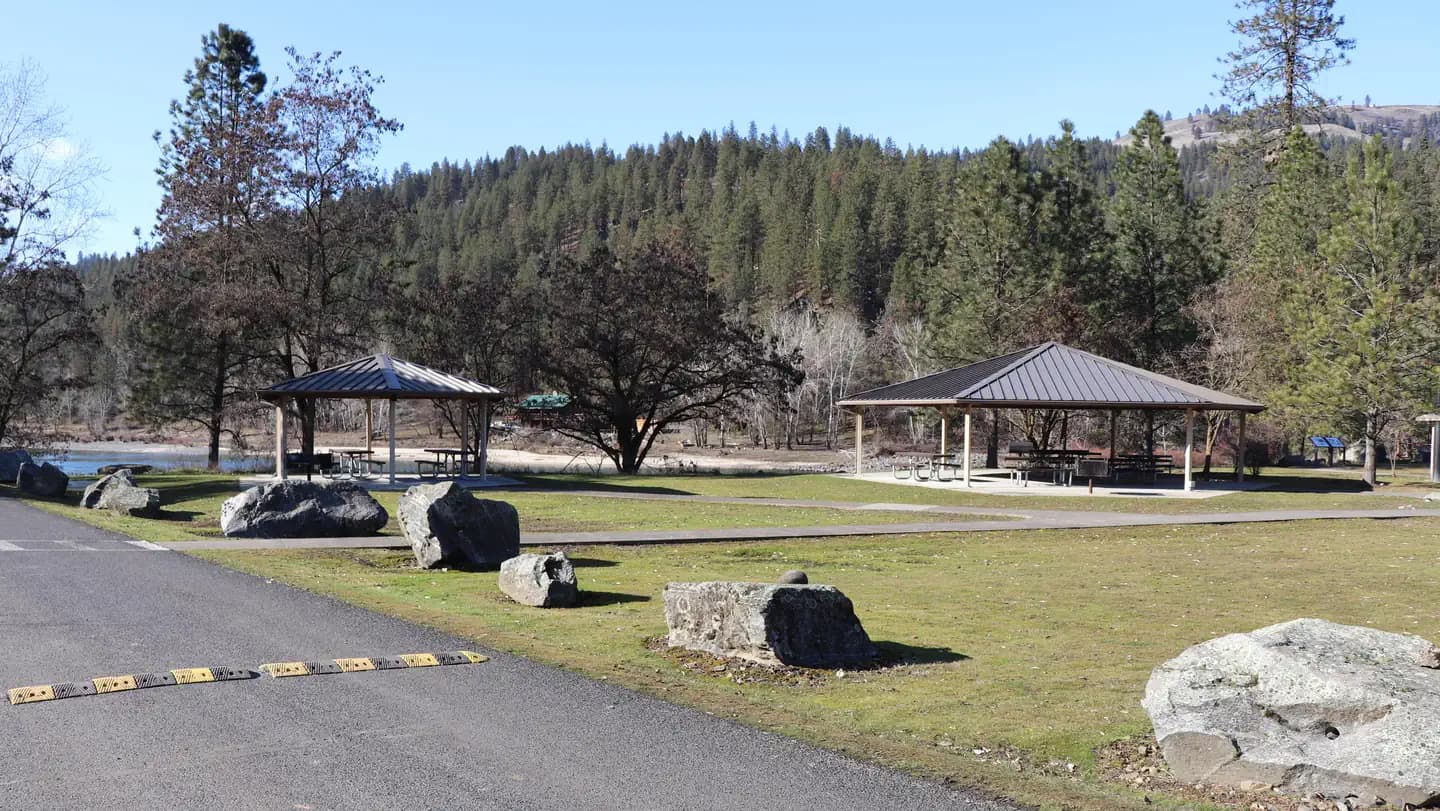
Overview Located 5 miles west of Orofino, Idaho, the Bureau of Land Management’s Pink House Recreation Site includes a large, developed campground with an on-site Campground Host and two reservable riverfront-accessible day use pavilions. The site is enjoyed by visitors from all over the country for camping, world class fishing, boating, tubing, swimming, picnicking, and wildlife viewing. Recreation This area is popular for boaters, anglers, wildlife watching, as well as for quiet relaxation. Pink House Recreation Site is home to one of the most heavily used boat launching sites upstream from Lewiston, Idaho. Guests have immediate access to the Clearwater River, home to world-renowned salmon and steelhead fisheries attracting anglers from around the world. Tubing is one of the most popular activities on the section upstream of Orofino due to the river’s mellow rapids and accessibility. With over 10 access sites along the Clearwater River to put-in and take-out, recreationists have the option to float on the river as long as they desire. Facilities This area is popular for boaters, anglers, wildlife watching, as well as for quiet relaxation. Pink House Recreation Site is home to one of the most heavily used boat launching sites upstream from Lewiston, Idaho. Guests have immediate access to the Clearwater River, home to world-renowned salmon and steelhead fisheries attracting anglers from around the world. Tubing is one of the most popular activities on the section upstream of Orofino due to the river’s mellow rapids and accessibility. With over 10 access sites along the Clearwater River to put-in and take-out, recreationists have the option to float on the river as long as they desire. Natural Features The site is nestled beside the Clearwater River at an elevation of 980 feet, surrounded by scenic views of semi-arid hills, and the Lewis and Clark National Historic Trail. Native trees provide abundant shade throughout the site and guests can access a large sandy beach with just a short walk from the pavilions. contact_info For facility specific information, please call (208) 962-3245. Nearby Attractions The Lewis and Clark National Historic Trail follows the Clearwater River from Greer, Idaho to the confluence with the Snake River. The Northwest Discovery Water Trail is the first 40-mile reach of the Clearwater River from Canoe Camp to the confluence with the Snake River in Lewiston, Idaho. Orofino, Idaho provides basic services and shopping opportunities—5 miles away. Nez Perce National Historical Park (Canoe Camp)—1 mile away. Dworshak Hatchery—9 miles away. Dworshak Dam and Visitor Center—12 miles away.
View details →
Overview Dorr Skeels Campground is located 13 miles south of Troy on Hwy 56. The Dorr Skeels Campground has 8 overnight campsites, including one host site and 2 day use sites with tables and fire rings. Amenities include potable water, vault toilets, swimming area with beach and a fully developed boat ramp with dock. A security gate is closed at 10:00 pm and opened at 07:00 am daily by the camphost. Recreation The campground has a boat ramp with dock, a beach area and bouyed off swimming area. There are several day use sites available for guests. Facilities The campground has a boat ramp with dock, a beach area and bouyed off swimming area. There are several day use sites available for guests. Natural Features At an elevation of 2,344 feet, the campground is nestled among mature pines at the north end of Bull Lake in the Bull Lake Area. The lake spans 1,162 acres. The lake is popular with recreationists as well as fisherman. Many species of fish can be found there including brook trout, bull trout, kokanee, small and large mouth bass, pike, suckers, whitefish and perch. Nearby Attractions The campground lies along the western edge of the Cabinet Mountains Wilderness and is just north of an ancient cedar grove, Ross Creek Cedars.
View details →
Overview Clear Creek Group Campground is less than a two hourdrive from the Albuquerque area, and provides relief from the New Mexico heat with the cool shade and refreshing air of the pines and mountains. The group campground is located in the last loop of the Clear Creek Campground, alongside the serene Clear Creek. Recreation Local streams and the San Gregorio reservoir provide fishing opportunities for anglers, and hikers will delight in the many hiking opportunities in the nearby San Pedro Parks Wilderness. Facilities Local streams and the San Gregorio reservoir provide fishing opportunities for anglers, and hikers will delight in the many hiking opportunities in the nearby San Pedro Parks Wilderness. Natural Features Evergreen ponderosa pines and Engelman spruce make up the forest around the campground, a welcome sight for those escaping the heat. The majesty of the Jemez Mountains provides amazing scenery for those inthe campground and for scenic drives through the forest. A variety of wildlife call this place home including black bears, mule deer, elk, and a plethora of bird species.
View details →
Overview Paliza Group Campground is found north of the small community of Ponderosa, surrounded by ponderosa pines and views of the stunning cliff faces of majestic mesas. There are two group areas within the campground, with walk in and drive in sites found separately in each loop. The group campground generally opens in mid-May and closes in October. It’s location is ideal for enjoying quiet, star filled nights as it is far away from major cities. The Jemez National Recreation Area is a short drive away and providesmany opportunities to enjoy the Santa Fe National Forest. Recreation Paliza Group Campground is not far from NM Highway 4 and the popular Jemez National Recreation Area. Scenic day hikes, hot springs, and historical landmarks can be found nearby. Fishing is popular on the nearby San Antonio Creek with plenty of fishing sites available. Facilities Paliza Group Campground is not far from NM Highway 4 and the popular Jemez National Recreation Area. Scenic day hikes, hot springs, and historical landmarks can be found nearby. Fishing is popular on the nearby San Antonio Creek with plenty of fishing sites available. Natural Features The short driveway from Forest Road 10 to the group campground is scenic, with riparian trees changing to towering ponderosa pines as the road climbs in elevation. Spectacular views of the surrounding mesas and clear blue skies are hallmarks of this campground. The dark greens of the conifers stand out against the bright yellows of flowering chamisa in the summer, and the yellows and reds of fall foliage provide a variety of scenery through the seasons. Nearby Attractions The East Fork of the Jemez National Wildand Scenic River can be accessed nearby. The Valles Caldera National Preserve is conveniently located north of Forest Road 10 on NM 4. An impressive geological formation known as Battleship Rock is worth stopping to look on NM 4, north of the town of Jemez Springs. The town itself has art created by locals, hot springs, and a restaurant for those not wanting to cook.
View details →
Overview Think of Colter Bay Village as summer camp for the entire family. This lovely area is set on the shores of Jackson Lake, and offers practical amenities like laundry facilities, showers, restaurants and a grocery store, as well as purely-for-fun diversions like a marina, gift shop, visitor center, and horse corrals. Colter Bay has an activity for everyone in the family. Visitors can enjoy hiking, kayaking and canoeing, horseback riding, fishing, swimming and beach-going, lake cruises, and ranger-led programs. Set against the majestic backdrop of the Teton mountains, Colter Bay Village is a must-visit. The vast Colter Bay Tent Village at Colter Bay Village is set amidst towering lodgepole pines just a short, picturesque stroll away from Jackson Lake. The Tent Village includes 66 tent cabins, and is open from mid-May to early-September. As with all campgrounds in the park, the Colter Bay Tent Village is very popular and tends to fill up quickly. Visitors are strongly encouraged to plan and book early. Recreation Colter Bay and the surrounding area offers a wide variety of activities for all ages, including marina rentals, horseback riding, world-class guided fishing, and lake cruises. Stop by our activities desk to find the perfect excursion for everyone in your group! Jackson Lake is a popular area for boating. Several islands float just off Colter Bay’s shores, and are home to fish, birds, river otters, beavers and other wildlife. Bring your own boat or rent a canoe, kayak, or motor boat from the Colter Bay Marina. Lake cruises are the perfect excursion for the entire family. Cruise around Jackson Lake and learn about the history, geology, flora and fauna of the area while getting up-close views of the spectacular Tetons, which rise majestically from the water. Breakfast, lunch, and dinner meal cruises offer a delicious opportunity to dine at our private meal site on Elk Island, and a truly unique vantage point for experiencing the park. Jackson Hole has world class fly and lake fishing that you won’t want to miss! Whether you’re learning to cast a fly for the first time, or are an experienced angler looking for the inside scoop on the best secret spots, our expert guides will provide a fishing experience you will not soon forget. No trip to the Old West is complete without a horseback ride. We offer one- and two-hour rides suitable for all experience levels. Take in beautiful Teton vistas while riding among wildflower meadows. Several easy to moderate hiking trails leave from Colter Bay. Hikers can take a leisurely stroll along the lakeshore, make their way to Swan Lake and Heron Pond for incredible birdwatching and wildlife sightings, or head out to Hermitage Point for a more challenging outing. The Colter Bay Visitor Center is home to the David T. Vernon Indian artifacts collection. The exhibit celebrates Indian artwork and educates on the long history of human habitation in Jackson Hole and the Greater Yellowstone Ecosystem. Stop by the visitor center to check-out daily Ranger-led programs including a hike to Swan Lake, a lakeshore stroll, a tipi demonstration, Indian arts and culture, wildlife watches, short presentations on park highlights, and a variety of evening programs. Facilities Colter Bay and the surrounding area offers a wide variety of activities for all ages, including marina rentals, horseback riding, world-class guided fishing, and lake cruises. Stop by our activities desk to find the perfect excursion for everyone in your group! Jackson Lake is a popular area for boating. Several islands float just off Colter Bay’s shores, and are home to fish, birds, river otters, beavers and other wildlife. Bring your own boat or rent a canoe, kayak, or motor boat from the Colter Bay Marina. Lake cruises are the perfect excursion for the entire family. Cruise around Jackson Lake and learn about the history, geology, flora and fauna of the area while getting up-close views of the spectacular Tetons, which rise majestically from the water. Breakfast, lunch, and dinner meal cruises offer a delicious opportunity to dine at our private meal site on Elk Island, and a truly unique vantage point for experiencing the park. Jackson Hole has world class fly and lake fishing that you won’t want to miss! Whether you’re learning to cast a fly for the first time, or are an experienced angler looking for the inside scoop on the best secret spots, our expert guides will provide a fishing experience you will not soon forget. No trip to the Old West is complete without a horseback ride. We offer one- and two-hour rides suitable for all experience levels. Take in beautiful Teton vistas while riding among wildflower meadows. Several easy to moderate hiking trails leave from Colter Bay. Hikers can take a leisurely stroll along the lakeshore, make their way to Swan Lake and Heron Pond for incredible birdwatching and wildlife sightings, or head out to Hermitage Point for a more challenging outing. The Colter Bay Visitor Center is home to the David T. Vernon Indian artifacts collection. The exhibit celebrates Indian artwork and educates on the long history of human habitation in Jackson Hole and the Greater Yellowstone Ecosystem. Stop by the visitor center to check-out daily Ranger-led programs including a hike to Swan Lake, a lakeshore stroll, a tipi demonstration, Indian arts and culture, wildlife watches, short presentations on park highlights, and a variety of evening programs. Natural Features The Colter Bay Tent Village is situated in a lodgepole pine forest within walking distance of Jackson Lake and numerous trails. From the lakeshore, visitors will have views across Jackson Lake to Mount Moran and the northern end of the Teton Range. Colter Bay is home to black and grizzly bears, moose, deer, elk and other large animals, as well as marmots, foxes, bald eagles, and more. Bears are often seen on trails and in the developed areas. Being prepared for an animal encounter can help ensure your safety as well as that of the wildlife that call this special place home. contact_info This location has limited staffing. Please call (877) 444-6777 for general information. Nearby Attractions Visitors can take a self-guided tour of Grand Teton via the 43-mile Scenic Loop Drive, offering an opportunity to photograph the famous landscape and local wildlife. Make sure you stop at the historic Jackson Lake Lodge for its famous huckleberry milkshakes and spectacular Teton views through 60-foot tall wall-to-wall windows. While you’re there, book a scenic raft trip or park bus tour. Then, head about 30 miles south to the town of Jackson, where you can visit the National Museum of Wildlife Art just outside of town, walk under the famous giant elk antler archway in town center, attend the Jackson Hole Rodeo, browse local shops, and dine at one of the many restaurants. In the opposite direction, Yellowstone National Park is within easy reach by car, and has a great diversity of activities for everyone to enjoy. Charges & Cancellations Changing Reservations: There is no change fee if a visitor extends or shortens a reservation, as long as the change includes dates from the original reservation. Additionally, there is no change fee if the visitor wants to switch sites that are the same price with the same reservation dates in the same facility. If a visitor wants to switch dates that are entirely outside of the original reservation dates, there is a $10 change fee. If a reservation is made that includes dates beyond the maximum booking window, that reservation cannot be changed until 18 days have passed from the original booking date. Once a reservation date has begun, visitors cannot change a reservation using the online system or through the Call Center. Onsite staff will assist with changes or cancellations. Cancellations: Visitors may cancel their reservation prior to arrival both on-line and through the call center. A $10 service fee will be withheld from any refund for a cancellation. A visitor who cancels a reservation the day before or on the day of arrival will pay a $10.00 service fee AND forfeit the first night's approved rate including tax and applicable add-on. Cancellations for a one-night reservation will forfeit the entire amount paid and will not be subject to an additional service fee. Visitors who cancel a group overnight facility reservation less than 14 days prior to arrival date will pay a $10 service fee AND forfeit the first night’s rate. No-Shows: A no-show visitor is one who does not arrive at a campground and does not cancel the reservation by check-out time on the day after the scheduled arrival date. Staff will hold a campsite until check-out time on the day following the arrival date. No-shows are assessed $20.00 service fee and forfeit the first night's rate, taxes and applicable add-on for a campsite. Early Departures: Visitors are requested to notify staff at the facility if they depart early to allow others to use the site. If the visitor chooses to depart early, they may forfeit the approved rate and applicable tax and applicable add-on for the day of departure. If a visitor departs prior to the scheduled check-out date, they may be eligible for a partial refund. Visitors may notify the Recreation.gov call center to request a refund of remaining unused nights. If a visitor requests a refund for an early departure after the facility check-out time (11 am) has passed, the visitor will not be refunded for that night and is eligible for a refund on any additional nights that will not be used. Refunds: Visitors may submit a refund request through their Recreation.gov profile within 7 days of the end date of their reservation. Visitors may also initiate a refund request through the call center at any time after their reservation has ended. Refunds for debit or credit card payments will be issued as a credit to the original bank or credit card used to pay. For check or cash purchases, Recreation.gov will mail a Treasury check for refunds of cash, check, or money order payments to the address associated with the reservation. Treasury check refunds may take up to 6-8 weeks to arrive. In the event of an emergency closure, the Recreation.gov team or facility manager will refund all fees and will attempt to notify you using the contact information within the Recreation.gov visitor profile.
View details →
Overview Belmont Park offers a primitive campground and access to some of the best public hunting and fishing opportunities on the Tombigbee River. The area gives quick access to properties located on the David K. Nelson Wildlife Management Area as well as areas managed by the Corps of Engineers. Campers will appreciate the group shelter and water borne restroom facilities conveniently located on the grounds. Recreation Fishing, boating, family gatherings, rustic/primitive camping opportunities are just a few of the activities you can enjoy at Belmont Park. Facilities Fishing, boating, family gatherings, rustic/primitive camping opportunities are just a few of the activities you can enjoy at Belmont Park.
View details →
Overview Campgrounds in Lake Chelan National Recreation Area are walk-in sites located in the Stehekin Valley. Harlequin Camp is located along the Stehekin River, 4.5 miles up the Stehekin Valley Road from Stehekin Landing and approximately 6.5 miles from High Bridge. Stehekin is a remote community with limited facilities and is only accessible by foot, boat, or plane. There is some shared parking at the campground for a limited number of vehicles but all sites are considered walk-in. Recreation Visitors can access several trails from the campground area, such as the Stehekin River Trail, Company Creek Trail, and Rainbow Loop. Many of these trails also lead to other backcountry trails and the opportunity for longer wilderness backpacks. A backcountry permit is required for overnight stays in the backcountry. Other trails along the Stehekin Valley Road can be reached by foot, bike, or shuttle bus. Visitors can boat, fish, and swim (although the water is a chilly 45 degrees) in Lake Chelan or the Stehekin River. Bears do inhabit the area, so care should be taken when hiking, picnicking, or camping. Facilities Visitors can access several trails from the campground area, such as the Stehekin River Trail, Company Creek Trail, and Rainbow Loop. Many of these trails also lead to other backcountry trails and the opportunity for longer wilderness backpacks. A backcountry permit is required for overnight stays in the backcountry. Other trails along the Stehekin Valley Road can be reached by foot, bike, or shuttle bus. Visitors can boat, fish, and swim (although the water is a chilly 45 degrees) in Lake Chelan or the Stehekin River. Bears do inhabit the area, so care should be taken when hiking, picnicking, or camping. contact_info For facility specific information, please call (360) 854-7200. Nearby Attractions Stehekin is a gateway into the east side of the North Cascades National Park Service Complex. Many short to multi-day backpacking trips begin in the Stehekin area. Other attractions in the area are the historic Buckner Orchard, where visitors can pick apples in the fall, and Rainbow Falls, a 312-foot waterfall near the Stehekin Valley Road.
View details →
Overview Campgrounds in Lake Chelan National Recreation Area are walk-in sites located in the Stehekin Valley at the head of Lake Chelan. Lakeview Campground is a five minute walk from the boat dock at Stehekin Landing. Stehekin is a remote community with limited facilities and is only accessible by foot, boat, or plane. There is a group shared space in Lakeview Campground reserved for backpackers heading out or coming back from a wilderness trip or PCT hikers with a valid PCTA permit. These sites need not be reserved separately; backpackers may camp for ONE NIGHT ONLY. Recreation Visitors can access several trails from near the campground, such as the Imus Trail, the Purple Creek Trail, and the Lakeshore Trail. Other trails further up the valley can be reached by foot, bike, or shuttle bus. Many of the trails from Stehekin provide the opportunity for longer wilderness backpacks. A backcountry permit is required for overnight stays in the backcountry. Visitors can boat, fish, and swim (although the water is a chilly 45 degrees) in Lake Chelan. Bears do inhabit the area, so care should be taken when hiking, picnicking, or camping. Facilities Visitors can access several trails from near the campground, such as the Imus Trail, the Purple Creek Trail, and the Lakeshore Trail. Other trails further up the valley can be reached by foot, bike, or shuttle bus. Many of the trails from Stehekin provide the opportunity for longer wilderness backpacks. A backcountry permit is required for overnight stays in the backcountry. Visitors can boat, fish, and swim (although the water is a chilly 45 degrees) in Lake Chelan. Bears do inhabit the area, so care should be taken when hiking, picnicking, or camping. contact_info For facility specific information, please call (360) 854-7200. Nearby Attractions Stehekin is a gateway into the east side of the North Cascades National Park Service Complex. Many short to multi-day backpacking trips begin in the Stehekin area. Other attractions in the area are the historic Buckner Orchard, where visitors can pick apples in the fall, and Rainbow Falls, a 312-foot waterfall near the Stehekin Valley Road.
View details →
Overview Campgrounds in Lake Chelan National Recreation Area are walk-in sites located in the Stehekin Valley at the head of Lake Chelan. Purple Point Campground is an approximatly eight minute walk from the boat dock at Stehekin Landing along a paved road. Most sites are located very near the road. Stehekin is a remote community with limited facilities and is only accessible by foot, boat, or plane. Recreation Visitors can access several trails from near the campground, such the Imus Trail, the Purple Creek Trail, and the Lakeshore Trail. Other trails trails further up the valley can be reached by via foot, bike, or shuttle bus. Many of the trails from Stehekin provide the opportunity for longer wilderness backpacks. A backcountry permit is required for overnight stays in the backcountry. Visitors can boat, fish, and swim (although the water is a chilly 45 degrees) in Lake Chelan. Bears do inhabit the area, so care should be taken when hiking, picnicking, or camping. Facilities Visitors can access several trails from near the campground, such the Imus Trail, the Purple Creek Trail, and the Lakeshore Trail. Other trails trails further up the valley can be reached by via foot, bike, or shuttle bus. Many of the trails from Stehekin provide the opportunity for longer wilderness backpacks. A backcountry permit is required for overnight stays in the backcountry. Visitors can boat, fish, and swim (although the water is a chilly 45 degrees) in Lake Chelan. Bears do inhabit the area, so care should be taken when hiking, picnicking, or camping. contact_info For facility specific information, please call (360) 854-7200. Nearby Attractions Stehekin is a gateway into the east side of the North Cascades National Park Service Complex. Many short to multi-day backpacking trips begin in the Stehekin area. Other attractions in the area are the historic Buckner Orchard, where visitors can pick apples in the fall, and Rainbow Falls, a 312-foot waterfall near the Stehekin Valley Road.
View details →
Overview This site is designed for stock use. If your party does not need access to a horse campsite, please consider selecting a campsite at the Pine Springs Campground located one mile west of Frijole Horse Corral Campground. Frijole Horse Corral Campground is located one mile east of Pine Springs Visitor Center, just off U.S. 62/180 and at an elevation of 5,400 feet. This campground has a large gravel parking area that is used as trailhead parking to access the Foothills and Frijole trails. It provides additional parking for horse trailers. The Frijole Horse Corral campground is located 1 mile from the Pine Springs area and Visitor Center. It is 100 miles or a 2 hour drive from the Dog Canyon horse corrals by road. The campground is open year-round and is busiest, March-May and September-November. High winds with over 50 mph gusts are common , especially during winter and spring The Frijole Horse Corral Campsite is approximately 100 yards from the very busy U.S. 62/180 highway, expect traffic noise, including large trucks, 24 hours a day. Recreation Stock users may access trails in the Pine Springs area after obtaining a free stock use permit at the Pine Springs Visitor Center (8:00 a.m. to 3:30 p.m.) the day of their trip or up to 24 hours in advance. Trails that allow stock use are indicated on the park map and on maps for sale at the park bookstore. Riders must start their trip from the Frijole corral using the Foothills trail or Frijole trail. The use of horses or pack animals is allowed on the following trails, routes or areas: Trails designated for stock use are as follows: El Capitan Trail, Salt Basin Overlook Trail, Foothills Trail, Frijole Trail, Tejas Trail, Bush Mountain Trail from Tejas Junction at Pine Top to hitching racks at Bush Mountain, Bush Mountain Trail from Dog Canyon to Marcus Junction and the Marcus Trail, Blue Ridge Trail from Marcus Junction to Tejas Trail, McKittrick Canyon Trail from Tejas Trail to McKittrick Ridge Campground hitching racks Roads designated for stock use are as follows: Dog Canyon Road & designated old roads in the west side escarpment area. Note that not all the old roads within the park are open for stock use. These roads are open to stock use to allow access to designated trails and because there are no alternative trails or routes. Hikers will find many opportunities as well: The nearby Pine Springs Trailhead includes access to many different types of hikes. Hikes to Guadalupe Peak or the Bowl are strenuous, 8-9 miles, and have 2500-3000 feet of elevation gain. Another strenuous hike is the Devil’s Hall Trail (4.2 miles round-trip, 500 feet elevation gain, ½ of the trail in a rocky, uneven wash which includes route-finding and boldering skills). For a more moderate hike consider the the Frijole/Foothills Trail. The El Capitan Trail is a strenuous trail that offers excellent open views of the surrounding desert and close approaches to the cliff face of El Capitan. Because of its distance, lack of shade, some primitive route travel, and numerous elevation changes, this trail is best saved for cooler times of year and for people with experience in route-finding. The ruins of a Butterfield stage station, called the Pinery are next to the highway, and a short, paved nature trail connects the visitor center and the historic site. The Frijole Ranch & History Museum is .25 miles away. The grounds are always open, but the museum is staffed intermittently. Six miles to the east on Hwy 62/180 is McKittrick Canyon. This area offers three trails, the McKittrick Canyon Nature Trail (0.9 miles loop), McKittrick Canyon Trail (4.8 miles round-trip to Pratt Cabin or 6.8 miles round-trip to the Grotto) and the Permian Reef Trail (8.4 miles round-trip, for serious geology buffs). Facilities Stock users may access trails in the Pine Springs area after obtaining a free stock use permit at the Pine Springs Visitor Center (8:00 a.m. to 3:30 p.m.) the day of their trip or up to 24 hours in advance. Trails that allow stock use are indicated on the park map and on maps for sale at the park bookstore. Riders must start their trip from the Frijole corral using the Foothills trail or Frijole trail. The use of horses or pack animals is allowed on the following trails, routes or areas: Trails designated for stock use are as follows: El Capitan Trail, Salt Basin Overlook Trail, Foothills Trail, Frijole Trail, Tejas Trail, Bush Mountain Trail from Tejas Junction at Pine Top to hitching racks at Bush Mountain, Bush Mountain Trail from Dog Canyon to Marcus Junction and the Marcus Trail, Blue Ridge Trail from Marcus Junction to Tejas Trail, McKittrick Canyon Trail from Tejas Trail to McKittrick Ridge Campground hitching racks Roads designated for stock use are as follows: Dog Canyon Road & designated old roads in the west side escarpment area. Note that not all the old roads within the park are open for stock use. These roads are open to stock use to allow access to designated trails and because there are no alternative trails or routes. Hikers will find many opportunities as well: The nearby Pine Springs Trailhead includes access to many different types of hikes. Hikes to Guadalupe Peak or the Bowl are strenuous, 8-9 miles, and have 2500-3000 feet of elevation gain. Another strenuous hike is the Devil’s Hall Trail (4.2 miles round-trip, 500 feet elevation gain, ½ of the trail in a rocky, uneven wash which includes route-finding and boldering skills). For a more moderate hike consider the the Frijole/Foothills Trail. The El Capitan Trail is a strenuous trail that offers excellent open views of the surrounding desert and close approaches to the cliff face of El Capitan. Because of its distance, lack of shade, some primitive route travel, and numerous elevation changes, this trail is best saved for cooler times of year and for people with experience in route-finding. The ruins of a Butterfield stage station, called the Pinery are next to the highway, and a short, paved nature trail connects the visitor center and the historic site. The Frijole Ranch & History Museum is .25 miles away. The grounds are always open, but the museum is staffed intermittently. Six miles to the east on Hwy 62/180 is McKittrick Canyon. This area offers three trails, the McKittrick Canyon Nature Trail (0.9 miles loop), McKittrick Canyon Trail (4.8 miles round-trip to Pratt Cabin or 6.8 miles round-trip to the Grotto) and the Permian Reef Trail (8.4 miles round-trip, for serious geology buffs). Natural Features The Frijole Corral Campground is in an area with small, scattered trees, shrubs, and grasses. Trees include gray oaks and redberry junipers. Higher elevations include Douglas fir and hop-hornbeam. Shrubs include whitethorn acacia, Mexican orange, Apache plume, sumacs, and algerita. Desert-adapted plants also occur in this area, and include prickly pear cactus, New Mexico agave, sotols, and soaptree yuccas. Hunter Peak, El Capitan and Guadalupe Peak are visible from the campground. Riding up either side of Pine Springs canyon offers excellent views of the surrounding desert. Birds commonly seen and/or heard around the campground can include Canyon towhees, turkey vultures, white-winged doves, common ravens, chipping sparrows, Say’s phoebes, common poorwills, and Woodhouse’s scrub jays depending on the season. Night sky visibility is excellent and nearly pristine. Nearby high ridges and peaks are situated to north. Nearby Attractions Carlsbad Caverns National Park: In addition to a variety of cave tours, the national park also offers hiking trails and a scenic drive. Rattlesnake Springs and Slaughter Canyon, part of Carlsbad Caverns are nearer attractions for day use activities. Birding is excellent at Rattlesnake Springs. Lincoln National Forest: The Guadalupe District of the Lincoln National Forest is located just over the state line, north of the national park. Road access is through New Mexico, north of White’s City, via Dark Canyon Road to NM SR 137 through Queen (also the way to the national park’s Dog Canyon). The forest provides for various camping, hiking, caving, hunting, and picnicking opportunities. Sitting Bull Falls is a nice waterfall and picnic area in the Lincoln National Forest. Five Point Vista is a glorious ridge road ride of the area, closer to Dog Canyon. Fort Davis National Historic Site and State Park: Fort Davis is one of the best surviving examples of an Indian Wars' frontier military post in the Southwest. From 1854 to 1891, Fort Davis was strategically located to protect emigrants, mail coaches, and freight wagons on the Trans-Pecos portion of the San Antonio-El Paso Road and on the Chihuahua Trail. This is located about 2.5 hours south of the park. A state park is located nearby with camping and a scenic drive. Also located in Fort Davis is McDonald Observatory with several programs available. White Sands National Park: Rising from the heart of the Tularosa Basin is one of the world's great natural wonders - the glistening white sands of New Mexico. Great wave-like dunes of gypsum sand have engulfed 275 square miles of desert, creating the world's largest gypsum dunefield. White Sands National Park preserves a major portion of this unique dunefield, along with the plants and animals that live here. Hueco Tanks State Park & Historic Site: Hueco Tanks State Park is located on the east side of El Paso, about an hour and a half from the Guadalupes. At Hueco Tanks, you can hike, rock climb, bird watch, study nature and history, picnic and stargaze. Visitors can take guided and self-guided tours to view rock imagery. Charges & Cancellations Group Site: Customers who cancel a group overnight reservation less than 14 days before the arrival date will pay a $10.00 service fee & forfeit the first night's use fee. If you need to cancel or modify your reservation you must do so through Recreation.gov .
View details →
Overview This high elevation, spruce fir surrounded campground is the largest and most popular campground on the Umatilla National Forest. Jubilee Lake is nestled among the trees and the lake provides a beautiful setting for day-use as well as camping. This site is known for good fishing and swimming and is a wonderful way to escape the summer heat. Jubilee Lake campground offers a variety of recreational actitivies for visitors of all abilities, including fishing and hiking trails. Recreation Jubilee Lake campground offers a variety of recreational actitivies for visitors of all abilities, including fishing, crawfishing, a 2.8 mile hiking trail, boating (non-motorized or electric trolling motor only), and wildlife viewing. Facilities Jubilee Lake campground offers a variety of recreational actitivies for visitors of all abilities, including fishing, crawfishing, a 2.8 mile hiking trail, boating (non-motorized or electric trolling motor only), and wildlife viewing. Natural Features The Umatilla National Forest is located in the Blue Mountains of southeast Washington and northeast Oregon and offers a vast selection of majestic scenery and recreational opportunities. It covers 1.4 million acres of diverse landscapes and plant communities. The Forest has some mountainous terrain, but most of the Forest consists of v-shaped valleys separated by narrow ridges or plateaus. The landscape also includes heavily timbered slopes, grassland ridges and benches, and bold basalt outcroppings. Elevations range from 1,600 to 8,000 feet above sea level. Changes in weather are common, but summers are generally warm and dry with cool evenings. Cold, snowy winters and mild temperatures during spring and fall can be expected. Nearby Attractions The unincorporated town of Tollgate is located 11.5 miles southwest of the campground. It has a store/resteraunt with gas being available. The 177,423 acre Wenaha-Tucannon Wilderness Area is accessable, via the Timothy Springs Trailhead, 7.8 miles northeast of the campground.
View details →
Overview River Point Campground on the West shore of Seeley Lake is bordered by the Clearwater River to the North. Beach-front day-use picnic sites and a roped swimming beach are just a short walk away from the 27 RV/Tent sites. This includes 5 sites with river-front access. River Point is a popular campground and day-use area that sees heavy use all season. The campground is well known for its sweeping views of the eastern shoreline, area peaks, and the old growth Western Larch trees that tower over the valley. Recreation The campground is popular for swimming, fishing, biking and paddling. There is no boat launch at this facility. A portion of the community trails network comes through the campground. The trails provide non-motorized access to town and nearby forest lands. The Clearwater Canoe Trailhead just North of Seeley Lake offers excellent flat water for viewing wildlife such as blue herons and river otters. The water trail is popular with canoeists and kayakers as it stretches 3.5 miles, or a couple of hours, down the river. The Morrell Falls National Recreation Trail on the East side of the valley offers an incredible day hike exploring recent burns, dense forests, and a large waterfall. Facilities The campground is popular for swimming, fishing, biking and paddling. There is no boat launch at this facility. A portion of the community trails network comes through the campground. The trails provide non-motorized access to town and nearby forest lands. The Clearwater Canoe Trailhead just North of Seeley Lake offers excellent flat water for viewing wildlife such as blue herons and river otters. The water trail is popular with canoeists and kayakers as it stretches 3.5 miles, or a couple of hours, down the river. The Morrell Falls National Recreation Trail on the East side of the valley offers an incredible day hike exploring recent burns, dense forests, and a large waterfall. Natural Features The campsites offer the chance to spend time with the old growth Western Larch trees. Many of these trees are over 500 years old and several feet in diameter. Just a short distance away is the Girard Grove, home of a Western Larch tree over 1000 years old and more than seven feet in diameter, known as “Gus”. The historic Camp Paxson can also be seen across the Clearwater River. Bald eagles and osprey dive for fish in the early morning and late evening. Nearby Attractions The town of Seeley Lake, MT on the southeastern tip of the lake offers a variety of recreation services such as boat, canoe, and kayak rentals as well as guide services and resorts. Services like gas, groceries, restaurants, and lodging can also be found in town. Access to a variety of forests, sweeping views, mountain lakes, and rugged peaks can be discovered just a short drive up any of the nearby Forest Service roads. Just a day trip away from Seeley Lake, Glacier National Park is known for a variety of opportunities to explore alpine landscapes, active glaciers, and view unique wildlife. Contact the park for current conditions. Missoula, one one of Western Montana’s outdoor recreation hubs is about an hour from Seeley Lake, MT. Missoula is a full-service city with 2 hospitals, an international airport, and access to services, hotels, and outdoor activities.
View details →
Overview The Rock Crossing Campground sits in a beautiful setting surrounded by ponderosa pine and oak at an elevation of 7,316'. The cool summer climate and countless recreational opportunities makes this a popular location. Wildlife is abundant in the area and includes elk, mule deer, black bear, bald eagles, and osprey. Recreation Many visitors spend time relaxing and exploring the area. The nearby C.C. Cragin Reservoir and Knoll Lake offer opportunities for water based recreation, while the Arizona National Scenic Trail, General Crook National Recreation Trail, and the historic Cabin Loop Trail System, offer opportunities for hikers, bicyclist, and equestrian users. There are also several Fire Lookout Towers in the area. Facilities Many visitors spend time relaxing and exploring the area. The nearby C.C. Cragin Reservoir and Knoll Lake offer opportunities for water based recreation, while the Arizona National Scenic Trail, General Crook National Recreation Trail, and the historic Cabin Loop Trail System, offer opportunities for hikers, bicyclist, and equestrian users. There are also several Fire Lookout Towers in the area. Natural Features Coconino National Forest offers 1.8 million acres of recreational opportunity from desert basins to mountain peaks. The campground sits in a forested setting. The nearby Mogollon Rim is one of the most striking geologic features in the state. This steep escarpment, measured in thousands of feet, stretches from New Mexico diagonally across two thirds of Arizona and offers sweeping views of the landscape. Nearby Attractions Tonto Natural Bridge State park is approximately 45 minutes away and offers what may be the world's largest travertine bridge. The community of Happy Jack, Arizona has a gas station, two convenience stores and two restaurants.
View details →
Overview Echo Bay Campground is located in the northern end of the park along the Overton Arm of Lake Mead. It’s open year-round and features paved sites that can accommodate tents or RVs, along with tables, fire pits and/or grills. Restrooms and water spigots are located throughout the campsite. Temperatures usually surpass 100F (37C) degrees June-August. In May and September, daytime highs are around 90F (32C). October-April, temperatures are much cooler. Lows can dip to freezing temps December-February. The area averages 4 inches of rain each year. Some sites have views of the lake, and vegetation provides some shade. Recreation The Echo Bay developed area has a small picnic area, boat launch and store that sells amenities. Anglers enjoy coming to this area to fish along the many coves that can be accessed by foot or boat. A fish cleaning station is located near the picnic area. Facilities The Echo Bay developed area has a small picnic area, boat launch and store that sells amenities. Anglers enjoy coming to this area to fish along the many coves that can be accessed by foot or boat. A fish cleaning station is located near the picnic area. Natural Features There is a mix of palm trees, oleanders, mature cottonwood trees and native vegetation that help provide shade and privacy between sites. Wildlife in the area includes many species of birds and lizards along with antelope squirrels and the occasional coyote. Some sites have a view of the lake. Echo Bay is remote, making it an ideal location to view the night skies. Nearby Attractions There are many adventures to be discovered from Echo Bay, including the Redstone Picnic Area, the historic once-flooded town of St. Thomas, Rogers Spring, Blue Point Spring and the Valley of Fire State Park. Charges & Cancellations If you need to cancel, please cancel as soon as possible through Recreation.gov so availability is opened up to others.
View details →
Overview Quartz Flat Campground is located just off of Interstate 90, 45 minutes west of Missoula, Montana and 15 minutes east of Superior, Montana. The paved campground has three loops and 78 sites total. There is water, dump stations, vault and flush toilets, trash, picnic tables, fire rings, a short interpretative trail, and Camp Hosts. The campground sits above the Clark Fork River in the shade of pines trees. Be aware the campground receives alot of noise from Interstate 90 and passing trains. Recreation The campground is in close proximity to launch sites along the Clark Fork River, including the Alberton Gorge. The campground can accomodate large groups recreating on the river or in the National Forest. It is within walking distance from the Clark Fork River and it has a self-guided nature trail. The Quartz Flat Campground is one of three campgrounds located along Interstate 90 between Idaho and Missoula, Montana. Facilities The campground is in close proximity to launch sites along the Clark Fork River, including the Alberton Gorge. The campground can accomodate large groups recreating on the river or in the National Forest. It is within walking distance from the Clark Fork River and it has a self-guided nature trail. The Quartz Flat Campground is one of three campgrounds located along Interstate 90 between Idaho and Missoula, Montana. Natural Features The campground resides in the valley bottom surrounded by pine trees and the Clark Fork River to the north. The campground is flat and easily accessible from Interstate 90. Nearby Attractions Missoula is 50 miles to the east. Superior is 10 miles to the west. St. Regis is 25 miles to the west. Route of the Hiawatha Trail is 53 miles to the west. Lookout Ski Area / Idaho is 58 miles to the west. Alberton Gorge is 11 miles to the east. contact_info For facility specific information, please call (406) 822-4233.
View details →
Overview The Mississippi River Project’s Muscatine Ranger Station has gone to a new way to pay for First-Come First-Serve campsites at the Blanchard Island Recreation Area. This new way is called "Scan & Pay". Blanchard Island’s open fee dates are May 15th through October 15th. Visitors are required to physically arrive at the campground to purchase and claim a site using the QR Code and Recreation.gov mobile APP. (Cash will no longer be accepted for payment. Credit Card Only.) Recreation Fisherman have good luck fishing for catfish from Blanchard Island. If you have a boat, you can launch it from here and find the best catfish holes. In the Fall, hunters enjoy camping and hunting deer from here, as well as the Island; if they bring their boat. Others just enjoy the serenity of the park and the natural views of the river and bottom lands. Wildife viewing is a popular activity here. Bald Eagles, ducks, Pileated Woodpeckers, deer, and the occasional muskrat or otter may be seen. Facilities Fisherman have good luck fishing for catfish from Blanchard Island. If you have a boat, you can launch it from here and find the best catfish holes. In the Fall, hunters enjoy camping and hunting deer from here, as well as the Island; if they bring their boat. Others just enjoy the serenity of the park and the natural views of the river and bottom lands. Wildife viewing is a popular activity here. Bald Eagles, ducks, Pileated Woodpeckers, deer, and the occasional muskrat or otter may be seen. Natural Features Blanchard Island Recreation Area is a great place to view wildlife due to it's serene backcountry feel. It sits along the backwaters of the Mississippi River. You'll have to travel about 2 miles on a gravel road to get here, but it's well worth it. You'll want to bring the bug spray though to be safe! Charges & Cancellations As in the past, no refunds will be given if you must leave the campground early.
View details →
Overview This duplex cabin is adjacent to the beautiful Currant Creek Reservoir at an elevation of 8,000 feet. A wide variety of recreational activities awaits, including boating, fishing and hiking. Recreation Rainbow, cutthroat and brown trout fishing is a popular activity on the reservoir, as is canoeing, kayaking and boating. Numerous horseback riding, hiking and biking trails crisscross the area, including a nice loop around the reservoir. Facilities Rainbow, cutthroat and brown trout fishing is a popular activity on the reservoir, as is canoeing, kayaking and boating. Numerous horseback riding, hiking and biking trails crisscross the area, including a nice loop around the reservoir. Natural Features There are aspen, fir and lodgepole pine trees, and summer wildflowers are plentiful. Deer and elk frequent the site, and there are scenic views of the reservoir and surrounding mountains. Nearby Attractions Race Track Creek Trailhead is just outside the campground. Coal Mine Hollow is just around the lake. Both offer off-road vehicle trail opportunities, hiking and fishing. Charges & Cancellations Change and Cancellation Policies and Fees Overnight and Day Use Facilities: To ensure fairness, reservation arrival or departure dates may not be changed beyond the booking window until 18 days after booking the reservation. Camping / Day Use: A $10.00 service fee will apply if you change or cancel your reservation (including campsites, cabins, lookouts, group facilities, etc.). The $10.00 service fee will be deducted from the refund amount. You can cancel or change reservations through Recreation.gov or by calling 1-877-444-6777. Late Cancellations Overnight and Day Use Facilities: Late cancellations are those cancelled between 12:01 a.m. (Eastern) on the day before arrival and check out time on the day after arrival. Individual Campsites: If a customer cancels a reservation the day before or on the day of arrival they will be charged a $10.00 service fee and will also forfeit the first night's use fee (not to exceed the total paid for the original reservation). Cancellations for a single night's reservation will forfeit the entire use fee but no cancellation fee will apply. Cabins / Lookouts: Customers will be charged a $10.00 cancellation fee and forfeit the first night's use fee if a cabin or lookout reservation is cancelled within 14 days of the scheduled arrival date. Cancellations for a single night's use will not be assessed a service fee. Group Facility: If a customer cancels a group overnight facility reservation within 14 days of the scheduled arrival date they will be charged the $10.00 service fee and forfeit the first night's use fee. Cancellations for a single night's use will not be assessed a service fee. Group Day Use Area: If a customer cancels a group day use facility reservation within 14 days of the scheduled arrival date, they will forfeit the total day use fee with no service fee charge. No-Shows Camping / Day Use: A camping no-show customer is one who does not arrive at a campground and does not cancel the reservation by check-out time on the day after the scheduled arrival date. Reserved campsites and group overnight facilities will be held until check-out time on the day following your scheduled arrival. Group day-use facilities will be held until check-in time on your scheduled arrival date. If a customer does not arrive at the campground or group facility by check-out time the day after arrival or does not cancel the reservation by the times listed under "Late Cancellations" above, the customer may be assessed a $20.00 service fee and forfeit use fees. Refunds Customers must request refunds no later than 14 days after the scheduled departure date. Recreation.gov will not grant refund requests after 14 days of departure. Reservation Fee: For some facilities, tours or permits an additional reservation fee is charged. For some overnight and day-use facilities, an additional non-refundable reservation fee may apply. The non-refundable reservation fee for tours and tickets is $1.00. The non-refundable reservation fee for permits varies by location. Refunds for Bankcard Purchases: Refunds for bank card payments will be issued as a credit to the original bank card. Refunds for Check or Cash Purchases: Refunds for Recreation.gov payments made by check or money order, and cash payments at selected campgrounds will be issued a check refund. A refund will be processed within 30 days of receipt and approval. Please Note: Refund requests made during or after departure can only be processed when approved by the facility management staff based upon local policy. Refunds for Emergency Closures: In the event of an emergency closure, the Recreation.gov team will attempt to notify users and offer alternate dates (as appropriate). If this is not possible, reservations will be cancelled and all fees paid will be refunded. Reservation fees for free tickets are non-refundable in the event of an emergency closure. Recreation.gov Billing Information Reservation transaction will appear on customer's credit card statements as "Recreation.gov 877-444-6777." Changes to Policies and Procedures Recreation.gov reserves the right, when necessary, to modify reservation policies. These policies were last updated July 2018.
View details →
Overview Ledgefork Guard Station is located just above Smith and Morehouse Reservoir on the western edge of the Uinta Mountains in northeastern Utah. Visitors enjoy fishing, canoeing and exploring the Smith and Morehouse Trail. This is a unique recreational experience of staying in a historic Forest Service cabin while providing funds for the ongoing maintenance and renovation of these historic buildings. Recreation The Smith and Morehouse reservoir is open to motorized boats, though a wake-less speed is enforced, making it an excellent place for canoeing and kayaking. A boat ramp is located on the northwest shore. Anglers enjoy fishing for stocked rainbow trout and other native fish species. The 12-mile round-trip Smith and Morehouse Trail is popular with hikers and backpackers. The trail begins in the campground and leads through forests, meadows and a marsh before spurring off to Erickson Basin and Island Lake. Facilities The Smith and Morehouse reservoir is open to motorized boats, though a wake-less speed is enforced, making it an excellent place for canoeing and kayaking. A boat ramp is located on the northwest shore. Anglers enjoy fishing for stocked rainbow trout and other native fish species. The 12-mile round-trip Smith and Morehouse Trail is popular with hikers and backpackers. The trail begins in the campground and leads through forests, meadows and a marsh before spurring off to Erickson Basin and Island Lake. Natural Features The cabin is surrounded by a scenic conifer and aspen forest. A variety of wildlife makes its home around the reservoir, including moose and deer. Nearby Attractions Mirror Lake Scenic Byway, Length 65 miles/104 km, Time to allow: 2 hours. Heading east from Kamas through the national forest, Mirror Lake Highway is one of the most popular mountain routes in the state. The road winds through farm and ranch lands and rises to heavily forested mountain terrain accented by the meadows and rugged peaks. There are numerous access points into the High Uinta Wilderness along this byway. Charges & Cancellations Rules & Reservation Policies
View details →
Overview The Mill Hollow Guard Station is located in the Uinta National Forest next to Mill Hollow Reservoir and campground at an elevation of 8,800 feet. This is a unique recreational experience of staying in a historic Forest Service cabin while providing funds for the ongoing maintenance and renovation of these historic buildings. Recreation Visitors enjoy canoeing and kayaking on the small Mill Hollow Reservoir. The reservoir also offers rainbow and albino rainbow trout fishing. The 1-mile Lakeshore Trail and 2-mile Mill Hollow Trail provide excellent hiking opportunities. Facilities Visitors enjoy canoeing and kayaking on the small Mill Hollow Reservoir. The reservoir also offers rainbow and albino rainbow trout fishing. The 1-mile Lakeshore Trail and 2-mile Mill Hollow Trail provide excellent hiking opportunities. Natural Features The Guard Station is situated in a dense forest of fir, lodgepole pine and aspen. Wildlife and summer wildflowers are abundant. Nearby Attractions Soapstone Basin, only 8 miles north of the guard station, offers miles of designated dier trails for off-road vehicle enthusiasts and mountain bikers. Soapstone also offers excellent birding opportunities. Charges & Cancellations Change and Cancellation Policies and Fees Overnight and Day Use Facilities: To ensure fairness, reservation arrival or departure dates may not be changed beyond the booking window until 18 days after booking the reservation. Camping / Day Use: A $10.00 service fee will apply if you change or cancel your reservation (including campsites, cabins, lookouts, group facilities, etc.). The $10.00 service fee will be deducted from the refund amount. You can cancel or change reservations through Recreation.gov or by calling 1-877-444-6777. Late Cancellations Overnight and Day Use Facilities: Late cancellations are those cancelled between 12:01 a.m. (Eastern) on the day before arrival and check out time on the day after arrival. Individual Campsites: If a customer cancels a reservation the day before or on the day of arrival they will be charged a $10.00 service fee and will also forfeit the first night's use fee (not to exceed the total paid for the original reservation). Cancellations for a single night's reservation will forfeit the entire use fee but no cancellation fee will apply. Cabins / Lookouts: Customers will be charged a $10.00 cancellation fee and forfeit the first night's use fee if a cabin or lookout reservation is cancelled within 14 days of the scheduled arrival date. Cancellations for a single night's use will not be assessed a service fee. Group Facility: If a customer cancels a group overnight facility reservation within 14 days of the scheduled arrival date they will be charged the $10.00 service fee and forfeit the first night's use fee. Cancellations for a single night's use will not be assessed a service fee. Group Day Use Area: If a customer cancels a group day use facility reservation within 14 days of the scheduled arrival date, they will forfeit the total day use fee with no service fee charge. No-Shows Camping / Day Use: A camping no-show customer is one who does not arrive at a campground and does not cancel the reservation by check-out time on the day after the scheduled arrival date. Reserved campsites and group overnight facilities will be held until check-out time on the day following your scheduled arrival. Group day-use facilities will be held until check-in time on your scheduled arrival date. If a customer does not arrive at the campground or group facility by check-out time the day after arrival or does not cancel the reservation by the times listed under "Late Cancellations" above, the customer may be assessed a $20.00 service fee and forfeit use fees. Refunds Customers must request refunds no later than 14 days after the scheduled departure date. Recreation.gov will not grant refund requests after 14 days of departure. Reservation Fee: For some facilities, tours or permits an additional reservation fee is charged. For some overnight and day-use facilities, an additional non-refundable reservation fee may apply. The non-refundable reservation fee for tours and tickets is $1.00. The non-refundable reservation fee for permits varies by location. Refunds for Bankcard Purchases: Refunds for bank card payments will be issued as a credit to the original bank card. Refunds for Check or Cash Purchases: Refunds for Recreation.gov payments made by check or money order, and cash payments at selected campgrounds will be issued a check refund. A refund will be processed within 30 days of receipt and approval. Please Note: Refund requests made during or after departure can only be processed when approved by the facility management staff based upon local policy. Refunds for Emergency Closures: In the event of an emergency closure, the Recreation.gov team will attempt to notify users and offer alternate dates (as appropriate). If this is not possible, reservations will be cancelled and all fees paid will be refunded. Reservation fees for free tickets are non-refundable in the event of an emergency closure. Recreation.gov Billing Information Reservation transaction will appear on customer's credit card statements as "Recreation.gov 877-444-6777." Changes to Policies and Procedures Recreation.gov reserves the right, when necessary, to modify reservation policies. These policies were last updated July 2018.
View details →
Overview This is a unique recreational experience of staying in a historic Forest Service cabin while providing funds for the ongoing maintenance and renovation of these historic buildings. The guard station cabin is located at Mirror Lake and is approximately 32 miles from Kamas Utah and 58 miles from Evanston Wyoming. It's just off the Mirror Lake Scenic Byway which cuts through the Uinta Mountains, known for their abundant recreational opportunities and scenic beauty. Recreation Mirror Lake offers great canoeing and kayaking opportunities. Anglers enjoy fishing for rainbow trout. The lake is open only to non-motorized watercraft. A gravel-surfaced interpretive nature trail circles the lake. Visitors of all ages enjoy learning about local flora and fauna through a series of educational displays scattered along the trail. Many hiking, biking, horse and off-road vehicle trails crisscross this beautiful region, including trails to Bonnie Lake, Scudder Lake and Naturalist Basin, all part of the Highline Trail. Fehr Lake Trail begins just outside the campground. Bald Mountain Trail can be accessed nearby. Facilities Mirror Lake offers great canoeing and kayaking opportunities. Anglers enjoy fishing for rainbow trout. The lake is open only to non-motorized watercraft. A gravel-surfaced interpretive nature trail circles the lake. Visitors of all ages enjoy learning about local flora and fauna through a series of educational displays scattered along the trail. Many hiking, biking, horse and off-road vehicle trails crisscross this beautiful region, including trails to Bonnie Lake, Scudder Lake and Naturalist Basin, all part of the Highline Trail. Fehr Lake Trail begins just outside the campground. Bald Mountain Trail can be accessed nearby. Natural Features Mirror Lake is situated at the base of the 11,943-foot Bald Mountain. The cabin lies among a forest of white fir trees and colorful summer wildflowers dot the landscape. Nearby Attractions Mirror Lake Scenic Byway parallels the Lower Provo River as it snakes across a portion of the Uinta Mountains, leading to numerous high alpine lakes and streams, countless trails, breathtaking scenic viewpoints and various campgrounds. Fishing, canoeing, hiking, backpacking, horseback riding and biking are popular activities. The High Uintas Wilderness can be accessed from several trails along the byway. Charges & Cancellations Changes and Cancellations Change and Cancellation Policies and Fees Overnight and Day Use Facilities: To ensure fairness, reservation arrival or departure dates may not be changed beyond the booking window until 18 days after booking the reservation. Camping / Day Use: A $10.00 service fee will apply if you change or cancel your reservation (including campsites, cabins, lookouts, group facilities, etc.). The $10.00 service fee will be deducted from the refund amount. You can cancel or change reservations through Recreation.gov or by calling 1-877-444-6777. Late Cancellations Overnight and Day Use Facilities: Late cancellations are those cancelled between 12:01 a.m. (Eastern) on the day before arrival and check out time on the day after arrival. Individual Campsites: If a customer cancels a reservation the day before or on the day of arrival they will be charged a $10.00 service fee and will also forfeit the first night's use fee (not to exceed the total paid for the original reservation). Cancellations for a single night's reservation will forfeit the entire use fee but no cancellation fee will apply. Cabins / Lookouts: Customers will be charged a $10.00 cancellation fee and forfeit the first night's use fee if a cabin or lookout reservation is cancelled within 14 days of the scheduled arrival date. Cancellations for a single night's use will not be assessed a service fee. Group Facility: If a customer cancels a group overnight facility reservation within 14 days of the scheduled arrival date they will be charged the $10.00 service fee and forfeit the first night's use fee. Cancellations for a single night's use will not be assessed a service fee. Group Day Use Area: If a customer cancels a group day use facility reservation within 14 days of the scheduled arrival date, they will forfeit the total day use fee with no service fee charge. No-Shows Camping / Day Use: A camping no-show customer is one who does not arrive at a campground and does not cancel the reservation by check-out time on the day after the scheduled arrival date. Reserved campsites and group overnight facilities will be held until check-out time on the day following your scheduled arrival. Group day-use facilities will be held until check-in time on your scheduled arrival date. If a customer does not arrive at the campground or group facility by check-out time the day after arrival or does not cancel the reservation by the times listed under "Late Cancellations" above, the customer may be assessed a $20.00 service fee and forfeit use fees. Refunds Customers must request refunds no later than 14 days after the scheduled departure date. Recreation.gov will not grant refund requests after 14 days of departure. Reservation Fee: For some facilities, tours or permits an additional reservation fee is charged. For some overnight and day-use facilities, an additional non-refundable reservation fee may apply. The non-refundable reservation fee for tours and tickets is $1.00. The non-refundable reservation fee for permits varies by location. Refunds for Bankcard Purchases: Refunds for bank card payments will be issued as a credit to the original bank card. Refunds for Check or Cash Purchases: Refunds for Recreation.gov payments made by check or money order, and cash payments at selected campgrounds will be issued a check refund. A refund will be processed within 30 days of receipt and approval. Please Note: Refund requests made during or after departure can only be processed when approved by the facility management staff based upon local policy. Refunds for Emergency Closures: In the event of an emergency closure, the Recreation.gov team will attempt to notify users and offer alternate dates (as appropriate). If this is not possible, reservations will be cancelled and all fees paid will be refunded. Reservation fees for free tickets are non-refundable in the event of an emergency closure. Recreation.gov Billing Information Reservation transaction will appear on customer's credit card statements as "Recreation.gov 877-444-6777." Changes to Policies and Procedures Recreation.gov reserves the right, when necessary, to modify reservation policies. These policies were last updated July 2018.
View details →
Overview Reservations must be made 5 days prior to arrival. Disregard the "FF" (First-Come-First-Serve) availability. We do not allow on-site transactions. Off the beaten path, this minimally developed campground along Canton Creek features riverside picnic sites, drinking water spigots, and a vault restroom facility. Nearby, there are several outstanding undeveloped swimming holes along both Canton and Steamboat Creeks. Canton Creek and Steamboat Creek are closed to all angling. Just 3 miles downstream from Scaredman, the North Umpqua River offers world-class fly-fishing. Recreation Picnicing, relaxing, and swimming are the primary recreation activites taking place at Cavitt Creek Recreation Site. Fishing and whitewater rafting activites can take place just 3 miles downstream on the North Umpqua River. Facilities Picnicing, relaxing, and swimming are the primary recreation activites taking place at Cavitt Creek Recreation Site. Fishing and whitewater rafting activites can take place just 3 miles downstream on the North Umpqua River. Natural Features The recreation site is remote in heavily wooded area of different species. The campground and day-use area are at 1390' along a creek and many waterfalls, rivers, and forests are in the surrounding region. Nearby Attractions Within a short drive from the campground you can have opportunities for day of rafting on the North Umpqua, fishing, hiking, viewing waterfalls, or driving along the Rogue - Umpqua National Scenic Byway. Just 3 miles downstream from Canton Creek is Steamboat Creek, a short tributary of the North Umpqua River, that can provide many opportunites for swimming.
View details →
Overview Tony Grove Campground is situated on the mountainside above beautiful Tony Grove Lake, about 19 miles east of Logan, Utah, at an elevation of 8,100 feet. This scenic area is known for its vivid summer wildflowers and excellent trails. Recreation Tony Grove Lake provides great fishing and canoeing opportunities. A self-guided nature trail circles the lake. Numerous additional hiking trails set off from the day-use site at the lake, accessing the Mount Naomi Wilderness. The popular 4.5-mile White Pine Lake Trail begins here as well. Facilities Tony Grove Lake provides great fishing and canoeing opportunities. A self-guided nature trail circles the lake. Numerous additional hiking trails set off from the day-use site at the lake, accessing the Mount Naomi Wilderness. The popular 4.5-mile White Pine Lake Trail begins here as well. Natural Features A colorful profusion of geraniums, paintbrush, columbine, lupine, daisies and mountain sunflowers stretches across the meadows and throughout the campground from approximately mid-July through mid-August. Engelmann spruce, white pines and aspens forest the site, offering plentiful shade. Nearby Attractions Only 25 miles away, Bear Lake, is often called the Caribbean of the Rockies for its intense turquoise-blue water. As visitors catch their first glimpse of the lake, they marvel at its color and wonder what makes the lake so blue. The unique color is due to the reflection of the limestone deposits suspended in the lake. The state park offers a developed marina with paved boat ramps and boat slips. In addition, there are boat ramps at several other places around the lake. Each season lends its own characteristic to the lake. Year-round, visitors enjoy a number of recreational and cultural activities. Experience the rush of snowmobiling in the nearby mountains. Navigate your personal watercraft across the turquoise water. Feel the rod-bending excitement of a Bear Lake cutthroat on the end of your fishing line. Sail off into the sunset. Leave the crowds, congestion, and traffic behind to create outdoor memories for your family reunion or vacation while enjoying clean air and a safe environment. Take some time during your own favorite season and enjoy yourself at Bear Lake! Charges & Cancellations Rules & Reservation Policies
View details →
Overview Ford's Well Recreation Area is located on the south side of Enid Lake. This recreation area is designed for horse enthusiasts to be able to camp with their horses and to ride a 20.8 mile horse trail. The campground features eighteen campsites with full hook-ups, a shower house, dump station, picnic shelter, playground, six picnic sites, five interpretive buildings that date back to the early 1900s, and a 20.8 mile equestrian trail. The Ford's Well Recreation Area is a point of historical significance as an early 1900s site where many visitors came to either drink or bathe in the therapeutic waters that were produced by Mr. W. B. Ford's water well. It was also a way station for a major stage coach route through North Mississippi. This area is popular among equestrian riders and historians. Recreation Spyglass Hill Trail offers outdoor enthusiasts 20.8 miles of moderately hilly terrain with rock outcrops and scenic views of Enid Lake. Interpretive programs and guided tours of the buildings are provide on request. Nearby recreation areas on Enid Lake offers access to the lake for boating, fishing, and designated swimming areas. Facilities Spyglass Hill Trail offers outdoor enthusiasts 20.8 miles of moderately hilly terrain with rock outcrops and scenic views of Enid Lake. Interpretive programs and guided tours of the buildings are provide on request. Nearby recreation areas on Enid Lake offers access to the lake for boating, fishing, and designated swimming areas. Natural Features There is a distance view of the lake from campsites but they are nestled among towering native pine and oak trees. The surrounding woods provide habitat for squirrels, raccoons, chipmunks, deer, butterflies, and variety of birds. Spyglass Hill Trail offers outdoor enthusiasts 20.8 miles of moderately hilly terrain with rock outcrops and scenic views of Enid Lake. Visitors hiking, horseback riding, or mountain biking along this trail will find numerous locations for viewing the local plants and animal species found in this northern Mississippi Hill County. It a perfect location for capturing a sunset or a rock sculpture made from some of the largest sandstone outcrops in the area. Nearby Attractions The nearby towns of Water Valley and Batesville, Mississippi offers shopping, hotels, restaurants and emergency care facilities if needed. Memphis, Tennessee, approximately 60 miles, offers tours of Graceland, Elvis Presley home. His birthplace is located in nearby Tupelo, Mississippi.
View details →
Overview Persimmon Hill is a quiet, family-oriented campground and day uses area that sits along the banks of Enid Lake in the forests of northeast Mississippi. View a virtual tour of Enid Lake Recreation Enid Lake has been recognized as one of the top 10 fishing locations in America with white crapple, bass and catfish available in abundance. The lake is the home of the world record white crappie, which weighed an impressive 5 pounds, 3 ounces. Fishing tournaments are held annually at the lake. Hiking trails wind along the lakeshore and throught the surround landscape, offering hiking and biking opportunities. Boating is a popular pastime on the lake, and there are two boat ramps in the area. A swimming beach is located in the day uses areas for visitors. Facilities Enid Lake has been recognized as one of the top 10 fishing locations in America with white crapple, bass and catfish available in abundance. The lake is the home of the world record white crappie, which weighed an impressive 5 pounds, 3 ounces. Fishing tournaments are held annually at the lake. Hiking trails wind along the lakeshore and throught the surround landscape, offering hiking and biking opportunities. Boating is a popular pastime on the lake, and there are two boat ramps in the area. A swimming beach is located in the day uses areas for visitors. Natural Features Enid Lake is part of a dam project on the Yoccon River. The dam creates almost 16,000 acres of water for millions of annual visitors to enjoy. An additional 44,000 acres of thick, green forests surrounding the lake offer countless recreational opportunities for campers, equestrians, hikers and more. Nearby Attractions The nearby towns of Water Valley and Batesville, Mississippi offers shopping, hotels, restaurants and emergency care facilities if needed. Memphis, Tennessee, approximately 60 miles, offers tours of Graceland, Elvis Presley home. His birthplace is located in nearby Tupelo, Mississippi.
View details →
Overview Wallace Creek is a quiet, family-oriented campground situated along the banks of Enid Lake in the forests of northern Mississippi. Picnic shelter is located at boat ramp for family gathering. View a virtual tour of Enid Lake. Recreation Enid Lake has been recognized as one of America's Top 10 Fishing Spots, with white crappie, bass and catfish available in abundance. The lake is the home of the world record white crappie, which weighed an impressive 5 pounds, 3 ounces. Fishing tournaments are held annually at the lake. Hiking trails wind along the lakeshore and throughout the surrounding landscape, offering hiking, biking and horseback riding opportunities. Boating is a popular pastime on the lake, and boat ramps are provided at the campground. Facilities Enid Lake has been recognized as one of America's Top 10 Fishing Spots, with white crappie, bass and catfish available in abundance. The lake is the home of the world record white crappie, which weighed an impressive 5 pounds, 3 ounces. Fishing tournaments are held annually at the lake. Hiking trails wind along the lakeshore and throughout the surrounding landscape, offering hiking, biking and horseback riding opportunities. Boating is a popular pastime on the lake, and boat ramps are provided at the campground. Natural Features Enid Lake is part of a dam project on the Yocona River. The dam creates almost 16,000 acres of water for the millions of annual visitors to enjoy. An additional 44,000 acres of thick, green forests surround the lake, offering countless recreational opportunities for campers, equestrians, hikers and more. Nearby Attractions The nearby towns of Water Valley and Batesville, Mississippi offers shopping, hotels, restaurants and emergency care facilities if needed. Memphis, Tennessee, approximately 60 miles, offers tours of Graceland, Elvis Presley home. His birthplace is located in nearby Tupelo, Mississippi.
View details →
Overview Water Valley Landing is a quiet, family-orinted campground and day use area along the banks of Enid Lake in the forests of northeast Mississippi. View a virtual tour of Enid Lake Recreation Enid Lake has been recognized as one of America's Top 10 Fishing Spots, with white crappie, bass and catfish available in abundance. The lake is the home of the world record white crappie, which weighed an impressive 5 pounds, 3 ounces. Fishing tournaments are held annually at the lake. Hiking trails wind along the lakeshore and throughout the surrounding landscape, offering hiking and biking opportunities. Boating is a popular pastime on the lake, and boat ramps are provided at the campground. Facilities Enid Lake has been recognized as one of America's Top 10 Fishing Spots, with white crappie, bass and catfish available in abundance. The lake is the home of the world record white crappie, which weighed an impressive 5 pounds, 3 ounces. Fishing tournaments are held annually at the lake. Hiking trails wind along the lakeshore and throughout the surrounding landscape, offering hiking and biking opportunities. Boating is a popular pastime on the lake, and boat ramps are provided at the campground. Natural Features Enid Lake is part of a dam project on the Yoccona River. The dam creates almost 16,000 acres of water for the millions of annual visitors to enjoy. An additiona 44,000 acres of thick, gree forests surrounding the lake offer countless opportunities for campers, equestrians, hikers and more. Nearby Attractions The nearby towns of Water Valley and Batesville, Mississippi offers shopping, hotels, restaurants and emergency care facilities if needed. Memphis, Tennessee, approximately 60 miles, offers tours of Graceland, Elvis Presley home. His birthplace is located in nearby Tupelo, Mississippi.
View details →
Overview There are two primitive wilderness tent areas which are accessible only by trail, Hōlua and Palikū. Backcountry users must plan to enter the park entrance for their stay no earlier than 7 am unless they have also obtained a sunrise reservation granting access to the park between 3 and 7 am. Sunrise reservations can be made on recreation.gov. Hōlua, the wilderness tent area reached by the shortest hike, lies at 6,940 ft (2,115m) in the shrubland near Koʻolau Gap. Hōlua is 3.7 mi (6 km) one way down the Halemauʻu trail or 7.4 mi one way (12km) from the Keoneheʻeheʻe (sliding sands) trailhead. Visitors staying at Hōlua can enjoy day hikes further into the crater. The landscape around Hōlua supports a native shrubland which colonizes the lava flows. At 6,380 ft (1,945m), Palikū is on the east end of the wilderness valley at the base of a rain forest cliff. This wilderness tent area is reached via a strenuous 9.3 mi (15km) one way hike on the Keoneheʻeheʻe (sliding sands) Trail or 10.4 mi (17km) one way hike on the Halemauʻu Trail. Clouds and fog often roll over the top of the cliffs behind Palikū, and rain is common. The extra moisture makes this spot exceptionally cool and lush. Recreation Both tent areas are wonderful opportunities for night sky viewing in what's considered one of the quietest natural places on earth! Campers may even come across native species such as the Nēnē (Hawaiian goose). Please remember to keep your distance from any wildlife and refrain from freeding them. From both Hōlua and Palikū campsites, campers have the option to day hike on trail through the crater. Locations to enjoy from Hōlua may be the Silversword loop or the loop around Halaliʻi cinder cone. Locations to enjoy from Palikū may be a loop hike toward Kapaloa or toward Kaupo Gap and back. Visit https://www.nps.gov/hale/planyourvisit/maps.htm to plan your day hikes from either campsite. Please stay on designated trails throughout your crater journey and pack out everything with you! Facilities Both tent areas are wonderful opportunities for night sky viewing in what's considered one of the quietest natural places on earth! Campers may even come across native species such as the Nēnē (Hawaiian goose). Please remember to keep your distance from any wildlife and refrain from freeding them. From both Hōlua and Palikū campsites, campers have the option to day hike on trail through the crater. Locations to enjoy from Hōlua may be the Silversword loop or the loop around Halaliʻi cinder cone. Locations to enjoy from Palikū may be a loop hike toward Kapaloa or toward Kaupo Gap and back. Visit https://www.nps.gov/hale/planyourvisit/maps.htm to plan your day hikes from either campsite. Please stay on designated trails throughout your crater journey and pack out everything with you! Natural Features Sites are located inside Haleakalā crater and involve a strenuous hike. Campers should prepare for hot, sunny, cold, wet, and windy conditions as weather can change rapidly. There is no shade or water on the crater floor, and temperatures can vary from 40-70 degrees Fahrenheit during the day and 30-50 degrees Fahrenheit at night, so pack plenty of water, sunscreen, and layers. If it is stormy, winds can exceed 80 miles per hour with temperatures dropping well below freezing. Hiking trails may be steep. Terrain may include loose cinders and/or rocks. Change in altitude can be from a high of 9,780ft to a low of 6,380ft. Due to the soft sandy nature of the trails, plan on spending twice as much time to hike out as to hike in. contact_info This location has limited staffing. Please call (808) 572-4400 for general information. Nearby Attractions Campsites are located near the wilderness visitor cabins. A wilderness tent permit does not grant access to any wilderness cabin within the crater. Wilderness cabins can be reserved through rec.gov. Charges & Cancellations Do not print your permit until you have confirmed you will be completing your backcountry trip. Once the permit has been printed you can not cancel or modify the reservation. Changes/Modifications Changes may be made prior to the day the reservation begins. If a customer wants to switch dates that are entirely outside of the original reservation dates, there is a $10 change fee. There is no change fee if a customer extends or shortens a reservation, as long as the change includes dates from the original reservation. If a reservation is made that includes dates beyond the maximum booking window, that reservation cannot be changed until 18 days have passed from the original booking date. Cancellations Customers may cancel their reservation prior to day of arrival both on-line and through the call center. A $10 cancellation fee will be withheld from any refund due back the customer. Depending on when you cancel in relation to your arrival day, it may be considered a late cancellation (see below). Late Cancellations or Cancellations within the Cut-off Window A customer who cancels a reservation the day before or on the day of arrival will have a $10.00 cancellation fee withheld from their refund AND will forfeit the first night's use fee (not to exceed the total paid for the original reservation). Cancellations for a one-night reservation will forfeit the entire amount paid and will not be subject to an additional service fee.
View details →
Overview East Branch Campground is located at East Branch Lake in Northeastern Elk County. East Branch Lake offers an excellent freshwater fishery as well as other recreational opportunities from hiking, boating, and picnicking. Campers have access to shopping, restaurants, and other natural resource attractions nearby. Recreation East Branch is known for being a high-quality fishery. The predominate fish species at East Branch are small and large mouth bass, lake trout, musky, walleye, and a variety of panfish. The outflow area below the dam is known for its year-round cool to cold waters and is managed as a delayed harvest trout fishing area. The outflow area is a popular destination for canoers and kayakers alike. For a tranquil experience visit our overlook and picnic area located across from the campground. Facilities East Branch is known for being a high-quality fishery. The predominate fish species at East Branch are small and large mouth bass, lake trout, musky, walleye, and a variety of panfish. The outflow area below the dam is known for its year-round cool to cold waters and is managed as a delayed harvest trout fishing area. The outflow area is a popular destination for canoers and kayakers alike. For a tranquil experience visit our overlook and picnic area located across from the campground. Natural Features East Branch Lake is in Northeastern Elk County, Pennsylvania. The lakeshore is lined with Aspen saplings that provide excellent cover for fish. East Branch is known for its clear and exceptional water quality. East Branch is located in High Plateau Section of Pennsylvania. Nearby Attractions Campers and visitors can visit Elk State Park, Bendigo State Park, or the Allegheny National Forest. The nearby cities of St. Marys and Kane offer a good variety of restaurants, microbreweries, wineries, shopping, and other activities.
View details →
Overview Crystal Springs campground is centrally located in Sequoia and Kings Canyon National Parks in central California's rugged Sierra Nevada range. This campground is at an elevation of 6,500 feet. The 14 mid-size group sites are available for reservation on the Crystal Springs Campground Mid-Size Group Sites page . Recreation There are numerous recreation opportunities in the immediate area. From your campsite, you can hike to a Sequoia Grove that includes the General Grant Tree, the Nation's Christmas Tree and only living memorial to our military veterans. Hike to the beautiful Ella Falls, a 50 foot waterfall or to Panoramic Point for a breathtaking view of the high Sierras. Facilities There are numerous recreation opportunities in the immediate area. From your campsite, you can hike to a Sequoia Grove that includes the General Grant Tree, the Nation's Christmas Tree and only living memorial to our military veterans. Hike to the beautiful Ella Falls, a 50 foot waterfall or to Panoramic Point for a breathtaking view of the high Sierras. Natural Features Crystal Springs campground is located in a mixed conifer forest of sugar pines, incense cedar, fir and sequoia trees. Summer days can be warm and dry with cool nights. Wildlife is abundant and includes black bear, mule deer, gray squirrel, golden-mantled ground squirrel, and a variety of resident birds, among many others. The dynamic landscape of the park evolves from geologic processes working over millennia to sculpt granite, marble and other forms of rock. Here in the parks are canyons carved by rivers and glaciers, towering rugged peaks and miles of underground caverns. Found throughout the park are thousands of lakes and ponds and miles of rivers and streams. contact_info For facility specific information, please call (559) 565-4357. Nearby Attractions Crystal Springs campground is within an hour's drive from the Giant Forest in Sequoia National Park, home of the biggest tree in the world, the General Sherman, and the Cedar Grove area of Kings Canyon National Park. Fishing is 30 minutes away at Hume Lake in Sequoia National Forest. The national forest also includes Converse Basin and Chicago Stump, where you can learn the history of logging in the area. Charges & Cancellations Payment in full will be charged to your credit card upon completion of the reservation. A $10.00 service fee will apply if you change or cancel your reservation. Additional fees will apply for late cancellations All cancellations made between midnight on the day before arrival and check out time on the day after arrival are considered late cancellations and will incur a $10.00 cancellation fee and will also forfeit the first night’s use fee. Cancellations for a single night’s reservation will forfeit the entire use fee but no cancellation fee will apply. If your campsite remains vacant for 24 hours after your arrival date it will be cancelled and made available on rec.gov. You will be charged for the first night's campsite fee and a $10 cancellation fee, all other fees after that will be refunded. Recreation.gov policies apply to all reservations, cancellations, refunds and date changes. Call (559) 565-4357 if you will be arriving 24 hours after your arrival date so your site won't be cancelled.
View details →
Overview Azalea campground is centrally located in Sequoia and Kings Canyon National Parks in central California's rugged Sierra Nevada range. This campground is at an elevation of 6,500 feet. Late spring, summer and early fall the campground is on reservations. When it is not on reservations sites are first come first served and paid for by using the rec.gov scan and pay app. Find out more here . Recreation There are numerous recreation opportunities in the immediate area. From your campsite, you can hike to a Sequoia Grove that includes the General Grant Tree, the Nation's Christmas Tree and only living memorial to our military veterans. Hike to the beautiful Ella Falls, a 50 foot waterfall or to Panoramic Point for a breathtaking view of the high Sierras. Facilities There are numerous recreation opportunities in the immediate area. From your campsite, you can hike to a Sequoia Grove that includes the General Grant Tree, the Nation's Christmas Tree and only living memorial to our military veterans. Hike to the beautiful Ella Falls, a 50 foot waterfall or to Panoramic Point for a breathtaking view of the high Sierras. Natural Features Azalea campground is located in a mixed conifer forest of sugar pines, incense cedar, fir and sequoia trees. Summer days can be warm and dry with cool nights. Wildlife is abundant and includes black bear, mule deer, gray squirrel, golden-mantled ground squirrel, and a variety of resident birds, among many others. The dynamic landscape of the park evolves from geologic processes working over millennia to sculpt granite, marble and other forms of rock. Here in the parks are canyons carved by rivers and glaciers, towering rugged peaks and miles of underground caverns. Found throughout the park are thousands of lakes and ponds and miles of rivers and streams. contact_info For facility specific information, please call (559) 565-4357. Nearby Attractions Azalea campground is within an hour's drive from the Giant Forest in Sequoia National Park, home of the biggest tree in the world, the General Sherman, and the Cedar Grove area of Kings Canyon National Park. Fishing is 30 minutes away at Hume Lake in Sequoia National Forest. The national forest also includes Converse Basin and Chicago Stump, where you can learn the history of logging in the area. Charges & Cancellations Payment in full will be charged to your credit card upon completion of the reservation. A $10.00 service fee will apply if you change or cancel your reservation. Additional fees will apply for late cancellations All cancellations made between midnight on the day before arrival and check out time on the day after arrival are considered late cancellations and will incur a $10.00 cancellation fee and will also forfeit the first night’s use fee. Cancellations for a single night’s reservation will forfeit the entire use fee but no cancellation fee will apply. If your campsite remains vacant for 24 hours after your arrival date it will be cancelled and made available on rec.gov. You will be charged for the first night's campsite fee and a $10 cancellation fee, all other fees after that will be refunded. Recreation.gov policies apply to all reservations, cancellations, refunds and date changes. Call (559) 565-4357 if you will be arriving 24 hours after your arrival date so your site won't be cancelled.
View details →
🏕️ Cherokee Park Campground (Arkansas River) – Morrilton, AR Cherokee Park Campground is a tranquil retreat nestled along the banks of the Arkansas River, near Morrilton, Arkansas. Managed by the U.S. Army Corps of Engineers, this campground offers a blend of natural beauty and modern amenities, making it a favored spot for both relaxation and recreation. 📍 Location & Access Address: #1 Quincy Road, Morrilton, AR 72110 Coordinates: 35.13052° N, -92.78681° W Directions: From Highway 64 in Morrilton, take AR 21 South, then turn onto Quincy Drive to reach Cherokee Park. Recreation.gov Listing 🏞️ Natural Features Situated along the McClellan-Kerr Arkansas River Navigation System, the campground provides scenic views of the river and its associated lock and dam. The area is a haven for wildlife enthusiasts, with opportunities to observe wintering bald eagles and other migratory birds. 🛶 Recreation & Activities Water Activities: Boating, fishing, and kayaking are popular, with a boat ramp available for easy river access. Land Activities: Picnicking, hiking, and wildlife viewing are facilitated by the park's well-maintained trails and picnic areas. Nearby Attractions: Petit Jean State Park is a short drive away, offering additional hiking trails, scenic overlooks, and historical sites. 🏕️ Campsite Details Total Sites: 35 campsites with water and electric hookups. Amenities: Each site includes a picnic table, fire ring, and grill. Facilities: Drinking water, flush toilets, hot showers, trash collection, and a dump station. Accessibility: Paved parking spurs accommodate vehicles up to 50 feet. 🐾 Pet Policy Pets are welcome at Cherokee Park Campground but must be kept on a leash at all times. Owners are responsible for cleaning up after their pets. 📸 Visual Highlights Entrance sign welcoming visitors to Cherokee Park Campground. A typical campsite featuring a picnic table, fire ring, and ample space for tents or RVs. Scenic view of the Arkansas River from the campground. 📞 Contact & Reservations Phone: (501) 340-1003 Email: CherokeeParkAR@gmail.com Reservations: Book via Recreation.gov
View details →
Overview Cliff Point Campground is located in southwestern Montana on the shoreline of scenic Cliff Lake. It is approximately 43 miles south of Ennis and 35 miles west of Yellowstone National Park. Each site in the small six site campground is equipped with a picnic table and fire ring. There is a centrally located vault toilet and drinking water tap. Some of the sites have partial shade. An undeveloped natural-surface boat launch is very close by and the lake has a no-wake speed limit. Visitors enjoy fishing, boating, and nearby hiking and ATV trails. All campsites are reservation only. With some tight curves and small turn-around loop, the campground may not be suitable for long trailers or RVs. The maximum recommended trailer length is 16 feet. Snow may hamper access during early and late seasons. Site number 6 is reservable two weeks in advance of your arrival date. All other sites have a six month in advance reservation window. Recreation Cliff Lake offers fishing for rainbow and Yellowstone cutthroat trout, as well as boating, canoeing and swimming, despite the cold water. Boats can be rented at Wade Lake Resort. Just five miles away, the world renowned Madison River offers blue ribbon flyfishing . There are hiking opportunities nearby, including the trail to Hidden Lake, beginning at the upper end of Cliff Lake, as well as trails in the nearby Lee Metcalf Wilderness. Off Road Vehicle trails are abundant in the Gravelly range. Facilities Cliff Lake offers fishing for rainbow and Yellowstone cutthroat trout, as well as boating, canoeing and swimming, despite the cold water. Boats can be rented at Wade Lake Resort. Just five miles away, the world renowned Madison River offers blue ribbon flyfishing . There are hiking opportunities nearby, including the trail to Hidden Lake, beginning at the upper end of Cliff Lake, as well as trails in the nearby Lee Metcalf Wilderness. Off Road Vehicle trails are abundant in the Gravelly range. Natural Features At an elevation of 6313 feet, the campground and lake lie in the bottom of a forested ravine at the southern end of the Gravelly mountain range. The 600 acre lake is known for it’s beautiful clear aquamarine water. Wade Lake is less than 1 mile away. Moose, deer, eagles, otters, an occasional bear and a variety of waterfowl can be seen in the area . Nearby Attractions Wade Lake, Wade Lake Campground and Hilltop Campground are within one mile. The west entrance to Yellowstone National Park is about 35 miles east at West Yellowstone. The Earthquake Lake Visitor Center and Geologic Site is about a ten mile drive. The Lee Metcalf designated wilderness begins about five miles to the northeast. A short drive will bring you to much larger Hebgen Lake to the east and Henry's Lake to the south.
View details →
Overview Wade Lake Campground is located in southwestern Montana on the shore of it’s scenic namesake lake. It is approximately 43 miles south of Ennis and 35 miles west of Yellowstone National Park. The 25 site campground, including two group sites, is situated in a dense Douglas Fir forest on the hillside above the lake. Each site is equipped with a picnic table and fire ring. Vault toilets and drinking water taps are provided in each of the two camping loops. The campground is situated on a steep hillside. For many of the sites, particularly in the upper loop, the only flat space for a tent may be in the parking driveway. There is an undeveloped natural-surface boat launch and the lake has a no-wake speed limit. Visitors enjoy fishing, small craft boating, and nearby hiking and ATV trails in the Gravelly Range. Trailers longer than 24 feet are not recommended due to small campsites, narrow roads and tight curves within the campground. Check the driveway length and width before booking to make sure the entirety of your equipment will fit the site. Snow may hinder access in early or late seasons. Cellular service may be available at the top of the hill near the Forest boundary, about 1.5 miles away. All sites are only available through reservations. To provide reservation opportunities for those who are unable to plan six months in advance, site numbers 6, 13, 17, 20 and 25 may only be reserved two weeks prior to arrival date. Sites 2, 9, 14 and 22 may only be reserved four days prior to arrival. All other sites have a six month booking window. Recreation Wade Lake offers fishing for rainbow and brown trout, as well as boating, canoeing and swimming, despite the cold water. Boats can be rented at Wade Lake Resort. Just five miles away, the world renowned Madison River offers blue ribbon flyfishing. Hiking trails begin right at the campground , as well as, in the nearby Lee Metcalf Wilderness. Off Road Vehicle trails are abundant in the Gravelly range though there are no trails in the immediate campground area. Facilities Wade Lake offers fishing for rainbow and brown trout, as well as boating, canoeing and swimming, despite the cold water. Boats can be rented at Wade Lake Resort. Just five miles away, the world renowned Madison River offers blue ribbon flyfishing. Hiking trails begin right at the campground , as well as, in the nearby Lee Metcalf Wilderness. Off Road Vehicle trails are abundant in the Gravelly range though there are no trails in the immediate campground area. Natural Features At an elevation of 6217 feet, the campground and lake lie in the bottom of a forested ravine at the southern end of the Gravelly mountain range. The spring fed 200 acre lake is known for its beautiful clear aquamarine water. The larger Cliff Lake is less than 1 mile away. Moose, deer, eagles, an occasional bear and a variety of waterfowl can be seen in the area . Nearby Attractions Cliff Lake, Cliff Point Campground and Hilltop Campground are within one mile. Hilltop is available on a “first come first served” basis. The west entrance to Yellowstone National Park is about 35 miles east at West Yellowstone. The Earthquake Lake Visitor Center and Geologic Site is about a ten mile drive. The Lee Metcalf designated wilderness begins about five miles to the northeast. A short drive will bring you to much larger Hebgen Lake to the east and Henry's Lake to the south. contact_info For facility specific information, please call (406) 682-4253.
View details →
Overview Center Hill Lake Primitive Camping is a unique camping experience at designated areas across Center Hill's 415 miles of shoreline. Primitive camping offers a unique rustic lake front camping experience. Remote locations along the shoreline offer campers a peaceful nature experience. Most designated tent sites are accessible only by boat; while a few can be reached by road. Campers are advised that these areas are remote, primitive sites. Cellular service may be non-existant or limited. Water or electric including restroom facilities of any kind are not availabile. Campers desiring on-site attendant, security, and law enforcement services are encouraged to use developed campgrounds where such services are provided. These services are not provided for primitive camping. Recreation Primitive camping Center Hill Lake is an outdoor enthusiast's paradise filled with camping, fishing, boating, and hiking experiences. Center Hill Lake is known for its fishing opportunities and host a lot of fishing tournaments. Facilities Primitive camping Center Hill Lake is an outdoor enthusiast's paradise filled with camping, fishing, boating, and hiking experiences. Center Hill Lake is known for its fishing opportunities and host a lot of fishing tournaments. Natural Features Lake view rustic camping experience surrounded by mature hardwood trees. Fishing and boating only a few steps from your designated camping site. Nearby Attractions Edgar Evins State Park, minutes from Center Hill Dam, sits on the shores of the lake. An observation tower at the Visitor Center offers a spectacular view of Center Hill Lake and the surrounding hillsides. Burgess Falls State Park is a 35-minute drive from the dam. Here, the Falling Water River drops approximately 250 feet, creating numerous breathtaking waterfalls. Hiking trails and overlooks help visitors enjoy the scenery. The large Native Butterfly Garden is a popular attraction within the park. Rock Island State Park is approximately one hour from the dam. Rock Island is located near the confluences of three rivers that make up Center Hill Lake; the Caney Fork, the Collins, and Rocky Rivers.
View details →
Overview JACOBS CREEK CAMPGROUND IS CURRENTLY CLOSED DUE TO IMPENDING WEATHER FROM HELENE. CLOSURE IS ANTICIPATED THRU MONDAY, SEPT 30, BUT COULD BE LATER DEPENDING ON DAMAGE ASSESSMENT. Jacobs Creek Campground is situated along the shores of beautiful South Holston Lake in Sullivan County, Tennessee, at an elevation of 1,730 ft. With a view of miles of undeveloped shoreline and the water, the campsites at Jacobs Creek Campground are a relaxing way to spend your vacation. There are 27 available campsites, 23 of which are reservable, including warm showers in the campground. Campground hosts are available on site to answer your questions. There is a Day-Use area adjacent to the Campground with a designated beach area. Recreation Fishing is a popular activity for campers at Jacobs Creek. There is a boat launch a few miles down the road along Hwy 421. A few campsites have easy access to the lake shore. Children and adults enjoy riding their bikes on the roads between camping loops. There is also a day-use area adjacent to the campground for swimming and picnicking. There is an array of wildflowers to enjoy throughout the season, as well as resident deer and turkey and other natural wonders for the naturalist in your group. Jacobs Creek Shooting Range is about 1 mile outside the campground. Facilities Fishing is a popular activity for campers at Jacobs Creek. There is a boat launch a few miles down the road along Hwy 421. A few campsites have easy access to the lake shore. Children and adults enjoy riding their bikes on the roads between camping loops. There is also a day-use area adjacent to the campground for swimming and picnicking. There is an array of wildflowers to enjoy throughout the season, as well as resident deer and turkey and other natural wonders for the naturalist in your group. Jacobs Creek Shooting Range is about 1 mile outside the campground. Natural Features South Holston Lake is a 7,580-acre hydroelectric reservoir managed by the Tennessee Valley Authority and surrounded by the Cherokee National Forest. Holston Mountain and nearby Iron Mountain provide habitat for an array of wildlife including a healthy population of black bear. Nearby Attractions Jacobs Creek Campground is within 30 minutes of Bristol, Tennessee, and nearby Bristol Motor Speedway. Backbone Rock Recreation Area is approximately 30 minutes away up beautiful Shady Valley, and just five minutes past Backbone Rock is Damascus, Virginia. Little Oak Campground is 25 minutes away for another campground option along South Holston Lake.
View details →
Overview North Park is only open Friday at 3pm until Sunday at 2pm April 1 - Sept 30. The Park is a primitive campground and each site comes with a picnic table, grill, fire ring, and access to the lake. Recreation Canyon Lake has become well known for boating, swimming, scuba diving, and so much more. Facilities Canyon Lake has become well known for boating, swimming, scuba diving, and so much more. Natural Features North Park is perched on top of a limestone bluff overlooking the beautiful blue waters of Canyon Lake. contact_info For facility specific information, please call (830) 964-3341. Nearby Attractions Charges & Cancellations The reservation system sets all change and cancellation fees.
View details →
Overview Ivan Oakes Campground is located on Lookout Point Lake in Oregon's Willamette Valley. Recreation Ivan Oakes Campground is located on the northern shore of Lookout Point Lake in the Calapooya Mountains. The Eugene-to-Pacific Crest Trail (EPCT), a 108 mile long recreation trail that connects the city of Eugene to the Cascade mountain range, runs along the campground providing easy access for hikers. The reservoir is a popular fishing spot with chinook salmon, walleye, rainbow trout, largemouth bass, and crappie. Facilities Ivan Oakes Campground is located on the northern shore of Lookout Point Lake in the Calapooya Mountains. The Eugene-to-Pacific Crest Trail (EPCT), a 108 mile long recreation trail that connects the city of Eugene to the Cascade mountain range, runs along the campground providing easy access for hikers. The reservoir is a popular fishing spot with chinook salmon, walleye, rainbow trout, largemouth bass, and crappie. Natural Features Located in the Calapooya Mountains, Ivan Oakes is surrounded by woodland. With close proximity to the Willamette National Forest, the area is home to lots of wildlife. The weather is generally mild during the recreation season with temperatures ranging from the low 50s to the upper 90s. Chances of precipitation are high from May through mid-June. Charges & Cancellations Reservation changes or cancellations can be made through Recreation.gov or by calling 1-877-444-6777. Cancelling/Changing a Reservation A $10.00 service fee will apply if you change or cancel your reservation. The $10.00 service fee will be deducted from the refund amount. Depending on when you cancel in relation to your arrival day, it may be considered a late cancellation (see below). Late Cancellations Individual Campsites: A customer who cancels a reservation the day before or on the day of arrival will pay a $10.00 service fee AND forfeit the first night's use fee (not to exceed the total paid for the original reservation). Cancellations for a one-night reservation will forfeit the entire amount paid and will not be subject to an additional service fee. Group Facility: Customers who cancel a group overnight facility reservation less than 14 days before the arrival date will pay a $10.00 service fee AND forfeit the first night's use fee. No-Shows A no-show customer is one who does not arrive at a campground and does not cancel the reservation by check-out time on the day after the scheduled arrival date. Staff will hold a campsite until 2pm on the day following the scheduled arrival date. No-shows are assessed $20.00 service fee and forfeit the first night’s recreation fee for a campsite. Early Departures If a customer departs prior to the scheduled check-out date, they may be eligible for a partial refund. Please notify staff at the facility if you depart early to allow others to use the site. Customers may notify the call center to request a refund of remaining unused nights. If a customer requests a refund for an early departure after the facility check-out time has passed, the customer will not be refunded for that night and is eligible for a refund on any additional nights that will not be used. Refunds Customers may submit a refund request through their Recreation.gov profile within 7 days of the end date of their reservation. Customers may also initiate a refund request through the call center at any time after their reservation has ended. Debit or Credit Card Purchases: Refunds for debit or credit card payments will be issued as a credit to the original card used to pay. Check or Cash Purchases: Recreation.gov will mail a Treasury check for refunds of cash, check, or money order payments to the address associated with the reservation. You may update the address at the time you request the refund. It may take up to 6-8 weeks for the Treasury check to arrive. Please make sure your address is up to date in your customer profile.
View details →
Overview The Rampart Range Recreation Area's Designated Dispersed Camping is operated by Rocky Mountain Recreation Company. Camping is only allowed in numbered campsites and requires a fee. Trailhead parking within the Rampart Range Recreation Area is free. The Rampart Range Recreation Area is known for its motorized trail system (OHV's less than 50 inches in width), Devils Head Fire Lookout Tower, and climbing areas. Access to over 300 miles of motorized trails in this area, in addition to the motorized trails on the adjacent Pikes Peak Ranger District. Please use the Motor Vehicle Use Map (MVUM) for the South Platte Ranger District to determine your OHV route(s). All motorized vehicles must be registered with the State of Colorado and have a Forest Service approved spark arrestor. Recreation Rampart Range Recreation Area is known for its motorized trail system, Devils Head Fire Lookout Tower, and climbing areas. Access to over 300 miles of trails in this area, in addition to the motorized trails on the adjacent Pikes Peak Ranger District. Hiking trail to the meadow below the Devils Head Fire Lookout Tower. Facilities Rampart Range Recreation Area is known for its motorized trail system, Devils Head Fire Lookout Tower, and climbing areas. Access to over 300 miles of trails in this area, in addition to the motorized trails on the adjacent Pikes Peak Ranger District. Hiking trail to the meadow below the Devils Head Fire Lookout Tower. Natural Features The Rampart Range Recreation Area is home to the Devils Head Lookout Tower. The tower is staffed by a U.S. Forest Service fire lookout personnel. contact_info For facility specific information, please call (303) 647-2366. Nearby Attractions Motorized trail system, Devils Head Fire Lookout Tower, and climbing areas. Charges & Cancellations Cancellations Individual Campsites: Cancellations up to 2 days before a reservation start date incur a $10.00 cancellation fee. A visitor who cancels a reservation the day before or on the day of arrival will pay a $10.00 service fee AND forfeit the first night's use fee including tax and applicable add-on for a campsite. Cancellations for a one-night reservation will forfeit the entire amount paid and will not be subject to an additional service fee. Group Sites Group Facility (including Cabins and Lookouts): A visitor who cancels a group overnight facility reservation less than 14 days before the arrival date will pay a $10.00 service fee AND forfeit the first night's use fee. No-Shows A no-show visitor is one who does not arrive at a campground and does not cancel the reservation by check-out time on the day after the scheduled arrival date. Staff will hold a campsite until check-out time on the day following the arrival date. No-shows are assessed $20.00 service fee and forfeit the first night's rate, taxes and applicable add-on for a campsite. Refunds Visitors may submit a refund request through their Recreation.gov profile within 7 days of the end date of their reservation. Refunds will not be issued after the 7 days has ended. Refunds for debit or credit card payments will be issued as a credit to the original bank or credit card used to pay. For check or cash purchases, Recreation.gov will mail a Treasury check for refunds of cash, check, or money order payments to the address associated with the reservation. Treasury check refunds may take up to 6-8 weeks to arrive. In the event of an emergency closure, the Recreation.gov team or facility manager will refund all fees and will attempt to notify you using the contact information within the Recreation.gov visitor profile.
View details →
Overview CCC Campground lies in the Badlands of North Dakota. There are a few trials located here. There are 32 sites and 3 campground loops. The campground has 5 reservable sites. This is a pay and scan facility. Ensure that you have Receration.gov app downloaded on your phone prior to arriving. Scan QR code to make payment. This location also excepts cash, use the fee envelopes located at the fee tubes for cash payments. Recreation Maah Daah Hey Trail that goes for 150 miles, Ends at Burning Coal Vein Campground. Sunset loop which is a short 2-mile hike that connects the Maah Daah Hey Trail and the Long X trail. If you are looking for a day hike, there is a 11-mile loop Maah Daah Hey Trial to the Long X Trail. Where you will see dramatic views of the badlands and prairies of Western North Dakota. The Little Missouri river runs along the northern part of the campground. Facilities Maah Daah Hey Trail that goes for 150 miles, Ends at Burning Coal Vein Campground. Sunset loop which is a short 2-mile hike that connects the Maah Daah Hey Trail and the Long X trail. If you are looking for a day hike, there is a 11-mile loop Maah Daah Hey Trial to the Long X Trail. Where you will see dramatic views of the badlands and prairies of Western North Dakota. The Little Missouri river runs along the northern part of the campground. Natural Features Here you will be surrounded by colorful buttes. During your stay you may have Prong horn, mule and white tail deer going through your site. On rare occasions Big horn sheep can be seen grazing in the area. This area is great for birders, plant enthusiast during the spring and summer months. Perfect all year for the outdoor adventurers. Nearby Attractions Right across the river is Theodore Roosevelt National Park. Watford City is a 15 min drive north on HWY 85 for any supplies that you may need.
View details →
Overview Eagle Creek Campground is located 2 miles northeast of the town of Gardiner on Jardine Road and approximately 55 miles south of the city of Livingston along scenic HWY 89 S. At an elevation of 6100 feet, the campground overlooks Yellowstone National Park's majestic peaks. This 20-site campground has gravel roads with unpaved sites that accommodate a maximum of 48’ RVs. The Yellowstone River Trailhead is also located within this campground. Vault toilets, fire rings, picnic tables, and horse corrals are provided to the public. There are no hook-ups available. Food storage order is in effect from March 1st through December 1st. Recreation The Yellowstone River Trailhead is located within the camground. There are horse corrals for use by campers and day users. Many other hiking opportunities are locted within a 15 minute drive. The Yellowstone River is close by with access to rafting and fishing activites. Facilities The Yellowstone River Trailhead is located within the camground. There are horse corrals for use by campers and day users. Many other hiking opportunities are locted within a 15 minute drive. The Yellowstone River is close by with access to rafting and fishing activites. Natural Features The campground is located at about 6100 feet overlooking the Gallatin Mountains. There is a small creek that runs along the west side of the campground filled with small Aspen trees. It is not uncommon to have Elk roaming through and bedding in the grass. Nearby Attractions The Northwest entrance to Yellowstone National Park is located about a 10 minute drive away and offers unparalleled wildlife viewing opportunities, breathtaking scenery and unique geological features. Soak and relax at Yellowstone Hotsprings resort situated in the nearby town of Corwin Springs.
View details →
Overview Cottage Creek is a new campground with all new amendities. It has double and triple sites. It has a beautiful view of the Bullards Bar Reservior. Recreation Activities include wildlife viewing, hiking, mountain biking, horseback riding, camping, fishing, boating, water skiing, and other water sports. Swimming opportunities are limited because of the steep slopes; however boaters will find numerous opportunities for swimming in various locations around the reservoir. The reservoir provides yearlong fishing opportunities for both warm and cold water fish species. Supplies are available at the marina as well as the nearby communities of Camptonville, North San Juan, and Dobbins. Facilities Activities include wildlife viewing, hiking, mountain biking, horseback riding, camping, fishing, boating, water skiing, and other water sports. Swimming opportunities are limited because of the steep slopes; however boaters will find numerous opportunities for swimming in various locations around the reservoir. The reservoir provides yearlong fishing opportunities for both warm and cold water fish species. Supplies are available at the marina as well as the nearby communities of Camptonville, North San Juan, and Dobbins. Natural Features The sides of the reservoir are generally steep and public access for boating and recreation is limited. The reservoir is surrounded by both conifer and hardwood forests with numerous brush spieces. There is plenty of shade at the campsites Nearby Attractions There is a beautiful non- motorized trail system in the area, with 5 different trails to choose from. Bullards Bar Trailhead is 14 miles, 7 Ball Trial is 1 mile, 8 Ball Trail is 3.8 miles, Rebel Ridge Trail is 1.6 miles and Schoolhouse Trail is 0.7 miles. Maps are available at the North Yuba Ranger Station just a couple miles east of the reservoir on Marysville Road. contact_info For facility specific information, please call (530) 265-4531. Charges & Cancellations No Show Policy A no-show customer is one who does not arrive at a campground and does not cancel the reservation by check-out time on the day after the scheduled arrival date (or for day-use facilities, by check-in time the day of arrival). * No-show customers are only recorded at staffed facilities. At most remote facilities, all customers are noted as automatically checked-in on the date of arrival. * It is recommended that staffed facilities hold a campsite until check-out time on the day following the arrival date. * It is recommended that staffed facilities hold group day-use facilities until check-in time on the arrival date. There is no change fee if a customer extends or shortens a reservation if the change includes dates from the original reservation. If they choose to depart early, they may forfeit some or all of the recreation fees. There is no change fee if the customer changes campsites that are the same price and on the same reservation dates in the same campground. If the campsite the customer is changing to has a price difference, the customer will be responsible for any additional fees or be provided with a refund, based on the price difference. Where recorded, no-show customers are assessed a $20.00 no-show fee and forfeit the first night's recreation fee for a campsite or forfeit the entire day-use recreation fee for a day-use facility. We recommend customers contact the facility if they are en route to their reservation but cannot make it by the check-in date. In these cases, no refund will be issued, but the facility can ensure that a "no-show" fee is not assessed.
View details →
Overview The rolling hills of Enoree Ranger District in Chester County are home to the Woods Ferry Recreation Area which includes the Woods Ferry Campground, Woods Ferry Picnic Area, Woods Ferry Boat Ramp. The Woods Ferry Recreation Area is situated in the piedmont of South Carolina along the east bank of the Broad River with elevation averaging around 350 feet and is approximately 40 miles southwest of Rock Hill and 57 miles southeast of Spartanburg. The surrounding area is the rolling hills of upland pine and maturing hardwood forests. It offers a wonderful change is scenery from the area’s typical pine forests. The highlight of the area is the Broad River corridor. The many variety of hardwood trees create an umbrella with their leaves in the summer, keeping you cool during your trail ride or hike. Thatches of pine are mingled in and the sun shines through them providing you warmth in the winter. Wander on the Woods Ferry Horse Trail and you’ll see wild azaleas clumped by the old homesites and dogwoods are scattered through-out the forest. Inhale fragrance of the honeysuckle in these peaceful surroundings. The forest and river environment draw a variety of wildlife to the area. Visitors interested in nature watching have an opportunity to see birds such as red-shouldered hawks, great blue herons, osprey, wood ducks, barred owls and the American Bald Eagle. Recreation The Woods Ferry Recreation Area offers Woods Ferry Campground users access to a wide range of recreational activities such as picnicking, fishing, canoeing, wildlife viewing or trail riding. Its location on the Broad River makes fishing and boating easily accessible. The Woods Ferry Day Use Picnic Area: picnic tables and grills, two group picnic shelters with group grills, three fishing platforms to fish or view wildlife from. A valid South Carolina fishing license is required to fish on the national forests. The Woods Ferry Horse Trail is a 26 mile trail system that traverses along the Broad River and hardwood drains of the area. The trail is open to horses, hikers and mountain bikers. Broad River- boating, canoeing and kayaking opportunities abound with current access south of the Neal Shoals Dam, 2 miles downstream from the Woods Ferry Campground. The surrounding national forest lands are a great place for big game deer and turkey hunting along with other small game hunting. Hunting and fishing in South Carolina is regulated by the South Carolina Department of Natural Resources. Visit www.dnr.sc.gov for more about the SCDNR. Facilities The Woods Ferry Recreation Area offers Woods Ferry Campground users access to a wide range of recreational activities such as picnicking, fishing, canoeing, wildlife viewing or trail riding. Its location on the Broad River makes fishing and boating easily accessible. The Woods Ferry Day Use Picnic Area: picnic tables and grills, two group picnic shelters with group grills, three fishing platforms to fish or view wildlife from. A valid South Carolina fishing license is required to fish on the national forests. The Woods Ferry Horse Trail is a 26 mile trail system that traverses along the Broad River and hardwood drains of the area. The trail is open to horses, hikers and mountain bikers. Broad River- boating, canoeing and kayaking opportunities abound with current access south of the Neal Shoals Dam, 2 miles downstream from the Woods Ferry Campground. The surrounding national forest lands are a great place for big game deer and turkey hunting along with other small game hunting. Hunting and fishing in South Carolina is regulated by the South Carolina Department of Natural Resources. Visit www.dnr.sc.gov for more about the SCDNR. Natural Features The Woods Ferry Recreation Area is situated in the piedmont of South Carolina, along the east bank of the Broad River and adjacent to the 26 mile Woods Ferry Horse Trail. It lies within a beautiful wooded floodplain surrounded by upland pine woods and maturing hardwood forests. The Francis Marion and Sumter National Forests encompass more than 629,000 acres in four districts throughout South Carolina, from the low country Atlantic Coast to the western foothills along the Georgia border. For more information on Francis Marion and Sumter National Forests https://www.fs.usda.gov/scnfs Nearby Attractions Leeds Shooting Range , Enoree Ranger District, Sumter National Forest. Bring your own weapon, target and target holder to practice from designated shooting tables down range with at a maximum distance 100 yards. Click here for more information https://www.fs.usda.gov/activity/scnfs/recreation/otheractivities. Olde English Tourism District. https://www.oldeenglishdistrict.com/about/district. Find upcoming events, restaurants, artists, farmers markets surrounding the Woods Ferry Recreation Area. Historic Brattonsville . https://www.visityorkcounty.com/things-to-do/history-culture/historic-brattonsville/
View details →
Overview McCloud Bridge Campground is located on the McCloud Arm of Shasta Lake, it has a total of 14 sites; 3 double sites and 11 single sites with an average back in around 35ft. This campground has vault restrooms and water spigots. There are picnic tables, bear lockers, and fire rings with grills on top located at each site. The campground is on the water when the lake is at full pool. The campground is 17 miles back on Gilman Road making it a more remote campground. This campground has no cell service. This Campground is on a First Come - First Serve Basis, vistors are required to physically be at the campground to purchase and claim a site. You must also occupy the area the day you pay for it, no advance payments. We encourage our visitors to download the recreation.gov app to take advantage of the Scan & Pay Option. There is also a Iron Ranger on site that you can pay with cash or check. Recreation Shasta is perfect for everyone whether you are a boater, angler or camper. There is something for everyone. Enjoy multiple marinas and natural wonders making it the perfect destination for adventure. Different Species of fish in Shasta Lake include rainbow trout, brown trout, largemouth bass, smallmouth bass, spotted bass, Chinook salmon, bluegill, black crappie, Sacramento sucker, white sturgeon, squawfish, white catfish, Threadfin shad, brown bullhead, golden shiner, green sunfish, riffle sculpin. Trout fishing – best during spring fishing on the McCloud Arm north of Hirz Bay, The Sacremento arm, Big Backbone Creek, and Little Squaw Creek, during summer trout move to deeper lake levels – successful baits are live minnows, and marshmallow /egg combinations. Successful lures used for trolling are Kastmasters, Rebels, Thinfins, Z-rays, Z-r or X-5 Flatfish, and Rapalas. Bass Fishing – Good year round but best during spring and early summer, fishing in shallower waters is best. Successful baits are mostly live baits, rubber worms, and spinner baits. Facilities Shasta is perfect for everyone whether you are a boater, angler or camper. There is something for everyone. Enjoy multiple marinas and natural wonders making it the perfect destination for adventure. Different Species of fish in Shasta Lake include rainbow trout, brown trout, largemouth bass, smallmouth bass, spotted bass, Chinook salmon, bluegill, black crappie, Sacramento sucker, white sturgeon, squawfish, white catfish, Threadfin shad, brown bullhead, golden shiner, green sunfish, riffle sculpin. Trout fishing – best during spring fishing on the McCloud Arm north of Hirz Bay, The Sacremento arm, Big Backbone Creek, and Little Squaw Creek, during summer trout move to deeper lake levels – successful baits are live minnows, and marshmallow /egg combinations. Successful lures used for trolling are Kastmasters, Rebels, Thinfins, Z-rays, Z-r or X-5 Flatfish, and Rapalas. Bass Fishing – Good year round but best during spring and early summer, fishing in shallower waters is best. Successful baits are mostly live baits, rubber worms, and spinner baits. Natural Features Shasta-Trinity is the largest national forest in California with a diverse landscape encompassing five wilderness areas, hundreds of mountain lakes and 6,278 miles of streams and rivers. Lake Shasta sits at an elevation of 1,067 feet, with 365 miles of shoreline punctuated by steep mountains blanketed in manzanita and evergreens. A snow-capped Mount Shasta, the second-tallest mountain in the Cascade Range, looms in the distance. Lakeside sites at McCloud Bridge offer excellent views and access to the water when lake is at full pool. Wildlife is abundant in the area. contact_info This location is unstaffed. To speak with our main office for general information, please call: (530) 275-8113. Nearby Attractions There are several attractions in the area for a list view our website: Local Attractions Charges & Cancellations Refunds for Check or Cash Purchases: Refunds for cash payments will be issued a check or cash refund. A refund will be processed within 30 days of receipt and approval. For cash or check refunds please call us at 530-275-8113. Please Note! Refund requests made during or after departure can only be processed when approved by the facility management staff based upon local policy. Refunds for Emergency Closures: In the event of an emergency closure the Recreation.gov will attempt to notify users and offer alternate dates and sites (as appropriate). If this is not possible, reservations will be canceled and all fees paid will be refunded. Refunds for Naturally Occurring Events: Refunds will not be issued for naturally occurring events like rain, snow, wind, smoke, extreme temperature, low lake level, etc. If you are requesting a refund for a walk-up site, please contact the host on-site or call us 530-275-8113. All refunds must be approved and issued through our office or processed though Recreation.gov.
View details →
Located at the mouth of its namesake canyon and along the scenic Lower Deschutes River Back Country Byway, Rattlesnake Canyon Campground is located 20.4 miles north of the city of Maupin, Oregon. Several campsites in the campground offer direct river access along a verdant strip of riparian vegetation. Know Before You Go: Rattlesnake Canyon Campground is open year-round with 8 individual campsites, one group-use campsite, a vault toilet and garbage service. No drinking water or utility hookups are available. No reservations are accepted; all campsites are on a first-come, first-served basis only. Campfires and smoking are allowed only from October 16 through May 31, annually, unless posted otherwise. When recreating on public lands, practice the Leave-No-Trace Principles . Point of Interest: Rattlesnakes? Yes, but they are out and about in all low elevation desert river canyons in the region. As predators, rattlesnakes play an important ecological role in keeping small mammal populations in check. Please observe rattlesnakes from a safe distance and do not attempt to engage with them; they want to avoid you as much as you may want to avoid them.
View details →
Featuring riverside campsites and a steep, primitive boat launch this cozy campground is a little bit away from the summertime busyness of nearby Maupin. One campsite offers limited shade so you’ll have to bring your own for the other sites. Know Before You Go: Long Bend Campground is open year-round and is with 4 campsites, one vault toilet and garbage service. No drinking water or utility hookups are available. No reservations are accepted; all campsites, are available on a first-come, first-served basis only. Campfires and smoking are allowed only from October 16 through May 31, annually, unless posted otherwise. When recreating on Public Lands, please practice the seven Leave-No-Trace Principles . Point of Interest: Long Bend offers a quieter alternative to the hubbub of nearby Harpham Flat Campground.
View details →
Overview At just under 10,500 feet Silver Lake Campground is the highest elevation campground on the Brush Creek/Hayden Ranger District. It opens in late June or early July depending on snow depth. The campground is beside the Snowy Range Scenic Byway on Silver Lake. This facility provides easy access to exploring the trails, lakes, streams, and glacial landscapes of the area. Facilities include 17 campsites with 3 RV pull-throughs (trailers under 32'), picnic tables, toilets, water, fire grates, and trash receptacles with a 14 day stay limit. There are two trailheads at the campground. Popular attractions near this campground include Silver Lake, Lake Marie Falls, Mirror Lake, Medicine Bow Peak Trail, French Creek CanyonTrail and Miners Cabin Trail. Recreation The Snowy Range offers endless recreational activities for any kind of visitor. Specifically, the Snowy Range contains a network of hiking trails suitable for day hiking and for extended, backcountry trips. Additionally, Streams and over 100 lakes in the area provide a variety of challenging recreational-fishing opportunities in the area. Popular attractions near this campground include Silver Lake, Lake Marie Falls, Mirror Lake, Medicine Bow Peak Trail, French Creek Canyon Trail and Miners Cabin Trail. Winter activities in the area include snowshoeing and skiing. Mountain Biking Areas for Mountain Biking at Snowy Range Area Bow River Campground Deep Creek Campground French Creek Campground French Creek Canyon Trail Keystone Cabins Lake Owen Trailhead Little Brooklyn Guard Station Little Laramie Trailhead North Fork Campground Pinkham Mountain Trailhead Rock Creek Trailhead Sheep Lake Trailhead Snow Survey Cabin Spruce Mountain Fire Lookout Tie Hack Lower Trailhead Tie Hack Upper Trailhead Tipple Trail Trailhead Mountain Climbing Areas for Mountain Climbing at Snowy Range Area Lewis Lake Picnic Site Libby Lake Picnic Site Day Hiking Areas for Day Hiking at Snowy Range Area Brooklyn Lake Campground Brush Creek Trails Chimney Park Trailhead Corner Mountain Trailhead Crater Lake Trailhead Deep Creek Campground Deep Lake Trail Dipper Lake Trail French Creek Campground French Creek Canyon Trail Green Rock Parking Lot Green Rock Picnic Site Keystone Cabins Lake Owen Trailhead Lakes Trailhead Lewis Lake Picnic Site Libby Lake Picnic Site Little Brooklyn Guard Station Little Laramie Trailhead Meadow Falls Trailhead Miner's Cabin Trailhead North Fork Campground Platte River Wilderness Quealy Lake Trailhead Rock Creek Trailhead Routt Access Trailhead Ryan Park Campground Savage Run Wilderness Sheep Lake Trailhead Silver Lake Campground Silver Lake Trailhead Six Mile Trailhead Snow Survey Cabin South Brush Creek Campground Spruce Mountain Fire Lookout Sugarloaf Campground Tie Hack Lower Trailhead Tie Hack Upper Trailhead Tipple Trail Trailhead West Lake Marie Backpacking Areas for Backpacking at Snowy Range Area Crater Lake Trailhead Deep Lake Trail Dipper Lake Trail Lakes Trailhead Lewis Lake Picnic Site Libby Lake Picnic Site Platte River Wilderness Quealy Lake Trailhead Rock Creek Trailhead Savage Run Wilderness Sheep Lake Trailhead Six Mile Trailhead Viewing Wildlife Areas for Viewing Wildlife at Snowy Range Area Brooklyn Lake Campground Keystone Cabins Libby Flats Observation Site Little Brooklyn Guard Station Snow Survey Cabin Spruce Mountain Fire Lookout Tipple Trail Trailhead Facilities The Snowy Range offers endless recreational activities for any kind of visitor. Specifically, the Snowy Range contains a network of hiking trails suitable for day hiking and for extended, backcountry trips. Additionally, Streams and over 100 lakes in the area provide a variety of challenging recreational-fishing opportunities in the area. Popular attractions near this campground include Silver Lake, Lake Marie Falls, Mirror Lake, Medicine Bow Peak Trail, French Creek Canyon Trail and Miners Cabin Trail. Winter activities in the area include snowshoeing and skiing. Mountain Biking Areas for Mountain Biking at Snowy Range Area Bow River Campground Deep Creek Campground French Creek Campground French Creek Canyon Trail Keystone Cabins Lake Owen Trailhead Little Brooklyn Guard Station Little Laramie Trailhead North Fork Campground Pinkham Mountain Trailhead Rock Creek Trailhead Sheep Lake Trailhead Snow Survey Cabin Spruce Mountain Fire Lookout Tie Hack Lower Trailhead Tie Hack Upper Trailhead Tipple Trail Trailhead Mountain Climbing Areas for Mountain Climbing at Snowy Range Area Lewis Lake Picnic Site Libby Lake Picnic Site Day Hiking Areas for Day Hiking at Snowy Range Area Brooklyn Lake Campground Brush Creek Trails Chimney Park Trailhead Corner Mountain Trailhead Crater Lake Trailhead Deep Creek Campground Deep Lake Trail Dipper Lake Trail French Creek Campground French Creek Canyon Trail Green Rock Parking Lot Green Rock Picnic Site Keystone Cabins Lake Owen Trailhead Lakes Trailhead Lewis Lake Picnic Site Libby Lake Picnic Site Little Brooklyn Guard Station Little Laramie Trailhead Meadow Falls Trailhead Miner's Cabin Trailhead North Fork Campground Platte River Wilderness Quealy Lake Trailhead Rock Creek Trailhead Routt Access Trailhead Ryan Park Campground Savage Run Wilderness Sheep Lake Trailhead Silver Lake Campground Silver Lake Trailhead Six Mile Trailhead Snow Survey Cabin South Brush Creek Campground Spruce Mountain Fire Lookout Sugarloaf Campground Tie Hack Lower Trailhead Tie Hack Upper Trailhead Tipple Trail Trailhead West Lake Marie Backpacking Areas for Backpacking at Snowy Range Area Crater Lake Trailhead Deep Lake Trail Dipper Lake Trail Lakes Trailhead Lewis Lake Picnic Site Libby Lake Picnic Site Platte River Wilderness Quealy Lake Trailhead Rock Creek Trailhead Savage Run Wilderness Sheep Lake Trailhead Six Mile Trailhead Viewing Wildlife Areas for Viewing Wildlife at Snowy Range Area Brooklyn Lake Campground Keystone Cabins Libby Flats Observation Site Little Brooklyn Guard Station Snow Survey Cabin Spruce Mountain Fire Lookout Tipple Trail Trailhead Natural Features The Snowy Range rises from sagebrush and lodgepole pine forests in lower elevations to spruce-fir forests and alpine areas in the high country. The area offers views of rugged peaks over 12,000 feet, gorgeous snow-melt lakes and stunning displays of native wildflowers. Nearby Attractions Popular attractions near this campground include Silver Lake, Lake Marie Falls, Mirror Lake, Medicine Bow Peak Trail, French Creek Canyon Trail and Miners Cabin Trail. Silver Lake can be acessed using the Silver Lake Trail that surrounds the lake. The lake is 17 acres in size with a maximum water depth of 25 feet. Brook trout reside in the lake. The Snowy Range Scenic Byway is a 29-mile stretch of paved road crosses through spectacular alpine habitats.
View details →
Overview Tie City Campground is comprised of 17 campsites in a single tear-drop loop. Some sites are nestled in a dense grove of aspen, fir, and spruce while others are in a grassy meadow. This campground will have a mix of reservation sites and first-come, first-served sites for the 2024 season. If you are not reserving your site, you may be able to pay for your campsite(s) by cash or check once you are at the campground. Recreation The Tie City trailhead leads to a network of challenging mountain bike trails, and is also used in the winter for cross country skiing. The South Fork of Lodgepole Creek runs close to the Tie City Campground and across the 719 road from Yellow Pine, which has good brook trout fishing. Facilities The Tie City trailhead leads to a network of challenging mountain bike trails, and is also used in the winter for cross country skiing. The South Fork of Lodgepole Creek runs close to the Tie City Campground and across the 719 road from Yellow Pine, which has good brook trout fishing. Natural Features The Medicine Bow-Routt National Forests and Thunder Basin National Grassland encompasses nearly 3 million acres from central and northeastern Wyoming to north-central Colorado. Lodgepole pine, aspen, fir, spruce, and shrubs dominate the landscape of the national forests. The Grassland boasts numerous species of grasses and wildflowers that add color to the landscape during warmer months. Black bear, bobcat, coyote, elk, mule deer, pronghorn antelope, and moose are just some of the many animals that inhabit these rich and diverse lands. Nearby Attractions Vedauwoo Recreation Area is nearby. Vedauwoo is a group of spectacular granite rock formations rising out of the thin soils on Pole Mountain. The area is a popular destination for rock climbers, hikers, mountain bikers and others who enjoy numerous opportunities to follow their own spirit of play in this gorgeous natural landscape.
View details →
Overview Vedauwoo Campground is composed of two camping areas, the main Vedauwoo Campground and the Vedauwoo Tent Campground. The main Vedauwoo Campground includes two loops with 29 campsites of standard nonelectric sites and walk-in tent sites. Vedauwoo Tent Campground contains a loop of 20 tent-only sites. All sites have tables, fire rings, trash pick up and access to vault toilets. Potable water may be available inside the main campground, look for the water handpump in the main campground's north loop. There is access to rock climbing and a nature trail through the rocks. The main Vedauwoo Campground and the Vedauwoo Tent Campground will both have a mix of reservation sites and first-come, first-served sites for the 2024 season. If you are not reserving your site, you may be able to pay for your campsite(s) by cash or check once you are at the campground. Recreation The rock formations at Vedauwoo provide oppotrunity for all types of rock climbing. Sightseeing and wildflower viewing begin within a short walk or drive from any campsite. Turtle Rock trail leaves from the campground and winds its way between multiple rock formations while passing meadows, streams, beaver ponds and forested areas. Box Canyon trail leaves from the picnic area, contains great views along a short distance and is fully accessible to people with disabilities. Facilities The rock formations at Vedauwoo provide oppotrunity for all types of rock climbing. Sightseeing and wildflower viewing begin within a short walk or drive from any campsite. Turtle Rock trail leaves from the campground and winds its way between multiple rock formations while passing meadows, streams, beaver ponds and forested areas. Box Canyon trail leaves from the picnic area, contains great views along a short distance and is fully accessible to people with disabilities. Natural Features The campground winds around the boulders, slabs and cliffs of the Vedauwoo rock formation. The formation is made up of 10 square miles of weathered Sherman granite, providing lots of space to explore. The vegetation is a variety of Limber pine, Engleman spruce, Douglas fir, and Aspen. The general area was once used as a hideout for outlaws. Native Americans thought playful spirits piled up the boulders. Nearby Attractions Popular attractions near this campground include Turtle Rock Trail, Box Canyon Trail, and the Tie City trail system.
View details →
Overview The campground is composed of 19 sites in a single loop among a nice stand of mixed conifers and Aspen. It has corrals available outside the campground, but no horses are allowed inside the campground. Recreation The campground connects to the Tie City trail system which is a challenging network of mountain bike trails, and is also used in the winter for cross country skiing. Facilities The campground connects to the Tie City trail system which is a challenging network of mountain bike trails, and is also used in the winter for cross country skiing. Natural Features The Medicine Bow-Routt National Forests and Thunder Basin National Grassland encompasses nearly 3 million acres from central and northeastern Wyoming to north-central Colorado. Lodgepole pine, aspen, fir, spruce, and shrubs dominate the landscape of the national forests. The Grassland boasts numerous species of grasses and wildflowers that add color to the landscape during warmer months. Black bear, bobcat, coyote, elk, mule deer, pronghorn antelope, and moose are just some of the many animals that inhabit these rich and diverse lands. Nearby Attractions Vedauwoo Recreation Area is nearby. Vedauwoo is a group of spectacular granite rock formations rising out of the thin soils on Pole Mountain. The area is a popular destination for rock climbers, hikers, mountain bikers and others who enjoy numerous opportunities to follow their own spirit of play in this gorgeous natural landscape.
View details →
Overview South Brush Creek Campground is located on the west side of the Snowy Range along the shore of South Brush Creek and is a sunny campground composed of two sections located in a dense stand of Lodgepole pines, fir and Aspen trees next to South Brush Creek. The campground has 20 sites, with 6 pull-through sites for trailers under 25 feet. Amenities include picnic tables, fire grates, toilets, trash service, and a camp host on site, and water is available late May through mid September. Pets are allowed but must be kept on a leash no longer than 6 feet and under control at all times. Many hiking, OHV, and fishing opportunities are available in the area Recreation The Snowy Range area in the Medicine Bow National Forest is located in southeast Wyoming. The Laramie Ranger District, Brush Creek/Hayden Ranger District, and Parks Ranger District manage portions of the Snowy Range. Year-round recreation uses include hiking, fishing, hunting, snowmobiling, skiing, OHV riding, camping, and biking. Primary access across the Snowy Range is by Highway 130, known as the Snowy Range Scenic Byway. Mountain Biking Areas for Mountain Biking at Snowy Range Area Bow River Campground Deep Creek Campground French Creek Campground French Creek Canyon Trail Keystone Cabins Lake Owen Trailhead Little Brooklyn Guard Station Little Laramie Trailhead North Fork Campground Pinkham Mountain Trailhead Rock Creek Trailhead Sheep Lake Trailhead Snow Survey Cabin Spruce Mountain Fire Lookout Tie Hack Lower Trailhead Tie Hack Upper Trailhead Tipple Trail Trailhead Mountain Climbing Areas for Mountain Climbing at Snowy Range Area Lewis Lake Picnic Site Libby Lake Picnic Site Day Hiking Areas for Day Hiking at Snowy Range Area Brooklyn Lake Campground Brush Creek Trails Chimney Park Trailhead Corner Mountain Trailhead Crater Lake Trailhead Deep Creek Campground Deep Lake Trail Dipper Lake Trail French Creek Campground French Creek Canyon Trail Green Rock Parking Lot Green Rock Picnic Site Keystone Cabins Lake Owen Trailhead Lakes Trailhead Lewis Lake Picnic Site Libby Lake Picnic Site Little Brooklyn Guard Station Little Laramie Trailhead Meadow Falls Trailhead Miner's Cabin Trailhead North Fork Campground Platte River Wilderness Quealy Lake Trailhead Rock Creek Trailhead Routt Access Trailhead Ryan Park Campground Savage Run Wilderness Sheep Lake Trailhead Silver Lake Campground Silver Lake Trailhead Six Mile Trailhead Snow Survey Cabin South Brush Creek Campground Spruce Mountain Fire Lookout Sugarloaf Campground Tie Hack Lower Trailhead Tie Hack Upper Trailhead Tipple Trail Trailhead West Lake Marie Backpacking Areas for Backpacking at Snowy Range Area Crater Lake Trailhead Deep Lake Trail Dipper Lake Trail Lakes Trailhead Lewis Lake Picnic Site Libby Lake Picnic Site Platte River Wilderness Quealy Lake Trailhead Rock Creek Trailhead Savage Run Wilderness Sheep Lake Trailhead Six Mile Trailhead Viewing Wildlife Areas for Viewing Wildlife at Snowy Range Area Brooklyn Lake Campground Keystone Cabins Libby Flats Observation Site Little Brooklyn Guard Station Snow Survey Cabin Spruce Mountain Fire Lookout Tipple Trail Trailhead Facilities The Snowy Range area in the Medicine Bow National Forest is located in southeast Wyoming. The Laramie Ranger District, Brush Creek/Hayden Ranger District, and Parks Ranger District manage portions of the Snowy Range. Year-round recreation uses include hiking, fishing, hunting, snowmobiling, skiing, OHV riding, camping, and biking. Primary access across the Snowy Range is by Highway 130, known as the Snowy Range Scenic Byway. Mountain Biking Areas for Mountain Biking at Snowy Range Area Bow River Campground Deep Creek Campground French Creek Campground French Creek Canyon Trail Keystone Cabins Lake Owen Trailhead Little Brooklyn Guard Station Little Laramie Trailhead North Fork Campground Pinkham Mountain Trailhead Rock Creek Trailhead Sheep Lake Trailhead Snow Survey Cabin Spruce Mountain Fire Lookout Tie Hack Lower Trailhead Tie Hack Upper Trailhead Tipple Trail Trailhead Mountain Climbing Areas for Mountain Climbing at Snowy Range Area Lewis Lake Picnic Site Libby Lake Picnic Site Day Hiking Areas for Day Hiking at Snowy Range Area Brooklyn Lake Campground Brush Creek Trails Chimney Park Trailhead Corner Mountain Trailhead Crater Lake Trailhead Deep Creek Campground Deep Lake Trail Dipper Lake Trail French Creek Campground French Creek Canyon Trail Green Rock Parking Lot Green Rock Picnic Site Keystone Cabins Lake Owen Trailhead Lakes Trailhead Lewis Lake Picnic Site Libby Lake Picnic Site Little Brooklyn Guard Station Little Laramie Trailhead Meadow Falls Trailhead Miner's Cabin Trailhead North Fork Campground Platte River Wilderness Quealy Lake Trailhead Rock Creek Trailhead Routt Access Trailhead Ryan Park Campground Savage Run Wilderness Sheep Lake Trailhead Silver Lake Campground Silver Lake Trailhead Six Mile Trailhead Snow Survey Cabin South Brush Creek Campground Spruce Mountain Fire Lookout Sugarloaf Campground Tie Hack Lower Trailhead Tie Hack Upper Trailhead Tipple Trail Trailhead West Lake Marie Backpacking Areas for Backpacking at Snowy Range Area Crater Lake Trailhead Deep Lake Trail Dipper Lake Trail Lakes Trailhead Lewis Lake Picnic Site Libby Lake Picnic Site Platte River Wilderness Quealy Lake Trailhead Rock Creek Trailhead Savage Run Wilderness Sheep Lake Trailhead Six Mile Trailhead Viewing Wildlife Areas for Viewing Wildlife at Snowy Range Area Brooklyn Lake Campground Keystone Cabins Libby Flats Observation Site Little Brooklyn Guard Station Snow Survey Cabin Spruce Mountain Fire Lookout Tipple Trail Trailhead Natural Features South Brush Creek Campground is situated in a pine, fir and aspen forest forest on the shores of South Brush Creek in the Medicine Bow National Forest in south-central Wyoming. Black bear, bobcat, coyote, elk, mule deer and moose are just some of the many animals that inhabit these rich and diverse lands. Nearby Attractions The Snowy Range Scenic Byway is a 29-mile stretch of paved road crosses through spectacular alpine habitats.
View details →
Overview The Joseph T. Fallini Campground, situated on the banks of the Mackay Reservoir, is the only recreational site in Challis Field Office that offers full RV hookups and features a diversity of other facilities. This scenic area has a gorgeous view of the Lost River Range and offers recreational opportunities such as boating in the summer and ice fishing in late winter. Mackay Reservoir offers a boat ramp providing access to the reservoir for jet skiing, water skiing and sailing . Other boat launches along the reservoir (and one downstream of the dam) are also available. Recreation Vistiors can engage in a variety of recreation opportunities including (ice) fishing, camping, picnicking, wildlife viewing, nature walking, boating, and star-gazing. Facilities Vistiors can engage in a variety of recreation opportunities including (ice) fishing, camping, picnicking, wildlife viewing, nature walking, boating, and star-gazing. Natural Features This site resides on the banks on Mackay Reservoir surrounded by the Lost River Range to the east and Knob Mountains to the west. contact_info For facility specific information, please call (208) 879-6200. Nearby Attractions Mackay Mine Hill Historical Self-Guided Tour Borah Peak Wilderness Study Area Borah Peak Trailhead Big Lost River Chilly Slough Wildlife Conservation Area Lost River Museum Craters of the Moon National Monument Lower Cedar Creek Waterfall
View details →
Overview Eagle Creek Campground is located on Trinity River and Eagle Creek, it has 17 single sites with an average back in around 16ft. This campground has vault restrooms and no water. There are picnic tables and fire rings with grills on top located at each site. The road is rough and it is a more primitive campground. This Campground is on a First Come - First Serve Basis, vistors are required to physically be at the campground to purchase and claim a site. You must also occupy the area the day you pay for it, no advance payments. We encourage our visitors to download the recreation.gov app to take advantage of the Scan & Pay Option. There is also a Iron Ranger on site that you can pay with cash or check. Recreation Trinity offers wholesome memories, perfect for families, adventures and everything in-between. There are multiple hiking trails and rivers making it the perfect destination for exploration. Popular activities on Trinity Lake include boating, fishing, sailing and water skiing. Different Species of fish in Trinity Lake include smallmouth bass, largemouth bass, rainbow trout, catfish, kokanee salmon, Chinook salmon. Bass fishing – dredger piles near the head of the lake is the most promising locations. Fishing near the shoreline during spring (March-June) is best. Trout fishing – found year-round throughout the lake but best during spring where they can be found nearly anywhere. During the summer months trout tend to stay near the mouths of the major tributaries. Facilities Trinity offers wholesome memories, perfect for families, adventures and everything in-between. There are multiple hiking trails and rivers making it the perfect destination for exploration. Popular activities on Trinity Lake include boating, fishing, sailing and water skiing. Different Species of fish in Trinity Lake include smallmouth bass, largemouth bass, rainbow trout, catfish, kokanee salmon, Chinook salmon. Bass fishing – dredger piles near the head of the lake is the most promising locations. Fishing near the shoreline during spring (March-June) is best. Trout fishing – found year-round throughout the lake but best during spring where they can be found nearly anywhere. During the summer months trout tend to stay near the mouths of the major tributaries. Natural Features Trinity Lake is one of the largest reservoirs in California, it has an elevation around 2,387' with around 145 miles of shoreline. Trinity is made up of 3 arms: Papose, Buckeye and Stuart Fork Arm. The Water Volume of Trinity Lake: 2,447,650 acre-ft. There are a variety of coves and arms perfect for fishing or a quiet picnic on the water. The main body of the lake has plenty of room for water sports like wakeboarding or tubing. Nearby Attractions There are several attractions in the area for a list view our website: Local Attractions
View details →
Overview Gregory Beach Camping/Day Use Area is located on the Sacramento River Arm of Shasta Lake, it has trash and portable restrooms provided in season. This is a shoreline area and doesn't have designated sites. This Campground is on a First Come - First Serve Basis, vistors are required to physically be at the campground to purchase and claim a site. You must also occupy the area the day you pay for it, no advance payments. We encourage our visitors to download the recreation.gov app to take advantage of the Scan & Pay Option. There is also a Iron Ranger on site that you can pay with cash or check. Dispersed Area has no facilities and is pack in/pack out in winter months typically Mid September to Mid May - no fees are due during that time. Recreation Shasta is perfect for everyone whether you are a boater, angler or camper. There is something for everyone. Enjoy multiple marinas and natural wonders making it the perfect destination for adventure. Different Species of fish in Shasta Lake include rainbow trout, brown trout, largemouth bass, smallmouth bass, spotted bass, Chinook salmon, bluegill, black crappie, Sacramento sucker, white sturgeon, squawfish, white catfish, Threadfin shad, brown bullhead, golden shiner, green sunfish, riffle sculpin. Trout fishing – best during spring fishing on the McCloud Arm north of Hirz Bay, The Sacremento arm, Big Backbone Creek, and Little Squaw Creek, during summer trout move to deeper lake levels – successful baits are live minnows, and marshmallow /egg combinations. Successful lures used for trolling are Kastmasters, Rebels, Thinfins, Z-rays, Z-r or X-5 Flatfish, and Rapalas. Bass Fishing – Good year round but best during spring and early summer, fishing in shallower waters is best. Successful baits are mostly live baits, rubber worms, and spinner baits. Catfishing – best during summer nights on the main arms of the lake. Best baits are chicken liver, anchovies, and stink baits used at low depths. Facilities Shasta is perfect for everyone whether you are a boater, angler or camper. There is something for everyone. Enjoy multiple marinas and natural wonders making it the perfect destination for adventure. Different Species of fish in Shasta Lake include rainbow trout, brown trout, largemouth bass, smallmouth bass, spotted bass, Chinook salmon, bluegill, black crappie, Sacramento sucker, white sturgeon, squawfish, white catfish, Threadfin shad, brown bullhead, golden shiner, green sunfish, riffle sculpin. Trout fishing – best during spring fishing on the McCloud Arm north of Hirz Bay, The Sacremento arm, Big Backbone Creek, and Little Squaw Creek, during summer trout move to deeper lake levels – successful baits are live minnows, and marshmallow /egg combinations. Successful lures used for trolling are Kastmasters, Rebels, Thinfins, Z-rays, Z-r or X-5 Flatfish, and Rapalas. Bass Fishing – Good year round but best during spring and early summer, fishing in shallower waters is best. Successful baits are mostly live baits, rubber worms, and spinner baits. Catfishing – best during summer nights on the main arms of the lake. Best baits are chicken liver, anchovies, and stink baits used at low depths. Natural Features Shasta-Trinity is the largest national forest in California with a diverse landscape encompassing five wilderness areas, hundreds of mountain lakes and 6,278 miles of streams and rivers. Lake Shasta sits at an elevation of 1,067 feet, with 365 miles of shoreline punctuated by steep mountains blanketed in manzanita and evergreens. A snow-capped Mount Shasta, the second-tallest mountain in the Cascade Range, looms in the distance. Wildlife is abundant in the area. Nearby Attractions There are several attractions in the area for a list of a few view our website: Local Attractions Charges & Cancellations Refunds for Check or Cash Purchases: Refunds for cash payments will be issued a check refund. A refund will be processed within 30 days of receipt and approval. For cash or check refunds please call us at 530-275-8113. Please Note! Refund requests made during or after departure can only be processed when approved by the facility management staff based upon local policy. Refunds for Emergency Closures: In the event of an emergency closure the Recreation.gov will attempt to notify users and offer alternate dates and sites (as appropriate). If this is not possible, reservations will be canceled and all fees paid will be refunded. Refunds for Naturally Occurring Events: Refunds will not be issued for naturally occurring events like rain, snow, wind, smoke, extreme temperature, low lake level, etc. If you are requesting a refund for a walk-up site, please contact the host on-site or call us 530-275-8113. All refunds must be approved and issued through our office or processed though Recreation.gov.
View details →
Overview Jones Valley Inlet Dispersed/Day Use Area is located on the Pit River Arm of Shasta Lake, it has trash and portable restrooms provided in season. This is a shoreline area and doesn't have designated sites. This Campground is on a First Come - First Serve Basis, vistors are required to physically be at the campground to purchase and claim a site. You must also occupy the area the day you pay for it, no advance payments. We encourage our visitors to download the recreation.gov app to take advantage of the Scan & Pay Option. There is also a Iron Ranger on site that you can pay with cash or check. Dispersed Area has no facilities and is pack in/pack out in winter months typically Mid September to Mid May - no fees are due during that time. Recreation A public boat ramp is located approximately 2 miles away at Jones Valley (dependent on water level), but informal mooring is allowed if the water levels are sufficient. This area is popular for water skiing and jet skiing. Lake Shasta offers excellent fishing for trout, catfish, Chinook salmon, crappie, bluegill, white sturgeon, brown bullhead and bass. Facilities A public boat ramp is located approximately 2 miles away at Jones Valley (dependent on water level), but informal mooring is allowed if the water levels are sufficient. This area is popular for water skiing and jet skiing. Lake Shasta offers excellent fishing for trout, catfish, Chinook salmon, crappie, bluegill, white sturgeon, brown bullhead and bass. Natural Features Shasta-Trinity is the largest national forest in California with a diverse landscape encompassing five wilderness areas, hundreds of mountain lakes and 6,278 miles of streams and rivers. Lake Shasta sits at an elevation of 1,067 feet, with 365 miles of shoreline punctuated by steep mountains blanketed in manzanita and evergreens. A snow-capped Mount Shasta, the second-tallest mountain in the Cascade Range, looms in the distance. Wildlife is abundant in the area. Nearby Attractions There are several attractions in the area for a list of a few view our website: Local Attractions Charges & Cancellations Refunds for Check or Cash Purchases: Refunds for cash payments will be issued a check or cash refund. A refund will be processed within 30 days of receipt and approval. For cash or check refunds please call us at 530-275-8113. Please Note! Refund requests made during or after departure can only be processed when approved by the facility management staff based upon local policy. Refunds for Emergency Closures: In the event of an emergency closure the Recreation.gov will attempt to notify users and offer alternate dates and sites (as appropriate). If this is not possible, reservations will be canceled and all fees paid will be refunded. Refunds for Naturally Occurring Events: Refunds will not be issued for naturally occurring events like rain, snow, wind, smoke, extreme temperature, low lake level, etc. If you are requesting a refund for a walk-up site, please contact the host on-site or call us 530-275-8113. All refunds must be approved and issued through our office or processed though Recreation.gov.
View details →
Overview Jones Valley Inlet West Dispersed/Day Use Area is located on the Pit River Arm of Shasta Lake, it has trash and portable restrooms provided in season. This is a shoreline area and doesn't have designated sites. This Campground is on a First Come - First Serve Basis, vistors are required to physically be at the campground to purchase and claim a site. You must also occupy the area the day you pay for it, no advance payments. We encourage our visitors to download the recreation.gov app to take advantage of the Scan & Pay Option. There is also a Iron Ranger on site that you can pay with cash or check. Dispersed Area has no facilities and is pack in/pack out in winter months typically Mid September to Mid May - no fees are due during that time. Recreation A public boat ramp is located approximately 1 mile away at Jones Valley (dependent on water level), but informal mooring is allowed if the water levels are sufficient. This area is popular for water skiing and jet skiing. Lake Shasta offers excellent fishing for trout, catfish, Chinook salmon, crappie, bluegill, white sturgeon, brown bullhead and bass. Facilities A public boat ramp is located approximately 1 mile away at Jones Valley (dependent on water level), but informal mooring is allowed if the water levels are sufficient. This area is popular for water skiing and jet skiing. Lake Shasta offers excellent fishing for trout, catfish, Chinook salmon, crappie, bluegill, white sturgeon, brown bullhead and bass. Natural Features Shasta-Trinity is the largest national forest in California with a diverse landscape encompassing five wilderness areas, hundreds of mountain lakes and 6,278 miles of streams and rivers. Lake Shasta sits at an elevation of 1,067 feet, with 365 miles of shoreline punctuated by steep mountains blanketed in manzanita and evergreens. A snow-capped Mount Shasta, the second-tallest mountain in the Cascade Range, looms in the distance. Wildlife is abundant in the area. Nearby Attractions There are several attractions in the area for a list of a few view our website: Local Attractions Charges & Cancellations Refunds for Check or Cash Purchases: Refunds for cash payments will be issued a check or cash refund. A refund will be processed within 30 days of receipt and approval. For cash or check refunds please call us at 530-275-8113. Please Note! Refund requests made during or after departure can only be processed when approved by the facility management staff based upon local policy. Refunds for Emergency Closures: In the event of an emergency closure the Recreation.gov will attempt to notify users and offer alternate dates and sites (as appropriate). If this is not possible, reservations will be canceled and all fees paid will be refunded. Refunds for Naturally Occurring Events: Refunds will not be issued for naturally occurring events like rain, snow, wind, smoke, extreme temperature, low lake level, etc. If you are requesting a refund for a walk-up site, please contact the host on-site or call us 530-275-8113. All refunds must be approved and issued through our office or processed though Recreation.gov.
View details →
Overview Lower Jones Valley Campground is located on the Pit River Arm of Shasta Lake, it has trash service, vault toilets and potable water. This is campground has 9 single sites and 2 double sites with an average back in around 30'. This Campground is on a First Come - First Serve Basis, vistors are required to physically be at the campground to purchase and claim a site. You must also occupy the area the day you pay for it, no advance payments. We encourage our visitors to download the recreation.gov app to take advantage of the Scan & Pay Option. There is also a Iron Ranger on site that you can pay with cash or check. Recreation A public boat ramp is located approximately 1 mile away at Jones Valley (dependent on water level). This area is popular for water skiing and jet skiing. Lake Shasta offers excellent fishing for trout, catfish, Chinook salmon, crappie, bluegill, white sturgeon, brown bullhead and bass. Facilities A public boat ramp is located approximately 1 mile away at Jones Valley (dependent on water level). This area is popular for water skiing and jet skiing. Lake Shasta offers excellent fishing for trout, catfish, Chinook salmon, crappie, bluegill, white sturgeon, brown bullhead and bass. Natural Features Shasta-Trinity is the largest national forest in California with a diverse landscape encompassing five wilderness areas, hundreds of mountain lakes and 6,278 miles of streams and rivers. Lake Shasta sits at an elevation of 1,067 feet, with 365 miles of shoreline punctuated by steep mountains blanketed in manzanita and evergreens. A snow-capped Mount Shasta, the second-tallest mountain in the Cascade Range, looms in the distance. Wildlife is abundant in the area. Nearby Attractions There are several attractions in the area for a list of a few view our website: Local Attractions Charges & Cancellations Refunds for Check or Cash Purchases: Refunds for cash payments will be issued a check or cash refund. A refund will be processed within 30 days of receipt and approval. For cash or check refunds please call us at 530-275-8113. Please Note! Refund requests made during or after departure can only be processed when approved by the facility management staff based upon local policy. Refunds for Emergency Closures: In the event of an emergency closure the Recreation.gov will attempt to notify users and offer alternate dates and sites (as appropriate). If this is not possible, reservations will be canceled and all fees paid will be refunded. Refunds for Naturally Occurring Events: Refunds will not be issued for naturally occurring events like rain, snow, wind, smoke, extreme temperature, low lake level, etc. If you are requesting a refund for a walk-up site, please contact the host on-site or call us 530-275-8113. All refunds must be approved and issued through our office or processed though Recreation.gov.
View details →
Overview Preacher Meadow Campground is located on Swift Creek, it has a total 44 single sites with an average back in around 16ft. The campground has vault restrooms and no water. There are picnic tables and fire rings with grills on top located at each site. The campground is a horse camp and very primitive. This Campground is on a First Come - First Serve Basis, vistors are required to physically be at the campground to purchase and claim a site. You must also occupy the area the day you pay for it, no advance payments. We encourage our visitors to download the recreation.gov app to take advantage of the Scan & Pay Option. There is also a Iron Ranger on site that you can pay with cash or check. Recreation Trinity offers wholesome memories, perfect for families, adventures and everything in-between. There are multiple hiking trails and rivers making it the perfect destination for exploration. Popular activities on Trinity Lake include boating, fishing, sailing and water skiing. Different Species of fish in Trinity Lake include smallmouth bass, largemouth bass, rainbow trout, catfish, kokanee salmon, Chinook salmon. Bass fishing – dredger piles near the head of the lake is the most promising locations. Fishing near the shoreline during spring (March-June) is best. Trout fishing – found year-round throughout the lake but best during spring where they can be found nearly anywhere. During the summer months trout tend to stay near the mouths of the major tributaries. Facilities Trinity offers wholesome memories, perfect for families, adventures and everything in-between. There are multiple hiking trails and rivers making it the perfect destination for exploration. Popular activities on Trinity Lake include boating, fishing, sailing and water skiing. Different Species of fish in Trinity Lake include smallmouth bass, largemouth bass, rainbow trout, catfish, kokanee salmon, Chinook salmon. Bass fishing – dredger piles near the head of the lake is the most promising locations. Fishing near the shoreline during spring (March-June) is best. Trout fishing – found year-round throughout the lake but best during spring where they can be found nearly anywhere. During the summer months trout tend to stay near the mouths of the major tributaries. Natural Features Trinity Lake is one of the largest reservoirs in California, it has an elevation around 2,387' with around 145 miles of shoreline. Trinity is made up of 3 arms: Papose, Buckeye and Stuart Fork Arm. The Water Volume of Trinity Lake: 2,447,650 acre-ft. There are a variety of coves and arms perfect for fishing or a quiet picnic on the water. The main body of the lake has plenty of room for water sports like wakeboarding or tubing. Nearby Attractions There are several attractions in the area for a list view our website: Local Attractions Charges & Cancellations Refunds for Check or Cash Purchases: Refunds for cash payments will be issued a check or cash refund. A refund will be processed within 30 days of receipt and approval. For cash or check refunds please call us at 530-275-8113. Please Note! Refund requests made during or after departure can only be processed when approved by the facility management staff based upon local policy. Refunds for Emergency Closures: In the event of an emergency closure the Recreation.gov will attempt to notify users and offer alternate dates and sites (as appropriate). If this is not possible, reservations will be canceled and all fees paid will be refunded. Refunds for Naturally Occurring Events: Refunds will not be issued for naturally occurring events like rain, snow, wind, smoke, extreme temperature, low lake level, etc. If you are requesting a refund for a walk-up site, please contact the host on-site or call us 530-275-8113. All refunds must be approved and issued through our office or processed though Recreation.gov.
View details →
Overview Salt Creek Camping/Day Use Area is located on the Sacramento River Arm of Shasta Lake, it has trash and portable restrooms provided in season. This is a shoreline area and doesn't have designated sites. This Campground is on a First Come - First Serve Basis, vistors are required to physically be at the campground to purchase and claim a site. You must also occupy the area the day you pay for it, no advance payments. We encourage our visitors to download the recreation.gov app to take advantage of the Scan & Pay Option. There is also a Iron Ranger on site that you can pay with cash or check. Dispersed Area has no facilities and is pack in/pack out in winter months typically Mid September to Mid May - no fees are due during that time. Recreation A public boat ramp is located approximately 6 miles away at Antlers (dependent on water level), but informal mooring is allowed if the water levels are sufficient. This area is popular for water skiing and jet skiing. Lake Shasta offers excellent fishing for trout, catfish, Chinook salmon, crappie, bluegill, white sturgeon, brown bullhead and bass. Facilities A public boat ramp is located approximately 6 miles away at Antlers (dependent on water level), but informal mooring is allowed if the water levels are sufficient. This area is popular for water skiing and jet skiing. Lake Shasta offers excellent fishing for trout, catfish, Chinook salmon, crappie, bluegill, white sturgeon, brown bullhead and bass. Natural Features Shasta-Trinity is the largest national forest in California with a diverse landscape encompassing five wilderness areas, hundreds of mountain lakes and 6,278 miles of streams and rivers. Lake Shasta sits at an elevation of 1,067 feet, with 365 miles of shoreline punctuated by steep mountains blanketed in manzanita and evergreens. A snow-capped Mount Shasta, the second-tallest mountain in the Cascade Range, looms in the distance. Wildlife is abundant in the area. Nearby Attractions There are several attractions in the area for a list of a few view our website: Local Attractions Charges & Cancellations Refunds for Check or Cash Purchases: Refunds for cash payments will be issued a check refund. A refund will be processed within 30 days of receipt and approval. For cash or check refunds please call us at 530-275-8113. Please Note! Refund requests made during or after departure can only be processed when approved by the facility management staff based upon local policy. Refunds for Emergency Closures: In the event of an emergency closure the Recreation.gov will attempt to notify users and offer alternate dates and sites (as appropriate). If this is not possible, reservations will be canceled and all fees paid will be refunded. Refunds for Naturally Occurring Events: Refunds will not be issued for naturally occurring events like rain, snow, wind, smoke, extreme temperature, low lake level, etc. If you are requesting a refund for a walk-up site, please contact the host on-site or call us 530-275-8113. All refunds must be approved and issued through our office or processed though Recreation.gov.
View details →
Overview Trinity River Campground is located on Trinity River, it has 7 single sites with an average back in around 16ft. This campground has a vault restroom and no water. There are picnic tables and fire rings with grills on top located at each site. This campground is more primitive. This Campground is on a First Come - First Serve Basis, vistors are required to physically be at the campground to purchase and claim a site. You must also occupy the area the day you pay for it, no advance payments. We encourage our visitors to download the recreation.gov app to take advantage of the Scan & Pay Option. There is also a Iron Ranger on site that you can pay with cash or check. Recreation Trinity offers wholesome memories, perfect for families, adventures and everything in-between. There are multiple hiking trails and rivers making it the perfect destination for exploration. Popular activities on Trinity Lake include boating, fishing, sailing and water skiing. Different Species of fish in Trinity Lake include smallmouth bass, largemouth bass, rainbow trout, catfish, kokanee salmon, Chinook salmon. Bass fishing – dredger piles near the head of the lake is the most promising locations. Fishing near the shoreline during spring (March-June) is best. Trout fishing – found year-round throughout the lake but best during spring where they can be found nearly anywhere. During the summer months trout tend to stay near the mouths of the major tributaries. Facilities Trinity offers wholesome memories, perfect for families, adventures and everything in-between. There are multiple hiking trails and rivers making it the perfect destination for exploration. Popular activities on Trinity Lake include boating, fishing, sailing and water skiing. Different Species of fish in Trinity Lake include smallmouth bass, largemouth bass, rainbow trout, catfish, kokanee salmon, Chinook salmon. Bass fishing – dredger piles near the head of the lake is the most promising locations. Fishing near the shoreline during spring (March-June) is best. Trout fishing – found year-round throughout the lake but best during spring where they can be found nearly anywhere. During the summer months trout tend to stay near the mouths of the major tributaries. Natural Features Trinity Lake is one of the largest reservoirs in California, it has an elevation around 2,387' with around 145 miles of shoreline. Trinity is made up of 3 arms: Papose, Buckeye and Stuart Fork Arm. The Water Volume of Trinity Lake: 2,447,650 acre-ft. There are a variety of coves and arms perfect for fishing or a quiet picnic on the water. The main body of the lake has plenty of room for water sports like wakeboarding or tubing. Nearby Attractions There are several attractions in the area for a list view our website: Local Attractions Charges & Cancellations Refunds for Check or Cash Purchases: Refunds for cash payments will be issued a check or cash refund. A refund will be processed within 30 days of receipt and approval. For cash or check refunds please call us at 530-275-8113. Please Note! Refund requests made during or after departure can only be processed when approved by the facility management staff based upon local policy. Refunds for Emergency Closures: In the event of an emergency closure the Recreation.gov will attempt to notify users and offer alternate dates and sites (as appropriate). If this is not possible, reservations will be canceled and all fees paid will be refunded. Refunds for Naturally Occurring Events: Refunds will not be issued for naturally occurring events like rain, snow, wind, smoke, extreme temperature, low lake level, etc. If you are requesting a refund for a walk-up site, please contact the host on-site or call us 530-275-8113. All refunds must be approved and issued through our office or processed though Recreation.gov.
View details →
Overview Beehive Dispersed Camping/Day Use Area is located on the Sacramento River Arm of Shasta Lake, it has trash and portable restrooms provided in season. This is a shoreline area and doesn't have designated sites. This Campground is on a First Come - First Serve Basis, vistors are required to physically be at the campground to purchase and claim a site. You must also occupy the area the day you pay for it, no advance payments. We encourage our visitors to download the recreation.gov app to take advantage of the Scan & Pay Option. There is also a Iron Ranger on site that you can pay with cash or check. Dispersed Area has no facilities and is pack in/pack out in winter months typically Mid September to Mid May - no fees are due during that time. Recreation A public boat ramp is located approximately 1 mile away at Sugarloaf (dependent on water level), but informal mooring is allowed if the water levels are sufficient. This area is popular for water skiing and jet skiing. Lake Shasta offers excellent fishing for trout, catfish, Chinook salmon, crappie, bluegill, white sturgeon, brown bullhead and bass. Facilities Provided trash service and portable toilets in season. This is a shoreline area with no formal sites. Natural Features Shasta-Trinity is the largest national forest in California with a diverse landscape encompassing five wilderness areas, hundreds of mountain lakes and 6,278 miles of streams and rivers. Lake Shasta sits at an elevation of 1,067 feet, with 365 miles of shoreline punctuated by steep mountains blanketed in manzanita and evergreens. A snow-capped Mount Shasta, the second-tallest mountain in the Cascade Range, looms in the distance. Wildlife is abundant in the area. Nearby Attractions There are several attractions in the area for a list of a few view our website: Local Attractions Charges & Cancellations Refunds for Check or Cash Purchases: Refunds for cash payments will be issued a check or cash refund. A refund will be processed within 30 days of receipt and approval. For cash or check refunds please call us at 530-275-8113. Please Note! Refund requests made during or after departure can only be processed when approved by the facility management staff based upon local policy. Refunds for Emergency Closures: In the event of an emergency closure the Recreation.gov will attempt to notify users and offer alternate dates and sites (as appropriate). If this is not possible, reservations will be canceled and all fees paid will be refunded. Refunds for Naturally Occurring Events: Refunds will not be issued for naturally occurring events like rain, snow, wind, smoke, extreme temperature, low lake level, etc. If you are requesting a refund for a walk-up site, please contact the host on-site or call us 530-275-8113. All refunds must be approved and issued through our office or processed though Recreation.gov.
View details →
Overview Bridge Camp Campground is located on Staurt Forts Creek, it has a total of 10 single sites with an average back in around 16ft. This campground has vault toilets and water spigots dependent on season. There are picnic tables and fire rings with grills on top located at each site. The campground is a horse camp and remote. This Campground is on a First Come - First Serve Basis, vistors are required to physically be at the campground to purchase and claim a site. You must also occupy the area the day you pay for it, no advance payments. We encourage our visitors to download the recreation.gov app to take advantage of the Scan & Pay Option. There is also a Iron Ranger on site that you can pay with cash or check. Recreation Trinity offers wholesome memories, perfect for families, adventures and everything in-between. There are multiple hiking trails and rivers making it the perfect destination for exploration. Popular activities on Trinity Lake include boating, fishing, sailing and water skiing. Different Species of fish in Trinity Lake include smallmouth bass, largemouth bass, rainbow trout, catfish, kokanee salmon, Chinook salmon. Bass fishing – dredger piles near the head of the lake is the most promising locations. Fishing near the shoreline during spring (March-June) is best. Trout fishing – found year-round throughout the lake but best during spring where they can be found nearly anywhere. During the summer months trout tend to stay near the mouths of the major tributaries. Facilities Trinity offers wholesome memories, perfect for families, adventures and everything in-between. There are multiple hiking trails and rivers making it the perfect destination for exploration. Popular activities on Trinity Lake include boating, fishing, sailing and water skiing. Different Species of fish in Trinity Lake include smallmouth bass, largemouth bass, rainbow trout, catfish, kokanee salmon, Chinook salmon. Bass fishing – dredger piles near the head of the lake is the most promising locations. Fishing near the shoreline during spring (March-June) is best. Trout fishing – found year-round throughout the lake but best during spring where they can be found nearly anywhere. During the summer months trout tend to stay near the mouths of the major tributaries. Natural Features Trinity Lake is one of the largest reservoirs in California, it has an elevation around 2,387' with around 145 miles of shoreline. Trinity is made up of 3 arms: Papose, Buckeye and Stuart Fork Arm. The Water Volume of Trinity Lake: 2,447,650 acre-ft. There are a variety of coves and arms perfect for fishing or a quiet picnic on the water. The main body of the lake has plenty of room for water sports like wakeboarding or tubing. Nearby Attractions There are several attractions in the area for a list view our website: Local Attractions
View details →
Overview Sandy Park Campground is located just below the Kaw Lake Dam. This campground is rural, quiet, wooded, and provides both sunny and shaded sites. Recreation Hikers and horseback riders are attracted to the beautiful trails along the eastern shore. The Eagle View Hiking Trail is approximately 12 miles long and runs between Osage Cove and Burbank Landing. The Five Fingers Equestrian Trail extends from Burbank Landing to the Sarge Creek Cove Public Use Area. Hunters' skills are tested with excellent populations of whitetail deer, turkey, quail, rabbit and squirrel. During the fall waterfowl seasons Kaw Lake often attracts large numbers of migrating ducks and geese. During the winter visitors are likely to spot migrating bald eagles, as Kaw Lake has one of the biggest populations in the state. Facilities Hikers and horseback riders are attracted to the beautiful trails along the eastern shore. The Eagle View Hiking Trail is approximately 12 miles long and runs between Osage Cove and Burbank Landing. The Five Fingers Equestrian Trail extends from Burbank Landing to the Sarge Creek Cove Public Use Area. Hunters' skills are tested with excellent populations of whitetail deer, turkey, quail, rabbit and squirrel. During the fall waterfowl seasons Kaw Lake often attracts large numbers of migrating ducks and geese. During the winter visitors are likely to spot migrating bald eagles, as Kaw Lake has one of the biggest populations in the state. Nearby Attractions The area holds several historical sites, including several Native American settlements, archeological sites and the Pioneer Woman Museum.
View details →
Overview The Klondike Pavilion Shelter is located on the Youghiogheny River Lake in the heart of the Laurel Highlands. The lake spans the Mason-Dixon Line between Pennsylvania and Maryland. Clean waters, forested mountains and steep-sided valleys provide an unsurpassed setting for recreational opportunities. Recreation Camping, fishing, boating, water skiing, hiking, biking, picnicking and sightseeing are the area's most popular activities. Boaters consider Youghiogheny River Lake, with its 16-mile length and channels up to one-half mile wide, the best powerboating and water-skiing lake in southwestern Pennsylvania. Youghiogheny Lake's outflow area is renowned for its excellent trout fishing and is stocked from April to September each year. A fishing pier is located in the campground. Facilities Camping, fishing, boating, water skiing, hiking, biking, picnicking and sightseeing are the area's most popular activities. Boaters consider Youghiogheny River Lake, with its 16-mile length and channels up to one-half mile wide, the best powerboating and water-skiing lake in southwestern Pennsylvania. Youghiogheny Lake's outflow area is renowned for its excellent trout fishing and is stocked from April to September each year. A fishing pier is located in the campground. Natural Features The country surrounding the lake is made up of narrow valleys and high rounded hills with steep slopes. Much of the land is covered with northern hardwoods including Beech, Sugar Maple, White Ash, Yellow Poplar and Basswood. A variety of wildlife makes its home around Youghiogheny River Lake, including deer, bear, turkey, grouse, rabbit and squirrel. contact_info For facility specific information, please call (814) 395-3242. Nearby Attractions Some of Pennsylvania and Maryland's finest state parks surround Youghiogheny Lake. Ohiopyle State Park is known for some of the best whitewater in the East and is often the location of national kayaking competitions. Cyclists enjoy the many miles of bike trails in the area. For the history buff, the area boasts many historical sites and parks. For sheer natural beauty, Youghiogheny Lake can't be beat.
View details →
Overview This location is available on a first-come, first-served basis only. Visitors are required to physically arrive at the campground to purchase and claim a site. Once on-site, you may be able to pay for your campsite(s) by scanning a QR code using the Recreation.gov mobile app, and the Scan and Pay feature. If this option is available, you will need to first download the free Recreation.gov mobile app https://www.recreation.gov/mobile-app prior to your arrival as some remote areas have limited or no cellular service. Bois D'Arc Trailhead has 28 campsites with picnic tables. Bois D'Arc Trailhead also has a pailion with grill. Nearby Attractions Lake Davy Crockett and Coffee Mill Lake
View details →
Overview This location is available on a first-come, first-served basis only. Visitors are required to physically arrive at the campground to purchase and claim a site. Once on-site, you may be able to pay for your campsite(s) by scanning a QR code using the Recreation.gov mobile app, and the Scan and Pay feature. Only pay for a site that you have verified as vacant. If this option is available, you will need to first download the free Recreation.gov mobile app https://www.recreation.gov/mobile-app prior to your arrival as some remote areas have limited or no cellular service. This campground has 22 campsites and is generally open all year long. This location may be inaccessible at any time during the year due to weather and road conditions. Recreation Visitors will be able to bike, hike, canoe, fish, and view wildlife. Facilities Visitors will be able to bike, hike, canoe, fish, and view wildlife. Natural Features Clear Springs Recreation Areas is nestled in a secluded area of roling hills. The area, surrounded by tall stands of pine and mixed hardwood treees, provide visitors with a shady forest atmostpehere. A 10 acre lake connects both camping areas. contact_info This location is unstaffed. To speak with our main office for general information, please call: (601) 384-5876. Nearby Attractions Okhissa lake is a 1,075 acre lake approximately 15 minutes away from the campground. It has a swim area, day use area, one boat launch. Fish that can be caught include catfish, largemouth bass, crappie, bluegill and other small panfish.
View details →
Overview This location is available on a first-come, first-served basis only. Visitors are required to physically arrive at the campground to purchase and claim a site. Once on-site, you may be able to pay for your campsite(s) by scanning a QR code using the Recreation.gov mobile app, and the Scan and Pay feature. If this option is available, you will need to first download the free Recreation.gov mobile app https://www.recreation.gov/mobile-app prior to your arrival as some remote areas have limited or no cellular service. Coffee Mill Campgrouns has 13 campsites and is open year-round. There is boat access to the 750 acre Coffee Mill Lake and a new fishing pier. Nearby Attractions Lake Davy Crockett and non-motorized trails.
View details →
Overview This Campground is on a First Come - First Serve Basis, vistors are required to physically be at the campground to purchase and claim a site. You must also occupy the area the day you pay for it, no advance payments. We encourage our visitors to download the recreation.gov app to take advantage of the Scan & Pay Option. There is also an Iron Ranger on site that you can pay with cash or check Pelican Lake Campground is located at 4,800 feet and has 11 individual campsites and two group sites. Pelican Lake is well known for the outstanding bluegill and bass fishing. Bird watching is also a popular pastime in the spring, when the waterfowl come to live and rear their downy young. Recreation Pelican Lake is well known for the outstanding bluegill and bass fishing. Bird watching is also a popular pastime in the spring. Facilities Pelican Lake is well known for the outstanding bluegill and bass fishing. Bird watching is also a popular pastime in the spring. Natural Features Pelican Lake has been a nationally-renowned bluegill fishery since the 1970’s when Jim Zumbo published an article in Outdoor Life on the potential for daily bag limits of 1.5 pound bluegill. Since then, anglers have held high expectations for Pelican Lake. Unfortunately, in 2008 and 2009, adult carp entered Pelican Lake in large numbers and turned the lake from a clear waterbody dominated by largemouth bass and bluegill to a lake dominated by carp. The carp’s ability to outcompete bluegill for food eventually led to a decline in bluegill condition and a few years later, a decline in largemouth bass condition. The Utah Division of Wildlife Resources (UDWR), Bureau of Land Management (BLM), Bureau of Reclamation (BOR), and avid Pelican Lake anglers anticipated this decline and convened a working group that developed a management plan for the lakes future success. Nearby Attractions Ouray National Wildlife Refuge Ouray National Wildlife Refuge lies along the Green River in the Uinta Basin of northeastern Utah. The Refuge provides diverse habitat types supporting over 350 fish and wildlife species and offers numerous wildlife-dependent recreational opportunities.
View details →
Overview This location is available on a first-come, first-served basis only. Visitors are required to physically arrive at the campground to purchase and claim a site. Once on-site, you may be able to pay for your campsite(s) by scanning a QR code using the Recreation.gov mobile app, and the Scan and Pay feature. If this option is available, you will need to first download the free Recreation.gov mobile app https://www.recreation.gov/mobile-app prior to your arrival as some remote areas have limited or no cellular service. Valley View Campground has 15 campsites and a 20' x 40' pavilion with grill. There is water for horses. Nearby Attractions Non-motorized trails and small ponds
View details →
Overview This location is available on a first-come, first-served basis only. Visitors are required to physically arrive at the campground to purchase and claim a site. Once on-site, you may be able to pay for your campsite(s) by scanning a QR code using the Recreation.gov mobile app, and the Scan and Pay feature. If this option is available, you will need to first download the free Recreation.gov mobile app https://www.recreation.gov/mobile-app prior to your arrival as some remote areas have limited or no cellular service. West Lake Crockett Campground has 12 campsites. Located on 450 acre Lake Davy Crockett. Nearby Attractions Coffee Mill Lake and Bois D'Arc Trailhead.
View details →
Overview Situated along Kentucky's Highland Rim, Holmes Bend Recreation Area is surrounded by forested tracks, rolling meadows and the pristine banks of Green River Lake. Recreation With 8,000 surface acres of water, the lake is an ideal place for boating. With ten boat ramps located around the shoreline, guests have plenty of room for fishing, jet skiing, wake boarding and more. Three full-service marinas are also located around the lake. Fishing is a popular activity at Green River Lake: Walleye, crappie, white bass, channel catfish, muskie and bluegill are all found in abundance. Hunters enjoy the surrounding land, with various habitats supporting deer, turkey, rabbit, quail, squirrel, dove and waterfowl. There are also miles of trails that wind around the lake and along the shore, affording some of the most scenic views in the region. Facilities With 8,000 surface acres of water, the lake is an ideal place for boating. With ten boat ramps located around the shoreline, guests have plenty of room for fishing, jet skiing, wake boarding and more. Three full-service marinas are also located around the lake. Fishing is a popular activity at Green River Lake: Walleye, crappie, white bass, channel catfish, muskie and bluegill are all found in abundance. Hunters enjoy the surrounding land, with various habitats supporting deer, turkey, rabbit, quail, squirrel, dove and waterfowl. There are also miles of trails that wind around the lake and along the shore, affording some of the most scenic views in the region. Natural Features Green River Lake area encompasses a total of some 32,000 acres in the central portion of Kentucky, creating countless recreational activities for visitors on the water and on land. contact_info For facility specific information, please call (270) 465-4463. Nearby Attractions Holmes Bend Campground is located just 1 mile from the shelter area. The campground offers 125 campsites, 40 of which have electric hookups only and 62 of which have water and electric hookups. Amenities like flush toilets, showers, fire rings and drinking water provide a comfortable camping experience. A playground and an interpretive trail offer additional recreation opportunities within the campground. Also nearby is the Holmes Bend Beach. This is public beach for visitors in the area. Several miles of multi-use trails to include horseback riding, parking areas, additonal playground and restroom facilities, boat ramp, courtesy dock, fishing pier, marina, and marina owned rental cabins are all located near the shelter area. The Corps of Engineers Visitor Center and the Historical Civil War Atkinson-Griffin Log Cabin are located only a short 10 miles northwest from Holmes Bend . Several historical attractions and National Parks are located within an hour of Green River Lake, including the birthplace of Abraham Lincoln and Mammoth Cave National Park. Charges & Cancellations Customers may cancel their reservation prior to arrival both on-line and through the call center. A $10 service fee will be withheld from any refund for a cancellation. If a customer wants to switch dates that are entirely outside of the original reservation dates, there is a $10 change fee.
View details →
Overview Hopkins Mountain Fireman's Cabin is approximately 17 miles north of White Sulphur Springs, West Virginia. It sits at an elevation of 3,162 feet. Guests enjoy the area for its magnificent views, animal watching, hunting and historic background. The Hopkins Mountain Fireman’s Cabin and Fire Tower site were constructed by the Civilian Conservation Corps (CCC) in 1935. Also on the property is a logging tramway, in use from about 1908 to the 1920s, and the Civil War Trail, used in 1863 for the rapid retreat of the 64th Virginia Battalion after the Battle of Droop Mountain. The fireman’s residence, measures 14 feet by 20 feet and has been virtually unaltered since construction. Recreation Hopkins Mountain Fireman's Cabin provides beautiful overlooks, hiking trails, animal watching and hunting. Facilities Hopkins Mountain Fireman's Cabin provides beautiful overlooks, hiking trails, animal watching and hunting. Natural Features Hopkins Mountain Fireman's Cabin is located a short distance from Blue Bend Recreation Area where Anthony Creek provides opportunities for picnicking, swimming, trout fishing and hunting. The Blue Bend Recreation Area provides access to BIg Draft WIlderness, a beautiful wilderness hiking experience. Blue Bend Loop Trail is a 5 mile trail with 3 scenic overlooks and connects to Anthony Creek Trail which winds its way along Anthony Creek for 3.8 miles and provides access to the South Boundary trail a 4.8 mile though hike. Nearby Attractions Blue Bend Recreation Area and Campground, Big Draft Wilderness, Greenbrier River Trail, Lake Sherwood campground and Day Use area, Historic towns of Lewisburg and White Sulphur Springs.
View details →
Overview This Campground is on a First Come - First Serve Basis, vistors are required to physically be at the campground to purchase and claim a site. You must also occupy the area the day you pay for it, no advance payments. We encourage our visitors to download the recreation.gov app to take advantage of the Scan & Pay Option. There is also an Iron Ranger on site that you can pay with cash or check. Whether your ideal trip is floating a raft to a remote campsite along the Green River or camping at a developed site, you'll find it in the high desert valley of Browns Park. Bridge Hollow campground is nestled along the the Green River across from the day-use area of the historic John Jarvie Ranch. If you're a fisherman, you won't want to miss the blue ribbon fishing along the Green River from the Flaming Gorge Dam down to the Colorado State line. Recreation River Activities — The Green River can fluctuate daily from 830 to 4500 cubic feet per second or higher, depending on the time of year. Life jackets are required on the river. Permits are required for commercial float boating only. No permits are required for personal use from the Flaming Gorge Dam to the Dinosaur National Monument at Ladore Canyon in Colorado. State of Utah Boating Law requires all boaters to wear life vests. Current streamflow conditions are available on the U.S Geological Survey website. Fishing — Fishing is limited to artificial bait only. All fish between 13 and 20 inches must be released. You may keep two fish under 13 inches and one fish over 20 inches. Camping/Picnicking — Indian Crossing and Bridge Hollow developed (fee) campgrounds, adjacent to the Jarvie site, offer drinking water, restrooms, picnic tables and fire rings. Day-use facilities at the Jarvie site include picnic tables, fire rings, drinking water and rest rooms. Pets must be on a leash at the site. Tours — Call to schedule a guided tour of the Jarvie property. Contact — BLM Vernal Field Office 170 S. 500 E. Vernal, Utah 84078 (435) 781-4400 Facilities River Activities — The Green River can fluctuate daily from 830 to 4500 cubic feet per second or higher, depending on the time of year. Life jackets are required on the river. Permits are required for commercial float boating only. No permits are required for personal use from the Flaming Gorge Dam to the Dinosaur National Monument at Ladore Canyon in Colorado. State of Utah Boating Law requires all boaters to wear life vests. Current streamflow conditions are available on the U.S Geological Survey website. Fishing — Fishing is limited to artificial bait only. All fish between 13 and 20 inches must be released. You may keep two fish under 13 inches and one fish over 20 inches. Camping/Picnicking — Indian Crossing and Bridge Hollow developed (fee) campgrounds, adjacent to the Jarvie site, offer drinking water, restrooms, picnic tables and fire rings. Day-use facilities at the Jarvie site include picnic tables, fire rings, drinking water and rest rooms. Pets must be on a leash at the site. Tours — Call to schedule a guided tour of the Jarvie property. Contact — BLM Vernal Field Office 170 S. 500 E. Vernal, Utah 84078 (435) 781-4400 Nearby Attractions John Jarvie Historic Ranch Experience the 1880s when the west was wild and this historic site was settled by Scotsman John Jarvie. Amenities include flushing toilets, picnic tables, and interpreted historic buildings and artifacts. Browns Park National Wildlife Refuge Browns Park National Wildlife Refuge is located along the Green River in northwest Colorado. Situated between the Cold Springs and Diamond Mountains, this remote river valley has long been an oasis to both wildlife and humans seeking shelter from the surrounding harsh, semi-arid environment. Flaming Gorge National Recreation Area The Flaming Gorge NRA is located in the northeast corner of Utah and the southwest corner of Wyoming. It is South of I-80, between Green River and Rock Springs, Wyoming and extends into the Uintah Mountains towards Vernal, Utah. The area is a mixture of climate, topography, and recreation opportunities well suited to a variety of summer and winter interests.
View details →
Overview Sloway Campground is located off of Interstate 90, just 60 minutes west of Missoula, Montana and 15 minutes west of Superior, Montana. The paved campground has 27 sites total. There is water, vault toilets, trash services, picnic tables, fire rings, volleyball net, horseshoe pits, and Camp Hosts. The campground sits on the Clark Fork River in the shade of pines trees and has a primitive boat launch and an equestrian site. Be aware the campground receives a lot of noise from Interstate 90 and passing trains. Recreation The campground is in close proximity to launch sites along the Clark Fork River, including the Alberton Gorge. The campground can accommodate small to medium groups recreating on the river or in the National Forest. The Sloway Campground is one of three full-service campgrounds located along Interstate 90 between Idaho and Missoula, Montana. Facilities The campground is in close proximity to launch sites along the Clark Fork River, including the Alberton Gorge. The campground can accommodate small to medium groups recreating on the river or in the National Forest. The Sloway Campground is one of three full-service campgrounds located along Interstate 90 between Idaho and Missoula, Montana. Natural Features The campground resides in the valley bottom surrounded by pine trees and the Clark Fork River to the south. The campground is flat and easily accessible from Interstate 90. Nearby Attractions Missoula is 60 miles to the east. Superior is 8 miles to the east. St. Regis is 7 miles to the west. Route of the Hiawatha Trail is 43 miles to the west. Lookout Ski Area / Idaho is 48 miles to the west. Alberton Gorge is 21 miles to the east.
View details →
Overview This location is available on a first-come, first-served basis only. Visitors are required to physically arrive at the campground to purchase and claim a site. Once on-site, you may be able to pay for your campsite(s) by scanning a QR code using the Recreation.gov mobile app, and the Scan and Pay feature. If this option is available, you will need to first download the free Recreation.gov mobile app https://www.recreation.gov/mobile-app prior to your arrival as some remote areas have limited or no cellular service. Recreation Bertha Creek campground makes a convenient base for berry picking, hiking, biking and exploring the area. The family can try out gold panning on unvegetated gravels along Bertha Creek. Facilities Bertha Creek campground makes a convenient base for berry picking, hiking, biking and exploring the area. The family can try out gold panning on unvegetated gravels along Bertha Creek. Natural Features Bertha Creek Campground is located just south of Turnagain Pass on the Seward Highway in the Kenai Mountains. The campground is tucked into an open forest beside the confluence of Bertha and Granite creeks at the base of steep mountains. contact_info This location is unstaffed. To speak with our main office for general information, please call: (907) 783-3242. Nearby Attractions Explorers can travel 1.5 miles south on the Seward Highway to the Johnston Pass Trailhead. From this trailhead you can hike or bike either the trail or the paved bike path that stretches roughly seven miles south to the wayside near the intersect of the Hope and Seward Highways. One can also head north on the Seward Highway 3 miles and reach Turnagain Pass. The parking area on the south side of the Highway offers access to the Turnagain Pass Trail to hike or bike and has ample opportunites to see wildlife and wildflowers in bloom.
View details →Overview This location is available on a first-come, first-served basis only. Visitors are required to physically arrive at the campground to purchase and claim a site. Once on-site, you may be able to pay for your campsite(s) by scanning a QR code using the Recreation.gov mobile app, and the Scan and Pay feature. If this option is available, you will need to first download the free Recreation.gov mobile app https://www.recreation.gov/mobile-app prior to your arrival as some remote areas have limited or no cellular service. Recreation Wildlife viewing includes moose, brown and black bears, mountain goats, lynx, bald eagles, and salmon. The Trail of Blue Ice that stretches almost the entire length of Portage Valley can be reached from the campground. From this trail you can acces the Williwaw Nature Trail, Williwaw Fish Viewing Platform, Moose Flats Area, Begich Boggs Visitor Center, Byron Glacier Trail, and Portage Glacier Cruises. Portage Lake, at the head of the valley, allows access for kayaking and packrafting. Facilities Wildlife viewing includes moose, brown and black bears, mountain goats, lynx, bald eagles, and salmon. The Trail of Blue Ice that stretches almost the entire length of Portage Valley can be reached from the campground. From this trail you can acces the Williwaw Nature Trail, Williwaw Fish Viewing Platform, Moose Flats Area, Begich Boggs Visitor Center, Byron Glacier Trail, and Portage Glacier Cruises. Portage Lake, at the head of the valley, allows access for kayaking and packrafting. Natural Features Black Bear campground sits in the stunning Portage Valley in the Chugach National Forest. contact_info This location is unstaffed. To speak with our main office for general information, please call: (907) 782-3242. Nearby Attractions Begich Boggs Visitor Center lies at the head of Portage Valley where you can learn about glaciers and Alaska. The Alaska Wildlife Conservation Center is located on near the intersect of the Seward Higway and Portage Highway. Here you can see all different kinds of Alaskan wildlife. Portage Glacier Cruises offers the chance to ride a boat and get up close to Portage Glacier.
View details →
Overview This location is available on a first-come, first-served basis only. Visitors are required to physically arrive at the campground to purchase and claim a site. Eleven maintained campsites are available at $10 per night. Payment can be made at a self-serve fee box located at the main pavilion. Visitors to Childs Glacier Campground and Recreation Area are instantly captivated by spectacular views of Childs Glacier, famous for its calving icebergs that once put on a great show. Other must-do activities in the area include hiking along the river and fishing for salmon. Childs Glacier was once accessible by road. In 2011 the dynamic nature of the Copper River washed out a section of highway at mile 36. Additional road damage occurred in 2018, washing out part of the road at Mile 44. Outfitters now provide tours and transport to the site. Recreation The Copper River boasts plenty of salmon. Wildlife watching opportunities include moose, grizzly and black bears. Lucky campers may spot bears fishing on the opposite side of the river. Recommended trails include Copper River and Childs Glacier North. Copper River Trail connects Childs Glacier Recreation Area to the historic Million Dollar Bridge following the shores of the Copper River. Childs Glacier North Trail begins north of the Million Dollar Bridge and leads hikers to the face of Childs Glacier. Facilities The Copper River boasts plenty of salmon. Wildlife watching opportunities include moose, grizzly and black bears. Lucky campers may spot bears fishing on the opposite side of the river. Recommended trails include Copper River and Childs Glacier North. Copper River Trail connects Childs Glacier Recreation Area to the historic Million Dollar Bridge following the shores of the Copper River. Childs Glacier North Trail begins north of the Million Dollar Bridge and leads hikers to the face of Childs Glacier. Natural Features Childs Glacier Campground is nestled in the Chugach Mountains on the south coast of Alaska. Alder, willow, devil's club and fern make up much of the campground understory. Tall cottonwoods dominate overhead. The campground is about 300 feet from the Copper River, a wide, glacier fed river that creates the extensive Copper River Delta and flows into the Gulf of Alaska. Nearby Attractions The historic Million Dollar Bridge, constructed in 1910, is nearby. The bridge over the Copper River was used to transport copper from the old mining town of Kennicott to the port of Cordova. contact_info For facility specific information, please call (907) 424-7661.
View details →
Overview Pyramid Ridge Campground sits at just over 6,000 feet above sea level and looks out to a backdrop of the red rock pyramids along the Hurricane Cliffs. This campground gives visitors a remote and backcountry feel while only being a few minutes drive from I-15 and the amenities of town. The campground also serves as one of the trailheads to the Iron Hills Trail System. The site is located 3.4 miles outside of the south end of town. Temperatures typically remain cool in the spring and late fall with low's during these times approaching or below freezing. Summer temperatures can often bring the high's into the range of 90-95 degrees Fahrnheit. The Iron Hills Trail System began as just a 5 mile loop and has since emerged into almost 30 miles of high quality mountain bike trails. While riders from all over the country have begun to travel to Cedar City to ride these trails, hikers, dog walkers, and nature lovers of all sorts will enjoy them as well. No matter which one of the 14 sites you chose from, you can access the Turnpike Trail from your campsite. Recreation The Turnpike trail leads straight out of the campground and provides bikers, hikers, trail runners, and more with access to almost 30 miles of singletrack. Almost all of the trails in this Iron Hills Trail System have been professionally constructed, and they have played a big role in Cedar City emerging as a premier mountain biking destination. Facilities The Turnpike trail leads straight out of the campground and provides bikers, hikers, trail runners, and more with access to almost 30 miles of singletrack. Almost all of the trails in this Iron Hills Trail System have been professionally constructed, and they have played a big role in Cedar City emerging as a premier mountain biking destination. Natural Features Nestled into the base of the mountain, the Pyramid Ridge Campground gets its name from the geologic features that tower above it. Campers will get to experience sunrise and sunset in one of the most beautiful locations that Cedar City, UT has to offer. Large sandstone monoliths emerge out of the mountain in multiple locations, adding beautiful red, orange and yellow contrast to the green pinyon-juniper forest that blankets the mountain side. Nearby Attractions Well known as "Festival Town USA," Cedar City, UT almost always has something going on. Visitors that are looking to stay close to camp can check out attractions like the Southern Utah Museum of Art, Frontier Homestead State Park, or certain times of year even enjoy a day at the world famous Shakespeare Festival. Pyramid Ridge Campground is only one hour from Zion National Park and just over a 1.5 hour drive to Bryce Canyon National Park.
View details →
Overview Hinman Campground is a gateway to the Mount Zirkel Wilderness along the Elk River Corridor with plenty of opportunities for hiking, hunting, biking, horseback riding, camping, fishing, river rafting and more. There are 12 campsites, 6 of which may be reserved. Remaining sites are first-come, first-served. At an elevation of 7,700 feet, Hinman lies in the mountains of the Park Range in the heart of the Routt National Forest near the Elk River which flows south to join the Yampa River. Hinman Campground offers the unique opportunity to observe forest succession in progress and will eventually return to a native lodgepole, spruce, and fir forest. Recreation Provides a great gateway for hiking, biking and hunting. Trout fishing is accessible on the river as well as several mountain streams. Facilities Provides a great gateway for hiking, biking and hunting. Trout fishing is accessible on the river as well as several mountain streams. Natural Features At an elevation of 7,700 feet, Hinman lies in the Rocky Mountains in the heart of the Routt National Forest near the South Fork of the Elk River. The Medicine Bow-Routt National Forests and Thunder Basin National Grassland encompass nearly three million acres from central and northeastern Wyoming to north-central Colorado. Black bear, bobcat, coyote, elk, mule deer and moose are just some of the many animals that inhabit these rich and diverse lands. contact_info For facility specific information, please call (970) 870-2299. Nearby Attractions Visitors might also enjoy stopping by Steamboat Lake State Park and Hahns Peak Lake Day Use, only a short drive away. Many more outdoor opportunities exist in the surrounding national forests and grasslands, including hiking, biking, camping, horseback and off-road vehicle riding, fishing, hunting, sightseeing and winter sports.
View details →
Overview Dry Lake Trailhead is located off County Road 60 (Buffalo Pass Road) and is near the Dry Lake Campground. This trailhead provides access to both non-motorized and motorized trails. Access for dirt bikes and other recreational vehicles on Buffalo Pass Road. This is a very high-use year-round trailhead and a gateway to exploring the aspens, sub-alpine firs, and wildflowers of the mountains of the Park Range. A vault toilet is provided at the Trailhead. Dry Lake Trailhead is managed by the Hahn’s Peak/Bears Ears Ranger District in Steamboat Springs. In the summer and shoulder seasons, there is access to multiple hiking trails which are also beginner through advanced mountain bike trails (Panorama, Fiddlehead, Flash of Gold, Spring Creek, Spring Roll, BTR, Soda, Buffalo Billy's, and several others) and single-track dirt-bike trails (Great White Buffalo and upper Flash of Gold). Continental Divide Trail heading south from the top of Buffalo Pass is open to ATC 50” or less. Heading north from the top of the pass users almost immediately enter Mount Zirkel Wilderness. In the winter, Dry Lake Trailhead is the primary access to the Buffalo Pass Winter Backcountry Permit Area. This area has special regulations to ensure the enjoyment of both non-motorized and motorized user. Winter users especially motorized users please pay attention to access regulations and information. Recreation Dry Lake campground provides a great gateway for hiking and biking. Facilities Dry Lake campground provides a great gateway for hiking and biking. Natural Features At an elevation of 8,277 feet, Dry lake lies in the Rocky Mountains in the heart of the Routt National Forest. The Medicine Bow-Routt National Forests and Thunder Basin National Grassland encompass nearly three million acres from central and northeastern Wyoming to north-central Colorado. Black bear, bobcat, coyote, elk, mule deer and moose are just some of the many animals that inhabit these rich and diverse lands. contact_info For facility specific information, please call (970) 870-2299. Nearby Attractions There are many attractions with Steamboat Springs only a short drive away. Many more outdoor opportunities exist in the surrounding national forests and grasslands, including hiking, biking, camping, horseback and off-road vehicle riding, fishing, hunting, sightseeing and winter sports.
View details →
Overview Meadows Campground is located on Rabbit Ears Pass outside of Steamboat Springs, CO and is surrounded by Spruce, Fir and Lodgepole forest. It has 30 campsites, with a combination of pull-through, back-in and walk-in tent sites. At an elevation of 9,300 feet, Meadows campground lies near the top of Continental Divide in the Park Range. Activities include stream fishing, hiking, wildflower viewing, and mountain biking easily accessible on nearby trails. Established Forest Service summer hiking and mountain biking trails are accessible nearby from the road to Dumont Campground (NFSR 315). Vault toilets and garbage services are provided. Recreation Activities include stream fishing, hiking and mountain biking easily accessible. Camping limit is 14 days. Facilities Activities include stream fishing, hiking and mountain biking easily accessible. Camping limit is 14 days. Natural Features At an elevation of 9,300 feet, Meadows campground lies in the Rocky Mountains in the heart of the Routt National Forest on Rabbit Ears pass. The Medicine Bow-Routt National Forests and Thunder Basin National Grassland encompass nearly three million acres from central and northeastern Wyoming to north-central Colorado. Black bear, bobcat, coyote, elk, mule deer and moose are just some of the many animals that inhabit these rich and diverse lands. contact_info For facility specific information, please call (970) 870-2299.
View details →
Overview Cabin City Campground is located 2.5 miles off of Interstate 90, Exit 22 and is 30 minutes west of Superior, Montana. It is a wooded quiet site adjacent to 12 Mile Creek. The paved campground has 24 sites total. There is water, vault toilets, trash services, picnic tables, fire rings, and Camp Hosts. A short interpretative trail is on site. Recreation Cabin City Campground is located 20 miles from the Hiawatha Bike Trail. The St Regis River and 12 mile Creek provide good areas to fish and nature watch. The Cabin City Campground is one of three full-service campgrounds located along Interstate 90 between Idaho and Missoula, Montana. Facilities Cabin City Campground is located 20 miles from the Hiawatha Bike Trail. The St Regis River and 12 mile Creek provide good areas to fish and nature watch. The Cabin City Campground is one of three full-service campgrounds located along Interstate 90 between Idaho and Missoula, Montana. Natural Features The campground is at 3200 feet in elevation and is surrounded by trees and 12 Mile Creek runs adjacent to it. The campground is fairly flat and easily accessible from Interstate 90. Nearby Attractions Missoula is 65 miles to the east. Superior is 30 miles to the east. St. Regis is 15 miles to the east. Route of the Hiawatha Trail is 30 miles to the west. Lookout Ski Area / Idaho is 40 miles to the west. Alberton Gorge is 45 miles to the east.
View details →
Overview Trout Creek Campground is located off Interstate 90, just 60 minutes west of Missoula, Montana and 10 minutes southeast of Superior, Montnana. The campground is graveled with 12 sites and has a large picnic area. There is no water available or a Camp Host. There are vault toilets, trash services, picnic tables, and fire rings. The campground sits by the Trout Creek stream and is shaded and quiet. Recreation This campground is in close proximity to Heart Lake, HooDoo Lake and the trail system off the state line. Facilities Trout Creek Campground is graveled and has vault toilets and trash services. Each site has a parking space, picnic table, and fire ring. There are 12 sites in total which are back in only and can accommodate RV's 27' to 35' in length depending on the site. Natural Features The campground resides in the valley bottom and Trout Creek runs next to it. The campground is flat and easily accessible from Interstate 90. Nearby Attractions Missoula is 60 miles to the east. Superior is 7 miles to the west. St Regis is 20 miles to the west. Route of the Hiawatha Trail is 50 miles to the west. Lookout Ski Area/Idaho is 54 miles to the west. Alberton Gorge is 21 miles to the east. contact_info For facility specific information, please call (406) 822-4233.
View details →
Overview Charlton Campground is located 17-miles west of Hot Springs National Park along Highway 270-West. This historic campground constructed by the Civilian Conservation Corps (CCC) in the 1930's has been upgraded with modern amenities. Known as one of the coldest swimming sites in the State of Arkansas, the cool water temperatures can be enjoyed through-out the summer months. Recreation Charlton Recreation Area offers a developed day use with swimming and picnicking facilities. A large pavilion is located in the day use area. The swimming area is known by area residents as being some of the coldest water through-out the summer months. Walnut Creek, a spring-fed stream provides refreshing water in the swim site. Hiking trails are located in and around the campground. An amphitheater is located in the day use area for group gatherings. Campsites are available from a basic campsite to more developed with additional amenities, to include 30-50 amp electrical service, water connections and some sites offering sewer connections. A dump station is located at the campground. Walnut Creek runs through the campground and access is available for wading and fishing in the creek. Facilities Charlton Recreation Area offers a developed day use with swimming and picnicking facilities. A large pavilion is located in the day use area. The swimming area is known by area residents as being some of the coldest water through-out the summer months. Walnut Creek, a spring-fed stream provides refreshing water in the swim site. Hiking trails are located in and around the campground. An amphitheater is located in the day use area for group gatherings. Campsites are available from a basic campsite to more developed with additional amenities, to include 30-50 amp electrical service, water connections and some sites offering sewer connections. A dump station is located at the campground. Walnut Creek runs through the campground and access is available for wading and fishing in the creek. Natural Features Located in the valley between two tree covered mountains, the campsites through-out the campground are well shaded. The campground constructed along Walnut Creek, a natural spring-fed stream, temperatures are cool, even through the summer months. Nearby Attractions Lake Ouachita Vista - Hickory Nut Mountain Lake Ouachita Vista Trail (LOViT) Lake Ouachita Hot Springs National Park Historic Hot Springs Quartz Crystal Mines
View details →
Overview Winding Stair Campground sits along the Talimena Scenic Byway. The mountain-top campground offers scenic views from Emerald Vista located adjacent to the campground. During the Spring and Fall seasons, cool mountain temperatures enhance the camping experience. The campground is open year-round and serves as a trailhead for the Ouachita National Recreation Trail. All RV/Tent campsites in the campground have paved surfaces and gravel tent pads for setting tents up at the site. The Backpackers Camp, located adjacent to the campground offer designated tent pads for tent placement. This location is available on a first-come, first served basis only. Visitors are required to physiclaly arrive at the campground to purchase and claim a site. Once on-site, you can pay for your campsite(s) with cash, check, money order, or by scanning a QR code using the Recreaion.gov mobile app. Please download the Recreation.gov app prior to arrival as some remote areas have limited or no cell service. Recreation The Winding Stair Campground is the only campground in Oklahoma along with Talimena Scenic Byway that provides developed campsites. Located along the Ouachita National Recreation Trail (OT), the campground serves as a trailhead for the OT. Facilities The Winding Stair Campground is the only campground in Oklahoma along with Talimena Scenic Byway that provides developed campsites. Located along the Ouachita National Recreation Trail (OT), the campground serves as a trailhead for the OT. Natural Features Mountain top and valley views can be seen from Emerald Vista located adjacent to the campground. All campsites in the campground are well shaded. Nearby Attractions Ouachita National Recreation Trail: https://friendsoftheouachita.org/wp/ Cedar Lake Recreation Area, Campground and Equestrian Camp Talimena Scenic Byway contact_info For facility specific information, please call (918) 653-2991. Charges & Cancellations Once payment is made on-site, we do not offer refunds or modifications.
View details →
Overview The North Klondike Campground is a mountain biker's paradise with campsites situated a short bike ride away from the North Klondike trail system. You will also find yourself camped within easy reach of other world renowned Moab mountain bike trail systems as well as the many other outdoor recreation opportunities the area has to offer. While relaxing in the evening at your campsite you will be treated to views of the La Sal mountains and Klondike Bluffs. The main campground with non-group campsites is available on a first-come, first-served basis only. You are required to physically arrive at the campground to pay for and claim a site. Once on-site, you can pay for your campsite by scanning a QR code using the Recreation.gov mobile app. You will need to download the free Recreation.gov mobile app on Android or iOS. This is best done prior to your arrival. There are two group campsites available for reservation. Your camping fees pay for campground maintenance and improvements. Recreation The Klondike Bluffs trail system offers 50+ miles of singletrack mountain bike trails ranging from fast flowy single track to tight and technical riding opportunities. While mountain biking is the focus of this area, The North Klondike Campground is within easy reach of Arches and Canyonlands National Parks as well as hundreds of miles of 4x4, ATV, side-by-side and motorcycle trails. Facilities The Klondike Bluffs trail system offers 50+ miles of singletrack mountain bike trails ranging from fast flowy single track to tight and technical riding opportunities. While mountain biking is the focus of this area, The North Klondike Campground is within easy reach of Arches and Canyonlands National Parks as well as hundreds of miles of 4x4, ATV, side-by-side and motorcycle trails. Natural Features The North Klondike Campground offers spectacular views of Copper Ridge and surrounding bluffs as well as the distant La Sal mountains. contact_info For facility specific information, please call (435) 259-2100. Nearby Attractions Copper Ridge Dinosaur Tracks and the Dinosaur Stomping Grounds trailheads are within 1 mile of the campground. Arches and Canyonlands National Parks and Hovenweep and Natural Bridges National Monuments are nearby. Also in the area are the Manti-La Sal National Forest and the La Sal Mountain Loop Road, which provide interesting exploration opportunities and cooler temperatures during the summer months. Charges & Cancellations FOR GROUP CAMPSITE RESERVATIONS: You may contact the BLM Moab Field Office for assistance with changes and cancellations at 435-259-2100. Changes You can make changes to a reservation through your online Recreation.gov user account any time prior to the arrival/first date of the reservation. There is a $10 change fee If you wish to change to dates entirely outside of the original reservation dates. There is no change fee if you wish to extend or shorten the original reservation dates as long as the changes include dates from the original reservation. There is a $10 change fee if you wish to change to another group site within the Ken's Lake area. You cannot make changes to your reservation after the arrival/first day through your Recreation.gov account. However, the BLM Moab Field Office may be able to assist you, 435-259-2100. For reservations with dates at the end of the available booking window (a.k.a. sliding window), you will not be able to make changes or cancellations until the site has been available to the general public for four days. Cancellations Please cancel your reservation if you do not plan to use it. This opens highly sought-after campsites for others to reserve. You can cancel your reservation online through your Recreation.gov user account or through the call center the (call center incurs an additional fee). You may also contact the BLM Moab Field Office for assistance. A $10 service fee will be withheld from any refund for a cancellation. Late Cancellations A late cancellation occurs less the 14 days before the arrival/first date of the reservation (a.k.a. cut-off window). Late cancellations will incur a $10.00 service fee AND forfeit the first night's use fee. Early Departures If you spend at least one night and then leave prior to the scheduled departure check-out date, please contact the BLM Moab Field Office (435-259-2100) to open the remaining nights for others to use. You will not be able to cancel these nights through your Recreation.gov account. You will be eligible for a partial refund of the nights AFTER you depart that you did not use. If you depart after the facility check-out time, you will not be eligible for a refund for that night No-Shows A No Show occurs if you do not arrive at your campsite or cancel your reservation by check-out time (Noon) on the day after the scheduled arrival date. Staff will hold a campsite until check-out time (Noon) on the day following the arrival date. No-shows are assessed a $20.00 Recreation.gov service fee and forfeit the first night’s recreation fee. Refunds You can submit a refund request through your Recreation.gov account within 7 days of the departure/end date of your reservation. Applicable fees, such as the Recreation.gov reservation fees, service/cancellation fees, lottery application fees, and change fees, are non-refundable. Refunds cannot be issued to any card other than the one used to pay. In the event of an emergency closure, all fees will be refunded. Attempts will be made to notify you using the contact information within your Recreation.gov customer profile. Interagency Pass Discounts Interagency Pass discounts do not apply to group campsite reservations.
View details →
Overview Quigley Group Use Site sits in forested mountain terrain on the top of MacDonald Pass about 15 miles west of Helena, Montana. Quigley is on public land managed by the Helena Ranger District of the Helena-Lewis and Clark National Forest and is adjacent to the Continental Divide National Scenic (CDNST) trail. Located right on the Continental Divide at 6,300 feet elevation, there are spectacular views of surrounding country encompassing meadows, timbered slopes, and mountains. The site is available for rental from June 1 to October 15 each year and closed at all other times. Recreation Quigley Group Use offers outdoor enthusiasts the opportunity to hike, bike and enjoy a long list of outdoor recreational activities on and around the Continental Divide Trail system. Hunting, photography, and exploration are all great recreational activities in this area. There is an extensive road system 10 miles to the west (Little Blackfoot) and five miles to the east (Rimini and Priest Pass) where many people use trucks or ride off-highway vehicles in the summer and fall to see the general area and old mining relics. The area to the south and north is sparsely roaded and offers a non-motorized, more remote experience. Facilities Quigley Group Use offers outdoor enthusiasts the opportunity to hike, bike and enjoy a long list of outdoor recreational activities on and around the Continental Divide Trail system. Hunting, photography, and exploration are all great recreational activities in this area. There is an extensive road system 10 miles to the west (Little Blackfoot) and five miles to the east (Rimini and Priest Pass) where many people use trucks or ride off-highway vehicles in the summer and fall to see the general area and old mining relics. The area to the south and north is sparsely roaded and offers a non-motorized, more remote experience. Natural Features At an elevation of 6,300 feet, beneath a canopy of lodgepole pine and Douglas fir trees, this Group Site is an ideal setting for larger families or groups seeking relaxation and recreation. Nearby rugged ridges, meadows, forests and grasslands provide wildlife diverse ecosystems. Grizzly bear, deer, elk, gray wolf, moose, black bear, mountain lion, all call the area home. contact_info For facility specific information, please call (406) 449-5201. Nearby Attractions The Continental Divide National Scenic Trail (CDNST) mile 616 is just a few hundred feet from the group use site, and the CDNST runs due north and south from there. The City of Helena is about 15 miles away via US Highway 12. Note, the area is near a fee campground and a trailhead, and both are well used by the general public all summer long. The area is not remote, and users can expect to encounter other people recreating.
View details →
Overview Apgar, Fish Creek, and St. Mary Campground reservations WILL NOT provide access to any vehicle reservation areas (including the west side of the Going-to-the-Sun Road, Many Glacier, and North Fork). To obtain a vehicle reservation, visit Glacier National Park Vehicle Reservations on Recreation.gov. Apgar campground is the largest campground in the park. It is situated in trees and provides tent and RV campers with shade and some privacy. Evening sunsets on Lake McDonald are only a short stroll, and you won't want to miss evening programs with a ranger at the Apgar Amphitheater. Many trails are located within a short drive of the campground. Five Group Sites are reservable in advance. Recreation This facility is conveniently located in the western part of the park. Explorers of all ages can attend nightly ranger programs at an amphitheater within the facility. Facilities This facility is conveniently located in the western part of the park. Explorers of all ages can attend nightly ranger programs at an amphitheater within the facility. Natural Features Apgar is heavily forested with partial shade. Some sites have views of Lake McDonald. The park is named for its prominent glacier-carved terrain and remnant glaciers descended from the ice ages almost 10,000 years ago. Its diverse habitats are home to nearly 70 species of mammals including the grizzly bear, wolverine, gray wolf and lynx. Over 270 species of birds visit or reside in the park, including such varied species as harlequin ducks, dippers and golden eagles. Nearby Attractions One must-see attraction is Waterton Lakes National Park, Glacier's sister park across the Canadian-U.S. border. As the other half of Waterton-Glacier International Peace Park, Waterton Lakes offers great hiking, scenic boat cruises and several scenic drives all centered around the townsite of Waterton. Waterton Lakes National Park
View details →
Overview Bulger's Hollow Recreation Area is a hidden gem located on the Mississippi River. Whether you like camping, fishing, boating, or just taking in nature, Bulger's Hollow Recreation Area is the perfect place. Recreation If you are looking for a few nights of good old fashioned camping, then Bulger’s Hollow Recreation Area is your stop. With 23 non-reservable campsites, 17 RV sites and 9 tent camping sites, this park is small in size but offers one of the best views of the Mississippi. This campground offers primitive amenities, such as drinking water, vault toilets, and a dump station. As a reminder, campers have a 14-day camping limit, within a 30-day period. The camping area is open from May 15-October 15. The boat ramp and day use areas are open year-round. Camping is not the only attraction to the area. Bulger’s Hollow also offers a boat ramp, playground equipment and picnic sites for a great way to spend an afternoon with the family. Fishing Opportunities: Bulger’s Hollow offers a gravel boat launch for access to Pool 13 of the Mississippi River. A popular launching site for local fishermen, you can easily find a honey hole for an afternoon of fishing. Directly in front of the campground is a field of lily pads that are ideal for fishing. You can also take a short trip up or down river to a find a calm backwater slough for hours of casting. Facilities If you are looking for a few nights of good old fashioned camping, then Bulger’s Hollow Recreation Area is your stop. With 23 non-reservable campsites, 17 RV sites and 9 tent camping sites, this park is small in size but offers one of the best views of the Mississippi. This campground offers primitive amenities, such as drinking water, vault toilets, and a dump station. As a reminder, campers have a 14-day camping limit, within a 30-day period. The camping area is open from May 15-October 15. The boat ramp and day use areas are open year-round. Camping is not the only attraction to the area. Bulger’s Hollow also offers a boat ramp, playground equipment and picnic sites for a great way to spend an afternoon with the family. Fishing Opportunities: Bulger’s Hollow offers a gravel boat launch for access to Pool 13 of the Mississippi River. A popular launching site for local fishermen, you can easily find a honey hole for an afternoon of fishing. Directly in front of the campground is a field of lily pads that are ideal for fishing. You can also take a short trip up or down river to a find a calm backwater slough for hours of casting. Natural Features Bulger's Hollow Recreation Area is a great place to view wildlife, boat, fish, and camp. It sits along the Mississippi River, 7.5 miles North of Clinton, IA off Highway 67. You'll have to travel about 1 mile on a gravel road to get here, but it's well worth it. Nearby Attractions Lock and Dam 13, Fulton, IL Eagle Point Park, Clinton, IA The Sawmill Museum, Clinton, IA Wide River Winery, Clinton, IA City of Clinton Showboat Clinton Lumberkings Baseball, Clinton, IA Bickelhaupt Arboretum, Clinton, IA Felix Adler Children's Discovery Center, Clinton, IA Windmill Culture Center, Fulton, IL Heritage Canyon, Fulton, IL Charges & Cancellations As in the past, no refunds will be given if you must leave the campground early.
View details →
Overview As San Francisco's only group campground, Rob Hill offers a national park camping experience just minutes from the city. Here you will have access to all of the recreational opportunities the Presidio of San Francisco has to offer, including hiking and biking trails, scenic overlooks, picnic sites, beaches, a golf course, and so much more. The campground's spacious campsites make it a perfect choice for groups of all kinds, including multi-family gatherings, school field trips, and scout troops. To learn more about the campgrouns rules we ask you to please read over the Terms and Conditions . We look forward to welcoming you to Rob Hill! Recreation Located at the Golden Gate, the Presidio of San Francisco is a place to escape in nature and explore key moments in history. The park features San Francisco’s best hiking and biking trails, scenic overlooks, picnic sites, beaches, a golf course, and other top attractions. And the Presidio is home to more than two-dozen visitor-serving businesses , including multiple museums, a golf course, and hotels and venues for celebrations and meetings . There are a dozen major trails in the Presidio and eight scenic overlooks. Whether you are looking for a leisurely stroll or a challenging hike, the Presidio has a trail for everyone. Learn more about hiking and biking trails on the Presidio Trust website . Visitors who wish to take advantage of the Presidio's many scenic bike routes can rent bikes through the Bay Wheels Bike Share program or at the Sports Basement on Crissy Field. Learn more about biking in the park on the Presidio Trust's biking page . In addition to the many hiking and biking trails, the Presidio is home to some of the best beaches in San Francisco. Whether you’re looking to dip your toes in the water and splash with the kids, toss a Frisbee near the Golden Gate Bridge, or watch the sun set over the Pacific Ocean, we’ve got great choices for you. Learn more about our beaches on the Presidio Trust's beach page . Facilities Located at the Golden Gate, the Presidio of San Francisco is a place to escape in nature and explore key moments in history. The park features San Francisco’s best hiking and biking trails, scenic overlooks, picnic sites, beaches, a golf course, and other top attractions. And the Presidio is home to more than two-dozen visitor-serving businesses , including multiple museums, a golf course, and hotels and venues for celebrations and meetings . There are a dozen major trails in the Presidio and eight scenic overlooks. Whether you are looking for a leisurely stroll or a challenging hike, the Presidio has a trail for everyone. Learn more about hiking and biking trails on the Presidio Trust website . Visitors who wish to take advantage of the Presidio's many scenic bike routes can rent bikes through the Bay Wheels Bike Share program or at the Sports Basement on Crissy Field. Learn more about biking in the park on the Presidio Trust's biking page . In addition to the many hiking and biking trails, the Presidio is home to some of the best beaches in San Francisco. Whether you’re looking to dip your toes in the water and splash with the kids, toss a Frisbee near the Golden Gate Bridge, or watch the sun set over the Pacific Ocean, we’ve got great choices for you. Learn more about our beaches on the Presidio Trust's beach page . Natural Features The Presidio is a natural oasis right next door to a big city – a place where you can experience wildflowers, watersheds, and wildlife on an afternoon hike. It is also a where important work is being done to revitalize natural areas and to show how people and the environment can thrive in harmony. At the Presidio, you can explore habitats that have been lost in the urban Bay Area; see a fox or a hawk hunt for their next meal; or stroll around a natural lake that has been brought back to life. Mountain Lake , one of San Francisco's last surviving natural lakes, is located less than two miles south of Rob Hill on the southern edge of the Presidio. Since 2013 the Presidio Trust has been working with scientists, academic institutions, and volunteers to help revitalize the lake. Polluted soil and invasive species were removed from the lake, and native plant and animal species, such as the Western Pond Turtle and Pacific Chorus Frog are being reestablished. In addition to the many resident species that call Mountain Lake home, 65 migratory bird species have been document visiting the lake on their journey along the Pacific Flyway. Experienced and newer birders alike will also want to visit Crissy Marsh and Quartermaster Reach Marsh , located about two miles northwest of Rob Hill. The fresh water that flows through the Presidio's largest watershed, the Tennessee Hollow Watershed ultimately meets the salty waters of San Francisco Bay here, creating a vibrant destination for more than 100 bird species, including those stopping for rest as they make their long journey along the Pacific Flyway. Campers interested in learning more about some of the unique plant life that can be found in the Presidio are encouraged to visit the Ecology Trail . A little over one mile in length, this trail passes through lush restored serpentine grasslands where, from spring to early summer, you may see the endangered Presidio Clarkia and other native wildflowers in bloom. You'll also find yourself amid towering redwoods, oaks, eucalyptus, Monterey pine, and Monterey cypress at various points along the trail. To learn more about the natural history of the Presidio, visit the Nature and Sustainability page on our website. Nearby Attractions In addition to the many places to visit within the Presidio, there is so much to explore in San Francisco itself. You can visit the Golden Gate Bridge, explore endless dining opportunities, visit a museum, and so much more. Visit the SF Travel website for tips to help you plan your visit to the city. Located just over one mile from the Golden Gate Bridge Welcome Center , the campground makes for an excellent base camp for groups wanting to walk or bike across the Golden Gate Bridge. Check with the Golden Gate Bridge Highway and Transportation District for tips to make the most of your visit to this beloved International Orange icon. Campers looking for more national park experiences can explore the other units of the Golden Gate National Recreation Area (GGNRA), including Fort Point National Historic Site , Muir Woods National Monument , and Alcatraz Island . Stretched across 80,000 acres north and south of the Golden Gate Bridge, the 37 parks sites of the GGNRA constitute one of the world’s largest national parks in an urban setting. In total, the GGNRA has more than 130 miles of trails, and 1,200 historic structures, making it a wonderful place to explore for nature lovers and history buffs alike. Charges & Cancellations Reservation holders may make up to two changes per reservation. A service fee may be charged at the time a modification is made depending on the changes. Customers may cancel their reservation prior to arrival both on-line and through the call center. A $10 service fee will be withheld from any refund for a cancellation. Cancellations less than 14 days before the arrival date will pay a $10.00 service fee and forfeit the first night's use fee. Please read Recreation.gov's Rules and Reservations Policies for more information.
View details →
Overview Perch Lake Campground is located 10 miles south of Sidnaw on the Kenton Ranger District. This one loop campground provides 20 drive-in campsites that can accommodate tents, trailers and motor homes. This location provides visitors with excellent fishing, and a unique camping experience, with many of the spacious sites having lake access. Recreation Besides fishing, canoeing and kayaking is popular on this lake and an excellent way to experience the beauty of this area. Facilities This one loop campground provides 20 drive-in campsites that can accommodate tents, trailers and motor homes. Each site offers a wood table, fire ring, and parking spur. Two sets of vault toilets, one accessible vault toilet and two hand pumps for drinking water are found within the camping loop. There is a boat ramp and parking area adjacent to the campground. Natural Features Perch Lake is ideal for those that want to get out on the water under their own power. Nearby Attractions Hannah-Web Lake and Winslow Lake are also located just minutes west of Perch Lake.
View details →
Overview Camp Discovery Group Campground is a reservation only campground located just outside the full service town of Red Bluff, California. The campground has 11 screened sleeping cabins, showers, dish washing facilities, vault toilets, amphitheater, two cabanas with picnic tables, preperation tables, secure storage areas, lighting, and four large grills. Additional tent camping is available under the small conifer forest at the same location. There are Sycamore, Oak, and Cottonwood shade trees. Other visitor facilities include day use areas, campground, 4.2 miles of hiking/walking trails, boat ramp, and the Sacramento River Discovery Center. Recreation Visitors can enjoy the 4-mile paved nature trail, which winds through flowering grasslands, wetlands and oak woodlands, providing access to an abundance of plants and wildlife, as well as incredible views of Mount Shasta, Mount Lassen and the Yolla Bolly Mountains. The nearby river provides visitors with access to a variety of water-related recreation opportunities, including fishing, boating, water skiing, jet skiing, swimming and canoeing. A variety of fish can be seen in the river, including Chinook, Steelhead, and Striped Bass. Facilities Visitors can enjoy the 4-mile paved nature trail, which winds through flowering grasslands, wetlands and oak woodlands, providing access to an abundance of plants and wildlife, as well as incredible views of Mount Shasta, Mount Lassen and the Yolla Bolly Mountains. The nearby river provides visitors with access to a variety of water-related recreation opportunities, including fishing, boating, water skiing, jet skiing, swimming and canoeing. A variety of fish can be seen in the river, including Chinook, Steelhead, and Striped Bass. Natural Features The campground is surrounded by mature Sycamore, Oak, and Cottonwood trees. The Sacramento River is less than a five minute walk away. Nearby Attractions Camp Discovery Group Campground is located in the middle of the Northern Sacramento Valley. It is two miles from the city of Red Bluff, 25 miles from Rolling Hills Casino, 34 Miles from Redding California, 40 miles from Lake Shasta, and 60 miles from Lassen Volcanic National Park. Charges & Cancellations Please review the rules and reservations policies for questions about refunds an d changing your reservation.
View details →
Overview Indiana Dunes National Park hugs 15 miles (24 km) of the southern shore of Lake Michigan and has much to offer. Whether you enjoy scouting for rare species of birds or flying kites on the sandy beach, the national park's 15,000 acres (6070 ha) will continually enchant you. Hikers will enjoy 50 miles (80 km) of trails over rugged dunes, mysterious wetlands, sunny prairies, meandering rivers and peaceful forests. Recreation There is no one-size-fits-all trip to the dunes. Each season offers new and different ways to enjoy Indiana Dunes National Park. Spring splashes the river banks of the Heron Rookery with an abundance of colorful wildflowers in this birder's paradise. Lake Michigan summer sunsets paint the skies with vibrant rays that offer a picture-perfect picnic setting. In the fall, Maple trees burst with warm red and golden hues crafting a spectacular backdrop for a hike by the Chellberg Farm and winter brings a scenic canvas of virgin white snow begging for a cross-country skiing adventure in the Glenwood Dunes. As the seasons change, so do the recreational opportunities, park facility operating hours and closures and safety concerns. Here is a list of some of the activities that occur in the National Park: Beach-going & Swimming, Biking, Bird Watching, Camping, Fishing & Boating, Hiking, Geocaching, Historical Sites, Horseback Riding, Interpretive Programs, Picnic, Winter Activities and Guided Tours. Check the Calendar page on our website for our list of Ranger-led programs. Facilities There is no one-size-fits-all trip to the dunes. Each season offers new and different ways to enjoy Indiana Dunes National Park. Spring splashes the river banks of the Heron Rookery with an abundance of colorful wildflowers in this birder's paradise. Lake Michigan summer sunsets paint the skies with vibrant rays that offer a picture-perfect picnic setting. In the fall, Maple trees burst with warm red and golden hues crafting a spectacular backdrop for a hike by the Chellberg Farm and winter brings a scenic canvas of virgin white snow begging for a cross-country skiing adventure in the Glenwood Dunes. As the seasons change, so do the recreational opportunities, park facility operating hours and closures and safety concerns. Here is a list of some of the activities that occur in the National Park: Beach-going & Swimming, Biking, Bird Watching, Camping, Fishing & Boating, Hiking, Geocaching, Historical Sites, Horseback Riding, Interpretive Programs, Picnic, Winter Activities and Guided Tours. Check the Calendar page on our website for our list of Ranger-led programs. Natural Features Indiana Dunes National Park is a treasure of diverse natural resources located within an urban setting. The national park features communities that have both scientific and historic significance to the field of ecology. In addition, four National Natural Landmarks (including Pinhook Bog and Cowles Bog ) and one National Historical Landmark (the Bailly Homestead ) are located within its boundaries. The park is comprised of over 15,000 acres (6070 ha) of dunes, oak savannas, swamps, bogs, marshes, prairies, rivers, and forests. It contains 15 miles (24 km) of Lake Michigan shoreline spanning the distance from Gary to Michigan City. Lake Michigan is part of the largest complex of freshwater lakes in the world. The national park's beaches are the park's most significant recreational resource. For more information on our natural features visit the Nature and Science page on the park website. Nearby Attractions Central Avenue Beach on Lake Michigan is located nearby, less than 5,000 feet (1524 m) from the campground. Several other national park beaches are within easy driving distance. A gas station / convenience store is located 1.5 miles (2.4 km) southwest of the campground on U.S. Highway 12. The Beverly Shores South Shore Railroad station with passenger service to Chicago and South Bend is located on Broadway Avenue. Indiana Dunes Tourism and LaPorte County Convention and Visitors Bureau have lists of other activities in the area. Charges & Cancellations A $10.00 service fee will apply if you modify your reservation or change your stay dates. Cancelling your reservation prior to 11:59 pm Eastern Time two nights before your stay will incur a $10 cancellation fee. Late cancellations (camping reservations cancelled the day before or day of arrival) incur a $10 cancellation fee plus a forfeiture of the first night's use fee. For more information please review Recreation.gov's Rules and Reservations Policies.
View details →
Overview Indiana Dunes National Park hugs 15 miles (24 km) of the southern shore of Lake Michigan and has much to offer. Whether you enjoy scouting for rare species of birds or flying kites on the sandy beach, the national park's 15,000 acres (6070 ha) will continually enchant you. Hikers will enjoy 50 miles (80 km) of trails over rugged dunes, mysterious wetlands, sunny prairies, meandering rivers and peaceful forests. Recreation There is no one-size-fits-all trip to the dunes. Each season offers new and different ways to enjoy Indiana Dunes National Park. Spring splashes the river banks of the Heron Rookery with an abundance of colorful wildflowers in this birder's paradise. Lake Michigan summer sunsets paint the skies with vibrant rays that offer a picture-perfect picnic setting. In the fall, Maple trees burst with warm red and golden hues crafting a spectacular backdrop for a hike by the Chellberg Farm and winter brings a scenic canvas of virgin white snow begging for a cross-country skiing adventure in the Glenwood Dunes. As the seasons change, so do the recreational opportunities, park facility operating hours and closures and safety concerns. Here is a list of some of the activities that occur in the National Park: Beach-going & Swimming, Biking, Bird Watching, Camping, Fishing & Boating, Hiking, Geocaching, Historical Sites, Horseback Riding, Interpretive Programs, Picnic, Winter Activities and Guided Tours. Check the Calendar page on our website for our list of Ranger-led programs. Facilities There is no one-size-fits-all trip to the dunes. Each season offers new and different ways to enjoy Indiana Dunes National Park. Spring splashes the river banks of the Heron Rookery with an abundance of colorful wildflowers in this birder's paradise. Lake Michigan summer sunsets paint the skies with vibrant rays that offer a picture-perfect picnic setting. In the fall, Maple trees burst with warm red and golden hues crafting a spectacular backdrop for a hike by the Chellberg Farm and winter brings a scenic canvas of virgin white snow begging for a cross-country skiing adventure in the Glenwood Dunes. As the seasons change, so do the recreational opportunities, park facility operating hours and closures and safety concerns. Here is a list of some of the activities that occur in the National Park: Beach-going & Swimming, Biking, Bird Watching, Camping, Fishing & Boating, Hiking, Geocaching, Historical Sites, Horseback Riding, Interpretive Programs, Picnic, Winter Activities and Guided Tours. Check the Calendar page on our website for our list of Ranger-led programs. Natural Features Indiana Dunes National Park is a treasure of diverse natural resources located within an urban setting. The national park features communities that have both scientific and historic significance to the field of ecology. In addition, four National Natural Landmarks (including Pinhook Bog and Cowles Bog ) and one National Historical Landmark (the Bailly Homestead ) are located within its boundaries. The park is comprised of over 15,000 acres (6070 ha) of dunes, oak savannas, swamps, bogs, marshes, prairies, rivers, and forests. It contains 15 miles (24 km) of Lake Michigan shoreline spanning the distance from Gary to Michigan City. Lake Michigan is part of the largest complex of freshwater lakes in the world. The national park's beaches are the park's most significant recreational resource. For more information on our natural features visit the Nature and Science page on the park website. Nearby Attractions Dunbar Beach, situated along the shoreline of Lake Michigan, is approximately 0.2 miles (.32 km) from the group camp site. Several other national park beaches are within easy driving distance. Do NOT park in the Town of Beverly Shores' beach parking lot, which is located just to the east of the Lake View lot. You will get ticketed. The town strictly enforces parking laws. A gas station / convenience store is located ¼ mile north of the campground at the intersection of U.S. Highway 12 and Broadway Avenue. The Beverly Shores South Shore Railroad station with passenger service to Chicago and South Bend is located on Broadway Avenue, ¼ mile (.4 km) north of the campground. Indiana Dunes Tourism and LaPorte County Convention and Visitors Bureau have lists of other activities in the area. Charges & Cancellations Customers who cancel a group site reservation less than 14 days before the arrival date will pay a $10.00 service fee AND forfeit the first night's use fee.
View details →
Overview French Creek Cove Campground offers a secluded quiet campground that is located on the Southwest side of Marion Reservoir. Recreation Popular activities include camping, boating, fishing and hunting. Anglers will find an abundance of channel catfish, walleye, white bass and wipers, and a boat ramp is provided at the campground for convenient access to the lake. Facilities Popular activities include camping, boating, fishing and hunting. Anglers will find an abundance of channel catfish, walleye, white bass and wipers, and a boat ramp is provided at the campground for convenient access to the lake. Natural Features Completed in 1968, Marion Reservoir encompasses 6,200 acres of water surrounded by 6,000 acres of public lands. The surrounding expanse of forest provides visitors with endless recreational activities, set against the backdrop of the sparkling lake. Nearby Attractions The nearby communities of Hillsboro and Marion offer additional tourist attractions. Both cities have a nationally recognized Art and Crafts show, as well as a variety of restaurants and shops.
View details →
Overview Pines Campground is conveniently located, just 15 miles from the Yosemite National Park boundary in northern California. It is an ideal base camp for visitors to explore not only Yosemite, but also the fantastic wilderness areas within Stanislaus National Forest, including Carson-Iceberg, Emigrant and Mokelumne Wildernesses. Pets are welcome, but must be compliant with Tuolumne County leash laws. Recreation Hike the Little Golden Forest Trail, a half-mile interpretive loop with the option for a longer two-mile loop. A short drive takes visitors to the Tuolumne River for wading and fishing. Winter sports are very popular in the area as well. Dodge Ridge, Bear Valley and Badger Pass Ski Areas offer a variety of winter activities. Facilities Hike the Little Golden Forest Trail, a half-mile interpretive loop with the option for a longer two-mile loop. A short drive takes visitors to the Tuolumne River for wading and fishing. Winter sports are very popular in the area as well. Dodge Ridge, Bear Valley and Badger Pass Ski Areas offer a variety of winter activities. Natural Features The tranquil campground sits at an elevation of 3,200 feet, in a mixed conifer forest. The Tuolumne River is nearby, which flows for 150 mies from the central Sierra Nevada to the San Joaquin River. Nearby Attractions Take a scenic drive through Yosemite National Park to view its legendary waterfalls and scenery.
View details →
Overview At approximately 1,000 feet in elevation, Kirch Flat Campground resides on a large flat area on the river’s edge of the scenic Kings River and is surrounded by rolling, oak-covered foothills and spectacular river canyon and mountain views of the Sierra Nevada. Though it can be very hot in the summer months, Kirch Flat Group Campground is a great place to camp during the spring and fall months and is popular with San Joaquin Valley residents, fisherman, day users, and whitewater enthusiasts who come to enjoy many challenging rapids and beautiful canyon scenery of the King’s River. A good amount of shade is provided by oak and pine trees throughout the area; however, there is no running water or cell service at the campground. Campers are encouraged to bring their own garbage bags, always keep a clean campsite, and keep trash and food packed up so wildlife is not tempted. The nearest services are in Sanger, a decently sized town about 45 miles (1 hour 20 min.) away, with all essential services (i.e., gas, supplies, groceries, restaurants, etc.). Although there is no cell phone coverage at the campground, there is a location with cell phone reception approximately 10 minutes away or the nearest pay phone is at Balch Camp, a PG & E community about a 10-minute drive. Watch out for rattlesnakes and poison oak. Poison Oak abounds in this area. Please avoid plants with three leaf clusters: "Leaves of three, let it be!" Recreation The Kings River offers an enjoyable ten-mile rafting run with Class III and IV rapids. Rafting season is usually from late April to mid-July depending on river runoff. No permit is required to raft the river. The Kings River is a 1 1/2 hour drive east of Fresno towards Pine Flat Reservoir via the Trimmer Springs Road. Put ins are available at Winfrey Mine and Garnet Dike up river from Kirch Flat Group Campground. There are several commercial outfitters that are permitted with the Sierra National Forest, for commercial trips on the Kings River. Please contact the High Sierra Ranger District for more information. A short walk from the Group Campground puts you on the edge of the Kings River, cooling off from the heat or working the water's edge fishing are popular activities. Please always use caution as the rivers current can be stronger than realized. There are several hikes available in the area, including hiking up the Kings River to the wild and scenic portion of the river. To get the trail head, continue driving upriver from the campground past Garnet Dike put in, shortly after the vault toilet there the road ends at the trailhead. Facilities The Kings River offers an enjoyable ten-mile rafting run with Class III and IV rapids. Rafting season is usually from late April to mid-July depending on river runoff. No permit is required to raft the river. The Kings River is a 1 1/2 hour drive east of Fresno towards Pine Flat Reservoir via the Trimmer Springs Road. Put ins are available at Winfrey Mine and Garnet Dike up river from Kirch Flat Group Campground. There are several commercial outfitters that are permitted with the Sierra National Forest, for commercial trips on the Kings River. Please contact the High Sierra Ranger District for more information. A short walk from the Group Campground puts you on the edge of the Kings River, cooling off from the heat or working the water's edge fishing are popular activities. Please always use caution as the rivers current can be stronger than realized. There are several hikes available in the area, including hiking up the Kings River to the wild and scenic portion of the river. To get the trail head, continue driving upriver from the campground past Garnet Dike put in, shortly after the vault toilet there the road ends at the trailhead. Natural Features The Kings River as it pours out of Kings Canyon and into the foothills is the big draw to this area. Upriver from the campgrounds and developed recreation sites, the river is designated by congress as wild and scenic. At the campground, the river is just about to enter Pine Flat reservoir, however there is no motorized boat access from the reservoir. The Sierra Nevada foothills are incredibly beautiful in the spring as the grasses green up and the native orange California poppies paint the hill sides, along with other wildflowers. contact_info This location is unstaffed. To speak with our main office for general information, please call: (559) 855-5355.
View details →
Overview Situated on the United States-Mexico border, Amistad National Recreation Area is known primarily for excellent year-round, Outdoor Activities including boating, fishing, swimming, scuba diving, and waterskiing. Amistad National Recreation Area also provides opportunities for picnicking, camping, and hunting. Amistad Dam created the reservoir at the confluence of the Rio Grande, Devils, and Pecos Rivers in 1969. In addition to excellent recreation, Amistad National Recreation Area is rich in archeology and rock art and contains a wide variety of plant and animal life. Amistad park headquarters is in Del Rio, Texas, population 35,000 Recreation Amistad National Recreation Area offers a diverse array of land- and water-based recreational opportunities, including fishing, swimming, boating, birding, hiking, picnicking, camping, and hunting. Visitors can experience expansive views, night skies, and a number of the area’s rock art sites. Examples of facilities that support these activities include boat ramps, picnic and camping areas, and hiking trails. Facilities Amistad National Recreation Area offers a diverse array of land- and water-based recreational opportunities, including fishing, swimming, boating, birding, hiking, picnicking, camping, and hunting. Visitors can experience expansive views, night skies, and a number of the area’s rock art sites. Examples of facilities that support these activities include boat ramps, picnic and camping areas, and hiking trails. Natural Features Amistad National Recreation Area consists of 57,292 acres (23185 ha) of federally owned land and is one of the largest tracts of land available for hunting in southwest Texas. Three ecological zones and three rivers meet at Amistad National Recreation Area. Plant communities are determined by topography, soil type, and rainfall and support a wide variety of plant and animal life. Rugged canyons provide outstanding scenic vistas. A majority of Amistad National Recreation Area contains Lake Amistad, which is fed by the Pecos, Rio Grande, and Devils Rivers. Crystal clear stretches of river, natural springs, and fluctuating reservoir levels support a variety of aquatic plant and animal species. The recreation area has some of the best bass fishing in the American Southwest. Nearby Attractions Lake Amistad is a top quality fishing spot for largemouth, smallmouth and striped bass. Amistad National Recreation Area offers 12 boat ramps allowing access to Lake Amistad, however, due to low water levels only 4 ramps remain open. Boat rentals are available at Rough Canyon just 29 miles (47 km) from Rock Quarry Group Campground. Park Approved Guides and Rentals offer activities such as guided fishing and kayak trips on the lake. Texas Parks and Wildlife maintains 3 state parks in the area; Kickapoo Cavern State Park (67 miles/108 km NE off of Ranch Road 674 ) offering guided cave tours, Devils River State Natural Area (67 Miles/108 km NW off of St Hwy 277) offering paddling, swimming and fishing opportunities and Seminole Canyon State Park & Historical Site (26 miles/42 km NW off of Hwy 90) offering world class ancient rock art viewing. The campground is just 15 miles (24 km) NW of Del Rio, TX (pop. around 35,0000). Del Rio enjoys many restauraunts, a movie theater and shopping. Charges & Cancellations Canellations and/or changes must be made at least two days in advance in order to receive a refund. All camping regulations apply.
View details →
Overview Situated on the United States-Mexico border, Amistad National Recreation Area is known primarily for excellent year-round, water-based recreation including boating, fishing, swimming, scuba diving, and waterskiing. Amistad National Recreation Area also provides opportunities for picnicking, camping, and hunting. Amistad Dam created the reservoir at the confluence of the Rio Grande, Devils, and Pecos Rivers in 1969. In addition to excellent recreation, Amistad National Recreation Area is rich in archeology and rock art and contains a wide variety of plant and animal life. Amistad park headquarters is in Del Rio, Texas, population 35,000. Recreation Amistad National Recreation Area offers a diverse array of land- and water-based Outdoor Activities including fishing, swimming, boating, birding, hiking, picnicking, camping, and hunting. Visitors can experience expansive views, night skies, and a number of the area’s rock art sites. Examples of facilities that support these activities include boat ramps, picnic and camping areas, and hiking trails. Facilities Amistad National Recreation Area offers a diverse array of land- and water-based Outdoor Activities including fishing, swimming, boating, birding, hiking, picnicking, camping, and hunting. Visitors can experience expansive views, night skies, and a number of the area’s rock art sites. Examples of facilities that support these activities include boat ramps, picnic and camping areas, and hiking trails. Natural Features Amistad National Recreation Area consists of 57,292 acres (23185 ha) of federally owned land and is one of the largest tracts of land available for hunting in southwest Texas. Three ecological zones and three rivers meet at Amistad National Recreation Area. Plant communities are determined by topography, soil type, and rainfall and support a wide variety of plant and animal life. Rugged canyons provide outstanding scenic vistas. A majority of Amistad National Recreation Area contains Lake Amistad, which is fed by the Pecos, Rio Grande, and Devils Rivers. Crystal clear stretches of river, natural springs, and fluctuating reservoir levels support a variety of aquatic plant and animal species. The recreation area has some of the best bass fishing in the American Southwest. Nearby Attractions Lake Amistad is a top quality fishing spot for largemouth, smallmouth and striped bass. Amistad National Recreation Area offers 12 boat ramps allowing access to Lake Amistad, however, due to low water levels only 4 ramps remain open. Boat rentals are available at Rough Canyon just 15 miles (24 km) from 277 North Campground. Park Approved Guides and Rentals offer activities such as guided fishing and kayak trips on the lake. Texas Parks and Wildlife maintains 3 state parks in the area-- Kickapoo Cavern State Park (63 miles/101 km NE off of Ranch Road 674), offering guided cave tours, Devils River State Natural Area (50 Miles/80 km NW off of St Hwy 277) offering paddling, swimming and fishing opportunities and Seminole Canyon State Park and Historic Site (41 miles/66 km NW off of Hwy 90), offering world class ancient rock art viewing. 277 North Group Campground is 11 miles (18 km) north of Del Rio, TX (pop. 35,0000). Del Rio enjoys many restauraunts, a movie theater and shopping.
View details →
Overview Located in beautiful Napa County, Putah Canyon Campground is approximately 1/2 mile north of Pope Canyon Road, on Berryessa Knoxville Road, Napa, CA. It takes about 45 minutes from both Winters and Napa. Perfect for a quick getaway. Recreation Boating Fishing Swimming Stand-up Paddleboarding (SUPs) Kayaking Facilities Boating Fishing Swimming Stand-up Paddleboarding (SUPs) Kayaking Natural Features Putah Canyon Campground is located on the Northwestern shore of Lake Berryessa in Napa County, a resorvior created by the United States Bureau of Reclamation in 1957. The lake has 165 miles of shoreline and some of the best lake fishing in the state. Three quarters of the campsites at Putah Canyon are waterfront sites, giving campers the option to moor their watercraft below their site and enjoy easy lake access. contact_info This location is staffed. Please call (707) 966-9051 to speak with local staff. Charges & Cancellations There is a $10 cancellation fee when you cancel within the 4-day window prior to the start of your reservation If you cancel after the start of your reservation, you will be charged a $10 cancellation fee + the first nights camping fees Requested changes to reservations dates cannot be guaranteed
View details →
Overview This campground is located just off the park entrance road, approximately ½ mile before the Harry Hampton Visitor Center, in a mixed pine/hardwood upland forest. This campground is located at a higher elevation than the floodplain and is not subject to the flooding events that occur regularly in other parts of the park. Recreation Campers with reservations at the Longleaf Campground have easy access to the park’s 27 miles of hiking trails. Campers can reach the Harry Hampton Visitor Center by car or by hiking on the Longleaf Trail. At the visitor center you can access the Boardwalk and find information on other trails to plan your trip into the old-growth forest of Congaree National Park. Those who would like to explore and experience Congaree via canoe or kayak can launch from one of the park's two landings, located between 5-10 minutes by car from the campground. Facilities Campers with reservations at the Longleaf Campground have easy access to the park’s 27 miles of hiking trails. Campers can reach the Harry Hampton Visitor Center by car or by hiking on the Longleaf Trail. At the visitor center you can access the Boardwalk and find information on other trails to plan your trip into the old-growth forest of Congaree National Park. Those who would like to explore and experience Congaree via canoe or kayak can launch from one of the park's two landings, located between 5-10 minutes by car from the campground. Natural Features Located in a mixed pine/hardwood upland forest, campsites are surrounded by pines and other trees. Campsites are generally in shade for large parts of the day. An open field in the middle of the campground is available for use by campers throughout the day, and this location offers campers excellent opportunities for observing wildlife such as birds, butterflies, and the occasional southern fox squirrel. Nearby Attractions Congaree National Park is located near many attractions including state parks, forests and parks. The city of Columbia is a short drive from the park and offers access to many attractions including museums, city parks and shopping.
View details →
Overview Marion Creek Campground is nestled on the south side of the Brooks Range in the Middle Fork Koyukuk River valley. It offers vistas of the Brooks Range and has access to the nearby undeveloped trail up to Marion Creek falls. The campground is a perfect basecamp for exploring Alaska’s Brooks Range. There are 27 sites, three of which are accessible. The site is located five miles north of Coldfoot. This location is available on a first-come, first-serve basis only. Visitors are required to physically arrive at the campground to claim and purchase a site. Once on-site, you can pay for your campsites(s) by scanning a QR code using the Recreation.gov mobile app. Download the free Recreation.gov mobile app on Android or iOS prior to your arrival as this is a remote area that has limited or no cellular service. More reliable cellular service can be found 5 miles south in Coldfoot. Recreation The Brooks Range offers excellent recreation opportunities. Explore undesignated routes from the Dalton Highway. Hiking is plentiful up and into the mountains where ridges and drainages provide firm footing, and the forest thins to low-growing tundra. Hiking east from the highway will lead you to the Arctic National Wildlife Refuge, while hiking west of the highway will take you towards Gates of the Arctic National Park and Preserve. Choose your route with care, let someone know where you plan on going, carry bear deterrent, and bring topographic maps, a GPS, and a compass with you. Panning for gold is allowed on a few federal stream segments along the Dalton Highway south of Atigun Pass (Milepost 244). No panning is permitted in the pipeline right-of-way (27 feet/8.2 m on either side of the pipeline) and no panning on federal mining claims without permission. Suction dredging is prohibited in the Utility Corridor. Visit the Arctic Interagency Visitor Center in Coldfoot to get more information on where you may legally pan for gold. There are several excellent river trips along the Dalton: • The Jim River and Middle Fork of the Koyukuk River: Class I-II, several access points along the highway. • Atigun and Sagavanirktok (the Sag) Rivers: Class III-IV+ whitewater, access Atigun at Milepost 271; Sag at MP 306. For expert boaters only. • Ivishak Wild and Scenic River: Class II, access by chartered air service from Deadhorse or Coldfoot. Other recreational activities include, bird watching, wildflower spotting/identifying, fishing, bicycling and hunting. More detailed information on all these activities is available at the Arctic Interagency Visitor Center. State statute prohibits off-road vehicle use within 5 miles either side of from the highway from the Yukon River to the Arctic Ocean. Facilities The Brooks Range offers excellent recreation opportunities. Explore undesignated routes from the Dalton Highway. Hiking is plentiful up and into the mountains where ridges and drainages provide firm footing, and the forest thins to low-growing tundra. Hiking east from the highway will lead you to the Arctic National Wildlife Refuge, while hiking west of the highway will take you towards Gates of the Arctic National Park and Preserve. Choose your route with care, let someone know where you plan on going, carry bear deterrent, and bring topographic maps, a GPS, and a compass with you. Panning for gold is allowed on a few federal stream segments along the Dalton Highway south of Atigun Pass (Milepost 244). No panning is permitted in the pipeline right-of-way (27 feet/8.2 m on either side of the pipeline) and no panning on federal mining claims without permission. Suction dredging is prohibited in the Utility Corridor. Visit the Arctic Interagency Visitor Center in Coldfoot to get more information on where you may legally pan for gold. There are several excellent river trips along the Dalton: • The Jim River and Middle Fork of the Koyukuk River: Class I-II, several access points along the highway. • Atigun and Sagavanirktok (the Sag) Rivers: Class III-IV+ whitewater, access Atigun at Milepost 271; Sag at MP 306. For expert boaters only. • Ivishak Wild and Scenic River: Class II, access by chartered air service from Deadhorse or Coldfoot. Other recreational activities include, bird watching, wildflower spotting/identifying, fishing, bicycling and hunting. More detailed information on all these activities is available at the Arctic Interagency Visitor Center. State statute prohibits off-road vehicle use within 5 miles either side of from the highway from the Yukon River to the Arctic Ocean. Natural Features The campsites are situated in a spruce forest with wide views of the Brooks Range. Namesake Marion Creek is only a short walk from the campsites. The area provides habitat for squirrels, voles, marten, lynx, wolf, moose, and grizzly and black bears. A variety of birds migrate north to breed in the area and further north. Some of the year-round resident birds include ravens, grouse, chickadees, hawk owls and Canada jays. Campers can experience 24-hour daylight during a period of about 30 days around June 21, and abundant light the rest of the summer season. In late August and into September bright, fall colors in trees and tundra extend for hundreds of miles. Late August and into September, sky gets dark enough that you have chances to see the aurora borealis. contact_info This location has limited staffing. Please call (907) 474-2200 for general information. Nearby Attractions The original gold rush town of Coldfoot was located on the Middle Fork of the Koyukuk River near the mouth of Slate Creek. It got is name in 1900 when early prospectors reportedly got “cold feet” and left before winter set in. Today it is small community serving truckers who drive the “haul road” to Prudhoe Bay, as well as visitors. There is a cafe, lodging, a post office, diesel and gasoline fuel, and limited repair service. Coldfoot is a transition point for people accessing the backcountry via small aircraft. The Arctic Interagency Visitor Center in Coldfoot introduces visitors from around the world to the unique and extreme environment of the Arctic. Explore interpretive exhibits, walk the nearby nature trails, and talk with knowledgeable staff to learn more about the region’s history, natural environment, and recreation opportunities. The visitor center is a partnership between the Bureau of Land Management (BLM), the National Park Service (NPS), and the U.S. Fish and Wildlife Service (USFWS). The Visitor Center is currently open daily from 11:00 a.m. until 9 p.m. from late May to mid-September, with nightly programs at 8:00 p.m. The historic mining village of Wiseman is a few miles to the north. Just after crossing the Middle Fork of the Koyukuk Bridge #1, take the turnoff to the west and follow the signs three miles (5km) to Wiseman. Established in 1907 when miners discovered gold in nearby Nolan Creek, the town was once a bustling community. Many residents today continue to subsist by hunting, trapping, and gardening. They enjoy sharing their stories with visitors. Note that all buildings in the Wiseman area are private property unless noted. Please stay on the roads. Travel further north, over Atigun Pass, onto the north slope and coastal plain to experience the dramatic difference from the boreal forest of the Marion Creek Campground area. Landscape is more open, affording chances to see mammals such as Dall’s sheep, muskoxen, caribou, Arctic fox, and Arctic ground squirrels. Also look for birds such wagtails, wheatears, golden eagles, jaegers, longspurs, shore birds, in breeding plumage. Charges & Cancellations No refunds.
View details →
Overview This is a hike-in campground that is located at the intersection of the Bluff and Firefly Trails, approximately 1 mile from both the Harry Hampton Visitor Center and the Longleaf Campground. It is surrounded by a mixed pine/hardwood upland forest. This campground is located at a higher elevation than the floodplain and is not subject to the flooding events that occur regularly in other parts of the park. Recreation Campers with reservations at the Bluff Campground have easy access to the park’s 27 miles of hiking trails. Campers can reach the Harry Hampton Visitor Center, boardwalk, and other hiking trails via either the Firefly or Bluff Trails. At the visitor center you find information on other trails to plan your trip into the old-growth forest of Congaree National Park. Those who would like to explore and experience Congaree via canoe or kayak can launch from one of the park's two landings, located between 5-10 minutes by car from the visitor center. Facilities Campers with reservations at the Bluff Campground have easy access to the park’s 27 miles of hiking trails. Campers can reach the Harry Hampton Visitor Center, boardwalk, and other hiking trails via either the Firefly or Bluff Trails. At the visitor center you find information on other trails to plan your trip into the old-growth forest of Congaree National Park. Those who would like to explore and experience Congaree via canoe or kayak can launch from one of the park's two landings, located between 5-10 minutes by car from the visitor center. Natural Features Campsites are located on the edges of an open, grassy clearing in the mixed pine/hardwood forest, and is adjacent to an area currently undergoing restoration to a longleaf pine grassland/savanna. Depending on the time of day, sites may be the sun during the morning or afternoon/evening hours. This location offers opportunities to observe wildlife such as birds, butterflies, and other wildlife. Nearby Attractions Congaree National Park is located near many attractions including state parks, forests and parks. The city of Columbia is a short drive from the park and offers access to many attractions including museums, city parks and shopping. contact_info For facility specific information, please call (803) 647-3970.
View details →
Overview 20 Miles north of Deer River off Highway 46, 4 miles west on Eagle Nest Road (FR 2198) and follow the road for 2.5 miles. East Seelye Bay has 13 campsites, a picnic area, swimming beach, boat ramp and parking area. Recreation Opportunities for fishing, swimming and boating on Lake Winnibigoshish. The Cut Foot Sioux National Recreation Trail runs past the campground and along Seelye Point, it is an unpaved trail used for hiking and horseback riding. Facilities Opportunities for fishing, swimming and boating on Lake Winnibigoshish. The Cut Foot Sioux National Recreation Trail runs past the campground and along Seelye Point, it is an unpaved trail used for hiking and horseback riding.
View details →
Overview Located 10 miles south of Blackduck, Minnesota on County Road 31. Follow Forest Road 2207 east for one mile, then drive two miles south on Forest Road 2236, the campground provides access to Webster Lake, a picnic area and a large trail system. There are 15 sites available as well as a boat launch.
View details →
Overview Landslide campground is at 5800' elevation and within Giant Sequoia National Monument. Recreation Recreational opportunities abound with Hume Lake nearby, many miles of OHV roads, and hiking trails that can be found within the National Monument and nearby Sequoia and Kings Canyon National Parks. Facilities Recreational opportunities abound with Hume Lake nearby, many miles of OHV roads, and hiking trails that can be found within the National Monument and nearby Sequoia and Kings Canyon National Parks. Natural Features This campground is surrounded by a mixed conifer forest and sits along Landslide Creek. Nearby Attractions Kings Canyon National Park Sequoia National Park General Sherman Tree The General Grant Tree Hume Lake Recreation Area contact_info For facility specific information, please call (559) 745-4209.
View details →
Overview Rainbow Park Campground is 28 miles (45 km) from the Quarry Visitor Center in the Utah portion of Dinosaur National Monument. It is located on a rugged dirt road that is impassable when wet. The campground sits beside the Green River near the Rainbow Park Boat Ramp at the head of Split Mountain Canyon. Rainbow Park Campground is open year-round, but there is no winter maintenance on the unpaved road. Recreation Dinosaur National Monument covers over 210,000 acres (84984 ha). Visitor Centers. The monument features two visitor centers - one in Colorado and one in Utah. Quarry Exhibit Hall. You can see over 1,500 dinosaur fossils still in the rock inside the Quarry Exhibit Hall (Jensen, Utah). History & Culture. Numerous cultural sites reveal stories of the people who lived here before and include Fremont petroglyphs, homestead cabins and former ranches. Hiking trails allow in-depth exploration. Hiking. There are miles of trails for hiking and cross-country travel. River Rafting & Boating. Whitewater rafting, both commercial and private, are is popular on the Green and Yampa Rivers. The Yampa River multi-day rafting trips begin at Deerlodge Park. The Yampa rushes downstream 44-miles (71 km) to join the Green River at Echo Park. Boaters continue downstream on the Green River to the take-out at the Split Mountain boat ramp. The Yampa is the largest free-flowing tributary within the Colorado River system. As such, it has a shorter season marked by fluctuations in water level resulting from snow received in the winter. It is characterized by famous rapids such as Teepee, Big Joe and Warm Springs. Raft trips must be arranged in advance. For more information, visit Dinosaur's Commercial Guided River Trips page. Private River Trips require a permit. Scenic Drives. Several roads provide access to key destinations and scenic sites. Scenic drives allow the windshield visitor to see spectacular geology. Facilities Dinosaur National Monument covers over 210,000 acres (84984 ha). Visitor Centers. The monument features two visitor centers - one in Colorado and one in Utah. Quarry Exhibit Hall. You can see over 1,500 dinosaur fossils still in the rock inside the Quarry Exhibit Hall (Jensen, Utah). History & Culture. Numerous cultural sites reveal stories of the people who lived here before and include Fremont petroglyphs, homestead cabins and former ranches. Hiking trails allow in-depth exploration. Hiking. There are miles of trails for hiking and cross-country travel. River Rafting & Boating. Whitewater rafting, both commercial and private, are is popular on the Green and Yampa Rivers. The Yampa River multi-day rafting trips begin at Deerlodge Park. The Yampa rushes downstream 44-miles (71 km) to join the Green River at Echo Park. Boaters continue downstream on the Green River to the take-out at the Split Mountain boat ramp. The Yampa is the largest free-flowing tributary within the Colorado River system. As such, it has a shorter season marked by fluctuations in water level resulting from snow received in the winter. It is characterized by famous rapids such as Teepee, Big Joe and Warm Springs. Raft trips must be arranged in advance. For more information, visit Dinosaur's Commercial Guided River Trips page. Private River Trips require a permit. Scenic Drives. Several roads provide access to key destinations and scenic sites. Scenic drives allow the windshield visitor to see spectacular geology. Natural Features This campground sits beside the Green River near the Rainbow Park Boat Ramp at the head of Split Mountain Canyon. It has wonderful views of geologic features such as the Mitten Park Fault.
View details →
Overview West Point Campground is located on the northwest shore of Union Valley reservoir off of North Union Valley Road. There are 22 sites ranging from sinlge to triple in capacity. There is a boat ramp with access to the reservior. The campground and boat ramp are at 4,875 feet in elevation. Recreation Boating Fishing Biking Swimming Hiking Facilities Boating Fishing Biking Swimming Hiking Nearby Attractions The Desolation Wilderness is nearby offering overnight pack trips or day hikes to see the beauty of the Seirras. contact_info For facility specific information, please call (831) 245-6891. Charges & Cancellations Change Fee: A service fee may be charged at the time a modification is made depending on the changes. Cancellation Fee: A $10 service fee will be withheld from any refunds for a cancelled reservation. Cut-Off Window: The latest date and/or time that you can make an advanced reservation or a change to an existing reservation. Cut-off windows can vary by location, but are typically 4 days before your arrival date. A customer who cancels a reservation the day before or on the day of arrival will pay a $10.00 service fee AND forfeit the first night's use fee (see Late Cancellation below). Late Cancellation: If you cancel your reservation too close to the start date, additional service fees may be withheld. Refunds: Refund requests made through www.recreation.gov will be charged a $10 processing fee. This fee is retained by the reservation service contractor along with the non-refundable reservation fee. All requests for the return of the non-refundable reservation fee and the cancellation fee will be declined by the campground concessionaire as they did not receive these fees (these are the fees retained by the reservation contractor, a different entity).
View details →
Overview Gates of Lodore Campground is located on the Green River, near the boat ramp at the head of Lodore Canyon. It is at the north end of the monument, 137 miles (220 km) from the Quarry Visitor Center and 106 miles (170 km) from the Canyon Visitor Center. It is a long drive to the area and the wild, remote country adds to its sense of isolation. The campground is popular with river rafters who often stay here before launching on the Green River. There are 19 sites, some with shade. The sites have tables and some sites have grills while others have fire pits. During the summer, there is running water and vault toilets, but no showers. The campsites can accommodate tents and RVs (no hook-ups). Access in winter may be difficult due to snow and road conditions. Recreation Dinosaur National Monument covers over 210,000 acres (84984 ha). Visitor Centers. The monument features two visitor centers - one in Colorado and one in Utah. Quarry Exhibit Hall. You can see over 1,500 dinosaur fossils still in the rock inside the Quarry Exhibit Hall (Jensen, Utah). History & Culture. Numerous cultural sites reveal stories of the people who lived here before and include Fremont petroglyphs, homestead cabins and former ranches. Hiking trails allow in-depth exploration. Hiking. There are miles of trails for hiking and cross-country travel. River Rafting & Boating. Whitewater rafting, both commercial and private, are is popular on the Green and Yampa Rivers. The Yampa River multi-day rafting trips begin at Deerlodge Park. The Yampa rushes downstream 44-miles (71 km) to join the Green River at Echo Park. Boaters continue downstream on the Green River to the take-out at the Split Mountain boat ramp. The Yampa is the largest free-flowing tributary within the Colorado River system. As such, it has a shorter season marked by fluctuations in water level resulting from snow received in the winter. It is characterized by famous rapids such as Teepee, Big Joe and Warm Springs. Raft trips must be arranged in advance. For more information, visit Dinosaur's Commercial Guided River Trips page . Private River Trips require a permit. Scenic Drives. Several roads provide access to key destinations and scenic sites. Scenic drives allow the windshield visitor to see spectacular geology. Facilities Dinosaur National Monument covers over 210,000 acres (84984 ha). Visitor Centers. The monument features two visitor centers - one in Colorado and one in Utah. Quarry Exhibit Hall. You can see over 1,500 dinosaur fossils still in the rock inside the Quarry Exhibit Hall (Jensen, Utah). History & Culture. Numerous cultural sites reveal stories of the people who lived here before and include Fremont petroglyphs, homestead cabins and former ranches. Hiking trails allow in-depth exploration. Hiking. There are miles of trails for hiking and cross-country travel. River Rafting & Boating. Whitewater rafting, both commercial and private, are is popular on the Green and Yampa Rivers. The Yampa River multi-day rafting trips begin at Deerlodge Park. The Yampa rushes downstream 44-miles (71 km) to join the Green River at Echo Park. Boaters continue downstream on the Green River to the take-out at the Split Mountain boat ramp. The Yampa is the largest free-flowing tributary within the Colorado River system. As such, it has a shorter season marked by fluctuations in water level resulting from snow received in the winter. It is characterized by famous rapids such as Teepee, Big Joe and Warm Springs. Raft trips must be arranged in advance. For more information, visit Dinosaur's Commercial Guided River Trips page . Private River Trips require a permit. Scenic Drives. Several roads provide access to key destinations and scenic sites. Scenic drives allow the windshield visitor to see spectacular geology. Natural Features Just south of the campground, the Green River slices into the mountains and enters the steep-walled Canyon of the Lodore. A short trail provides a scenic view of the river as it enters the gates. Nearby Attractions Browns Park National Wildlife Refuge John Jarvie Historic Ranch Charges & Cancellations This is a Scan & Pay campground. No refunds, changes, cancellations, or other fee changes are allowed with Scan & Pay payments.
View details →
Overview Deerlodge Park Campground is located 51 miles (85 km) east of the Canyon Visitor Center and 80 miles (129 km) from the Quarry Visitor Center. The campground sits on the Yampa River by the boat ramp at the head of Yampa Canyon. Deerlodge Park Campground is open year-round, but winter access can be very difficult due to snow. When the Yampa River exceeds an 18,000 cfs flow rate, the campground will flood. This is typically during the late spring runoff. Before you camp at Deerlodge Park, check the USGS current Yampa River flow rates and the NOAA Yampa river predicted flow rates The campground has seven shady walk-in sites suitable for tents. The sites have tables and fire pits. There is drinking water and vault toilets available seasonally, but no showers. This location is available on a first-come, first-served basis only. Visitors are required to physically arrive at the campground to purchase and claim a site. Once on-site, you can pay for your campsite(s) by scanning a QR code using the Recreation.gov mobile app . Download the free Recreation.gov mobile app on Android or iOS prior to your arrival as some remote areas have limited or no cellular service. Recreation Dinosaur National Monument covers over 210,000 acres (84984 ha). Visitor Centers . The monument features two visitor centers - one in Colorado and one in Utah. Quarry Exhibit Hall. You can see over 1,500 dinosaur fossils still in the rock inside the Quarry Exhibit Hall (Jensen, Utah). History & Culture. Numerous cultural sites reveal stories of the people who lived here before and include Fremont petroglyphs, homestead cabins and former ranches. Hiking trails allow in-depth exploration. Hiking. There are miles of trails for hiking and cross-country travel. River Rafting & Boating. Whitewater rafting, both commercial and private, are is popular on the Green and Yampa Rivers. The Yampa River multi-day rafting trips begin at Deerlodge Park. The Yampa rushes downstream 44-miles (71 km) to join the Green River at Echo Park. Boaters continue downstream on the Green River to the take-out at the Split Mountain boat ramp. The Yampa is the largest free-flowing tributary within the Colorado River system. As such, it has a shorter season marked by fluctuations in water level resulting from snow received in the winter. It is characterized by famous rapids such as Teepee, Big Joe and Warm Springs. Raft trips must be arranged in advance. For more information, visit Dinosaur's Commercial Guided River Trips page. Private River Trips require a permit. Scenic Drives. Several roads provide access to key destinations and scenic sites. Scenic drives allow the windshield visitor to see spectacular geology. Facilities Dinosaur National Monument covers over 210,000 acres (84984 ha). Visitor Centers . The monument features two visitor centers - one in Colorado and one in Utah. Quarry Exhibit Hall. You can see over 1,500 dinosaur fossils still in the rock inside the Quarry Exhibit Hall (Jensen, Utah). History & Culture. Numerous cultural sites reveal stories of the people who lived here before and include Fremont petroglyphs, homestead cabins and former ranches. Hiking trails allow in-depth exploration. Hiking. There are miles of trails for hiking and cross-country travel. River Rafting & Boating. Whitewater rafting, both commercial and private, are is popular on the Green and Yampa Rivers. The Yampa River multi-day rafting trips begin at Deerlodge Park. The Yampa rushes downstream 44-miles (71 km) to join the Green River at Echo Park. Boaters continue downstream on the Green River to the take-out at the Split Mountain boat ramp. The Yampa is the largest free-flowing tributary within the Colorado River system. As such, it has a shorter season marked by fluctuations in water level resulting from snow received in the winter. It is characterized by famous rapids such as Teepee, Big Joe and Warm Springs. Raft trips must be arranged in advance. For more information, visit Dinosaur's Commercial Guided River Trips page. Private River Trips require a permit. Scenic Drives. Several roads provide access to key destinations and scenic sites. Scenic drives allow the windshield visitor to see spectacular geology. Natural Features Deerlodge Park campground is in a large flat open area underneath large cottonwood trees along the Yampa River Charges & Cancellations This is a Scan & Pay campground. There are no refunds, changes, cancellations, or other fee changes allowed with Scan and Pay payments. San & Pay is similar to putting payment into a fee tube at the campground that cannot be retrieved.
View details →
Overview Nestled in a scenic canyon just off the Big Pines Highway, Apple Tree provides a scenic and relaxing destination for camping, hiking, picnicking and wildlife viewing. Within driving distance of Jackson Lake for easy access to fishing, canoeing, and swimming. Just northwest of the Los Angeles metro area. Visitors enjoy exploring the Angeles Crest Scenic Byway, which offers incredible views of oak thickets, high desert landscapes, chaparral and pine forests. Recreation Wildlife viewing is a popular activity, as visitors may see bobcats, mountain lions, bears and Nelson bighorn sheep. Powerboating is not permitted on Jackson Lake, so the setting is peaceful and quiet for swimming, canoeing and fishing. The lake is stocked with trout and bluegill. Facilities Wildlife viewing is a popular activity, as visitors may see bobcats, mountain lions, bears and Nelson bighorn sheep. Powerboating is not permitted on Jackson Lake, so the setting is peaceful and quiet for swimming, canoeing and fishing. The lake is stocked with trout and bluegill. Natural Features Apple Tree Campground sits at an elevation of 6,100 feet in Angeles National Forest. Campsites are shaded with scattered oak trees and Jeffrey pines. Daytime temperatures in the summer are usually in the low 80s and evenings are cool. The Angeles National Forest spans nearly 695,000 acres over most of the San Gabriel Mountain Range in southern California. Vegetation ranges from chaparral and oak at lower elevations to pine forests at higher altitudes. Elevations range from 1,200 to 10,000 feet. The endangered California condor inhabits the forest. The Least Bells vireo and the Southwestern Willow flycatcher are two migratory birds that visitors enjoy spotting in the area. Other local inhabitants include the Arroyo toad, mountain yellow-legged frog, the mountain lion and the two-striped garter snake. Nearby Attractions The Angeles Crest Highway, part of California State Route 2, is a scenic byway that meanders through oak thickets, chaparral, high desert landscapes and pine tree forests. The ski resort town of Wrightwood is very close by. Restaurants and a disc golf course can be found at the North Resort. Take a hike on the Blue Ridge Trail or the Pacific Crest Trail. The Pacific Crest Trail is an impressive path that starts in Mexico and zigzags its way through Angeles and continues north across California, Oregon and Washington.
View details →
Overview Just northwest of the Los Angeles metro area, Peavine provides a scenic and relaxing destination for camping, hiking, picnicking and wildlife viewing. Within walking distance of Jackson Lake for easy access to fishing, canoeing, and swimming. Visitors enjoy exploring the Angeles Crest Scenic Byway, which offers incredible views of oak thickets, high desert landscapes, chaparral and pine forests. Recreation Wildlife viewing is a popular activity, as visitors may see bobcats, mountain lions, bears and Nelson bighorn sheep. Powerboating is not permitted on Jackson Lake, so the setting is peaceful and quiet for swimming, canoeing and fishing. The lake is stocked with trout and bluegill. Facilities Wildlife viewing is a popular activity, as visitors may see bobcats, mountain lions, bears and Nelson bighorn sheep. Powerboating is not permitted on Jackson Lake, so the setting is peaceful and quiet for swimming, canoeing and fishing. The lake is stocked with trout and bluegill. Natural Features Peavine Campground sits at an elevation of 6,100 feet in Angeles National Forest. Campsites are shaded with scattered oak trees and Jeffrey pines. Daytime temperatures in the summer are usually in the low 80s and evenings are cool. The Angeles National Forest spans nearly 695,000 acres over most of the San Gabriel Mountain Range in southern California. Vegetation ranges from chaparral and oak at lower elevations to pine forests at higher altitudes. Elevations range from 1,200 to 10,000 feet. The endangered California condor inhabits the forest. The Least Bells vireo and the Southwestern Willow flycatcher are two migratory birds that visitors enjoy spotting in the area. Other local inhabitants include the Arroyo toad, mountain yellow-legged frog, the mountain lion and the two-striped garter snake. Nearby Attractions The Angeles Crest Highway, part of California State Route 2, is a scenic byway that meanders through oak thickets, chaparral, high desert landscapes and pine tree forests. The ski resort town of Wrightwood is very close by. Restaurants and a disc golf course can be found at the North Resort. Take a hike on the Blue Ridge Trail or the Pacific Crest Trail. The Pacific Crest Trail is an impressive path that starts in Mexico and zigzags its way through Angeles and continues north across California, Oregon and Washington.
View details →
Overview Dockery Lake Recreation Area is a U.S. Forest Service Campground located approximately 2 hours North of Atlanta in the North Georgia mountains of the Chattahoochee National Forest. Dockery Lake is nestled deep within the mountains 12 miles north of Dahlonega, GA. Dockery Lake Recreation Area offers camping, picnicking and fishing for all ages. Dockery Lake Campground is small and located right along the banks of Dockery Lake. The campground is situated under a dense forest of deciduous and evergreen trees which brings plenty of shade in the summer time. 11 campsites are neatly arranged within close proximity to the Lake and the Day Use area (no fee). The climate here is fairly mild and generally offers all four seasons, so it is a wonderful place to relax and experience each of these throughout the year. North Georgia is a playground for wildlife watchers. An abundance of Deer, Turkey, Bear and, small furbearers can be seen as well as bird watching. If you need to get away from the hustle and bustle of everyday life, come to Dockery Lake Recreation Area. Recreation Day Hiking: Lakeshore Trail - 0.5 mile easy loop around lake. Dockery Lake Trail( LEADS FROM DAY USE AREA) - 3.5 miles leads to the Appalachian Trail in Miller Gap. Other trails within a 30 minute drive: The Appalachian Trail cross Hwy 60 at Woody Gap, The Benton MacKaye Trail crosses Hwy. 60 in two places, approximately 12 miles north. Dockery Lake - Carry Down Electric Motors Only Facilities Day Hiking: Lakeshore Trail - 0.5 mile easy loop around lake. Dockery Lake Trail( LEADS FROM DAY USE AREA) - 3.5 miles leads to the Appalachian Trail in Miller Gap. Other trails within a 30 minute drive: The Appalachian Trail cross Hwy 60 at Woody Gap, The Benton MacKaye Trail crosses Hwy. 60 in two places, approximately 12 miles north. Dockery Lake - Carry Down Electric Motors Only Natural Features Dockery Lake campground and day-use area is constructed next to a small pond. The area, operated by the U.S. Forest Service of the Blue Ridge Ranger Disctict in the Chattahoochee National Forest, is nestled among the Cedar Ridge range of the Blue Ridge Mountains. Situated on a small tributary to Waters Creek, Dockery Lake is a 6-acre (24,000 m2) man-made lake stocked with trout. During the Month of October, North Georgia’s trees put on a vibrant show. Summer's dark greens change to brilliant reds, oranges and yellows which makes the camping atmosphere amazing. Thousands make the yearly trek into the mountains near Dockery Lake for a front row seat. Nearby Attractions Waters Creek Day Use: Head south on Dockery Lk Rd toward GA-60 S 282 ft Turn left onto GA-60 S 3.6 mi At the traffic circle, take the 3rd exit onto US-19 N 4.8 mi Turn left onto Dicks Crk Rd 2.8 mi Waters Creek Day Use Area Dicks Crk Rd, Cleveland, GA 30528
View details →
Overview Williams Lake Campground offers 9 campsites for both RV and tent camping. Potable water, vault toilets, picnic tables, fire rings, and ample shade are available at all sites. RVs and trailers are not recommended on the lower loop past Site 6. Recreation Campground is 2 miles from Forest Service boat dock and Williams Lake access area. Williams Lake is popular with anglers and offers both motorized and non-motorized recreation opportunities. The surrounding area offers a multitude of recreation opportunities including motorized and non-motorized trails, hunting, fishing, and wildlife viewing. Facilities Campground is 2 miles from Forest Service boat dock and Williams Lake access area. Williams Lake is popular with anglers and offers both motorized and non-motorized recreation opportunities. The surrounding area offers a multitude of recreation opportunities including motorized and non-motorized trails, hunting, fishing, and wildlife viewing. Natural Features The campsites do not offer views of Williams Lake, but they are nestled among Douglas-fir trees that provide ample shade and wildlife habitat. Lake access is located 2 miles away at the Forest Service boat dock and access area. Nearby Attractions Williams Lake Shoup Bridge Campground contact_info This location is unstaffed. To speak with our main office for general information, please call: (208) 756-5400.
View details →
Overview The Lewis & Clark Expedition camped at the Tower Rock site, along the main Salmon River. Today, the site offers prime river access for floaters and steelhead and trout anglers. Camping and picnic sites are also available, and the area makes a great stopping point for scenic drivers. Recreation The area surrounding the campground offers a multitude of recreation opportunities including motorized and non-motorized trails, hunting, fishing, and wildlife viewing. Rafters and anglers often use the boat ramp to access the Salmon River. Facilities The area surrounding the campground offers a multitude of recreation opportunities including motorized and non-motorized trails, hunting, fishing, and wildlife viewing. Rafters and anglers often use the boat ramp to access the Salmon River. Natural Features William Clark described the rock formation above the campground, known today as Tower Rock, as a “Clift of dark brown flint”. The Precambrian quartzite is some of the oldest rock in Idaho and can be found in the outcrops between the campground and North Fork, ID. At the nearby Tower Pirimids Day Use Area "hoodoo" type sandstone, gravel, and capstone formation can be seen near another Corps of Discovery campsite. Nearby Attractions Salmon River Tower Pirimids Day Use Area Morgan Bar Campground contact_info This location is unstaffed. To speak with our main office for general information, please call: (208) 756-5400. Charges & Cancellations No changes/cancellations/refunds are allowed as all fees are paid either on-site or through the Recreation.gov Scan & Pay App.
View details →
Overview McFarland Campground offer 9 campsites for both RVs and tent camping along the Lemhi River. The Lemhi Valley lies between the Beaverhead Mountains and the Lemhi Range, where the river creates a riparian zone in an otherwise arid region. Recreation McFarland Campground offers many recreation opportunities including public river access for fishing the Lemhi River, and area roads lead into the Beaverhead and Lemhi Ranges. The surrounding area offers a multitude of recreation opportunities including motorized and non-motorized trails, hunting, fishing, and wildlife viewing. The Continental Divide National Scenic Trail can be found along the top of the Beaverhead Mountains to the east of the campground and provides single-day or multi-day hiking opportunities. Facilities McFarland Campground offers many recreation opportunities including public river access for fishing the Lemhi River, and area roads lead into the Beaverhead and Lemhi Ranges. The surrounding area offers a multitude of recreation opportunities including motorized and non-motorized trails, hunting, fishing, and wildlife viewing. The Continental Divide National Scenic Trail can be found along the top of the Beaverhead Mountains to the east of the campground and provides single-day or multi-day hiking opportunities. Natural Features The Lemhi River creates a lush riparian zone lined with willows that runs through the arid Lemhi Valley. The Beaverhead and Lemhi Mountain Ranges rise above the Lemhi River on both sides of the valley creating a stunning backdrop. Nearby Attractions Lemhi River Beaverhead Mountains Lemhi Mountain Range Continental Divide National Scenic Trail Tarpon's Roost Shelter contact_info This location is unstaffed. To speak with our main office for general information, please call: (208) 756-5400. Charges & Cancellations No changes/cancellations/refunds are allowed as all fees are paid either on-site or through the Recreation.gov Scan & Pay App.
View details →
Overview Morgan Bar Campground offers RV-friendly and tent campsites with group facilities and a boat ramp. The site is adjacent to the Salmon River with a magnificent eastern view of the Beaverhead Mountains. The site was formally homesteaded by the Morgan family and still has a remnant orchard. A trail winds around a wetland pond and along almost a mile of the Salmon River's west bank. Recreation Morgan Bar Campground offers many recreation opportunities including river access for rating, fishing, tubing, and swimming. The wetland pond and riverfront trail to the south of the campground provide excellent birding opportunities. The surrounding area offers a multitude of recreation opportunities including motorized and non-motorized trails, hunting, fishing, and wildlife viewing. Facilities Morgan Bar Campground offers many recreation opportunities including river access for rating, fishing, tubing, and swimming. The wetland pond and riverfront trail to the south of the campground provide excellent birding opportunities. The surrounding area offers a multitude of recreation opportunities including motorized and non-motorized trails, hunting, fishing, and wildlife viewing. Natural Features The campground is adjacent to the Salmon River with a magnificent eastern view of the Beaverhead Mountains. A trail winds around a wetland pond and along almost a mile of the Salmon River's west bank providing ample opportunities for birding and wildlife viewing. The rock cliffs to the west of the campground are popular nesting sites for Canada goose. contact_info This location is unstaffed. To speak with our main office for general information, please call: (208) 756-5400. Nearby Attractions Salmon River Tower Rock Campground Lemhi County Fairgrounds Charges & Cancellations No changes/cancellations/refunds are allowed, as all fees are paid either on-site or through the Recreation.gov Scan & Pay App.
View details →
Overview Look Rock Campground is located along the beautiful Foothills Parkway West. The campground offers 68 campsites in a high country wooded landscape. It offers a traditional outdoor camping experience with the added convenience of flush toilets, drinking water, and a dump station. There are 10 sites with electric hookups. There are no shower facilities at the campground. Avoid GPS directions leading you along Montavale Rd, Happy Valley Rd, or Flats Rd if you are towing a trailer or vehicle. Recreation The Great Smoky Mountains National Park is a hikers paradise. Visitors to Look Rock Campground love the opportunity to enjoy day hiking and backpacking the parks 802 miles of trails. There are abundant opportunities for wildlife viewing as well as birding. The park is also a fisheman's paradise. While there are no fishing opportunities at the campground itself, it is just a short drive to several lakes and many streams where trout are abundant. Many visitors enjoy the scenic views that the Look Rock observation tower offers. There is a beautiful picnic area nearby for day use. Visitor looking for scenic roadways will not be disappointed. The Foothills Parkway West offers a relaxing drive through the high country, with many scenic pulloffs along the way. Nearby is the section of State Route 129 know as "The Tail of the Dragon". This unique section of roadway offers scenic views and features 318 curves in 11 miles. Facilities The Great Smoky Mountains National Park is a hikers paradise. Visitors to Look Rock Campground love the opportunity to enjoy day hiking and backpacking the parks 802 miles of trails. There are abundant opportunities for wildlife viewing as well as birding. The park is also a fisheman's paradise. While there are no fishing opportunities at the campground itself, it is just a short drive to several lakes and many streams where trout are abundant. Many visitors enjoy the scenic views that the Look Rock observation tower offers. There is a beautiful picnic area nearby for day use. Visitor looking for scenic roadways will not be disappointed. The Foothills Parkway West offers a relaxing drive through the high country, with many scenic pulloffs along the way. Nearby is the section of State Route 129 know as "The Tail of the Dragon". This unique section of roadway offers scenic views and features 318 curves in 11 miles. Natural Features Look Rock sits at a higher elevation than most of the other campgrounds in Great Smoky Mountains. It features a wooded, high country landscape. There is a nearby picnic area for day use, and the Look Rock observation tower offering panoramic views of the park. The campground is just a short drive to Chilhowee, Cadlerwood, and Cheoah Lakes, providing ample fishing and boating recreation. There are many opportunites for unique and scenic drives in the area. Wildlife viewing opportunities abound. While hiking is limited from the campground itself, the nearby main section of the park offers over 802 miles of hiking trails. A hikers paradise. contact_info For facility specific information, please call (865) 448-4103. Nearby Attractions Look Rock Observation Tower State Route 129 (Tail of the Dragon) Calderwood Lake Cheoah Lake Chilhowee Lake Look Rock Picnic Area Little River Abrams Creek Cades Cove Twenty Mile Appalachian Trail
View details →
Overview Three Creek Group Campground sits in forested, mountain terrain on the banks of the Entiat River in the Okanogan-Wenatchee National Forest in the Entiat Ranger District. Fishing is allowed on this stretch of the river and hiking/motorized trails are nearby. Recreation Three Creek Campground is a great base camp for a variety of outdoor recreational activities. Anglers enjoy casting a line into the Entiat River near the campground on the stretch of the river above Entiat Falls. Carving through a wide, U-shaped valley, the river is dominated by relatively shallow riffles interspersed with pools, plunge pools and glides where the trout fishing is quite good. Populations of rainbow, cutthroat and eastern brook trout are found in this tributary. Selective gear rules apply to fishing in the Entiat River. See Washington Department of Fish and Wildlife for fishing rules and regulations. Hiking and motorized trails are nearby that can take you into high meadows or along the river into the Glacier Peak wilderness. Facilities Three Creek Campground is a great base camp for a variety of outdoor recreational activities. Anglers enjoy casting a line into the Entiat River near the campground on the stretch of the river above Entiat Falls. Carving through a wide, U-shaped valley, the river is dominated by relatively shallow riffles interspersed with pools, plunge pools and glides where the trout fishing is quite good. Populations of rainbow, cutthroat and eastern brook trout are found in this tributary. Selective gear rules apply to fishing in the Entiat River. See Washington Department of Fish and Wildlife for fishing rules and regulations. Hiking and motorized trails are nearby that can take you into high meadows or along the river into the Glacier Peak wilderness. Natural Features The Okanogan-Wenatchee National Forest offers stunning scenic vistas, with high, glaciated alpine peaks, valleys of old growth forest and rugged shrub-steppe country making up the diverse landscape. Elevations range from below 1,000 feet to more than 9,000 feet. The surrounding forest provides excellent habitat for a wide range of wildlife. Visitors may catch glimpses of mule deer, elk, bald and golden eagles and a variety of woodpeckers and owls. Precipitation varies greatly throughout the area, ranging from approximately 140 inches along the Cascade Crest to only 10 inches along the eastern edge. Visitors can expect many days of warm, sunny weather in the summer, and winters with clear skies and plenty of snow.
View details →
Overview Nestled in a cove between Hoodview and Gone Creek, Stone Creek includes a day-use area with a non-motorized boat access, trail access, picnicking and a view of Mt. Hood. Separate tent and RV loops limit the sound of generators. Two equestrian-friendly group camps are located across the road. Recreation Proximity to Timothy Lake allows campers to enjoy a variety of water-related recreation activities, including boating and sailing, as well as swimming, windsurfing and fishing. Anglers can expect a catch of kokanee salmon and a variety of trout. A range of trails are located in the area. The Timothy Lake Trail is popular for hiking, mountain biking and horseback riding. The 12 miles of relatively level terrain loops trekkers around the lake, providing scenic views of the area. It connects to the Pacific Crest National Scenic Trail, a lengthy hike that extends across three states, from the borders of Canada and Mexico. Portions of that trail also lead southwest to Clackamas Lake Campground. The Clackamas Lake Ranger Station Historic District is less than 3 miles from the campground. It was built to house forest service workers in the early 1900s. The rustic architecture and historic nature of the buildings and the surrounding area draws thousands of tourists each year. Facilities Proximity to Timothy Lake allows campers to enjoy a variety of water-related recreation activities, including boating and sailing, as well as swimming, windsurfing and fishing. Anglers can expect a catch of kokanee salmon and a variety of trout. A range of trails are located in the area. The Timothy Lake Trail is popular for hiking, mountain biking and horseback riding. The 12 miles of relatively level terrain loops trekkers around the lake, providing scenic views of the area. It connects to the Pacific Crest National Scenic Trail, a lengthy hike that extends across three states, from the borders of Canada and Mexico. Portions of that trail also lead southwest to Clackamas Lake Campground. The Clackamas Lake Ranger Station Historic District is less than 3 miles from the campground. It was built to house forest service workers in the early 1900s. The rustic architecture and historic nature of the buildings and the surrounding area draws thousands of tourists each year. Natural Features The campground is situated on the southeastern shore of the roughly 1,400-acre lake, at an elevation of 3,400 feet. Timothy Lake was created in 1956 as a storage reservoir for the Oak Grove Hydroelectric Project. It is one of the larger lakes in the Mt. Hood National Forest. The campground is nestled in a mixed conifer forest. The day use area offers views of Mt. Hood. A thick understory of rhododendron bushes provide privacy between sites. Nearby Attractions Stone Creek is about 28 miles from the base of majestic Mt. Hood, the highest point in Oregon. The historic Timberline Lodge in Government Camp offers scenic views of the snow-capped mountain. Charges & Cancellations A service fee will apply if you change or cancel your reservation. Late cancellations are subject to additional fees. For full details see the Recreation.gov Rules & Reservation Policies.
View details →
Overview Wagner Lake Campground is a small but popular 12 site campground set on the banks of Wagner Lake. This shallow lake is surrounded by National Forest System lands. Recreation Water Activities: Wagner Lake provides visitors with an area for beach play and swimming. Visitors may also carry-in non-motorized watercraft such as canoes and kayaks for use on Wagner Lake. Fishing: Anglers can try their luck fishing from shore, a boat, or wadding into the lake. Wagner Lake has excellent bass and pan fish fishing. Facilities Wagner Lake Campground has handpump wells for drinking water, vault toliets, and garbage collection services. Each campsite has a picnic table, a campfire ring, a lantern post, and a paved parking pad. Natural Features Wagner Lake Campground is surrounded by a mixed hardwood forest. Wagner Lake is shallow sandy bottom lake. contact_info This location is unstaffed. To speak with our main office for general information, please call: (989) 826-3252. Charges & Cancellations All reservation changes, cancellations, and refunds are managed through Recreation.gov.
View details →
Overview Island Lake Campground is a popular campground and picnic area featuring a swimming beach marked with buoys on the 58-acre Island Lake. Located on the southern edge of the Mio Ranger District of the Huron-Manistee National Forest, this site is a short drive North on M-33 from Rose City, MI. This site is gated in the off-season. Island Lake Brochure and Map. Recreation Water Activities: Island Lake is a popular location for swimming, fishing, and non-motorized boating. The water tempurate is cold with a maximum depth of 25 feet. Anglers can expect to catch sunfish, perch, and bass. Visitors can carry-in kayaks, canoes, and other non-motorized watercraft a short distance from the day use parking area to day use beach. Hiking: There is a 1.25 mile loop trail that departs from the campground. A spur trail off the main loop connects Island Lake Campground with Loon Lake Day Use Area. OHV Riding: Nearby M-33 trailhead provides OHV riders with access to the Mack Lake Motorized Trail System and the Bull Gap Hill Climb Area . Additionally, a large majority of Forest Service roads are open to OHV use. Please refer to the motor vehicle use map (MVUM) to understand which roads are open to OHV use. Facilities The campground provides handpump wells for drinking water, several vault toilets, and trash collection services. The embedded day use area also provides visitors with picnic tables and grills. Campsites at Island Lake have paved parking pads, picnic tables, campfire rings, and lantern posts. Natural Features Island Lake is a small, sheltered lake. It's namesake Island is visable from the day use area. Several of the campsites offer views of Island Lake through the trees. The forest around the campground is mixed hardwoods with many wildlife and waterfowl viewing opportunites. Island Lake and the surrounding landscape are the result of glacial retreat and showcases some of Michigan's geologic history. While retreating from Michigan, glaciers left behind a pattern of broad ridges, called moraines. A chaotic arragnement of deep circular depressions and winding ridges, the Island Lake campground and Island Lake nature trail takes visitors through part of the West Branch Morraine. contact_info This location is unstaffed. To speak with our main office for general information, please call: (989) 826-3252. Charges & Cancellations All reservation changes, cancellations, and refunds are managed through Recreation.gov.
View details →
Overview Gabions Campground offers camping on the National Scenic stretch of the Au Sable River. Natural springs are common on this section of the river, including a small one at the river's edge near the gabions. Gabions are rock-filled wire baskets that are placed along the riverbank to help reduce erosion. The Shore-to-Shore Trail passes near the campground; however, Gabions is not a designated horse camp and horse camping is not permitted. Wildlife and waterfowl viewing opportunities exist; please respect wildlife and observe from a distance. Recreation Water Activites: Anglers can boat, wade, and fish from shore. Fish species found in the Au Sable River include bass, pike, brown trout, walleye, perch, sunfish, steelhead, and salmon. The water flows at a speed of 2 mph. The Au Sable River provides opportunities for non-motorized boating using watercraft such as canoes, kayaks, and rafts. 4001 Canoe Access is a short drive and provides developed access to the Au Sable river. Alcona Canoe Rental in nearby Glennie and Hinchman's Acres Resort in Mio provide watercraft rentals for canoes, kayaks, and tubes. Hiking: Visitors can walk the Shore-to-Shore Horse Trail which passes through the campground. This trail is open to hiking and horseback riding. Hikers should be aware this is not a loop trail. Additionally, hikers can drive southwest on Au Sable River road to reach the Ruffed Grouse trail head for a short leasurely 0.6 mile loop through the forest. OHV Riding: An OHV trail utilizes Au Sable River road at the mouth of the campground road. Taking the trail to the east will connect riders to the Alcona ATV Trail and taking the trail to the west will connect riders to to the Mack Lake Motorized Trail System and the Bull Gap Hill Climb Area . Additionally, a large majority of Forest Service roads are open to OHV use. Please refer to the motor vehicle use map (MVUM) to understand which roads are open to OHV use. Facilities Amenities available include a vault toilet and trash collection. There is no water provided in the campground. Campsites are equipped with picnic tables, campfire rings, and lantern posts. Natural Features The Au Sable River is a short walk from the campground where visitors can experience world class fishing and floating opportunities. Each site is shaded by a mixed forest of hardwoods, red pines, and jack pine. contact_info This location is unstaffed. To speak with our main office for general information, please call: (989) 826-3252.
View details →
Overview As visitors exit McKinley Road to enter the Au Sable Loop Scenic Overlook, they will first see a panoramic vista of the National Scenic portion of the Au Sable River. From the Au Sable Loop Scenic Overlook follow the unpaved road to reach the campground. The small five site campground is set amidst a mixed hardwood forest. The campground and day use areas are ideal for scenery viewing, wildlife viewing, and picnicking. Recreation Water Activities: The Au Sable Loop Campground provides forest visitors with a variety of water activities. Access to the Au Sable River is afforded by a short path from the campground. Anglers can boat, wade, and fish from shore. Fish species found in the Au Sable River include bass, pike, brown trout, walleye, perch, sunfish, steelhead, and salmon. The water flows at a speed of 2 mph. The Au Sable River provides opportunities for non-motorized boating using watercraft such as canoes, kayaks, and rafts. Watercraft can be rented in Mio at Hinchman’s Acres Resort or at Alcona Canoe Rental in Glennie. Hiking: Along the north side of the river is the 0.5 mile Mio Nature Trail with a trailhead located in the Mio Ranger Station parking lot. Along the south side of the river is the 4.5 mile Wolf Creek Trail . The trailhead for Wolf Creek is on the lefthand side 1 mile west of Mio down South River road. Both trails provide views of the Au Sable River and are appropriate for a variety of skill levels. Facilities Water Activities: The Au Sable Loop Campground provides forest visitors with a variety of water activities. Access to the Au Sable River is afforded by a short path from the campground. Anglers can boat, wade, and fish from shore. Fish species found in the Au Sable River include bass, pike, brown trout, walleye, perch, sunfish, steelhead, and salmon. The water flows at a speed of 2 mph. The Au Sable River provides opportunities for non-motorized boating using watercraft such as canoes, kayaks, and rafts. Watercraft can be rented in Mio at Hinchman’s Acres Resort or at Alcona Canoe Rental in Glennie. Hiking: Along the north side of the river is the 0.5 mile Mio Nature Trail with a trailhead located in the Mio Ranger Station parking lot. Along the south side of the river is the 4.5 mile Wolf Creek Trail . The trailhead for Wolf Creek is on the lefthand side 1 mile west of Mio down South River road. Both trails provide views of the Au Sable River and are appropriate for a variety of skill levels. Natural Features Located near the banks of the National Scenic Au Sable River, this campground is a haven for water based recreation. An exemplary setting for wildlife viewing, visitors and campers will see a melding of habitats as the river turns to forest and then to field. The area is inhabited by bald eagles, deer, bear, bobcat, porcupine, various songbirds, and waterfowl. Please respect wildlife and observe from a distance. contact_info This location is unstaffed. To speak with our main office for general information, please call: (989) 826-3252. Charges & Cancellations All reservation changes, cancellations, and refunds are managed through Recreation.gov.
View details →
Overview Superbowl Campground is a good option for visitors wishing to recreate in the Indian Creek area of Bears Ears National Monument or be close to the Needles District of Canyonlands National Park. The campground is located south off the Needles Highway (accessed from Utah State Route 211), approximately 6.5 miles southeast of Canyonlands National Park and 13.5 miles northwest of Newspaper Rock. The campground provides 37 campsites that each feature a tent/trailer space, a picnic table, a fire ring, and vault toilets. Each campsite can hold 10 people and 2 vehicles. There is no drinking water at the campground. Reservations are not available for camping at this location. Individual campsites are available on a first come, first served basis upon arrival at the self-register kiosk at the site. The Superbowl Group Site is available for larger groups, and may be reserved here . The Indian Creek area is generally primitive and undeveloped, with few services. Recreation The Indian Creek area of Bears Ears National Monument has gained international recognition for its extraordinary natural beauty and recreational opportunities. The Indian Creek canyon opens to a broad valley rimmed by Wingate Sandstone cliffs known for world-class rock climbing. Prominent geologic features include Lavender Mesa, Bridger Jack Mesa, and North and South Six Shooter Peaks. This spectacular setting and rich archeological resources provide visitors with recreational opportunities such as rock climbing, camping, cultural resource viewing, scenic photography, and off-highway vehicle (OHV) touring on designated routes. Facilities The Indian Creek area of Bears Ears National Monument has gained international recognition for its extraordinary natural beauty and recreational opportunities. The Indian Creek canyon opens to a broad valley rimmed by Wingate Sandstone cliffs known for world-class rock climbing. Prominent geologic features include Lavender Mesa, Bridger Jack Mesa, and North and South Six Shooter Peaks. This spectacular setting and rich archeological resources provide visitors with recreational opportunities such as rock climbing, camping, cultural resource viewing, scenic photography, and off-highway vehicle (OHV) touring on designated routes. Natural Features The campground is located near the banks of Indian Creek. Creek flow is intermittent, and except for spring or immediately after precipitation, the creek bed is typically dry. Cottonwood trees line the banks of the creek and provide shade at some campsites. Nearby Attractions Newspaper Rock Needles District of Canyonlands National Park contact_info For facility specific information, please call (435) 587-1500. Charges & Cancellations No refunds are available.
View details →
Overview Sand Island Recreation Area is a good camping option for visitors launching San Juan River float trips , or wishing to camp close to the town of Bluff or the Cedar Mesa area of Bears Ears National Monument. The campground provides 23 campsites that each feature a tent/trailer space, a picnic table, a fire ring, and vault toilets. Drinking water is available seasonally (typically March through October). Each campsite can hold 8 people and 2 vehicles. Reservations are not available for camping at this location. Individual campsites are available on a first come, first served basis upon arrival at the self-register kiosk at the site. The Sand Island Group Sites are available for larger groups, and may be reserved here . Recreation Sand Island is the primary launch point for multi-day San Juan River float trips. San Juan River trips provide boaters with access to spectacular canyons rich in scenery, geology, archeology, history and wildlife. A river permit is required in advance. The Sand Island Petroglyph Panel site is located on the sandstone walls on the north side of the recreation area. There are many nearby hiking and scenic driving opportuites in the Cedar Mesa area of Bears Ears National Monument. Facilities Sand Island is the primary launch point for multi-day San Juan River float trips. San Juan River trips provide boaters with access to spectacular canyons rich in scenery, geology, archeology, history and wildlife. A river permit is required in advance. The Sand Island Petroglyph Panel site is located on the sandstone walls on the north side of the recreation area. There are many nearby hiking and scenic driving opportuites in the Cedar Mesa area of Bears Ears National Monument. Natural Features Sand Island is located along the San Juan River. Cottonwood trees line the banks of the river and are scattered throughout the campground, providing shade at many of the sites. The north side of the campground is lined with red sandstone walls. contact_info For facility specific information, please call (435) 587-1500. Nearby Attractions Bears Ears National Monument San Juan River Cedar Mesa Valley of the Gods Goosenecks State Park Charges & Cancellations No refunds are available.
View details →
Overview Creek Pasture Campground is a good option for visitors wishing to recreate in the Indian Creek area of Bears Ears National Monument or be close to the Needles District of Canyonlands National Park. The campground is located north off the Needles Highway (accessed from Utah State Route 211), approximately 5 miles southeast of Canyonlands National Park and 15 miles northwest of Newspaper Rock. The campground provides 32 campsites that each feature a tent/trailer space, a picnic table, a fire ring, and vault toilets. Each campsite can hold 10 people and 2 vehicles. There is no drinking water at the campground. Reservations are not available for camping at this location. Individual campsites are available on a first come, first served basis upon arrival at the self-register kiosk at the site. The Creek Pasture Group Site is available for larger groups, and may be reserved here . The Indian Creek area is generally primitive and undeveloped, with few services. Recreation The Indian Creek area of Bears Ears National Monument has gained international recognition for its extraordinary natural beauty and recreational opportunities. The Indian Creek canyon opens to a broad valley rimmed by Wingate Sandstone cliffs known for world-class rock climbing. Prominent geologic features include Lavender Mesa, Bridger Jack Mesa, and North and South Six Shooter Peaks. This spectacular setting and rich archeological resources provide visitors with recreational opportunities such as rock climbing, camping, cultural resource viewing, scenic photography, and off-highway vehicle (OHV) touring on designated routes. Facilities The Indian Creek area of Bears Ears National Monument has gained international recognition for its extraordinary natural beauty and recreational opportunities. The Indian Creek canyon opens to a broad valley rimmed by Wingate Sandstone cliffs known for world-class rock climbing. Prominent geologic features include Lavender Mesa, Bridger Jack Mesa, and North and South Six Shooter Peaks. This spectacular setting and rich archeological resources provide visitors with recreational opportunities such as rock climbing, camping, cultural resource viewing, scenic photography, and off-highway vehicle (OHV) touring on designated routes. Natural Features The campground is located along the banks of Indian Creek. Creek flow is intermittent, and except for spring or immediately after precipitation, the creek bed is typically dry. Cottonwood trees line the banks of the creek and provide shade at some campsites. A small sandstone cliff lines the west side of the campground. Nearby Attractions Newspaper Rock Needles District of Canyonlands National Park contact_info For facility specific information, please call (435) 587-1500. Charges & Cancellations No refunds are available.
View details →
Overview Hamburger Rock Campground is a good option for visitors wishing to recreate in the Indian Creek area of Bears Ears National Monument or be close to the Needles District of Canyonlands National Park. The campground is located north off the Needles Highway (accessed from Utah State Route 211), approximately 3 miles southeast of Canyonlands National Park and 17 miles northwest of Newspaper Rock. The campground provides 10 campsites that each feature a tent/trailer space, a picnic table, a fire ring, and vault toilets. Each campsite can hold 10 people and 2 vehicles. There is no drinking water at the campground. Reservations are not available for camping at this location. Campsites are available on a first come, first served basis upon arrival at the self-register kiosk at the site. The Indian Creek area is generally primitive and undeveloped, with few services. Recreation The Indian Creek area of Bears Ears National Monument has gained international recognition for its extraordinary natural beauty and recreational opportunities. The Indian Creek canyon opens to a broad valley rimmed by Wingate Sandstone cliffs known for world-class rock climbing. Prominent geologic features include Lavender Mesa, Bridger Jack Mesa, and North and South Six Shooter Peaks. This spectacular setting and rich archeological resources provide visitors with recreational opportunities such as rock climbing, camping, cultural resource viewing, scenic photography, and off-highway vehicle (OHV) touring on designated routes. Facilities The Indian Creek area of Bears Ears National Monument has gained international recognition for its extraordinary natural beauty and recreational opportunities. The Indian Creek canyon opens to a broad valley rimmed by Wingate Sandstone cliffs known for world-class rock climbing. Prominent geologic features include Lavender Mesa, Bridger Jack Mesa, and North and South Six Shooter Peaks. This spectacular setting and rich archeological resources provide visitors with recreational opportunities such as rock climbing, camping, cultural resource viewing, scenic photography, and off-highway vehicle (OHV) touring on designated routes. Natural Features The campsites are situated at the base of the Hamburger Rock geologic feature, a red sandstone monolith. A few of the sites are shaded by small juniper trees, but most are shaded only by the rock itself. Nearby Attractions Newspaper Rock Needles District of Canyonlands National Park contact_info For facility specific information, please call (435) 587-1500. Charges & Cancellations No refunds are available.
View details →
Overview Civilian Conservation Corps Campground offers spread out camp sites with large sycamore trees providing shade. Picnic tables and firepits with cooking grates are available for families to enjoy while passing the time away together. Cave Creek Trailhead is nearby where you can follow along the Cave Creek Riparian Ecosystem. This spot is popular for bird watching! This location is available on a first-come, first-served basis only. Visitors are required to physically arrive at the campground to purchase and claim a site. Once on-site, you may be able to pay for your campsite(s) by scanning a QR code using the Recreation.gov mobile app, and the Scan and Pay feature. If this option is available, you will need to first download the free Recreation.gov mobile app https://www.recreation.gov/mobile-app prior to your arrival as some remote areas have limited or no cellular service. Camping passes can also be purchased at a Tonto Fee Machine Pass. $16 per site, per night. Nearest fee machine location is at the Cave Creek Ranger Station. Recreation Camping Hiking Creek Access OHV Routes Bird Watching Facilities Camping Hiking Creek Access OHV Routes Bird Watching Natural Features Large sycamore trees provide plenty of shade and the Cave Creek Riparian Ecosystem is just steps away from your campsite. Nearby Attractions Towns of Carefree and Cave Creek contact_info For facility specific information, please call (480) 595-3300.
View details →
Overview Horseshoe Campground is farther up the road from Mesquite Campground. Offering more developed campground sites with picnic tables, fire pits and access to the Verde River at campsites 11 and 12. Gorgeous vistas of surrounding mountains and the Verde River are offered along the path for families to enjoy. Most campsites are less shaded than the favored 11 and 12 campsites, so please feel free to bring canopies and coolers to provide shade and stay hydrated during the day, but this campground does have some large mesquite trees providing shade. Bald eagles are frequently seen in this vicinity. This location is available on a first-come, first-served basis only. Visitors are required to physically arrive at the campground to purchase and claim a site. Once on-site, you may be able to pay for your campsite(s) by scanning a QR code using the Recreation.gov mobile app, and the Scan and Pay feature. If this option is available, you will need to first download the free Recreation.gov mobile app https://www.recreation.gov/mobile-app prior to your arrival as some remote areas have limited or no cellular service. Camping passes can also be purchased at a Tonto Fee Machine Pass. $16 per site, per night. Nearest fee machine location is at the Cave Creek Ranger Station. Recreation Swimming Fishing Boating (Non-Motorized on the Verde River and a 25 horsepower motor limit on Horseshoe Reservoir.) Birding Photography OHV Routes Facilities Swimming Fishing Boating (Non-Motorized on the Verde River and a 25 horsepower motor limit on Horseshoe Reservoir.) Birding Photography OHV Routes Natural Features This campground provides some river access for activities like swimming and fishing and offers stunning views of the surrounding mountains. Its proximity to Horseshoe Reservoir makes it a great basecamp for all your lake adventures! contact_info For facility specific information, please call (480) 595-3300. Nearby Attractions Horseshoe Lake, Horseshoe Dam, Mesquite Campground, Catfish Point Day Use Site
View details →