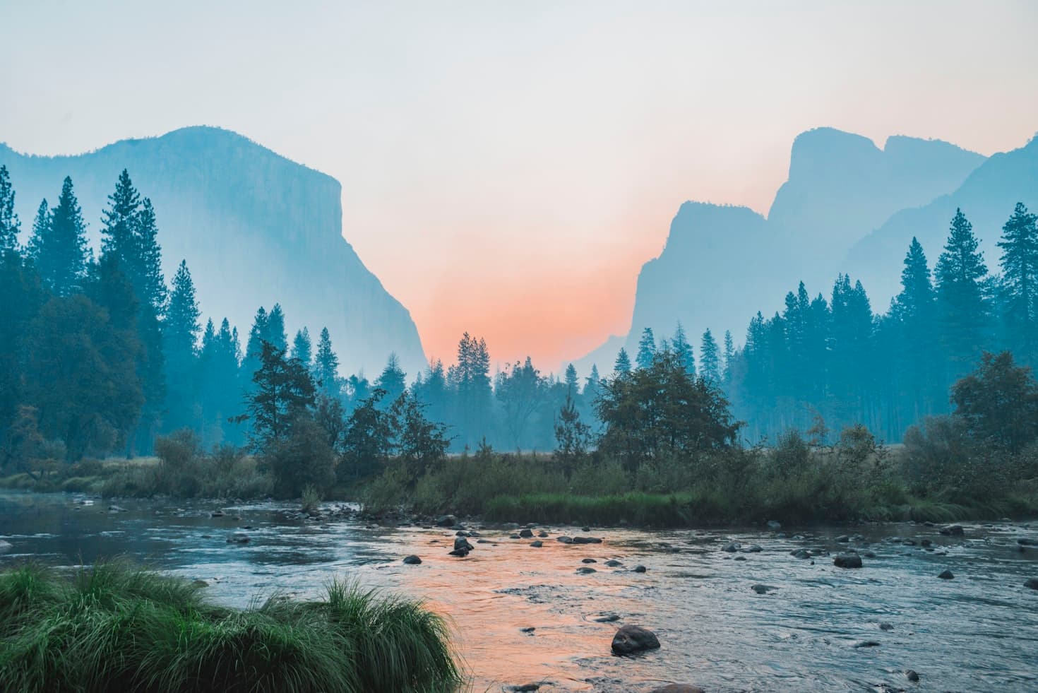
Campgrounds in Idaho
Explore wilderness camping and stunning mountain landscapes in the Gem State
131
Campgrounds listed
100%
With photos
100%
Detailed descriptions
Campground
Top campground type
Highlights
Featured campgrounds in Idaho
Explore by campground name letter
Jump to A-Z landing hubs for stronger discovery paths beyond Idaho.
All campgrounds
Showing 131 campgrounds
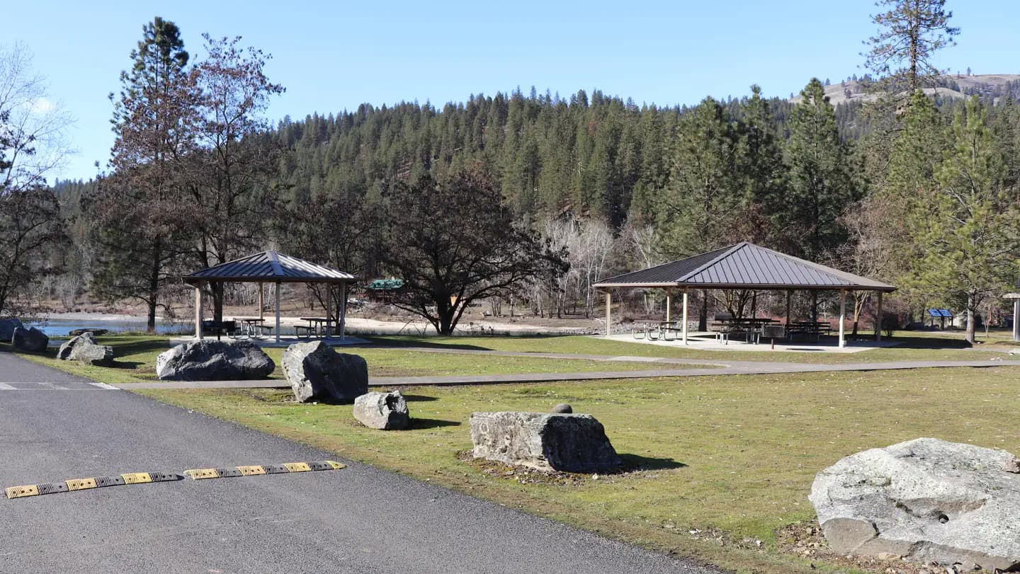
Overview Located 5 miles west of Orofino, Idaho, the Bureau of Land Management’s Pink House Recreation Site includes a large, developed campground with an on-site Campground Host and two reservable riverfront-accessible day use pavilions. The site is enjoyed by visitors from all over the country for camping, world class fishing, boating, tubing, swimming, picnicking, and wildlife viewing. Recreation This area is popular for boaters, anglers, wildlife watching, as well as for quiet relaxation. Pink House Recreation Site is home to one of the most heavily used boat launching sites upstream from Lewiston, Idaho. Guests have immediate access to the Clearwater River, home to world-renowned salmon and steelhead fisheries attracting anglers from around the world. Tubing is one of the most popular activities on the section upstream of Orofino due to the river’s mellow rapids and accessibility. With over 10 access sites along the Clearwater River to put-in and take-out, recreationists have the option to float on the river as long as they desire. Facilities This area is popular for boaters, anglers, wildlife watching, as well as for quiet relaxation. Pink House Recreation Site is home to one of the most heavily used boat launching sites upstream from Lewiston, Idaho. Guests have immediate access to the Clearwater River, home to world-renowned salmon and steelhead fisheries attracting anglers from around the world. Tubing is one of the most popular activities on the section upstream of Orofino due to the river’s mellow rapids and accessibility. With over 10 access sites along the Clearwater River to put-in and take-out, recreationists have the option to float on the river as long as they desire. Natural Features The site is nestled beside the Clearwater River at an elevation of 980 feet, surrounded by scenic views of semi-arid hills, and the Lewis and Clark National Historic Trail. Native trees provide abundant shade throughout the site and guests can access a large sandy beach with just a short walk from the pavilions. contact_info For facility specific information, please call (208) 962-3245. Nearby Attractions The Lewis and Clark National Historic Trail follows the Clearwater River from Greer, Idaho to the confluence with the Snake River. The Northwest Discovery Water Trail is the first 40-mile reach of the Clearwater River from Canoe Camp to the confluence with the Snake River in Lewiston, Idaho. Orofino, Idaho provides basic services and shopping opportunities—5 miles away. Nez Perce National Historical Park (Canoe Camp)—1 mile away. Dworshak Hatchery—9 miles away. Dworshak Dam and Visitor Center—12 miles away.
View details →
Overview The Joseph T. Fallini Campground, situated on the banks of the Mackay Reservoir, is the only recreational site in Challis Field Office that offers full RV hookups and features a diversity of other facilities. This scenic area has a gorgeous view of the Lost River Range and offers recreational opportunities such as boating in the summer and ice fishing in late winter. Mackay Reservoir offers a boat ramp providing access to the reservoir for jet skiing, water skiing and sailing . Other boat launches along the reservoir (and one downstream of the dam) are also available. Recreation Vistiors can engage in a variety of recreation opportunities including (ice) fishing, camping, picnicking, wildlife viewing, nature walking, boating, and star-gazing. Facilities Vistiors can engage in a variety of recreation opportunities including (ice) fishing, camping, picnicking, wildlife viewing, nature walking, boating, and star-gazing. Natural Features This site resides on the banks on Mackay Reservoir surrounded by the Lost River Range to the east and Knob Mountains to the west. contact_info For facility specific information, please call (208) 879-6200. Nearby Attractions Mackay Mine Hill Historical Self-Guided Tour Borah Peak Wilderness Study Area Borah Peak Trailhead Big Lost River Chilly Slough Wildlife Conservation Area Lost River Museum Craters of the Moon National Monument Lower Cedar Creek Waterfall
View details →
Overview Williams Lake Campground offers 9 campsites for both RV and tent camping. Potable water, vault toilets, picnic tables, fire rings, and ample shade are available at all sites. RVs and trailers are not recommended on the lower loop past Site 6. Recreation Campground is 2 miles from Forest Service boat dock and Williams Lake access area. Williams Lake is popular with anglers and offers both motorized and non-motorized recreation opportunities. The surrounding area offers a multitude of recreation opportunities including motorized and non-motorized trails, hunting, fishing, and wildlife viewing. Facilities Campground is 2 miles from Forest Service boat dock and Williams Lake access area. Williams Lake is popular with anglers and offers both motorized and non-motorized recreation opportunities. The surrounding area offers a multitude of recreation opportunities including motorized and non-motorized trails, hunting, fishing, and wildlife viewing. Natural Features The campsites do not offer views of Williams Lake, but they are nestled among Douglas-fir trees that provide ample shade and wildlife habitat. Lake access is located 2 miles away at the Forest Service boat dock and access area. Nearby Attractions Williams Lake Shoup Bridge Campground contact_info This location is unstaffed. To speak with our main office for general information, please call: (208) 756-5400.
View details →
Overview The Lewis & Clark Expedition camped at the Tower Rock site, along the main Salmon River. Today, the site offers prime river access for floaters and steelhead and trout anglers. Camping and picnic sites are also available, and the area makes a great stopping point for scenic drivers. Recreation The area surrounding the campground offers a multitude of recreation opportunities including motorized and non-motorized trails, hunting, fishing, and wildlife viewing. Rafters and anglers often use the boat ramp to access the Salmon River. Facilities The area surrounding the campground offers a multitude of recreation opportunities including motorized and non-motorized trails, hunting, fishing, and wildlife viewing. Rafters and anglers often use the boat ramp to access the Salmon River. Natural Features William Clark described the rock formation above the campground, known today as Tower Rock, as a “Clift of dark brown flint”. The Precambrian quartzite is some of the oldest rock in Idaho and can be found in the outcrops between the campground and North Fork, ID. At the nearby Tower Pirimids Day Use Area "hoodoo" type sandstone, gravel, and capstone formation can be seen near another Corps of Discovery campsite. Nearby Attractions Salmon River Tower Pirimids Day Use Area Morgan Bar Campground contact_info This location is unstaffed. To speak with our main office for general information, please call: (208) 756-5400. Charges & Cancellations No changes/cancellations/refunds are allowed as all fees are paid either on-site or through the Recreation.gov Scan & Pay App.
View details →
Overview McFarland Campground offer 9 campsites for both RVs and tent camping along the Lemhi River. The Lemhi Valley lies between the Beaverhead Mountains and the Lemhi Range, where the river creates a riparian zone in an otherwise arid region. Recreation McFarland Campground offers many recreation opportunities including public river access for fishing the Lemhi River, and area roads lead into the Beaverhead and Lemhi Ranges. The surrounding area offers a multitude of recreation opportunities including motorized and non-motorized trails, hunting, fishing, and wildlife viewing. The Continental Divide National Scenic Trail can be found along the top of the Beaverhead Mountains to the east of the campground and provides single-day or multi-day hiking opportunities. Facilities McFarland Campground offers many recreation opportunities including public river access for fishing the Lemhi River, and area roads lead into the Beaverhead and Lemhi Ranges. The surrounding area offers a multitude of recreation opportunities including motorized and non-motorized trails, hunting, fishing, and wildlife viewing. The Continental Divide National Scenic Trail can be found along the top of the Beaverhead Mountains to the east of the campground and provides single-day or multi-day hiking opportunities. Natural Features The Lemhi River creates a lush riparian zone lined with willows that runs through the arid Lemhi Valley. The Beaverhead and Lemhi Mountain Ranges rise above the Lemhi River on both sides of the valley creating a stunning backdrop. Nearby Attractions Lemhi River Beaverhead Mountains Lemhi Mountain Range Continental Divide National Scenic Trail Tarpon's Roost Shelter contact_info This location is unstaffed. To speak with our main office for general information, please call: (208) 756-5400. Charges & Cancellations No changes/cancellations/refunds are allowed as all fees are paid either on-site or through the Recreation.gov Scan & Pay App.
View details →
Overview Morgan Bar Campground offers RV-friendly and tent campsites with group facilities and a boat ramp. The site is adjacent to the Salmon River with a magnificent eastern view of the Beaverhead Mountains. The site was formally homesteaded by the Morgan family and still has a remnant orchard. A trail winds around a wetland pond and along almost a mile of the Salmon River's west bank. Recreation Morgan Bar Campground offers many recreation opportunities including river access for rating, fishing, tubing, and swimming. The wetland pond and riverfront trail to the south of the campground provide excellent birding opportunities. The surrounding area offers a multitude of recreation opportunities including motorized and non-motorized trails, hunting, fishing, and wildlife viewing. Facilities Morgan Bar Campground offers many recreation opportunities including river access for rating, fishing, tubing, and swimming. The wetland pond and riverfront trail to the south of the campground provide excellent birding opportunities. The surrounding area offers a multitude of recreation opportunities including motorized and non-motorized trails, hunting, fishing, and wildlife viewing. Natural Features The campground is adjacent to the Salmon River with a magnificent eastern view of the Beaverhead Mountains. A trail winds around a wetland pond and along almost a mile of the Salmon River's west bank providing ample opportunities for birding and wildlife viewing. The rock cliffs to the west of the campground are popular nesting sites for Canada goose. contact_info This location is unstaffed. To speak with our main office for general information, please call: (208) 756-5400. Nearby Attractions Salmon River Tower Rock Campground Lemhi County Fairgrounds Charges & Cancellations No changes/cancellations/refunds are allowed, as all fees are paid either on-site or through the Recreation.gov Scan & Pay App.
View details →
Overview Located far from any ocean, the St. Anthony Sand Dunes appears as a rolling sea of sand on the eastern edge of Idaho’s volcanic Snake River Plain. These vast dunes are the largest in Idaho. They blanket an area approximately 20 miles long and 5 miles wide and range from 50 to 400 feet high. This 10,600-acre playground of shifting, white quartz sand is known for its unique beauty and exceptional space for off-highway vehicle (OHV) enthusiasts, hikers and equestrians. Picnicking, snowmobiling, wildlife viewing and camping opportunities are also available. The best time to visit is spring through fall. Summer temperatures cause sands to reach over 100 degrees. The area features Deadhorse Bowl, a popular OHV sand bowl one-mile in circumference and 400 feet deep, located in the western section of the dune complex. The Egin Lakes Campground located 8 miles to the west from St. Anthony, ID. The developed campground offers a potable water system, RV dump station and 48 improved camp units, including electrical service. There is also a day use and horse trailer parking area. Recreation The campground sites have electric pedestals, access to water hydrant, campfire rings, picnic tables and a vault toilet. There are numerous opportunities to go hiking, biking, horseback riding and ride off-road vehicles in the area. Facilities The campground sites have electric pedestals, access to water hydrant, campfire rings, picnic tables and a vault toilet. There are numerous opportunities to go hiking, biking, horseback riding and ride off-road vehicles in the area. Natural Features This 10,600-acre playground of shifting, white quartz sand is known for its unique beauty and exceptional space for off-highway vehicle (OHV) enthusiasts, hikers and equestrians. The dunes are an important environment for a variety of plants and animals. The sand dunes themselves may appear lifeless, but they harbor three unique and sensitive species: the Saint Anthony evening primrose and two species of beetle. The dunes are ringed by thousands of acres of native grasses, junipers and sagebrush that provide habitat for sage-grouse and critical winter range for elk, mule deer and moose. Nearby Attractions The campground is within a couple of hours drive from Grand Teton and Yellowstone National Parks.
View details →
Overview Blackfoot Reservoir Campground is managed by the Bureau of Land Management (BLM) and is located on the southwest end of the Blackfoot Reservoir. The Reservoir covers 18,000 surface acres when full and is the second largest reservoir in southeastern Idaho. The campground has an annual fee season from May 15th - September 15th and is equipped with 16 fully developed campsites, 12 standard campsites, 6 day-use sites, 2 boat ramps, and an RV dump station. The site offers recreational activities such as fishing, camping, picnicking, motorized boating, non-motorized boating (i.e. kayaks, rafts, standup paddle boards, etc.), swimming, wildlife viewing, and hunting opportunities. Recreation Blackfoot Reservoir Campground offers recreational activities such as camping, (ice) fishing, picnicking, motorized boating, non-motorized boating (i.e. kayaks, rafts, standup paddle boards, etc.), swimming, wildlife viewing, and hunting opportunities. With almost year-round fishing the reservoir offers anglers a great place to try their luck at catching Cutthroat Trout, Rainbow Trout, Smallmouth Bass, and Cutbows. Big game hunting in the fall draws in a lot of sportsmen coming to Southeastern Idaho, with the campground being centrally located between three popular hunting areas it offers a great place for them to stay. The Blackfoot River coming off the northside of the reservoir offers non-motorized boaters a fun thrilled float with over 23 river miles, offering several Class II and a few Class III rapids. Facilities Blackfoot Reservoir Campground offers recreational activities such as camping, (ice) fishing, picnicking, motorized boating, non-motorized boating (i.e. kayaks, rafts, standup paddle boards, etc.), swimming, wildlife viewing, and hunting opportunities. With almost year-round fishing the reservoir offers anglers a great place to try their luck at catching Cutthroat Trout, Rainbow Trout, Smallmouth Bass, and Cutbows. Big game hunting in the fall draws in a lot of sportsmen coming to Southeastern Idaho, with the campground being centrally located between three popular hunting areas it offers a great place for them to stay. The Blackfoot River coming off the northside of the reservoir offers non-motorized boaters a fun thrilled float with over 23 river miles, offering several Class II and a few Class III rapids. Natural Features With the campground situated directly on the shore of the Blackfoot Reservoir nearly every campsite offers stunning views of the reservoir. China Hat, China Cap, and North Cone mountains are three geological sites adjacent to the campground, known for their noticeable distinct shapes, the rhyolite domes formed around older volcano lava flows that intruded and pierced the basalt of the Blackfoot Lava Field. The area is known for its abundance of wildlife and birdwatching opportunities. Deer, elk, and moose can be seen coming down to get a drink from the reservoir. Idaho Birding Trail #29 offers the chance to see a vast number of different birds, Gull Island located within the reservoir supports one of the largest nesting colonies in Idaho for the American White Pelican, Double-crested Cormorant, and California Gull. The reservoir is also used by waterfowl, waterbirds, and shorebirds. Nearby Attractions The Blackfoot Reservoir Campground is located off Idaho State Highway 34 between Jackson Hole, Wyoming, and Soda Springs, Idaho. This stretch of highway is designated as the Pioneer Historic Byway, a main travel route for travelers going to the Teton and Yellowstone National Parks, St. Anthony Sand Dunes, Harriman State Park and Island Park surrounding areas, Bear Lake, and Utah. Local attractions near Soda Springs, Idaho consist of: Formation Springs and Cave - Nature Conservancy Preserve. Ancient mineral springs and wildlife viewing area. Hooper Springs Park - Natural carbonated spring water, picnic spots, playground, and pavilion. Geyser Park - The only captive geyser in the world. Visitor information and history. Oregon Trail Wagon Ruts - Actual ruts left by the Oregon Trail emigrants. Sheep Rock Point - Where the Oregon/California Trail divides.
View details →
Overview O'Hara Campground sits along the Selway River amid lush vegetation and old cedar trees. This is the largest campground on the Selway, with 32 sites, and makes a great base for exploring all the recreational activities and attractions in the area. *Water is currently unavailable at this campground as it is under maintenence for the 2024 season. Water and dump station can be found at Cedar Flats, 1.5 miles from campground on Selway Road. Recreation The Selway River is a destination fly fishing experience for cutthroat and rainbow trout and is also well-known for whitewater rafting. Several trailheads for hiking and biking can be accessed from Selway River Road and lead into the Selway-Bitterroot Wilderness area. Facilities The Selway River is a destination fly fishing experience for cutthroat and rainbow trout and is also well-known for whitewater rafting. Several trailheads for hiking and biking can be accessed from Selway River Road and lead into the Selway-Bitterroot Wilderness area. Natural Features In the heart of north central Idaho, rugged peaks, deep canyons, dense forests and remote wilderness comprise the Nez Perce National Forest. Due in large part to dramatic elevational differences, the forest supports a wide variety of vegetation, from cedar groves to desert ecosystems. O'Hara is located in the Selway Wild and Scenic River Corridor, an area known for its rugged natural beauty and wildlife. Nearby Attractions An 11 mile sightseeing drive from Lowell to Selway Falls offers visitors opportunities to appreciate the pristine beauty of the Selway Wild and Scenic River and picturesque Selway Falls. O'Hara is near the Fenn Ranger Station, which is on the National Register of Historic Places.
View details →
Overview Grayback Campground is located 36 miles northeast of Boise, Idaho, just off scenic Highway 21. Historic Idaho City is just two miles north of the campground. Visitors enjoy fishing in Mores Creek and exploring the Grayback Gulch Trail. Recreation Mores Creek can be accessed just below the campground. Anglers fish for whitefish and rainbow trout. Grayback Loop Trail begins within the site, offering a 1-mile footpath for hikers. Numerous trail opportunities are in the area just north of Idaho City, where hiking, biking, horseback riding and off-road vehicles can be enjoyed. During the winter, the area becomes a playground for back country skiers and snowmobiles. Facilities Mores Creek can be accessed just below the campground. Anglers fish for whitefish and rainbow trout. Grayback Loop Trail begins within the site, offering a 1-mile footpath for hikers. Numerous trail opportunities are in the area just north of Idaho City, where hiking, biking, horseback riding and off-road vehicles can be enjoyed. During the winter, the area becomes a playground for back country skiers and snowmobiles. Natural Features The campground is situated on a hillside about a quarter-mile above Highway 21, at an elevation of 4,200 feet. A ponderosa pine forest covers the site, offering partial shade. Wildlife and summer wildflowers are abundant in the area. Nearby Attractions Highway 21, also known as the Ponderosa Pine Scenic Byway, snakes along Mores Creek to Mores Creek Summit, Gold Fork and Banner Ridge, offering historic sites, hot springs pools and breathtaking views of the surrounding mountains and forest along the way to the campground.
View details →
Overview Flat Rock Campground is located 22 miles south of West Yellowstone, Montana and 30 miles north of Ashton, Idaho in beautiful Island Park, Idaho. Flat Rock is adjacent to U.S. Highway 20 and the Henry's Fork of the Snake River at an elevation of 6,400 feet. Recreation Henry's Fork has great fly-fishing for rainbow and brook trout. The river's headwaters are at Big Springs, one of the nation's largest springs, just 4.5 miles from the campground. Tubing, canoeing, kayaking and rafting are also popular on the river. The Big Springs National Recreation Water Trail begins at Big Springs and ends just northeast of the campground at Macks Inn. It offers a lazy three-hour float or canoe trip through beautiful scenery. Wildlife, including moose, bald eagles and Sandhill cranes, is often seen along the trail. Hiking, biking, horseback riding and ATVing are popular activities. Many miles of trails crisscross Island Park, including the 2.5-mile Coffee Pot Rapids Trail, which begins at nearby Upper Coffee Pot Campground and meanders along the riverbank. The Continental Divide National Scenic Trail and the Nez Perce Trail are in the area. Island Park Reservoir and Henry's Lake are nearby, both offer boating, water skiing and excellent fishing opportunities. Facilities Henry's Fork has great fly-fishing for rainbow and brook trout. The river's headwaters are at Big Springs, one of the nation's largest springs, just 4.5 miles from the campground. Tubing, canoeing, kayaking and rafting are also popular on the river. The Big Springs National Recreation Water Trail begins at Big Springs and ends just northeast of the campground at Macks Inn. It offers a lazy three-hour float or canoe trip through beautiful scenery. Wildlife, including moose, bald eagles and Sandhill cranes, is often seen along the trail. Hiking, biking, horseback riding and ATVing are popular activities. Many miles of trails crisscross Island Park, including the 2.5-mile Coffee Pot Rapids Trail, which begins at nearby Upper Coffee Pot Campground and meanders along the riverbank. The Continental Divide National Scenic Trail and the Nez Perce Trail are in the area. Island Park Reservoir and Henry's Lake are nearby, both offer boating, water skiing and excellent fishing opportunities. Natural Features Island Park is composed of two areas of extinct volcanic activity. The Henry's Fork Caldera sits inside the larger Island Park Caldera. The area is known for its dense forests of lodgepole pine, broad grassy meadows bursting with summer wildflowers and a wide variety of wildlife, including black and grizzly bears, moose, elk, deer, bald eagles, Sandhill cranes and much, much more. A mixed growth of lodgepole pine forest provides partial shade. A portion of one loop is fairly close to the river and some sites have river views. Nearby Attractions Mesa Falls Scenic Byway is 11 miles south of the campground. This 28-mile road leads to scenic overlooks and trails at 110 foot Upper Mesa Falls and 85 foot Lower Mesa Falls. Harriman State Park is 13 miles south. The Henry's Fork meanders through the Harriman, offering excellent fishing. Over 20 miles of trails are available, and wildlife is abundant in this scenic park. Henry's Lake State Park is 10 miles north, offering fishing, a fish cleaning station and boat ramp. Yellowstone National Park's west entrance is just 22 miles north in the town of West Yellowstone, Montana. Visitors enjoy day-tripping to the park for unparalleled wildlife viewing and the beautiful and unique scenery.
View details →
Overview McCrea Bridge Campground is located on the backwaters of beautiful Island Park Reservoir in Island Park, Idaho at an elevation of 6,200 feet. Visitors love Island Park for its world-class fishing and outstanding scenery and wildlife viewing opportunities. Recreation Island Park Reservoir offers boating, water skiing, fishing and canoeing. A boat ramp is located within the campground. The reservoir is used for irrigation so the water level recedes throughout the summer and by August, the reservoir cannot be accessed from McCrea Bridge. The Island Park area is renowned for its fishing; Henry's Fork is considered one of the best fly-fishing streams in the nation. Anglers cast for rainbow, cutthroat and brook trout and Kokanee salmon. Hiking, biking, horseback riding and ATVing are popular activities. Many miles of trails are in the area, including the Continental Divide National Scenic Trail and the Nez Perce Trail. The Big Springs National Recreation Water Trail offers a roughly three-hour float or canoe trip through beautiful scenery. Wildlife, including moose, bald eagles and Sandhill cranes, are often seen along the trail. Facilities Island Park Reservoir offers boating, water skiing, fishing and canoeing. A boat ramp is located within the campground. The reservoir is used for irrigation so the water level recedes throughout the summer and by August, the reservoir cannot be accessed from McCrea Bridge. The Island Park area is renowned for its fishing; Henry's Fork is considered one of the best fly-fishing streams in the nation. Anglers cast for rainbow, cutthroat and brook trout and Kokanee salmon. Hiking, biking, horseback riding and ATVing are popular activities. Many miles of trails are in the area, including the Continental Divide National Scenic Trail and the Nez Perce Trail. The Big Springs National Recreation Water Trail offers a roughly three-hour float or canoe trip through beautiful scenery. Wildlife, including moose, bald eagles and Sandhill cranes, are often seen along the trail. Natural Features Island Park is composed of two areas of extinct volcanic activity. The Henry's Fork Caldera sits inside the larger Island Park Caldera. The area is known for its dense forests of lodgepole pine, broad grassy meadows bursting with summer wildflowers and a wide variety of wildlife, including black and grizzly bears, moose, elk, deer, bald eagles, Sandhill cranes and much, much more. The campground is situated in a forest of lodgepole pine, which provides partial shade in some sites. Some areas of the campground are more open and sunny than others. Nearby Attractions Mesa Falls Scenic Byway is 12 miles south of the campground. This 28-mile road leads to scenic overlooks and trails at 110 foot Upper Mesa Falls and 85 foot Lower Mesa Falls. Harriman State Park is 14 miles south. The Henry's Fork meanders through the Harriman, offering excellent fishing. Over 20 miles of trails are available, and wildlife is abundant in this scenic park. Henry's Lake State Park is 16 miles north, offering fishing, a fish cleaning station and boat ramp. Yellowstone National Park's west entrance is just 29 miles north in the town of West Yellowstone, Montana. Visitors enjoy day-tripping to the park for unparalleled wildlife viewing and the beautiful and unique scenery.
View details →
Overview Alturas Area Picnic B is located along the sandy shoreline of scenic Alturas Lake, at the foot of the Sawtooth Mountain Range. Recreation The site is part of the Sawtooth National Recreation Area, where outdoor activities abound. Alturas Lake offers excellent boating, water skiing, canoeing, kayaking and fishing for bull trout and Kokanee salmon. Alturas Creek runs through the adjacent campground. The 10-mile round trip Alpine Meadows Trail begins nearby, with spectacular canyon, meadow and alpine lake views. The trail is also a popular area for bird watching. Facilities The site is part of the Sawtooth National Recreation Area, where outdoor activities abound. Alturas Lake offers excellent boating, water skiing, canoeing, kayaking and fishing for bull trout and Kokanee salmon. Alturas Creek runs through the adjacent campground. The 10-mile round trip Alpine Meadows Trail begins nearby, with spectacular canyon, meadow and alpine lake views. The trail is also a popular area for bird watching. Natural Features Summer wildflowers are plentiful, and a mixed-growth conifer forest provides partial shade. Temperatures are cool with an average summer high of 78 degrees and a low of 40 degrees. Nearby Attractions The Sawtooth National Recreation Area offers a myriad of excellent hiking and biking opportunities, and an estimated 750 miles of trails crisscross the valley and surrounding mountains. Perkins Lake is less than 2 miles away, with excellent fishing and canoeing. Pettit and Yellowbelly Lakes are nearby with more fishing, canoeing and hiking. The Salmon River offers fishing for rainbow trout, Westslope cutthroat trout and occasional hybrid cutbows and bull trout. Popular area events include an Arts and Crafts Fair in July, and Wagon Days, Salmon Festival, Quilt Fair and Fireman's Ball in September.
View details →
Overview Amanita Campground is located next to scenic Lake Cascade in west-central Idaho. It is near the town of Donnelly, at an elevation of 4,850 feet. Boating, fishing, swimming and hiking are popular activities in this scenic region. Recreation Lake Cascade offers excellent opportunities for boating, water skiing, canoeing, windsurfing and sailing. Anglers enjoy casting for rainbow trout, coho salmon, smallmouth bass and perch. A boat ramp is located at the neighboring Rainbow Point Campground. Many hiking and ATV trails are in the area as well. Facilities Lake Cascade offers excellent opportunities for boating, water skiing, canoeing, windsurfing and sailing. Anglers enjoy casting for rainbow trout, coho salmon, smallmouth bass and perch. A boat ramp is located at the neighboring Rainbow Point Campground. Many hiking and ATV trails are in the area as well. Natural Features The campground is situated on the west shore of the lake, among a mixed-growth conifer forest that towers over the campground. Summer wildflowers are abundant in the area. A wide variety of wildlife makes its home around the lake. Waterfowl and songbirds can also be seen in the area, as well as pelicans and bald eagles.
View details →
Overview Antelope Campground is located on the shores of the scenic Sagehen Reservoir in the Boise National Forest, perched at an elevation of 5031 feet. Visitors enjoy boating, fishing and exploring the non-motorized Sagehen Reservoir Trail. Recreation Sagehen Reservoir offers excellent boating, canoeing and rainbow trout fishing. A boat ramp and dock are located within the campground.The speed limit on the reservoir is 15 mph. Hiking, biking, horse and off-road vehicle trails are abundant in the area. The non-motorized Sagehen Reservoir Trail, a 4-mile loop around the lake, offers great fishing spots, beautiful viewpoints and abundant wildlife watching opportunities. The Sagehen and KYAOTT ATV Trail Systems can be accessed near the reservoir, offering more than 35 miles of trails for off-road vehicles and motorcycles, but hikers, mountain bikers and horseback riders can enjoy these trails as well. Facilities Sagehen Reservoir offers excellent boating, canoeing and rainbow trout fishing. A boat ramp and dock are located within the campground.The speed limit on the reservoir is 15 mph. Hiking, biking, horse and off-road vehicle trails are abundant in the area. The non-motorized Sagehen Reservoir Trail, a 4-mile loop around the lake, offers great fishing spots, beautiful viewpoints and abundant wildlife watching opportunities. The Sagehen and KYAOTT ATV Trail Systems can be accessed near the reservoir, offering more than 35 miles of trails for off-road vehicles and motorcycles, but hikers, mountain bikers and horseback riders can enjoy these trails as well. Natural Features The campground is situated in a forest of towering Ponderosa pine, Engelmann spruce, Douglas fir and grand fir. Most sites have plentiful shade and some have partial lake views. Summer temperatures range from 80-90 degrees during the day with crisp, cool nights. A variety of berries and mushrooms can be found throughout the area. Local wildlife includes deer, elk, black bear, goshawk, woodpeckers and boreal owls.
View details →
Overview Chemeketan Campground sits near the headwaters of the Salmon River, at the foot of the Sawtooth Mountain Range. Recreation This site is part of the Sawtooth National Recreation Area, where outdoor activities abound. The Salmon River offers excellent fishing for rainbow trout, westslope cutthroat trout and occasional hybrid cutbows and bull trout. The Idaho Centennial Trail can be easily accessed nearby. Alturas, Perkins, Pettit and Yellowbelly Lakes are nearby, with fishing, canoeing and hiking. Facilities This site is part of the Sawtooth National Recreation Area, where outdoor activities abound. The Salmon River offers excellent fishing for rainbow trout, westslope cutthroat trout and occasional hybrid cutbows and bull trout. The Idaho Centennial Trail can be easily accessed nearby. Alturas, Perkins, Pettit and Yellowbelly Lakes are nearby, with fishing, canoeing and hiking. Natural Features Chemeketan is a secluded, peaceful campground situated among lodgepole pines, which provide partial shade. Rugged peaks of the Sawtooth Range surround the area and the Salmon River flows at the campground's edge. Temperatures are cool, with an average summer high of 78 degrees and a low of 40 degrees. Nearby Attractions The Sawtooth National Recreation Area offers a myriad of excellent hiking and biking opportunities, and an estimated 750 miles of trails crisscross the valley and surrounding mountains. Popular area events include an Arts and Crafts Fair in July, and Wagon Days, Salmon Festival, Quilt Fair and Fireman's Ball in September.
View details →
Overview Easley Campground is located along the beautiful Big Wood River at an elevation of 6800 feet, conveniently close to Ketchum, Idaho only 14 miles south. Visitors enjoy fishing, hiking and soaking at Easley Hot Springs. Recreation Easley is part of the Sawtooth National Recreation Area, where outdoor activities abound. Fly-fishing for rainbow, brown and brook trout is popular on the Big Wood River, as is float tubing. The 20-mile Harriman Trail passes through the campground, offering excellent hiking and biking. Numerous trails spur off the Harriman Trail leading to deep canyons, sparkling lakes, swimming holes and more great high country fishing. Facilities Easley is part of the Sawtooth National Recreation Area, where outdoor activities abound. Fly-fishing for rainbow, brown and brook trout is popular on the Big Wood River, as is float tubing. The 20-mile Harriman Trail passes through the campground, offering excellent hiking and biking. Numerous trails spur off the Harriman Trail leading to deep canyons, sparkling lakes, swimming holes and more great high country fishing. Natural Features A forest of Douglas fir, ponderosa pine, lodgepole pine and aspen offers plentiful shade in the campground. Colorful summer wildflowers are abundant and willows dot the banks of the river. Temperatures are cool with an average summer high of 78 and a low of 40. Nearby Attractions Easley Hot Springs is less than 1/4-mile away, just past the campground entrance. A swimming pool, hot tubs and showers are available for a small fee, and a small store is located on-site. The Sawtooth National Recreation Area Visitor Center is 6.5 miles from the campground, with a small museum, bookstore and area information. A dump station and drinking water are located here as well. Sun Valley Resort is 11 miles away, with hiking, biking, guided horseback riding and beautiful mountain scenery. Popular area events include Wagon Days in Ketchum in September, and in Stanley an hour away, an Arts & Crafts Fair in July, and Salmon Festival, Quilt Fair and Fireman's Ball in September.
View details →
Overview Eastside Campground is located on the shores of scenic Sagehen Reservoir at an elevation of 4,956 feet. Visitors enjoy boating, fishing and exploring the non-motorized Sagehen Reservoir Trail. Recreation Sagehen Reservoir offers great boating, canoeing, and rainbow trout fishing. Boat ramps and docks are located nearby at both Antelope and Sagehen Creek Campgrounds. There is a 15 mph speed limit on the reservoir. Hiking, biking, horse, and ATV trails are abundant in the area. The non-motorized Sagehen Reservoir Trail, a 4-mile loop around the lake, offers great fishing spots, beautiful viewpoints, and wildlife watching opportunities for hikers, mountain bikers and horseback riders. The Sagehen and KYAOTT ATV Trail Systems can be accessed near the reservoir, offering more than 35 miles of trails for ATVs and motorcycles, but hikers, mountain bikers and horseback riders can enjoy these trails as well. Facilities Sagehen Reservoir offers great boating, canoeing, and rainbow trout fishing. Boat ramps and docks are located nearby at both Antelope and Sagehen Creek Campgrounds. There is a 15 mph speed limit on the reservoir. Hiking, biking, horse, and ATV trails are abundant in the area. The non-motorized Sagehen Reservoir Trail, a 4-mile loop around the lake, offers great fishing spots, beautiful viewpoints, and wildlife watching opportunities for hikers, mountain bikers and horseback riders. The Sagehen and KYAOTT ATV Trail Systems can be accessed near the reservoir, offering more than 35 miles of trails for ATVs and motorcycles, but hikers, mountain bikers and horseback riders can enjoy these trails as well. Natural Features The campground is situated in a forest of towering Ponderosa pine, Engelmann spruce, Douglas fir, and grand fir. Most sites have plentiful shade. Summer temperatures range from 80 to 90-degree days to cooler nights. A variety of berries and mushrooms can be found throughout the area. Local wildlife includes deer, elk, black bear, goshawk, woodpeckers, and boreal owls.
View details →
Overview Elk Creek Campground lies just off Highway 21 in a beautiful valley at the foot of the Sawtooth Mountain Range in central Idaho. Recreation Elk Creek is situated in the Sawtooth National Recreation Area. A myriad of excellent hiking and biking opportunities are available, with an estimated 750 miles of trails crisscrossing the valley and surrounding mountains, including the Idaho Centennial Trail, which passes nearby. Expansive and scenic Elk Meadow is near the campground, providing a great location for bird and wildlife watching. Facilities Elk Creek is situated in the Sawtooth National Recreation Area. A myriad of excellent hiking and biking opportunities are available, with an estimated 750 miles of trails crisscrossing the valley and surrounding mountains, including the Idaho Centennial Trail, which passes nearby. Expansive and scenic Elk Meadow is near the campground, providing a great location for bird and wildlife watching. Natural Features Summer wildflowers are plentiful and lodgepole pines provide partial shade. Elk Creek is nearby. Temperatures are cool, with an average summer high of 78 degrees and a low of 40 degrees. Nearby Attractions Numerous sparkling lakes and streams, including the Salmon River, dot the area, making for great rainbow and native Westslope cutthroat trout fishing. Stanley and Redfish Lakes are nearby with great boating, water skiing, canoeing, kayaking and even more fishing. Popular area events include an Arts and Crafts Fair in July, and Wagon Days, Salmon Festival, Quilt Fair and Fireman's Ball in September.
View details →
Overview French Creek Campground is located next to scenic Lake Cascade in west-central Idaho. It is near the town of Donnelly, at an elevation of 4,850 feet. Boating, fishing, swimming and hiking are popular activities in this scenic region. Recreation Lake Cascade offers excellent opportunities for boating, water skiing, canoeing, windsurfing and sailing. Anglers enjoy casting for rainbow trout, coho salmon, smallmouth bass and perch. Many hiking and biking trails are in the area as well. Facilities Lake Cascade offers excellent opportunities for boating, water skiing, canoeing, windsurfing and sailing. Anglers enjoy casting for rainbow trout, coho salmon, smallmouth bass and perch. Many hiking and biking trails are in the area as well. Natural Features The campground is situated on the western shore of Lake Cascade and on the banks of French Creek. A forest of mixed conifers covers the campground, providing ample shade. Thimbleberry and huckleberry plants are abundant throughout the upper reaches of the campground. A wide variety of wildlife makes its home around the lake. Waterfowl and songbirds are abundant, as well as pelicans and bald eagles.
View details →
Overview Glacier View Campground is located next to beautiful Redfish Lake, beneath the Sawtooth Mountain Range, at an elevation of 6,500 feet. Recreation Glacier View is in the heart of the beautiful Sawtooth National Recreation Area, where outdoor activities abound. Redfish Lake offers excellent boating, water skiing, canoeing, kayaking and fishing for rainbow trout and Kokanee salmon. Little Redfish Lake is just down the road, offering additional fishing and canoeing. The Redfish Lake Visitor Center is within 1/4-mile, offering interpretive activities, evening programs and wildlife, geology and historical exhibits. Facilities Glacier View is in the heart of the beautiful Sawtooth National Recreation Area, where outdoor activities abound. Redfish Lake offers excellent boating, water skiing, canoeing, kayaking and fishing for rainbow trout and Kokanee salmon. Little Redfish Lake is just down the road, offering additional fishing and canoeing. The Redfish Lake Visitor Center is within 1/4-mile, offering interpretive activities, evening programs and wildlife, geology and historical exhibits. Natural Features Summer wildflowers are plentiful, lodgepole pines provide partial shade and Fishhook Creek is nearby. Temperatures are cool, with an average summer high of 78 degrees and a low of 40 degrees. Nearby Attractions The Sawtooth National Recreation Area offers a myriad of excellent hiking and biking opportunities; an estimated 750 miles of trails crisscross the valley and surrounding mountains. Alpine Way, Fishhook Creek, Redfish Lake Creek and Bench Lakes Trails all offer trailheads in the immediate area. The Idaho Centennial Trail passes nearby. The Salmon River offers excellent fishing for rainbow trout, Westslope cutthroat trout and occasional hybrid cutbows and bull trout. Popular area events include an Arts and Crafts Fair in July, and Wagon Days, Salmon Festival, Quilt Fair, and Fireman's Ball in September.
View details →
Overview Hot Springs Campground is located just east of Garden Valley, Idaho along the Banks-Lowman Highway at an elevation of 3169 feet. Visitors enjoy rafting, kayaking, fishing on the South Fork Payette River, and soaking in the hot springs at the river's edge. Recreation The South Fork Payette River is across the road from the campground, offering fishing, whitewater rafting, and kayaking. A natural hot springs soaking pool is located on the river directly across the road and down a staircase. Facilities The South Fork Payette River is across the road from the campground, offering fishing, whitewater rafting, and kayaking. A natural hot springs soaking pool is located on the river directly across the road and down a staircase. Natural Features The campground is situated at the foot of a forested hillside. Towering Ponderosa pines are scattered throughout the site, offering partial shade. Summer wildflowers dot the landscape. Nearby Attractions Numerous natural hot springs pools can be found along the Banks-Lowman Highway, also known as the Wildlife Canyon Scenic Byway. The area offers scenic views, wildlife watching, historical information kiosks, and several hiking opportunities. Whitewater rafting and kayaking are popular activities on the South Fork and Main Payette Rivers. Several companies in the area offer guided half and full-day trips.
View details →
Overview Point Campground is located next to beautiful Redfish Lake at the foot of the Sawtooth Mountain Range at an elevation of 6,500 feet. Recreation Point Campground is in the heart of the beautiful Sawtooth National Recreation Area, where outdoor activities abound. Redfish Lake offers excellent boating, water skiing, canoeing, kayaking and fishing for rainbow trout and Kokanee salmon. Little Redfish Lake is just down the road, offering additional fishing and canoeing. A designated swimming beach and dock are located at the adjacent public day-use area. Sandy Beach Boat Ramp is across the lake, about a mile away. Facilities Point Campground is in the heart of the beautiful Sawtooth National Recreation Area, where outdoor activities abound. Redfish Lake offers excellent boating, water skiing, canoeing, kayaking and fishing for rainbow trout and Kokanee salmon. Little Redfish Lake is just down the road, offering additional fishing and canoeing. A designated swimming beach and dock are located at the adjacent public day-use area. Sandy Beach Boat Ramp is across the lake, about a mile away. Natural Features Summer wildflowers are plentiful, lodgepole pines provide partial shade and Fishhook Creek is nearby. Temperatures are cool, with an average summer high of 78 degrees and a low of 40 degrees. Nearby Attractions The Sawtooth National Recreation Area offers a myriad of excellent hiking and biking opportunities, and an estimated 750 miles of trails crisscross the valley and surrounding mountains. In the immediate area are trailheads for the Alpine Way, Fishhook Creek, Redfish Lake Creek and Bench Lakes Trails. The Idaho Centennial Trail passes nearby. Redfish Lake Lodge is nearby with a restaurant, general store, boat and kayak rentals, mooring services, lake tours and a lake shuttle. Popular area events include an Arts and Crafts Fair in July, and Wagon Days, Salmon Festival, Quilt Fair and Fireman's Ball in September.
View details →
Overview Rainbow Point Campground is located next to scenic Lake Cascade in west central Idaho. It is near the town of Donnelly, at an elevation of 4,850 feet. Boating, fishing, swimming and hiking are popular activities in this scenic region. Note: During the 2022 season, thinning work will be conducted in neighboring Amanita campground to reduce the risk associated with root rot and subsequent hazard trees. Recreation Lake Cascade offers excellent opportunities for boating, water skiing, canoeing, windsurfing and sailing. Anglers enjoy casting for rainbow trout, coho salmon, smallmouth bass and perch. A boat ramp is located within the campground. Many hiking and biking trails are in the area as well. Facilities Lake Cascade offers excellent opportunities for boating, water skiing, canoeing, windsurfing and sailing. Anglers enjoy casting for rainbow trout, coho salmon, smallmouth bass and perch. A boat ramp is located within the campground. Many hiking and biking trails are in the area as well. Natural Features The campground is situated on the west shore of the lake, among a mixed-growth conifer forest that towers over the campground. Summer wildflowers are abundant. A wide variety of wildlife makes its home around the lake. Waterfowl and songbirds can also be seen in the area, as well as pelicans and bald eagles.
View details →
Overview Sagehen Creek Campground is located on the shores of the scenic Sagehen Reservoir at an elevation of 4997 feet. Visitors enjoy boating, fishing, exploring Joe's Creek Trail, as well as utilizing the non-motorized Sagehen Reservoir Trail. Recreation Sagehen Reservoir offers great boating, canoeing, and rainbow trout fishing. A boat ramp and dock are located within the campground.There is a 15 mph speed limit on the reservoir. Hiking, biking, horse, and ATV trails are abundant in the area, including Joe's Creek Trail, which begins not far from the campground. The Sagehen Reservoir Trail, a 4-mile loop around the lake, offers great fishing spots, beautiful viewpoints and wildlife watching opportunities for hikers, mountain bikers and horseback riders. The Sagehen and KYAOTT ATV Trail Systems can be accessed near the reservoir, offering more than 35 miles of trails for ATVs and motorcycles, but hikers, mountain bikers and horseback riders can enjoy these trails as well. Facilities Sagehen Reservoir offers great boating, canoeing, and rainbow trout fishing. A boat ramp and dock are located within the campground.There is a 15 mph speed limit on the reservoir. Hiking, biking, horse, and ATV trails are abundant in the area, including Joe's Creek Trail, which begins not far from the campground. The Sagehen Reservoir Trail, a 4-mile loop around the lake, offers great fishing spots, beautiful viewpoints and wildlife watching opportunities for hikers, mountain bikers and horseback riders. The Sagehen and KYAOTT ATV Trail Systems can be accessed near the reservoir, offering more than 35 miles of trails for ATVs and motorcycles, but hikers, mountain bikers and horseback riders can enjoy these trails as well. Natural Features The campground is situated in a forest of towering Ponderosa pine, Engelmann spruce, Douglas fir, and grand fir, which provide plentiful shade in most sites. Some sites afford lake views. Summer temperatures range from 80 to 90-degree days to cooler nights. A variety of berries and mushrooms can be found throughout the area. Local wildlife includes deer, elk, black bear, goshawk, woodpeckers, and boreal owls.
View details →
Overview Sheep Trail Campground is located at an elevation of 6,670 feet in a beautiful valley at the foot of the Sawtooth Mountain Range in central Idaho. Recreation Sheep Trail is situated in the Sawtooth National Recreation Area. A myriad of excellent hiking and biking opportunities are available, with an estimated 750 miles of trails crisscrossing the valley and surrounding mountains, including the nearby Idaho Centennial Trail. Expansive and scenic Elk Meadow is near the campground, providing a great location for bird and wildlife watching. Facilities Sheep Trail is situated in the Sawtooth National Recreation Area. A myriad of excellent hiking and biking opportunities are available, with an estimated 750 miles of trails crisscrossing the valley and surrounding mountains, including the nearby Idaho Centennial Trail. Expansive and scenic Elk Meadow is near the campground, providing a great location for bird and wildlife watching. Natural Features Summer wildflowers are plentiful and a mixed stand of pines provides partial shade. A small creek runs next to the campground. Temperatures are cool, with an average summer high of 78 degrees and a low of 40 degrees. Nearby Attractions Numerous sparkling lakes and streams, including the Salmon River, dot the area, making for great rainbow and native Westslope cutthroat trout fishing. Stanley and Redfish Lakes are nearby, offering excellent boating, water skiing, canoeing, kayaking and fishing. Popular area events include an Arts and Crafts Fair in July, and Wagon Days, Salmon Festival, Quilt Fair and Fireman's Ball in September.
View details →
Overview Shoreline Campground is located just across the road from beautiful Warm Lake, at an elevation of 5,300 feet. Visitors enjoy boating, fishing, swimming, hiking and viewing local wildlife. Recreation Warm Lake offers great fishing opportunities for cutthroat, rainbow, lake and bull trout. Boating, canoeing and swimming are popular activities. Billy Rice Swim Beach is nearby, offering a day-use site for picnicking and swimming. A boat ramp is located just across the road from the campground. The surrounding area offers great hiking, mountain biking, horseback and off-road vehicle riding, and hunting. The WeWuKiye (Wa Wu Kia) Trail No. 252 is popular among hikers and mountain bikers. It was recently built and can be accessed at the campground's entrance. For off-road vehicle enthusiasts, Telephone Ridge Trail No. 112 offers 20 miles of trails for all riding levels, with staging areas within the campground and at Warm Lake Campground just down the road. Facilities Warm Lake offers great fishing opportunities for cutthroat, rainbow, lake and bull trout. Boating, canoeing and swimming are popular activities. Billy Rice Swim Beach is nearby, offering a day-use site for picnicking and swimming. A boat ramp is located just across the road from the campground. The surrounding area offers great hiking, mountain biking, horseback and off-road vehicle riding, and hunting. The WeWuKiye (Wa Wu Kia) Trail No. 252 is popular among hikers and mountain bikers. It was recently built and can be accessed at the campground's entrance. For off-road vehicle enthusiasts, Telephone Ridge Trail No. 112 offers 20 miles of trails for all riding levels, with staging areas within the campground and at Warm Lake Campground just down the road. Natural Features The campground is situated in a mixed-growth lodgepole pine forest, which offers partial shade. Summer wildflowers are abundant in the area. A variety of wildlife including bears, deer, elk, fox, grouse, eagles, osprey, grosbeaks, whooping cranes and otters, lives around the lake.
View details →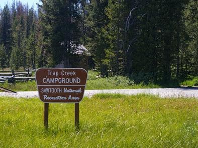
Overview Trap Creek Campground is located in a beautiful valley at the foot of the Sawtooth Mountain Range in central Idaho. Recreation Trap Creek is situated in the Sawtooth National Recreation Area. A myriad of excellent hiking and biking opportunities are available, with an estimated 750 miles of trails crisscrossing the valley and surrounding mountains, including the Idaho Centennial Trail, which passes through the site. Expansive and scenic Elk Meadow is near the campground, providing a great location for bird and wildlife watching. Facilities Trap Creek is situated in the Sawtooth National Recreation Area. A myriad of excellent hiking and biking opportunities are available, with an estimated 750 miles of trails crisscrossing the valley and surrounding mountains, including the Idaho Centennial Trail, which passes through the site. Expansive and scenic Elk Meadow is near the campground, providing a great location for bird and wildlife watching. Natural Features Summer wildflowers are plentiful and a mixed stand of pines provides partial shade. Trap Creek flows nearby. The campground sits at an elevation of 6,670 feet, and temperatures are cool, with an average summer high of 78 degrees and a low of 40 degrees. Nearby Attractions Numerous sparkling lakes and streams, including the Salmon River, dot the area, making for great rainbow and native Westslope cutthroat trout fishing. Stanley and Redfish Lakes are nearby, offering great boating, water skiing, canoeing, kayaking and fishing. Popular area events include an Arts and Crafts Fair in July, and Wagon Days, Salmon Festival, Quilt Fair and Fireman's Ball in September.
View details →
Overview Wood River Group Overnight Area is located inside the Wood River Campground, which has 30 single campsites for RV's and tent camping, which are available for use on a first-come first-served basis. This campground is located on the banks of the beautiful Big Wood River at an elevation of 6400 feet. Ketchum, Idaho is conveniently close, only 10 miles south. Visitors enjoy fishing, tubing and exploring local trails. Recreation This site is part of the Sawtooth National Recreation Area, where outdoor activities abound. Fly-fishing for rainbow, brown and brook trout is popular on the Big Wood River, as is float tubing. A self-guided nature trail begins near the amphitheater, leading to a small cave and a beaver pond. Facilities This site is part of the Sawtooth National Recreation Area, where outdoor activities abound. Fly-fishing for rainbow, brown and brook trout is popular on the Big Wood River, as is float tubing. A self-guided nature trail begins near the amphitheater, leading to a small cave and a beaver pond. Natural Features A forest of Douglas fir, Ponderosa pine, Lodgepole pine and aspens offers plentiful shade within the facility. Colorful summer wildflowers are abundant and willows dot the banks of the river. Temperatures are cool with an average summer high of 78 degrees and a low of 40 degrees. Nearby Attractions The 20-mile Harriman Trail passes nearby, offering excellent hiking and biking. Numerous additional trails spur off the Harriman Trail leading to deep canyons, sparkling lakes, swimming holes and more great high country fishing. The Sawtooth National Recreation Area Visitor Center is 2.5 miles from the campground, with a small museum, bookstore and area information. An RV dump station and drinking water are located here as well. Easley Hot Springs is 4 miles north, offering a swimming pool, hot tubs, showers and a small store. Sun Valley Resort is 7 miles south, with hiking, biking, guided horseback riding and beautiful mountain scenery. Popular area events include Wagon Days in Ketchum in September. In Stanley an hour away, an Arts & Crafts Fair is held in July and a Salmon Festival, Quilt Fair and Fireman's Ball in September.
View details →
Overview Mountain View Campground is located just east of Lowman, Idaho, along Highway 21 at an elevation of 3,900 feet. Visitors enjoy rafting, kayaking and fishing on the South Fork Payette River, and soaking in the area's many hot springs pools. Recreation The South Fork Payette River offers whitewater rafting, kayaking and trout fishing. The Deadwood and Danskin River Access areas are nearby. Popular Kirkham Hot Springs is less than 3 miles from the campground, with several soaking pools on the river's edge. Facilities The South Fork Payette River offers whitewater rafting, kayaking and trout fishing. The Deadwood and Danskin River Access areas are nearby. Popular Kirkham Hot Springs is less than 3 miles from the campground, with several soaking pools on the river's edge. Natural Features Towering Ponderosa pines cover the campground, offering partial shade in most sites. Summer wildflowers dot the landscape. Deer and elk may be seen wandering through the area on occasion. contact_info For facility specific information, please call (208) 259-3361. Nearby Attractions Numerous natural hot springs pools can be found along Highway 21, the Ponderosa Pine Scenic Byway and the Banks-Lowman Highway, also known as the Wildlife Canyon Scenic Byway. Both byways offer scenic views, wildlife watching, historical information kiosks and several trail opportunities. Whitewater rafting and kayaking are popular activities on the South Fork and Main Payette Rivers. Several companies in the area offer guided half and full-day trips.
View details →
Overview Park Creek Campground is located 4 miles from Lowman, Idaho, off the beaten path at the confluence of Park and Clear Creeks. Visitors enjoy fishing, hunting and exploring local trails. Recreation Park Creek and Clear Creek both offer good trout fishing. Various hiking, biking, horseback and off-road vehicle riding trails are in the vicinity. Facilities Park Creek and Clear Creek both offer good trout fishing. Various hiking, biking, horseback and off-road vehicle riding trails are in the vicinity. Natural Features Towering Ponderosa pine and Douglas fir trees forest the campground, offering plentiful shade. Summer wildflowers dot the landscape. A variety of wildlife lives in the area, including black bears, deer and elk. contact_info This location is unstaffed. To speak with our main office for general information, please call: (208) 259-3361. Nearby Attractions Beautiful Bear Valley is up the road from Park Creek, offering scenic views, wildlife watching and numerous trail opportunities for hiking, biking, horseback and off-road vehicle riding. Several natural hot springs pools can be found along the Banks-Lowman Highway, also known as the Wildlife Canyon Scenic Byway, and Highway 21, the Ponderosa Pine Scenic Byway. Both byways also offer pretty scenery, wildlife viewing, historical information kiosks and trail opportunities. Whitewater rafting and kayaking are popular activities on the South Fork and Main Payette Rivers; several companies in the area offer guided half and full-day trips.
View details →
Overview Luby Bay Campground is located near both Lamb Creek and Priest Lake. The campground is densely wooded with nicely secluded sites, and is within easy access to many great views of the Selkirk Mountains. Recreation Visitors enjoy kayaking, canoeing and power boating up the 3.5-mile thoroughfare that leads to the Upper Priest Lake Scenic Area. The upper lake cannot be accessed by car. Fishing, swimming, birding and wildlife viewing are popular activities as well. The Beach Trail #48 can be accessed from the campground. The 8-mile scenic excursion loops around the southern part of Priest Lake. Facilities Visitors enjoy kayaking, canoeing and power boating up the 3.5-mile thoroughfare that leads to the Upper Priest Lake Scenic Area. The upper lake cannot be accessed by car. Fishing, swimming, birding and wildlife viewing are popular activities as well. The Beach Trail #48 can be accessed from the campground. The 8-mile scenic excursion loops around the southern part of Priest Lake. Natural Features The campground sits at an elevation of 2,500 feet on the western shores of Priest Lake. Campsites are shaded by hemlock and cedar. Priest Lake consists of the main lake where most water recreation takes place. To the north, the lake connects via a narrow channel with Upper Priest Lake. Nearby Attractions Off-road vehicle enthusiasts will find authorized trails like the Peewee Trail, Steep Creek Trail and John Wayne Trail. In winter, hundreds of miles of groomed trails beckon nordic skiers and snowmobile riders.
View details →
Overview Reeder Bay Campground is a picturesque hideaway for nature immersion and relaxing water sports on Priest Lake. Campsites are shaded by a dense forest of cedar, fir and hemlock. Campers visit Reeder for its incredible beach that slopes down into the refreshing, clear lake. Recreation Wake boarding, jet skiing, bird watching and canoeing are among the many activities campers enjoy. Hike the 8-mile Lakeshore Trail which passes through alder, pine, young cedar and open hillsides of brush, providing memorable scenic views throughout the journey. Anglers seek Dolly Varden and cutthroat trout, as well as kokanee salmon, on the lake and nearby Priest River. Facilities Wake boarding, jet skiing, bird watching and canoeing are among the many activities campers enjoy. Hike the 8-mile Lakeshore Trail which passes through alder, pine, young cedar and open hillsides of brush, providing memorable scenic views throughout the journey. Anglers seek Dolly Varden and cutthroat trout, as well as kokanee salmon, on the lake and nearby Priest River. Natural Features The campground is situated on the eastern shore of Priest Lake, nestled deep below the crest of the Selkirk Mountains. The lake spans 19 miles in length and reaches a depth of 300 feet. Priest Lake is noteworthy for its incredibly clear waters, fed by streams cascading from the high Selkirk peaks. A variety of wildlife inhabits the surrounding area, including deer, elk, moose, grizzly and black bears, wolves and mountain lions. Nearby Attractions Explore the extensive trail system around the lake. The Upper Priest Lake Trail takes hikers and mountain bikers to the Upper Priest Lake Scenic Area, which can also be accessed by boat.
View details →
Overview Sam Owen Campground is nestled on the banks of Lake Pend Oreille in a densely wooded forest of pine and cedar. Popular activities include hiking, canoeing, swimming and boating in summer, and skiing in winter. Recreation A beach draws crowds of sunbathers and swimmers. Visitors also like to hike the half-mile, accessible Sam Owen Trail #4. The trail reaches a beautiful vista of Owens Bay, where hikers can rest on benches and take in the astonishing view. Anglers take pleasure in catching kamloops, Dolly Varden, northern pike, trout and catfish. A boat ramp and dock are located on-site. Facilities A beach draws crowds of sunbathers and swimmers. Visitors also like to hike the half-mile, accessible Sam Owen Trail #4. The trail reaches a beautiful vista of Owens Bay, where hikers can rest on benches and take in the astonishing view. Anglers take pleasure in catching kamloops, Dolly Varden, northern pike, trout and catfish. A boat ramp and dock are located on-site. Natural Features Sam Owen Campground is situated on a peninsula on the east side of Lake Pend Oreille in the Idaho Panhandle National Forest, at an elevation of 2,000 feet. The lake spans 82,088 acres and has 125 miles of shoreline. The well-loved campground shares a peninsula with the Sam Owen Game Preserve, which provides plenty of opportunities to see wildlife up close. Deer are very easy to spot, and watching for unique birds is a rewarding activity. Nearby Attractions The Pend Oreille Scenic Byway is well worth exploring.
View details →
Overview Alpine North Loop Campground is located in beautiful Star Valley, Wyoming at an elevation of 5,640 feet. The cozy town of Alpine is just 2 miles west. Visitors enjoy boating and fishing on Palisades Reservoir, and day-tripping to Jackson and Grand Teton National Park. Recreation Palisades Reservoir is very close, with excellent boating, water skiing, swimming and canoeing. Lake and shore fishing for wild and stocked cutthroat trout is very popular. Brown trout, Kokanee salmon and Mackinaw trout can also be found. Boat ramps are located 2 miles away in Alpine and about 10 miles away near Blowout Campground, off Highway 26. The Grey's River, Salt River and Snake River merge nearby, offering great fishing and wildlife viewing opportunities. The Palisades Creek Trail begins nearby, leading hikers, mountain bikers and horseback riders to beautiful Upper Palisades Lake and expansive views of Swan Valley. Facilities Palisades Reservoir is very close, with excellent boating, water skiing, swimming and canoeing. Lake and shore fishing for wild and stocked cutthroat trout is very popular. Brown trout, Kokanee salmon and Mackinaw trout can also be found. Boat ramps are located 2 miles away in Alpine and about 10 miles away near Blowout Campground, off Highway 26. The Grey's River, Salt River and Snake River merge nearby, offering great fishing and wildlife viewing opportunities. The Palisades Creek Trail begins nearby, leading hikers, mountain bikers and horseback riders to beautiful Upper Palisades Lake and expansive views of Swan Valley. Natural Features The campground is situated near Palisades Reservoir in a forest of lodgepole pines, which provide partial shade. The campground is relatively flat and some sites offer views of Star Valley. Summer wildflowers are abundant. Wind and summer thunderstorms should be expected. Nearby Attractions The town of Alpine is just 2 miles east. The popular Mountain Days Celebration is held annually in June, complete with arts and crafts shows, food, live music, a horseshoe tournament, authentic pioneer village and Native American dancers. Jackson, Wyoming is 40 miles north, with restaurants, shops, galleries and ski resorts with summer activities. Grand Teton National Park is approximately 55 miles north, with boating, fishing, hiking, canoeing and outstanding mountain scenery. The Snake River and Swan Valley offer more great fishing and boating, as well as rafting, canoeing and numerous trails for hiking, biking, horseback and ATV riding.
View details →
Overview Big Elk Campground is situated along Big Elk Creek on a quiet arm of the beautiful Palisades Reservoir, just 55 miles east of Idaho Falls, Idaho. Visitors enjoy boating, fishing and exploring the scenic Big Elk Creek Trail. Recreation Big Elk Creek has great fishing for cutthroat trout and the occasional Kokanee salmon. Canoeing and swimming are popular activities on the reservoir. A small boat ramp is located on-site. When the reservoir level is low, boats cannot be launched on Big Elk Creek. Big Elk Creek Trail, for hiking, biking and horseback riding, begins at the campground and meanders up a beautiful canyon brimming with wildflowers, towering trees and scenic views. Palisades Reservoir is across the highway, offering excellent boating, water skiing, swimming and canoeing. Lake and shore fishing are very popular there as well, with wild and stocked cutthroat trout as the predominate species. Kokanee salmon, brown and Mackinaw trout can also be found. A boat ramp is located at Calamity Campground less than 10 miles away. Facilities Big Elk Creek has great fishing for cutthroat trout and the occasional Kokanee salmon. Canoeing and swimming are popular activities on the reservoir. A small boat ramp is located on-site. When the reservoir level is low, boats cannot be launched on Big Elk Creek. Big Elk Creek Trail, for hiking, biking and horseback riding, begins at the campground and meanders up a beautiful canyon brimming with wildflowers, towering trees and scenic views. Palisades Reservoir is across the highway, offering excellent boating, water skiing, swimming and canoeing. Lake and shore fishing are very popular there as well, with wild and stocked cutthroat trout as the predominate species. Kokanee salmon, brown and Mackinaw trout can also be found. A boat ramp is located at Calamity Campground less than 10 miles away. Natural Features The campgrounds lies on a hillside at an elevation of 5,700 feet, above Big Elk Creek among aspens and Douglas fir trees, which provide partial shade. Sagebrush and summer wildflowers dot the landscape. Nearby Attractions The Palisades Creek Trail begins nearby, leading hikers, mountain bikers and horseback riders to beautiful Upper Palisades Lake and expansive views of Swan Valley. The Snake River and Swan Valley offer more great fishing and boating opportunities, as well as rafting, canoeing and numerous trails for hiking, biking, horseback and ATV riding. Fall Creek Falls is 20 miles away, and the Fall Creek area has hundreds of miles of such trails.
View details →
Overview Falls Campground is located next to the Snake River in beautiful Swan Valley at an elevation of 5,100 feet. Idaho Falls, Idaho is just 45 miles west. Visitors enjoy fishing and canoeing on the Snake and viewing local wildlife. Recreation The Snake River offers excellent cutthroat trout fishing, canoeing, floating, rafting and kayaking. Conant Boat Ramp is nearby and open to the public. Facilities The Snake River offers excellent cutthroat trout fishing, canoeing, floating, rafting and kayaking. Conant Boat Ramp is nearby and open to the public. Natural Features The campground is situated alongside the Snake River among cottonwood trees, which provide partial shade. Grassy meadows and summer wildflowers dot the landscape. Wildlife is plentiful in the river bottom. Eagles, osprey, moose and deer are frequently spotted. Fall Creek Falls is less than 1/4 mile from the campground. This scenic cascade drops 60 feet over a travertine outcropping on the river's edge. It is visible from some parts of the campground. Nearby Attractions Palisades Reservoir is less than 20 miles from Falls Campground, with great boating, water skiing, canoeing, fishing and swimming. The Fall Creek area has many trails for hiking, mountain biking, horseback and ATV riding.
View details →
Overview Dog Creek Campground is located on the banks of Dog Creek, at the foot of the Trinity Mountain Range. It is four miles from the town of Pine, in south-central Idaho. Visitors enjoy fishing, swimming and exploring local trails. Recreation The South Fork Boise River is less than a quarter-mile away from the campground, offering rafting, swimming and fishing for rainbow trout. Paradise Hot Springs is nearby. Green Creek Trail 270, a 4.5-mile trail for hiking, horseback riding, biking and off-road vehicles, begins a mile from the site. Cross Cut Trail 172 begins close by and is open to hiking, biking, horseback riding and off-road vehicles. Facilities The South Fork Boise River is less than a quarter-mile away from the campground, offering rafting, swimming and fishing for rainbow trout. Paradise Hot Springs is nearby. Green Creek Trail 270, a 4.5-mile trail for hiking, horseback riding, biking and off-road vehicles, begins a mile from the site. Cross Cut Trail 172 begins close by and is open to hiking, biking, horseback riding and off-road vehicles. Natural Features The campground is situated in a scenic ponderosa pine forest, at an elevation of 4,600 feet. Summer wildflowers are plentiful and deer and hummingbirds frequent the area. Nearby Attractions Baumgartner Hot Springs is approximately 16 miles away with a soaking pool and nature trail. Kelly Creek Flats Recreation Area is adjacent to Baumgartner, with several more trail opportunities.
View details →
Overview Shafer Butte is located atop the scenic Boise Ridge Mountains, near Bogus Basin Mountain Recreation Area, at an elevation of 7,000 feet. Visitors enjoy hiking and biking on various trails in the surrounding area, and simply relaxing and taking in the area's beautiful views. Recreation Popular activities in the area include hiking and mountain biking, the Mores Mountain Trail begins in the campground. This 2-mile interpretive nature trail is family friendly. Facilities Popular activities in the area include hiking and mountain biking, the Mores Mountain Trail begins in the campground. This 2-mile interpretive nature trail is family friendly. Natural Features Shafer Butte offers scenic views of Deer Point, Mores Mountain and Shafer Butte summits, as well as the expansive valley below. The campground is situated among Douglas fir and aspen trees, which offer partial shade in most sites. Wildlife and summer wildflowers are abundant in the area. Nearby Attractions Bogus Basin Mountain Recreation Area is close by and offers more hiking and biking trails, as well as other summer activities, check out this link for more information http://bogusbasin.org. The Ridge to River trail system is near by as well, check out this link for more information http://www.ridgetorivers.org
View details →
Overview Buffalo Campground is located 26 miles south of West Yellowstone, Montana and 25 miles north of Ashton, Idaho in beautiful Island Park, Idaho. Buffalo is a large campground just off U.S. Highway 20 on the banks of the Buffalo River at an elevation of 6,200 feet. Visitors love Island Park for its world-class fishing and outstanding scenery and wildlife viewing opportunities. Recreation The Island Park area is renowned for its fishing; the Henry's Fork is known as one of the nation's best fly-fishing streams. Anglers cast for rainbow, cutthroat and brook trout and Kokanee salmon. Island Park Reservoir and Henry's Lake are nearby, both offering boating, water skiing and excellent fishing opportunities. Hiking, biking, horseback riding and ATVing are popular activities. Many miles of trails are in the area, including the Continental Divide National Scenic Trail and the Nez Perce Trail. The Big Springs National Recreation Water Trail offers an approximately three-hour float or canoe trip through beautiful scenery. Wildlife, including moose, bald eagles and Sandhill cranes, are often seen along the trail. Facilities The Island Park area is renowned for its fishing; the Henry's Fork is known as one of the nation's best fly-fishing streams. Anglers cast for rainbow, cutthroat and brook trout and Kokanee salmon. Island Park Reservoir and Henry's Lake are nearby, both offering boating, water skiing and excellent fishing opportunities. Hiking, biking, horseback riding and ATVing are popular activities. Many miles of trails are in the area, including the Continental Divide National Scenic Trail and the Nez Perce Trail. The Big Springs National Recreation Water Trail offers an approximately three-hour float or canoe trip through beautiful scenery. Wildlife, including moose, bald eagles and Sandhill cranes, are often seen along the trail. Natural Features Island Park is composed of two areas of extinct volcanic activity. The Henry's Fork Caldera sits inside the larger Island Park Caldera. The area is known for its dense forests of lodgepole pine, broad grassy meadows bursting with summer wildflowers and a wide variety of wildlife, including black and grizzly bears, moose, elk, deer, bald eagles, Sandhill cranes and much, much more. The campground lies alongside the Buffalo River, created by a large spring just 4.5 miles away. The Buffalo is a tributary of the Henry's Fork, and flows into it just 2 miles east of the campground. Brook and rainbow trout are plentiful in the Buffalo and a variety of waterfowl and wildlife frequents the river corridor. Nearby Attractions Mesa Falls Scenic Byway is 7 miles south of the campground. This 28-mile road leads to scenic overlooks and trails at 110 foot Upper Mesa Falls and 85 foot Lower Mesa Falls. Harriman State Park is 8 miles south. The Henry's Fork meanders through the Harriman, offering excellent fishing. Over 20 miles of trails are available, and wildlife is abundant in this scenic park. Henry's Lake State Park is 11 miles north, offering fishing, a fish cleaning station and boat ramp. Yellowstone National Park's west entrance is just 26 miles north in the town of West Yellowstone, Montana. Visitors enjoy day-tripping to the park for unparalleled wildlife viewing and the beautiful and unique scenery.
View details →
Overview Riverside Campground is on the banks of the Henry's Fork of the Snake River, just 15 miles north of Ashton, Idaho. Beautiful Island Park is nearby, where visitors enjoy boating, fishing and exploring local trails. Please click here for further information about the facility and recreation opportunities in the area. Recreation Henry's Fork has great fly-fishing for rainbow and brook trout. Tubing, canoeing, kayaking and rafting are also popular activities on the river. Facilities Henry's Fork has great fly-fishing for rainbow and brook trout. Tubing, canoeing, kayaking and rafting are also popular activities on the river. Natural Features The campground is situated along the Henry's Fork at an elevation of 6,200 feet. Lodgepole pines provide partial shade and aspens dot the landscape. Summer wildflowers are abundant. A variety of wildlife, including moose and deer, is frequently spotted throughout the area. Nearby Attractions Island Park has outdoor activities for visitors of all ages. Hundreds of miles of hiking, biking, horseback riding and ATV trails crisscross the area. Island Park Reservoir and Henry's Lake are nearby, with boat ramps, fish cleaning stations, boating, water skiing and fishing. Yellowstone and Grand Teton National Parks are close enough for a day trip. Both parks offer hiking and fishing in breathtaking natural settings.
View details →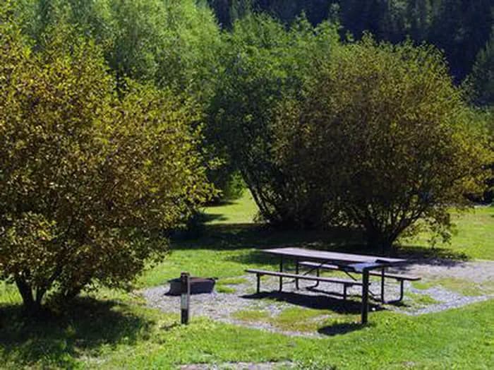
Overview Warm River Campground is located on its namesake in the Caribou-Targhee National Forest of southwestern Idaho. Visitors love the campground for its river tubing opportunities. Fishing and hiking are popular as well. Recreation Warm River is a popular location for tubing and fishing. Anglers cast for whitefish, brook, rainbow and cutthroat trout. Numerous hiking, mountain biking and horseback riding trails are in the immediate area, leading to natural springs, waterfalls and old railroad lines and tunnels. Facilities Warm River is a popular location for tubing and fishing. Anglers cast for whitefish, brook, rainbow and cutthroat trout. Numerous hiking, mountain biking and horseback riding trails are in the immediate area, leading to natural springs, waterfalls and old railroad lines and tunnels. Natural Features The campground is situated along the slow-moving Warm River at an elevation of 5,200 feet. Thickets of willow line the riverbanks and pine trees offer partial shade. Nearby Attractions Ashton, Idaho, about 9 miles away, offers gas and grocery services. Island Park is nearby, with numerous lakes, rivers, streams and trails, offering plentiful outdoor activities for visitors of all ages. Yellowstone and Grand Teton National Parks are within a couple hour's drive as well, with outstanding scenery and wildlife.
View details →
Overview Calamity Campground is located along the Snake River drainage at the north end of beautiful Palisades Reservoir at an elevation of 5,700 feet, just 55 miles east of Idaho Falls, Idaho. Visitors enjoy boating, water skiing, fishing and canoeing. Recreation Palisades Reservoir offers excellent boating, water skiing, swimming and canoeing. Lake and shore fishing are very popular here as well, with wild and stocked cutthroat trout as the predominate species. Kokanee salmon, brown and Mackinaw trout can also be found. A boat ramp and large parking area are located on-site. The Palisades Creek Trail begins nearby, leading hikers, mountain bikers and horseback riders to beautiful Upper Palisades Lake and expansive views of Swan Valley. Facilities Palisades Reservoir offers excellent boating, water skiing, swimming and canoeing. Lake and shore fishing are very popular here as well, with wild and stocked cutthroat trout as the predominate species. Kokanee salmon, brown and Mackinaw trout can also be found. A boat ramp and large parking area are located on-site. The Palisades Creek Trail begins nearby, leading hikers, mountain bikers and horseback riders to beautiful Upper Palisades Lake and expansive views of Swan Valley. Natural Features The campground is situated on a hillside above Palisades Reservoir, affording scenic views from many sites. A mixed forest of lodgepole pine, spruce, fir, aspen and maple trees partially shade the campground. Summer wildflowers dot the landscape. Nearby Attractions Big Elk Creek Trail, for hiking, biking and horseback riding, begins at nearby Big Elk Campground and meanders up a beautiful canyon brimming with wildflowers, towering trees and views of the surrounding mountains. Swan Valley and the Snake River offer more great fishing and boating opportunities, as well as rafting, canoeing and numerous trails for hiking, biking, horseback and ATV riding. Fall Creek Falls is 20 miles away, and the Fall Creek area has hundreds of miles of such trails.
View details →
Overview Big Trinity Cabin offers a quiet retreat in a beautiful high alpine landscape. The cabin is situated within a popular summer recreation area with many activities to enjoy. The cabin has a limited season due to late snow melt, but is accessible by vehicles with reasonable ground clearance. Many creature comforts are provided; however, guests may want to bring some supplies and gear to make their experience more comfortable and enjoyable. Recreation The 4- mile Rainbow Basin Trail system for pedestrain travel only, offers access to several lakes, hikers can access the trail System from the trailhead located within Big Trinity Lake campground. Other trails within the area Roaring River trail 045, and Lava Mountain trail 125, these are motorized motorcycle trails. Click here for an Idaho OHV Safety Message. Anglers can fish in any of the nearby lakes for rainbow and cutthroat trout. The lakes are also ideal for exploring by canoe or kayak. Facilities The 4- mile Rainbow Basin Trail system for pedestrain travel only, offers access to several lakes, hikers can access the trail System from the trailhead located within Big Trinity Lake campground. Other trails within the area Roaring River trail 045, and Lava Mountain trail 125, these are motorized motorcycle trails. Click here for an Idaho OHV Safety Message. Anglers can fish in any of the nearby lakes for rainbow and cutthroat trout. The lakes are also ideal for exploring by canoe or kayak. Natural Features The cabin is located in a dense lodgepole pine forest close to the East Fork Roaring River at an elevation of 7,900 feet. It's nestled among four subalpine lakes: Big Roaring River Lake, Little Roaring River Lake, Big Trinity Lake and Little Trinity Lake. The peaks of the Boise Mountains surround the cabins, and Trinity Mountain, the tallest in the range at 9,451 feet, is just to the south. Snow can make this area inaccessible until early July, but soon afterward, the land is blanketed by colorful summer wildflowers. This area is a haven for elk and deer, but wildlife watchers may also spot an occasional black bear. Nearby Attractions The summit of Trinity Mountain is the highest drivable point in Idaho, although the road may be blocked by snow until early July. A short, steep hike takes visitors to the lookout tower for panoramic views of several subalpine lakes and other mountains in the Boise Range.
View details →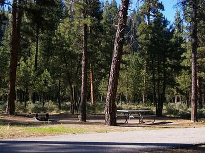
Overview Helende Campground is located 10 miles east of Lowman, Idaho, along Highway 21 at an elevation of 4,100 feet. The South Fork Payette River lies a few hundred yards away. Visitors enjoy fishing and rafting on the river, soaking at nearby Kirkham Hot Springs and exploring the extensive Kirkham Ridge Trail. Recreation The South Fork Payette River offers whitewater rafting, kayaking and trout fishing. The Deadwood and Danskin River Access areas are nearby. Popular Kirkham Hot Springs is less than 5 miles west of the campground along Highway 21. A trail with staircases leads down to the soaking pools on the riverside. Kirkham Ridge Trail is one of the Lowman Ranger District's premier trails. It begins near Kirkham Campground and stretches through beautiful country for 35 miles, connecting with many other trails in the area. It is open to hiking, mountain biking and horseback riding. Sections of the trail are open seasonally to off-road vehicles. Facilities The South Fork Payette River offers whitewater rafting, kayaking and trout fishing. The Deadwood and Danskin River Access areas are nearby. Popular Kirkham Hot Springs is less than 5 miles west of the campground along Highway 21. A trail with staircases leads down to the soaking pools on the riverside. Kirkham Ridge Trail is one of the Lowman Ranger District's premier trails. It begins near Kirkham Campground and stretches through beautiful country for 35 miles, connecting with many other trails in the area. It is open to hiking, mountain biking and horseback riding. Sections of the trail are open seasonally to off-road vehicles. Natural Features The campground is situated in a dense forest of lodgepole and Ponderosa pine, which offers plentiful shade in most sites. Summer wildflowers dot the landscape. Deer and elk may be seen wandering through the area on occasion. Nearby Attractions Numerous natural hot springs pools can be found along the Banks-Lowman Highway, also known as the Wildlife Canyon Scenic Byway and Highway 21, the Ponderosa Pine Scenic Byway. Both byways offer scenic views, wildlife watching, historical information kiosks and several trail opportunities. Whitewater rafting and kayaking are popular activities on the South Fork and Main Payette Rivers. Several companies in the area offer guided half and full-day trips.
View details →
Overview Bonneville Campground is 19 miles east of Lowman, Idaho just off Highway 21 at an elevation of 4,700 feet. Warm Springs Creek runs alongside the campground and the South Fork Payette River lies across the highway. Visitors enjoy soaking at Bonneville Hot Springs a short distance above the campground, and fishing in the creek and river. Recreation A 1/4-mile hiking trail leads from the campground to Bonneville Hot Springs, where a soaking pool awaits. Warm Springs Creek offers good trout fishing. The South Fork Payette River offers whitewater rafting, kayaking and trout fishing. The Deadwood River Access area is located near Lowman. Facilities A 1/4-mile hiking trail leads from the campground to Bonneville Hot Springs, where a soaking pool awaits. Warm Springs Creek offers good trout fishing. The South Fork Payette River offers whitewater rafting, kayaking and trout fishing. The Deadwood River Access area is located near Lowman. Natural Features The campground is situated on a bluff overlooking Warm Springs Creek. A forest of towering Ponderosa pine and Douglas fir covers the campground. Most campsites have plentiful shade. Summer wildflowers dot the landscape. Deer and elk may be seen wandering through the area on occasion. Nearby Attractions Numerous natural hot springs pools can be found along Highway 21, also known as the Ponderosa Pine Scenic Byway, and the Banks-Lowman Highway, also known as the Wildlife Canyon Scenic Byway. Both byways offer scenic views, wildlife watching, historical information kiosks and several trail opportunities. Whitewater rafting and kayaking are popular activities on the South Fork and Main Payette Rivers. Several companies in the area offer guided half and full-day trips.
View details →
Overview Pine Flats Campground is located a few miles west of Lowman, Idaho, along the Banks-Lowman Highway at an elevation of 3,700 feet. Visitors enjoy rafting, kayaking and fishing on the South Fork Payette River, and soaking in the hot springs at the river's edge. Recreation The South Fork Payette River flows next to the site, down a small hill, and offers trout fishing, rafting and kayaking. The Danskin River Access area is 5 miles west of the campground. A 1/4-mile nature trail begins in the campground and leads to a natural hot springs soaking pool on the riverside. Facilities The South Fork Payette River flows next to the site, down a small hill, and offers trout fishing, rafting and kayaking. The Danskin River Access area is 5 miles west of the campground. A 1/4-mile nature trail begins in the campground and leads to a natural hot springs soaking pool on the riverside. Natural Features Towering Ponderosa pines cover the campground, offering partial shade in most sites. Summer wildflowers dot the landscape. Deer and elk may be seen wandering through the campground on occasion. Nearby Attractions Numerous natural hot springs pools can be found along the Banks-Lowman Highway, also known as the Wildlife Canyon Scenic Byway. The area offers scenic views, wildlife watching, historical information kiosks and several trail opportunities. Whitewater rafting and kayaking are popular activities on the South Fork and Main Payette Rivers. Several companies in the area offer guided half and full-day trips.
View details →
Overview Kirkham Campground is located next to the South Fork Payette River just east of Lowman, Idaho, along Highway 21 at an elevation of 4,000 feet. Visitors enjoy soaking in popular Kirkham Hot Springs on the banks of the river and exploring the scenic Kirkham Ridge Trail. Recreation Popular Kirkham Hot Springs is located at the river's edge within the campground. A trail with staircases leads down to the soaking pools and small steaming waterfalls. The South Fork Payette River offers whitewater rafting, kayaking and trout fishing. The Deadwood and Danskin River Access areas are nearby. Kirkham Ridge Trail is one of the Lowman Ranger District's premier trails. It begins less than 1/4-mile away and stretches through beautiful country for 35 miles, connecting with many other trails in the area. It is open to hiking, mountain biking and horses. Sections of the trail are open seasonally to off-road vehicles. Facilities Popular Kirkham Hot Springs is located at the river's edge within the campground. A trail with staircases leads down to the soaking pools and small steaming waterfalls. The South Fork Payette River offers whitewater rafting, kayaking and trout fishing. The Deadwood and Danskin River Access areas are nearby. Kirkham Ridge Trail is one of the Lowman Ranger District's premier trails. It begins less than 1/4-mile away and stretches through beautiful country for 35 miles, connecting with many other trails in the area. It is open to hiking, mountain biking and horses. Sections of the trail are open seasonally to off-road vehicles. Natural Features The campground offers little shade, though a few Ponderosa pines are scattered throughout the site. The campground can be very hot and sunny during the summer. Wildflowers dot the landscape. Nearby Attractions Numerous natural hot springs pools can be found along Highway 21, also known as the Ponderosa Pine Scenic Byway, and the Banks-Lowman Highway, also known as the Wildlife Canyon Scenic Byway. Both byways offer scenic views, wildlife watching, historical information kiosks and several trail opportunities. Whitewater rafting and kayaking are popular activities on the South Fork and Main Payette Rivers. Several companies in the area offer guided half and full-day trips.
View details →
Overview Beaver Creek Campground sits in the Idaho Panhandle National Forest, offering phenomenal views of the Selkirk Mountains across the reflective waters of Priest Lake. Recreation A local beach is easily accessible, where swimming and boating are available. Visitors enjoy kayaking, canoeing or power boating up a 2.5-mile channel called Thoroughfare that leads to the Upper Priest Lake Scenic Area, where birding is a popular activity. Beaver Creek has two trailheads, one for the 9-mile Navigation Trail that heads north, and one for the 8-mile Lakeshore Trail that heads south. Both trails offer sweeping mountain views and are enjoyed by both hikers and horseback riders. Anglers find an abundance of trout fishing in Beaver Creek and in Upper and Lower Priest Lake. Facilities A local beach is easily accessible, where swimming and boating are available. Visitors enjoy kayaking, canoeing or power boating up a 2.5-mile channel called Thoroughfare that leads to the Upper Priest Lake Scenic Area, where birding is a popular activity. Beaver Creek has two trailheads, one for the 9-mile Navigation Trail that heads north, and one for the 8-mile Lakeshore Trail that heads south. Both trails offer sweeping mountain views and are enjoyed by both hikers and horseback riders. Anglers find an abundance of trout fishing in Beaver Creek and in Upper and Lower Priest Lake. Natural Features The campground is situated on the shores of Priest Lake at an elevation of 2,500 feet, shaded by hemlock and cedar. Priest Lake consists of the main lake, where most water recreation takes place, and the smaller Upper Priest Lake to the north. The two lakes are divided by a narrow channel. Nearby Attractions Cross country skiing and snow shoeing are excellent in the Kaniksu Forest Region of Priest Lake.
View details →
Overview Devil's Elbow Campground is perched on the banks of the North Fork Coeur d'Alene River, providing a perfect escape for a warm summer weekend. Here, visitors can camp in tents or RVs and spend their days fishing or floating the river. Recreation Rafting, swimming and kayaking are favorite activities on the river. Rafters will find class I-III rapids further down the river. Catch-and-release cutthroat trout fishing is also popular. Visitors also enjoy explore the river valley on foot to see nearby Downey Creek or Valitons Creek. Facilities Rafting, swimming and kayaking are favorite activities on the river. Rafters will find class I-III rapids further down the river. Catch-and-release cutthroat trout fishing is also popular. Visitors also enjoy explore the river valley on foot to see nearby Downey Creek or Valitons Creek. Natural Features The campground sits among lodgepole and other mixed pines along the river at an elevation of 2,600 feet. The area is located in the Coeur d'ALene Mountains, 69 miles from popular Coeur d'Alene Lake. Wildlife watchers and photographers have the chance to see mule deer, moose, osprey and calliope hummingbirds.
View details →
Overview Kit Price is a beautiful campground overlooking the North Fork Coeur d'Alene River. Campers enjoy the benefits of the river by fishing along the banks, swimming and floating. Hiking is also a great way to see mountain views. “Past visitors may notice a change in the appearance and openness in the park due recent removal of dead and diseased trees. This was done to improve safety for visitors and to improve forest health. New tree plantings are currently being planned to replace some of those lost and to increase the natural appearance of the campground for years to come. Please visit our website for additional information.” Recreation Tubing, swimming and kayaking on the North Fork Coeur d'Alene River are popular summertime activities. Rafters like to head downstream for the class I-III rapids. Catch and release fishing for cutthroat trout is also popular. Facilities Tubing, swimming and kayaking on the North Fork Coeur d'Alene River are popular summertime activities. Rafters like to head downstream for the class I-III rapids. Catch and release fishing for cutthroat trout is also popular. Natural Features The campground is situated along the North Fork Coeur d'Alene River at an elevation of 2,550 feet. Campsites are in a meadow like setting, in full to partial sun, in the river bottom of the Coeur d'Alene Mountains. Popular Coeur d'Alene Lake is about 65 miles west of Kit Price. Wildlife in the region includes mule deer, moose, osprey and calliope hummingbirds.
View details →
Overview Elks Flat Campground is situated on the banks of the South Fork Boise River, at the foot of the Trinity Mountain Range in Idaho. It is five miles north of the town of Pine. Visitors enjoy fishing, swimming and exploring trails in the surrounding area. Recreation The South Fork Boise River runs along the eastern edge of the campground, offering rafting, swimming and fishing for rainbow trout. Paradise Hot Springs is nearby. Green Creek Trail 270, a 4.5-mile trail for hiking, horseback riding and dirt bikes, begins a mile from the site. Cross Cut Trail 172 also begins close by and is open to hiking, biking, horseback riding and off-road vehicles. Facilities The South Fork Boise River runs along the eastern edge of the campground, offering rafting, swimming and fishing for rainbow trout. Paradise Hot Springs is nearby. Green Creek Trail 270, a 4.5-mile trail for hiking, horseback riding and dirt bikes, begins a mile from the site. Cross Cut Trail 172 also begins close by and is open to hiking, biking, horseback riding and off-road vehicles. Natural Features The campground is settled in a grassy meadow. It is surrounded by stands of cottonwood, aspen, Douglas fir and ponderosa pine, at an elevation of 4,400 feet. Nearby Attractions Baumgartner Hot Springs is approximately 16 miles away with a soaking pool and nature trail. Kelly Creek Flats Recreation Area is adjacent to Baumgartner with several more trail opportunities.
View details →
Overview Swinging Bridge Campground is located 10 miles north of Banks, Idaho just off Highway 55 at an elevation of 4,000 feet. The North Fork Payette River flows next to the highway, where extreme kayaking is a popular activity. Recreation The North Fork of the Payette River is a very popular location for expert kayaking. Whitewater rafting is nearby on the Main and South Fork sections of the Payette River. Anglers will find good to excellent fishing for whitefish and rainbow trout. Facilities The North Fork of the Payette River is a very popular location for expert kayaking. Whitewater rafting is nearby on the Main and South Fork sections of the Payette River. Anglers will find good to excellent fishing for whitefish and rainbow trout. Natural Features The campground is situated is a scenic canyon just above Highway 55. The mountains are forested with a mix of Ponderosa and lodgepole pines and shade is plentiful within most of the campground. Summer days are warm, reaching 80-90 degrees; nights are cooler.
View details →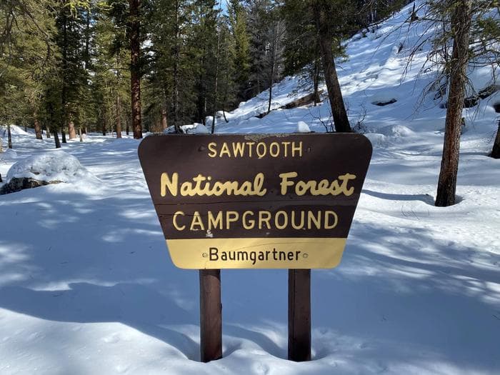
Overview Baumgartner Campground is situated alongside the South Fork Boise River, 11 miles from Featherville, Idaho. The area offers excellent fishing, hiking and off-road vehicle riding opportunities. Baumgartner Hot Springs is located within the campground, where visitors can enjoy soaking in the pool while admiring the scenic, natural setting. Recreation The campground's main draw is Baumgartner Hot Springs. The 101-degree water is piped into a large concrete soaking pool. The pool is open during daylight hours and is drained and refilled daily. The pool is pressure washed Tuesday mornings and will not open until around noon. The South Fork Boise River provides great fishing for wild and stocked rainbow trout. Younger campers love splashing in the cool mountain waters. An accessible path leads to a bench overlooking the swimming/fishing hole on thenorth end of the campground. The John Baumgartner Gravesite is a short walk from the hot springs. A 1/4-mile interpretive nature trail begins at the hot springs and meanders up the hill through the forest. Kelley Creek/Iron Mountain, Virginia Gulch, Willow Creek, Van Gulch and Big Water Trails all begin in the area. Ponderosa Trail Learner's Loop is located approximately 1 mile to the west of the campground and offers beginner level trails for young ATV and off-road motorcycle riders. ATVs, UTVs and off-road motorcycles cannot be ridden within the campground. You may trailer them in and out of the campground but the trailer must fit within your camping spur. Facilities The campground's main draw is Baumgartner Hot Springs. The 101-degree water is piped into a large concrete soaking pool. The pool is open during daylight hours and is drained and refilled daily. The pool is pressure washed Tuesday mornings and will not open until around noon. The South Fork Boise River provides great fishing for wild and stocked rainbow trout. Younger campers love splashing in the cool mountain waters. An accessible path leads to a bench overlooking the swimming/fishing hole on thenorth end of the campground. The John Baumgartner Gravesite is a short walk from the hot springs. A 1/4-mile interpretive nature trail begins at the hot springs and meanders up the hill through the forest. Kelley Creek/Iron Mountain, Virginia Gulch, Willow Creek, Van Gulch and Big Water Trails all begin in the area. Ponderosa Trail Learner's Loop is located approximately 1 mile to the west of the campground and offers beginner level trails for young ATV and off-road motorcycle riders. ATVs, UTVs and off-road motorcycles cannot be ridden within the campground. You may trailer them in and out of the campground but the trailer must fit within your camping spur. Natural Features The campground is nestled beneath towering ponderosa pines at an elevation of 5,200 feet. The gentle South Fork Boise River runs along the site, offering beautiful scenery and recreation. A variety of wildlife is commonly seen in and around the campground, including deer and moose. Nearby Attractions Numerous hiking, biking, horseback and off-road vehicle trails crisscross the surrounding area. Kelley Creek Flats Recreation Area is adjacent with additional designated dispersed site camping and livestock corrals near Kelley Creek. The historic Iron Mountain Lookout is located to the south of the campground. It is approximately a 12 mile one-way trip along the Kelley Creek trail which is open to vehicles 50" or less in width.
View details →
Overview Outlet Campground is located next to beautiful Redfish Lake beneath the Sawtooth Mountain Range at an elevation of 6,500 feet. Recreation Outlet Campground is in the heart of the beautiful Sawtooth National Recreation Area, where outdoor activities abound. Redfish Lake offers excellent boating, water skiing, canoeing, kayaking and fishing for rainbow trout and Kokanee salmon. Little Redfish Lake is just down the road, offering additional fishing and canoeing. In the immediate area are trailheads for the Alpine Way, Fishhook Creek, Redfish Lake Creek and Bench Lakes Trails. The Idaho Centennial Trail also passes nearby. Facilities Outlet Campground is in the heart of the beautiful Sawtooth National Recreation Area, where outdoor activities abound. Redfish Lake offers excellent boating, water skiing, canoeing, kayaking and fishing for rainbow trout and Kokanee salmon. Little Redfish Lake is just down the road, offering additional fishing and canoeing. In the immediate area are trailheads for the Alpine Way, Fishhook Creek, Redfish Lake Creek and Bench Lakes Trails. The Idaho Centennial Trail also passes nearby. Natural Features Summer wildflowers are plentiful, lodgepole pines provide partial shade and Fishhook Creek is nearby. Temperatures are cool, with an average summer high of 78 degrees and a low of 40 degrees. Nearby Attractions The Sawtooth National Recreation Area offers a myriad of excellent hiking and biking opportunities, and an estimated 750 miles of trails crisscross the valley and surrounding mountains. Redfish Lake Lodge is nearby with a restaurant, general store, boat and kayak rentals, mooring services, lake tours and a lake shuttle. Popular area events include an Arts and Crafts Fair in July, and Wagon Days, Salmon Festival, Quilt Fair, and Fireman's Ball in September.
View details →
Overview Table Rock Campground is located in a small but scenic canyon near Kelly Canyon Ski Resort, approximately 30 miles from Idaho Falls, Idaho. Hiking, mountain biking and ATV riding are popular activities. Recreation Hawley Gulch Trail begins at the campground, offering great opportunities for ATV enthusiasts, hikers and mountain bikers. Numerous forest roads and trails in the area allow ATV travel, hiking, horseback riding and mountain biking. Facilities Hawley Gulch Trail begins at the campground, offering great opportunities for ATV enthusiasts, hikers and mountain bikers. Numerous forest roads and trails in the area allow ATV travel, hiking, horseback riding and mountain biking. Natural Features The campground is situated in a quiet draw covered by an open grassy meadow dotted with summer wildflowers. Aspens and towering pines border the site, offering partial shade.
View details →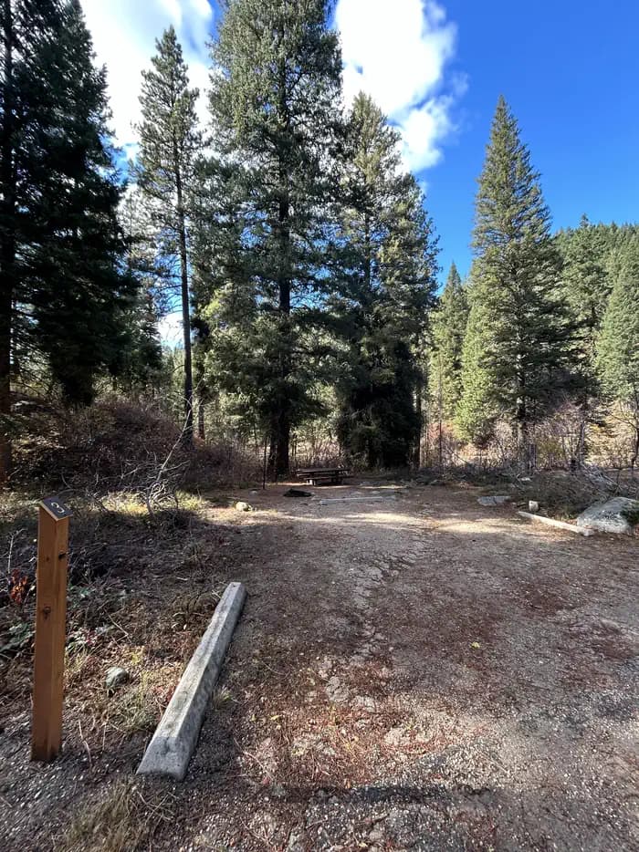
Overview Hayfork Group Campground is located 49 miles northeast of Boise, Idaho, along scenic Highway 21. Historic Idaho City is just 12 miles south of the campground. Visitors enjoy fishing in Mores Creek and exploring local trails. Recreation Mores Creek runs between the highway and the campground, offering whitefish and rainbow trout fishing. Numerous trails are in the area, providing ample opportunities for hiking, biking, horseback riding and off-road vehicle riding. In the winter, the area becomes a playground for back country skiers and snowmobiles. Facilities Mores Creek runs between the highway and the campground, offering whitefish and rainbow trout fishing. Numerous trails are in the area, providing ample opportunities for hiking, biking, horseback riding and off-road vehicle riding. In the winter, the area becomes a playground for back country skiers and snowmobiles. Natural Features The campground is situated at the foot of a ponderosa pine-forested hillside along Highway 21, at an elevation of 5,100 feet. The campsite, however, is in an open area with limited shade. Wildlife and summer wildflowers are abundant in the surrounding area. Nearby Attractions Highway 21, also known as the Ponderosa Pine Scenic Byway, snakes along Mores Creek to Mores Creek Summit, Gold Fork and Banner Ridge, offering historic sites, hot springs pools and breathtaking views of the surrounding mountains and forest along the way.
View details →
Overview Warm Lake Campground is near the eastern shore of beautiful Warm Lake, at an elevation of 5,300 feet. Visitors enjoy boating, fishing, swimming, hiking and viewing local wildlife. Recreation Warm Lake offers great fishing opportunities for cutthroat, rainbow, lake and bull trout. Boating, canoeing and swimming are popular activities. A developed swim beach is available less than a quarter-mile away, at Warm Lake Lodge. Billy Rice Swim Beach is just over a mile from the campground, on the north side of the lake. The area offers a day-use site for picnicking and swimming. A boat ramp is located at nearby Shoreline Campground. The surrounding area offers great hiking, mountain biking, horseback and off-road vehicle riding, and hunting. The WeWuKiye (Wa Wu Kia) Trail No. 252 was recently built and can be accessed at Shoreline Campground. It is popular for hiking and mountain biking. For off-road vehicle enthusiasts, Telephone Ridge Trail No. 112 offers 20 miles of trails for all riding levels, with staging areas within the campground and up the road at Shoreline Campground. Facilities Warm Lake offers great fishing opportunities for cutthroat, rainbow, lake and bull trout. Boating, canoeing and swimming are popular activities. A developed swim beach is available less than a quarter-mile away, at Warm Lake Lodge. Billy Rice Swim Beach is just over a mile from the campground, on the north side of the lake. The area offers a day-use site for picnicking and swimming. A boat ramp is located at nearby Shoreline Campground. The surrounding area offers great hiking, mountain biking, horseback and off-road vehicle riding, and hunting. The WeWuKiye (Wa Wu Kia) Trail No. 252 was recently built and can be accessed at Shoreline Campground. It is popular for hiking and mountain biking. For off-road vehicle enthusiasts, Telephone Ridge Trail No. 112 offers 20 miles of trails for all riding levels, with staging areas within the campground and up the road at Shoreline Campground. Natural Features The campground is situated in a scenic forest of towering, old-growth ponderosa pine, which provides partial shade in the campground. Chipmunk Creek runs alongside the campground. Summer wildflowers are abundant. A variety of wildlife including bears, deer, elk, fox, grouse, eagles, osprey, grosbeaks, whooping cranes and otters, lives around the lake. Nearby Attractions Warm Lake Lodge is located across the road from the campground and has a restaurant and small store with camping and fishing essentials.
View details →
Overview Bull Trout Campground is located on the shores of beautiful Bull Trout Lake at an elevation of 6,900 feet. The lake offers great fishing and canoeing opportunities. Many trails for hiking, biking, horseback and off-road vehicle riding are in the area. Only equestrian users may reserve equestrian sites. If an equestrian site is not reserved, it may be occupied by other user groups on a first-come, first-served basis. Recreation Bull Trout Lake offers excellent canoeing and kayaking opportunities, as the lake is for non-motorized watercraft only. Anglers fish for brook and rainbow trout. A primitive boat ramp is located on the west side of the lake. Martin Lake is nearby, offering canoeing and fishing. The lake is stocked with rainbow trout. Many miles of trails can be found in the area, including the 11-mile Warm Spring Trail for hikers. The 35-mile Kirkham Ridge Trail is open to hiking, mountain biking, horseback riding and dirt biking. Facilities Bull Trout Lake offers excellent canoeing and kayaking opportunities, as the lake is for non-motorized watercraft only. Anglers fish for brook and rainbow trout. A primitive boat ramp is located on the west side of the lake. Martin Lake is nearby, offering canoeing and fishing. The lake is stocked with rainbow trout. Many miles of trails can be found in the area, including the 11-mile Warm Spring Trail for hikers. The 35-mile Kirkham Ridge Trail is open to hiking, mountain biking, horseback riding and dirt biking. Natural Features The campground is situated in a mixed-growth forest of Douglas fir and lodgepole pine, which offers partial shade. Summer wildflowers are abundant.
View details →
Overview Peace Valley Campground sits just 27 miles north of Garden Valley, Idaho, at an elevation of 4591 feet. The beautiful Peace Valley offers excellent hiking, motorcycle riding, fishing, and hunting opportunities. Recreation Peace Valley offers several trails for hiking, mountain biking, horseback riding, and OHV use. Peace Creek Trail and Bitter Creek Trail (both motorcycle trails) begin nearby. The Rattlesnake Trail and 465 ATV Trail are in the vicinity of the campground. Peace Creek and nearby Silver Creek offer excellent fishing most of the year. Anglers cast for whitefish and rainbow trout. In-season big game hunting for deer, elk, and bear is a popular activity in the surrounding mountains. Facilities Peace Valley offers several trails for hiking, mountain biking, horseback riding, and OHV use. Peace Creek Trail and Bitter Creek Trail (both motorcycle trails) begin nearby. The Rattlesnake Trail and 465 ATV Trail are in the vicinity of the campground. Peace Creek and nearby Silver Creek offer excellent fishing most of the year. Anglers cast for whitefish and rainbow trout. In-season big game hunting for deer, elk, and bear is a popular activity in the surrounding mountains. Natural Features The surrounding area consists of high, forested mountains, and steep valleys. The campground lies close to an experimental forest and a fire lookout. A variety of wildlife makes its home in and around Peace Valley, including deer, elk, bald eagles, and red-tailed hawks. Nearby Attractions Silver Creek Plunge, a privately-developed hot springs resort, is 2.5 miles away with a hot springs pool, general store, concessions, a playground, horseshoe pits, and both volleyball and basketball courts.
View details →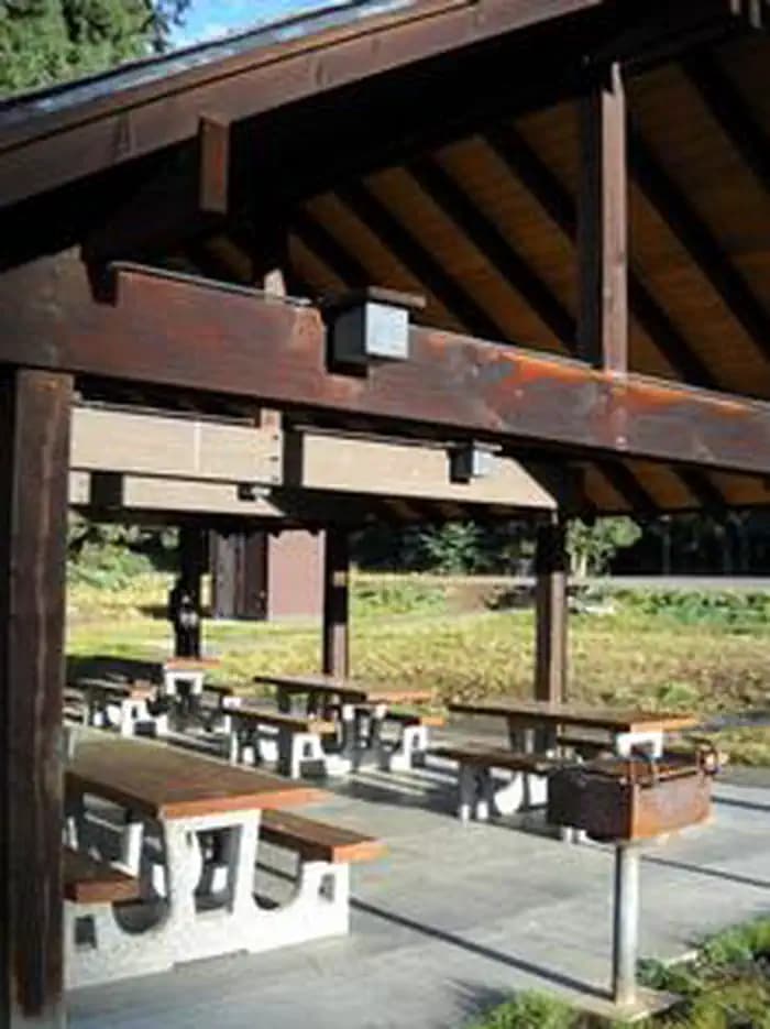
Overview Fish Creek Pavilion is a day-use picnic area adjacent to Fish Creek Campground. It's situated in a meadow surrounded by conifers and near a variety of recreational activities. Recreation The Fish Creek Cross Country Trail begins within the adjacent campground. This 7-mile multi-use loop is open to hikers, mountain bikers, horseback riders and off-road vehicle enthusiasts. Hikers will find additional foot trails as well. Visitors who wish to camp can stay at Fish Creek Campground, which has first-come, first-served sites. Groups can reserve the Fish Creek Group Site about 2 miles down the road. Facilities The Fish Creek Cross Country Trail begins within the adjacent campground. This 7-mile multi-use loop is open to hikers, mountain bikers, horseback riders and off-road vehicle enthusiasts. Hikers will find additional foot trails as well. Visitors who wish to camp can stay at Fish Creek Campground, which has first-come, first-served sites. Groups can reserve the Fish Creek Group Site about 2 miles down the road. Natural Features In the heart of north central Idaho, rugged peaks, deep canyons, dense forests and remote wilderness comprise the Nez Perce National Forest. Due in large part to dramatic elevational differences, the forest supports a wide variety of vegetation, from cedar groves to desert ecosystems. Fish Creek Pavilion is located in the Salmon River/Highway 95 Corridor. The landscape here varies from the emerald Salmon River pouring through steep canyon walls to sapphire Moore's Lake in the remote Gospel-Hump Wilderness. Nearby Attractions Grangeville is the nearest town. It offers camping supplies and a historical museum.
View details →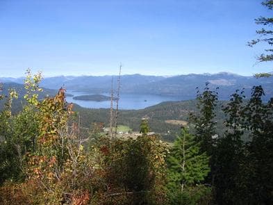
Overview Surrounded by clear waters of Priest Lake, the 52 sites on Kalispell Island provide the ideal getaway for people looking for a rugged, but highly rewarding, camping experience on the peaceful shores of Priest Lake. There are 51 single sites on the island as well as one group site known as Three Pines Group Site. This Group Site is located on the southeast side of the island and has been renumbered from Site #001 to site #29 for groups of 10-30 individuals. All sites are only reachable by boat. A popular activity among visitors is to kayak, canoe, or power boat up a 3.5-mile thoroughfare, which leads to the Upper Priest Lake Scenic Area. The upper lake - just like Kalispell Island - cannot be access by car, so water is an excellent navigation option. Recreation Priest Lake is less than an hour from the Canadian Border, nestled deep below the crest of the Selkirk Mountains. Surrounded by the natural beauty of Northern Idaho and the mile-high mountains, this 25,000-acre lake offers clear, blue waters reaching depths of 300 feet. Fantastic wildlife viewing is available on the 2.5-mile loop trail that encircles Kalispell Island, offering phenomenal lake views and bird watching opportunities. The waters of Priest Lake offer anglers access to record-breaking Mackinaw trout, Dolly Varden, Cutthroat and Kokanee. Facilities Priest Lake is less than an hour from the Canadian Border, nestled deep below the crest of the Selkirk Mountains. Surrounded by the natural beauty of Northern Idaho and the mile-high mountains, this 25,000-acre lake offers clear, blue waters reaching depths of 300 feet. Fantastic wildlife viewing is available on the 2.5-mile loop trail that encircles Kalispell Island, offering phenomenal lake views and bird watching opportunities. The waters of Priest Lake offer anglers access to record-breaking Mackinaw trout, Dolly Varden, Cutthroat and Kokanee. Natural Features Kalispell Island is one of seven islands scattered throughout Priest Lake. Kalispell is the largest of these islands, spanning 264 acres, and is shaped like a tooth. Priest Lake, at a 2,400 foot elevation, is one of the top three largest lakes in Idaho. To the north, the lake connects to the Upper Priest Lake, divided by a narrow channel, which can be passed through by boat. Nearby Attractions Hike the Lakeshore or Beach Trails that traverse along the west shore of Priest Lake. The Beach trail extends between Outlet Bay Campground and the Kalispell Bay Boat Launch. The Lakeshore Trail runs for 8 miles along the northwest shores of Priest Lake. In winter, ice fishing, shoe shoeing and snowmobiling on nearby trails entertain visitors.
View details →
Overview Beauty Creek Campground is located a half mile from Lake Coeur d'Alene along the peaceful Beauty Creek. Visitors enjoy breathtaking scenery and convenient access to miles of trails. Recreation The trailhead for the Caribou Ridge National Recreation Trail starts at the campground. The 5-mile trail features a moderate climb with two outstanding overlooks of Lake Coeur d'Alene. Biking and hiking trails in the area include the 1.8-mile Beauty Creek Overlook and the 4.9-mile Mt. Coeur d'Alene Viewpoint. Anglers enjoy an abundance of northern pike, chinook salmon and bass in the nearby stream. Facilities The trailhead for the Caribou Ridge National Recreation Trail starts at the campground. The 5-mile trail features a moderate climb with two outstanding overlooks of Lake Coeur d'Alene. Biking and hiking trails in the area include the 1.8-mile Beauty Creek Overlook and the 4.9-mile Mt. Coeur d'Alene Viewpoint. Anglers enjoy an abundance of northern pike, chinook salmon and bass in the nearby stream. Natural Features The campground is nestled in a narrow valley along Beauty Creek in northern Idaho. At an elevation of 2,100 feet, it is a sparsely wooded valley surrounded by heavily wooded hillsides. Beauty Creek sits in the Idaho Panhandle National Forest, between the Cascade Mountains to the west and the Bitterroot Mountains to the east. Nearby Attractions Lake Coeur d'Alene offers excellent boating, fishing and canoeing. Towns around the lake offer opportunities for para-sailing, ferry rides, paddle boating and sea plane rides.
View details →
Overview Mokins Bay Campground is located near the eastern shore of Hayden Lake in northwest Idaho. Its picturesque setting in the northwest portion of the Bitterroot Mountain range, known as the Coeur d'Alene mountains, creates solitude in a forested setting at this campground. The lake is a 10 minute walk from the campground. Recreation Fishing is popular in the surrounding lakes and streams, and cutthroat trout and large and small-mouth bass are the most common catches. Power boating and other water sports are also popular activities. Facilities Fishing is popular in the surrounding lakes and streams, and cutthroat trout and large and small-mouth bass are the most common catches. Power boating and other water sports are also popular activities. Natural Features The small campground is surrounded by a heavy canopy of pines. Wildflowers like trillium and buttercups thrive in the springtime, creating a stunning backdrop for campers. Hayden Lake boasts a 40-mile shoreline with a surface area of 3,800 acres. The lake was formed by the Missoula Floods that occurred nearly 15,000 years ago, at the end of the last ice age. Nearby Attractions The town of Coeur d'Alene, Idaho is 21 miles away, and offers several tourist attractions, as well as restaurants, gas and groceries.
View details →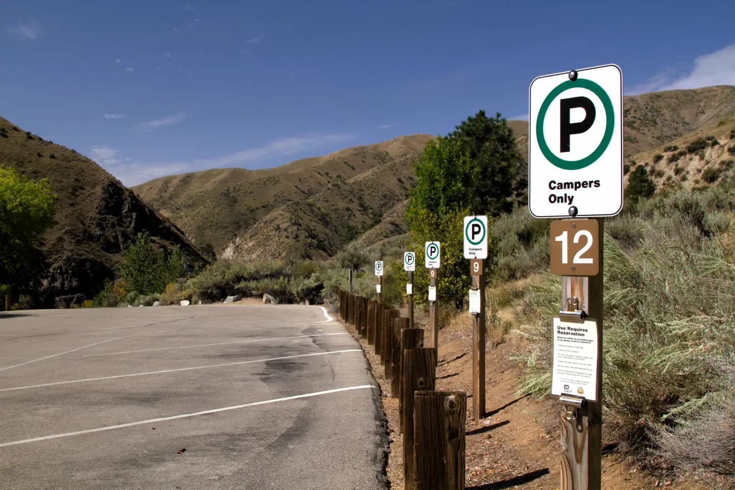
Overview Macks Creek Park is a very popular small campground just 25 miles from the Boise area along Arrowrock road off Highway 21 operated and managed by the US Army Corps of Engineers. The campground is reservation only May-September and closed to vehicle traffic the remainder of the year. Visitors make the trip to enjoy quality seasonal recreational activities like boating, swimming, camping, fishing, and hunting. Regular seasonal drawdowns occur each year which impact the recreational activities available at Lucky Peak Lake. Recreation Boating, camping, fishing, swimming, water sports, hiking, biking, picnicking, and much more! The lake offers family-friendly outdoor recreation opportunities for both travelers and residents of the urban Boise area. Macks Creek Park offers scenic views and convenient access to lake recreation. Anglers fish for rainbow trout, Kokanee and smallmouth bass. A boat ramp is located within the campground. Facilities Boating, camping, fishing, swimming, water sports, hiking, biking, picnicking, and much more! The lake offers family-friendly outdoor recreation opportunities for both travelers and residents of the urban Boise area. Macks Creek Park offers scenic views and convenient access to lake recreation. Anglers fish for rainbow trout, Kokanee and smallmouth bass. A boat ramp is located within the campground. Natural Features Lucky Peak Lake is located in the foothills of southwestern Idaho on the Boise River at an elevation of 3,055 feet. When full, the lake stretches 12 miles up-river, with 45 miles of shoreline and over 3,000 surface acres of water. The campground tent sites are situated among shady trees along the lakeshore. The trailer spots are situated on the opposite side of the road from the tent sites with a wide open clear view of the lake and surrounding mountains. The surrounding mountains are consistent with sagebrush steppe, dotted with sagebrush and bitterbrush. A variety of wildlife lives around Lucky Peak, including bald and golden eagles, mule deer, antelope, red-tailed hawks, California quail and chukar. contact_info This location has limited staffing. Please call (208) 343-0671 for general information. Nearby Attractions Arrowrock Reservoir, operated by the Bureau of Reclamation, is nearby, as is the beautiful Boise National Forest. These areas provide additional camping, boating, fishing, hiking and sightseeing opportunities. Recreation at Arrowrock Reservoir is managed by the U.S. Forest Service. Check with the Boise National Forest office for rules, regulations, and temporary closures before visiting.
View details →
Overview Edna Campground is located 56 miles northeast of Boise, Idaho, in a scenic Ponderosa pine forest along Highway 21 at an elevation of 5,700 feet. Wildlife and summer wildflowers are abundant. Historic Idaho City is just 18 miles south. Crooked River runs near the site, offering whitefish and rainbow trout fishing. This campground contains 11 sites. Picnic tables, utility tables, and fire rings are provided, along with two vault toilets and a water pump. The site is in an open area with shade. Parking spurs are graveled. Due to its proximity to the highway, some noise from passing traffic is to be expected. Highway 21, also known as the Ponderosa Pine Scenic Byway, snakes along Mores Creek to Mores Creek Summit, Gold Fork, and Banner Ridge with breathtaking views of the surrounding mountains and forest. Numerous trail opportunities are in the area, offering hiking, biking, horseback riding, and ATVing. In winter, the area becomes a playground for backcountry skiers and snowmobilers.
View details →
Overview Bad Bear Campground is located 48 miles northeast of Boise, Idaho, in a scenic Ponderosa pine forest along Highway 21 at an elevation of 5,100 feet. Wildlife and summer wildflowers are abundant. Historic Idaho City is just 11 miles south. Mores Creek runs adjacent to the site, offering whitefish and rainbow trout fishing. Highway 21, also known as the Ponderosa Pine Scenic Byway, snakes along Mores Creek to Mores Creek Summit, Gold Fork, and Banner Ridge with breathtaking views of the surrounding mountains and forest. Recreation Numerous trail opportunities are in the area, offering hiking, biking, horseback riding, and ATVing. In winter, the area becomes a playground for backcountry skiers and snowmobilers. Facilities Numerous trail opportunities are in the area, offering hiking, biking, horseback riding, and ATVing. In winter, the area becomes a playground for backcountry skiers and snowmobilers. Nearby Attractions
View details →
Overview Boundary Creek Campground is located at the edge of the Frank Church River of No Return Wilderness, adjacent to the boat launch for the Middle Fork of the Salmon River in Idaho. The site generally provides overnight camping for boaters waiting to launch the next day on their permit to float the Middle Fork. Of the 15 campsites, 5 can be reserved during the high-use season (June 15-Aug. 15); the remaining 10 are first-come, first-served. Outside of those dates, all 15 sites are first-come, first-served. Recreation Boundary Creek Campground is a popular spot for boaters running the Middle Fork of the Salmon. A nearby transfer camp provides long-term parking and trail access into the Frank Church River of No Return Wilderness. Visitors enjoy hiking, horseback riding, picnicking, fishing and viewing wildlife. Facilities Boundary Creek Campground is a popular spot for boaters running the Middle Fork of the Salmon. A nearby transfer camp provides long-term parking and trail access into the Frank Church River of No Return Wilderness. Visitors enjoy hiking, horseback riding, picnicking, fishing and viewing wildlife. Natural Features At an elevation of 6,280 feet, the campground is situated among lodgepole pine trees, near the Wild and Scenic Middle Fork of the Salmon River. The air is crisp and fresh, even in the heart of summer, due to it's high elevation. Nearby Attractions The Middle Fork of the Salmon River flows over 100 miles through the heart of the Frank Church-River of No Return Wilderness, and originates 20 miles northwest of Stanley, Idaho, at the confluence of Bear Valley and Marsh Creeks. Float permits are required year round. It was one of the original eight rivers in the nation designated as Wild and Scenic on October 2, 1968.
View details →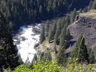
Overview Grand View Campground is located on the Mesa Falls Scenic Byway, adjacent to the Lower Mesa Falls Overlook, approximately 13 miles northeast of Ashton, Idaho. Upper Mesa Falls is within a mile. Visitors enjoy exploring the trails at the falls, viewing wildlife and hiking. Recreation Mesa Falls Recreation Area offers walkways and overlooks for all to enjoy. Upper Falls has an accessible path and close-up overlook of the falls, as well as a staffed Interpretive Center. Visitors enjoy viewing the power and beauty of the falls, as well as watching the osprey and eagles that frequent the area. An abandoned railroad bed acts as a trail for hiking, biking and horseback riding from the Bear Gulch parking lot to West Yellowstone, Montana. Several entry/exit points are found along the trail. Numerous additional trails are in the vicinity. Facilities Mesa Falls Recreation Area offers walkways and overlooks for all to enjoy. Upper Falls has an accessible path and close-up overlook of the falls, as well as a staffed Interpretive Center. Visitors enjoy viewing the power and beauty of the falls, as well as watching the osprey and eagles that frequent the area. An abandoned railroad bed acts as a trail for hiking, biking and horseback riding from the Bear Gulch parking lot to West Yellowstone, Montana. Several entry/exit points are found along the trail. Numerous additional trails are in the vicinity. Natural Features The Mesa Falls Scenic Byway leads through Idaho's backcountry to the 85-foot Lower Mesa Falls and 110-foot Upper Mesa Falls, both on the Henry's Fork of the Snake River. A beautiful rainbow created by sunlight passing through the mist is visible from approximately 9 a.m. to 1 p.m. during sunny days at Upper Mesa Falls. The byway is home to an abundance of seasonal wildflowers. A variety of wildlife makes it home in the area, including moose, bear, deer, elk, marmots, coyotes, martens, eagles, osprey and many other small mammals and birds. Nearby Attractions Harriman State Park, a wildlife refuge featuring Blue Ribbon trout fishing (fly fishing, catch and release), trumpeter swans, elk, moose and various waterfowl, is located approximately 11 miles north on the Mesa Falls Scenic Byway. Island Park is within a short drive beyond Harriman, with outdoor activities for visitors of all ages. Hundreds of miles of hiking, biking, horseback riding and off-road vehicle trails crisscross the area. Island Park Reservoir and Henry's Lake are nearby, with boat ramps, fish cleaning stations, boating, water skiing and fishing. Yellowstone National Park and West Yellowstone, Montana, are an hour's drive away. Yellowstone offers hiking, wildlife viewing and fishing in a breathtaking natural setting.
View details →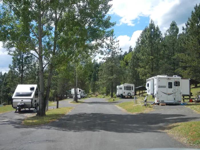
Overview Located in northern Idaho's beautiful Clearwater Valley, Dent acres Campground on Dworshak Lake is surrounded by forests and abundant wildlife. Dworshak Lake is 54 miles long, hosts kokanee salmon, rainbow trout and small mouth bass fishing. It has excellent boating, water skiing and hunting opportunities. Recreation Dent Acres is an excellent location for boaters, fishermen, hunters, hikers, wildlife watching, as well as quiet relaxation. There is a boat ramp for access to the reservoir, multiple trails for hiking, and thousands of surrounding acres of public lands for the hunter. Facilities Dent Acres is an excellent location for boaters, fishermen, hunters, hikers, wildlife watching, as well as quiet relaxation. There is a boat ramp for access to the reservoir, multiple trails for hiking, and thousands of surrounding acres of public lands for the hunter. Natural Features Dworshak Reservoir is surrounded by steep forested, mountainous country. Numerous small creeks feed the reservoir. Nearby Attractions -Dent Bridge, which spans Dworshak Reservoir, is approximately one mile east of Dent Acres and is the largest cable suspension bridge in the state of Idaho. -Dworshak Dam and Visitor Center -Dworshak Hatchery -Clearwater National Forest -Clearwater Historical Society and Museum - Weippe Discovery Center -Canoe Camp -Nez Perce (National Park site at Spalding) -Orofino Chamber of Commerce contact_info For facility specific information, please call (208) 476-1255.
View details →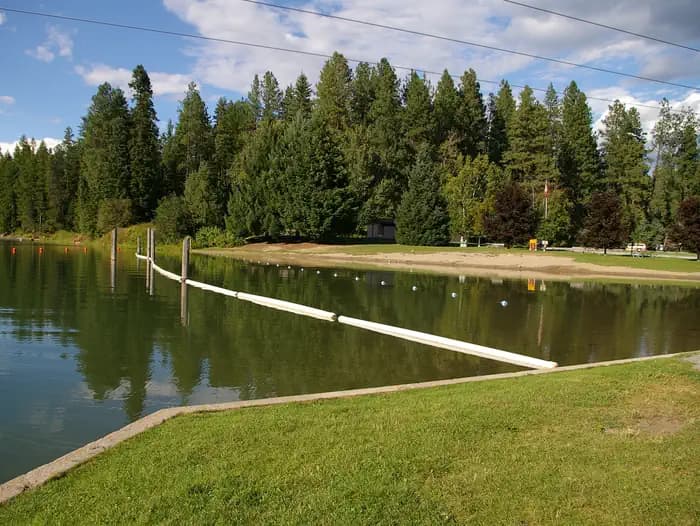
Overview Priest River Campground is situated on the banks of Priest River, shaded by firs, cedars and pines, just upstream from the confluence of the Pend Oreille River. Recreation Water activities are popular at the campground including kayaking, fishing and swimming. The day-use area includes a picnic shelter, playground, softball field, swim beach, boat ramp and a large grassy area for family fun . Adjacent to the campground is the Priest River Wildlife area, offering excellent fishing as well as birding. Wildlife in the area includes bald eagles, osprey, a wide variety of birds, and deer. Facilities Water activities are popular at the campground including kayaking, fishing and swimming. The day-use area includes a picnic shelter, playground, softball field, swim beach, boat ramp and a large grassy area for family fun . Adjacent to the campground is the Priest River Wildlife area, offering excellent fishing as well as birding. Wildlife in the area includes bald eagles, osprey, a wide variety of birds, and deer. Natural Features Albeni Falls Dam was built in 1955 for flood control and power production on the Pend Oreille River. Today, the popular lake has the added benefit of providing visitors with countless year-round recreational activities. Lake Pend Oreille is surrounded by scenic mountains and is one of the largest and deepest natural lakes in the western United States, plunging to depths of more than 1,200 ft. in some areas. Behind the dam, the Pend Oreille River stretches 65 miles through a glacial-carved valley that separates three mountain ranges. Nearby Attractions The Albeni Falls Visitor Center features exhibits on the history of the dam and the natural features of the area. Tours of the dam are given daily during the summer. The nearby town of Priest River, Idaho, offers gas and grocery services.
View details →
Overview Riley Creek Recreation Area, situated on the banks of the Pend Oreille River, is the largest recreation area for the Albeni Falls Project, but still offers visitors peace and quiet and plenty of space to enjoy the scenic surroundings. Recreation Water sports are the most common activity at the lake, and boat ramps are provided at the campground. Visitors enjoy kayaking, canoeing, swimming, fishing, water skiing and jet skiing. Campers are likely to spot wildlife in the area, with bald eagles, osprey, bears and most commonly, deer. A biking and hiking trail is available, giving campers a chance to enjoy the wildlife and greenery. Fishing piers, horseshoe pits, a beach volleyball court, basketball court and more make this campground an ideal place for family trips or groups of friends. A hiking and biking trail is accessible from the campground. Facilities Water sports are the most common activity at the lake, and boat ramps are provided at the campground. Visitors enjoy kayaking, canoeing, swimming, fishing, water skiing and jet skiing. Campers are likely to spot wildlife in the area, with bald eagles, osprey, bears and most commonly, deer. A biking and hiking trail is available, giving campers a chance to enjoy the wildlife and greenery. Fishing piers, horseshoe pits, a beach volleyball court, basketball court and more make this campground an ideal place for family trips or groups of friends. A hiking and biking trail is accessible from the campground. Natural Features Albeni Falls Dam was built in 1955 for flood control and power production on the Pend Oreille River. Today, the popular lake has the added benefit of providing visitors with countless year-round recreational activities. Lake Pend Oreille is surrounded by scenic mountains and is one of the largest and deepest natural lakes in the western United States, plunging to depths of more than 1,200 ft. in some areas. Behind the dam, the Pend Oreille River stretches 65 miles through a glacial-carved valley that separates three mountain ranges. Nearby Attractions The Albeni Falls Visitor Center features exhibits on the history of the dam and the natural features of the area. Tours of the dam are given daily during the summer. The nearby town of Laclede, Idaho offers gas and grocery services.
View details →
Overview Springy Point Campground is situated amid firs, cedars and pines overlooking the Pend Oreille River with views of the Cabinet and Selkirk Mountains. The city of Sandpoint is just a short trip across the water and offers a marina, parks, shopping and plenty of sightseeing opportunities. Recreation Water sports are the most popular activity at Springy Point, and with a boat ramp located on-site, kayaking, canoeing, water skiing, jet skiing and fishing are never far out of reach. A large swimming area provides visitors with comfortable access to the river's clear, clean waters. Visitors may also enjoy biking or hiking across the Long Bridge into the town of Sandpoint for a change of scenery or stroll around town. For the bird watchers or moose watchers, a short trip up to the Pack River Area to watch wildlife provides a great day trip. Facilities Water sports are the most popular activity at Springy Point, and with a boat ramp located on-site, kayaking, canoeing, water skiing, jet skiing and fishing are never far out of reach. A large swimming area provides visitors with comfortable access to the river's clear, clean waters. Visitors may also enjoy biking or hiking across the Long Bridge into the town of Sandpoint for a change of scenery or stroll around town. For the bird watchers or moose watchers, a short trip up to the Pack River Area to watch wildlife provides a great day trip. Natural Features Lake Pend Oreille is a glacier-carved lake surrounded by scenic mountains in the northern Idaho Panhandle. It is one of the largest and deepest natural lakes in the western United States with depths plunging more than 1,200 ft., in some areas. The area around the Lake is the traditional home of the Kalispell Indians. French settlers named the area "Pend Oreille," which means "ear pendant," after observing the large shell earrings worn by the Kalispell people. Nearby Attractions The Albeni Falls Visitor Center features exhibits on the history of the dam and the natural features of the area, with tours of the dam given daily during the summer.
View details →
Overview Albeni Cove is a small campground located just upstream from Albeni Falls Dam on the Pend Oreille. Situated amongst firs, cedars and pines, Albeni Cove provides a rustic, but incredibly beautiful location for camping and recreation on the river. Recreation Water sports are the most common activity at Albeni Cove, including swimming, fishing and boating. Campers are likely to spot wildlife in the area, including bald eagles, osprey, a wide variety of birds, and most commonly, deer. Facilities Water sports are the most common activity at Albeni Cove, including swimming, fishing and boating. Campers are likely to spot wildlife in the area, including bald eagles, osprey, a wide variety of birds, and most commonly, deer. Natural Features Albeni Falls Dam on the Pend Oreille River, provides flood control, power production and countless recreational activities for visitors year-round. Behind the dam, the Pend Oreille River stretches 65 miles through a glacial-carved valley that separates three mountain ranges. Lake Pend Oreille is surrounded by scenic mountains and is one of the largest and deepest natural lakes in the western United States, plunging to depths of more than 1,200 ft. in some areas. Nearby Attractions The Albeni Falls Visitor Center features exhibits on the history of the dam and the natural features of the area. Tours of the dam are given daily during the summer. Charges & Cancellations A $10.00 service fee will apply if you change or cancel your reservation. Late cancellations are subject to additional fees. For full details see NRRS Reservation Policy.
View details →
Overview Big Springs Warming Hut is located 22 miles south of West Yellowstone, Montana in beautiful Island Park, Idaho at an approximate elevation of 6,300 feet. Visitors love Island Park for its world-class fishing and outstanding scenery and wildlife viewing opportunities. Recreation Big Springs is the headwaters of Henry's Fork and is one of the largest springs in the country. Henry's Fork is considered one of the best fisheries in the nation. Fly-fishermen cast for rainbow and brook trout. Tubing, canoeing, kayaking and rafting are also popular on the river. The Big Springs National Recreation Water Trail can be accessed from the campground and ends 4.5 miles away at Macks Inn. It offers a lazy three-hour float or canoe trip through beautiful scenery. Wildlife, including moose, bald eagles and Sandhill cranes, are often seen along the trail. The charming and historic John Sack Cabin is nearby, noted for its unique location, construction and furnishings. Hiking, biking, horseback riding and ATVing are popular activities. Many miles of trails crisscross Island Park, including the Continental Divide National Scenic Trail and the Nez Perce Trail are in the area. Facilities Big Springs is the headwaters of Henry's Fork and is one of the largest springs in the country. Henry's Fork is considered one of the best fisheries in the nation. Fly-fishermen cast for rainbow and brook trout. Tubing, canoeing, kayaking and rafting are also popular on the river. The Big Springs National Recreation Water Trail can be accessed from the campground and ends 4.5 miles away at Macks Inn. It offers a lazy three-hour float or canoe trip through beautiful scenery. Wildlife, including moose, bald eagles and Sandhill cranes, are often seen along the trail. The charming and historic John Sack Cabin is nearby, noted for its unique location, construction and furnishings. Hiking, biking, horseback riding and ATVing are popular activities. Many miles of trails crisscross Island Park, including the Continental Divide National Scenic Trail and the Nez Perce Trail are in the area. Natural Features Island Park is composed of two areas of extinct volcanic activity. The Henry's Fork Caldera sits inside the larger Island Park Caldera. The area is known for its dense forests of lodgepole pine, broad grassy meadows bursting with summer wildflowers and a wide variety of wildlife, including black and grizzly bears, moose, elk, deer, bald eagles, Sandhill cranes and much, much more. The warming hut is surrounded by a forest of lodgepole pines. Grasses and summer wildflowers dot the landscape. Nearby Attractions Island Park Reservoir and Henry's Lake are nearby, both offer boating, water skiing, fishing, kayaking and canoeing. Numerous additional small lakes and streams are scattered throughout Island Park. Yellowstone and Grand Teton National Parks are within a short drive, offering additional hiking and fishing, as well as outstanding scenery. Macks Inn is 4.5 miles west. This full-service facility offers boat rentals, rafting, shuttle service, gas, groceries, showers and laundry facilities.
View details →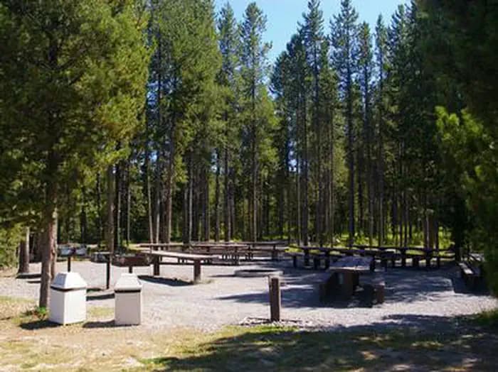
Overview Buttermilk Campground is located approximately 30 miles southwest of West Yellowstone, Montana and 32 miles north of Ashton, Idaho in beautiful Island Park, Idaho. Buttermilk sits next to Island Park Reservoir at an elevation of 6,200 feet. Visitors love Island Park for its world-class fishing and outstanding scenery and wildlife viewing opportunities. Recreation The Island Park area is prized for its fishing; the Henry's Fork is known as one of the nation's best fly-fishing streams. Anglers cast for rainbow, cutthroat and brook trout and Kokanee salmon. Island Park Reservoir offers boating, water skiing and excellent fishing opportunities. The reservoir is used for irrigation so the water level recedes throughout the summer, but is generally useable all season. Henry's Lake is nearby. Hiking, biking, horseback riding and ATVing are popular activities. Many miles of trails are in the area, including the Continental Divide National Scenic Trail and the Nez Perce Trail. The Big Springs National Recreation Water Trail offers an approximately three-hour float or canoe trip through beautiful scenery. Wildlife, including moose, bald eagles and Sandhill cranes, are often seen along the trail. Facilities The Island Park area is prized for its fishing; the Henry's Fork is known as one of the nation's best fly-fishing streams. Anglers cast for rainbow, cutthroat and brook trout and Kokanee salmon. Island Park Reservoir offers boating, water skiing and excellent fishing opportunities. The reservoir is used for irrigation so the water level recedes throughout the summer, but is generally useable all season. Henry's Lake is nearby. Hiking, biking, horseback riding and ATVing are popular activities. Many miles of trails are in the area, including the Continental Divide National Scenic Trail and the Nez Perce Trail. The Big Springs National Recreation Water Trail offers an approximately three-hour float or canoe trip through beautiful scenery. Wildlife, including moose, bald eagles and Sandhill cranes, are often seen along the trail. Natural Features Island Park is composed of two areas of extinct volcanic activity. The Henry's Fork Caldera sits inside the larger Island Park Caldera. The area is known for its dense forests of lodgepole pine, broad grassy meadows bursting with summer wildflowers and a wide variety of wildlife, including black and grizzly bears, moose, elk, deer, bald eagles, Sandhill cranes and much, much more. The campground is situated in a forest of lodgepole pine, which provides partial shade in some sites. Some areas of the campground are more open and sunny than others. Nearby Attractions Mesa Falls Scenic Byway is 13 miles south of the campground. This 28-mile road leads to scenic overlooks and trails at 110 foot Upper Mesa Falls and 85 foot Lower Mesa Falls. Harriman State Park is 15 miles south. The Henry's Fork meanders through the Harriman, offering excellent fishing. Over 20 miles of trails are available, and wildlife is abundant in this scenic park. Henry's Lake State Park is 18 miles north, offering fishing, a fish cleaning station and boat ramp. Yellowstone National Park's west entrance is just 29 miles north in the town of West Yellowstone, Montana. Visitors enjoy day-tripping to the park for unparalleled wildlife viewing and the beautiful and unique scenery.
View details →
Overview Montpelier Canyon Campground provides a rustic camping opportunity next to Highway 89, along Montpelier Creek, at an elevation of 6,400 feet. Montpelier Reservoir is within five miles, offering fishing, boating and canoeing. Recreation Montpelier Creek offers rainbow, cutthroat and brown trout fishing. Many visitors make the short drive to Montpelier Reservoir for boating, canoeing and additional fishing opportunities. A boat ramp is located at the reservoir. Facilities Montpelier Creek offers rainbow, cutthroat and brown trout fishing. Many visitors make the short drive to Montpelier Reservoir for boating, canoeing and additional fishing opportunities. A boat ramp is located at the reservoir. Natural Features The campground in situated in dense stands of willow, which help shelter the campground from traffic noise. Montpelier Creek runs alongside the campground. Nearby Attractions Beautiful Bear Lake straddles the Utah-Idaho border and is within a 35-minute drive of the campground. Outdoor activities abound at Bear Lake, with endless boating, water skiing, jet skiing, scuba diving, swimming, hiking, biking, horseback riding and off-road vehicle riding opportunities. Sightseeing and scenic driving are popular activities as well.
View details →
Overview Emigration Campground is located in 17 miles west of Montpelier, Idaho, just off State Highway 36 in Emigration Canyon. Visitors enjoy exploring the nearby Highline Trail and fishing on local streams. Recreation The Highline National Recreation Trail is adjacent to the campground and is considered the premier trail of the Montpelier District. It is open to hikers, bikers, horseback riders, motorcyclists and off-road vehicle riders. The trail stretches 55 miles along the backbone of the Bear River Range and intersects many other trails on the west side of the district. Facilities The Highline National Recreation Trail is adjacent to the campground and is considered the premier trail of the Montpelier District. It is open to hikers, bikers, horseback riders, motorcyclists and off-road vehicle riders. The trail stretches 55 miles along the backbone of the Bear River Range and intersects many other trails on the west side of the district. Natural Features The campground is situated in a quiet canyon forested with pine, spruce and aspen trees. Summer wildflowers dot the landscape and grasses cover the area. Wild huckleberries are abundant in mid-August.
View details →
Overview Albert Moser Campground is situated on the banks of the Cub River about nine miles from Preston, Idaho. Built by the Civilian Conservation Corps in the late 1930s, the campground is just off Cub River Road, at an elevation of 6,000 feet. Visitors enjoy trout fishing in the river and exploring local trails. Recreation The Cub River provides excellent trout fishing. Anglers enjoy fly-fishing for wild cutthroat and hatchery rainbows. Numerous hiking, biking, horse and off-road vehicle trails crisscross the Cub River area, offering great opportunities to get out and see the beautiful surroundings. Facilities The Cub River provides excellent trout fishing. Anglers enjoy fly-fishing for wild cutthroat and hatchery rainbows. Numerous hiking, biking, horse and off-road vehicle trails crisscross the Cub River area, offering great opportunities to get out and see the beautiful surroundings. Natural Features The banks of the gentle Cub River are lined with dense stands of cottonwood trees, which offer pleasant shade in the summer and bright autumn color.
View details →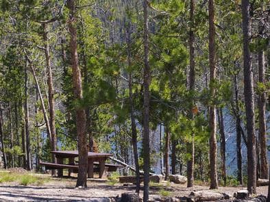
Overview Stanley Lake Campground is located on the shoreline above beautiful Stanley Lake at the foot of the Sawtooth Mountains. Recreation Stanley Lake offers excellent boating, water skiing, canoeing, kayaking and fishing for rainbow, cutthroat, brook and bull trout. A boat ramp is located just outside the campground. The Idaho Centennial Trail passes nearby and can be accessed from the Stanley Lake Trailhead across the lake. Facilities Stanley Lake offers excellent boating, water skiing, canoeing, kayaking and fishing for rainbow, cutthroat, brook and bull trout. A boat ramp is located just outside the campground. The Idaho Centennial Trail passes nearby and can be accessed from the Stanley Lake Trailhead across the lake. Natural Features The campground is situated on a hillside above the lake in a thick grove of lodgepole pines, at an elevation of 6,500 feet. Most campsites have partial shade and views of the lake and/or the rugged 9860-foot McGowan Peak. Temperatures are cool, with an average summer high of 78 degrees and a low of 40 degrees. Nearby Attractions Stanley Lake lies within the Sawtooth National Recreation Area, which offers a myriad of excellent hiking and biking opportunities. An estimated 750 miles of trails crisscross the valley and surrounding mountains. Numerous sparkling lakes and streams, including the Salmon River, dot the area, making for great rainbow and native Westslope cutthroat trout fishing. Redfish Lake is nearby, offering additional water recreation opportunities. Popular area events include an Arts and Crafts Fair in July, and Wagon Days, Salmon Festival, Quilt Fair and Fireman's Ball in September.
View details →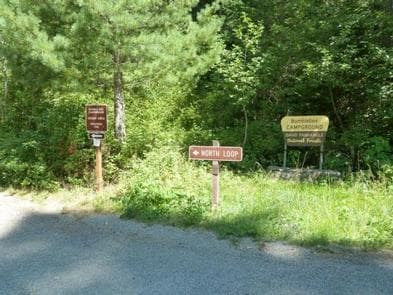
Overview Bumblebee Campground is located in a beautiful meadow with no standing trees, near the Little North Fork Coeur D'Alene River. It makes a perfect fishing and seasonal hunting base camp. Swimming and floating the river are popular activities as well. Recreation Bumblebee's creekside location creates easy access for floating, swimming and wading. Trout fishing is available about a half-mile from the campground in the Little North Fork of Coeur d'Alene River. Rainbow and cutthroat trout are the most common catches. About 15 miles from the campground is the 803 Motorized Trail System, which provides dedicated off-road trails and open roads in the Steamboat Creek area. Facilities Bumblebee's creekside location creates easy access for floating, swimming and wading. Trout fishing is available about a half-mile from the campground in the Little North Fork of Coeur d'Alene River. Rainbow and cutthroat trout are the most common catches. About 15 miles from the campground is the 803 Motorized Trail System, which provides dedicated off-road trails and open roads in the Steamboat Creek area. Natural Features The campground sits next to Bumblebee Creek near the Little North Fork Coeur D'Alene River at an elevation of 2,200 feet. Coeur d'Alene National Forest spans 726,819 acres and is one of three forests comprising the Idaho Panhandle National Forests. The majority of Idaho's waters are located in this northern region. Nearby Attractions The town of Coeur d'Alene is a delightful place to explore. Visitors can go paddle boating or parasailing on Lake Coeur d'Alene, or even take a trip around the lake on a seaplane. A variety of shops and restaurants are available. Charges & Cancellations A $10.00 service fee will apply if you change or cancel your reservation. Late cancellations are subject to additional fees. For full details see NRRS Reservation Policy.
View details →
Overview Campers come to Osprey for sunshine and boating at Priest Lake, and for breathtaking views of the rugged Selkirk Mountains. Fishing is also a big draw, with trout just waiting to be caught. While here, watch for moose, grizzly and black bears, wolves, mountain lions and deer. Osprey, as inferred by the campground name, also inhabit the area. Recreation Boating, canoeing, kayaking and wake boarding are summertime favorites. Boaters like to head north on the lake and traverse a narrow thoroughfare to reach Upper Priest Lake Scenic Area. Anglers often catch Dolly Varden and cutthroat trout and kokanee salmon. Facilities Boating, canoeing, kayaking and wake boarding are summertime favorites. Boaters like to head north on the lake and traverse a narrow thoroughfare to reach Upper Priest Lake Scenic Area. Anglers often catch Dolly Varden and cutthroat trout and kokanee salmon. Natural Features Osprey Campground is perched on the lower western shore of Priest Lake near Outlet Bay. The beautiful 25,000-acre lake is fed by springs trickling down from the Selkirks. The clear, blue lake reaches 300 feet in depth. Nearby Attractions Hike the Chipmunk Rapids Trail that traverses along the Kaniksu Marsh, Priest River and Chipmunk Rapids. In winter, ice fishing, snowshoeing and snowmobiling are popular activities in the surrounding area.
View details →
Overview Bell Bay Campground is a prime place to set up camp on Coeur d'Alene Lake. The upper camp loop is on a hill overlooking the beautiful lake, while the lower loop sits on a short ridge along the shoreline. Recreation Hikers enjoy the Bell Bay Trail, a foot path that runs for a mile around the lake shore. The lake beach offers plenty of opportunities for fishing, swimming, power boating and canoeing. Anglers enjoy the abundance of trout, salmon and panfish in the vast lake. Facilities Hikers enjoy the Bell Bay Trail, a foot path that runs for a mile around the lake shore. The lake beach offers plenty of opportunities for fishing, swimming, power boating and canoeing. Anglers enjoy the abundance of trout, salmon and panfish in the vast lake. Natural Features Located in the Panhandle of northern Idaho, the campground is surrounded by a forest of Ponderosa and other mixed pines. It lies on the southeast shores of Coeur d'Alene Lake just north of Harrison, Idaho. The lake spans 50 square miles, offering countless recreation opportunities and scenic views for visitors. Nearby Attractions The town of Coeur d'Alene, Idaho, on the northern side of the lake, is a popular destination. About an hour away, the area offers paddle boat rentals, ferry rides, sea plane rides and more.
View details →
Overview Rattlesnake Campground is located 13 miles north of Crouch, Idaho along the Middle Fork Payette River at an elevation of 3621 feet. The Middle Fork drainage offers a variety of excellent trails. Fishing and hunting are popular activities as well. Recreation The Middle Fork Payette River offers good to excellent fishing most of the year. Anglers cast for whitefish and rainbow trout. Many trails for hiking, mountain biking, horseback and ATV riding can be found in the area. The One Spoon Trail, Rattlesnake Trail, and 465 ATV Trail are all in the vicinity of the campground. In-season big game hunting for deer, elk and bear is a popular activity in the surrounding mountains. Facilities The Middle Fork Payette River offers good to excellent fishing most of the year. Anglers cast for whitefish and rainbow trout. Many trails for hiking, mountain biking, horseback and ATV riding can be found in the area. The One Spoon Trail, Rattlesnake Trail, and 465 ATV Trail are all in the vicinity of the campground. In-season big game hunting for deer, elk and bear is a popular activity in the surrounding mountains. Natural Features The campground is situated on the banks of the Middle Fork Payette River among Douglas fir and lodgepole pine trees, which offer partial shade. A few sites offer river views through the dense vegetation on the banks. A variety of wildlife makes its home in the Middle Fork drainage, including deer, elk, and red-tailed hawks.
View details →
Overview Mink Creek Group Site Campground is located just 12 miles south of Pocatello, Idaho, along the Bannock Highway. The Mink Creek area is a popular area for birding and wildlife viewing, with many miles of multi-use trails waiting to be explored. Recreation The West Fork Mink Creek Trail begins just outside the campground and is popular with hikers, mountain bikers and horseback riders. Additional trails including Corral Creek Trail and Valve House Trail are in the vicinity. Facilities The West Fork Mink Creek Trail begins just outside the campground and is popular with hikers, mountain bikers and horseback riders. Additional trails including Corral Creek Trail and Valve House Trail are in the vicinity. Natural Features The campground is situated along Mink Creek in the scenic Bannock Mountain Range of southeastern Idaho. A grove of ponderosa pines borders one side of the site, offering partial shade. Aspens and pines dot the surrounding mountainsides. A wide variety of birds can be found in the area, including the Western Scrub-Jay, Juniper Titmouse, Bushtit, Blue-gray Gnatcatcher, Mountain Bluebird and Green-tailed and Spotted Towhees and Calliope Hummingbirds. Nearby Attractions Cherry Springs Nature Area is nearby, with its pretty namesake spring, a stream for fishing, paved self-guided nature trails and picnic facilities. Mink Creek Nordic Center is also nearby, with hiking and horseback riding trails in summer months and groomed cross-country ski trails in the winter.
View details →
Overview Big Springs Campground is nestled along the banks of Pebble Creek at an elevation of 6,500 feet, just 16 miles from Lava Hot Springs, Idaho. Visitors enjoy fishing and exploring local trails. Recreation Pebble Creek offers cutthroat and rainbow trout fishing. Big Springs Nature Trail begins in the site, offering an easy path along the creek. The multi-use Boundary Trail, for hiking, biking, horseback and off-road vehicle riding, begins in the campground and accesses several additional local trails. Facilities Pebble Creek offers cutthroat and rainbow trout fishing. Big Springs Nature Trail begins in the site, offering an easy path along the creek. The multi-use Boundary Trail, for hiking, biking, horseback and off-road vehicle riding, begins in the campground and accesses several additional local trails. Natural Features A Douglas fir forest towers over Loop A, offering partial shade. Loop B is situated among a grove of aspens which provide limited shade. Sagebrush, grasses and summer wildflowers dot the landscape. contact_info For facility specific information, please call (208) 236-7500. Nearby Attractions Lava Hot Springs is close enough for an exciting day trip. A natural hot springs soaking pool, Olympic-sized swimming pool, water slides and diving platforms provide fun for all ages. Two 9-hole disc golf courses are linked around the pool complex. Tubing on the Portneuf River is also a very popular activity. Tube rentals are available at many locations in town.
View details →
Overview Scout Mountain Campground is located on beautiful Scout Mountain at an elevation of 6,900 feet, just 13 miles south of Pocatello, Idaho. Scout Mountain is part of the Mink Creek area, a popular place for birding and wildlife viewing. Visitors enjoy exploring a variety of local multi-use trails. Recreation Hiking, mountain biking, horseback riding and dirt biking are very popular activities in the area. The paved 1-mile Scout Mountain Nature Trail loops the campground, leading to several overlooks. The East Fork Mink Creek Trail begins within the site and the Crestline Trail is nearby. Facilities Hiking, mountain biking, horseback riding and dirt biking are very popular activities in the area. The paved 1-mile Scout Mountain Nature Trail loops the campground, leading to several overlooks. The East Fork Mink Creek Trail begins within the site and the Crestline Trail is nearby. Natural Features The campground sits high atop the Bannock Mountain Range in a scenic forest of Douglas fir, lodgepole pine and aspen, which offers partial shade. Summer wildflowers are abundant. A wide variety of birds can be found in the area, including the Western Scrub-Jay, Juniper Titmouse, Bushtit, Blue-gray Gnatcatcher, Mountain Bluebird, Green-tailed and Spotted Towhees and Calliope Hummingbirds. Nearby Attractions Cherry Springs Nature Area is less than 6 miles from the campground, with its pretty namesake spring, a stream for fishing, paved self-guided nature trails and picnic facilities. Mink Creek Nordic Center is about 5 miles away, with hiking and horseback riding trails in summer months and groomed cross-country ski trails in the winter. Charges & Cancellations A $10.00 service fee will apply if you change or cancel your reservation. Late cancellations are subject to additional fees. For full details see NRRS Reservation Policy.
View details →
Overview Malad Summit Campground is situated next to Mill Creek, just 14 miles north of Malad, Idaho, at an elevation of 6,100 feet. Visitors enjoy hiking, horseback riding and off-road vehicle riding on the area's many trails. Recreation Mill Creek offers cutthroat and rainbow trout fishing. Numerous trails begin nearby, including the 12-mile multi-use Summit Trail, which connects with Farmers Canyon, East Elkhorn and Wright Creek trails. Old Canyon and South Canyon trails begin a short distance from the campground. Facilities Mill Creek offers cutthroat and rainbow trout fishing. Numerous trails begin nearby, including the 12-mile multi-use Summit Trail, which connects with Farmers Canyon, East Elkhorn and Wright Creek trails. Old Canyon and South Canyon trails begin a short distance from the campground. Natural Features The campground is settled in a dense forest of maple trees, which offer plentiful shade. Stately Douglas fir trees dot the landscape. The campground receives snow throughout the winter.
View details →
Overview Curlew Campground is located just seven miles north of Snowville, Utah, and fewer than 10 miles south of Holbrook, Idaho. The campground is adjacent to Stone Reservoir in the Curlew National Grassland. It sits at an elevation of 4,700 feet. Recreation Stone Reservoir is closed to all motor crafts, boats and water crafts do to invasive spieces. The surrounding area is crisscrossed by numerous off-road vehicle trails. Horseback riding is allowed on the open range. Facilities Stone Reservoir is closed to all motor crafts, boats and water crafts do to invasive spieces. The surrounding area is crisscrossed by numerous off-road vehicle trails. Horseback riding is allowed on the open range. Natural Features The surrounding area is an open desert environment dotted with sagebrush and very few trees. The campground contains open, mowed lawns. Natural shade is very limited. Curlew National Grassland offers great areas for year-round birding. Some of the birds found in the area include Sage Thrasher, Vesper Sparrow, Brewer's Sparrow, Ash-throated Flycatcher and Scott's Oriole. Sharp-tailed grouse are best viewed in March and April. Nesters include the Ferruginous Hawk, Common Poorwill, Gray Flycatcher, Pinyon and Western Scrub-Jays, Juniper Titmouse, Blue-gray Gnatcatcher, Mountain Bluebird and Loggerhead Shrike. Redhead, Ring-necked duck, Canvasback and Lesser Scaup can often be seen near Stone Reservoir. Fall brings Canada and Snow geese. Wintering birds include Killdeer, Marsh Wren and song sparrows.
View details →
Overview Third Creek Group Campground is located just 12 miles northeast of Malad, Idaho, on the Weston Highway near Deep Creek Reservoir. Visitors enjoy exploring the local trail system and fishing at Deep Creek. Recreation Third Creek Trailhead is adjacent to the campground, complete with hitching racks for horses. It accesses the Oxford Peak Trail System and is open to hikers, bikers, motorcyclists and off-road vehicle users as well. Deep Creek Reservoir offers good trout, as well as boating and swimming opportunities. Facilities Third Creek Trailhead is adjacent to the campground, complete with hitching racks for horses. It accesses the Oxford Peak Trail System and is open to hikers, bikers, motorcyclists and off-road vehicle users as well. Deep Creek Reservoir offers good trout, as well as boating and swimming opportunities. Natural Features The group site lies in an open, flat area in Weston Canyon at an approximate elevation of 5,000 feet. Pines and hardwoods are scattered around the edges of the campground, which receives snow through the winter.
View details →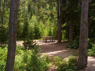
Overview Cloverleaf Campground is situated on St. Charles Creek in a scenic canyon in the forests of southeast Idaho. Recreation Nearby, the North Fork Trail and its associated trails access the Highline Trail #316. The Highline Trail is part of the National Trail System and is the area's premier trail. It stretches 55 miles along the backbone of the Wasatch Mountains and is open to hikers, mountain bikers, horseback riders and motorcyclists, attracting trail users from around the world. The Idaho Department of Fish and Game manages the river fisheries, providing excellent fishing most of the year, including in St. Charles Creek. In-season big game hunting is also a popular activity. Facilities Nearby, the North Fork Trail and its associated trails access the Highline Trail #316. The Highline Trail is part of the National Trail System and is the area's premier trail. It stretches 55 miles along the backbone of the Wasatch Mountains and is open to hikers, mountain bikers, horseback riders and motorcyclists, attracting trail users from around the world. The Idaho Department of Fish and Game manages the river fisheries, providing excellent fishing most of the year, including in St. Charles Creek. In-season big game hunting is also a popular activity. Natural Features Pines and aspens forest the area, providing partial shade, and summer wildflowers dot the landscape. St. Charles Creek flows gently past the campground. Nearby Attractions Minnetonka Cave, one of only two developed caves in the Forest Service, is a few miles from the campground. Guided cave tours are scheduled every 30 minutes daily from early June until Labor Day. The Bear Lake National Wildlife Refuge is just north of Bear Lake, offering excellent bird watching. Bear Lake's Raspberry Days Festival occurs the first weekend in August every year, with a parade, fireworks, craft booths and a rodeo.
View details →
Overview Alturas Lake Inlet Campground is located on the shores of scenic Alturas Lake at the foot of the Sawtooth Mountain Range. Recreation This site is part of the Sawtooth National Recreation Area, where outdoor activities abound. Alturas Lake offers excellent boating, water skiing, canoeing, kayaking and fishing for bull trout and Kokanee salmon. The 10-mile round trip Alpine Meadows Trail begins nearby, with spectacular canyon, meadow and alpine lake views. The trail is also a popular area for bird watching. Facilities This site is part of the Sawtooth National Recreation Area, where outdoor activities abound. Alturas Lake offers excellent boating, water skiing, canoeing, kayaking and fishing for bull trout and Kokanee salmon. The 10-mile round trip Alpine Meadows Trail begins nearby, with spectacular canyon, meadow and alpine lake views. The trail is also a popular area for bird watching. Natural Features Alturas Creek runs through the campground, where summer wildflowers are plentiful and a mixed-growth conifer forest provides partial shade. Temperatures are cool, with an average summer high of 78 degrees and a low of 40 degrees. Nearby Attractions The Sawtooth National Recreation Area offers a myriad of excellent hiking and biking opportunities, and an estimated 750 miles of trails crisscross the valley and surrounding mountains. Perkins Lake is less than 2 miles away, with excellent fishing and canoeing. Pettit and Yellowbelly Lakes are nearby, with more fishing, canoeing and hiking. The Salmon River offers fishing for rainbow trout, Westslope cutthroat trout and occasional hybrid cutbows and bull trout. Popular area events include an Arts and Crafts Fair in July, and Wagon Days, Salmon Festival, Quilt Fair and Fireman's Ball in September.
View details →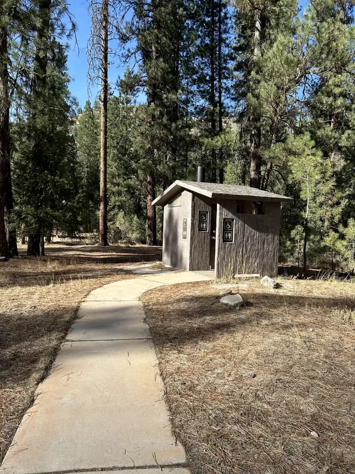
Overview Black Rock Campground is located 20 miles from Idaho City, on the North Fork Boise River, at an elevation of 4,300 feet. Visitors enjoy fishing, swimming and exploring local trails. Recreation The North Fork Boise River offers rainbow trout fishing in a beautiful natural setting. Many swimming holes can be found within a short distance of the campground. Numerous trail opportunities for hiking, mountain biking, horseback riding and dirt biking can be found in the vicinity. Facilities The North Fork Boise River offers rainbow trout fishing in a beautiful natural setting. Many swimming holes can be found within a short distance of the campground. Numerous trail opportunities for hiking, mountain biking, horseback riding and dirt biking can be found in the vicinity. Natural Features The campground sits on the banks of the North Fork Boise River, where ponderosa pines tower over the area. Most campsites have partial shade, but little privacy from other campers. A variety of wildlife makes its home around the campground.
View details →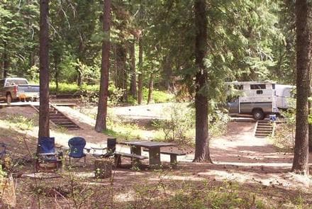
Overview Spring Creek Campground is located along the peaceful Spring Creek in the Hitt Mountains of western Idaho. Visitors enjoy relaxing along the gentle creek, fishing and exploring local trails. Once on-site, you may be able to pay for your campsite(s) by scanning a QR code using the Recreation.gov mobile app, and the Scan and Pay feature. If this option is available, you will need to first download the free Recreation.gov mobile app https://www.recreation.gov/mobile-app prior to your arrival as some remote areas have limited or no cellular service. Recreation Several miles of hiking, biking and off-road vehicle trails crisscross the area. The Sturgill Peak Trail climbs to a 7,289-foot summit and an active fire lookout built in 1934. Hikers are rewarded with views of the surrounding Hitt Range and the Wallowa Mountains to the west. Facilities Several miles of hiking, biking and off-road vehicle trails crisscross the area. The Sturgill Peak Trail climbs to a 7,289-foot summit and an active fire lookout built in 1934. Hikers are rewarded with views of the surrounding Hitt Range and the Wallowa Mountains to the west. Natural Features The campground is situated beneath tall ponderosa pine and fir trees at an elevation of 4,750 feet. Summer temperatures are hot during the day, but the surrounding trees provide ample shade. The Payette National Forest encompasses some of Idaho's most beautiful and diverse country. Located in west-central Idaho north of Boise, the 2.3 million-acre forest extends 100 miles west to east from Hells Canyon to the Middle Fork Salmon River, and 70 miles north to south from the Salmon River to the Weiser River. Nearby Attractions Mann Creek Reservoir is about 15 miles from the campground, offering boating and fishing opportunities.
View details →
Overview Upper Payette Lake Campground is located 16 miles from McCall, Idaho, on the shores of beautiful Upper Payette Lake. Visitors enjoy fishing, canoeing and exploring local trails. Once on-site, you may be able to pay for your campsite(s) by scanning a QR code using the Recreation.gov mobile app, and the Scan and Pay feature. If this option is available, you will need to first download the free Recreation.gov mobile app https://www.recreation.gov/mobile-app prior to your arrival as some remote areas have limited or no cellular service. Recreation Upper Payette Lake is a no-wake lake that offers great fishing, canoeing and kayaking opportunities. The paved, mile-long Shoreline Trail begins in the campground and several additional hiking and biking trails begin just across the road from the entrance. Facilities Upper Payette Lake is a no-wake lake that offers great fishing, canoeing and kayaking opportunities. The paved, mile-long Shoreline Trail begins in the campground and several additional hiking and biking trails begin just across the road from the entrance. Natural Features The lake is situated at the foot of the Salmon River Mountains at an approximate elevation of 5,900 feet. Engelmann spruce and lodgepole pine forest the site, providing partial shade. Summer wildflowers are abundant. Summer days are typically warm and nights are cool.
View details →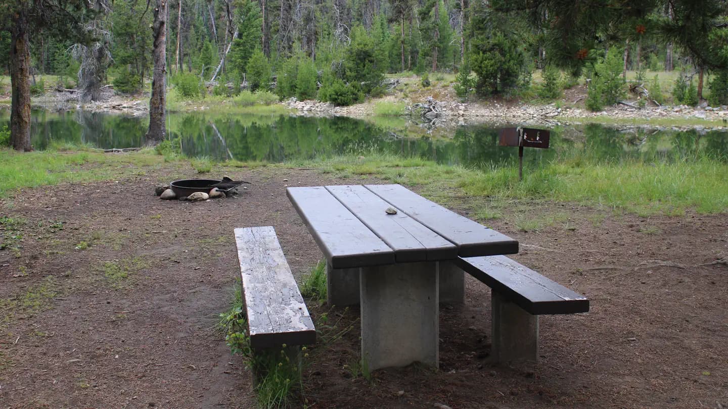
Overview River Side Campground is located along the Deadwood River at the north end of scenic Deadwood Reservoir at an elevation of 5,300 feet. Boating, fishing and hiking are popular activities. Recreation Because of its remote location, Deadwood Reservoir is quiet and unpopulated, making for great fishing for Chinook and Kokanee salmon, and rainbow and cutthroat trout. Boating, water skiing, canoeing and kayaking are popular on the lake. A boat ramp is located about 2 miles away at Cozy Cove Campground. Many trails for hiking, mountain biking, horseback and off-road vehicle riding are in the area. Facilities Because of its remote location, Deadwood Reservoir is quiet and unpopulated, making for great fishing for Chinook and Kokanee salmon, and rainbow and cutthroat trout. Boating, water skiing, canoeing and kayaking are popular on the lake. A boat ramp is located about 2 miles away at Cozy Cove Campground. Many trails for hiking, mountain biking, horseback and off-road vehicle riding are in the area. Natural Features The campground is situated in a mixed-growth pine forest, which offers plentiful shade. Summer wildflowers are abundant. The entire campground affords views of the river.
View details →
Overview Cozy Cove Campground is located on the southeast shore of scenic Deadwood Reservoir at an elevation of 5,300 feet. Boating, fishing and hiking are popular activities. Please click here for further information about the facility and recreation opportunities in the area. Recreation Because of its remote location, Deadwood Reservoir is quiet and unpopulated, making for great fishing for Chinook and Kokanee salmon, and rainbow and cutthroat trout. Boating, water skiing, canoeing and kayaking are popular on the lake. A boat ramp is located on-site. Many trails for hiking, mountain biking, horseback and off-road vehicle riding are in the area. Facilities Because of its remote location, Deadwood Reservoir is quiet and unpopulated, making for great fishing for Chinook and Kokanee salmon, and rainbow and cutthroat trout. Boating, water skiing, canoeing and kayaking are popular on the lake. A boat ramp is located on-site. Many trails for hiking, mountain biking, horseback and off-road vehicle riding are in the area. Natural Features The campground is situated on a bluff overlooking the reservoir. All sites have lake views. A mixed-growth pine forest covers the campground, offering plentiful shade. Summer wildflowers are abundant.
View details →
Overview Howers Campground is located on the northeast shore of the scenic Deadwood Reservoir in western Idaho. Boating, fishing and hiking are popular activities in this remote area. Please click here for further information about the facility and recreation opportunities in the area. Recreation Because of its remote location, Deadwood Reservoir is quiet and unpopulated, making for great fishing for Chinook and Kokanee salmon, as well as rainbow and cutthroat trout. Boating, water skiing, canoeing and kayaking are popular on the lake, and a boat ramp is located about two miles away at Cozy Cove Campground. Several trails for hiking, mountain biking, horseback and off-road vehicle riding wind around the lake shore and surrounding landscape. Facilities Because of its remote location, Deadwood Reservoir is quiet and unpopulated, making for great fishing for Chinook and Kokanee salmon, as well as rainbow and cutthroat trout. Boating, water skiing, canoeing and kayaking are popular on the lake, and a boat ramp is located about two miles away at Cozy Cove Campground. Several trails for hiking, mountain biking, horseback and off-road vehicle riding wind around the lake shore and surrounding landscape. Natural Features The campground is situated in a mixed-growth pine forest, offering plenty of shade. Summer wildflowers are abundant, and the campground affords sweeping views of the reservoir.
View details →
Overview Barneys Campground is located on the northeast shore of scenic Deadwood Reservoir at an elevation of 5,300 feet. Boating, fishing and hiking are popular activities at this site. Please click here for further information about the facility and recreation opportunities in the area. Recreation Because of its remote location, Deadwood Reservoir is quiet and unpopulated, making for great fishing for Chinook and Kokanee salmon, and rainbow and cutthroat trout. Boating, water skiing, canoeing and kayaking are popular on the lake. A boat ramp is located about 2 miles away at Cozy Cove Campground. Many trails for hiking, mountain biking, horseback and ATV riding are in the area. Facilities Because of its remote location, Deadwood Reservoir is quiet and unpopulated, making for great fishing for Chinook and Kokanee salmon, and rainbow and cutthroat trout. Boating, water skiing, canoeing and kayaking are popular on the lake. A boat ramp is located about 2 miles away at Cozy Cove Campground. Many trails for hiking, mountain biking, horseback and ATV riding are in the area. Natural Features The campground is situated in a mixed-growth pine forest, which offers plentiful shade. Summer wildflowers are abundant. The entire campground affords views of the reservoir.
View details →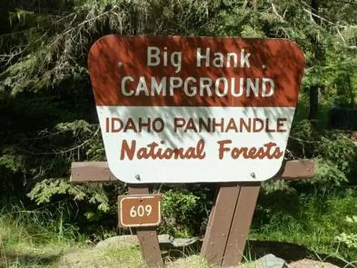
Overview Big Hank Campground is located along the North Fork of the Coeur d'Alene River in Idaho Panhandle National Forest. Shore fishing is a large draw, along with local hiking and biking trails. The campground also provides an excellent base camp for hunters during season. Wildlife like mule deer, moose, osprey and calliope hummingbirds are often spotted. Recreation Tubing on the river is a popular summertime activity, as is cutthroat fishing. Whitewater rafting enthusiasts enjoy the class I-III rapids down the river. Hiking, biking and horseback riding trails are a short drive away. Highlights include trails to Centennial Falls, Shadow Falls and Settler's Grove of Ancient Cedars. Facilities Tubing on the river is a popular summertime activity, as is cutthroat fishing. Whitewater rafting enthusiasts enjoy the class I-III rapids down the river. Hiking, biking and horseback riding trails are a short drive away. Highlights include trails to Centennial Falls, Shadow Falls and Settler's Grove of Ancient Cedars. Natural Features Big Hank is in a heavily wooded area on the banks of the Couer D' Alene River and Big Hank Creek. At 2,800 feet elevation, the campground sits on the Big Hank Meadow.
View details →
Overview Upper Coffee Pot Campground is located in Island Park, Idaho on a beautiful, floatable stretch of the Henry's Fork of the Snake River at an elevation of 6,300 feet. Visitors love Island Park for its world-class fishing and outstanding scenery and wildlife viewing opportunities. Recreation Henry's Fork has great fly-fishing for rainbow and brook trout. Tubing, canoeing, kayaking and rafting are also popular on the river. Coffee Pot Rapids are located downstream. The rapids are rated class III whitewater, providing a river playground for kayakers and rafters. Hiking, biking, horseback riding and ATVing are popular activities. Many miles of trails crisscross Island Park, including the 2.5-mile Coffee Pot Rapids Trail, which begins in the campground and meanders along the riverbank. The Continental Divide National Scenic Trail and the Nez Perce Trail are in the area. Island Park Reservoir and Henry's Lake are nearby, both offering boating, water skiing and excellent fishing opportunities. The Big Springs National Recreation Water Trail offers an approximately three-hour float or canoe trip through beautiful scenery. Wildlife, including moose, bald eagles and Sandhill cranes, are often seen along the trail. Facilities Henry's Fork has great fly-fishing for rainbow and brook trout. Tubing, canoeing, kayaking and rafting are also popular on the river. Coffee Pot Rapids are located downstream. The rapids are rated class III whitewater, providing a river playground for kayakers and rafters. Hiking, biking, horseback riding and ATVing are popular activities. Many miles of trails crisscross Island Park, including the 2.5-mile Coffee Pot Rapids Trail, which begins in the campground and meanders along the riverbank. The Continental Divide National Scenic Trail and the Nez Perce Trail are in the area. Island Park Reservoir and Henry's Lake are nearby, both offering boating, water skiing and excellent fishing opportunities. The Big Springs National Recreation Water Trail offers an approximately three-hour float or canoe trip through beautiful scenery. Wildlife, including moose, bald eagles and Sandhill cranes, are often seen along the trail. Natural Features Island Park is composed of two areas of extinct volcanic activity. The Henry's Fork Caldera sits inside the larger Island Park Caldera. The area is known for its dense forests of lodgepole pine, broad grassy meadows bursting with summer wildflowers and a wide variety of wildlife, including black and grizzly bears, moose, elk, deer, bald eagles, Sandhill cranes and much, much more. The campground is situated on the banks of the Henry's Fork among a forest of lodgepole pines, which provide partial shade in some sites. Some areas of the campground are more open and sunny than others. Nearby Attractions Mesa Falls Scenic Byway is 14 miles south of the campground. This 28-mile road leads to scenic overlooks and trails at 110 foot Upper Mesa Falls and 85 foot Lower Mesa Falls. Harriman State Park is 16 miles south. The Henry's Fork meanders through the Harriman, offering excellent fishing. Over 20 miles of trails are available, and wildlife is abundant in this scenic park. Henry's Lake State Park is 12 miles north, offering fishing, a fish cleaning station and boat ramp. Yellowstone National Park's west entrance is just 23 miles north in the town of West Yellowstone, Montana. Visitors enjoy day-tripping to the park for unparalleled wildlife viewing and the beautiful and unique scenery.
View details →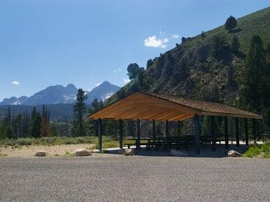
Overview Sunny Gulch Campground sits along the shores of Salmon River in the forests of central Idaho. Recreation Excellent fishing is right out your back door on the Salmon River, with rainbow trout, Westslope cutthroat trout and occasional hybrid cutbows and bull trout available. Sunny Gulch lies in the heart of the Sawtooth National Recreation Area. A myriad of excellent hiking and biking opportunities are available, and an estimated 750 miles of trails crisscross the valley and surrounding mountains. Facilities Excellent fishing is right out your back door on the Salmon River, with rainbow trout, Westslope cutthroat trout and occasional hybrid cutbows and bull trout available. Sunny Gulch lies in the heart of the Sawtooth National Recreation Area. A myriad of excellent hiking and biking opportunities are available, and an estimated 750 miles of trails crisscross the valley and surrounding mountains. Natural Features The campground offers spectacular views of the Sawtooth Mountains. Summer wildflowers are plentiful and lodgepole pines provide partial shade. Temperatures are cool with an average summer high of 78 degrees and a low of 40 degrees. Nearby Attractions The Alpine Way Trail begins less than a mile from the campground, and the Idaho Centennial Trail passes nearby. Redfish and Stanley Lakes are nearby with great boating, water skiing, canoeing, kayaking and fishing. Numerous additional sparkling lakes and streams dot the area. Popular area events include an Arts and Crafts Fair in July, and Wagon Days, Salmon Festival, Quilt Fair and Fireman's Ball in September.
View details →
Overview Mike Harris Campground is located along scenic Teton Pass, just 5 miles from Victor, Idaho at an elevation of 6,200 feet. Visitors enjoy fishing, exploring local trails and sightseeing in this beautiful region. Recreation Hiking, mountain biking and horseback riding are popular activities on the Mikesell Canyon Trail, which begins at the site. Trail Creek offers fishing for Yellowstone cutthroat and brook trout. Facilities Hiking, mountain biking and horseback riding are popular activities on the Mikesell Canyon Trail, which begins at the site. Trail Creek offers fishing for Yellowstone cutthroat and brook trout. Natural Features The campground is situated near Trail Creek among a forest of Douglas fir and lodgepole pine. A variety of wildlife makes its home in the area, including moose and deer. Summer wildflowers are abundant. Nearby Attractions Popular activities in the area include the Teton Valley Summer Festival over the Fourth of July in Driggs, with a hot air balloon festival, parade, rodeo, bike races and craft booths. Grand Targhee Resort is nearby with outstanding annual music festivals: Targhee Fest is in mid-July; Targhee Bluegrass Festival is in mid-August. The resort also offers lift-served hiking and mountain biking, scenic lift rides, guided horseback riding, a climbing wall and an 18-hole disc golf course. Grand Teton National Park's Granite Entrance is 22 miles away; Jackson, Wyoming is 19 miles away. Yellowstone National Park is within a couple hours drive.
View details →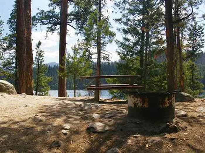
Overview Picnic Point Campground is located on a bluff overlooking beautiful Warm Lake, at an elevation of 5,300 feet. Visitors enjoy boating, fishing, swimming, hiking and viewing local wildlife. Recreation Warm Lake offers great fishing opportunities for cutthroat, rainbow, lake and bull trout. Boating, canoeing and swimming are popular activities. A boat ramp is located at neighboring Shoreline Campground. Billy Rice Swim Beach is within walking distance, offering a day-use site for picnicking and access to a swimming beach. The surrounding area offers great hiking, mountain biking, horseback and off-road vehicle riding and hunting. The WeWuKiye (Wa Wu Kia) Trail No. 252 was recently built and can be accessed nearby, at the entrance to Shoreline Campground. It is available for hiking and mountain biking. For off-road vehicle enthusiasts, Telephone Ridge Trail No. 112 offers 20 miles of trails for all riding levels, with staging areas at Shoreline Campground and at Warm Lake Campground down the road. Facilities Warm Lake offers great fishing opportunities for cutthroat, rainbow, lake and bull trout. Boating, canoeing and swimming are popular activities. A boat ramp is located at neighboring Shoreline Campground. Billy Rice Swim Beach is within walking distance, offering a day-use site for picnicking and access to a swimming beach. The surrounding area offers great hiking, mountain biking, horseback and off-road vehicle riding and hunting. The WeWuKiye (Wa Wu Kia) Trail No. 252 was recently built and can be accessed nearby, at the entrance to Shoreline Campground. It is available for hiking and mountain biking. For off-road vehicle enthusiasts, Telephone Ridge Trail No. 112 offers 20 miles of trails for all riding levels, with staging areas at Shoreline Campground and at Warm Lake Campground down the road. Natural Features The campground is situated beneath towering ponderosa pines, which provide partial shade. Summer wildflowers are abundant in the area. A variety of wildlife including bears, deer, elk, fox, grouse, eagles, osprey, grosbeaks, whooping cranes and otters, lives around the lake. Nearby Attractions Rustic North Shore Lodge is not far from the campground, offering a small restaurant, lounge and store with limited supplies.
View details →
Overview Porcupine Springs Campground is located along the scenic Rock Creek Road, in southern Idaho. It sits at an elevation of 6,950 feet. Visitors enjoy the area for its abundance of trails and scenic beauty. Recreation Numerous hiking, biking, horseback riding and off-road vehicle trails begin within or near the campground, including Porcupine Springs, Ross Falls, Rim View, Pike Mountain and Third Fork trails. Fishing is popular on Rock Creek. Facilities Numerous hiking, biking, horseback riding and off-road vehicle trails begin within or near the campground, including Porcupine Springs, Ross Falls, Rim View, Pike Mountain and Third Fork trails. Fishing is popular on Rock Creek. Natural Features The campground is situated in a scenic forest of pine and aspen trees. Summer wildflowers are vivid and abundant, and wildlife frequents the area.
View details →
Overview Thompson Flat Campground is located high in the Albion Mountain Range of southern Idaho, near the towns of Declo and Albion. Visitors enjoy the area for its abundant trails, alpine lakes and scenic beauty. Recreation The Twin Lakes Campground area is located just outside the campground and across the road. It offers picnic areas, horse corrals and access to a variety of trails. Lake Cleveland is a two-mile drive from the campground, offering fishing, canoeing and trail opportunities. Several additional hiking, mountain biking, horse and off-road vehicle trails are on the mountain. Facilities The Twin Lakes Campground area is located just outside the campground and across the road. It offers picnic areas, horse corrals and access to a variety of trails. Lake Cleveland is a two-mile drive from the campground, offering fishing, canoeing and trail opportunities. Several additional hiking, mountain biking, horse and off-road vehicle trails are on the mountain. Natural Features The campground is situated in a beautiful wildflower-filled meadow lined with tall pine and fir trees, on the eastern slope of Mount Harrison. It sits at an elevation of 8,400 feet. Nearby Attractions A visit up the road to the Mount Harrison Lookout offers interesting area information and breathtaking panoramic views of the valleys below. Pomerelle Ski Area, just below Thompson Flat, offers lift-served hiking and mountain biking, scenic chairlift rides and a few dining options, generally on weekends.
View details →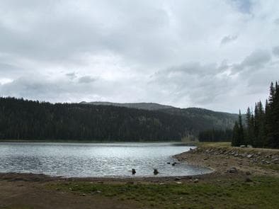
Overview Grouse Campground is located just 16 miles from McCall, Idaho, on the shores of Goose Lake. Visitors enjoy canoeing, fishing and horseback riding. Once on-site, you may be able to pay for your campsite(s) by scanning a QR code using the Recreation.gov mobile app, and the Scan and Pay feature. If this option is available, you will need to first download the free Recreation.gov mobile app https://www.recreation.gov/mobile-app prior to your arrival as some remote areas have limited or no cellular service. Recreation Goose Lake is a no-wake lake offering rainbow and brook trout fishing, canoeing and kayaking. Numerous hiking, horseback riding and dirt bike trails are in the vicinity, including Granite Mountain Lookout and Goose Creek Falls. Facilities Goose Lake is a no-wake lake offering rainbow and brook trout fishing, canoeing and kayaking. Numerous hiking, horseback riding and dirt bike trails are in the vicinity, including Granite Mountain Lookout and Goose Creek Falls. Natural Features Goose Lake is situated in the beautiful Salmon River Mountain range at an elevation of 6,500 feet. A forest of Engelmann spruce and lodgepole pines provides partial shade in the campground, which is a short, three-minute walk from the shoreline. Summer wildflowers are abundant. Nearby Attractions Brundage Mountain Resort, located nearby, offers scenic chairlift rides and excellent lift-served mountain biking and hiking.
View details →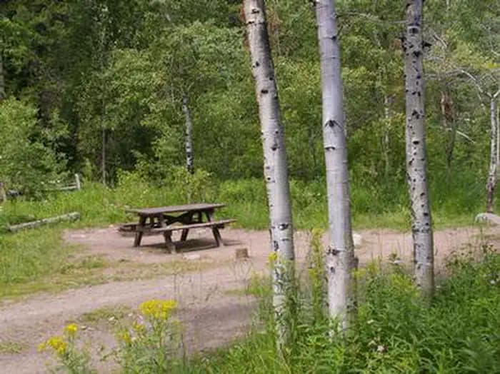
Overview North Fork Campground is situated on the banks of the beautiful Big Wood River at an elevation of 6,300 feet. Visitors enjoy fishing and tubing on the river and exploring the Harriman Trail. Recreation This site is part of the Sawtooth National Recreation Area, where outdoor activities abound. Fly-fishing for rainbow, brown and brook trout is popular on the Big Wood River, as is float tubing. The 20-mile Harriman Trail leads past the campground, offering excellent hiking and biking. Numerous additional trails spur off the Harriman Trail leading to deep canyons, sparkling lakes, swimming holes and more excellent high country fishing. Facilities This site is part of the Sawtooth National Recreation Area, where outdoor activities abound. Fly-fishing for rainbow, brown and brook trout is popular on the Big Wood River, as is float tubing. The 20-mile Harriman Trail leads past the campground, offering excellent hiking and biking. Numerous additional trails spur off the Harriman Trail leading to deep canyons, sparkling lakes, swimming holes and more excellent high country fishing. Natural Features A scenic aspen forest covers North Fork, offering plentiful shade. Pines dot the landscape and colorful summer wildflowers are abundant. Willows and grasses line the riverbank. Temperatures are cool with an average summer high of 78 degrees and a low of 40 degrees. Nearby Attractions The Sawtooth National Recreation Area Visitor Center is 1/2-mile from the campground, with a small museum, bookstore and area information. An RV dump station and drinking water are located here as well. Easley Hot Springs is 6 miles north, offering a swimming pool, hot tubs, showers and a small store. Popular area events include Wagon Days in Ketchum in September.
View details →
Overview Bonanza CCC Group Campground is located nine miles up the scenic and historic Yankee Fork drainage. It is approximately 23 miles from Stanley, Idaho, at an elevation of 6,500 feet. Recreation The Yankee Fork provides good fishing for rainbow trout, cutthroat trout and whitefish. Many miles of trails crisscross the area, including the West Fork of Yankee Fork, Crimson Lake Trail and Lightning Creek Trail. Trailheads for each are not far from the campground. Facilities The Yankee Fork provides good fishing for rainbow trout, cutthroat trout and whitefish. Many miles of trails crisscross the area, including the West Fork of Yankee Fork, Crimson Lake Trail and Lightning Creek Trail. Trailheads for each are not far from the campground. Natural Features Bonanza is situated in a beautiful valley near the Yankee Fork of the Salmon River. Lodgepole pines are scattered throughout the campground, providing limited shade. Summer wildflowers are abundant in the area. Nearby Attractions Yankee Fork has a rich history, all of which is easily accessed from the campground. Within a mile is the ghost town of Bonanza and two miles further is the ghost town of Custer. Bonanza, Boot Hill and Custer cemeteries are in the vicinity. The Yankee Fork Gold Dredge towers over the stream near Custer. Interpretive tours of the structure are offered from Memorial Day weekend through Labor Day. Sunbeam Dam site is nine miles down the canyon. Information about the only dam ever built on the Salmon River are provided at the river's edge.
View details →
Overview Loristica Group Campground is located in a wooded meadow high in the Lost Creek Range, in eastern Idaho. It sits at an elevation of 8,100 feet. Visitors come to the area for its great trail opportunities and scenic beauty. Recreation Two trailheads can be accessed within a mile of the campground. The Bear-Wet Creek Trail is open to hiking, horseback riding and off-road vehicles. The Long Lost-Wet Creek Trail is a non-motorized trail leading to a high plateau with spectacular views of Little Lost and Big Mountain Ranges. Visitors should watch for bighorn sheep, deer and elk in the Big Creek area, along the trail. Facilities Two trailheads can be accessed within a mile of the campground. The Bear-Wet Creek Trail is open to hiking, horseback riding and off-road vehicles. The Long Lost-Wet Creek Trail is a non-motorized trail leading to a high plateau with spectacular views of Little Lost and Big Mountain Ranges. Visitors should watch for bighorn sheep, deer and elk in the Big Creek area, along the trail. Natural Features The campground is situated among Douglas fir, lodgepole pine and aspen trees. A variety of wildlife, including deer, elk, bears, foxes and coyotes, makes its home in the surrounding area.
View details →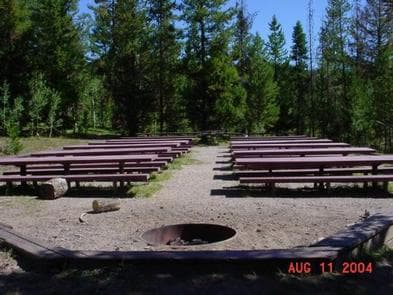
Overview Steel Creek Group Campground is located 35 miles northeast of the town of Dubois, Idaho, and 9 miles northwest of Kilgore. Visitors come to the area to enjoy the abundance of trails, wildlife viewing opportunities and scenic beauty. Recreation Hiking, hunting, fishing, mountain biking and ATV riding are popular activities in area. Facilities Hiking, hunting, fishing, mountain biking and ATV riding are popular activities in area. Natural Features The campground offers picturesque views of the surrounding mountains and is situated among willow and pine trees adjacent to a small stream. A variety of wildlife makes its home around the campground. Nearby Attractions Phone, gas, and groceries are available in Dubois, Idaho. Minimal services are available in Kilgore, Idaho at the quaint Kilgore Store.
View details →
Overview Stoddard Creek Campground is located just 1 mile off I-15 and 17 miles north of the town of Dubois, Idaho. Visitors come to the area to enjoy the abundance of trails, wildlife viewing opportunities and scenic beauty. Recreation Fishing, hiking, mountain biking, motorcycling and ATV riding are popular activities in the area. The Continental Divide National Scenic Trail can be accessed 8 miles away, where it crosses I-15. Facilities Fishing, hiking, mountain biking, motorcycling and ATV riding are popular activities in the area. The Continental Divide National Scenic Trail can be accessed 8 miles away, where it crosses I-15. Natural Features The campground is situated in a Douglas fir and aspen forest. Stoddard Creek runs just below the site. The campground is approximately 11 miles south of the Idaho-Montana border via Monida Pass on the Continental Divide. Nearby Attractions Phone, gas and groceries are 5 miles away in Spencer, Idaho or 17 miles away in Dubois.
View details →
Overview Johnson Bar Group Site is situated in a large, open field along the Selway River. The site is perfect for gatherings of up to 100 people, with room for tents and RVs. The site offers access to many recreational activities and sightseeing opportunities. Recreation The Selway River is a destination fly fishing experience for cutthroat and rainbow trout and is also well-known for whitewater rafting. Several trailheads for hiking and biking are accessible from Selway River Road and lead into the Selway-Bitterroot Wilderness area. Johnson Bar offers beach and boating access. Facilities The Selway River is a destination fly fishing experience for cutthroat and rainbow trout and is also well-known for whitewater rafting. Several trailheads for hiking and biking are accessible from Selway River Road and lead into the Selway-Bitterroot Wilderness area. Johnson Bar offers beach and boating access. Natural Features In the heart of north central Idaho, rugged peaks, deep canyons, dense forests and remote wilderness comprise the Nez Perce National Forest. Due in large part to dramatic elevational differences, the forest supports a wide variety of vegetation, from cedar groves to desert ecosystems. Johnson Bar is located in the Selway Wild and Scenic River Corridor, an area known for its rugged natural beauty and wildlife. Nearby Attractions An 11-mile sightseeing drive from Lowell to Selway Falls offers visitors opportunities to appreciate the pristine beauty of the Selway Wild and Scenic River and picturesque Selway Falls. Johnson Bar is near the Fenn Ranger Station, which is on the National Register of Historic Places.
View details →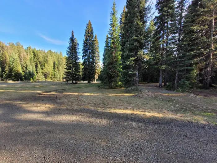
Overview Fish Creek Group Camp is located a few miles from the developed Fish Creek Campground. The primitive group site is a horse-friendly camp that can accommodate up to 75 people. It is also known as "Eagle's Nest," "Girl Scout Camp" and "Fish Creek Dispersed Site." Recreation The Fish Creek Cross Country Trail begins at nearby Fish Creek Campground. This 7-mile multi-use loop is open to hikers, mountain bikers, horseback riders and off-road vehicle enthusiasts, and offers scenic views of Gospel Mountain, Pilot Rock and Buffalo Hump. Facilities The Fish Creek Cross Country Trail begins at nearby Fish Creek Campground. This 7-mile multi-use loop is open to hikers, mountain bikers, horseback riders and off-road vehicle enthusiasts, and offers scenic views of Gospel Mountain, Pilot Rock and Buffalo Hump. Natural Features The group site is laid out in a large, flat area beneath tall pines within the Nez Perce National Forest in the heart of north central Idaho. The forest is comprised of rugged peaks, deep canyons, dense forests and remote wilderness. Due in large part to dramatic elevational differences, the forest supports a wide variety of vegetation, from cedar groves to desert ecosystems. Fish Creek Group Camp is located in the Salmon River/Highway 95 Corridor. The landscape here varies from the emerald-colored Salmon River pouring through steep canyon walls to sapphire-hued Moore's Lake in the remote Gospel-Hump Wilderness. Nearby Attractions Grangeville is the closest town. It offers camping supplies and a historical museum. The surrounding area offers a wealth of recreational activities, including whitewater rafting on the Salmon and Snake Rivers, golfing and fishing.
View details →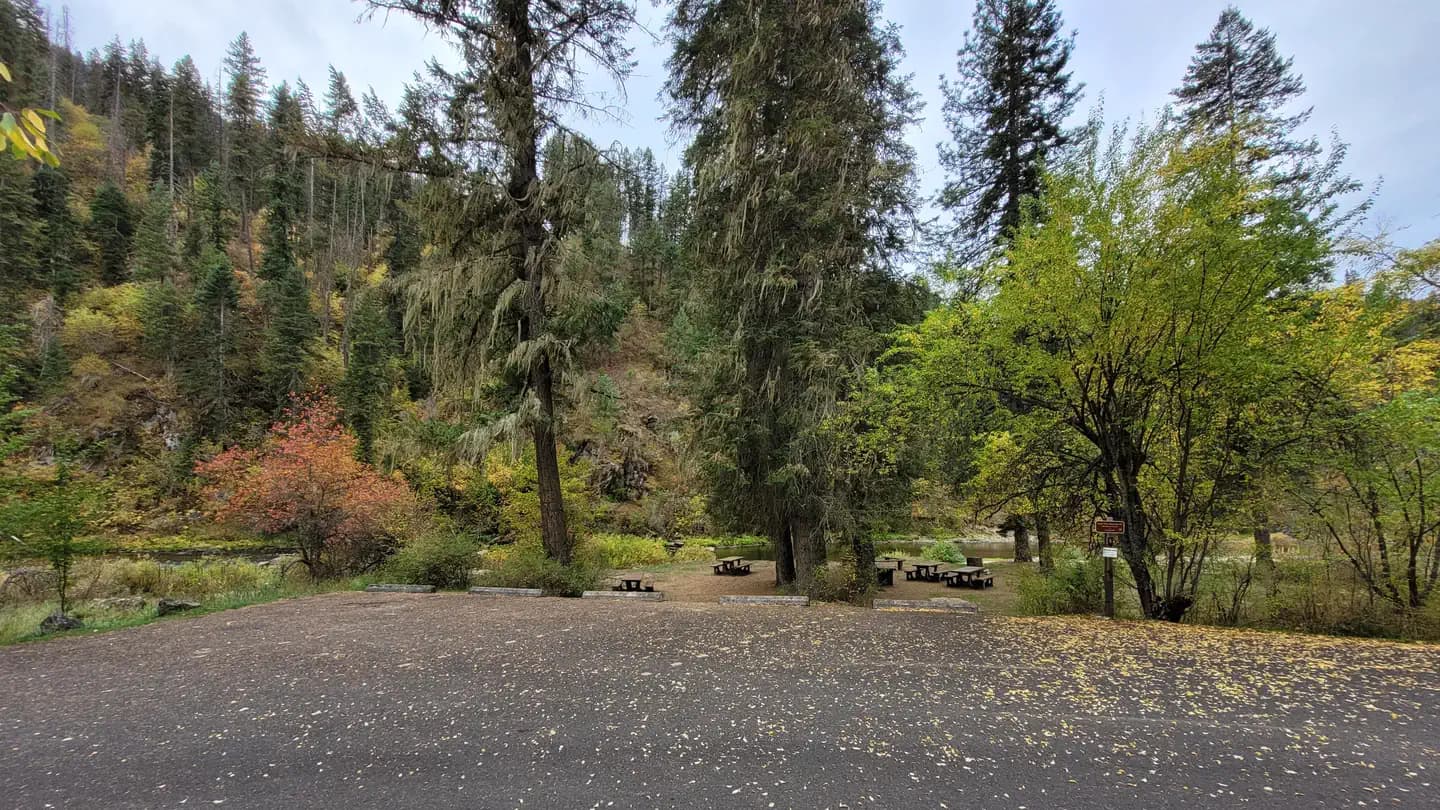
Overview South Fork Campground is nestled along the South Fork of Clearwater River. All standard sites are first-come, first-served, but a group site that can accommodate up to 25 people is available for reservations. South Fork Campground is well-suited to moderately-sized RVs. An abundance of recreational activities and scenic attractions are in the area. Recreation Anglers can fish for trout, steelhead and salmon in the Clearwater River. Berry picking is popular in season. Facilities Anglers can fish for trout, steelhead and salmon in the Clearwater River. Berry picking is popular in season. Natural Features In the heart of north central Idaho, rugged peaks, deep canyons, dense forests and remote wilderness comprise the Nez Perce National Forest. Due in large part to dramatic elevational differences, the forest supports a wide variety of vegetation, from cedar groves to desert ecosystems. South Fork Campground is located in the Highway 14 Corridor. This area features forested canyons with sections of rugged granite outcroppings, as well as gently sloping lodgepole pine-covered uplands and lush wildflower meadows. Nearby Attractions The campground's proximity to Highway 14 makes it easy to do a scenic drive. This picturesque route winds through changing landscapes and historic areas.
View details →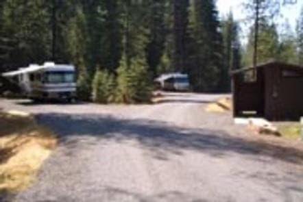
Overview Elk Creek Campground offers visitors a little bit of everything. From scenic views and vistas, to attractive waterfalls and ancient foliage, the campground provides a great place to stay in the mountains of north central Idaho. Recreational opportunities abound in the area and a variety of services are located nearby. Recreation Elk Creek and nearby Elk River Reservoir provide visitors with opportunities for fishing and other water-related recreation. Cutthroat and rainbow trout, chinook salmon and steelhead swim in the clear waters. Fishing or hunting are popular activities in the rugged and primitive landscape. Hiking, mountain biking and horseback riding are available on the area's many trails and forest roads. The Elk Creek Falls Trail takes hikers 3.5 miles to the tallest waterfall in the state. Facilities Elk Creek and nearby Elk River Reservoir provide visitors with opportunities for fishing and other water-related recreation. Cutthroat and rainbow trout, chinook salmon and steelhead swim in the clear waters. Fishing or hunting are popular activities in the rugged and primitive landscape. Hiking, mountain biking and horseback riding are available on the area's many trails and forest roads. The Elk Creek Falls Trail takes hikers 3.5 miles to the tallest waterfall in the state. Natural Features The campground is situated in a mature pine forest in the Clearwater National Forest, next to Elk Creek, at an elevation of about 3,000 feet. The surrounding area is home to the tallest waterfall in Idaho, as well as the largest cedar tree east of the Cascade Range. Elk, deer, moose, bear and cougar make the forested country their home. Nearby Attractions The town of Elk River is less than a mile from the campground and offers a variety of basic services, including gas, groceries, showers and fishing equipment.
View details →
Overview Bald Mountain Lookout offers the opportunity to enjoy unforgettable views and participate in a variety of recreational opportunities. It was built in 1956 and was used as a fire lookout until 1984. Guests can drive to the lookout in vehicles with good ground clearance, but trailers are not recommended due to some rough spots on the road. The lookout is typically open from early July through early October. The accommodations are mostly primitive, but some conveniences are provided. Guests will need to bring some of their own supplies and gear for a comfortable experience. Recreation Access to Strychnine Ridge Trail 319 is just southwest of the lookout. This 4-mile trail intersects with Beason Meadows Trail 228 a half-mile below the lookout. The Beason Meadows Trail is 8.9 miles long and leads down to Giant White Pine Campground. These trails are open to hikers, mountain bikers, motorcyclists and equestrians. Click here for an Idaho OHV safety message. Facilities Access to Strychnine Ridge Trail 319 is just southwest of the lookout. This 4-mile trail intersects with Beason Meadows Trail 228 a half-mile below the lookout. The Beason Meadows Trail is 8.9 miles long and leads down to Giant White Pine Campground. These trails are open to hikers, mountain bikers, motorcyclists and equestrians. Click here for an Idaho OHV safety message. Natural Features Bald Mountain is one of the highest peaks in the Hoodoo Mountain Range, and it's heavily forested with a mix of larch, red cedar, hemlock, western white pine, Douglas fir and Engelmann spruce. The lookout offers a bird's eye view of the surrounding mountains from its perch 5,334 feet above sea level. Guests who come to this rustic retreat can enjoy a panorama featuring the golden, rolling hills of the Palouse to the south and St. Maries to the north. The lookout offers an ideal vantage point to watch sunrises and sunsets or gaze at the stars. Wildlife watchers may see eagles soaring through the sky. Bear, moose, elk and deer are frequently spotted in the area. Nearby Attractions Bald Mountain Lookout is located just off Highway 6, which is known as the White Pine Scenic Byway. This 80-mile scenic drive takes visitors through beautiful forests, historic towns and scenic farmland.
View details →
Overview Big Springs Group Area is located 22 miles south of West Yellowstone, Montana in beautiful Island Park, Idaho at an approximate elevation of 6,300 feet. Visitors love Island Park for its world-class fishing and outstanding scenery and wildlife viewing opportunities. Recreation Big Springs is the headwaters of Henry's Fork and is one of the largest springs in the country. Henry's Fork is considered one of the best fly-fishing streams in the nation. Fishermen cast for rainbow and brook trout. Tubing, canoeing, kayaking and rafting are also popular on the river. The Big Springs National Recreation Water Trail can be accessed from the campground and ends 4.5 miles away at Macks Inn. It offers a lazy three-hour float or canoe trip through beautiful scenery. Wildlife, including moose, bald eagles and Sandhill cranes, are often seen along the trail. The charming and historic John Sack Cabin is nearby, noted for its unique location, construction and furnishings. Hiking, biking, horseback riding and ATVing are popular activities. Many miles of trails crisscross Island Park, including the Continental Divide National Scenic Trail and the Nez Perce Trail are in the area. Facilities Big Springs is the headwaters of Henry's Fork and is one of the largest springs in the country. Henry's Fork is considered one of the best fly-fishing streams in the nation. Fishermen cast for rainbow and brook trout. Tubing, canoeing, kayaking and rafting are also popular on the river. The Big Springs National Recreation Water Trail can be accessed from the campground and ends 4.5 miles away at Macks Inn. It offers a lazy three-hour float or canoe trip through beautiful scenery. Wildlife, including moose, bald eagles and Sandhill cranes, are often seen along the trail. The charming and historic John Sack Cabin is nearby, noted for its unique location, construction and furnishings. Hiking, biking, horseback riding and ATVing are popular activities. Many miles of trails crisscross Island Park, including the Continental Divide National Scenic Trail and the Nez Perce Trail are in the area. Natural Features Island Park is composed of two areas of extinct volcanic activity. The Henry's Fork Caldera sits inside the larger Island Park Caldera. The area is known for its dense forests of lodgepole pine, broad grassy meadows bursting with summer wildflowers and a wide variety of wildlife, including black and grizzly bears, moose, elk, deer, bald eagles, Sandhill cranes and much, much more. The campground is situated in a clearing surrounded by a forest of lodgepole pines. Grasses and summer wildflowers dot the landscape. Nearby Attractions Macks Inn is 4.5 miles west. This full-service facility offers boat rentals, rafting, shuttle service, gas, groceries, showers and laundry facilities. Island Park Reservoir and Henry's Lake are nearby, both offering boating, water skiing, fishing, kayaking and canoeing. Numerous additional small lakes and streams are scattered throughout Island Park. Yellowstone and Grand Teton National Parks are within a short drive, offering hiking and fishing, as well as outstanding scenery.
View details →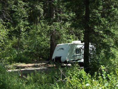
Overview Evergreen Campground is situated next to the Weiser River just off Highway 95 between the towns of Council and New Meadows, Idaho. Fishing and hiking are popular activities. Once on-site, you may be able to pay for your campsite(s) by scanning a QR code using the Recreation.gov mobile app, and the Scan and Pay feature. If this option is available, you will need to first download the free Recreation.gov mobile app https://www.recreation.gov/mobile-app prior to your arrival as some remote areas have limited or no cellular service. Recreation The Weiser River flows between the campground and the highway, offering excellent rainbow trout fishing, and an occassional crawdad. The Weiser River Trail is popular for hiking, mountain biking and horseback riding, and can be accessed within the site. Facilities The Weiser River flows between the campground and the highway, offering excellent rainbow trout fishing, and an occassional crawdad. The Weiser River Trail is popular for hiking, mountain biking and horseback riding, and can be accessed within the site. Natural Features Evergeen lives up to its name, as it's settled in a scenic, lush Douglas fir and spruce forest at an approximate elevation of 4,000 feet. Although right off the highway, the large trees and dense bushed provide seclusion and privacy. The Weiser River flows between the campsites and the highway.
View details →
Overview Mann Creek Campground is located near the Mann Creek Reservoir in the foothills of the West Central Mountains in western Idaho near the Payette National Forest. The reservoir is a popular boating and fishing destination. Once on-site, you may be able to pay for your campsite(s) by scanning a QR code using the Recreation.gov mobile app, and the Scan and Pay feature. If this option is available, you will need to first download the free Recreation.gov mobile app https://www.recreation.gov/mobile-app prior to your arrival as some remote areas have limited or no cellular service. Recreation The reservoir offers 283 surface-acres of water and five miles of shoreline, although the water level fluctuates seasonally. Visitors enjoy boating, canoeing, swimming and trout fishing. Facilities The reservoir offers 283 surface-acres of water and five miles of shoreline, although the water level fluctuates seasonally. Visitors enjoy boating, canoeing, swimming and trout fishing. Natural Features Mann Creek Reservoir lies in the rolling and arid foothills of the Hitt Mountains. At an elevation of 3,300 feet, the area is hot and dry in the summer months. Large shade trees help block some of the intense sun, but shade is limited. contact_info For facility specific information, please call (208) 549-4200.
View details →
Overview Silver Creek Campground is located 25 miles north of Garden Valley, Idaho, in beautiful Peace Valley at an elevation of 4,490 feet. Peace Valley offers a variety of great trails. Fishing and hunting are popular activities as well. Recreation Peace Valley contains many trails for hiking, mountain biking, as well as horseback and OHV riding. Peace Creek Trail, Silver Creek Summit Trail, and Bull Creek Trail all begin nearby. Silver Creek, Peace Creek, and the nearby Middle Fork Payette River offer good-to-excellent fishing most of the year. Anglers in the area cast for whitefish and rainbow trout. In-season big game hunting for deer, elk and bear is a popular activity in the surrounding mountains. Facilities Peace Valley contains many trails for hiking, mountain biking, as well as horseback and OHV riding. Peace Creek Trail, Silver Creek Summit Trail, and Bull Creek Trail all begin nearby. Silver Creek, Peace Creek, and the nearby Middle Fork Payette River offer good-to-excellent fishing most of the year. Anglers in the area cast for whitefish and rainbow trout. In-season big game hunting for deer, elk and bear is a popular activity in the surrounding mountains. Natural Features The campground is situated among a mixed-growth lodgepole pine forest, which provides partial shade. Silver Creek runs alongside the campground. A variety of wildlife makes its home in and around Peace Valley, including deer, elk, bald eagles, and red-tailed hawks. Nearby Attractions Silver Creek Plunge, a privately developed hot springs campground, is within a quarter-mile from the campground. It offers a hot springs pool, general store, a playground, horseshoe pits, as well as sand volleyball court and basketball hoop.
View details →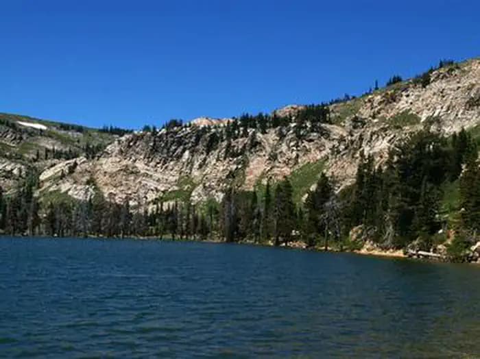
Overview Lake Cleveland Campground is a very popular summer recreational facility. Located next to its namesake, the campground is divided into the East Side and West Side loops. Very popular with residents of local communities, the campground is often full every weekend from early July to Labor Day. Recreation Fishing, kayaking, hiking and swimming are all popular activities within the Lake Cleveland area during the summer months. Non-motorized boating and floating is allowed on Lake Cleveland. Motorized recreation is limited to system roads and trails; no cross-country motorized travel is allowed. Facilities Fishing, kayaking, hiking and swimming are all popular activities within the Lake Cleveland area during the summer months. Non-motorized boating and floating is allowed on Lake Cleveland. Motorized recreation is limited to system roads and trails; no cross-country motorized travel is allowed. Natural Features At an elevation of 8,300 feet, the campground facility is located in an alpine lake basin below Mt. Harrison which has an elevation of 9,240 feet. Late season snowdrifts on the county road and in the campground often block access until early to mid-July. The campground is near the timberline and alpine wildflower meadows. Expansive views north across the Snake River Plain and south into Utah and Nevada can be found near the campground. Nearby Attractions Two miles from Lake Cleveland, Mt. Harrison has a fully functional fire lookout tower. Nearby Pomerelle ski area offers lift-served access to mountain bike and hiking trails. Two miles away, Twin Lakes Campground offers equestrian facilities and access to the Skyline Trail which is open for hiking, horseback riding, mountain biking and dirt bikes.
View details →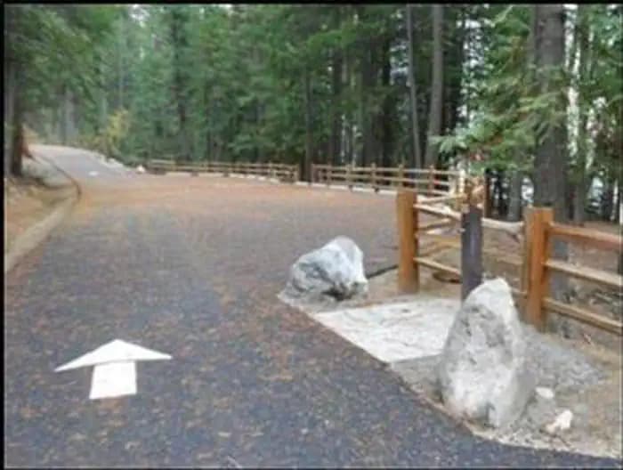
Overview Outlet campground is located on the southwest shore of Priest Lake at the headwaters of Priest River. Campers come to Outlet for sunshine, fishing, boating, kayaking, and the breathtaking views of the rugged Selkird Mountains of the Idaho Panhandle National Forests. Recreation Visitors enjoy kayaking, canoeing, and power boating on Priest Lake and up the 3.5 mile thoroughfare that leads to the Upper Priest Lake Scenic Area. The upper lake cannot be accessed by car. Fishing, swimming, bird and wildlife viewing are popular activities, as well. Beach Trail #48 runs through Outlet campground and stretches northward along an 8-mile scenic part of Priest Lake. Off-highway vehicle enthusiasts will find authorized trails like the Peewee Trail, Steep Creek Trail, and John Wayne Trail. Hike the Chipmunk Rapids Trail that traverses along the Kaniksu Marsh, Priest River, and Chipmunk Rapids. Facilities Visitors enjoy kayaking, canoeing, and power boating on Priest Lake and up the 3.5 mile thoroughfare that leads to the Upper Priest Lake Scenic Area. The upper lake cannot be accessed by car. Fishing, swimming, bird and wildlife viewing are popular activities, as well. Beach Trail #48 runs through Outlet campground and stretches northward along an 8-mile scenic part of Priest Lake. Off-highway vehicle enthusiasts will find authorized trails like the Peewee Trail, Steep Creek Trail, and John Wayne Trail. Hike the Chipmunk Rapids Trail that traverses along the Kaniksu Marsh, Priest River, and Chipmunk Rapids. Natural Features Outlet campground is situated at an elevation of 2,500 feet on Priest Lake. The lake is one of three largest and most beautiful lakes in the Idaho Panhandle, and reaches 300 feet in depth and covers 25,000 acres. The world's largest Mackinaw trout was caught here in 1963. Upper Priest Lake is part of the Upper Priest Lake Scenic Area. The entire shoreline of Upper Priest Lake is either the State of Idaho or federal ownership, and is administered as a scenic area. While visiting Priest Lake, watch for moose, black bear, wolves, deer, elk, and eagles, among others. Nearby Attractions Kalispell boat launch is the closest public boat launch, located about 7.5 miles north of the campground.
View details →
Overview Glade Creek Campground is a group site, only available by reservation. The campground is located along US Highway 12 in the Clearwater National Forest about seven miles east of Lowell, Idaho. Located in the mountains of north central Idaho, the forested site offers campers river access and beautiful scenery. The site is suitable for groups up to 35 people and is perfect for families and groups who want easy access to the Lochsa River. Fees are $50 per night. A combination code is needed to gain entry to the site and will be provided in the confirmation email. Check out is 12:00 pm. Check in is 2:00pm Recreation Popular activities include fishing and swimming. For the whitewater thrill-seekers, the Wild and Scenic Lochsa River holds exciting floating and kayaking opportunities. There are three hiking/biking trails within two miles of the campground; #142, #111 and #107. These trails are also open to motorcycles from approximately June through September. Facilities Popular activities include fishing and swimming. For the whitewater thrill-seekers, the Wild and Scenic Lochsa River holds exciting floating and kayaking opportunities. There are three hiking/biking trails within two miles of the campground; #142, #111 and #107. These trails are also open to motorcycles from approximately June through September. Natural Features The campground is situated between US Highway 12 and the Lochsa River. The campground is on a large bend in the river, which makes the beach completely hidden from the highway. With shade from the surrounding stand of mixed-age conifers and low-growing shrubs, It is a cool reprieve during the summer.
View details →
Overview Berlin Flats Group Area is located along Shoshone Creek, near the North Fork Coeur d'Alene River. This area provides a perfect escape for a warm summer weekend. Here, visitors can tent camp or pull out their RVs and trailers. The nearby river provides ample fishing and river floating opportunities. Recreation Catch-and-release cutthroat trout fishing is also popular on Shoshone Creek, and the North Fork Coeur d'Alene River. Rafting, swimming and kayaking are favorite activities on the water. Facilities Catch-and-release cutthroat trout fishing is also popular on Shoshone Creek, and the North Fork Coeur d'Alene River. Rafting, swimming and kayaking are favorite activities on the water. Natural Features The campground sits among lodgepole and other mixed pines along the river at an elevation of 2,600 feet. The area is located among peaks of the Cascades, about 70 miles from the popular Coeur d'Alene Lake. Wildlife watchers and photographers have the chance to see mule deer, moose, osprey and calliope hummingbirds.
View details →
Overview Cold Springs Campground is one of four campgrounds along Idaho's State Highway 55, next to the North Fork of the Payette River. This area is a popular location for river rafting trips and camping. This campground rests at 3,878 feet. Recreation The North Fork of the Payette River is a very popular location for expert kayaking. Whitewater rafting is nearby on the Main and South Fork sections of the Payette River. Anglers will find good to excellent fishing for whitefish and rainbow trout. Facilities The North Fork of the Payette River is a very popular location for expert kayaking. Whitewater rafting is nearby on the Main and South Fork sections of the Payette River. Anglers will find good to excellent fishing for whitefish and rainbow trout. Natural Features The campground is situated in a scenic canyon just above Highway 55. The mountains are forested with a mix of ponderosa and lodgepole pines and shade is plentiful within most of the campground. Summer days are warm, reaching 80-90 degrees; nights are cooler. Nearby Attractions Near the boat and kayak launch of the Payette River.
View details →
Overview Twin Creek Group Camping Site is part of the larger Twin Creek Campground. This beautiful campsite is located 15 miles north of North Fork, Idaho, and is situated along Twin Creek at an elevation of 5,100 feet. Recreation The recreational opportunities are abundant in this corner of the Salmon-Challis National Forest. There are fishing opportunities in the North Fork of the Salmon River and in Twin Creek. For the hikers, there are numerous trails in the area but trails #6108 and #6109 are located just behind the campground (pick up a visitor map or contact the North Fork District Office for more information). During certain parts of the year berry picking can be excellent around the campground. Facilities The recreational opportunities are abundant in this corner of the Salmon-Challis National Forest. There are fishing opportunities in the North Fork of the Salmon River and in Twin Creek. For the hikers, there are numerous trails in the area but trails #6108 and #6109 are located just behind the campground (pick up a visitor map or contact the North Fork District Office for more information). During certain parts of the year berry picking can be excellent around the campground. Natural Features Twin Creek Campground Group Camping Site is located in the Twin Creek drainage near its confluence with the North Fork of the Salmon River. Large pine trees and brush surround the campsite offering plenty of shade and privacy. Nearby Attractions While you are in the area be sure to check out the beautiful Salmon River, located 15 south of the campsite. Also, brush up on some history and imagine you are Lewis and Clark as you travel along Highway 93, which contains portions of the Lewis and Clark National Historic Trail.
View details →
Overview Pink House Recreation Site is a large developed site located approximately 5 miles west of Orofino, ID. Nestled beside the Clearwater River at an elevation of 980 feet, the Pink House Recreation Site is surrounded by scenic views of semi-arid hillsides, and the Lewis and Clark National Historic Trail. Visitors come to this site from all over the country to enjoy camping, world class fishing, boating, tubing, swimming, picnicking, and wildlife viewing. Lucky visitors may encounter a river otter swimming by or see eagles soaring above. The site is open year-round and a full-time Campground Host is present. Campers can opt to pay overnight camping fees at the site through the free, easy-to-use www.Recreation.gov mobile app using the ‘scan and pay’ option. Selecting a camping site at Pink House Recreation Site will remain first-come, first-served; they will not be reservable in advance through Recreation.gov. Recreation This area is popular for boaters, anglers, wildlife watching, as well as for quiet relaxation. The site is home to one of the most heavily used boat launching sites upstream from Lewiston, Idaho. Guests have immediate access to the Clearwater River, home to world-renowned salmon and steelhead fisheries attracting anglers from around the world. Tubing is one of the most popular activities on the section upstream of Orofino due to the river’s mellow rapids and accessibility. With over 10 access sites along the Clearwater River to put-in and take-out, recreationists have the option to float on the river as long as they desire. Facilities This area is popular for boaters, anglers, wildlife watching, as well as for quiet relaxation. The site is home to one of the most heavily used boat launching sites upstream from Lewiston, Idaho. Guests have immediate access to the Clearwater River, home to world-renowned salmon and steelhead fisheries attracting anglers from around the world. Tubing is one of the most popular activities on the section upstream of Orofino due to the river’s mellow rapids and accessibility. With over 10 access sites along the Clearwater River to put-in and take-out, recreationists have the option to float on the river as long as they desire. Natural Features The area is situated along the Clearwater River with beautiful views of the surrounding semi-arid hillsides. Most of the RV sites and all three tent sites offer excellent views of the Clearwater River. Native trees provide abundant shade throughout the site. Guests can access the large sandy beach with just a short walk from their campsite. The beach is open for year-round use, but is closed to vehicle use from June 1 to September 30 to enhance the safety of beach users in the summer months. Nearby Attractions The Lewis and Clark National Historic Trail follows the Clearwater River from Greer, Idaho to the confluence with the Snake River. The Northwest Discovery Water Trail is the first 40-mile reach of the Clearwater River from Canoe Camp to the confluence with the Snake River in Lewiston, Idaho. Orofino, Idaho provides basic services and shopping opportunities—5 miles away. Nez Perce National Historical Park (Canoe Camp)—1 mile away. Dworshak Hatchery—9 miles away. Dworshak Dam and Visitor Center—12 miles away.
View details →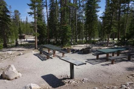
Overview Meadow Lake Campground is located on the Leadore Ranger District of the Salmon-Challis National Forest. This high alpine campground sits at an elevation of 9,160 feet in the Lemhi Mountain Range, 22 miles from Leadore, Idaho. Recreation There's no lack of recreational opportunities around Meadow Lake Campground. The lake is stocked twice a year so the fish are always biting. Fish from the bank or carry your boat down to the lake and try from the water, as there is no boat ramp or boat dock at the lake. Hiking opportunities are available right out of the campground and include trail # 342 which provides a gentle loop around the backside of the campground. Try trail # 057 which takes you up to the steep ridge above the campground (the trail to Meadow Lake Peak is not maintained by the Forest Service). If a slower pace is appealing, pull up a chair and soak-up the incredible views from the campground. Facilities There's no lack of recreational opportunities around Meadow Lake Campground. The lake is stocked twice a year so the fish are always biting. Fish from the bank or carry your boat down to the lake and try from the water, as there is no boat ramp or boat dock at the lake. Hiking opportunities are available right out of the campground and include trail # 342 which provides a gentle loop around the backside of the campground. Try trail # 057 which takes you up to the steep ridge above the campground (the trail to Meadow Lake Peak is not maintained by the Forest Service). If a slower pace is appealing, pull up a chair and soak-up the incredible views from the campground. Natural Features Meadow Lake Campground is located at the base of the 10,720-foot Meadow Lake Peak and along the banks of the 13.3-acre Meadow Lake. The high elevation campground is dotted with lodge pole pine and white bark pine trees and is frequented by deer and mountain goats. Nearby Attractions There are plenty of other attractions in the vicinity of Meadow Lake including the Gilmore Ghost Town and a number of other Forest Service recreation sites and trails. Stop at the Leadore Ranger Station and pick up a visitor map for more information. Charges & Cancellations A $8.00 non-refundable on line reservation fee may be charged for some facilities.
View details →
Overview Huckleberry Campground is located along the shores of the St. Joe River, 29 miles east of St. Maries, Idaho on the St. Joe River Road. Reserve a campsite here: https://www.recreation.gov/camping/campgrounds/273785/campsites . Recreation RV Camping, Fishing, Wildlife Viewing. In close proximity to Forest Service lands Facilities RV Camping, Fishing, Wildlife Viewing. In close proximity to Forest Service lands Natural Features Riverfront Campground Nearby Attractions The campground's location serves as a central hub for campers and recreationists recreating along the river between Calder and Avery Idaho. Multiple hunting, fishing, and ATV/UTV user groups travel to the campground and use it to access the nearby miles of US Forest Service and Idaho Department of Lands (IDL) roads. The campground also serves as a central location to stage for fishing and floating trips.
View details →
Overview Elk Creek Pavilion offers visitors a little bit of everything. From scenic views and vistas, to attractive waterfalls and foliage, the pavilion provides a great place to host group events in the mountains of north central Idaho. Recreational opportunities abound in the area and a variety of services are located nearby. For groups greater than 50 people please call the Palouse Ranger District at (208) 875-1131 to make additional parking arrangements. Recreation Elk Creek and nearby Elk River Reservoir provide visitors with opportunities for fishing and other water-related recreation. Cutthroat and rainbow trout, chinook salmon and steelhead swim in the clear waters. Fishing or hunting are popular activities in the rugged and primitive landscape. Hiking, mountain biking and horseback riding are available on the area's many trails and forest roads. The Elk Creek Falls Trail takes hikers 3.5 miles to the tallest waterfall in the state. Facilities Elk Creek and nearby Elk River Reservoir provide visitors with opportunities for fishing and other water-related recreation. Cutthroat and rainbow trout, chinook salmon and steelhead swim in the clear waters. Fishing or hunting are popular activities in the rugged and primitive landscape. Hiking, mountain biking and horseback riding are available on the area's many trails and forest roads. The Elk Creek Falls Trail takes hikers 3.5 miles to the tallest waterfall in the state. Natural Features The pavilion is situated alongside Elk Creek Campground in a mature pine forest in the Nez Perce-Clearwater National Forests, next to Elk Creek, at an elevation of about 3,000 feet. The surrounding area is home to the tallest waterfall in Idaho, as well as the largest cedar tree east of the Cascade Range. Elk, deer, moose, bear and cougar make the steep forested country their home. Nearby Attractions The town of Elk River is less than a mile from the campground and offers a variety of basic services, including gas, groceries, showers and fishing equipment.
View details →FAQ
Camping in Idaho
How many campgrounds are listed in Idaho?
TheCampVerse currently lists 131 campgrounds in Idaho.
What campground types are most common in Idaho?
The most common campground types are Campground.
How can I compare campgrounds in Idaho?
Use the campground cards and featured links on this page to compare descriptions, amenities, and details before opening each campground profile.
Keep exploring