
Campgrounds in Alaska
Experience the untamed wilderness and scenic landscapes of the Last Frontier
32
Campgrounds listed
100%
With photos
100%
Detailed descriptions
Campground
Top campground type
Highlights
Featured campgrounds in Alaska
Explore by campground name letter
Jump to A-Z landing hubs for stronger discovery paths beyond Alaska.
All campgrounds
Showing 32 campgrounds

Overview Brushkana Creek Campground is located at MP 104.5 along the Denali Highway. The 22-unit camping area with fire rings and picnic tables also provides three double vaulted accessible toilets, numerous bear-proof trash receptacles and food lockers, parking for vehicles and trailers, potable water, trails, picnic area with shelter, and interpretive panels dispersed throughout the site. This site is mostly utilized during the snow free season, May through September. Winter physically closes the campground road access, and it is only reached by foot, dog sled or snowmachine. Its location along the Denali Highway has made it a destination for travelers along the gravel road connecting Paxson to Cantwell. Brushkana Creek and Tangle Lakes Campgrounds are the only developed, public campground facilities along the 135-mile road. Recreation https://www.blm.gov/programs/recreation/recreation-activities/alaska Facilities https://www.blm.gov/programs/recreation/recreation-activities/alaska Natural Features The Denali Highway offers some of the most spectacular scenery and recreational opportunities in Alaska. For those with a heart for adventure and a little extra time, the highway is an historic and archaeological glimpse of the Last Frontier – wild landscapes in all directions. With planning, an abundance of camping, fishing, wildlife viewing and hiking opportunities can be yours. https://www.blm.gov/documents/alaska/public-room/brochure/denali-highway-points-interest-brochure Nearby Attractions Brushkana Creek Campground is located at MP 104.5 along the Denali Highway. The 22-unit camping area with fire rings and picnic tables also provides three double vaulted accessible toilets, numerous bear-proof trash receptacles and food lockers, parking for vehicles and trailers, potable water, trails, picnic area with shelter, and interpretive panels dispersed throughout the site. This site is mostly utilized during the snow free season, May through September. Winter physically closes the campground road access, and it is only reached by foot, dog sled or snowmachine. Its location along the Denali Highway has made it a destination for travelers along the gravel road connecting Paxson to Cantwell. Brushkana Creek and Tangle Lakes Campgrounds are the only developed, public campground facilities along the 135-mile road. https://www.blm.gov/sites/blm.gov/files/documents/files/Maps_GeoPDF_Alaska_Denali_Highway.pdf
View details →
Overview This location is available on a first-come, first-served basis only. Visitors are required to physically arrive at the campground to purchase and claim a site. Once on-site, you may be able to pay for your campsite(s) by scanning a QR code using the Recreation.gov mobile app, and the Scan and Pay feature. If this option is available, you will need to first download the free Recreation.gov mobile app https://www.recreation.gov/mobile-app prior to your arrival as some remote areas have limited or no cellular service. Recreation Bertha Creek campground makes a convenient base for berry picking, hiking, biking and exploring the area. The family can try out gold panning on unvegetated gravels along Bertha Creek. Facilities Bertha Creek campground makes a convenient base for berry picking, hiking, biking and exploring the area. The family can try out gold panning on unvegetated gravels along Bertha Creek. Natural Features Bertha Creek Campground is located just south of Turnagain Pass on the Seward Highway in the Kenai Mountains. The campground is tucked into an open forest beside the confluence of Bertha and Granite creeks at the base of steep mountains. contact_info This location is unstaffed. To speak with our main office for general information, please call: (907) 783-3242. Nearby Attractions Explorers can travel 1.5 miles south on the Seward Highway to the Johnston Pass Trailhead. From this trailhead you can hike or bike either the trail or the paved bike path that stretches roughly seven miles south to the wayside near the intersect of the Hope and Seward Highways. One can also head north on the Seward Highway 3 miles and reach Turnagain Pass. The parking area on the south side of the Highway offers access to the Turnagain Pass Trail to hike or bike and has ample opportunites to see wildlife and wildflowers in bloom.
View details →Overview This location is available on a first-come, first-served basis only. Visitors are required to physically arrive at the campground to purchase and claim a site. Once on-site, you may be able to pay for your campsite(s) by scanning a QR code using the Recreation.gov mobile app, and the Scan and Pay feature. If this option is available, you will need to first download the free Recreation.gov mobile app https://www.recreation.gov/mobile-app prior to your arrival as some remote areas have limited or no cellular service. Recreation Wildlife viewing includes moose, brown and black bears, mountain goats, lynx, bald eagles, and salmon. The Trail of Blue Ice that stretches almost the entire length of Portage Valley can be reached from the campground. From this trail you can acces the Williwaw Nature Trail, Williwaw Fish Viewing Platform, Moose Flats Area, Begich Boggs Visitor Center, Byron Glacier Trail, and Portage Glacier Cruises. Portage Lake, at the head of the valley, allows access for kayaking and packrafting. Facilities Wildlife viewing includes moose, brown and black bears, mountain goats, lynx, bald eagles, and salmon. The Trail of Blue Ice that stretches almost the entire length of Portage Valley can be reached from the campground. From this trail you can acces the Williwaw Nature Trail, Williwaw Fish Viewing Platform, Moose Flats Area, Begich Boggs Visitor Center, Byron Glacier Trail, and Portage Glacier Cruises. Portage Lake, at the head of the valley, allows access for kayaking and packrafting. Natural Features Black Bear campground sits in the stunning Portage Valley in the Chugach National Forest. contact_info This location is unstaffed. To speak with our main office for general information, please call: (907) 782-3242. Nearby Attractions Begich Boggs Visitor Center lies at the head of Portage Valley where you can learn about glaciers and Alaska. The Alaska Wildlife Conservation Center is located on near the intersect of the Seward Higway and Portage Highway. Here you can see all different kinds of Alaskan wildlife. Portage Glacier Cruises offers the chance to ride a boat and get up close to Portage Glacier.
View details →
Overview Marion Creek Campground is nestled on the south side of the Brooks Range in the Middle Fork Koyukuk River valley. It offers vistas of the Brooks Range and has access to the nearby undeveloped trail up to Marion Creek falls. The campground is a perfect basecamp for exploring Alaska’s Brooks Range. There are 27 sites, three of which are accessible. The site is located five miles north of Coldfoot. This location is available on a first-come, first-serve basis only. Visitors are required to physically arrive at the campground to claim and purchase a site. Once on-site, you can pay for your campsites(s) by scanning a QR code using the Recreation.gov mobile app. Download the free Recreation.gov mobile app on Android or iOS prior to your arrival as this is a remote area that has limited or no cellular service. More reliable cellular service can be found 5 miles south in Coldfoot. Recreation The Brooks Range offers excellent recreation opportunities. Explore undesignated routes from the Dalton Highway. Hiking is plentiful up and into the mountains where ridges and drainages provide firm footing, and the forest thins to low-growing tundra. Hiking east from the highway will lead you to the Arctic National Wildlife Refuge, while hiking west of the highway will take you towards Gates of the Arctic National Park and Preserve. Choose your route with care, let someone know where you plan on going, carry bear deterrent, and bring topographic maps, a GPS, and a compass with you. Panning for gold is allowed on a few federal stream segments along the Dalton Highway south of Atigun Pass (Milepost 244). No panning is permitted in the pipeline right-of-way (27 feet/8.2 m on either side of the pipeline) and no panning on federal mining claims without permission. Suction dredging is prohibited in the Utility Corridor. Visit the Arctic Interagency Visitor Center in Coldfoot to get more information on where you may legally pan for gold. There are several excellent river trips along the Dalton: • The Jim River and Middle Fork of the Koyukuk River: Class I-II, several access points along the highway. • Atigun and Sagavanirktok (the Sag) Rivers: Class III-IV+ whitewater, access Atigun at Milepost 271; Sag at MP 306. For expert boaters only. • Ivishak Wild and Scenic River: Class II, access by chartered air service from Deadhorse or Coldfoot. Other recreational activities include, bird watching, wildflower spotting/identifying, fishing, bicycling and hunting. More detailed information on all these activities is available at the Arctic Interagency Visitor Center. State statute prohibits off-road vehicle use within 5 miles either side of from the highway from the Yukon River to the Arctic Ocean. Facilities The Brooks Range offers excellent recreation opportunities. Explore undesignated routes from the Dalton Highway. Hiking is plentiful up and into the mountains where ridges and drainages provide firm footing, and the forest thins to low-growing tundra. Hiking east from the highway will lead you to the Arctic National Wildlife Refuge, while hiking west of the highway will take you towards Gates of the Arctic National Park and Preserve. Choose your route with care, let someone know where you plan on going, carry bear deterrent, and bring topographic maps, a GPS, and a compass with you. Panning for gold is allowed on a few federal stream segments along the Dalton Highway south of Atigun Pass (Milepost 244). No panning is permitted in the pipeline right-of-way (27 feet/8.2 m on either side of the pipeline) and no panning on federal mining claims without permission. Suction dredging is prohibited in the Utility Corridor. Visit the Arctic Interagency Visitor Center in Coldfoot to get more information on where you may legally pan for gold. There are several excellent river trips along the Dalton: • The Jim River and Middle Fork of the Koyukuk River: Class I-II, several access points along the highway. • Atigun and Sagavanirktok (the Sag) Rivers: Class III-IV+ whitewater, access Atigun at Milepost 271; Sag at MP 306. For expert boaters only. • Ivishak Wild and Scenic River: Class II, access by chartered air service from Deadhorse or Coldfoot. Other recreational activities include, bird watching, wildflower spotting/identifying, fishing, bicycling and hunting. More detailed information on all these activities is available at the Arctic Interagency Visitor Center. State statute prohibits off-road vehicle use within 5 miles either side of from the highway from the Yukon River to the Arctic Ocean. Natural Features The campsites are situated in a spruce forest with wide views of the Brooks Range. Namesake Marion Creek is only a short walk from the campsites. The area provides habitat for squirrels, voles, marten, lynx, wolf, moose, and grizzly and black bears. A variety of birds migrate north to breed in the area and further north. Some of the year-round resident birds include ravens, grouse, chickadees, hawk owls and Canada jays. Campers can experience 24-hour daylight during a period of about 30 days around June 21, and abundant light the rest of the summer season. In late August and into September bright, fall colors in trees and tundra extend for hundreds of miles. Late August and into September, sky gets dark enough that you have chances to see the aurora borealis. contact_info This location has limited staffing. Please call (907) 474-2200 for general information. Nearby Attractions The original gold rush town of Coldfoot was located on the Middle Fork of the Koyukuk River near the mouth of Slate Creek. It got is name in 1900 when early prospectors reportedly got “cold feet” and left before winter set in. Today it is small community serving truckers who drive the “haul road” to Prudhoe Bay, as well as visitors. There is a cafe, lodging, a post office, diesel and gasoline fuel, and limited repair service. Coldfoot is a transition point for people accessing the backcountry via small aircraft. The Arctic Interagency Visitor Center in Coldfoot introduces visitors from around the world to the unique and extreme environment of the Arctic. Explore interpretive exhibits, walk the nearby nature trails, and talk with knowledgeable staff to learn more about the region’s history, natural environment, and recreation opportunities. The visitor center is a partnership between the Bureau of Land Management (BLM), the National Park Service (NPS), and the U.S. Fish and Wildlife Service (USFWS). The Visitor Center is currently open daily from 11:00 a.m. until 9 p.m. from late May to mid-September, with nightly programs at 8:00 p.m. The historic mining village of Wiseman is a few miles to the north. Just after crossing the Middle Fork of the Koyukuk Bridge #1, take the turnoff to the west and follow the signs three miles (5km) to Wiseman. Established in 1907 when miners discovered gold in nearby Nolan Creek, the town was once a bustling community. Many residents today continue to subsist by hunting, trapping, and gardening. They enjoy sharing their stories with visitors. Note that all buildings in the Wiseman area are private property unless noted. Please stay on the roads. Travel further north, over Atigun Pass, onto the north slope and coastal plain to experience the dramatic difference from the boreal forest of the Marion Creek Campground area. Landscape is more open, affording chances to see mammals such as Dall’s sheep, muskoxen, caribou, Arctic fox, and Arctic ground squirrels. Also look for birds such wagtails, wheatears, golden eagles, jaegers, longspurs, shore birds, in breeding plumage. Charges & Cancellations No refunds.
View details →
Overview Arctic Circle Campground is located on a beautiful mixed forest hillside at the Arctic Circle. It was fully renovated in 2021. There are some views of nearby hills and the Kanuti Flats. It is located ½ mile east (uphill) from the Dalton Highway and Arctic Circle sign. The campground is a perfect stop for those exploring their way up the Dalton Highway. There are 19 accessible campsites. This location is available on a first-come, first-serve basis only. Visitors are required to physically arrive at the campground to claim and purchase a site. Once on-site, you can pay for your campsites(s) by scanning a QR code using the Recreation.gov mobile app. Download the free Recreation.gov mobile app on Android or iOS prior to your arrival as this is a remote area that has limited or no cellular service. Recreation The hills in the area are remote with rugged terrain and offer no developed routes. Backcountry hiking opportunities can be found on ridges in the area. Be advised that hiking can be difficult due to tussocks, wet ground and uneven footing. Choose your route with care and bring topographic maps, a satellite communication device, a GPS and a compass with you if you choose to go exploring. Fishing opportunities are numerous in this area. Try your luck in the aptly named Fish Creek at the base of the hill, or just a little ways to the north are the two forks of Bonanza Creek. Make sure you have a State of Alaska fishing license and know the regulations for the area you are fishing. Panning for gold is also allowed on a several federal stream segments along the Dalton Highway south of Atigun Pass (Milepost 244). No panning is permitted in the pipeline right-of-way (27 feet/8.2 m on either side of the pipeline) and no panning on federal mining claims without permission. Suction dredging is prohibited in the Utility Corridor. Visit the BLM Public Room in Fairbanks (222 University Ave, Fairbanks, Alaska) or the Arctic Interagency Visitor Center in Coldfoot, Alaska, to get information on where you may legally pan for gold. The Jim River can be a nice Class I-II float trip with several access points along the highway. Watch out for sweepers and strainers! Other recreational activities include bird watching and bicycling. State statute prohibits off-road vehicle use within five miles either side of from the highway from the Yukon River to the Arctic Ocean. Facilities The hills in the area are remote with rugged terrain and offer no developed routes. Backcountry hiking opportunities can be found on ridges in the area. Be advised that hiking can be difficult due to tussocks, wet ground and uneven footing. Choose your route with care and bring topographic maps, a satellite communication device, a GPS and a compass with you if you choose to go exploring. Fishing opportunities are numerous in this area. Try your luck in the aptly named Fish Creek at the base of the hill, or just a little ways to the north are the two forks of Bonanza Creek. Make sure you have a State of Alaska fishing license and know the regulations for the area you are fishing. Panning for gold is also allowed on a several federal stream segments along the Dalton Highway south of Atigun Pass (Milepost 244). No panning is permitted in the pipeline right-of-way (27 feet/8.2 m on either side of the pipeline) and no panning on federal mining claims without permission. Suction dredging is prohibited in the Utility Corridor. Visit the BLM Public Room in Fairbanks (222 University Ave, Fairbanks, Alaska) or the Arctic Interagency Visitor Center in Coldfoot, Alaska, to get information on where you may legally pan for gold. The Jim River can be a nice Class I-II float trip with several access points along the highway. Watch out for sweepers and strainers! Other recreational activities include bird watching and bicycling. State statute prohibits off-road vehicle use within five miles either side of from the highway from the Yukon River to the Arctic Ocean. Natural Features The campsites are situated in a mixed forest with views of the nearby hills and the Kanuti Flats National Wildlife Refuge. The surrounding forest provides habitat for squirrels, marten, lynx, wolf and brown and black bears. A variety of birds migrate north to breed in the area. Some of the resident birds include ravens, grouse, and chickadees. contact_info For facility specific information, please call (907) 474-2200. Nearby Attractions The Arctic Circle sign is located nearby. Take your photo in front of the sign and get your certificate to prove to your friends and family that you were there! Drive north about 20 miles to Gobblers Knob to get expansive views of the Brooks Range and Kanuti Flats National Wildlife Refuge. Drive just a little further and you can visit Coldfoot, which is located in the foothills of the Brooks Range. Fuel, food, lodging and cell service are available at Coldfoot.
View details →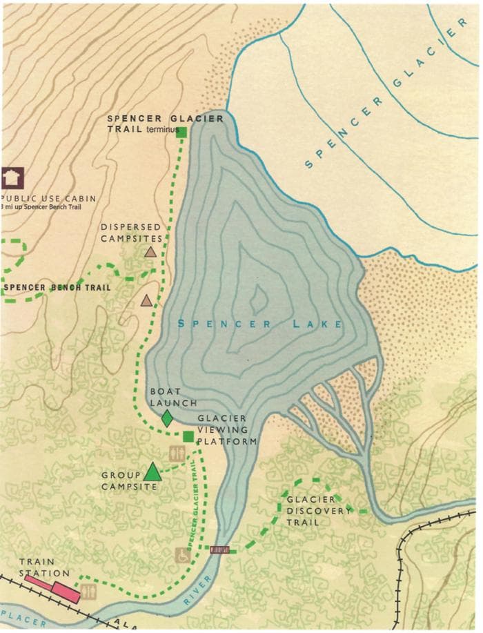
Overview The Spencer Glacier Whistle Stop Group Campground is located at the head of the beautiful Placer River Valley at the Spencer Whistlestop. The campsites are nestled among the cottonwood and alder that have grown in after Spencer Glacier’s retreat. This area known for packrafting, wildlife viewing, glacier viewing, and hiking. One can frequently see icebergs floating on Spencer Glacier Lake and might even be able to watch the glacier calving! The two group campsites at Spencer Glacier Whistle Stop Group Campground are available for reservations in the summer months while the Glacier Discovery Train is running on the Alaska Railroad. During these months, train transportation is required to reach the Spencer Whistlestop. To book train tickets visit the Alaska Railroad website. Recreation Spencer Glacier Lake offers amazing opportunities for packrafting, kayaking, or canoeing. All these options allow you to explore the amazing icebergs floating in the lake. It also allows you to get close to Spencer Glacier and amaze at it’s vast size. Please note, glacier calving can cause large, unpredictable waves on the lake, so it is recommended that you stay at least 500 yards away. This area also offers other recreational opportunities including easy hiking, rock climbing, and fishing during the summer months. In the winter this area is popular with backcountry skiers, snowmobilers and ice climbers. Facilities Spencer Glacier Lake offers amazing opportunities for packrafting, kayaking, or canoeing. All these options allow you to explore the amazing icebergs floating in the lake. It also allows you to get close to Spencer Glacier and amaze at it’s vast size. Please note, glacier calving can cause large, unpredictable waves on the lake, so it is recommended that you stay at least 500 yards away. This area also offers other recreational opportunities including easy hiking, rock climbing, and fishing during the summer months. In the winter this area is popular with backcountry skiers, snowmobilers and ice climbers. Natural Features The Spencer Glacier Whistle Stop Group Campground is located at the head of Placer River Valley near the Placer River outflow from Spencer Glacier Lake and is surrounded by the beautiful Kenai Mountains. There is a viewing area for Spencer Glacier located ¼ mile down trail. Black and brown bears, wolves, lynx, wolverine, and moose inhabit the area. Mountain goats, marmots, arctic ground squirrels and spruce grouse may be spotted higher in the mountains around Spencer Glacier Lake. Crow berries and Salmon Berries are plentiful at higher elevations in the late summer, along with low-bush blueberries. Nearby Attractions Spencer Glacier Whistle Stop Campground is located off the road system and accessible by train only. To book train tickets visit the Alaska Railroad website. contact_info This location is unstaffed. To speak with our main office for general information, please call: (907) 783-3242.
View details →
Overview Galbraith Lake Campground is the only campground along the Dalton Highway situated north of the Brooks Range. The tundra environment affords stunning views of the Brooks Range and the north slope. Hiking can be found in almost any direction from the campground, which is an excellent basecamp for exploring the Brooks Range. There are 12 designated campsites. Please note due to tundra, there is no firewood available in the vicinity of the campground. This location is available on a first-come, first-serve basis only. Visitors are required to physically arrive at the campground to claim and purchase a site. Once on-site, you have the option to pay for your campsites(s) with cash/check or by scanning a QR code using the Recreation.gov mobile app. Download the free Recreation.gov mobile app on Android or iOS prior to your arrival as this is a remote area that has limited or no cellular service. Recreation The Brooks Range offers excellent recreation opportunities, but very few are along designated routes. Hiking is plentiful in the mountains where ridges and drainages provide firm footing, open tundra areas may have uneven and difficult footing due to tussocks. Hiking east from the highway will lead you to the Arctic National Wildlife Refuge, while hiking west of the highway will take you towards Gates of the Arctic National Park and Preserve. Choose your route with care and bring topographic maps, a GPS and a compass with you. There are several excellent river trips in the vicinity of Galbraith Lake Campground: • Atigun and Sagavanirktok (the Sag) Rivers: Class III-IV+ whitewater, access Atigun at Milepost 271; Sag at MP 306. For expert boaters only. • Ivishak Wild and Scenic River: Class II, access by chartered air service from Deadhorse or Coldfoot. More detailed descriptions of these rivers are available at the Arctic Interagency Visitor Center. Other recreational activities include bird watching and fishing. State statute prohibits off-road vehicle use within five miles either side of from the highway from the Yukon River to the Arctic Ocean. Facilities The roads, and parking aprons have a gravel surface. Twelve sites are pull-through allowing easy access for RVs. The campground has a vault toilet, food storage lockers, and trash receptacles. Each campsite has a fire ring (firewood is not available in the vicinity) and picnic table. There is no electricity, no dump station and no potable water. Water can be filtered from a nearby creek. A camp-host may be onsite. Cell service may be available. Natural Features The campsites are situated on the open tundra with spectacular views of the Brooks Range mountains. Galbraith Lake is located approximately 1.3 miles to the east. A stream flows along the southern perimeter of the campground. The surrounding tundra and mountains provides habitat for ground squirrels, marmots, fox, sheep, caribou, wolf and brown bears. Many species of birds migrate north to breed in the area. Some of the resident birds include ravens and ptarmigan. Nearby Attractions Drive a little further north and you will get expansive views of the north slope, possibility of seeing musk ox, caribou and other arctic dwelling wildlife. contact_info This location has limited staffing. Please call (907) 474-2200 for general information.
View details →
Overview The USDA FS Sawmill Creek Campground is a recently renovated recreational facility with camping, picnicking, hiking, and bird and wildlife viewing opportunities nearby. It is 1.5 miles up Blue Lake Road, accessible by vehicles from May 15 to November 1 or accessible by foot, cross-country skis, or bikes year-round. The campground has 3 single tent sites and 1 group site with a 30-person capacity. There are also picnic tables, fire rings, garbage bins, a covered group picnic shelter, and a vault toilet. Two sites can accommodate small RVs, but hookups are not available. For campsites, there is 14-day overnight stay limit per calendar year that is monitored and enforced year-round. It is also advised that visitors bring their own potable water or to treat water collected from Sawmill Creek. There is no campground host on site and firewood is not available for sale. Pallet burning is not allowed. Bear safety is crucial as brown bears can be present any time; please use the bear-proof lockers provided on site. The trailhead for Beaver Lake/Herring Cove Trail is accessible from the campground. This page is for advance (future) reservations for the Sawmill Creek Group Campsite only. Unless an advance reservation is made, this campsite is free and first come, first serve. If the campsite is already reserved, the reservation dates will be posted at the campsite. Recreation Access to Beaver Lake Trail within campground: https://www.fs.usda.gov/recarea/tongass/recarea/?recid=79060 Fishing opportunities in Sawmill Creek Facilities The Sawmill Creek Group Campsite has access to a vault toilet and day-use picnic shelter (only available when not reserved in advance). Natural Features Sawmill Creek Temperate rainforest environment Views of surrounding mountains Access to Beaver Lake Trail contact_info This location is unstaffed. To speak with our main office for general information, please call: (907) 747-4212. Nearby Attractions Beaver Lake Trail (within campground): https://www.fs.usda.gov/recarea/tongass/recarea/?recid=79060 Access to the Thimbleberry/Heart Lake Trails (on Blue Lake Road): https://www.fs.usda.gov/recarea/tongass/recarea/?recid=79142 Blue Lake
View details →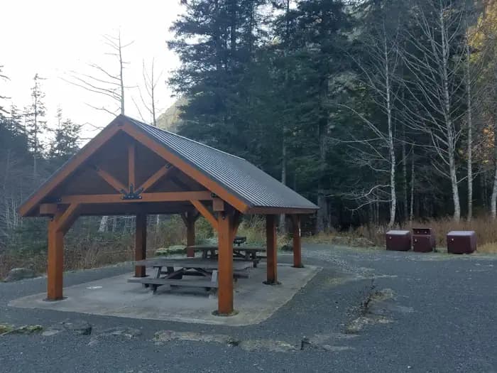
Overview The USDA FS Sawmill Creek Campground is a recently renovated recreational facility with camping, picnicking, hiking, and bird and wildlife viewing opportunities nearby. It is 1.5 miles up Blue Lake Road, accessible by vehicles from May 15 to November 1 or accessible by foot, cross-country skis, or bikes year-round. The campground has 3 single tent sites and 1 group site with a 30-person capacity. There are also picnic tables, fire rings, garbage bins, and a vault toilet. Two sites can accommodate small RVs, but hookups are not available. For campsites, there is 14-day overnight stay limit per calendar year that is monitored and enforced year-round. It is also advised that visitors bring their own potable water or to treat water collected from Sawmill Creek. There is no campground host on site and firewood is not available for sale. Pallet burning is not allowed. Bear safety is crucial as brown bears can be present any time; please use the bear-proof lockers provided on site. The trailhead for Beaver Lake/Herring Cove Trail is accessible from the campground. This page is for advance (future) reservations for the Sawmill Creek Picnic Shelter only. Unless an advance reservation is made, this shelter is free and first come, first serve. If the shelter is already reserved, the reservation dates will be posted at the shelter. Recreation Access to Beaver Lake Trail within campground: https://www.fs.usda.gov/recarea/tongass/recarea/?recid=79060 Fishing opportunities in Sawmill Creek Facilities Vault Toilet Natural Features Sawmill Creek Temperate rainforest environment Views of surrounding mountains Access to Beaver Lake Trail Nearby Attractions Beaver Lake Trail (within campground): https://www.fs.usda.gov/recarea/tongass/recarea/?recid=79060 Access to the Thimbleberry/Heart Lake Trails (on Blue Lake Road): https://www.fs.usda.gov/recarea/tongass/recarea/?recid=79142 Blue Lake contact_info This location is unstaffed. To speak with our main office for general information, please call: (907) 747-4212.
View details →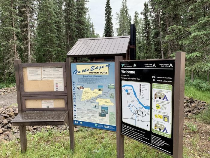
Overview Cripple Creek Campground- Located at milepost 60 o f the Steese Highway, Cripple Creek Campground has 12 first come first served universal design campsites, as well as 6 walk-in campsites. The campground also has a riverside day use area with fishing access along the Chatanika River. Winding through tall white spruce trees along the river between the day use area and the campground is a short interpretive trail for visitors. A class I-II float trip to the Upper Chatanika State Recreation Site at milepost 39 is approximately 25 miles (40 km) long. Occasional low water and log jams may require some boat dragging or portaging. The campground is maintained during the summer season, June through mid-September. The campground has a hand pump well for potable water, trash cans, and outhouse style toilets. Each campsite has a parking area, picnic tables, and fire rings. Fees- $12 per night per site (sites 1-12) on a first come basis. $6 per night per walk in site (Walk-in-sites T1-T-6) on a first come basis. Directions- Blacktop highway accessible. Campground is at mile 60 on the Steese Highway, northeast of Fairbanks, Alaska. Recreation Hiking the short interprative trail along the Chatanika River, fishing, floating, day trip into the Nome Creek Valley. Facilities Hiking the short interprative trail along the Chatanika River, fishing, floating, day trip into the Nome Creek Valley. Nearby Attractions Nome Creek Valley, Quartz Creek Trail, Table Top Trail, Pinnell Mt. Trail, Chatanika River, Nome Creek, Beaver Creek Wild and Scenic River Put-in.
View details →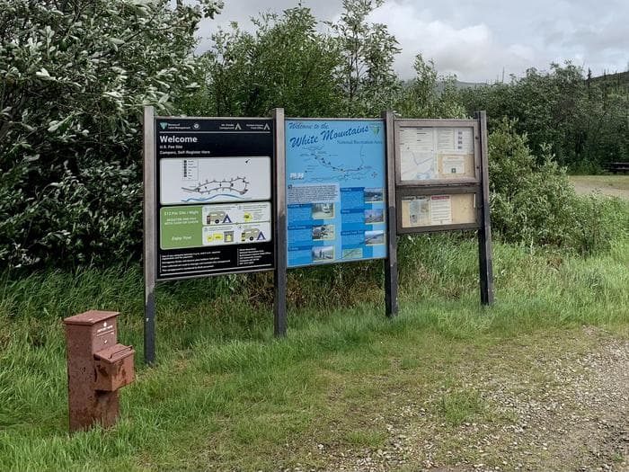
Overview Mount Prindle Campground- The Mount Prindle Campground is one of two campgrounds located at either end of the Nome Creek Valley, on the southern edge of the White Mountains NRA. The campground’s 13 sites are situated among tall willow shrubs, below expansive alpine tundra meadows and Mount Prindle (5,286 feet), making it the ideal spot to begin a trip into the high country. From here you can enjoy gold panning in Nome Creek or explore the nearby Quartz Creek Trail. Campgrounds are maintained during the summer season (June thru mid-September) and have hand pump wells, trash cans, and outhouse-style toilets. Each campsite has a parking area, picnic tables, and fire rings. Firewood is not provided. The nearest RV dump station is in Fairbanks. Fees- $12 per night per site (sites 1-13) on a first come basis. Directions- To reach Nome Creek from Fairbanks, take the Steese Highway to mile 57 and follow the U.S. Creek Road for seven miles to the Nome Creek Road. Taking a right at the junction, it is 4 miles to the upper end of Nome Creek Valley, the Quartz Creek Trailhead, and the Mount Prindle Campground. Recreation The campground’s 13 sites are situated among tall willow shrubs, below expansive alpine tundra meadows and Mount Prindle (5,286 feet), making it the ideal spot to begin a trip into the high country. From here you can enjoy gold panning in Nome Creek or explore the nearby Quartz Creek Trail. Facilities The campground’s 13 sites are situated among tall willow shrubs, below expansive alpine tundra meadows and Mount Prindle (5,286 feet), making it the ideal spot to begin a trip into the high country. From here you can enjoy gold panning in Nome Creek or explore the nearby Quartz Creek Trail. Nearby Attractions Quartz Creek Trail, Table Top Trail, Nome Creek for fishing, floating, and or goldpanning, put-in for Beaver Creek Wild and Scenic River.
View details →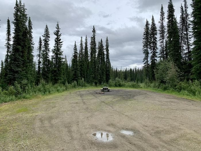
Overview Ophir Creek Campground- The Ophir Creek Campgr ound is one of two campgrounds located at either end of the Nome Creek Valley, on the southern edge of the White Mountains National Recreation Area. Nestled in tall white spruce trees on the bank of Nome Creek, the campground includes 20 campsites, including one group site. From here you can enjoy fishing in Nome Creek or take a short day-hike over to Beaver Creek. Also nearby is the 3-mile loop trail to Table Top Mountain, with awesome views of the higher peaks in the White Mountains. Ophir Creek Campground also provides river access to Nome Creek for paddlers headed to Beaver Creek Wild and Scenic River. The campground is maintained during the summer season (June through mid-September) and have hand pump wells, trash cans, and outhouse-style toilets. Each campsite has a parking area, picnic tables, and fire rings. Firewood is not provided. The nearest RV dump station is in Fairbanks. Accessibility Description (ABA/ADA) Yes. An accessible toilet and hand water pump are available. Fees- $12 per night per site (sites 1-19) on a first come basis. $24 for group site 20 per night on a first come basis. Directions- To reach Nome Creek from Fairbanks, take the Steese Highway to mile 57 and follow the U.S. Creek Road for seven miles to the Nome Creek Road. Taking a left at the junction, it is 12 miles to the Ophir Creek Campground and the put-in for floating Beaver Creek Wild and Scenic River. Recreation Fishing, gold panning, hiking, floating, wildlife watching. Facilities Fishing, gold panning, hiking, floating, wildlife watching. Nearby Attractions Put-in for Beaver Creek Wild and Scenic River, Table Top Trail (3 mile loop non-motorized trail).
View details →
Overview Tangle Lakes Campground, located at MP 21.5 of the north side of the Denali Highway, is situated within the Delta Wild and Scenic River corridor and the Tangle Lakes Archaeological District boundary where over 10,000 years of human use have been documented. The campground provides 45 accessible campsites and 4 walk-in sites and is equipped with water pumps, toilets and a boat launch. The campground rests amid a series of long, narrow lakes known as the Tangle Lakes that are connected by the Tangle River and form the headwaters of the Delta River. The boat launch provides access to the lakes and is also the designated put-in for the popular 30-mile Delta Wild & Scenic River float trip. The Tangle Ridge Hiking Trail (for non-motorized use only) extends out of the campground and provides a 360 degree view of the stunning landscape. Recreation https://www.blm.gov/programs/recreation/recreation-activities/alaska Facilities https://www.blm.gov/programs/recreation/recreation-activities/alaska Natural Features This BLM-maintained campground sits amid the Tangle Lakes, a series of long, narrow lakes. This is a designated put-in for the 30-mile-long Delta National Wild and Scenic River float trip. There are moose and caribou in the area, many hunters use this as a base camp during the fall hunting season. Nearby Attractions The campground rests amid a series of long, narrow lakes known as the Tangle Lakes that are connected by the Tangle River and form the headwaters of the Delta River. The boat launch provides access to the lakes and is also the designated put-in for the popular 30-mile Delta Wild & Scenic River float trip. The Tangle Ridge Hiking Trail (for non-motorized use only) extends out of the campground and provides a 360 degree view of the stunning landscape. https://www.blm.gov/visit/denali-highway https://www.blm.gov/sites/default/files/docs/2021-08/PublicRoom_Alaska_Denali-Hwy-Brochure.pdf
View details →
Overview Paxson Lake Campground MP 175 Richardson Hwy Large boat launch and parking area for 70 vehicles, toilet, boater registration stand and information panels. RV Dump station – $10 fee for non-campers. 50 campsites First Loop: 20 camp sites, universally accessible toilets, one hand pump well, rules/map panels and bulletin boards, and boardwalk to lake. Second Loop: 20 camp sites, 10 walk in sites, toilets (1 universally accessible), rules/map panels and bulletin boards. Trail and bridge across the creek between the two loops. Fee Station: Per night = $15 drive in site; $6/Walk in site; Federal Senior Pass half price. Recreation BLM Alaska Recreation Guide Facilities BLM Alaska Recreation Guide Natural Features Paxson Lake Campground is located at MP 175 of the Richardson Highway near the shore of Paxson Lake. The campground has 50 camp sites, including 2 accessible sites and 10 walk-in sites. All campsites are available on a first-come, first-served basis and have access to water, picnic tables, fire rings, and restrooms. Fees: $15/night for regular, $6/night for walk-in site. The campground's boat launch is the starting point for those floating the main branch of the Gulkana Wild and Scenic River. Located in the 1st loop of Paxson Campground is a foot trail shore access to the lake and boat mooring area. Nearby Attractions Denali Highway Info Gulkana Wild and Scenic River Denali Highway contact_info This location is unstaffed. To speak with our main office for general information, please call: (907) 822-3217.
View details →
Overview Sourdough Creek Campground is located at MP 147.5 of the Richardson Highway near the shores of the Gulkana River. The campground has 42 camp sites, including 4 accessible and 2 walk-in sites. All campsites are available on a first-come, first-served basis. The campground is equipped with restrooms, water, picnic tables, and fire rings. Campers may also enjoy a short hike along the Sourdough Creek Interpretive Trail within the campground. The boat launch area is the take-out for float trips on the Gulkana Wild and Scenic River and provides river access to both motorized boaters and floaters. Recreation In addition to RV and tent recreational camping opportunities, the campground provides access to the Gulkana Wild and Scenic River. Floaters use the boat launch as a put-in and take-out point as well as jet boat users in the river corridor. Activities this site supports include recreational fishing from the bank, subsistence hunting access for caribou and moose, as well as berry picking and trapping. There is a boat launch at the rivers edge and a nice picnic area for day use. Outhouse style bathrooms, information and bulletin boards, hiking trails, and handicapped accessible fishing ramps and trails complete with interpetative panels. Sourdough Creek Campground along with the boat launch can be very busy from approximately Memorial Day through mid July mainly by fishermen and boaters taking part in the King salmon fishing in the Gulkana River. There are a number of fishing guides using the boat launch at Sourdough Creek Campground. Later in the summer, after the salmon fishing subsides, the campground generally gets a lot quieter. Facilities In addition to RV and tent recreational camping opportunities, the campground provides access to the Gulkana Wild and Scenic River. Floaters use the boat launch as a put-in and take-out point as well as jet boat users in the river corridor. Activities this site supports include recreational fishing from the bank, subsistence hunting access for caribou and moose, as well as berry picking and trapping. There is a boat launch at the rivers edge and a nice picnic area for day use. Outhouse style bathrooms, information and bulletin boards, hiking trails, and handicapped accessible fishing ramps and trails complete with interpetative panels. Sourdough Creek Campground along with the boat launch can be very busy from approximately Memorial Day through mid July mainly by fishermen and boaters taking part in the King salmon fishing in the Gulkana River. There are a number of fishing guides using the boat launch at Sourdough Creek Campground. Later in the summer, after the salmon fishing subsides, the campground generally gets a lot quieter. Natural Features Activities this site supports include recreational fishing from the bank, subsistence hunting access for caribou and moose, as well as berry picking and trapping. There is a boat launch at the rivers edge and a nice picnic area for day use. contact_info This location is unstaffed. To speak with our main office for general information, please call: (907) 822-3217. Nearby Attractions https://www.blm.gov/visit/gulkana-river
View details →
Overview Signal Creek Campground is a year-round facility located in the Ward Lake Recreation Area, 7 miles north of downtown Ketchikan and about 4 miles north of the State ferry terminal. The campground straddles Signal Creek and lies on the banks of Ward Lake, with easy access to fishing, hiking and wildlife viewing. Recreation Hiking is a popular option, as the Ward Lake Recreation Area boasts seven trails. The Ward Lake Nature Travel meanders 1.3 miles around the lake. A large day-use complex with picnic sites and shelters is also available. Freshwater fishing, canoeing, kayaking, wildlife viewing and scenery are favorite draws at Ward Lake. Facilities Hiking is a popular option, as the Ward Lake Recreation Area boasts seven trails. The Ward Lake Nature Travel meanders 1.3 miles around the lake. A large day-use complex with picnic sites and shelters is also available. Freshwater fishing, canoeing, kayaking, wildlife viewing and scenery are favorite draws at Ward Lake. Natural Features The campground is surrounded by an old-growth temperate rainforest comprised primarily of western hemlock and Sitka spruce. Signal Creek flows through the campground, and Ward Lake is adjacent. At nearly 17 million acres, the Tongass National Forest covers most of Southeast Alaska and is the largest forest in the national forest system. The Tongass surrounds the Inside Passage, the network of waterways that buffers the jagged Alaskan Coast and a cluster of coastline islands. The Tongass offers visitors a chance to view wildlife, including eagles, bears and spawning salmon. Expansive vistas, including fjords, glaciers and mountain peaks abound.
View details →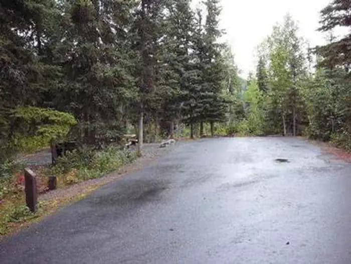
Overview Beginning Aug. 15, 2024, the Russian River Campground will be closed to the Public for construction. Construction crews will rebuild and widen one mile of the access road, making it more stable and resistant to frost heaves. During the closure, all vehicle and pedestrian access will be restricted and campground reservations on Recreation.gov will be unavailable. The Forest Service anticipates the first day for reservation arrivals will be June 5, 2025. Russian River Campground is perched between the Russian and Kenai Rivers in south-central Alaska. It lies within driving distance of two main population centers, 110 miles south of Anchorage and 40 miles east of Soldotna, surrounded by the Chugach National Forest and the Kenai National Wildlife Refuge. Each year, this area is visited by over 100,000 people who recreate at the Russian River Campground, Ferry Access Site, Sportsman's Boat Launch, Russian Lakes Trail and K'beq Site. Hiking, biking and fishing are popular pastimes. Recreation The Russian River is the most popular sockeye salmon stream in Alaska and a top-rated spot for rainbow trout. Retention of sockeye salmon is legal from June 11th to August 20th. Silver salmon can be retained from July 1st to September 30th. Trout can be retained from June 11th through April 30th. Anglers are required to have a State of Alaska Fishing license and obey all regulations and emergency orders. Kenai Peninsula is also a hiker's paradise, boasting hundreds of miles of maintained trails. The following two trails are accessible from the campground. The Russian Lakes Trail begins in the campground, and is the most popular trail on the Chugach National Forest. Most hikers travel only 2.3 miles to Russian River Falls where a viewing platform allows views of leaping salmon. More ambitious hikers and backpackers can travel another 19 miles past two lakes to the Upper Trailhead on Snug Harbor Rd. Along the trail, three public use cabins can be reserved; Barber Cabin, Aspen Flats Cabin and Upper Russian Lake Cabin. The Angler's Trail also begins in the Russian River Campground and travels 1.25 miles from the Russian River Canyon to the Kenai-Russian River Confluence. Along the way, 22 sustainable river access points allow anglers to enter the Russian River. At the confluence, hardy anglers can cross the Russian River (hip-waders recommended) and continue along the Kenai River, where another 15 access points are located. Staircases lead to this trail from campground loops as well as day use parking lots. Facilities The Russian River is the most popular sockeye salmon stream in Alaska and a top-rated spot for rainbow trout. Retention of sockeye salmon is legal from June 11th to August 20th. Silver salmon can be retained from July 1st to September 30th. Trout can be retained from June 11th through April 30th. Anglers are required to have a State of Alaska Fishing license and obey all regulations and emergency orders. Kenai Peninsula is also a hiker's paradise, boasting hundreds of miles of maintained trails. The following two trails are accessible from the campground. The Russian Lakes Trail begins in the campground, and is the most popular trail on the Chugach National Forest. Most hikers travel only 2.3 miles to Russian River Falls where a viewing platform allows views of leaping salmon. More ambitious hikers and backpackers can travel another 19 miles past two lakes to the Upper Trailhead on Snug Harbor Rd. Along the trail, three public use cabins can be reserved; Barber Cabin, Aspen Flats Cabin and Upper Russian Lake Cabin. The Angler's Trail also begins in the Russian River Campground and travels 1.25 miles from the Russian River Canyon to the Kenai-Russian River Confluence. Along the way, 22 sustainable river access points allow anglers to enter the Russian River. At the confluence, hardy anglers can cross the Russian River (hip-waders recommended) and continue along the Kenai River, where another 15 access points are located. Staircases lead to this trail from campground loops as well as day use parking lots. Natural Features The campground sits at an elevation of 400 feet on the Eastern Kenai Peninsula in the Chugach National Forest. The forest, spanning more than 5 million acres, is comprised of jagged mountains, deep fjords and glacier-fed rivers. contact_info For local information, please call (907) 522-8368 or call (907) 288-3178 for general information. Nearby Attractions Resurrection Pass Trail: This trail climbs from 500 to 2,600 feet over 38 miles. It connects the towns Hope and Cooper Landing via a historic route. Russian River Ferry: The ferry transports anglers across the Kenai River. Sportsman's Boat Launch: The boat launch provides boat access to the Kenai River. K'beq Interpretive Site: At this site, tribal members share traditions, stories and culture with visitors through interpretive walks featuring archeological sites, traditional plant use, informational signs, and artifacts. The gift shop features Native art.
View details →
Overview Williwaw Campground, an idyllic area, sits beside Williwaw Creek near the town of Girdwood, Alaska. The campground boasts prime fishing, hiking and wildlife watching all within the Portage Valley. Next to the campground is the Williwaw Salmon Viewing Area, a top-notch spot for salmon viewing. In August, visitors can see these fish spawning in impressive numbers through the translucent waters. The area is a great place to view numerous glaciated valleys and the Portage Glacier. Over the past 80 years, the glacier calved large icebergs into Portage Lake, located just east of the campground. Recreation Wildlife viewing includes moose, brown and black bears, mountain goats, lynx, bald eagles and wolves. The Williwaw Nature Trail can be reached from the campground. It heads to the Williwaw Fish Viewing Platform, passes under the highway bridge and follows Williwaw Creek to a series of ponds. The trail then connects to the Trail of Blue Ice, which accesses the Begich, Boggs Visitor Center. The Trail of Blue Ice is also popular among mountain bikers. Facilities Wildlife viewing includes moose, brown and black bears, mountain goats, lynx, bald eagles and wolves. The Williwaw Nature Trail can be reached from the campground. It heads to the Williwaw Fish Viewing Platform, passes under the highway bridge and follows Williwaw Creek to a series of ponds. The trail then connects to the Trail of Blue Ice, which accesses the Begich, Boggs Visitor Center. The Trail of Blue Ice is also popular among mountain bikers. Natural Features The campground sits in the Portage Valley of the eastern Kenai Peninsula in the Chugach National Forest. The Forest, spanning 5,361,803 acres is comprised of arid tundra wilderness, jagged mountains, deep fjords and glacier-fed rivers that surround the Prince William Sound. contact_info For local information, please call (907) 522-8368 or call (907) 288-3178 for general information. Nearby Attractions Consider visiting the Alaska Wildlife Conservation Center, Portage Glacier, the town of Whittier and Byron Glacier.
View details →
Overview Last Chance Campground is located in the Ward Lake Recreation Area, 9 miles north of downtown Ketchikan and about 4 miles north of the State ferry terminal. This campground straddles Last Chance Creek and lies next to Ward Creek with easy access to fishing, hiking and wildlife viewing. Recreation Hiking is a popular option, as the Ward Lake Recreation Area boasts seven trails. The Ward Lake Nature Trail meanders 1.3 miles around the lake. A large day-use complex with picnic sites and shelters is also available. Freshwater fishing, wildlife viewing and scenery are favorite draws at Ward Lake. Facilities Hiking is a popular option, as the Ward Lake Recreation Area boasts seven trails. The Ward Lake Nature Trail meanders 1.3 miles around the lake. A large day-use complex with picnic sites and shelters is also available. Freshwater fishing, wildlife viewing and scenery are favorite draws at Ward Lake. Natural Features Last Chance is surrounded by an old-growth temperate rainforest comprised primarily of western hemlock and Sitka spruce. Last Chance Creek flows through the campground, and Ward Creek runs alongside. At nearly 17 million acres, the Tongass National Forest covers most of Southeast Alaska and is the largest forest in the national forest system. The Tongass surrounds the Inside Passage, the network of waterways that buffers the jagged Alaskan Coast and a cluster of coastline islands. The Tongass offers visitors a chance to view wildlife, including eagles, bears and spawning salmon. Expansive vistas, including fjords, glaciers and mountain peaks abound.
View details →
Overview Located along Cooper Creek and the Kenai River, Cooper Creek South Campground presents a beautiful wooded area with sweeping mountain views within close proximity to many recreational opportunities. Recreation Sockeye (Red) salmon fishing is a popular activity on the nearby Kenai and Russian Rivers, and both boat and bank fishing offer excellent catches. The nearby Resurrection Pass Trail takes hikers and bikers on a 38-mile scenic adventure that climbs from 500 to 2,600 feet. Facilities Sockeye (Red) salmon fishing is a popular activity on the nearby Kenai and Russian Rivers, and both boat and bank fishing offer excellent catches. The nearby Resurrection Pass Trail takes hikers and bikers on a 38-mile scenic adventure that climbs from 500 to 2,600 feet. Natural Features At an elevation of 400 feet, Cooper Creek South sits among a spruce and cottonwood forest. The Chugach National Forest covers 5 million acres and is comprised of arid tundra wilderness, jagged mountains, deep fjords, glacier-fed rivers and the Prince William Sound. contact_info For local information, please call (907) 522-8368 or call (907) 288-3178 for general information.
View details →
Overview Eagles Nest Campground is located on Prince of Wales Island in a temperate rainforest surrounded by muskeg and Balls Lake. Visitors enjoy viewing wildlife, hiking, fishing, canoeing and kayaking. This campground is situated on Prince of Wales Island, the third largest island in the U.S., on the shores of Balls Lake, eighteen miles west of Thorne Bay. Recreation An interpretive trail parallels the lake for approximately 1,800 feet, offering scenic views of the Thorne Mountains and surrounding foothills. Canoeing, kayaking and fishing are popular activities at Balls Lake. A canoe ramp is located on the lakeshore. Sockeye salmon, wildflowers and industrious beavers are common sights in and around the lake. The 2.5-mile Balls Lake Trail lets visitors hike around the lake, where swans, kingfisher and ducks are often seen, along with an array of riparian areas. Facilities An interpretive trail parallels the lake for approximately 1,800 feet, offering scenic views of the Thorne Mountains and surrounding foothills. Canoeing, kayaking and fishing are popular activities at Balls Lake. A canoe ramp is located on the lakeshore. Sockeye salmon, wildflowers and industrious beavers are common sights in and around the lake. The 2.5-mile Balls Lake Trail lets visitors hike around the lake, where swans, kingfisher and ducks are often seen, along with an array of riparian areas. Natural Features The campground is situated near Control Creek and Balls Lake, within the Tongass National Forest, which covers nearly 17 million acres in southeast Alaska and is the largest forest in the national forest system. The Tongass surrounds the Inside Passage, the network of waterways that buffers the jagged Alaskan Coast and a cluster of coastal islands. The Tongass offers visitors a chance to view wildlife, including eagles, bears and spawning salmon. Expansive vistas of fjords, glaciers and mountain peaks abound. Much of the forest is a temperate rainforest. Nearby Attractions A number of hiking trails and recreation sites are in the area.
View details →
Overview Fure's Cabin, a beautifully constructed one-room house, is a public use cabin in Katmai National Park and Preserve. The cabin is located on the north side of the Bay of Islands in Naknek Lake and accessed by float plane or boat. Now a refuge for kayakers, canoers, and hikers, the cabin was once the home of trapper, miner, and famed Naknek local Roy Fure. The cabin was built in 1926, a labor of love. The roof, walls, and floor are made of hand-hewn spruce logs with dovetail notching reminiscent of European craftsmanship. In 1931 the land on which the cabin stands was incorporated into the expanded Katmai National Monument. Fure's cabin was listed on the National Register of Historic Places in 1976. Recreation Fure's Cabin is a key stopover for those attempting the Savonoski Loop (PDF) paddle trip, or as a beautiful destination in its own right. It is not an alternate for Brooks Camp Campground and requires a full day of paddling to reach, or the use of a boat or plane. View a list of authorized commercial partners that may provide transportation services to Fure's Cabin. Paddlers originating from Brooks Camp should allow one to three days to travel the 32 miles along shorelines from Brooks Camp to Fure's Cabin in the Bay of Islands. Facilities Fure's Cabin is a key stopover for those attempting the Savonoski Loop (PDF) paddle trip, or as a beautiful destination in its own right. It is not an alternate for Brooks Camp Campground and requires a full day of paddling to reach, or the use of a boat or plane. View a list of authorized commercial partners that may provide transportation services to Fure's Cabin. Paddlers originating from Brooks Camp should allow one to three days to travel the 32 miles along shorelines from Brooks Camp to Fure's Cabin in the Bay of Islands. Natural Features Katmai National Monument was established in 1918 to protect the volcanically devastated region surrounding Mount Katmai and the Valley of Ten Thousand Smokes. Today, Katmai National Park and Preserve remains an active volcanic landscape, but it also protects 9,000 years of human history as well as important habitat for salmon and the thousands of brown bears that feed on them. Charges & Cancellations Fure's Cabin follows the standard Recreation.gov cabin cancellation policy.
View details →
Overview Aspen Flats Cabin is a rustic cabin along the Upper Russian River of south-central Alaska. The rustic cabin has few amenities, but provides access to the great outdoors. There is great fishing in the adjacent Russian River and hiking and biking trails abound. Wildlife viewing is good in the area as well, though visitors should watch out for bears. The site can be accessed by hiking, biking, skiing and horseback. Visitors are responsible for their own travel arrangements and safety, and must bring several of their own amenities. Recreation Dolly Varden and rainbow trout can be found in the Russian River. Fishing for salmon upstream of Russian River Falls is not permitted. Click here to learn more about Alaska Department of Fish & Game regulations. Sockeye and coho salmon run the river from June to September. The rivers in Alaska are extremely cold, so be prepared with dry clothing. A variety of trails and unexplored areas exist near the cabin. Hikers and bikers can explore varying terrain, including muskeg, meadows and high-canopied forest along the 21-mile Russian Lakes Trail. The trail is closed year-round to motorized vehicles from Russian River Campground to Upper Russian Lake Cabin; the remainder of the trail, between Cooper Lake Road and Upper Russian Lake Cabin, is open to motorized vehicles only from Dec. 1 to April 30. There is a high avalanche hazard on Russian Lakes Trail in winter; learn about avalanche safety . Facilities Dolly Varden and rainbow trout can be found in the Russian River. Fishing for salmon upstream of Russian River Falls is not permitted. Click here to learn more about Alaska Department of Fish & Game regulations. Sockeye and coho salmon run the river from June to September. The rivers in Alaska are extremely cold, so be prepared with dry clothing. A variety of trails and unexplored areas exist near the cabin. Hikers and bikers can explore varying terrain, including muskeg, meadows and high-canopied forest along the 21-mile Russian Lakes Trail. The trail is closed year-round to motorized vehicles from Russian River Campground to Upper Russian Lake Cabin; the remainder of the trail, between Cooper Lake Road and Upper Russian Lake Cabin, is open to motorized vehicles only from Dec. 1 to April 30. There is a high avalanche hazard on Russian Lakes Trail in winter; learn about avalanche safety . Natural Features The cabin is south of the Sterling Highway on the Russian Lakes trail along the Russian River, between the Lower and Upper Russian Lakes. The surrounding area is flat to hilly with scattered spruce and cottonwood, and abundant mountain views. A variety of wildlife makes its home in the area, including moose, black and brown bears and wolves. Abundant berries in the area ripen in late July through September. For information on access and regulations pertaining to this cabin, trail conditions, safety precautions and outdoor safety and ethics , please contact the Seward Ranger District.
View details →
Overview Starrigavan Creek Cabin is a drive-up, high-use, seasonally accessible log cabin within the Starrigavan Recreation Area. The cabin was constructed in 2008 from young Sitka spruce trees harvested around Starrigavan Creek to improve wildlife and fish habitat. The cabin is an experiment in the longevity of young spruce logs for construction purposes, making it the first young-growth cabin and also the first cabin within a recreation area in the Tongass National Forest. Access to Sitka is only by ferry or airplane. The cabin is a two-minute drive from the Alaska Marine Highway Sitka Ferry Terminal or a 7-mile drive from downtown Sitka or the airport. Visitors are responsible for their own travel arrangements and safety, and must bring some of their own amenities. Recreation Starrigavan offers saltwater and freshwater fishing opportunities. Visitors also enjoy kayaking, photography, hiking and birding. Hiking options include the Estuary Life Trail, Forest and Muskeg Trail, Mosquito Cove Trail and numerous intertwining paths and roadways within the recreation area. For information about fishing permits and seasons, visit the Alaska Department of Fish and Game website. Facilities Starrigavan offers saltwater and freshwater fishing opportunities. Visitors also enjoy kayaking, photography, hiking and birding. Hiking options include the Estuary Life Trail, Forest and Muskeg Trail, Mosquito Cove Trail and numerous intertwining paths and roadways within the recreation area. For information about fishing permits and seasons, visit the Alaska Department of Fish and Game website. Natural Features The cabin is situated next to Starrigavan Creek and is surrounded by a temperate rainforest of hemlock and spruce trees with salmonberry bushes, low shrubs and mosses covering the forest floor. The cabin occupies an old campsite and is located within the major camping loop of Starrigavan Recreation Area. Starrigavan Recreation Area houses a diverse range of forest, estuary and marine habitats. Depending on the season, visitors may view brown bear, spawning coho and pink salmon, common merganser, bald eagle, great blue heron, bufflehead, kingfisher, river otter or Sitka black-tailed deer. Brown bear frequent the area.
View details →
Overview Quartz Creek Campground is tucked between Kenai Lake and Quartz Creek in Cooper Landing, Alaska. Boating, hiking, nature-viewing and fishing are popular pastimes at this family-friendly campground, where most campsites offer sweeping views of the lake. At an elevation of 500 feet, the campground is relatively flat with small spruce trees dotting the area. Recreation Kenai Lake is the third largest lake in the Kenai Peninsula. It is over 20 miles long and 500 ft. deep. It boasts about 14,000 acres of water as well as one island the three remote campsites at Ship Creek, Meadow Creek and Porcupine Island. These can be reached by boat from the boat launch at Quartz Creek Campground. Fishing is also popular in the area. Rainbow, lake trout and Dolly Varden are found in Kenai Lake, with rainbow and Dolly Varden found in Quartz Creek later in the summer. About two miles east of Quartz Creek Campground, Kenai Lake becomes Kenai River. Kenai River is world-famous for its trophy trout fishing as well as salmon fishing. Rafting and drifting are both popular on the river. Many outfitters and guides in the area can help anglers understand local fishing regulations as well as increase your chances of fishing success. Kenai Lake and River, offer unparalleled nature and wildlife viewing. However, they are also very cold and conditions can quickly deteriorate from calm to rough. If you plan to venture on the water, always let someone know where you are, when you will return and wear your life jacket at all times. Facilities Kenai Lake is the third largest lake in the Kenai Peninsula. It is over 20 miles long and 500 ft. deep. It boasts about 14,000 acres of water as well as one island the three remote campsites at Ship Creek, Meadow Creek and Porcupine Island. These can be reached by boat from the boat launch at Quartz Creek Campground. Fishing is also popular in the area. Rainbow, lake trout and Dolly Varden are found in Kenai Lake, with rainbow and Dolly Varden found in Quartz Creek later in the summer. About two miles east of Quartz Creek Campground, Kenai Lake becomes Kenai River. Kenai River is world-famous for its trophy trout fishing as well as salmon fishing. Rafting and drifting are both popular on the river. Many outfitters and guides in the area can help anglers understand local fishing regulations as well as increase your chances of fishing success. Kenai Lake and River, offer unparalleled nature and wildlife viewing. However, they are also very cold and conditions can quickly deteriorate from calm to rough. If you plan to venture on the water, always let someone know where you are, when you will return and wear your life jacket at all times. Natural Features Chugach National Forest covers more than 5 million acres and is comprised of ice fields, alpine tundra, jagged mountains, dense forests, glacier-fed rivers and the Prince William Sound. Bears, moose, mountain goats and wolves call the area home. contact_info For local information, please call (907) 522-8368 or call (907) 288-3178 for general information. Nearby Attractions Quartz Creek Road leads to Crescent Creek Campground, Crescent Creek Trail and eventually becomes the Old Sterling Highway. The bridge over Quartz Creek is a great place to view salmon spawning from late July through September. The Crescent Creek Trail follows the creek for six miles to Crescent Lake where Crescent Lake Public Use Cabin can be reserved. Grayling fishing is popular in Crescent Lake. More adventurous hikers can continue on a primitive trail another eight miles along the lake to the Crescent Saddle Cabin. Beyond Crescent Lake, hikers traverse another three miles of beautiful alpine wildflower meadows and pass Carter Lake to end at the Seward Highway in Moose Pass. The Old Sterling Highway is open to motorized use, and great for OHV enthusiasts and wildlife viewers. It leads five miles through the woods above open marshy areas from Quartz Creek Road to the Tern Lake Day Use Area. Observant hikers may spot wood frogs, moose, hawks, owls and bears. The Tern Lake Day Use Area has picnic tables, vault toilets and a salmon viewing platform. Tern Lake is a premier spot for bird watching and photography. Throughout the summer arctic terns, trumpeter swans, and many types of ducks, wading birds and songbirds can be identified. This shallow, marshy lake often has a perfect reflection of the steep surrounding mountains making it a great spot to enjoy nature and wildlife. Other popular trails in the area include the Resurrection Pass Trail which takes hikers and bikers on a 38-mile scenic adventure that climbs from 500 to 2,600 feet.
View details →
Overview Harris River Campground is located on Prince of Wales Island on a paved highway just 10 miles from the Hollis Ferry Terminal and 20 miles from the Craig/Klawock area. Visitors enjoy hiking, fishing and viewing abundant wildlife. Recreation Hiking, fishing and wildlife viewing are popular activities. The Harris River Trail and the Twentymile Spur Trail both pass along the Harris River. The latter ends at a set of beaver ponds. A short boardwalk trail dissects the campground to offer campers a close-up view of a muskeg habitat without getting their feet wet. A bridge and short path across the Harris River connect the campground to the Harris River Picnic Area. About two miles east of the campground is the Harris River Interpretive Trail, which provides information about recent river restoration work and habitat management experiments. Facilities Hiking, fishing and wildlife viewing are popular activities. The Harris River Trail and the Twentymile Spur Trail both pass along the Harris River. The latter ends at a set of beaver ponds. A short boardwalk trail dissects the campground to offer campers a close-up view of a muskeg habitat without getting their feet wet. A bridge and short path across the Harris River connect the campground to the Harris River Picnic Area. About two miles east of the campground is the Harris River Interpretive Trail, which provides information about recent river restoration work and habitat management experiments. Natural Features The campground is situated along the Harris River, a short drive from hiking trails and fishing outposts, within the Tongass National Forest, which covers nearly 17 million acres in southeast Alaska and is the largest forest in the national forest system. The Tongass surrounds the Inside Passage, the network of waterways that buffers the jagged Alaskan Coast and a cluster of coastal islands. The Tongass offers visitors a chance to view wildlife, including eagles, bears and spawning salmon. Expansive vistas of fjords, glaciers and mountain peaks abound. Much of the forest is a temperate rain forest. Nearby Attractions The One Duck Trail was originally constructed by the Youth Conservation Corps in the mid-1980's. The trail offers a challenging hike and spectacular views of the Harris River watershed award those who complete it. Prince of Wales Island offers boat rentals, fishing supplies and other conveniences a short drive away.
View details →
Overview Tenderfoot Creek Campground unveils views of the surrounding mountains from every direction and offers campsites that face the edge of a glistening lake. Perched along Summit Lake on the Eastern Kenai Peninsula of Alaska, Tenderfoot Creek provides an ideal destination for fishing, kayaking, canoeing, hiking and wildlife watching. Campers may experience morning wakeup calls from loons or view bald eagles fishing in the clear waters. Impressive wildlife inhabitants include moose, brown and black bears, mountain goats, lynx and wolves. Campsites are nicely spaced along the eastern shores of Summit Lake. Tenderfoot Creek passes through the campground and surrounding forest includes spruce and hemlock. Recreation The Summit Lake Trail heads south of Summit Lake and connects with the Resurrection Pass Trail, a wonderful 39-mile hiking and biking trail that climbs 2,100 feet of elevation, providing excellent views of the area. The lake is stocked with Dolly Varden and Rainbow trout. Winter recreation includes backcountry skiing, snow-boarding and snowshoeing. Facilities The Summit Lake Trail heads south of Summit Lake and connects with the Resurrection Pass Trail, a wonderful 39-mile hiking and biking trail that climbs 2,100 feet of elevation, providing excellent views of the area. The lake is stocked with Dolly Varden and Rainbow trout. Winter recreation includes backcountry skiing, snow-boarding and snowshoeing. Natural Features Summit Lake is a small cirque lake, or tarn, reaching a depth of 20 feet. This cirque was the beginning of a long-gone, alpine glacier. The surrounding terrain and unique mountain landscape is all glacially carved. contact_info For local information, please call (907) 522-8368 or call (907) 288-3178 for general information. Nearby Attractions Visit Portage Glacier in the Portage Valley, a 14-mile isthmus that connects the Kenai Peninsula to mainland Alaska. Glacial remnants that can be seen today are Explorer, Middle, Byron, Burns and Shakespeare glaciers.
View details →
Overview Porcupine Campground is located in the Chugach National Forest in south-central Alaska near the town of Hope. Visitors have a prime location to watch windsurfers in the bay and spot Beluga whales from the scenic overlook. Recreation Popular activities include fishing, hiking, whitewater rafting and gold panning. Gull Rock Trail offers excellent hiking, mountain biking and horseback riding. It extends for 5.1 miles along the south shore of Turnagain Arm from the end of the Hope Highway to a rocky peninsula. Snow usually melts in the area by early May and the scenic trail leads visitors over gradual hills with occasional steep sections. Facilities Popular activities include fishing, hiking, whitewater rafting and gold panning. Gull Rock Trail offers excellent hiking, mountain biking and horseback riding. It extends for 5.1 miles along the south shore of Turnagain Arm from the end of the Hope Highway to a rocky peninsula. Snow usually melts in the area by early May and the scenic trail leads visitors over gradual hills with occasional steep sections. Natural Features The remote campground, surrounded by a mostly birch forest, sits beside Porcupine Creek on the south coast of Turnagain Arm. Turnagain Arm is a branch of the Cook Inlet, the waterway that divides the Kenai Peninsula from the mainland of Alaska. Nearby Attractions The town of Hope is considered the best preserved gold rush town in the region. Campers can head to town to explore the quaint historic streets and try their hand at gold panning.
View details →
Overview Granite Creek Campground is set in the captivating Kenai Mountains on Turnagain Pass, surrounded by wildflowers and spruce forests. The campground, about 1 hour south of Achorage, AK on the Seward Highway, boasts prime fishing, hiking, packrafting, and wildlife watching. Recreation Biking is a popular activity at Granite Creek Campground. There is a paved bike path along the Seward Highway that extends for five miles south to the Hope Higway and Johnson Pass North Trailhead just north of the campground offers a 23 mile mountain biking or hiking opportunity. For the packrafters, Granite and Six-Mile Creeks offer world class opportunities. Whatever recreation activity you choose, look for raspberries to pick and wildflowers to smell. Fishing is considered intermediate, and Dolly Varden trout are among the tasty fish you might catch. Look for wildlife like moose, snowshoe hare, black and brown bears, marmots, and mountain goats, or sit back and listen to water rushing through the glacier-fed Granite Creek. Facilities Biking is a popular activity at Granite Creek Campground. There is a paved bike path along the Seward Highway that extends for five miles south to the Hope Higway and Johnson Pass North Trailhead just north of the campground offers a 23 mile mountain biking or hiking opportunity. For the packrafters, Granite and Six-Mile Creeks offer world class opportunities. Whatever recreation activity you choose, look for raspberries to pick and wildflowers to smell. Fishing is considered intermediate, and Dolly Varden trout are among the tasty fish you might catch. Look for wildlife like moose, snowshoe hare, black and brown bears, marmots, and mountain goats, or sit back and listen to water rushing through the glacier-fed Granite Creek. Natural Features Set in the Chugach National Forest, Granite Creek Campground nestled among the spruce near the confuluence of Granite Creek and Six-Mile Creek. These roaring glacier-fed creeks provide wonder recreational opportunities. From many place in the campground, one can see the towering Kenai mountains and other spectacular sights that await. Nearby Attractions A mile east of Granite Creek Campground is the Johnson Pass North Trailhead with a well-maintained 23-mile trail with breathtaking vistas. Parking for Turnagain Pass trail is located 6 miles north of the campground entrance. Also nearby is Six Mile Creek, with Class V whitewater for rafting and kayaking. Consider spending the day in Portage Valley visiting the Alaska Wildlife Conservation Center, Portage Glacier, the town of Whittier, or Byron Glacier. contact_info For local information, please call (907) 522-8368 or call (907) 228-3178 for general information.
View details →
Overview Mendenhall Campground is situated on the shore of Mendenhall Lake, in view of massive Mendenhall Glacier, about 13 miles from downtown Juneau. The site is a popular destination for viewing beautiful scenery and abundant wildlife. Hiking opportunities abound. Recreation The West Glacier Trail, with an elevation gain of 1,300 feet, can be hiked in 5-6 hours roundtrip. The trailhead is a half mile from the campground entrance by road or on the Aak'w Sit' Trail. The .4 mile Tolch Rock Trail is in this vicinity. The campground has several paths in it with interpretive signs relating facts about the area wildlife and environment. Facilities The West Glacier Trail, with an elevation gain of 1,300 feet, can be hiked in 5-6 hours roundtrip. The trailhead is a half mile from the campground entrance by road or on the Aak'w Sit' Trail. The .4 mile Tolch Rock Trail is in this vicinity. The campground has several paths in it with interpretive signs relating facts about the area wildlife and environment. Natural Features The campground is situated on the shore of Mendenhall Lake at about 100 feet elevation. Mendenhall Glacier lies to the north and the Mendenhall River flows on the east. On either side of the campground, the mountains rise from 4,000 to to 7,000 feet above the Mendenhall Glacier. The topography is relatively flat and open, consisting of glacial moraines, small lakes and ponds. Forbs and lichens, black cottonwood, Sitka alder, willow and mature spruce hemlock forests cover the area. The forest floor is dotted with blueberry bushes and mosses. At nearly 17 million acres, the Tongass National Forest covers most of Southeast Alaska and is the largest forest in the national forest system. The Tongass surrounds the Inside Passage, the network of waterways that buffer the jagged Alaskan Coast and a cluster of coastline islands. The Tongass offers visitors a chance to view wildlife, including eagles, bears and spawning salmon. Expansive vistas, including fjords, glaciers and mountain peaks fill the area. Much of the forest is a temperate rain forest. Nearby Attractions Run the rapids down the Mendenhall River, take a helicopter to the top of the glacier, bicycle or hike in the area. Outfitters offer these services. Many trails can be accessed from the Mendenhall Glacier Visitor Center area, including East Glacier Trail, with an elevation gain of 400 feet, takes 2-3 hours roundtrip. Some of the shorter trails in this area include the 1.7 mile Nugget Falls Trail, where the waterfall drops 377 feet in two tiers onto a sandbar in Mendenhall Lake, the 1.5 mile Moraine Ecology Trail, and the .7 mile Trail of Time.
View details →
Overview Auk Village Campground is located 15 miles from downtown Juneau, Alaska, and 1.5 miles from the Alaska State Ferry terminal at Auke Bay. The area offers a variety of outdoor opportunities. Recreation The area offers fishing, wildlife viewing, kayaking, picnicking, motor boating, hiking, berry picking, rafting, sailing, bicycling, and glacier viewing. Facilities The area offers fishing, wildlife viewing, kayaking, picnicking, motor boating, hiking, berry picking, rafting, sailing, bicycling, and glacier viewing. Natural Features The campground sits above Auk Bay in a western hemlock and Sitka spruce forested area. Views of the Chilkat Range and the ocean are spectacular. Bears frequent the area. Nearby Attractions Auk Recreation Area includes a large day use area on the shores of Auk Bay. The area includes shelters, picnic tables, drinking water, fire rings and a trail. At the Auk Bay Harbor, commercial operators offer sport fishing, kayak rentals, and whale watching tours.
View details →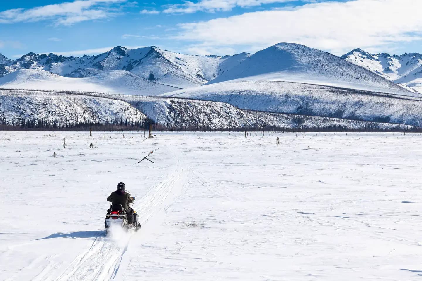
Overview Located just an hour's drive from Fairbanks, Alaska, the one-million-acre White Mountains National Recreation Area offers stunning scenery, peaceful solitude and outstanding opportunities for year-round recreation including hiking, snowmobiling, snowshoeing, skiing, wildlife and scenic viewing. There are 13 beautiful log cabins throughout the White Mountains offering many opportunities to enjoy the outdoors. Be sure to carry your cabin permit at all times while in the White Mountains National Recreation Area. Also located in the White Mountains National Recreation Area are two trail shelters that are available on a first-come, first-served basis only. Recreation Winter visitors travel by ski, snowshoe, dog team, fat bike and snowmobile to enjoy the 12 public-use cabins and 250 miles of maintained trails that make the White Mountains one of Interior Alaska's premier winter destinations. The cabins must be reserved up to 30 days in advance. There are two trail shelters that are on a first come-first served basis, are free of charge and not reservable. In Summer, visitors to the White Mountains pan for gold, fish, hike and camp under Alaska's midnight sun. The Nome Creek Road provides access to two campgrounds, trails, a gold-panning area and a departure point for float trips on Beaver Creek Wild and Scenic River. Learn more about current trail conditions or call the Fairbanks District Office at (907) 474-2200. For a winter trails condition report, go to the Trail Update Facilities The White Mountains National Recreation Area offers 250 miles of maintained winter trails and 13 public recreation cabins and two trail shelters surrounded by jagged limestone mountains and cliffs, high mountain passes, and broad, rounded valleys. Whether you choose to explore by ski, snowshoe, snowmobile, or dog team, you'll find crisp, clean air, dazzling views, and if you're lucky, shimmering northern lights against a star-studded sky. Many of the trails used for winter travel may be difficult to travel during the summer due to wet, muddy conditions or difficult water crossings. To protect sensitive resources, vehicles must remain on BLM routes designated for their use unless traveling in an area designated open to cross-country motorized travel. The entire area is open to all forms of non-motorized use, so feel free to explore off-trail. The most popular places to ride OHVs are in the Nome Creek tailings and the Quartz Creek Trail. Most of the cabins become difficult to reach in the summer, but a few are regularly used such as Fred Blixt Cabin and Lee’s Cabin . Three campgrounds are open from late-May until the snow flies in October Note : Not all trails are accessible to ATV's in the summer. Please contact the BLM Fairbanks District Office for further information at (907)474-2200 Note: Not all trails are suitable for hiking in the summer. They may be wet and boggy. Check with the Fairbanks District Office for more information. Note: All lands to the north of the Nome Creek Rd. from the Bear Creek Trail, west to Ophir Creek Campground and the Beaver Creek Put-In are closed to the use of motorized vehicles in the summer from May 1 - October 14 or until there is adequate snow cover for use by snowmobiles. Nome Creek Valley Map Winter Trails Map Summer OHV fact sheet Summer Recreation Map (Georeferenced PDF) Nearby Attractions The cabins are surrounded by vast amounts of land you can venture on to and view the scenery around the area.
View details →FAQ
Camping in Alaska
How many campgrounds are listed in Alaska?
TheCampVerse currently lists 32 campgrounds in Alaska.
What campground types are most common in Alaska?
The most common campground types are Campground.
How can I compare campgrounds in Alaska?
Use the campground cards and featured links on this page to compare descriptions, amenities, and details before opening each campground profile.
Keep exploring